
Recommandé
Recommandé
Contenu connexe
Tendances
Tendances (20)
Similaire à Sea level rise
Similaire à Sea level rise (20)
Dernier
Dernier (20)
Sea level rise
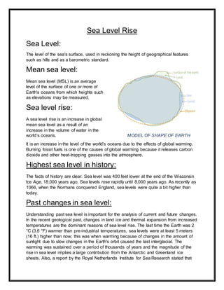
- 1. Sea Level Rise Sea Level: The level of the sea's surface, used in reckoning the height of geographical features such as hills and as a barometric standard. Mean sea level: Mean sea level (MSL) is an average level of the surface of one or more of Earth's oceans from which heights such as elevations may be measured. Sea level rise: A sea level rise is an increase in global mean sea level as a result of an increase in the volume of water in the world’s oceans. MODEL OF SHAPE OF EARTH It is an increase in the level of the world's oceans due to the effects of global warming. Burning fossil fuels is one of the causes of global warming because it releases carbon dioxide and other heat-trapping gasses into the atmosphere. Highest sea level in history: The facts of history are clear. Sea level was 400 feet lower at the end of the Wisconsin Ice Age, 18,000 years ago. Sea levels rose rapidly until 8,000 years ago. As recently as 1066, when the Normans conquered England, sea levels were quite a bit higher than today. Past changes in sea level: Understanding past sea level is important for the analysis of current and future changes. In the recent geological past, changes in land ice and thermal expansion from increased temperatures are the dominant reasons of sea level rise. The last time the Earth was 2 °C (3.6 °F) warmer than pre-industrial temperatures, sea levels were at least 5 meters (16 ft.) higher than now; this was when warming because of changes in the amount of sunlight due to slow changes in the Earth's orbit caused the last interglacial. The warming was sustained over a period of thousands of years and the magnitude of the rise in sea level implies a large contribution from the Antarctic and Greenland ice sheets. Also, a report by the Royal Netherlands Institute for Sea Research stated that
- 2. around three million years ago, levels of carbon dioxide in the Earth's atmosphere were similar to today's levels which increased temperature by two to three degrees Celsius and melted one third of Antarctica's ice sheets. This in turn caused sea levels to rise 20 meters. Since the last glacial maximum about 20,000 years ago, the sea level has risen by more than 125 meters (410 ft.), with rates varying from less than a mm/year to 40+ mm/year, as a result of melting ice sheets over Canada and Eurasia. Rapid disintegration of ice sheets led to so called 'melt water pulses', periods during which sea level rose rapidly. The rate of rise started to slow down about 8,200 years before present; the sea level was almost constant in the last 2,500 years, before the recent rising trend that started at the end of the 19th century or in the beginning of the 20th. Causes of Sea level rise Ocean warming (thermal expansion) Eustasy Isostasy Melting of Glaciers & Ice sheets Decline in water storage on land Ice loss from Greenland and West Antarctica Global warming Ocean warming (thermal expansion) Global warming not only causes the temperature on land to increase, but also leads to an increase in sea water warming. This warming started mainly during the industrial evolution, and intensified when more and more trees were being cut down. Thermal expansion also affects the movement of hot and cold oceanic currents around the globe, and even a slight shift in the direction and temperature of any major current can have large-scale effects, especially on the sea level rise. Due to this, the water expands and its volume increases. This leads to a periodic rise in sea levels.
- 3. TEMPERATURE CHANGES IN OCEAN Eustasy Any uniformly global change of sea level that may reflect a change in the quantity of water in the ocean, or a change in the shape and capacity of the ocean basins that results in change in sea level. Isostasy Changes in Earth’s geology. The tectonic plates of the Earth are moving in a slow pace constantly. This changes the structure of the Earth and increases or decreases the height of land above and below sea level.
- 4. Melting of Glaciers & Ice sheets Large ice formations, like glaciers and the polar ice caps, naturally melt back a bit each summer. In the winter, snows, primarily from evaporated seawater, are generally sufficient to balance out the melting. Recently, though, persistently higher temperatures caused by global warming have led to greater- than-average summer melting as well as diminished snowfall due to later winters and earlier springs. This imbalance results in a significant net gain in the ratio of runoff to ocean evaporation, causing sea levels to rise. Ice loss from Greenland and West Antarctica As with the glaciers and ice caps, increased heat is causing the massive ice sheets that cover Greenland and Antarctica to melt at an accelerated pace. Scientists also believe melt water from above and seawater from below is seeping beneath Greenland's and West Antarctica's ice sheets, effectively lubricating ice streams and causing them to move more quickly into the sea. Higher sea temperatures are causing the massive ice shelves that extend out from Antarctica to melt from below, weaken, and break off.
- 5. Global warming Earth's warming climate is causing sea levels to rise in two different ways. First, warmer air temperatures are causing glaciers and land ice to melt. As the melt water flows into the ocean, the increase in the total amount of water causes the sea level to rise. Land water storage Humans impact how much water is stored on land. Building dams prevents large masses of water from flowing into the sea and therefore increases the storage of water on land. On the other hand, humans extract water from lakes, wetlands and underground reservoirs for food production leading to rising seas. Furthermore, the hydrological cycle is influenced by climate change and deforestation, which can lead to further positive and negative contributions to sea level rise. In the 20th century, these processes roughly balanced, but dam building has slowed down and is expected to stay low for the 21st century.
- 6. Impacts of Sea level rise When sea levels rise as rapidly as they have been, even a small increase can have devastating effects on coastal habitats farther inland, it can cause destructive erosion, wetland flooding, aquifer and agricultural soil contamination with salt, and lost habitat for fish, birds, and plants. Wet land loss Coastal erosion Salt water intrusion Loss of habitats of fish, birds & plants Ecological imbalance Contamination of agricultural soil Loss of mangroves & coral reefs Loss of low lying lands Powerful storm surges
- 7. Future effects: Future sea level rise could lead to potentially catastrophic difficulties for shore-based communities in the next centuries: for example, millions of people will be affected in cities such as Miami, Rio de Janeiro, Osaka and Shanghai if following the current trajectory of 3 °C (5.4 °F). The Egyptian city Alexandria faces a similar situation, where hundreds of thousands of people living in the low-lying areas may already have to be relocated in the coming decade. However, modest increases in sea level are likely to be offset when cities adapt by constructing sea walls or through relocating.
- 8. Miami has been listed as "the number-one most vulnerable city worldwide" in terms of potential damage to property from storm-related flooding and sea-level rise. Storm surge will be one of the important disasters caused by sea level rise in the future that can cause the largest loss of life and property in the world's coastal areas. Storm surges have been affected in recent years by rising sea levels, which have increased in frequency and intensity. For example, one of the most severely affected areas is New York City, where study simulations show that the impact of sea level rise on the New York area will be reduced from 100-year flooding to 19-68 years by 2050 and 40- 60 years by 2080. Effect of sea level rise on economy of Pakistan: Results of climate changes are already costing around $14bn/year which is 5% of Pakistan's GDP. Continued losses due to sea level rise will have a further negative impact on the fragile coastal economy. Karachi and the Indus Deltaic coastal areas are vulnerable to the threat of sea level rise. Pakistan has over 10% of its population living in the vicinity of the coastal zone, over 20 % of coastal area of Pakistan is relatively developed, and 40% of industry is situated on or near the coast. Protecting these human assets will be costly, particularly if the effects of climate change are sudden rather than gradual. A rise sea level of a few mm per year, although not threatening but direct and indirect impact of this rise would have a profound impact on the coastal resources for sustainable coastal zone management. Direct land loss of low-lying areas can rapidly damage or destroy coastal ecosystems. In addition to sea level change a rise in global warming will also increase the frequency of tropical cyclones and will further add to the miseries of the coastal states. Pakistan's coastline with the Arabian Sea stretches to over 990 km. It comprises two distinct units in physiographic outline and geological characteristics. The coastal and offshore geology of Pakistan tectonically exhibits both active and passive margin features. The impacts of the hazards resulting from progressive climate change are apparent all along the coast. The adverse effect of sea level rise on the Pakistan coast is expected to be pronounced in the Indus Delta. Topographically it is a tidal flat zone. A sea level rise of about 2 meters is expected to submerge or sea encroach an area of about 7,500 sq. km in the Indus Delta. The low-lying areas along the Baluchistan coast may also exert a significant effect. The mean sea level (MSL) along the coast at Pasni is about 1.4 m from the chart datum. The MSL is slowly but gradually rising at a rate of about 1.1 mm/year. Although a small sea level rise may be compensated by tectonic uplift rate of the Makran coastline estimated at 1-2 mm/year at Ormara. Measurement of Sea level: There are a few ways to directly measure sea level:
- 9. 1. By Tide gauge 2. By Satellites 1. Tide gauge observations—simply measuring the height of a tide on a fixed marker. As the tide marker is attached to land, this provides a measurement of sea level relative to land. In some areas, the land might be rising (uplift) which would mean the local sea level would be falling faster than if there was no land motion. In other areas, the land might be subsiding, which would result in higher local sea-level rise. 2. Satellite altimetry, where satellites measure the actual height of the ocean surface. It just measures the distance from the satellite to the sea level surface.
- 10. By combining these two methods, scientists can put together a picture of average global sea level changes. Combined tide-gauge and satellite altimetry data indicate that average global sea level rose by around 20 centimeters between 1880 and 2014. There was an increase in average global sea level of around 3 millimeters a year during the 20th century. Mitigation measures IPCC FRAME WORK The IPCC (Intergovernmental Panel on Climate Change) adopted a work plan for adaptive responses & strategies based on data regarding environmental, economic, social, cultural, legal, institutional and financial implications. identify coastal areas, populations and resources at risk develop global and regional research and monitoring systems develop public awareness of risks to coastal resources encourage integrated coastal area and resource management use country-specific studies to evaluate available adaptive options develop techniques for mitigation through cost effective approaches for adaptation Adopt a framework convention on climate change to facilitate cooperative efforts to limit and/or adapt to climate change. • PROTECTION (DEFENSE) ADAPTION STRATEGIES • ATTACK • RETREAT • ACCOMODATION • Planting and maintaining mangroves is considered as a potential natural mitigation measure against this problem. Mangroves reduce the intensity of waves crashing on the shoreline and also help in reducing the associated impact in case of sea level rise. Strategy Features Methods Site Advantages Protection (Defense) Dikes Levees Sea Walls Groins Build physical barriers to block water For hard-to-move facilities and infrastructure on flat ground
- 11. Mangroves Wetlands Sand dunes Tidal Flats Create buffer with vegetation or landforms For maintaining shoreline at sites with existing coastal forest or sand dunes Pre implementation Implementation Post implementation Pre implementation Implementation Post implementation Strategy Features Methods Site Advantages Accommodation Raising level Desalination Drainage Alarm system Upgrade functions while maintaining location For redevelopment projects or facilities at sites without high ground nearby Pre implementation Implementation Post implementation Strategy Features Methods Site Advantages Retreat Relocation Abandonment Relocate facilities to low- risk uplands For residential and public facilities at sites with low-risk uplands nearby
- 12. Pre implementation Implementation Post implementation Strategy Features Methods Site Advantages Attack Land Reclamation Piers Ports Harbors Extend facilities towards water For facilities requiring direct access to water Pre implementation Implementation Post implementation Mitigation Measures Temporary installation of porous rock structures on the shores, and construction of buildings on elevated land can help minimize the damage caused by potential sea level rise. The advantage of elevation is very important, especially in low-lying regions, if sea levels are increasing steadily. The most important and long-term mitigation measure is to reduce our carbon footprint, and reduce the harmful emissions, which are damaging the environment on
- 13. land, in the oceans, and the atmosphere. If global warming can somehow be decreased substantially, then the sea level rise can also be minimized and controlled. Building tall walls and similar structures might help reduce sea water intrusion up to a certain level, but this solution is of no help when the sea level rises drastically and even during tsunamis striking the coastal regions. Constructing levees might help on a small scale, especially if the particular coastal region experiences less increase in ocean water over a longer period of time.