1. Office of the Chief | April 2022
Gallinas-Las Dispensas Prescribed
Fire Declared Wildfire Review
Santa Fe National Forest, Southwestern Region
2. ii
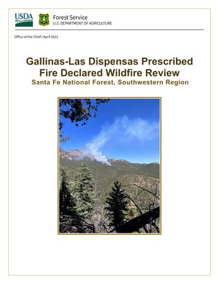
Cover image: The Las Dispensas Prescribed Fire on the Pecos/Las Vegas Ranger District of the Santa Fe National
Forest as seen from an elevation of 8,000 feet on the Chuparosa Ridge. USDA Forest Service photo.
In accordance with Federal civil rights law and U.S. Department of Agriculture (USDA) civil rights regulations and
policies, the USDA, its Agencies, offices, and employees, and institutions participating in or administering USDA
programs are prohibited from discriminating based on race, color, national origin, religion, sex, gender identity
(including gender expression), sexual orientation, disability, age, marital status, family/parental status, income
derived from a public assistance program, political beliefs, or reprisal or retaliation for prior civil rights activity, in
any program or activity conducted or funded by USDA (not all bases apply to all programs). Remedies and
complaint filing deadlines vary by program or incident.
Persons with disabilities who require alternative means of communication for program information (e.g., Braille,
large print, audiotape, American Sign Language, etc.) should contact the responsible Agency or USDA's TARGET
Center at (202) 720-2600 (voice and TTY) or contact USDA through the Federal Relay Service at (800) 877-8339.
Additionally, program information may be made available in languages other than English.
To file a program discrimination complaint, complete the USDA Program Discrimination Complaint Form, AD-
3027, found online at How to File a Program Discrimination Complaint and at any USDA office or write a letter
addressed to USDA and provide in the letter all of the information requested in the form. To request a copy of the
complaint form, call (866) 632-9992. Submit your completed form or letter to USDA by: (1) mail: U.S. Department
of Agriculture, Office of the Assistant Secretary for Civil Rights, 1400 Independence Avenue, SW, Washington,
D.C. 20250-9410; (2) fax: (202) 690-7442; or (3) email: program.intake@usda.gov.
USDA is an equal opportunity provider, employer, and lender.
3. iii
Contents
Gallinas-Las Dispensas Prescribed Fire Declared Wildfire Review ............................................... i
Contents .........................................................................................................................................iii
Foreword from Chief Randy Moore ............................................................................................... 1
Executive Summary........................................................................................................................ 3
Setting ............................................................................................................................................. 4
National....................................................................................................................................... 4
Regional...................................................................................................................................... 6
Project Area ................................................................................................................................ 6
Prescribed Fire Plan, Objectives, Prescription and Desired Outcomes 7
Seasonal Severity, Weather, and On-site Conditions ................................................................. 9
Narrative Description of the Event ............................................................................................... 13
Planning Analysis ......................................................................................................................... 24
Analysis of the Environmental Assessment.............................................................................. 24
Analysis of the Prescribed Fire Plan......................................................................................... 26
Fuel Model Assignment 28
Spatial Fire Behavior Modeling 29
Complexity Analysis 29
Key Implementation Analysis Observations and Learning Elements .......................................... 31
Analysis of the Prescribed Fire Implementation for Consistency with the Prescription, Actions
and Procedures in the Prescribed Fire Plan............................................................................... 31
Analysis of Information Related to Fuel Conditions, Weather and Other Key Factors ........... 32
Test Fire Location 32
Fuel Loadings 32
Foliar Fuel Moisture 33
Fire Danger 34
Weather 35
Findings/Lessons Learned ............................................................................................................ 37
Weather..................................................................................................................................... 37
Findings 37
Lessons Learned 38
Fuels and Fire Behavior............................................................................................................ 38
4. iv
Findings 38
Lessons Learned 39
Finding 41
Findings 41
Lessons Learned 41
Finding 41
Findings 41
Finding 42
Recommendations......................................................................................................................... 42
Weather 42
Fuels and Fire Behavior 43
Fire Culture 43
Communications 43
Project/Plan Design 44
Prescribed Fire Implementation Process 44
Programmatic Recommendations............................................................................................. 44
Qualifications and Training 44
Project/Plan Design 44
Prescribed Fire Implementation Process 45
Capacity Building 45
Organizational Learning 46
Conclusions................................................................................................................................... 46
Appendices.................................................................................................................................... 48
A - Letter of Delegation............................................................................................................ 48
B - Potential Control Locations – Risk Management Assistance (Stratton and Miller 2021).. 49
C - Chronology of Events ......................................................................................................... 51
D - Spot Weather Forecast........................................................................................................ 57
E - Burning Index and Severe Fire Danger Index..................................................................... 57
Burning Index 57
Severe Fire Danger Index 58
F - Fuel Model – Fire Behavior Comparison............................................................................ 59
5. v
Flame Length 59
Rate of Spread 60
G - Spatial Analysis – Prescription – FlamMap ....................................................................... 61
H - Spatial Analysis – Holding/Contingency – Minimum Travel Time................................... 62
I - Review of Las Dispensas Complexity Analysis .................................................................. 65
J - Disturbance History ............................................................................................................. 71
K - Suppression Difficulty Index – Risk Management Assistance (Stratton and Miller 2021) 71
L - Review of the Qualifications............................................................................................... 73
Experience and Involvement of Key Personnel Involved in the Prescribed Fire 73
Approving Agency Administrator’s Qualifications, Experience, and Involvement 73
Glossary of Terms......................................................................................................................... 74
Review Team ................................................................................................................................ 80
6. 1
Foreword from Chief Randy Moore
On May 10, 2022, I established a Chief’s Review of the Hermit’s Peak Fire (Santa Fe National
Forest, NM), which was a result of an escaped prescribed fire (Las Dispensas). The devastating
impact of this fire to the communities and livelihoods of those affected in New Mexico demanded
this level of review to ensure we understand how this tragic event unfolded. I cannot overstate
how heartbreaking these impacts are on communities and individuals. In the most tragic events,
people have lost their lives and it grieves us as agency employees who live and work in these
communities.
Climate change is leading to conditions on the ground we have never encountered. We know
these conditions are leading to more frequent and intense wildfires. Drought, extreme weather,
wind conditions and unpredictable weather changes are challenging our ability to use
prescribed fire as a tool to combat destructive fires. This spring in New Mexico, a pile burn of
hazardous logs that started in January, smoldered underground for months, persisting through
multiple snowstorms and freezing temperatures, before resurfacing as a wildfire. That type of
event was nearly unheard of until recently in the century-plus of experience the Forest Service
has in working on these landscapes. Fires are outpacing our models and, as the final report
notes, we need to better understand how megadrought and climate change are affecting our
actions on the ground. We must learn from this event and ensure our decision-making processes,
tools, and procedures reflect these changed conditions.
The Forest Service takes its role to respond to and prevent wildfires seriously. The safety of the
communities and firefighters involved is our primary goal. Wildfire mitigation, wildland
firefighting, and many other land management activities we perform are inherently dangerous.
When that work does not go as planned, it is imperative that we learn from those experiences.
And we do. This review, which will be made available on the Wildland Fire Lessons Learned
Center website, includes an analysis of the conditions on the ground, the planning process and
design, an assessment of the decisions leading up to the prescribed fire implementation, a
summary of contributing factors, and key findings, lessons learned and recommendations.
On May 20th
I temporarily ceased all Forest Service prescribed burning nationwide as an
immediate safety precaution due to continued extreme conditions. We are conducting a 90-day
learning review of the agency’s national prescribed fire program. Representatives from across
the wildland fire and research community are evaluating the prescribed fire program, from the
best available science to on-the-ground implementation. Wildfires are threatening more
communities than they ever have. Prescribed fire must remain a tool in our toolbox to combat
them. Unfortunately, the effects of climate change are narrowing the windows where this tool
can be used safely. This Chief’s Review of the Hermit’s Peak Fire, and the results of the 90-day
prescribed burn program review, will help us learn what needs to change to be able to continue
to safely use this tool in today’s fire environment.
I hope you will read the entire report to truly understand how this fire went from a prescribed
fire, in which the employees involved followed all procedures and policies, to a fire that escaped
its containment lines and became the largest wildfire in New Mexico’s history. I want to thank
our review team for their dedication to this work and their thorough, forthright, and detailed
7. 2
analysis. This Chief’s Review is an example of how the Forest Service, as a learning
organization, must account for its actions and move forward to continue to deliver our critical
mission of protecting forests and communities from wildfires.
8. 3
Executive Summary
The Gallinas Watershed Prescribed Fire, Las Dispensas Unit, is located on the Santa Fe National Forest Pecos-
Las Vegas Ranger District in New Mexico. Test fire ignitions began the morning of April 6, 2022. The test fire
was determined successful at 1234, and ignitions continued. The prescribed fire was declared a wildfire
(Hermit’s Peak Fire) about four hours later. On May 10, 2022, USDA Forest Service Chief Randy Moore
launched a review team to conduct a Declared Wildfire Review of the incident.
In addition to examining the parameters set forth in the Interagency Prescribed Fire Planning and
Implementation Procedures Guide (PMS 484) for Declared Wildfire Review, the team was asked to provide
(Appendix A):
• A description of the overall fuels and wildfire situation on the Santa Fe National Forest and the
overall context within which these events took place;
• An assessment of the planning and analysis related to the Gallinas Prescribed Fire Wildland Urban
Interface (WUI) project, including the purpose and need for treatment as well as factors that
contributed to the overall design and sequencing of planned treatments;
• An assessment of the prescribed fire planning specific to the Las Dispensas Prescribed Fire;
• An assessment of the information related to fuel conditions, weather and other key factors that
informed decisions leading up to the implementation of the Las Dispensas Prescribed Fire up until
the declaration of the Hermit’s Peak fire on April 6, 2022; and
• A summary of factors that contributed to the declaration, along with proposed recommendations to
improve policies, protocols or performance.
In order to maintain and restore existing fire-dependent ecosystems, prescribed fires are often conducted in
areas absent of recent fire history. These areas typically have higher densities of vegetation and
concentrations of downed woody debris, creating a situation where the ecosystem is heavily departed from
the natural range of variability within the fire regime.
The review team found that the personnel assigned to the Las Dispensas Prescribed Fire followed their
approved prescribed fire plan. There was confidence they were within the approved prescription limits, and
they had a plan to suppress the fire and cease ignitions if the prescription parameters were exceeded.
However, a post-prescribed fire analysis of fuel and weather revealed that the implementation was occurring
under much drier conditions than were recognized. Persistent drought, limited overwinter precipitation, less
than average snowpack, fine fuel accumulation—post mechanical treatment, and increased heavy fuel
loading after fireline preparation all contributed to increasing the risk of fire escape.
Competing obligations limit the ability of the workforce to prioritize and focus on prescribed fire projects.
Increasing agency goals for prescribed fire treatments and, in this case, expectations from the forest, district
and the Burn Boss to begin catching-up after 2 years of delays due to government shutdowns, a global
pandemic, and Mexican Spotted Owl regulations have led to unrealistic expectations. These expectations,
coupled with the opportunity to implement during a narrow window when the crew was available, smoke
dispersion was good and the prescribed fire area was forecasted to be in prescription, led to acceptance of
unforeseen risk.
The prescribed fire plan appeared to be complete and in compliance with current policy. However, the fire
environment is in constant flux. The environmental conditions in which the plan was executed generated
unforeseen challenges. Training of prescribed fire personnel is highly weighted toward developing and
implementing the plan to ensure adherence to policy.
While innovative tools associated with robust analysis of the fire environment have been developed and are
readily available, they are not routinely internalized into the planning and implementation process of
9. 4
prescribed fire. Training and education efforts are often outdated and do not incorporate the latest tools or
the latest fire science available to consider the fire environment (fuels, topography, climate, and weather)
when developing and implementing prescribed fire plans. There are very few subject matter experts (SMEs)
with the skillsets associated with robust analysis and interpretation of potential fire behavior and weather
patterns. In addition, the number of specialists is diminishing due to some of the requirements needed to
attain qualifications. Furthermore, these SMEs are not always readily available due to conflicting needs
within their fire management positions. Although essential, these skills are not currently required as
elements in prescribed fire qualifications or position descriptions for fire management employees.
This report begins with the setting in which the incident took place, followed by a narrative chronology of
events. The team analyzed both planning and implementation elements of the operation. There are findings
and lessons learned in the areas of: weather, fire behavior and fuels, communications, prescribed fire
planning and design, and other socio-political influences. The team makes recommendations in these areas
as well as in the prescribed fire plan implementation process, (fire) qualifications, capacity building and
organizational learning.
Setting
National
In recent years the Forest Service has treated up to 3 million acres per year for hazardous fuels and forest
health across the nation. The historic Infrastructure Investment and Jobs Act (IIJA) signed in November 2021
directed $3 billion toward restoring ecosystems and reducing wildfire risk over the next five years. The
related USFS Wildfire Crisis Strategy is driving the agency toward treating 20 million acres over the next 10
years. The expectations are for the Forest Service to increase treatments to 4 million acres per year on
National Forest System lands and support our partners in treating an additional 30 million acres per year on
other federal, state, tribal and private lands. Depending upon our role with partners, this means that the
Forest Service will be expected to treat between 5 and 8 million acres of hazardous fuels using all the tools
available.
Over the past dozen years, prescribed fire has accounted for an average of 51% of the acreage of hazardous
fuels reduction accomplished, or an average of 1.4 million acres per year. Meeting the objectives of the IIJA is
likely to require the Forest Service to conduct prescribed fires on between 2.5 and 4 million acres annually,
nationally. However, because the majority of the additional fuels reduction effort will be focused in the West,
some regions may actually be expected to quadruple their hazardous fuel reduction efforts. Prescribed fire is
the most ecologically appropriate, and often the most economical, way to maintain healthy forest
ecosystems and to reduce or maintain fuel loads. Prescribed fire at a national scale becomes even more
critical as a tool to maintain fuels after the initial reduction efforts.
To accomplish this level and frequency of prescribed fire on the landscape, we must ensure that practitioners
have access to the best science and the best tools, and that they are confident and practiced in using both. In
the past, fire suppression has had a higher utilization of science and technology, while prescribed fire has
typically been more or less a collateral effort. If we are truly expected to meet these landscape restoration
needs across the nation, the agency’s commitment to prescribed fire will need to be commensurate with the
effort that is invested in wildland fire suppression.
10. 5
Figure 1: USFS Hazardous Fuels Accomplishments 2010 to 2021 from USFS Hazardous Fuels Program FY21 Accomplishments,
Gromatzky.
Figure 2: USFS Hazardous Fuels accomplishments by region from USFS Hazardous Fuels Program FY21 Accomplishments,
Gromatzky.
11. 6
Figure 3: Forest Service Regions.
Regional
The Southwestern Region, encompassing Arizona and New Mexico, boasts a very diverse mix of ecosystems
that range from Sonoran Desert to high-elevation tundra types. Over 70% of the southwestern ecosystems
have adapted to frequent fire regimes. These frequent fires have not been able to influence undergrowth and
forest structure in as much of these ecosystems as they would have historically in over 100 years. As with
much of the western United States, ponderosa pine and mixed conifer forests in the Gallinas Watershed have
changed greatly due to a lack of wildland fires over the last 100 years. Approximately one century of fire
suppression in the watershed has resulted in a highly modified ponderosa pine forest structure that is more
prone to high-intensity and high-severity wildfires (GTR 191, DeBuys and Allen 2005). Refer to map in
Appendix B. In order to address the risk of high-severity wildfires and the risk to values, property and lives,
the Southwestern Region has encouraged land managers to carefully plan to increase the use of fuels
treatments, including the use of fire as a management tool.
Project Area
In May of 2000, the Viveash Fire burned in the Cow Creek drainage just west of the Gallinas Watershed. This
high-intensity, high-severity fire produced dramatic effects to the Las Vegas, New Mexico city water quality.
Although the fire occurred on only a small part of the Gallinas Watershed, sediment and ash showed up in
the Las Vegas municipal water treatment works about 22 miles downstream. Concern grew around the
potential effects to water quality of a larger fire within that same watershed.
Additionally, the area was identified in the 2001 National Fire Plan as a community at risk, highlighting the
need for hazardous fuel management. In order to meet the need for treatment, the Gallinas Municipal
Watershed Wildland Urban Interface Project Environmental Assessment (Gallinas EA) process was initiated.
The Gallinas Watershed Council, made up of specialists from the state of New Mexico; Forest Service; U.S.
Fish and Wildlife Service; City of Las Vegas, New Mexico; and other constituents, served as a stakeholder
group to help inform and develop alternatives to address the situation.
About 17,000 people in the City of Las Vegas, New Mexico and surrounding communities depend on Gallinas
Creek for their drinking water. Gallinas Creek feeds the Peterson, Bradner and Storrie Lake reservoirs,
providing the primary source of water to residents (EA, p. 3). The Watershed is an 84-square-mile mosaic of
12. 7
privately-owned land, national forest and other public lands. National Forest System lands comprise about
two thirds of the Watershed (51 square miles or 33,000 acres). The project area is about 20,600 acres in size
and consists of ponderosa pine forest (about 2,400 acres), mixed conifer forest (about 10,800 acres), spruce-
fir forest (about 5,700 acres), and other/aspen (about 1,700 acres).
Figure 4: Forest types in the Gallinas EA project area, from the 2006 Gallinas EA.
Several Major Setbacks Prompt Sense of Urgency to Accomplish Projects
Implementation of the Gallinas EA and other projects across the Santa Fe National Forest and other New
Mexico forests has been hampered by several consecutive restraints. In December 2018 most Forest Service
employees were furloughed because of a government shutdown that lasted until February 2019. In addition
to the furlough time, work time was lost to orderly shutdown and return-to-work processes. In March 2020,
the COVID 19 pandemic sent most employees home again for more than two years. Then the Mexican
Spotted Owl Injunction from September 2019 through October 2020 restricted mechanical and prescribed
fire treatments throughout the Region. These consecutive and overlapping events not only affected overall
employee morale, but also built a sense of urgency to accomplish projects to “catch up.”
Prescribed Fire Plan, Objectives, Prescription and Desired Outcomes
The Gallinas Watershed Prescribed Fire Plan outlines mechanical treatments ranging from hand thinning to
machine thinning with log decking followed by prescribed fire. The Gallinas Prescribed Fire project area is
divided into 12 prescribed fire units to help mitigate smoke impacts (see Las Dispensas Vicinity Map on next
page). One of these prescribed fire units, Las Dispensas, encompasses approximately 1,273 acres of the
overall 8,300 acres that are treatable within the project area. Las Dispensas was further divided into 10
prescribed fire sub-units to provide greater implementation flexibility.
13. 8
Figure 5: Las Dispensas Aerial Vicinity Map.
The Las Dispensas prescribed fire unit sits on the eastern edge of the project area against private land to the
east. The unit is mostly characterized by ponderosa pine with some mixed conifer. Pretreatment conditions
include 700 to 1,000 trees per acre of ponderosa pine, Douglas fir and white fir. To prevent potential adverse
impacts from high-severity wildfire in the watershed in the future, the Santa Fe National Forest, Pecos/Las
Vegas Ranger District developed a plan to restore the forest and protect the watershed by reducing the risk
of high-intensity wildfire. According to the approved prescribed fire plan, the project specifically intended to:
1. Reduce potential for large-scale, high-intensity crown fires
2. Restore soil and hydrological condition
3. Reduce risk to life, property and natural resources
4. Restore fire-adapted ecosystem
5. Reduce mortality in mature trees (>12 inch diameter breast height [dbh]) to ≤ 20%
The forest in the project area had been precommercial thinned in 2008. This resulted in fuel loading as high
as 20 to 25 tons per acre. Piled material had been burned in preparation for broadcast burning. Firelines had
been improved through additional thinning and limbing. The task order for fireline construction required the
debris to be dragged at least 66 feet (one chain) away from the fireline to the interior of the prescribed fire
unit and placed parallel to the fireline exterior to the prescribed fire unit. The intent of this implementation
was to increase the probability of holding the fire line, reduce fire intensity, and limit mortality to the
remaining overstory trees. Local timber market conditions made this the only viable option.
The desired conditions post-project included fewer trees per acre, reduced ladder fuels, less brush and
downed woody debris, a more open forest canopy, and improved groundcover conditions. Under these
14. 9
conditions, future fires would more likely remain surface fires and be less likely to result in torching or crown
fire.
Seasonal Severity, Weather, and On-site Conditions
Traditional monsoon precipitation was significantly below the historic average in 2019 and 2020 during the
planning and preparation phase of the Gallinas Watershed Project leading up to the Las Dispensas Prescribed
Fire. In the summer of 2021, a monsoon did bring some short-term benefits. However, overall precipitation
for the season was near to below average for the northern New Mexico mountains. Nevertheless, there was
an increase in late season fine fuels growth that cured in the fall and early winter coincident with seasonal
dormancy. Overall, these fine fuels remained upright and available to burn because the few light snow events
that occurred failed to compact them.
According to the Drought Mitigation Center’s Drought Monitor product, which represents long-term impacts,
both the magnitude and spatial extent of drought improved beginning in July and August 2021 due to the
monsoon precipitation. They slightly improved from the highest drought category “Exceptional, D4” to
“Extreme, D3”. This trend continued through fall, winter and spring during the time leading up to the
prescribed fire.
Figure 6: Comparison of Drought Classification from July 6 2021 to April 5 2022 from the U.S. Drought Monitor shows that the
Las Dispensas Prescribed Fire area improved from D4 to D3 following beneficial monsoonal moisture, but still showed below
average precipitation in the fall and winter months leading up to the day of the prescribed fire.
Despite the limited improvement to the drought conditions, anomalous dryness continued in the fall and
then transitioned to a second consecutive winter (Double Dip) La Niña cycle that strengthened in the spring.
15. 10
Figure 7: Fall-Winter Precipitation (left) and Temperature (right) anomalies suggest drier and warmer than average
conditions for the Las Dispensas Prescribed Fire area for the period.
Figure 8: Winter-Spring Precipitation (left) and Temperature (right) anomalies continue to suggest drier and warmer
than average conditions for the Las Dispensas Prescribed Fire area for the period, but cooler than average conditions
surrounding the area and throughout the region.
Along with below normal precipitation, the seasonal snowpack was significantly compressed, as it did not
start until January then abruptly melted off much earlier than average.
16. 11
Figure 9: Snow Water Equivalent Data for the Water Year 2021-2022 in the Upper Pecos Basin. Courtesy USDA NRCS.
This setup was declared and monitored by the National Integrated Drought Information System (NIDIS) as a
“snow drought."
More specifically, snowpack accrual in the Upper Rio Grande Hydrologic Basin, where the prescribed fire area
is located, began the last week in December and into the New Year, which is much later than the median late
October date. Then, the snow water equivalent (SWE) was maintained in the snowpack with adequately cool
temperatures but very little additional accrual until a storm cycle in March and early April brought snowpack
and the water contained within it back up to normal.
Weather Leading up to the Wildfire Declaration
Warm temperature and dry precipitation anomalies were reflected in the nighttime minimum temperatures
for both the long- and short-term periods leading up to the April 6 prescribed fire ignition. This resulted in
drier overnight conditions with lower humidity recoveries and led to drier fuels and longer daily burning
periods.
The days preceding the Las Dispensas Prescribed Fire were described as a weather roller coaster with a light
snow event just the weekend beforehand, the benefits of which quickly diminished as shown below from the
Hot, Dry, and Windy Index (HDWI) that reached a peak value on April 5. The HDWI helps users determine
which days are more likely to have adverse atmospheric conditions that could make it more difficult to
manage a fire. It combines the maximum wind speed and evaporative potential in the lowest levels of the
atmosphere.
17. 12
Figure 10: Forecast Hot, Dry, Windy Index provided courtesy Joseph Charney, Ph D. Research Meteorologist, USFS Northern
Research Station.
This was quickly followed by a back-door cold front, with cooler and less windy but drier conditions on April
6. The cold front brought a shift in low-level winds from an easterly direction, along with cooler
temperatures in the 50s. These post-cold frontal weather conditions on the day of the prescribed fire were
considerably cooler than previous days, with somewhat lower wind speeds due to less instability and less
wind mixing down from aloft than previously seen. Each of the forecasts from the National Weather
Service (NWS) in Albuquerque leading up to the day of the prescribed fire (Fire Weather Zone 103 Forecast,
Tabular, and Spot forecasts) predicted a complete airmass replacement of considerably drier air to move in
from the northwest that would subsequently create much lower relative humidity in the afternoon
compared to recent days, despite the cooler temperatures. Although the cooler weather on the day of the
prescribed fire presented conditions that were more favorable than had been presented for much of the
fall and spring, they were still predicted to be near the high end of the prescription parameters in Element
7 of the prescribed fire plan.
A National Weather Service Red Flag Warning was not headlined for Forecast Zone 103 in the Fire Weather
Forecast (FWF) or the Spot Weather Forecast (FWS). However, Red Flag Warnings were in effect for other
fire weather zones on the day of the prescribed fire due to the combination of relative humidity and wind,
as defined in the criteria of the SW Fire Weather Annual Operating Plan, pg. 32.
18. 13
Narrative Description of the Event
For a table chronology of the event please refer to Appendix C.
2000
In 2000 the Viveash Fire burned in the Cow Creek drainage just west of the Gallinas Watershed, with
dramatic effects to the City of Las Vegas, New Mexico’s water quality. Though occurring on only a small part
of the Gallinas Watershed, sediment and ash from this fire disrupted the Las Vegas municipal water
treatment works about 22 miles downstream.
2004 to 2006
The first version of the Gallinas EA was published in February 2004. The decision dated June 24, 2004 (Project
Record 122) was appealed and the decision was reversed by Forest Service Region 3 on September 27, 2004.
The Pecos/Las Vegas Ranger District revised the EA by modifying the selected alternative, adding an
alternative, and bolstering the effects analysis. Alternative 1 was chosen, and the Decision Notice (DN) was
signed on June 19, 2006.
2017
The first (recorded) prescribed fire entry in the Gallinas Prescribed Fire Project Area occurred in early October
of 2017. This entry consisted of pile burning in several units located within the municipal watershed of the
City of Las Vegas, New Mexico. Due to persistently dry weather, prescribed fire implementation actions
continued throughout the fall in multiple units. Moisture/snow was predicted on several occasions across the
prescribed fire area, but snowfall accumulation was well below normal and snow across the project area
melted rapidly. This resulted in the prescribed fire spreading away from the piles but remaining well within
the project area. The district had a presence throughout the fall and responded appropriately to areas of
concern. This strategy resulted in a long-duration event. In late fall, a portion of the prescribed fire crossed
into an area where fire was not desired within the unit. On December 29, the decision was made to suppress
that portion of the prescribed fire.
2018
On January 18, the same portion of the prescribed fire that was designated for suppression was converted to
a wildfire due to unwanted fire effects. This decision was made due to the potential for ash to enter the
municipal watershed, which could have degraded water quality and compromised community relations.
In March, the Forest Supervisor requested a Facilitated Learning Analysis (FLA) of this event to explore
opportunities to improve communications, safety, coordination and the prescribed fire program. After
hearing from individuals involved in the planning and implementation of the prescribed fire, the FLA Team
identified “communication” and “prescribed fire preparation and risk” as two common themes.
2019
In 2019, the Santa Fe National Forest drafted an addendum to the Gallinas EA to: include the acres left out in
the Gallinas EA for broadcast prescribed fire between thinning treatment units; tie in previous treatment
units for a larger, more consistent hazardous fuel treatment area; and place proposed containment lines on
the roads and ridgelines where firefighters could safely and successfully conduct broadcast prescribed fire.
These units would incorporate existing areas but also add areas that had not been included initially to better
meet the need for fuels and risk reduction within the watershed. As of June 2022, this draft has not been
finalized.
2021
In May, a task order was solicited for hand-constructed fuel breaks and fireline, along with manual thinning
and piling, on the Espanola and Pecos/Las Vegas ranger districts of the Santa Fe National Forest. Work began
on June 22 and was completed on July 21. This preparation work included the units in the Gallinas Prescribed
19. 14
Fire Project Area, and specifically Las Dispensas Unit 10. Work was completed within specifications of the
contract. Slash from fireline prep was lopped and scattered no higher than two feet in height and pulled
interior from the control lines a minimum of 66 feet (1 chain).
March 2022
In March, wind speeds were determined to be too high and dead woody fuel moistures too wet to achieve
prescribed fire plan objectives. Several other planned prescribed fire implementation actions in the area
were also canceled due to similar factors.
March 8
A news release announced the planned Las Dispensas Prescribed Fire implementation actions.
March 18
Citing information from the prescription narrative, a second news release announced that the prescribed fire
would be canceled due to unfavorable weather conditions resulting from recent snowstorms and wet roads.
March 24
The Burn Boss and District Ranger (Agency Administrator) signed the Agency Administrator Ignition
Authorization (Form 2A) authorizing ignitions on the Las Dispensas Unit between April 1-30, 2022. They
believed that these future burn windows would better fit prescription parameters.
April 1
Additional news releases were issued to ensure the public was informed of the potential for prescribed fire
implementation if optimal windows became available.
April 2-3
The weekend before the prescribed fire was implemented, the project area received snow. This was cited in
the prescribed fire plan 2A (Ignition Authorization) as a mitigation for long-term drought because there was a
perception that fuels were moist.
April 3
Personnel sampled live and dead fuel moistures onsite in Unit 2. An observation was made that fuel moisture
values fell compared to previous samples. An electronic Kestrel instrument was hung out to record weather
observations. A spot weather forecast was requested.
April 4
The Burn Boss was notified that the New Mexico State Inmate Crew preidentified in the prescribed fire
organization was unavailable for assignment. The Burn Boss requested a spot weather forecast. An additional
email was sent to the Regional Smoke Coordinator and Predictive Services Meteorologist referencing
potential concerns regarding forecasted winds. The response email indicated that there was a solid burn
window that would not be limited by the expected winds. Because it was the closet Remote Automated
20. 15
Weather Station (RAWS), the Pecos RAWS was used in lieu of the Bartley RAWS.
April 5
The Division Bravo Firing Boss met with four members of the Hotshot Crew in prescribed fire Unit 10.
Anecdotal observations were made in reference to the availability and amount of fuel. The Firing Boss asked
the crew to scout units 1 and 2 as secondary options.
Onsite weather observations were taken at 1100 and 1500 local time in Unit 10. These were the same times
as the ignitions planned for the following day.
1500 Weather Observations for spot weather forecast: Elevation 7,512 feet; dry bulb temperature 70; wet
bulb temperature 45; relative humidity 15%; winds N/NW gusts to 11 mph; clear sky.
At 1501 a spot weather forecast was requested from the National Weather Service through Dispatch. At 1539
Dispatch relayed the spot weather forecast.
April 6
On the morning of April 6, resources were shown enroute to the prescribed fire unit at 0806. At 0807 the
Burn Boss arrived on scene. At 0823 a spot weather forecast was requested through Dispatch. At 0829 the
name of the Burn Boss (RXB2) was relayed to Dispatch, along with the information that there would be no
Burn Boss Trainee.
At 0900 crew and equipment shuttles began, and at 0930 onsite resources were briefed at El Porvenir
Campground. At 0938 the spot weather forecast (Appendix D) was relayed by Dispatch. Personnel on scene
reviewed and signed the Job Hazard Analysis (JHA) at 1015. At 1023 the Burn Boss called Dispatch on the
radio to relay that the briefing had been completed and resources were getting in place to conduct the test
fire. The Go/No-Go Checklist (2b) was documented by the Burn Boss. The Burn Boss stated that he had
obtained and reviewed the tabular and zone weather forecasts from the National Weather Service online.
The Organization was broken into two Firing Groups and two holding groups. Alpha Firing and Holding were
assigned to work the southern end of the unit. Bravo Firing and Holding were assigned to work from the test
fire site north and east. Each firing group had a trainee Firing Boss and fully qualified Firing Boss assigned.
Bravo firing would lead the prescribed firing operation to create a buffer to the north side (first entry) of the
slope due to heavier concentrations of dead and down fireline-prepared fuels inside of the unit about 30 feet
inside the fireline.
After briefing, one engine was parked at El Porvenir Campground due to narrow road conditions and
inaccessibility to Drop Point 7. There was also a tanked Utility Terrain Vehicle (UTV) staffed by one of the
engine crewmembers. A second engine was moved up to the saddle near Unit 6, north of Drop Point 7. At
1100 resources were getting in place to initiate the test fire at the saddle in Unit 10. A Kestrel reading of light
2.4 mph wind speeds was observed below the Test Fire site.
1100 Weather Observations: Dry bulb temperature 50; wet bulb temperature 37; relative humidity 30%;
winds 3-8 mph from SW.
21. 16
Figure 11: Area Map of Unit 10 of the Las Dispensas Prescribed Fire area.
22. 17
Las Dispensas Unit 10 test fire site post burn May 19, 2022. Las Dispensas Unit 10 test fire from above on April 6, 2022.
At 1134 the Test Fire was initiated in 2-inch-deep needle cast in Unit 10 of the Las Dispensas Prescribed Fire
area. The location was on the top of the knob on the northwest end of the unit. The decision was made to
start the test fire there because there was minimum heavy fuel within the test fire area. It was believed to be
a place that could be easily extinguished if fire behavior and effects were not desirable. Single-tree torching
occurred during the test fire.
Line preparation consisted of lop and scatter fuels arrangement, with some areas of higher concentrations of
fuels. Heavy concentrations of dead and downed fireline-prepared fuels were located 66 feet (one chain)
inside the fireline throughout all the units on the downhill side. In some cases, these heavy concentrations of
fuels were underneath trees with ladder fuels. With this type of line preparation, the only available fuel near
the line was light fuels (1 and 10 hour fuels, pine needles, twigs and patchy grasses). From the test fire site
moving north within the unit, there was an area that was a first entry for fire—meaning that no fire activity,
prescribed or otherwise, had ever been recorded there. Fuels inside this area of the unit were heavy dead
and down ponderosa pine and mixed conifer with ladder fuels; tree height estimation ranged from 20 to 80
feet.
Wind Observation: Upslope, upcanyon with speeds around 2 to 4 mph with occasional gusts to 6 mph.
Smoke observation: Several hundred feet NW white/light.
Weather Observations: Dry bulb temperature 55; wet bulb temperature 39; relative humidity 25%; winds 3-6
mph; gusts 6-10 mph from a S/SW direction. Probability of Ignition 50% shaded-50% unshaded.
Fire Behavior Observations: Fire consuming jackpot heavies well; single-tree torching when jackpot heavies
are underneath them; fire spreading in needle cast (when present). Backing and flanking behavior.
The firing plan on the Bravo side was to take fire about 500 feet to the southeast from the test fire (knob)
along a rocky ridge, keeping fire to the northeast side of a rock outcrop. Next, to take fire down to an area
where it would have to back into the wind downslope to flat ground where rocks would keep it from backing
down into the other side (Alpha). This technique was used to promote a backing fire to the north. Once Bravo
firing had made three passes from the test fire to the toe of the slope and back, Alpha was given the OK to
start their blackline and to widen out from the edge of the rock outcrop (test fire to the south) and help fire
back down the slope to the south. Alpha blackline would stay even with the backing fire on their end. At
1220, Bravo Firing continued to bring fire along the knob to the north. (Refer to map on page 16.)
23. 18
1230 Smoke Observation: Drifting NE, light smoke with some gray.
The test fire results were determined successful by the Burn Boss. At 1234, “Test Fire successful” was called
into Dispatch.
Wind Observations: Winds upslope, upcanyon 2 to 3 mph with occasional gusts to 6 mph, terrain-dominated,
predominantly SW.
Fire Behavior Observation: Fire consuming heavies well and spreading where fine fuels are present, backing
and flanking behavior, winds SW.
1235 Dispatch emailed Pecos/Las Vegas District Group informing that test fire was successful and ignitions
would continue.
1242 Smoke Observation: Smoke drifting 1600 feet NE.
1300 Division Alpha began firing on the West Flank.
Weather Observations: Dry bulb temperature 57; wet bulb temperature 37; relative humidity 22%; winds 2-6
mph E/SE; probability of ignition 60% shaded-60% unshaded.
24. 19
1310 District Fire Management Officer was shown to be enroute to the prescribed fire.
1322 Smoke Observation: Smoke drifting 2,000 feet NE/E, gray.
Fire Observation: Backing off knob, consuming jackpot heavies.
1335 A small spot fire was reported on Division Bravo; there were no reported control issues.
As Alpha Firing started their operation, Bravo Firing Boss, radioed Bravo Trainee and informed that they were
going to walk down to the east (toe of slope) to check the fire spread.
Fire Behavior Observations: Low intensity backing fire with flame lengths of 3-6 inches at the toe of the slope
with the wind still upslope. Interior fire slowly backing through dead and down fuels towards the north.
Bravo Firing Boss proceeded to the south and west to look at the topography and fuels Alpha was going to be
working through. When Bravo Firing Boss arrived back up to the handline via a drainage on the Alpha side,
they met with Alpha Firing Boss and the Bravo Holding Boss. They discussed being patient and not rushing
the ignitions. They didn’t expect to finish the entire unit in one day. They agreed to find a good spot to cut it
off in the evening.
Bravo Firing Boss then walked north up the fireline past the test fire site to meet Bravo Trainee. They
discussed taking it slow; Bravo Trainee would use a dotting firing technique and work available jackpots.
25. 20
1351 Burn Boss called Deputy Fire Staff Officer to check on additional resources. Fire Management Officer
was going to follow-up with Deputy to confirm availability of resources for the next day.
As fire was backing into the heavier concentration of dead and down fireline-prepared fuels in Division Bravo,
the winds were observed to occasionally shift from up slope to down slope. Bravo Firing Boss Trainee asked
to take one more pass to the east with one igniter (to bring fire around the corner to the base of the knob
and hang it up for the evening), while the other two igniters began to bring blackline down slope 10 to 20
feet at a time.
The igniter that took fire to the toe returned unannounced with a second pass back up to the fireline,
bringing fire with them. As they waited for fire to come together, intensities picked up due to the heavy
concentration of dead and downed fuels and interior single and group tree torching began. This interior tree
torching created the first large spot fire. The 10 x 20-foot spot fire occurred at approximately 1426 on the
northeast corner of Division Bravo.
During the spot fire, Bravo Firing Boss tried to radio Bravo Holding Boss several times to get a status on the
spot but received no response. Holders and two igniters from Alpha were pulled to Bravo to assist with the
spot.
Fire Behavior Observations: Intense slash burning, fireline-prepared fuels involved, torching.
1400 Lookout Weather Observation: Dry bulb temperature 51; wet bulb temperature 36; relative humidity
23%; winds 2-7 mph from the E/SE. Probability of ignition 60% shaded-60% unshaded.
1403 Smoke Observation: Smoke drifting 2,000 feet NE.
Fire Behavior Observation: Heavies and terrain-dominated winds influence, winds east and up-canyon.
Bravo Firing Boss walked back down to the toe of the slope to monitor any spread into Division Alpha.
Division Alpha had picked up a couple additional spots.
Between 1430 and 1445, Bravo Firing Boss observed low fire intensity at the toe of the slope. Bravo Firing
Boss established radio contact with Holding Boss. The holding resources had discovered a 10 X 20-foot spot
fire and eventually contained it at 0.25 acre. The holding resources then gridded the green for other spots.
26. 21
1439 The Burn Boss updated Dispatch: “Everything is going good on the Alpha side, no concerns. On the
Bravo side, we’ve picked up a few small spots and caught them, currently working a quarter acre spot, should
be able to hold it with engines, will call back later with another update.”
The Bravo Firing Boss requested a meeting via radio with the Bravo Holding Boss. The outcome of this
meeting was that the Bravo Holding Boss would scout a ridge to the south to verify it as a viable location for a
check line.
1455 The Burn Boss updated Dispatch that they were able to get around the 0.25-acre spot with the engine
crews.
1458 Dispatch relayed they would be sending Santa Fe Hotshots to the prescribed fire implementation site in
the morning and their Crew Manifest would be sent to Burn Boss.
1500 Weather Observations: Dry bulb temperature 56; wet bulb temperature 37; relative humidity 18%;
winds 3-7 mph, gusts to 15 mph from the E/SE; probability of ignition 70% shaded-70% unshaded.
While hiking along the northern fire edge, Bravo Firing Boss realized that the tanked UTV pumping the hose
lay to the 10 x 20-foot spot was almost out of water. He walked down to the to ask one of the Hotshot UTV
operators to give him a ride to the road to reposition the engine.
Halfway to Drop Point 7, the tanked UTV was topped off with water, and the engine was moved up to where
27. 22
the line started on Unit 9, just below Drop Point 7. The Hotshots assigned to Alpha were moved to Bravo to
chase spots.
1530 The Holding Boss-B radioed Bravo Firing Boss and stated that the earlier-discussed check line location
would be viable. They had found the ridge he was talking about. Although it would take some work to ensure
it could be held, it (a checkline) could be done.
Due to variable and shifting winds, Bravo Firing Boss decided to hold off on firing until holding was in good
shape to start again. He made several attempts to contact Bravo Holding on the radio with no success. He
then radioed Alpha Firing to ask what they were seeing. Alpha Firing Boss mentioned they had a couple of
small spot fires they were able to pick up and that they were planning to take another (“small bite”) strip
below the ridge line and blackline at the same time.
Bravo Firing Boss asked a Hotshot Squad Leader face-to-face if he could contact Bravo Holding. The Squad
Leader established contact with Bravo Holding on a crew net channel. Bravo Holding responded on the
designated tactical frequency saying everything was good and there were no new spots. At this time,
ignitions were still on hold and Bravo Firing Boss decided to walk back down to the toe of the slope.
1545 At the toe of the slope, the fire still had not progressed any farther to the east or to the south, as it was
tied into some rocks and creeping in the open flat ground. The dead and down fuel in this area (Open Flat
Ground) had been removed by wood haulers and fuels were sparse. Bravo Firing Trainee radioed Bravo Firing
Boss to advise they would continue ignitions. Bravo Firing radioed Alpha Firing to let them know they were
starting up again with one more pass to the east. Three igniters took fire east down to the toe. Bravo Firing
radioed Bravo Firing Trainee, asked their location, and asked them to hold the igniters. Bravo Firing Trainee
relayed that the igniters were already at the toe. Bravo Firing Boss directed Bravo Firing Trainee not to bring
any more fire up the line and to bring more blackline down.
1555 The Burn Boss reported multiple spots to Dispatch. Alpha had a few small spots; Burn Boss reported no
holding concerns, several spots on Bravo, and that all ignition operations had stopped.
1600 Weather Observations: Dry bulb temperature 56; wet bulb temperature 35; relative humidity 10%;
winds 4-8 mph, gusts to 15 mph W/SW.
28. 23
Fire Behavior Observations: Increased fire activity and prolonged group tree torching observed.
At this time the Bravo Firing Boss radioed Bravo Holding Boss with no response. Fire was spotting within the
unit. The tanked UTV and operator was instructed to move down to the corner where the road and the line
met.
A wind shift was noted at this time to upcanyon S/SE.
1606 The Burn Boss updated Dispatch that there were multiple spots on the NW corner of Unit 10. He stated
that there were a dozen or so spots, and that it would take a bit of time to get around them. He placed a
request for contingency resources and asked the Forest Fire Staff to give him a call.
At 1610 crews were working multiple spots on the north side in Division Bravo. Multiple spots across the
creek-bed at eye level were observed. One spot was 300 feet above the rest and growing.
1615 The Bravo Firing Boss (FIRB) reported frequent spots across the line and not enough resources to catch
them. Holders disengaged from spots along the eastern fireline on the Bravo side and moved downslope
toward Drop Point 7. Bravo Firing Boss asked holders to engage four new spots just above Drop Point 7.
Several resources returned to the spot fires that had now grown together; the tanked UTV was out of water;
there was a lot of dead and downed fuel outside the line. Heat off the spot was intense and fire was starting
to spot up-canyon. At this time, the Lookout came over the radio stating she has spotted “a couple of spot
fires 0.25 miles north of the drainage and are starting to grow.” Firing Boss Bravo contacted the Burn Boss on
the radio to let him know they were unable to catch the larger spot and that they would disengage.
Resources were instructed to disengage and regroup at the vehicles at Drop Point 7 due to increased fire
behavior. All assigned resources met back at the vehicles.
29. 24
Fire Behavior Observations: Group tree torching, fireline prep fuels fully involved, spotting.
1620 Spots were growing and pulling together with south/southwest wind. The wind had shifted in multiple
directions above Drop Point 7, causing multiple spot fires to the west, north and east sides of the fireline of
Unit 10. The resources on scene were unable to handle everything across the fireline. The Burn Boss had
instructed everyone to disengage and head down the road to regroup. As the resources making their way
down passed Drop Point 7, the Burn Boss asked Bravo Firing Boss to “go get an evaluation of how much fire
was across the lines and to develop strategies and tactics to re-engage if safe to do so.”
Bravo Firing Boss was unable to reach the west end, where most of the spot fires had already come together,
to scout safely. Because the fire activity was relatively moderate on the east flank, he was able to find the
heel of the larger spot fire mid-slope, which he followed upslope to a rock ridge. As he reached the rocks, he
noticed top smoke from another spot fire west of the spot fire he was located.
1621 The Burn Boss instructed Dispatch to contact the Forest Fire Management Officer and advise of the
multiple spots and need to order contingency resources, also to contact the Agency Administrator and
advise. There was one spot on the north end; crews were anchoring the west side and assessing the east side.
1625 Dispatch acknowledged the request for mobilization of contingency resources. Resources were
physically located in Taos, New Mexico at the Fire Summit (an annual training exercise). At 1628 Dispatch
advised the District Ranger of the situation at the prescribed fire. At 1630 there was an uphill crown run to
the top of the ridge due to wind and slope alignment.
1634 The Burn Boss requested Dispatch to contact the Agency Administrator via phone. The Burn Boss had
spoken with the District Fire Management Officer, and they had determined that it would be proper to
declare the prescribed fire a wildfire.
The fire was heading north toward Hermit’s Peak and west toward the Pecos Wilderness. At 1638 Dispatch
advised the Agency Administrator that the Burn Boss and the Fire Management Officer were recommending
wildfire declaration. The Agency Administrator made the wildfire declaration. At 1645 a FireCode was
requested. At 1650 the Incident was named the Hermit’s Peak wildfire.
Planning Analysis
Analysis of the Environmental Assessment
Planning for the overall Gallinas Municipal Watershed Wildland Urban Interface (WUI) project began in 2001
after the Las Vegas municipal water quality was negatively impacted by the 2000 Viveash Fire. An
Environmental Assessment (Gallinas EA) was prepared and a Decision Notice was signed in 2004. The Forest
Service Region 3 Regional Office reversed this decision to include an alternative proposed by the Gallinas
Watershed Council. The Gallinas EA was modified and the second Decision Notice was signed in June of 2006.
Alternative 1, Mechanical in Place, was the selected alternative over the proposed action because more
pretreatment, thinning, piling and burning before broadcast burning were identified as more fully meeting
the purpose and need.
One of three key issues brought forth in the Gallinas EA was the risk of escaped prescribed fire. Areas that
were only identified for broadcast burn treatment were judged to have a higher risk of prescribed fire
burning beyond unit boundaries versus areas that received a mechanical pretreatment first.
This treatment sequence reduced the probability of escaped fire as compared to the proposed action, which
proposed more broadcast burning of natural fuels without any mechanical pretreatment. Alternative 1 would
mechanically pretreat 1,600 more acres than the proposed action before broadcast burning, in this case hand
30. 25
thinning with piles or lop and scatter followed by burning of piled material and broadcast burning. As of May
2022, 5,221 acres of mechanical treatment and 2,442 acres of prescribed burning had been completed on the
overall 8,300 acres.
While 45% of the overall area falls within an Inventoried Roadless Area (IRA), and a majority of the watershed
to the west is within Mexican Spotted Owl Habitat, the Las Dispensas Prescribed Fire unit does not fall within
those designations and therefore was not as limited in mechanical and burn options.
The Gallinas EA has not been revisited within the 16 years since the Decision Notice was signed, although
changes in fuels conditions likely occurred in that time. However, there was an effort to draft an addendum
to the EA to address the need to implement prescribed fire treatments more safely and effectively. The
purpose of the proposed addendum was to: include the acres left out in the Gallinas EA for broadcast
prescribed fire between thinning treatment units; tie-in previous treatment units for a larger, more
consistent hazardous fuel treatment area; and place proposed containment lines on the roads and ridgelines
where firefighters could safely and successfully conduct broadcast prescribed fire. However, the addendum
has not been finalized or signed.
Las Dispensas consisted of two prescribed fire units totaling 1,204 acres of broadcast burning. There are
46,926 feet of fireline and 14 acres of broadcast prescribed fire that fall outside of the current EA planning
acres, and 5 acres of thinning and fireline prep that falls outside of the current EA planning area.
Figure 12: Prescribed Fire Units Included in EA Addendum.
31. 26
Analysis of the Prescribed Fire Plan
The Gallinas Watershed Prescribed Fire Plan was prepared in 2019. The prescribed fire plan and complexity
analysis was approved on January 10, 2020 by the Agency Administrator. The prescribed fire plan and
complexity analysis was reviewed and approved again on October 22, 2021. This plan encompasses many
prescribed fire units tied to the 2006 Gallinas EA.
Table 1:Analysis of Las Dispensas Prescribed Fire Plan Elements, Compliance and Potential Contributions
PRESCRIBED FIRE
PLAN ELEMENTS
POLICY
CONSISTENT COMMENTS
CONTRIBUTING
FACTOR?
Element 1:
Signature Page
YES The signature page of the prescribed fire plan was
signed by the preparer on December 12, 2019, the
technical reviewer on December 18, 2019, and the
Agency Administrator on October 22, 2021.
NO
Element 2A:
Agency
Administrator
Ignition
Authorization
YES The authorization was signed by the Prescribed
Fire Burn Boss and Agency Administrator on March
24, 2022 with an authorization period of April 1
through April 30, 2022.
NO
Element 2B:
Prescribed Fire
GO/NO-GO
Checklist
YES The checklist was completed by the Burn Boss on
April 6, 2022.
NO
Element 3:
Complexity
Analysis Summary
and
Final Complexity
YES The most current Prescribed Fire Complexity
Rating System Guide (PMS 424, July 2017) was
signed by the Prescribed Fire Plan preparer and
the Technical Reviewer on December 18, 2019 and
Agency Administrator on January 10, 2020 and
resigned digitally on October 22, 2021.
YES
Element 4:
Description of
Prescribed Fire
Area
YES Fuel model (FM) estimates did not accurately
depict previous thinning in the area that is better
represented by FM 2 (Appendices E and F). Line
prep also resulted in concentrations of fuels 66
feet inside and parallel to the fireline; these fuels
were likely to be more representative of fuel
model 12.
YES
Element 5:
Objectives
YES Criteria met as per PMS-484. NO
Element 6:
Funding
YES Criteria met as per PMS-484. NO
Element 7:
Prescription
YES Criteria met the PMS-484 requirements. Refer to
the findings (Table 2)
YES
32. 27
Element 8:
Scheduling
YES Criteria met as per PMS-484 NO
Element 9:
Pre-burn
Considerations and
Weather
YES Criteria met as per PMS-484 NO
Element 10:
Briefing
YES Criteria met as per PMS-484. NO
Element 11:
Organization and
Equipment
YES CONTAIN module was not used in the
development of the prescribed fire plan (see
narrative).
YES
Element 12:
Communication
YES Criteria met as per PMS-484. NO
Element 13:
Public and
Personnel Safety
and Medical
YES Criteria met as per PMS-484. NO
Element 14:
Test Fire
YES Criteria met as per PMS-484. NO
Element 15:
Ignition Plan
YES Criteria met as per PMS-484. NO
Element 16:
Holding Plan
YES The “Minimum Organization or Capabilities” were
determined on misguided understanding of the
resources necessary to effectively stop fire outside
the line. See Element 11 and above narrative.
YES
Element 17:
Contingency Plan
YES Contingency resources identified were not
adequate when evaluating the need to include fuel
models 2 and 12 in analysis of potential fire
behavior.
YES
Element 18:
Wildfire
Declaration
YES Criteria met as per PMS-484. NO
Element 19:
Smoke
Management and
Air Quality
YES Criteria met as per PMS-484. NO
Element 21:
Post Burn
Activities
YES Criteria met as per PMS-484. NO
Prescribed Fire
Plan Appendices:
Appendix A:
Maps: Vicinity,
Project (Ignition
Units)
YES Criteria met as per PMS-484. NO
33. 28
Appendix B:
Technical Review
Checklist
YES Criteria met as per PMS-484.
Technical Reviewer did not recognize the lack of
CONTAIN modeling outputs. The technical
reviewer commended a few elements in the
prescribed fire plan, did not request any changes
to it, and recommended the plan for approval on
December 18, 2019.
NO
Appendix C:
Complexity
Analysis
YES Criteria met as per PMS-484 YES
Appendix D:
JHA Risk
Assessment
YES Criteria met as per PMS-484 NO
Appendix E:
Medical Plan
YES Criteria met as per PMS-484 NO
Appendix F:
Fire Behavior
Modeling
Documentation
YES CONTAIN module was not used in the
development of the prescribed fire plan. Fuels
models 2 and 12 were not included in the
SURFACE, SPOT, SCORCH, IGNITE BehavePlus 5.05
modules. CROWN module was not used.
YES
Appendix G:
Smoke
Management Plan
and Smoke
Modeling
Documentation
(Optional)
N/A Criteria met as per PMS-484 NO
Fuel Model Assignment
Elements 7, 11 and 18 of the prescribed fire plan were developed using BehavePlus 5.0.5 (GTR 249).
Modeling output results were generated for fuel models 8, 9, 10 and 11 (Anderson 1982) to produce the
high- and low-intensity fire thresholds of the prescription utilizing the SURFACE, SPOT, SCORCH and IGNITE
modules. Both the complexity analysis and the prescribed fire plan indicated that the CONTAIN module
should have been used to determine the required suppression resources. Results from the CONTAIN module
in BehavePlus were not included in Appendix F of the prescribed fire plan, nor were they used in the
development of the prescribed fire plan. Further analysis suggests that fuel model 10 was used in the
planning analysis to account for the highest rate of spread (ROS) and to determine resource needs based on
the production rates outlined in the Wildland Fire Incident Management Field Guide. The ROS for fuel model
10 was calculated to be 22.8 chains per hour (ch/hr). The prescribed fire plan makes reference to suppression
resources needing to exceed 22.8 ch/hr of line production. The CONTAIN module requires suppression
resources to be at or above 48 ch/hr of line construction to successfully catch an escape under the most
optimistic parameters. A key difference in results is that CONTAIN requires suppression of both flanks. This
creates a situation in which the required suppression resources were underestimated. The use of the
CONTAIN module in BehavePlus 5.0.5 is not required when estimating the numbers and types of resources
necessary to hold a prescribed fire within unit boundaries, nor identifying the minimum number and type of
contingency resources needed to keep the prescribed fire within the scope of the prescribed fire plan. Such
fire behavior modeling though can inform holding/contingency plans, especially when combined with
empirical observations and experience.
34. 29
Spatial Fire Behavior Modeling
Spatial fire behavior is a better modeling method that can be used to capture a potential fuel model, as well
as other components of the landscape/vegetation, including elevation, slope, aspect, canopy cover, stand
height, canopy base height and canopy bulk density. The variability and juxtaposition of these variables varies
spatially across landscapes. Thus, only through spatial fire behavior analysis can those complexities and their
associated interactions with fire behavior be captured. In addition, these programs can utilize satellite-
derived landscape information from LANDFIRE, updated at a regular interval, that captures fuel model
changes associated with treatment or disturbance (see Appendices G and H). In the figure below (Figure 13),
the Las Dispensas burn area is composed of primarily 8 fuels models. Fuel models 1 and 2 are grass models,
fuel models 4, 5 and 6 are shrub models, fuel models 8, 9 and 10 are timber litter models (GTR 122).
Figure 13: Spatial representation of fuels models (GTR 122) within the Las Dispensas Prescribed Fire area as represented from
LANDFIRE 2014 version 1.4.0.
Complexity Analysis
A review of the Complexity Analysis (CA) process offers the following observations.
The term “complexity” is generally used to characterize something with many parts where those parts
interact with each other in multiple ways. In the context of the prescribed fire complexity analysis,
complexity refers to the interconnectedness and dependence of the individual elements as they
relate to the planning and implementation of the prescribed fire. July 2017, PMS-424
35. 30
See Appendix I
Value Identification
The rating of Moderate Significance of the On-Site and Political and Public Values in the CA is likely an
underestimate. The identified values in the CA represent some of the highest values that can exist, including
numerous summer homes, watershed-supplying drinking water, historic and prehistoric heritage sites,
Mexican Spotted Owl and Northern Goshawk habitat, range allotments, the adjacent Pecos Wilderness and
small rural communities. Additionally, smoke impacts to nearby residences and rural communities were
identified.
Pre-Plan Risk Assessment and Ratings, Agency Administrator Review
The fire behavior element did not consider the fuels outside the burn unit. Additionally, this section identifies
“Fire behavior may present challenges that are easily mitigated” but does not describe the challenges or the
mitigations to be taken. It also indicates “Probability of ignition outside the unit is low and any spotting is
expected to be short-range” without any indication as to why. In fact, on the date the burn was conducted,
the probability of ignition was 70 percent.
In the resistance to control element, the pre-plan assessment reports “...probability of ignition in fuels
outside the unit is moderate to high,” and it recognizes local drought and/or fire indices are expected to be
high or extreme. These statements are in direct conflict with the fire behavior element.
In the management organization element, the pre-plan assessment significantly underestimates the
suppression capacity that is necessary. Later, the modeling used to calculate suppression capacity amplifies
the error.
In the constraints element, the pre-plan assessment correctly reports that: “Water resources will need
to be brought in (port/fold-a-tanks) when necessary.” In the project logistics element, the pre-plan
assessment correctly identifies that “Extensive dedicated logistical support through most phases of the
prescribed fire is required to safely meet project objectives.” It appears that neither identified water
resources nor extensive logistical support was addressed in the prescribed fire plan.
Prescribed Fire Plan Developed Addressing Mitigations Associated with Complexity Analysis Elements
The plan did not adequately address fuels outside planned burn area and CONTAIN was not used in
calculating resource requirements. The Burn Plan did not limit the prescription to the low end, ensuring
low or moderated fire behavior as called for in the pre-plan assessment. The plan did not include, nor
did it mitigate for, the identified need for water as suggested by the constraints element. The plan also
did not address the “extensive logistical support” identified.
Post-Plan Risk Management Assessment and Ratings
In the safety element of post-plan risk assessment, the risk was reduced from high to moderate in part
due to inaccurate modeling. The model outcomes utilized in the approved prescribed fire plan required
significantly less personnel than would have been required if the modeling was accurate.
The fire behavior element indicates that risk will be mitigated because: “The prescribed fire prescription
dictates ignitions will be conducted under conditions in which low to moderate fire behavior can be
expected. Use of slow ignition operations during black lining will decrease fire behavior.” However, the
plan includes weather parameters that include high-end fire behaviors.
Within the resistance to control element, mitigations that contribute to reducing the risk from high to
moderate include “Control lines will be thoroughly prepped prior to the day of the burn to remove fuel
concentrations and ladder fuels near critical holding points.” While this did occur, this prep work
concentrated fuels into jackpots that contributed to torching and spotting. Additionally, the mitigation
reported as “Based on high-end fire behavior predicted using Behave, resources on-site can handle spot fires
and slops from line production rates in the Wildland Fire Incident Management Field Guide” was
36. 31
underestimated because CONTAIN was not used.
The constraints section in the pre-plan risk assessment suggests the need for water resources in the form of
porta/fold-a tanks, but the plan and post-plan assessment has no mention of those resources.
The pre-plan assessment identified risks from project logistics to be high and the post-plan risk is rated as
moderate, and yet there are no additional mitigation strategies listed that adjusted the risk ranking.
Post-Plan Technical Difficulty Assessment
Inadequate mitigation of risk identified in the initial assessment (high range), particularly in elements safety,
resistance to control, constraints and project logistics. In the case of constraints, the valid concern in the pre-
plan risk assessment that “Water resources will need to be brought in (port/fold-a-tanks) when necessary”
was ignored during plan development and removed from the post-plan risk assessment.
Summary Post-plan Assessment of Risk and Planned Technical Difficulty Resulting in the Calculated
Prescribed Fire Complexity Rating
Based on the information provided, this subjective assessment draws an acceptable conclusion. The problem
is that several underestimations made in individual elements underestimate the actual risk.
Final Complexity Determination
The final rating for the complexity analysis under-represented the actual complexity. Errors in the
preliminary rating and overestimating the effects of mitigating actions resulted in an inaccurate final
rating. The complexity analysis provided the Agency Administrator with a picture that indicated risks had
been reduced, when in fact that was not the case.
Key Implementation Analysis Observations and Learning Elements
Analysis of the Prescribed Fire Implementation for Consistency with the
Prescription, Actions and Procedures in the Prescribed Fire Plan
The prescribed fire organization followed the prescribed fire plan. They believed they were within the
approved prescription limits, and they had a plan to construct a check line and cease ignitions if the
prescription parameters were exceeded. However, analysis of fuel and weather information shows that the
prescribed fire was burning under much drier conditions than they understood. Persistent drought, limited
snow and rain, fine fuel accumulation, and fuel loading from burn unit preparation all contributed to
increasing the risk of escape. A mix of spot weather forecasts and on-site observations were the only
methods of weather collection used. The Pecos RAWS, although available at the time of the prescribed fire,
was not representative of the area. The calculated fuel moistures presented in the table below for the Pecos
RAWS are considered irrelevant. Therefore, on-site sampled fuel moistures were used rather than the Pecos
RAWS calculated fuel moistures.
Table 2: Weather and fuel moisture parameters and limited observations that display whether the
prescribed fire was within prescription parameters.
Broadcast and
Jackpot RX FM:
8,9,10,11
Jackpot/
Pile
Low Fire
Intensity
Jackpot/
Pile
High Fire
Intensity
Broad-
cast
Low Fire
Intensity
Broad-
cast
High Fire
Intensity
Spot
Wx
4/6
Sampled
On-site
Obs (4/3)
During
Burn
On-
site
Obs
Pecos
RAWS
WIMS
ID:
291202
(FM-G)
Temperature (F) NA 65 30 80 54-58 56 58
37. 32
Relative humidity
(%) NA 12 60 12 9-13* 10* 6*
Mid-flame wind
speed (mph) 0 8 0 8 8
20 ft wind speed
(mph) 0 25 0 25
10-15
g25 12
1-hr fuel
moisture (%) NA 10 12 5 8 4* 2*
10-hr fuel
moisture (%) NA 12 13 6 11 3*
100-hr fuel
moisture (%) NA 15 14 7 16 8
1000-hr fuel
moisture (%) NA 10 NA 15 16 12.5*
Live herbaceous
moisture (%) NA 150 300 50 2*
Live woody
moisture (%) NA 100 150 75 60*
Slope 0 50 0 50
Any Any Any Any Any
* Exceeds Element 7 of the Prescribed Fire Plan.
Analysis of Information Related to Fuel Conditions, Weather and Other Key
Factors
Test Fire Location
The test fire is intended to be conducted in a location that is representative of the prescribed fire area (PMS
484). According to prescribed fire organization descriptions of the Las Dispensas Prescribed Fire
implementation, the test fire was initiated in the northern portion of the unit on top of the ridge in a small
saddle (Figure 11). This area was expressed to have relatively light fuels and was “scabby.” It was referenced
that it took time for the fire to “react” in the fuels when the test fire was lit. It was also noted that when
heavy fuels were present under tree canopies, individual tree torching occurred. After the test fire was
deemed successful, the ignition continued downslope and into heavier fuels that were associated with debris
resulting from previously completed line preparation in 2021. Element 14 of the prescribed fire plan
references that the test fire should be conducted in a location that is representative of the rest of the unit.
Since the test fire was initiated in a location on the unit with lighter fuels, it was not representative. The test
fire was ignited within the prescription parameters identified in the prescribed fire plan and the forecasted
weather values predicted in the spot weather forecast.
Fuel Loadings
Although spatial interpolation of fuel models is not a requirement, the PMS 484 does list the following as a
previous lesson learned: “Long-duration prescribed fire plans that did not take into consideration the
potential changes in fuels and weather typically shifted from proactive to reactive management when fire
activity increased.” Fuel conditions are dynamic and can change as a result of many natural and land
38. 33
management factors on an annual or even an interannual basis. In 2008, mechanical thinning was
implemented in Unit 10 and other units within the Las Dispensas Prescribed Fire area that resulted in a
transition to a higher percentage of fuel model 2 within a 6-year period as represented from LANDFIRE 2014
1.4.0 data derived in IFTDSS (Figure 14). This fuel model component was not represented or modeled in the
prescribed fire plan (Element 7) that was authored in 2019. Fuel model 2 is considered a grass fuel model
within GTR 122 (Aids to determining fuel models for estimating fire behavior). Fuel model 2 will result in
substantially higher flame lengths and faster rates of spread than the original fuel models included in the
analysis phase of the prescribed fire plan preparation. (See Appendices E and F.) Furthermore, the spatial
arrangement of fuel models can help in the development of holding and contingency plans if adequately
modeled/considered.
Foliar Fuel Moisture
Foliar, live herbaceous, live woody fuel moisture plays a key role in fire behavior. Foliar moisture plays a
unique role in the ignition of crown fire (Van Wagner 1977, Scott and Reinhardt 2001). Although the potential
impacts in changes to foliar moisture can be modeled by both spatial and nonspatial fire behavior models,
accurate and consistent sampling, measuring and monitoring continues to be difficult (PMS 437, Haase et al
2016, FS 2011, Pollet and Brown 2007). In addition, it is equally difficult to model crown fire initiation
effectively (Alexander and Cruz 2013). Fuels and foliar moisture samples that were taken onsite at the Las
Dispensas Prescribed Fire area showed a substantial downward trend from the March 16 to April 3 samples.
Among the 4 species with foliar moistures sampled (Douglas fir, ponderosa pine, white fir, white pine), there
was an average of 19% moisture reduction to 94%. The average generally accepted value to model crown fire
initiation is 100% if no other data exists (Scott and Reinhardt 2001). Monitoring dead and live fuel moistures
was acknowledged and conducted per Elements 9 and 20 of the prescribed fire plan, but the significance of
monitoring the live fuel moistures, especially the conifer foliar fuel moistures could have led to greater
situational awareness.
Table 3: Samples taken by Pecos District personnel on-site at the Las Dispensas Prescribed Fire area.
Fuel 16-Mar 3-Apr Trend
10 HR 12 11 -1
100 HR 12 16 4
1000 HR 17 16 -1
Oak 54 55 1
Douglas fir 116 91 -25*
Ponderosa pine 104 88 -16*
White fir 118 101 -17*
White pine 115 97 -18*
*Exceeds Element 7 of the Prescribed Fire Plan.
This data provides a better understanding of the events that occurred during the Las Dispensas Prescribed
Fire escape when associating the potential for longer flame lengths that resulted from Unit 10 having a high
proportion of fuel model 2 (resulting from open forest canopy post mechanical treatment), potentially fuel
model 12 (resulting from contracted fireline prep thinning and fireline creation), and low foliar moisture
percentages in the overstory tree canopies (resulting from prolonged drought and less than average over
winter precipitation). Higher flame lengths would have introduced more radiant and convective heat, leading
39. 34
to high fire intensity than what was modeled/expected. Low fuel/foliar moisture creates less of a heat sink, or
resistance in the combustion process. This can increase the potential fire initiation to the crowns.
Descriptions provided by individuals involved during the firing operation reported higher fire intensity in
areas of heavy fuel concentrations. Tree canopies above these heavy fuel concentrations torched readily and
sustained single to group tree torching longer than anticipated. Shortly after this event, multiple spot fires
occurred over the line and presented a high resistance to control as holding resources engaged.
Fire Danger
Monitoring trends in Fire Danger indices is an effective component toward assessing and predicting fire
potential and fire season trends (see Figure 14), especially when compared with historical trends and
extremes (PMS 932). For example, the Energy Release Component (ERC) directly relates to the amount of
potential energy in flaming front from the head fire.
Figure 14: Energy Release Component.
Although the National Fire Danger Rating System (NFDRS) is undergoing a transition to a new version (NWCG
Memo 19-002), the Santa Fe National Forest does have an older signed National Fire Danger Rating System
(NFDRS) plan from 2015 and associated pocket cards to provide reference (FSM 5120) from 2019.
ERC is listed in Element 9 of the prescribed fire plan, but no reference frame is provided to indicate if values
are considered to be a concern or out of prescription. In addition, while ERC provides a strong correlation to
fire season trends, it does not capture the impact of wind in the fire environment. Burning Index (BI) is often
used to capture the influence of wind to Fire Danger and fire potential (Appendix E). More importantly, the
40. 35
combination of ERC and BI values creates the Severe Fire Danger Index (SFDI) (Appendix E). The SFDI
incorporates (National Gridded Forecast Database forecasts from the National Weather Service for a seven-
day period and predicts a statistically significant forecast of days with high Fire Danger (Jolly 2019). Each of
these indices can be presented in a text product using individual RAWS or as a gridded product (WFAS).
Issues with the RAWS stations have been referenced (see weather analysis section below), however, the
gridded products could have provided information to better inform fire potential on the day of the prescribed
fire.
Weather
Numerous details regarding situational awareness of weather in the fire environment were overlooked or
misrepresented, including remote automated weather station (RAWS) availability and representativeness,
handheld electronic weather observations, and documentation.
Neither Bartley RAWS nor Pecos RAWS were used to help prepare for nor observe weather conditions for the
Las Dispensas Prescribed Fire (FSM 5140). Bartley RAWS, which was more representative of the fuels, aspect
and climatology of the prescribed fire area, did not meet NWCG Standards because it had not been
maintained. Furthermore, it was unavailable prior to and during the prescribed fire and therefore could not
be used to determine seasonal trends for fire potential. The Pecos RAWS was not considered representative
of the prescribed fire area because it is separated by a major terrain feature locally referred to as “The
Skyline” that creates different microclimate and fuels conditions. It was also offline with missing data for
several weeks from January through mid-February 2022 and therefore could not be used to determine
seasonal trends for fire potential. Pecos RAWS does not currently have a fuels stick. While this is not a
requirement for the RAWS to meet NFDRS standards, it does provide more accurate readings of fuel
moistures. The best source for weather and Fire Danger trends was determined to be a combination of
Truchas (WIMS 290210) and Pecos (WIMS 291202) RAWS, which collectively make up SW10 Special Interest
Group (SIG) in the Weather Interactive Management System (WIMS).
Spot weather forecasts from the National Weather Service Albuquerque office were obtained prior to
ignition day beginning on April 3, consistent with requirements listed in the prescribed fire plan elements 9,
14 and 20—except for some typographical errors in the requests that were made to the National Weather
Service. For example, the dates of the observations were in error, as was the size of the prescribed fire.
Instead of approximately 150 acres for Unit 10 intended for the prescribed fire, 1,204 acres—which
represents the entire project—was listed. These spot weather forecasts predicted minimum relative humidity
dipping as low as the single digits, which is below the minimum value in Element 7. Management Action Point
(MAP) 1 in Element 17 (contingency plan) specifies that if RH values fall close to 12% or winds near 8 mph are
sustained for 20 minutes, that weather observations will be taken every half hour. There is no documentation
that the frequency of weather observations increased after the MAP thresholds were met.
The 20-foot winds predicted by the NWS Spot Weather Forecast were to be from a westerly direction with
ridgetop winds from the northwest. The success of meeting the prescribed fire objectives was dependent on
this wind direction because the intent was to lead fire away from the wilderness and private property
boundaries toward the interior of Unit 10. The general area near the Las Dispensas Prescribed Fire area
exhibits highly variable terrain and topographical features as it lies within the headwaters of the Rio Grande
River where multiple drainages converge. Collective experience from in-person discussions with personnel in
the prescribed fire organization suggest that forecast predictions from the National Weather Service are
seldom representative of what is observed at the site because of the terrain influences overriding the
numerical weather predictions.
Consistent and accurate relative humidity readings and trends could have led to better situational awareness
of the actual warming and drying trends within the context of the prescription and increasing fire behavior
that was observed leading up to the wildfire declaration.
41. 36
Weather observations were initially taken at the test fire location using an electronic Kestrel instrument.
After the test fire, the lookout continued to take weather observations with the Kestrel from Chuparosa
Ridge, which is directly south of the campground at an elevation of 8,000 feet. (The lookout’s location was
near the ridgetop just over on the north aspect.) According to the lookout’s unit log and WildCAD dispatch
log, during most of the prescribed fire, weather parameters appeared to be within prescription with a
notable exception at 1600 hours when the relative humidity dipped to 10% and Fine Dead Fuel Moisture
(FDFM) also dropped.
Regarding temperature (dry bulb and wet bulb) and relative humidity, the observations recorded by the
lookout showed a cooler and more moist bias when compared with other observations of weather and fire
behavior on the site. Specifically, relative humidity readings taken from the Kestrel differed from what the
relative humidity values should have been if calculated using the NWCG standard tables for that elevation
and the dry bulb and wet bulb observations. The relative humidity values recorded from the Kestrel provided
values that are nearly 10 percent higher than those calculated. Fire behavior and weather observations from
the Alpha Firing Boss were more similar to the relative humidity values calculated from dry and wet bulb
temperature observations than those documented on the unit log.
Table 4: Weather Observations from the Lookout along with recalculated values.
Time
Dry
Bulb
Wet
Bulb
Original
RH%
Recalculated
RH%
Wind
speed
(avg)
Wind
speed
(max)
Wind
direc-
tion
Cloud
Cover
Comments
and
Probability
of Ignition
1100 50 37 30 30 3-8 - SW 0
PIG 40%
Shaded
40%
Unshaded
1200 55 39 25 24 3-6 10 S-SW 0
PIG 50%
Shaded
50%
Unshaded
1300 57 37 22 11 2-6 - E-SE 0
PIG 60%
Shaded
60%
Unshaded
1400 51 36 23 23 2-7 10 E-SE 0
PIG 60%
Shaded
60%
Unshaded
1500 56 37 18 13 3-7 15 E-SE 0
PIG 70%
Shaded
70%
Unshaded
1600 56 35 10 6 4-8 15 W-SW 0
PIG 70%
Shaded
42. 37
70%
Unshaded
1700 51 34 12 14 3-7 15 N-NW 0
PIG 70%
Shaded
70%
Unshaded
1800 51 33 12 10 3-8 - SW - PIG 50%
1900 47 31 15 12
Light &
Variable
- Erratic -
In the prescribed fire plan, Element 20 “Monitoring, B” states that observations on site will include dewpoint.
Since no dewpoints were included, it is not possible to determine the source of these errors.
Findings/Lessons Learned
Weather
Findings
• Remote Automated Weather Stations (RAWS) were unavailable to support seasonal pre-planning
and implementation (FSM 5140/element 9).
o Both nearby stations were offline for periods in 2022. The Pecos RAWS that was online for
the day of the prescribed fire was not representative for the Las Dispensas project area.
• Spot weather forecasts predicted a range of minimum relative humidity values that included values
below the prescribed fire minimum of 12% in element 7 of the prescribed fire plan.
• Observed relative humidity values fell below the prescribed minimum of 12% determined in element
7 of the prescribed fire plan for at least an hour. Significantly, the relative humidity dropped well
below the forecasted range of 9-13%, reaching 6%. Therefore, the magnitude of the increase in
fire behavior in response to the weather was much greater than what would be expected had it
remained within the 9-13% range.
• Management Action Point (element 17), requiring weather observations to be increased from hourly
to half-hourly frequency when conditions were observed, was not initiated.
o Weather observations were taken at hourly intervals despite the relative humidity dropping
below the 12% threshold that was identified in the management action point (element 17)
for taking more frequent half-hourly weather observations.
• Discrepancies in weather observations taken on site could have limited or reduced situational
awareness.
o Observations were disparate regarding temperature (dry bulb and wet bulb) and relative
humidity. Observations showed a cooler and more moist bias when compared with other
observations of weather and fire behavior on the site. The relative humidity values recorded
from the Kestrel provided values that are nearly 10 percent higher than those calculated.
• Variable wind directions that were caused by complex terrain on the prescribed fire unit should have
been considered and anticipated based on local expertise. Instead, there was an over-reliance on
predicted winds from the National Weather Service (NWS) forecasts.
Recalculation was done using Dry and Wet Bulb observations and NWCG charts
Elevation: 8,000 Aspect: North Fuel Type: Timber/Grass
Values in Red indicate they are outside prescribed parameters
43. 38
• There was no Red Flag Warning in effect for the prescribed fire area or the fire weather zone on April
6, 2022.
o A National Weather Service Red Flag Warning was not headlined for Forecast Zone 103 in
the Fire Weather Forecast (FWF) or the Spot Weather Forecast (FWS) products. However,
there were Red Flag Warnings in effect for other fire weather zones on the day of the
prescribed fire due to the combination of relative humidity and wind. That said, the forecast
parameters for wind and relative humidity in the FWF Zone 103 could have met Red Flag
criteria for part of Zone 103 according to the Southwest Fire Weather Annual Operating
Plan. But the majority of the zone was not expected to experience those conditions.
o Refer to NWSI 10-401 to differentiate the intended uses and differences in the various
National Weather Service products including Red Flag Warning (RFW), Fire Weather Forecast
(FWF) and Spot Weather Forecast (SWS). There is not a recommendation for improvement in
this case, just a reminder that the FWF for a large zone may not provide much detail for a
prescribed fire and is not expected to. Furthermore, the FWF wind forecast takes a high-end
from a range of values and may not represent the prescribed fire area, especially in complex
terrain.
Lessons Learned
• Awareness of wind adjustment factors in complex terrain, a broad training emphasis in the NWCG
“S-Series” and “RX-B-Series” as well as annual fire refreshers may help practitioners with data
gathering and communication.
• Accurate weather observation is an input into methods that help us understand the fire
environment. Ensure weather observation devices follow calibration standards and are performed by
trained individuals. Ensure that weather collection is included in annual fire refreshers (RT-130) and
includes both observations from the belt weather kit and electronic devices (RAWS, Kestrel).
Fuels and Fire Behavior
Findings
• Assigned personnel did not recognize and mitigate a high potential for escape.
o Personnel did not cease ignitions or suppress the prescribed fire after clear indications of
high fire intensity and receptive fuels.
• Fine and heavy fuel loading increased after the prescribed fire plan was developed, resulting from a
combination of canopy opening from thinning (fine fuels) and fireline preparation (heavy fuels). This
contributed to high fire intensity, torching, prolific spotting and resistance to control.
o Fuel models were not adequately represented in the prescribed fire plan (elements 4 and 7)
or the spot weather forecast requests.
• The foliar fuel moistures were low and contributed to the transition from surface to crown fire.
o Fuel moisture samples taken from March 16 to April 3 showed a significant downward trend
that contributed to the transition from surface to crown fire and increased spotting
potential. Foliar moistures were listed to be sampled in the prescribed fire plan (Element 9),
but they were not part of the prescription (Element 7).
• Fuel models may not have been adequately represented in the development of the prescribed fire
plan (fuel models 8, 9, 10 and 11).
o According to spatial fuel models from the LANDFIRE system, the primary fuel models
represented in the Las Dispensas prescribed fire area are fuel model 2, 5, 8, 9 and 10. Unit
10 and the surrounding area is comprised of all 8 fuel models present in the larger planning
area; however, a larger proportion of Unit 10 was covered by fuel model 2.
44. 39
o Fuel model 12 would have been a more representative fuel model for the heavy fuels that
resulted from contracted fireline preparation work.
o Furthermore, there are additional standard fuel models (GTR 153) featuring fuel models that
can dynamically adjust fuel loading based on fuel moisture. They also offer a wider range of
fuel model selections than the original 13 fuel models used in the preplanning efforts.
• There was an underestimation of fire potential leading up to the prescribed fire.
o Energy Release Component (ERC) is mentioned in the prescribed fire plan (Element 9) as an
element of the National Fire Danger Rating System (NFDRS) that should be monitored, but
was not clearly used in preplanning or implementation of the prescribed fire.
• Suppression resources (holding and contingency) were not calculated adequately (element 11 and
16).
o In preparing the prescription, the CONTAIN module of BehavePlus was referenced in the
complexity analysis but not utilized in developing the prescribed fire plan.
o Recalculations of the original BehavePlus runs, including fuel models 2 and 12, result in
longer flame lengths and higher rates of spread than the original fuel models used. This
information is key when trying to determine the maximum potential fire behavior and
resistance to control under low- and high-fire intensity prescriptions.
• No spatial analysis of fire behavior seems to have been used.
o EA analysis of effects relied heavily on Forest Vegetation Simulator, Fuels and Fire Extension,
and other timber and silvicultural tools.
o Although not required by policy, utilizing existing spatial modeling tools such as the
Interagency Fuel Treatment Decision Support System (IFTDSS), the Wildland Fire Decision
Support System (WFDSS) or the Fire Behavior Mapping and Analysis Program (FlamMap)
would have helped more accurately capture the spatial complexities of the fire environment
(see Appendices G and H).
• There was no indication of Extreme Fire Danger in San Miguel County or adjacent counties consistent
with the Prescribed Fire Approval Act of 2016.
o San Miguel County (Las Dispensas Prescribed Fire area) is bordered by 6 other counties in
New Mexico (Mora, Harding, Quay, Guadalupe, Torrance and Santa Fe). When reviewing
ERC as an indicator of Fire Danger, all available RAWS stations showed values near or below
the 90th
percentile. These values are below thresholds for an Extreme Adjective Rating as
defined by PMS-932. Quay and Guadalupe counties do not have a RAWS station within the
county. Therefore, the Fire Danger Adjective Rating would have to be inferred by adjacent
counties with RAWS stations.
Lessons Learned
• A clear recognition and acknowledgment of long-term drought and climate factors versus short-term
weather events would have led toward better situational awareness of the fire environment and
could have led to more favorable outcomes.
• The test fire was initiated in an area of the unit that was not representative of the rest of the unit
(Element 14).
o On several occasions, both before the burn was ignited and after test fire was considered
and accepted, some personnel felt that the dry conditions would result in difficult burning
conditions and an increase in risk, but they accepted the assignment.
• Additional anecdotal information shared from prescribed fire organization personnel, as well as the
prescribed fire unit prep task order, suggests that fuel model 12 would have better captured the
resulting debris from hand line prep (Appendix F) than the original fuel model 11 used.
o The task order stated that all debris associated with hand line prep will be moved interior a
minimum of 66 feet, lopped and scattered no greater than 2 feet in depth.
45. 40
• To ensure prescription validity, reassess fuel models annually or after environmental changes, such
as changes in fuel loadings resulting from prescribed fire unit preparation or changes in fine fuel
resulting from seasonal weather events or previous treatments.
• Planning did not properly recognize challenges posed by the tree density, fuel loading and continuity
outside the prescribed fire area.
o There were few natural or human-made barriers outside the project area.
o The lack of previous fire history (Appendix J) had resulted in continuous fuel concentrations,
creating high suppression difficulties and limiting control opportunities in the event of a
wildfire declaration (Appendix H and K).