2. • Reservoir Types, Investigations, Site selection,
Zones of storage, Safe yield, Reservoir capacity,
Reservoir sedimentation and control.
Syllabus
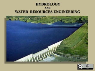
3. Reservoir
• A Reservoir is a artificial lake or
impoundment from a dam which is used to
store water.
• Reservoirs may be created in river valleys
by the construction of a dam or may be built
by excavation in the ground or by
conventional construction techniques such as
brickwork or cast concrete.
5. Purpose of Reservoir
• The Storage reservoir is formed for the
following purpose:
• Flood Control
• Irrigation
• Water Supply
• Hydroelectric Power Generation
• Development of fishery
• Navigation
• Soil Conservation
13. Reservoir may be designated by.
• Single Purpose Reservoir: This type of reservoir
is formed mainly to serve a single purpose, such
as irrigation, flood control, water supply, etc.
• Multipurpose Reservoir: This type is formed to
serve many purpose such as,
• Irrigation and water supply.
• Irrigation water supply and flood control.
• Irrigation, water supply, flood control,
hydroelectric power generation, fishery, etc.
15. Classification of Reservoir
Storage Reservoir
• Storage Reservoir The storage reservoir is
formed by constructing a dam across a river
valley. The idea of constructing such a
reservoir is to store the excess water which
flows through the river during the high floods
or rainy season. This stored water is then utilized
for various purposes, such as irrigation, water
supply, fishery, hydroelectric power generation,
etc. Again the storage reservoir may be named
as single purpose reservoir or multipurpose
reservoir according to its utility.
17. Classification of Reservoir
• Flood Control Reservoir: Flood control
reservoir are for are formed by constructing
dams at suitable places in the catchment area
or river valley to arrest the flood water
temporarily so that the downstream area may
not get damaged by sudden high flood
discharge. The arrested water is then allowed to
flow or released gradually without causing any
harm to the low lying area on the downstream
side. This type of reservoir is designated as
single purpose reservoir. The flood control
reservoir can be of two type:
19. Classification of Reservoir
Detention Reservoir
• In this type of reservoir, the spill ways with adjustable
gates provided with the dam so that the flood water
may be detained for sometime and then released
according to the situation of the downstream area by
operating the gates of the spillways.
Retarding Reservoir
• In this type of reservoir spillways are provided with
the dam at such a level an capacity so that the flood
discharge is retarded and it takes long time for the
flood water to flow completely towards the downstream
area. The discharge stops when the water level falls below
the crest of the spillways.
21. Classification of Reservoir
Distribution Reservoir:
• The distribution reservoir is not formed by
constructing a dam across a river or valley. It
is constructed by masonry work or concrete
work in the form of a rectangular or circular
tank at suitable places near the town or city.
The water from the river or lake is pumped into
this reservoir and stored there for supplying to the
consumers of the town or city. The water may be
supplied to consumers by pumping system or
gravity system.
23. Site Selection for Reservoir
• The following points should be remembered while
selecting a site for a reservoir.
• Stable foundation for the dam should be available
where the reservoir basin is proposed to be formed.
• At the selected site the river valley should be narrow
and well defined so that the length of the dam may be
short.
• The proposed reservoir basin should be watertight and
free from cracks, fissures, etc. so that there is no loss of
water due to percolation.
• The reservoir water should not submerge valuable land
or property.
24. Site Selection for Reservoir
• The tributaries which carry high content of sediment
should be avoided.
• The site should be such that a deep reservoir may
be formed with minimum surface area to control
the loss of water due to evaporation.
• The site should be easily accessible by road or
railway.
• The construction material for the dam and other
allied works should be available in the vicinity of
the site.
• Suitable area should be available for labour
colonies, staff quarters, godowns, stack yards etc.
26. Investigation works for the
Reservoir
• The following investigation should be carried out for
planning the storage reservoir.
• Engineering Survey
• The area of the dam site and reservoir basin should
be surveyed thoroughly to prepare topographical
map and contour map. From the contour map the
storage capacity of the reservoir should be fixed by
ascertaining the height of the dam. Thus, the valuable
land and properties which may get submerged in the
reservoir can be found out. So, the amount of
compensation to be paid to the owner can be
estimated. A detailed statement may be prepared for
the land acquisition.
28. Investigation works for the
Reservoir
• Geological Survey: It should be carried out to
determine the following informations:
• (i) Dam foundation: The sub-surface
exploration at the dam site should be carried
out to locate the cracks, fissures, etc, which are
responsible for the percolation loss. Necessary
measures can then be recommended for
percolation zones to control the losses.
29. Investigation works for the
Reservoir
• (ii) Characteristics of reservoir basin: The geological
survey of the basin should be carried out to locate the
cracks, fissures etc. which are responsible for the
percolation loss. Necessary measures can then be
recommended for percolation zones to control the losses.
• (iii) Availability of Construction Materials: Huge
quantity of materials like fine aggregate and coarse
aggregate are required for the construction of dam and
allied structures The place where these materials are
available should be located and they should preferably be
near the site. If the quarries and sand pits are situated
in the vicinity of the project, it reduces the cost of the
project.
31. Investigation works for the
Reservoir
• Hydrological Survey: This survey includes
the collection of following data:
• River gauging: River gauging should be
carried out for the main river and its
tributaries in the catchment area and on the
upstream side of the site. This is to estimate
the probable discharge of the river
throughout the year.
32. Investigation works for the
Reservoir
• Rainfall records: The rainfall records from the rain
gauge stations in the catchment area for the past few
decades are collected and the runoff is estimated.
Then the hydrographs are prepared from the high flood
discharge for the previous decades. The probable
flood discharge for the future decades are
ascertained from the graphs.
• Determination of discharge from empirical formulae:
The peak flood discharge may also be determined by
empirical formulae like Ryve’s formulae, Dickens's
formulae, etc. The number and capacity of spillway are
determined according to the available highest flood
discharge from different observations.
34. Yield of Reservoir
• Yield The yield of reservoir is defined as the
amount of water which is available in the
reservoir at a specified interval of time.
• Safe yield: It is the maximum quantity of
water available in the reservoir during critical
dry period.
36. Capacity of Reservoir
• Capacity The capacity of a reservoir is
defined as the total volume of water that can
be stored in it. The capacity of a reservoir
may be determined by the following methods.
• By Mass Curve
• By Actual Discharge
• By Empirical Formulae
38. Zones of Storage Reservoir
• The storage capacity of a reservoir is designated by
several zones which are demarcated by certain pools.
• Normal Pool Level (N.P.L) It is the maximum
elevation of the water surface which is to be stored
in the reservoir during normal working period. The
water above this level will flow over the spillway crest.
This water level is also known as full reservoir level
(F.R.L)
• Maximum Pool Level (M.P.L) It is the maximum
elevation to which the water surface is allowed to
rise in the reservoir during the period of flood. This
level can be controlled by providing spillway gate
(M.W.L).
39. Zones of Storage Reservoir
Minimum Pool Level:
• It is the lowest elevation to which the water
level is allowed to drop in a reservoir. This
level is fixed by providing outlets in the dam.
In case of hydroelectric power generation, the
minimum head is essential. So, the water level
of the reservoir should not drop below the
minimum pool level (L.W.L).
40. The following are the various
Storage Zones:
• Dead Storage: The volume of water which is
stored below the minimum pool level of a
reservoir is known as dead storage. This water
cannot be utilized under normal operating
Condition.
• Live Storage: The volume of water stored in
the reservoir between normal pool level and
minimum pool level is known as useful storage
or live storage. This water can be used for
various purposes, such as irrigation, water
supplies, fisheries, hydroelectric power
generation.
41. The following are the various Storage
Zones:
• Surcharge Storage: The volume of water
stored in a reservoir between the normal
pool level and maximum pool level is known
as surcharge storage, this storage is not
meant for any work, but it is mainly for the
detention of flood water so that it may not
cause any danger on the downstream side.
42. The following are the various
Storage Zones:
• Valley Storage: The minimum volume of water
which flows through a river before the
construction of dam is known as valley storage.
This water may always be available from the river
even before the formation of reservoir. This water
may always be available from the river even
before the formation of reservoir.. So, the
effective storage capacity is given by.
• Effective Storage= (Live storage + Surcharge
Storage- Valley Storage).
44. Causes of Sedimentation in
Reservoir
• In the catchment area the soil may get
eroded and rocks may get disintegrated due
to various reasons. The disintegrated rocks
and loose soil form the sediment which is
carried by the river and gets deposited on the
reservoir bed near the base of the dam. The
sediment mainly consists of sand and silt.
The process of deposition of sand and silt in
the reservoir is designated as reservoir
sedimentation.
46. The following are the causes of
sedimentation
• Characteristics of soil in Catchment area: If the catchment
area is composed of loose soil, then it may get easily eroded
and get carried away by the river. On the other hand, if the
soil of the catchment area is hard and rocky, the river would
not be able to carry sediment.
• Topography of the catchment Area: If the catchment area
consists of steep slope, then it will develop high velocity of
flow which will cause more erosion of the surface soil
thereby making the river carry a lot of sediment.
• Intensity of Rainfall in Catchment Area: If the intensity of
rainfall in catchment area is high, then it will increase the
rate of run-off and the river will carry more sediment.
47. The following are the causes of
Sedimentation
• Cultivation in Catchment Area: The intensive
cultivation in the catchment area will make the
soil loose and rain water will carry a lot of
sediment to the river.
• Vegetation cover in Catchment Area: If the
catchment area is covered with vegetation
cover like grass, plants, forest area, etc. then the
erosion of the soil will be controlled and the river
will not carry sediment. If there is no such
vegetal apron or cover, the soil may be easily
eroded and the river will carry much sediment.
48. Effect of Sedimentation
When the sediment laden water of the river
approaches the zone of reservoir, the velocity of flow
reduces gradually and thus the heavier particles are
settled down at the head of the reservoir, i.e.. starting
zone of reservoir. This zone is termed as delta. Most of the
sediments get deposited at this zone. The fine sediments
remain in suspension for a considerable time and are carried
towards the dam. These sediments are deposited at the foot
of the dam. The very fine particles are carried with water
as turbid flow and ultimately discharged through the
outlets. The floating debris is collected above delta. The
clear water circulates the middle portion of the reservoir.
Thus, the life of reservoir depends on the trend of the
sedimentation.
50. Control of Sedimentation
• In order to increase the useful life of a reservoir, it is necessary
to control the phenomenon of sedimentation. The following
steps should be taken to control the deposition of sediment:
• Selection of a Reservoir Site The reservoir site should be
selected in such a way that so that load of sediment in the
flowing water from tributaries is considerably low. If it is
found that a tributary carries heavy sediment, the reservoir site
should be shifted towards the upstream to avoid the tributary.
• Design of Reservoir At the beginning the reservoir should not
be constructed to its full capacity. Initially a reservoir of less
capacity is constructed. When the reservoir gets silted, gradually
the capacity should be increased stage by stage, by increasing
the height of the dam.
• Sufficient outlets should be provided in the dam at different
elevations so that the water carrying heavy sediment may be
discharged to the downstream by opening the outlets.
52. Control of Sedimentation
• Removal of Sediments The sediment already
deposited in the reservoir may be removed through
the scouring sluices provided at the bottom of the dam
by loosening the sediments by mechanical agitator.
• Afforestation New plantations should be planned in
the catchment to extend the forest area which serves
as a vegetal apron to reduce the soil erosion.
• Control of Deforestation The cutting of Trees, i.e.
deforestation in the catchment should be restricted
by the government so that the vegetal cover is not
destroyed. The deforestation may cause soil erosion
and this may cause soil erosion and this may impart
sedimentation load to river water.
54. Control of Sedimentation
• Control of Cultivation: The intensive cultivation in the
catchment makes the soil loose which may then get easily
carried by the rainwater to the river. So the cultivation
should be done in a planned manner and necessary
measures should be taken to avoid the loose soil getting
carried away by the rain.
• Control of Grazing The grazing of cattle in the catchment
should be restricted and they should not be allowed in the
area where the soil can get easily eroded by their feet.
• Construction of Check Dams: If the tributaries of a river
are found to carry heavy sediment load, then check dams of
low height are constructed across the tributaries at different
stages to arrest the sediments just in the catchment area.
Here, the check dams serve the purpose of detention
reservoir where the heavy sediments get settled down.
56. Control of Sedimentation
• Construction of Contour Bunds: In hilly area contour
bunds are constructed on the slope of the catchment at
different elevations so that the heavy sediments are
arrested at the base of the bunds and comparatively less
turbid water passes over the bunds.
• Stabilization of Slips: Most of the tributaries of a river
obtain the sediments from the land slides which are
caused due to heavy rainfall in the hilly area. It is
generally composed of loose soil or permeable rock
formation. These slips should be stabilized by suitable
methods so that the debris may not be carried by flowing
water.