Mapping Skillshare with School of Data
•Télécharger en tant que PPTX, PDF•
4 j'aime•7,693 vues

School of Data Fellow Codrina Maria Ilie gave this skillshare as part of our community series. In this slideshare, you will learn why maps are useful visualization tools as well as what doesn't work with maps. And Codrina shares some tool examples. Be sure to check the detailed notes. About School of Data: http://schoolofdata.org/ About Open Knowledge: Okfn.org ( Presented via G+ On Friday October 10, 2014 )

Recommandé
Contenu connexe
En vedette
Similaire à Mapping Skillshare with School of Data
Similaire à Mapping Skillshare with School of Data (20)
Plus de School of Data
Plus de School of Data (16)
Dernier
Dernier (20)
Mapping Skillshare with School of Data
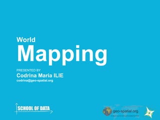
- 1. World Mapping PRESENTED BY Codrina Maria ILIE codrina@geo-spatial.org
- 2. Summary So what will we be talking about? ● Mapping. Super short introduction ● What kind of data can one map? ● Looking at one’s data ● Tools to make beautiful maps ● Resources
- 3. So..what is mapping all about? first maps looked like this… OLAUS MAGNUS, 1539 Carta Marina
- 4. And our interaction with them, like this.. Elizabeth I of England (1533 - 1603)
- 5. Today, our maps are a little bit different…
- 6. And the interaction seems to have changed too..
- 7. Is my data ‘map-able’ ? Is a map the best way to visualize my data? Do you have a location related info? Then, YES, it is map-able. But… Maps are useful when significant information is added through spatial correlations and analysis.
- 8. Looking at the data Data is neutral! ● Data interpretation gives knowledge (meaning) ● Steps to build the best map ever: put all your information on it and then start removing what (YOU) consider is not significant for the purpose of the map. ● Understand what you map!
- 9. What?! They are both correct?! Mathematically, yes.
- 10. Looking at the data types of data – forms of maps Data can be: ● sequential 1,2,3,4,5.. ● diverging -2,-1,0,1,2 ● qualitative white, blue, red Maps can be: ● Choropleth ● Isopleth ● Proportional symbols ● Dot maps Metadata!
- 11. The same dataset is mapped. The number of classes and the division method are the same. The only different thing is the projection and the form of map
- 12. The impression of ‘being on top’ is given by visual contrast. Visual hierarchy
- 13. Map data check ● Geographical elements! ( such as name places) ● Correct position of what you manually placed on your map + geocoded ● Topology (no duplicates, no silver polygons) ● Have you removed all unnecessary information ? ● What about cartographic elements? Projection, color, legend, scale ● Data attribution!
- 14. Mapping tools Free and Open Source tools
- 15. Resources - Open (geo)data portals http://www.naturalearthdata.com/ Free vector and raster map data at 1:10m, 1:50m, and 1:110m scales http://www.geonames.org/ The GeoNames geographical database covers all countries and contains over eight million place names that are available for download free of charge. http://www.eionet.europa.eu/about The official EU geoportal for environmental data http://data.un.org/ The United Nations database http://publicdata.eu/ a Pan European data portal, providing access to open, freely reusable datasets from local, regional and national public bodies across Europe.
- 16. A map is the most scientific work of art one can truly hope for. Thank you!