SlideShare une entreprise Scribd logo
1  sur  32
Lake Chad Basin
Data Research
and Analysis
Serena Emanuel and Haley Kujawa
Presentation Overview:
1. Background Research/Literature Review
2. Data Acquisition
3. Data Analysis
4. Watershed Delineation and Mapping
5. Basin Trends and Conclusions
Directly affected countries:
• Chad, Niger, Nigeria, Cameroon
Indirectly affected countries:
• Central African Republic
• Sudan
• Algeria
Part 1: Background Research and Literature Review
History of Lake Chad
Part 1: Background Research and Literature Review
Low adaptive capacity of arid regions
Part 1: Background Research and Literature Review
Decreased lake size could be due to
decreased inflow
Part 1: Background Research and Literature Review
IPCC GCM report on water and climate
change
Regions experiencing significant increases or decreases in precipitation –
The Lake Chad Basin (LCB) marked by a significant decrease
Part 1: Background Research and Literature Review
On the causes of shrinking Lake Chad
Part 1: Background Research and Literature Review
Model of inflow
for Lake Chad to
return to pre-
1960s levels
Part 1: Background Research and Literature Review
Impact of droughts, split, and irrigation model
Part 1: Background Research and Literature Review
Historical Lake
Levels show cause
could be
part of a natural
cycle
Part 1: Background Research and Literature Review
Part 2: Data Acquisition
GRDC: River Discharge Data
• Application process
• Received daily and monthly data
• Daily Data Includes:
• Lake Chad Basin
• 11 Nigeria Stations
• 21 Central African Republic Stations
• 12 Chad Stations
• Congo River Basin (for future diversion impact
study)
• 44 stations
NOAA Precipitation and Temperature Data
• Daily and monthly data for:
• Cameroon (3 stations)
• Nigeria (10 stations)
• Central African Republic (17 stations)
• Chad (11 stations)
Part 2: Data Acquisition
Part 3: Data Research and Analysis
KEY
Precipitation
Station: Date
Range
Flow Station:
Date Range
Justifying data selection
Criteria for evaluating monotonic trends
• Minimum of 5 years monthly data
• Data gaps less than 1/3 the total data
Climatic analysis of data
• Minimum of 50 years preferable
• For lack of consistent data, 30 years of data was considered useful in this
study
Part 3: Data Research and Analysis
Flow Large Data Ranges
Flow Selected Stations:
Ndjamena: 1976-1991
Ouli Bangala: 1978-1990
Hadejia: 1963-2006
Wudil: 1963-2005
Bossangoa: 1986-1992
Bangui: 1935-2007
Part 3: Data Research and Analysis
Precipitation Large Date Ranges
Precipitation Selected Stations:
Ndjamena: 1950-2016 (67%)
Bousso: 1952-1978 (91%)
Magaria: 1980-1992 (90%)
Moundou: 1950-2016 (62%)
Pala: 1952-1978 (92%)
Garoua: 1973-2016 (71%)
Bour: 1950-1980 (94%)
N Guigni: 1926-2016 (79%)
Sarh: 1950-2016 (64%)
Bouca: 1950-1965 (96%)
Bangui: 1950-1980 (93%)
Part 3: Data Research and Analysis
Part 4: Watershed Delineation
• Accessed 90 m accuracy data from
CGIAR-CSI GeoPortal
• Downloaded about 20 DEM
files/squares that encompass the
Watershed
• Use GIS to delineate watershed and
sub-basins
• Can determine which stations we
have data for and where these
stations are located in the sub-basins
Lake Chad Basin
• Huge area2,500,000 km^2 at
90 m accuracy
• Too large for even ArcGIS to
handle
• Must decrease accuracy while still
maintaining correct watershed
Part 4: Watershed Delineation
Problem Solving: Lake Chad Basin Delineation
• Use CIMA watershed delineation to determine correct Lake Chad Basin
boundaries
• Used AutoCAD to outline basin, and then used previous CIMA file to
correctly scale and locate the basin
CIMA Watershed Boundaries
AutoCAD tracing of
watershed
Part 4: Watershed Delineation
Problem Solving: Lake Chad Basin Delineation
• Imported AutoCAD basin
outline and DEM files into
Global Mapper, to chop data
to watershed size and
reduce cell size, further
decreasing the size of the
data
• Exported the cropped DEM
files and imported them into
WMS
• Used WMS functions in
order to delineate
watershed and sub-basins
Part 4: Watershed Delineation
Global
Mapper
WMS
Lake Chad Basin Delineation
Part 4: Watershed Delineation
Comparison between WMS Delineation (left) and CIMA delineation (right)
Lake Chad Basin Delineation: Adding the Lake
Part 4: Watershed Delineation
• Used GIS raster calculator to add
290 m elevation lake (historic size)
and 280 m elevation lake (2008 size)
• Compared with Google Earth
to check accuracy of raster
calculator/elevation method
Lake Chad Basin Delineation using WMS
Sub-Basin 1Sub-Basin 2Sub-Basin 3Sub-Basin 4Sub-Basin 5Overall Basin
Part 4: Watershed Delineation
Part 5: Basin Trends and Conclusions
Key:
Precipitation
Flow
Mann-Kendall analysis
Part 5: Basin Trends and Conclusion
Sen slope; estimate of rate
of change in the trend
Test statistic; large
absolute value
indicates a trend
β0 is the null hypothesis (no trend);
when non-zero, the null hypothesis
is rejected
n = number of data points
Tau statistic; similar
to correlation
coefficient
Linear regression of the data
Significance Equations
Relative Factor
• Used to fill missing data
• Stations with spatial relations could be plotted on x (station A) and y-
axis (station B) to determine a linear fit
• If R>0.8, the linear relationship between the data can be used to
transform data from station A to station B
Part 5: Basin Trends and Conclusion
Part 5: Basin Trends and Conclusions
Ndjamena
Moundou
Bangui
Bossangoa
Wudil
Hadejia
Station Precipitation
Date Range
Flow Date
Range
Ndjamena 1950-1978 1953-2009
Bangui -------- 1935-2007
Bossangoa -------- 1951-1972
Hadejia -------- 1963-2005
Wudil -------- 1963-1991
Moundou 1950-1978 ----------
Significant: CI>90%
Seasonal Trend Analysis:
Rainy season
Conclusion of Data Analysis and Results
• Map of trends concludes decrease in flow
and precipitation could be a significant
cause of the shrinking of the Lake Chad
• Conclusion coincides with background
research
Part 5: Basin Trends and Conclusion
Data Discussion
• Historically, countries around Lake Chad haven’t focused on
investments in data collection
• Data is sporadic and infrequent, many sets are missing too large of
gaps to run Mann-Kendall analysis
• Relative analysis was able to fill some of the data gaps
• Using only one month out of the year may produce a more
continuous series of data to run in the Mann-Kendall (i.e. August or
September, during the rainy season)
Part 5: Basin Trends and Conclusions
Future Work
• Further analysis and organization of the data must be done
• Collection of more data sets to verify and fill gaps in the data
• More research on and a better understanding of the Mann-Kendall
analysis
• Finding more data for stations in upper sub-basins (Sahel region)
• Using historical data to project future trends
• Analyzing impact of the basin transfer project on the the Lake Chad
Basin and Congo River Basin
Part 5: Basin Trends and Conclusions
Thank you!
Any questions?
Special thanks to: Dr. Guo, Bibi, David, Mr. Song, Yang, and all others who have graciously helped with our project and
our internship

Contenu connexe

Tendances

Hydrologic analysis
Hydrologic analysisHydrologic analysis
Hydrologic analysissaif07amu
 
23 - NRSC - Remote Satellite Imgae - Hydrology and Water Management-Sep-17
23 - NRSC - Remote Satellite Imgae - Hydrology and Water Management-Sep-1723 - NRSC - Remote Satellite Imgae - Hydrology and Water Management-Sep-17
23 - NRSC - Remote Satellite Imgae - Hydrology and Water Management-Sep-17indiawrm
 
2016 conservation track: automated river classification using gis delineated ...
2016 conservation track: automated river classification using gis delineated ...2016 conservation track: automated river classification using gis delineated ...
2016 conservation track: automated river classification using gis delineated ...GIS in the Rockies
 
2016 conservation track: evaluating lidar derived synthetic streams as a ...
2016 conservation track: evaluating   lidar derived   synthetic streams as a ...2016 conservation track: evaluating   lidar derived   synthetic streams as a ...
2016 conservation track: evaluating lidar derived synthetic streams as a ...GIS in the Rockies
 
Assessment of Water Supply–Demand for a Watershed using WEAP Model
Assessment of Water Supply–Demand  for a Watershed using WEAP Model Assessment of Water Supply–Demand  for a Watershed using WEAP Model
Assessment of Water Supply–Demand for a Watershed using WEAP Model dipesh thakur
 
Surface Water modelling using Remote Sensing
Surface Water modelling using Remote SensingSurface Water modelling using Remote Sensing
Surface Water modelling using Remote SensingArk Arjun
 
Aquifer recharge from flash floods in the arid environment: A mass balance ap...
Aquifer recharge from flash floods in the arid environment: A mass balance ap...Aquifer recharge from flash floods in the arid environment: A mass balance ap...
Aquifer recharge from flash floods in the arid environment: A mass balance ap...Amro Elfeki
 
Survey and Design of Gravity Fed Water supply system at a DadaGaun ,Banepa
Survey and Design of Gravity Fed Water supply system at a DadaGaun ,BanepaSurvey and Design of Gravity Fed Water supply system at a DadaGaun ,Banepa
Survey and Design of Gravity Fed Water supply system at a DadaGaun ,BanepaNepal Flying Labs
 
Application of water evaluation and planning (WEAP)
Application of water evaluation and planning (WEAP)Application of water evaluation and planning (WEAP)
Application of water evaluation and planning (WEAP)oloofrank
 
Hydrologic Assessment in a Middle Narmada Basin, India using SWAT Model
Hydrologic Assessment in a Middle Narmada Basin, India using SWAT ModelHydrologic Assessment in a Middle Narmada Basin, India using SWAT Model
Hydrologic Assessment in a Middle Narmada Basin, India using SWAT ModelSumant Diwakar
 
Using HEC-RAS to assess flash floods risk in arid regions
Using HEC-RAS to assess flash floods risk in arid regionsUsing HEC-RAS to assess flash floods risk in arid regions
Using HEC-RAS to assess flash floods risk in arid regionsAhmed Saleh, Ph.D
 
Master's course defense presentation in Water Resource Management and GIS
Master's course defense presentation in Water Resource Management and GIS  Master's course defense presentation in Water Resource Management and GIS
Master's course defense presentation in Water Resource Management and GIS Tooryalay Ayoubi
 
The Development of a Catchment Management Modelling System for the Googong Re...
The Development of a Catchment Management Modelling System for the Googong Re...The Development of a Catchment Management Modelling System for the Googong Re...
The Development of a Catchment Management Modelling System for the Googong Re...GavanThomas
 
TGS GPS - APPA Project Brochure
TGS GPS - APPA Project Brochure TGS GPS - APPA Project Brochure
TGS GPS - APPA Project Brochure TGS
 
Scale-dependency and Sensitivity of Hydrological Estimations to Land Use and ...
Scale-dependency and Sensitivity of Hydrological Estimations to Land Use and ...Scale-dependency and Sensitivity of Hydrological Estimations to Land Use and ...
Scale-dependency and Sensitivity of Hydrological Estimations to Land Use and ...Beniamino Murgante
 

Tendances (18)

Hydrologic analysis
Hydrologic analysisHydrologic analysis
Hydrologic analysis
 
23 - NRSC - Remote Satellite Imgae - Hydrology and Water Management-Sep-17
23 - NRSC - Remote Satellite Imgae - Hydrology and Water Management-Sep-1723 - NRSC - Remote Satellite Imgae - Hydrology and Water Management-Sep-17
23 - NRSC - Remote Satellite Imgae - Hydrology and Water Management-Sep-17
 
2016 conservation track: automated river classification using gis delineated ...
2016 conservation track: automated river classification using gis delineated ...2016 conservation track: automated river classification using gis delineated ...
2016 conservation track: automated river classification using gis delineated ...
 
Weap final
Weap finalWeap final
Weap final
 
2016 conservation track: evaluating lidar derived synthetic streams as a ...
2016 conservation track: evaluating   lidar derived   synthetic streams as a ...2016 conservation track: evaluating   lidar derived   synthetic streams as a ...
2016 conservation track: evaluating lidar derived synthetic streams as a ...
 
Assessment of Water Supply–Demand for a Watershed using WEAP Model
Assessment of Water Supply–Demand  for a Watershed using WEAP Model Assessment of Water Supply–Demand  for a Watershed using WEAP Model
Assessment of Water Supply–Demand for a Watershed using WEAP Model
 
Surface Water modelling using Remote Sensing
Surface Water modelling using Remote SensingSurface Water modelling using Remote Sensing
Surface Water modelling using Remote Sensing
 
Aquifer recharge from flash floods in the arid environment: A mass balance ap...
Aquifer recharge from flash floods in the arid environment: A mass balance ap...Aquifer recharge from flash floods in the arid environment: A mass balance ap...
Aquifer recharge from flash floods in the arid environment: A mass balance ap...
 
Survey and Design of Gravity Fed Water supply system at a DadaGaun ,Banepa
Survey and Design of Gravity Fed Water supply system at a DadaGaun ,BanepaSurvey and Design of Gravity Fed Water supply system at a DadaGaun ,Banepa
Survey and Design of Gravity Fed Water supply system at a DadaGaun ,Banepa
 
Application of water evaluation and planning (WEAP)
Application of water evaluation and planning (WEAP)Application of water evaluation and planning (WEAP)
Application of water evaluation and planning (WEAP)
 
Hydrologic Assessment in a Middle Narmada Basin, India using SWAT Model
Hydrologic Assessment in a Middle Narmada Basin, India using SWAT ModelHydrologic Assessment in a Middle Narmada Basin, India using SWAT Model
Hydrologic Assessment in a Middle Narmada Basin, India using SWAT Model
 
Using HEC-RAS to assess flash floods risk in arid regions
Using HEC-RAS to assess flash floods risk in arid regionsUsing HEC-RAS to assess flash floods risk in arid regions
Using HEC-RAS to assess flash floods risk in arid regions
 
Sediment and nutrient load model
Sediment and nutrient load modelSediment and nutrient load model
Sediment and nutrient load model
 
Arc swat
Arc swat Arc swat
Arc swat
 
Master's course defense presentation in Water Resource Management and GIS
Master's course defense presentation in Water Resource Management and GIS  Master's course defense presentation in Water Resource Management and GIS
Master's course defense presentation in Water Resource Management and GIS
 
The Development of a Catchment Management Modelling System for the Googong Re...
The Development of a Catchment Management Modelling System for the Googong Re...The Development of a Catchment Management Modelling System for the Googong Re...
The Development of a Catchment Management Modelling System for the Googong Re...
 
TGS GPS - APPA Project Brochure
TGS GPS - APPA Project Brochure TGS GPS - APPA Project Brochure
TGS GPS - APPA Project Brochure
 
Scale-dependency and Sensitivity of Hydrological Estimations to Land Use and ...
Scale-dependency and Sensitivity of Hydrological Estimations to Land Use and ...Scale-dependency and Sensitivity of Hydrological Estimations to Land Use and ...
Scale-dependency and Sensitivity of Hydrological Estimations to Land Use and ...
 

En vedette

Georgetown SFS - Chevron FDI Risk in Emerging Markets Strategy
Georgetown SFS - Chevron FDI Risk in Emerging Markets StrategyGeorgetown SFS - Chevron FDI Risk in Emerging Markets Strategy
Georgetown SFS - Chevron FDI Risk in Emerging Markets StrategyPatrick Ottenhoff
 
Chad's Creative Concept
Chad's Creative ConceptChad's Creative Concept
Chad's Creative ConceptBishnu Kumar
 
Offshore 1D infinite slope modeling in seismic conditions with opensees
Offshore 1D infinite slope modeling in seismic conditions with openseesOffshore 1D infinite slope modeling in seismic conditions with opensees
Offshore 1D infinite slope modeling in seismic conditions with openseesDAPPOLONIA
 
D’Appolonia: Challenges and opportunities for IESC
D’Appolonia: Challenges and opportunities for IESCD’Appolonia: Challenges and opportunities for IESC
D’Appolonia: Challenges and opportunities for IESCDAPPOLONIA
 
Energycasestudy chad
Energycasestudy chadEnergycasestudy chad
Energycasestudy chadbobcrank
 
51432284 project-finance
51432284 project-finance51432284 project-finance
51432284 project-financeamritakamarath
 
Chad cameroon pipeline project
Chad cameroon pipeline projectChad cameroon pipeline project
Chad cameroon pipeline projectUjjwal Joshi
 

En vedette (10)

Georgetown SFS - Chevron FDI Risk in Emerging Markets Strategy
Georgetown SFS - Chevron FDI Risk in Emerging Markets StrategyGeorgetown SFS - Chevron FDI Risk in Emerging Markets Strategy
Georgetown SFS - Chevron FDI Risk in Emerging Markets Strategy
 
ExxonMobil
ExxonMobilExxonMobil
ExxonMobil
 
Chad's Creative Concept
Chad's Creative ConceptChad's Creative Concept
Chad's Creative Concept
 
Offshore 1D infinite slope modeling in seismic conditions with opensees
Offshore 1D infinite slope modeling in seismic conditions with openseesOffshore 1D infinite slope modeling in seismic conditions with opensees
Offshore 1D infinite slope modeling in seismic conditions with opensees
 
D’Appolonia: Challenges and opportunities for IESC
D’Appolonia: Challenges and opportunities for IESCD’Appolonia: Challenges and opportunities for IESC
D’Appolonia: Challenges and opportunities for IESC
 
Energycasestudy chad
Energycasestudy chadEnergycasestudy chad
Energycasestudy chad
 
risk management
risk managementrisk management
risk management
 
Em Chad
Em ChadEm Chad
Em Chad
 
51432284 project-finance
51432284 project-finance51432284 project-finance
51432284 project-finance
 
Chad cameroon pipeline project
Chad cameroon pipeline projectChad cameroon pipeline project
Chad cameroon pipeline project
 

Similaire à Lake Chad Basin Data Analysis Reveals Precipitation and Flow Trends

Pilbara rfa ea presentation v3.2 1
Pilbara rfa ea presentation v3.2 1Pilbara rfa ea presentation v3.2 1
Pilbara rfa ea presentation v3.2 1Engineers Australia
 
DSD-INT 2016 Regional groundwater flow systems in the Kenya Rift Valley - Mur...
DSD-INT 2016 Regional groundwater flow systems in the Kenya Rift Valley - Mur...DSD-INT 2016 Regional groundwater flow systems in the Kenya Rift Valley - Mur...
DSD-INT 2016 Regional groundwater flow systems in the Kenya Rift Valley - Mur...Deltares
 
Storm intensity not increasing - factual review of engineering data - Canada ...
Storm intensity not increasing - factual review of engineering data - Canada ...Storm intensity not increasing - factual review of engineering data - Canada ...
Storm intensity not increasing - factual review of engineering data - Canada ...Robert Muir
 
M.S. Capstone Seminar
M.S. Capstone SeminarM.S. Capstone Seminar
M.S. Capstone Seminarshirabay
 
Download-manuals-surface water-manual-sw-volume3referencemanualhydro-meteoro...
 Download-manuals-surface water-manual-sw-volume3referencemanualhydro-meteoro... Download-manuals-surface water-manual-sw-volume3referencemanualhydro-meteoro...
Download-manuals-surface water-manual-sw-volume3referencemanualhydro-meteoro...hydrologyproject001
 
Easter Desert Project
Easter Desert ProjectEaster Desert Project
Easter Desert ProjectIwl Pcu
 
DSD-Kampala 2023 Analytic Tools for Cooperative Water Resources Assessments i...
DSD-Kampala 2023 Analytic Tools for Cooperative Water Resources Assessments i...DSD-Kampala 2023 Analytic Tools for Cooperative Water Resources Assessments i...
DSD-Kampala 2023 Analytic Tools for Cooperative Water Resources Assessments i...Deltares
 
Lecture 3-Water Resources Monitoring.ppt
Lecture 3-Water Resources Monitoring.pptLecture 3-Water Resources Monitoring.ppt
Lecture 3-Water Resources Monitoring.pptLawrence Omai
 
Got Streamflow? Why More Rain is Providing Less Streamflow in The Upper Color...
Got Streamflow? Why More Rain is Providing Less Streamflow in The Upper Color...Got Streamflow? Why More Rain is Providing Less Streamflow in The Upper Color...
Got Streamflow? Why More Rain is Providing Less Streamflow in The Upper Color...TWCA
 
REMOTE SENSING DATA FOR HYDROLOGICAL MODELING
REMOTE SENSING DATA FOR HYDROLOGICAL MODELINGREMOTE SENSING DATA FOR HYDROLOGICAL MODELING
REMOTE SENSING DATA FOR HYDROLOGICAL MODELINGShyam Mohan Chaudhary
 
Day 1 neno kukuric igrac - methodology
Day 1 neno kukuric   igrac - methodologyDay 1 neno kukuric   igrac - methodology
Day 1 neno kukuric igrac - methodologygroundwatercop
 
Coastal Landcover Trends & Applications in the NW
Coastal Landcover Trends & Applications in the NWCoastal Landcover Trends & Applications in the NW
Coastal Landcover Trends & Applications in the NWEric Morris
 
2012 02 The State of the Severn Report Dr. Rhoda Ballinger, Cardiff University
2012 02 The State of the Severn Report  Dr. Rhoda Ballinger, Cardiff University2012 02 The State of the Severn Report  Dr. Rhoda Ballinger, Cardiff University
2012 02 The State of the Severn Report Dr. Rhoda Ballinger, Cardiff UniversitySevernEstuary
 
Download-manuals-ground water-manual-gw-volume8operationmanualdataprocessing...
 Download-manuals-ground water-manual-gw-volume8operationmanualdataprocessing... Download-manuals-ground water-manual-gw-volume8operationmanualdataprocessing...
Download-manuals-ground water-manual-gw-volume8operationmanualdataprocessing...hydrologywebsite1
 
Download-manuals-ground water-manual-gw-volume8operationmanualdataprocessing...
 Download-manuals-ground water-manual-gw-volume8operationmanualdataprocessing... Download-manuals-ground water-manual-gw-volume8operationmanualdataprocessing...
Download-manuals-ground water-manual-gw-volume8operationmanualdataprocessing...hydrologyproject001
 

Similaire à Lake Chad Basin Data Analysis Reveals Precipitation and Flow Trends (20)

Pilbara rfa ea presentation v3.2 1
Pilbara rfa ea presentation v3.2 1Pilbara rfa ea presentation v3.2 1
Pilbara rfa ea presentation v3.2 1
 
DSD-INT 2016 Regional groundwater flow systems in the Kenya Rift Valley - Mur...
DSD-INT 2016 Regional groundwater flow systems in the Kenya Rift Valley - Mur...DSD-INT 2016 Regional groundwater flow systems in the Kenya Rift Valley - Mur...
DSD-INT 2016 Regional groundwater flow systems in the Kenya Rift Valley - Mur...
 
Presentation_Niraj_Final
Presentation_Niraj_Final Presentation_Niraj_Final
Presentation_Niraj_Final
 
Storm intensity not increasing - factual review of engineering data - Canada ...
Storm intensity not increasing - factual review of engineering data - Canada ...Storm intensity not increasing - factual review of engineering data - Canada ...
Storm intensity not increasing - factual review of engineering data - Canada ...
 
M.S. Capstone Seminar
M.S. Capstone SeminarM.S. Capstone Seminar
M.S. Capstone Seminar
 
Trend Analysis.pdf
Trend Analysis.pdfTrend Analysis.pdf
Trend Analysis.pdf
 
Download-manuals-surface water-manual-sw-volume3referencemanualhydro-meteoro...
 Download-manuals-surface water-manual-sw-volume3referencemanualhydro-meteoro... Download-manuals-surface water-manual-sw-volume3referencemanualhydro-meteoro...
Download-manuals-surface water-manual-sw-volume3referencemanualhydro-meteoro...
 
Estimating Groundwater Availability at the Catchment Scale Using Streamflow R...
Estimating Groundwater Availability at the Catchment Scale Using Streamflow R...Estimating Groundwater Availability at the Catchment Scale Using Streamflow R...
Estimating Groundwater Availability at the Catchment Scale Using Streamflow R...
 
Easter Desert Project
Easter Desert ProjectEaster Desert Project
Easter Desert Project
 
DSD-Kampala 2023 Analytic Tools for Cooperative Water Resources Assessments i...
DSD-Kampala 2023 Analytic Tools for Cooperative Water Resources Assessments i...DSD-Kampala 2023 Analytic Tools for Cooperative Water Resources Assessments i...
DSD-Kampala 2023 Analytic Tools for Cooperative Water Resources Assessments i...
 
Lecture 3-Water Resources Monitoring.ppt
Lecture 3-Water Resources Monitoring.pptLecture 3-Water Resources Monitoring.ppt
Lecture 3-Water Resources Monitoring.ppt
 
Got Streamflow? Why More Rain is Providing Less Streamflow in The Upper Color...
Got Streamflow? Why More Rain is Providing Less Streamflow in The Upper Color...Got Streamflow? Why More Rain is Providing Less Streamflow in The Upper Color...
Got Streamflow? Why More Rain is Providing Less Streamflow in The Upper Color...
 
September 1 - 0916 - Ziwei Li and Zhiming Qi
September 1 - 0916 - Ziwei Li and Zhiming QiSeptember 1 - 0916 - Ziwei Li and Zhiming Qi
September 1 - 0916 - Ziwei Li and Zhiming Qi
 
REMOTE SENSING DATA FOR HYDROLOGICAL MODELING
REMOTE SENSING DATA FOR HYDROLOGICAL MODELINGREMOTE SENSING DATA FOR HYDROLOGICAL MODELING
REMOTE SENSING DATA FOR HYDROLOGICAL MODELING
 
Day 1 neno kukuric igrac - methodology
Day 1 neno kukuric   igrac - methodologyDay 1 neno kukuric   igrac - methodology
Day 1 neno kukuric igrac - methodology
 
Coastal Landcover Trends & Applications in the NW
Coastal Landcover Trends & Applications in the NWCoastal Landcover Trends & Applications in the NW
Coastal Landcover Trends & Applications in the NW
 
2012 02 The State of the Severn Report Dr. Rhoda Ballinger, Cardiff University
2012 02 The State of the Severn Report  Dr. Rhoda Ballinger, Cardiff University2012 02 The State of the Severn Report  Dr. Rhoda Ballinger, Cardiff University
2012 02 The State of the Severn Report Dr. Rhoda Ballinger, Cardiff University
 
FSG_2016_Lyons
FSG_2016_LyonsFSG_2016_Lyons
FSG_2016_Lyons
 
Download-manuals-ground water-manual-gw-volume8operationmanualdataprocessing...
 Download-manuals-ground water-manual-gw-volume8operationmanualdataprocessing... Download-manuals-ground water-manual-gw-volume8operationmanualdataprocessing...
Download-manuals-ground water-manual-gw-volume8operationmanualdataprocessing...
 
Download-manuals-ground water-manual-gw-volume8operationmanualdataprocessing...
 Download-manuals-ground water-manual-gw-volume8operationmanualdataprocessing... Download-manuals-ground water-manual-gw-volume8operationmanualdataprocessing...
Download-manuals-ground water-manual-gw-volume8operationmanualdataprocessing...
 

Lake Chad Basin Data Analysis Reveals Precipitation and Flow Trends

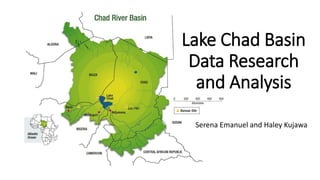
  • 1. Lake Chad Basin Data Research and Analysis Serena Emanuel and Haley Kujawa
  • 2. Presentation Overview: 1. Background Research/Literature Review 2. Data Acquisition 3. Data Analysis 4. Watershed Delineation and Mapping 5. Basin Trends and Conclusions
  • 3. Directly affected countries: • Chad, Niger, Nigeria, Cameroon Indirectly affected countries: • Central African Republic • Sudan • Algeria Part 1: Background Research and Literature Review
  • 4. History of Lake Chad Part 1: Background Research and Literature Review
  • 5. Low adaptive capacity of arid regions Part 1: Background Research and Literature Review
  • 6. Decreased lake size could be due to decreased inflow Part 1: Background Research and Literature Review
  • 7. IPCC GCM report on water and climate change Regions experiencing significant increases or decreases in precipitation – The Lake Chad Basin (LCB) marked by a significant decrease Part 1: Background Research and Literature Review
  • 8. On the causes of shrinking Lake Chad Part 1: Background Research and Literature Review
  • 9. Model of inflow for Lake Chad to return to pre- 1960s levels Part 1: Background Research and Literature Review
  • 10. Impact of droughts, split, and irrigation model Part 1: Background Research and Literature Review
  • 11. Historical Lake Levels show cause could be part of a natural cycle Part 1: Background Research and Literature Review
  • 12. Part 2: Data Acquisition GRDC: River Discharge Data • Application process • Received daily and monthly data • Daily Data Includes: • Lake Chad Basin • 11 Nigeria Stations • 21 Central African Republic Stations • 12 Chad Stations • Congo River Basin (for future diversion impact study) • 44 stations
  • 13. NOAA Precipitation and Temperature Data • Daily and monthly data for: • Cameroon (3 stations) • Nigeria (10 stations) • Central African Republic (17 stations) • Chad (11 stations) Part 2: Data Acquisition
  • 14. Part 3: Data Research and Analysis KEY Precipitation Station: Date Range Flow Station: Date Range
  • 15. Justifying data selection Criteria for evaluating monotonic trends • Minimum of 5 years monthly data • Data gaps less than 1/3 the total data Climatic analysis of data • Minimum of 50 years preferable • For lack of consistent data, 30 years of data was considered useful in this study Part 3: Data Research and Analysis
  • 16. Flow Large Data Ranges Flow Selected Stations: Ndjamena: 1976-1991 Ouli Bangala: 1978-1990 Hadejia: 1963-2006 Wudil: 1963-2005 Bossangoa: 1986-1992 Bangui: 1935-2007 Part 3: Data Research and Analysis
  • 17. Precipitation Large Date Ranges Precipitation Selected Stations: Ndjamena: 1950-2016 (67%) Bousso: 1952-1978 (91%) Magaria: 1980-1992 (90%) Moundou: 1950-2016 (62%) Pala: 1952-1978 (92%) Garoua: 1973-2016 (71%) Bour: 1950-1980 (94%) N Guigni: 1926-2016 (79%) Sarh: 1950-2016 (64%) Bouca: 1950-1965 (96%) Bangui: 1950-1980 (93%) Part 3: Data Research and Analysis
  • 18. Part 4: Watershed Delineation • Accessed 90 m accuracy data from CGIAR-CSI GeoPortal • Downloaded about 20 DEM files/squares that encompass the Watershed • Use GIS to delineate watershed and sub-basins • Can determine which stations we have data for and where these stations are located in the sub-basins
  • 19. Lake Chad Basin • Huge area2,500,000 km^2 at 90 m accuracy • Too large for even ArcGIS to handle • Must decrease accuracy while still maintaining correct watershed Part 4: Watershed Delineation
  • 20. Problem Solving: Lake Chad Basin Delineation • Use CIMA watershed delineation to determine correct Lake Chad Basin boundaries • Used AutoCAD to outline basin, and then used previous CIMA file to correctly scale and locate the basin CIMA Watershed Boundaries AutoCAD tracing of watershed Part 4: Watershed Delineation
  • 21. Problem Solving: Lake Chad Basin Delineation • Imported AutoCAD basin outline and DEM files into Global Mapper, to chop data to watershed size and reduce cell size, further decreasing the size of the data • Exported the cropped DEM files and imported them into WMS • Used WMS functions in order to delineate watershed and sub-basins Part 4: Watershed Delineation Global Mapper WMS
  • 22. Lake Chad Basin Delineation Part 4: Watershed Delineation Comparison between WMS Delineation (left) and CIMA delineation (right)
  • 23. Lake Chad Basin Delineation: Adding the Lake Part 4: Watershed Delineation • Used GIS raster calculator to add 290 m elevation lake (historic size) and 280 m elevation lake (2008 size) • Compared with Google Earth to check accuracy of raster calculator/elevation method
  • 24. Lake Chad Basin Delineation using WMS Sub-Basin 1Sub-Basin 2Sub-Basin 3Sub-Basin 4Sub-Basin 5Overall Basin Part 4: Watershed Delineation
  • 25. Part 5: Basin Trends and Conclusions Key: Precipitation Flow
  • 26. Mann-Kendall analysis Part 5: Basin Trends and Conclusion Sen slope; estimate of rate of change in the trend Test statistic; large absolute value indicates a trend β0 is the null hypothesis (no trend); when non-zero, the null hypothesis is rejected n = number of data points Tau statistic; similar to correlation coefficient Linear regression of the data Significance Equations
  • 27. Relative Factor • Used to fill missing data • Stations with spatial relations could be plotted on x (station A) and y- axis (station B) to determine a linear fit • If R>0.8, the linear relationship between the data can be used to transform data from station A to station B Part 5: Basin Trends and Conclusion
  • 28. Part 5: Basin Trends and Conclusions Ndjamena Moundou Bangui Bossangoa Wudil Hadejia Station Precipitation Date Range Flow Date Range Ndjamena 1950-1978 1953-2009 Bangui -------- 1935-2007 Bossangoa -------- 1951-1972 Hadejia -------- 1963-2005 Wudil -------- 1963-1991 Moundou 1950-1978 ---------- Significant: CI>90% Seasonal Trend Analysis: Rainy season
  • 29. Conclusion of Data Analysis and Results • Map of trends concludes decrease in flow and precipitation could be a significant cause of the shrinking of the Lake Chad • Conclusion coincides with background research Part 5: Basin Trends and Conclusion
  • 30. Data Discussion • Historically, countries around Lake Chad haven’t focused on investments in data collection • Data is sporadic and infrequent, many sets are missing too large of gaps to run Mann-Kendall analysis • Relative analysis was able to fill some of the data gaps • Using only one month out of the year may produce a more continuous series of data to run in the Mann-Kendall (i.e. August or September, during the rainy season) Part 5: Basin Trends and Conclusions
  • 31. Future Work • Further analysis and organization of the data must be done • Collection of more data sets to verify and fill gaps in the data • More research on and a better understanding of the Mann-Kendall analysis • Finding more data for stations in upper sub-basins (Sahel region) • Using historical data to project future trends • Analyzing impact of the basin transfer project on the the Lake Chad Basin and Congo River Basin Part 5: Basin Trends and Conclusions
  • 32. Thank you! Any questions? Special thanks to: Dr. Guo, Bibi, David, Mr. Song, Yang, and all others who have graciously helped with our project and our internship

Notes de l'éditeur

  1. Discuss goals/purpose
  2. Economy depends on agriculture and fishing which depends on lake Water use for drinking and daily activities Around 30 million people depend on Lake Chad
  3. 25000 to 15000 km^2 This is the historywhat is the cause? Huadong’s major goal before going forth with the water diversion project Anthropogenic such as dams or irrigation or natural climate variation Brittanica: Travelers reported high water levels and overflow into the El-Ghazal during the 13th and 19th centuries. In 1870, for example, Lake Chad covered some 10,800 square miles (28,000 square km). At the turn of the 20th century the lake began to diminish in size, but by the 1920s it had recovered, and in 1956 it again overflowed into the El-Ghazal. During the 1970s and ’80s the amplitude of the lake’s annual variability was the highest recorded in the 20th century, with average levels falling below long-term norms; the surface area was reduced to less than 1,500 square miles (3,900 square km) for a time in the mid-1980s and again in the early 21st century. The corresponding variability in rainfall appears to have been related to the effects of environmental degradation.
  4. Recent studies have confirmed that particularly the arid and semi-arid regions of Africa are the most vulnerable areas to climate variability and change because of multiple stresses and low adaptive capacity (Osman- Elasha, 2007; IPCC WGII, 2007) The changes in the lake chad may be due to natural climate variability and droughts and natural erosion Could also be due to human activity such as unsustainable farming practices that use irrigation or grazing that removes plants important to the hydrology of the lake
  5. Map of gauging station on the Chari-Logone R., where Lake Chad receives an estimated 80% of its inflow Study on discharge measurements Has daily measurements, but not throughout the course of a month at the same data station Used velocity measurements from ADCP (acoustic principle) to get a 3-dimensional view of the velocity. The map of the velocity distribution in the cross sectional area is included in the report. Concludes rating curves should be used with caution during flood/ estimating peak flow. During floods water burst into banks of the river system and caused lower flow than expected in the river, sometimes by 50%
  6. https://www.ipcc.ch/pdf/technical-papers/climate-change-water-en.pdf The intergovernmental panel on climate change technical report on climate change and water The lake chad region is one of significant decrease
  7. Historical split in the northern and southern basin caused seasonal changes in hydrology Northern basin separated by great barrier and almost always dry now Of interest because this is a new occurance in the basin; in models, this split makes the lake chad more difficult to return to pre-1960s lake chad, could be a turning point in hydrologic history
  8. This graph shows what inflows would be needed over the course of years to return Lake Chad to pre-1960s levels. These flow rates are highly unlikely to happen in nature. From On the causes of the shrinking of Lake Chad
  9. Climate in 1990s was not conducive to a full recovery from previous droughts   These results clearly show that even without irrigation withdrawals, the 1952–2006 mean climate state does not favor a single lake.   We also tested the impact of temperature change by increasing the annual average air temperature by 2K (approximately the observed temperature increase from 1952– 2006), and found that modeled inflow decreased by about 10% relative to climatology due to increased evapotranspiration   Figure 5 shows that with a recurring net annual inflow of 50 km3 yr−1, the two lakes would have merged into one in about four years, and a total of 10 years would be required for the lake to resume its 1963 size(9.25 m annual minimumlake level). For an annual inflow of 60 km3 it would take five years to recover to the 1963 size. A larger annual inflow not only implies a shorter time but also a smaller total volume needed for recovery to a given size. However, because 1963 was one of the wettest years in the study period (and had low irrigation withdrawals), it is unlikely that an equivalent/largerinflow(after irrigationusage) will occur for even one year, let alone multiple consecutive years, under foreseeable climate conditions.
  10. GRDC Lat/Long of each station Catchment area Altitude of Station Mean Daily Discharge Mean monthly Discharge
  11. NOAA Lat/Long of each station Elevation of station Daily precipitation total Max daily temperature Min daily temperature
  12. National nonpoint source monitoring program by EPA
  13. GRDC Selected Stations: Ndjamena: 1976-1991 Ouli Bangala: 1978-1990 Hadejia: 1963-2006 Wudil: 1963-2005 Bossangoa: 1986-1992 Bangui: 1935-2007
  14. NOAA Selected Stations: Ndjamena: 1950-2016 (67%) Bousso: 1952-1978 (91%) Magaria: 1980-1992 (90%) Pala: 1952-1978 (92%) Garoua: 1973-2016 (71%) Bour: 1950-1980 (94%) N Guigni: 1926-2016 (79%) Sarh: 1950-2016 (64%) Bouca: 1950-1965 (96%) Bangui: 1950-1980 (93%)
  15. Huge area2,500,000 km^2 at 90 m accuracy Too large for even ArcGIS to handle. Must decrease accuracy while still maintaining correct watershed
  16. -“Mann-Kendall trend test is a nonparametric test used to identify a trend in a series, even if there is a seasonal component in the series.” Null hypothesis states that β0 = 0 and no trend is present S indicates an upward trend (large positive number) or downward trend (large negative number) τ, the test statistic, is the equivalent of a correlation coefficient (-1 to 1) When S and τ are significantly different from zero, null hypothesis is rejected and a trend is indicated Sen slope estimator used to find rate of change (β1)
  17. 100% of precipitation from May- October Over 50% of the data is between aug-oct Used months of September for flow data and September or August for rainfall NDJA  1953-2009 GRDC, 1950-1978 NOAA BANGUI  1935-2007 GRDC BOSSANGOA  1951-1972 GRDC HADEJIA  1963-2005 GRDC WUDIL  1963-1991 GRDC MOUNDO  1950-1978 GRDC
  18. Flow is: Precipitation is: Relate to previous research
  19. Relative analysis = Bossangoa and Moissala, Often times the relative analysis did match, but the data in both sequences was missing too much and didn’t create a full enough data set CIMA said they had data in their files, but it was not found in the files given (i.e. for the Ouli Bangala station)
  20. Further analysis  Outside influences need to be eliminated for “pristine” flow data to detect changes due to climate