SlideShare a Scribd company logo
1 of 25
CONDUCTING RIVER CROSS
SECTION SURVEY OF
MAHANANDA RIVER AND ITS
TRIBUTARIES
Under National Hydrology Project
REVIEW OF SURVEY REPORT
GOVERNMENT OF BIHAR
WATER RESOURCES DEPARTMENT
The river Mahananda is a major Northern tributary of the river Ganga. It
originates in the Himalayas at Chimali near the town of Kurseng in Darjeeling
District of West Bengal at an altitude of 2060 m. This river is flowing through
Nepal, India and Bangladesh.
In the plains of Bihar, flooding is experienced along both the banks of
Mahananda all along its course starting from near Sonapurhatt up to its outfall
in the Ganga.
The river remains above the bankful level for 3 to 4 days. The problem of
spilling is no less severe in the right bank tributaries of the Mahananda
originating in Nepal, whose contribution to the flow of Mahananda exceeds
that of main stream of Mahananda itself.
Besides flooding, bank erosion is also a common feature of the Mahananda
river system. In Bihar, erosion takes place at Dhabaul, Ajamnagar, Baharkhal
and Gobindpur-Sikatiya. and in upper reaches also. In order to have a better
water resources management of Mahananda basin, it is essential to go for
mathematical modeling of this basin.
The objective of the present assignment is to collect precise level data
at close intervals across the selected river reaches and the associated
embankments for creating high precise river cross sections from
countryside Natural Surface Levels (NSL) on one bank to countryside
NSL on the other bank including channel bed profile.
© 2020 WeWork. Proprietary and Confidential.
Project Overview
Project Layout Map
The prime objective of the assignment is to conduct river
cross-section surveys along with embankment cross-section
including the detail of structures across the river and on the
Embankment/ Banks in Mahananda river basin including all
its tributaries viz Parman, Kankai, Burhi Kankai, Mechi,
Donk, Ratua and Bakra.
The observed cross sectional data will be used for carrying
out flood modelling exercises and flood forecasting in the
state including generation of necessary alerts/warning
system for the welfare of the people, maintenance of
existing embankments, planning of new embankments in
unprotected vulnerable areas, river training and flood
fighting works.
River Stretches as per TOR
Sl.
No.
River Name
River
Length
(km)
Number of Cross-
Section (Nos)
Length of Cross-Section (km)
Land
Portion
Water
Portion
Total
1 Mahananda 237 187 360 89 449
2 Parman 175 244 120 29 149
3 Kankai 96 56 39 10 49
4 Burhi Kankai 29 24 15 4 19
5 Mechi 47 25 25 7 32
6 Donk 67 47 58 15 73
7 Ratua 37 32 12 4 16
8 Bakra 120 111 34 9 43
Total:- 808 726 663 167 830
River Stretches Submitted
Sl.
No.
River Name
Number of
Cross- Section
(Nos)
Length of Cross-Section (km)
Weighted %
Land
Portion
Water
Portion
Total
1 Mahananda 60 97.64 6.28 103.92 12.52%
2 Parman 278 134.79 20.25 155.04 18.68%
3 Kankai 59 45.10 7.48 52.58 6.34%
4 Burhi Kankai 26 19.88 1.79 21.67 2.61%
5 Mechi 25 31.92 2.53 34.45 4.15%
6 Donk 51 66.51 6.16 72.67 8.75%
7 Ratua 35 15.50 2.00 17.50 2.11%
8 Bakra 125 38.34 6.16 44.49 5.36%
Total:- 659 449.67 52.65 502.32 60.52 %
Scope of Services
PLANNING REPORT
● Conducting Reconnaissance Survey
● Finalization of Survey Plan
● Identification of Existing Survey of India GTS/GCP Benchmarks
● Preparation of Planning Report
DETAIL TOPOGRAPHIC AND X-SECTION SURVEY
● Establishment of Primary Benchmarks through DGPS
● River Cross-Sectional survey extended upto 100-500 m beyond
the NSL (Natural Surface Level ) on both the banks.
● Levels at 5 to 10 m interval on each cross-section.
● L-Section of deepest bed level
Scope of Services
RIVER/EMBANKMENT STRUCTURE SURVEY
● Collection of information of structures along/across the
Mahananda River and its tributaries including geo-tagged
photographs, location, design, drawings from different
agencies (if available), measurement of visible dimensions
and current status.
ESTABLISHMENT OF MUSTO TYPE BENCHMARK
● Construction of Musto-Type Benchmarks
● Establishment of Secondary Benchmarks through
engraving or paint on existing structures
© 2020 WeWork. Proprietary and Confidential.
Overview of Survey Report
The Survey Report described in detail all the work activities that are foreseen for Detail Topographic and X-section Survey of Rivers. It is designed to
give client confidence that the assignment will be carried out as agreed on in the contract and specifically to identify exactly what work is to be done.
This shows the whole working mechanism to the respective client i.e. Water Resources Department, Bihar.
Following activities are performed for preparation of Survey Report:
 Collection of precise level data at close intervals to generate cross-section, contour and assisted with high resolution satellite images for precise
targeting of crucial data collection point.
 Carrying out Cross-section Survey using modern technology like DGPS linked RTK and ADCP devices for the development of an accurate and
realistic cross-section.
 Survey is conducted for both land and water portion of the Mahananda rivers along with its tributaries in the river length of nearly 808 kms from
Indo Nepal Border upto the confluence of river Mahananda with river Ganga.
 All topographic data has been acquired, stored and processed in a Geo-referenced manner in user friendly standard format that can be accessed
both by CAD Programs such as AutoCAD and GIS programs such as Arc View, Geo media or Map Info etc.
We have completed the fieldwork of taking cross-sections of river Mahananda and its tributaries. The draft river cross section report of 60% work of
total was submitted on 30th May, 2022 through hard copies in 2 sets which was reviewed by FMISC and the concerning department of Water
Resource Department. A site visit was conducted based upon the draft cross section report on 14th and 15th of June, 2022 by concerning officers of
Water Resource Department. After the physical verification on site, the final cross section data has been submitted in hard copies in 5 sets of the
rivers on 27th June, 2022.
Survey Equipment
Trimble RTK R12 LT Machine RiverRay ADCP Machine
Survey Photographs
Survey Photographs
FIELD VALIDATION
Field Validation of surveyed cross section of the
Mahananda river and its tributaries were conducted on 14th
and 15th June, 2022.
The detailed approach and methodology adopted in the
project was discussed and explained to the concerning
officials.
The ground levels taken by DGPS were verified by RTK
equipment and found to be within permissible tolerance.
The bathymetric cross-sections were also taken at field in
presence of the concerning officers to co-relate with the
submitted data.
LEVELS VERIFIED AT CH. 60.135 KM OF MAHANANDA RIVER(X-50)
Field Validation of surveyed cross section of the Mahananda
river of Section no. 60 at Ch. 60.135 km.
The ground levels taken by DGPS were verified by RTK
equipment and verified with the data submitted.
The hydrographic cross sections were also taken at field and
verified with the data submitted.
Differences between Submitted levels and observed levels are
shown in images.
Water level
Ground level
SITE VISIT PHOTOGRAPHS
© 2020 WeWork. Proprietary and Confidential.
Sample Survey of Parman River
© 2020 WeWork. Proprietary and Confidential.
Sample Survey of Parman River
© 2020 WeWork. Proprietary and Confidential.
Sample Survey of Bakra River
© 2020 WeWork. Proprietary and Confidential.
Sample Survey of Ratua River
© 2020 WeWork. Proprietary and Confidential.
Sample Survey of Kankai River
© 2020 WeWork. Proprietary and Confidential.
Sample Survey of Burhi Kankai River
© 2020 WeWork. Proprietary and Confidential.
Sample Survey of Mechi River
© 2020 WeWork. Proprietary and Confidential.
Sample Survey of Donk River
© 2020 WeWork. Proprietary and Confidential.
Sample Survey of Mahananda River
© 2020 WeWork. Proprietary and Confidential.
Sample Survey of Mahananda River
Thank You!

More Related Content

Similar to River X section PPT.pptx

IRJET- Hydrographic Survey Conducted on River Jhelum between Pampore and ...
IRJET-  	  Hydrographic Survey Conducted on River Jhelum between Pampore and ...IRJET-  	  Hydrographic Survey Conducted on River Jhelum between Pampore and ...
IRJET- Hydrographic Survey Conducted on River Jhelum between Pampore and ...IRJET Journal
 
Kaigah Hydropower Project
Kaigah Hydropower ProjectKaigah Hydropower Project
Kaigah Hydropower ProjectAli Sial
 
Cpcb hp ii final supervision mission
Cpcb hp ii final supervision mission Cpcb hp ii final supervision mission
Cpcb hp ii final supervision mission hydrologywebsite1
 
Preparation of flood risk and vulnerability map final report ktm sept_17
Preparation of flood risk and vulnerability map final report ktm sept_17Preparation of flood risk and vulnerability map final report ktm sept_17
Preparation of flood risk and vulnerability map final report ktm sept_17DPNet
 
Ganga river corridor mapping, pollution impact assessment in the Haridwar Dis...
Ganga river corridor mapping, pollution impact assessment in the Haridwar Dis...Ganga river corridor mapping, pollution impact assessment in the Haridwar Dis...
Ganga river corridor mapping, pollution impact assessment in the Haridwar Dis...IRJET Journal
 
PLANNING AND DESIGN OF SEWERS USING ADVANCED TECHNIQUES FOR PROPOSED SEWERA...
PLANNING AND DESIGN OF SEWERS  USING ADVANCED TECHNIQUES  FOR PROPOSED SEWERA...PLANNING AND DESIGN OF SEWERS  USING ADVANCED TECHNIQUES  FOR PROPOSED SEWERA...
PLANNING AND DESIGN OF SEWERS USING ADVANCED TECHNIQUES FOR PROPOSED SEWERA...Rajnish Bajaj
 
Morphometric Analysis and prioritization of watersheds of Mahanadi River Basi...
Morphometric Analysis and prioritization of watersheds of Mahanadi River Basi...Morphometric Analysis and prioritization of watersheds of Mahanadi River Basi...
Morphometric Analysis and prioritization of watersheds of Mahanadi River Basi...RINKU MEENA
 
Vision for ground water management
Vision for ground water managementVision for ground water management
Vision for ground water managementhydrologyproject2
 
23 - NRSC - Remote Satellite Imgae - Hydrology and Water Management-Sep-17
23 - NRSC - Remote Satellite Imgae - Hydrology and Water Management-Sep-1723 - NRSC - Remote Satellite Imgae - Hydrology and Water Management-Sep-17
23 - NRSC - Remote Satellite Imgae - Hydrology and Water Management-Sep-17indiawrm
 
EIA PRESENTATION ON NARMDA RIVER
EIA PRESENTATION ON NARMDA RIVEREIA PRESENTATION ON NARMDA RIVER
EIA PRESENTATION ON NARMDA RIVERvikas rahangdale
 
IRJET- Quantitative Morphometric Analysis of a Manganga Basin, Maharashtr...
IRJET-  	  Quantitative Morphometric Analysis of a Manganga Basin, Maharashtr...IRJET-  	  Quantitative Morphometric Analysis of a Manganga Basin, Maharashtr...
IRJET- Quantitative Morphometric Analysis of a Manganga Basin, Maharashtr...IRJET Journal
 
WATER RESOURCES MODELING OF THE GANGES-BRAHMAPUTRA-MEGHNA RIVER BASINS USING ...
WATER RESOURCES MODELING OF THE GANGES-BRAHMAPUTRA-MEGHNA RIVER BASINS USING ...WATER RESOURCES MODELING OF THE GANGES-BRAHMAPUTRA-MEGHNA RIVER BASINS USING ...
WATER RESOURCES MODELING OF THE GANGES-BRAHMAPUTRA-MEGHNA RIVER BASINS USING ...Moudud Hasan
 
TEMPORAL MAPPING AND MONITORING DYNAMICS OF PANDU RIVER UTTAR PRADESH USING R...
TEMPORAL MAPPING AND MONITORING DYNAMICS OF PANDU RIVER UTTAR PRADESH USING R...TEMPORAL MAPPING AND MONITORING DYNAMICS OF PANDU RIVER UTTAR PRADESH USING R...
TEMPORAL MAPPING AND MONITORING DYNAMICS OF PANDU RIVER UTTAR PRADESH USING R...IRJET Journal
 
water-resources-development-dam-engineering-water-resources-and-dam-engineeri...
water-resources-development-dam-engineering-water-resources-and-dam-engineeri...water-resources-development-dam-engineering-water-resources-and-dam-engineeri...
water-resources-development-dam-engineering-water-resources-and-dam-engineeri...LeenaMujahed
 

Similar to River X section PPT.pptx (20)

IRJET- Hydrographic Survey Conducted on River Jhelum between Pampore and ...
IRJET-  	  Hydrographic Survey Conducted on River Jhelum between Pampore and ...IRJET-  	  Hydrographic Survey Conducted on River Jhelum between Pampore and ...
IRJET- Hydrographic Survey Conducted on River Jhelum between Pampore and ...
 
Kaigah Hydropower Project
Kaigah Hydropower ProjectKaigah Hydropower Project
Kaigah Hydropower Project
 
Cpcb hp ii final supervision mission
Cpcb hp ii final supervision mission Cpcb hp ii final supervision mission
Cpcb hp ii final supervision mission
 
Preparation of flood risk and vulnerability map final report ktm sept_17
Preparation of flood risk and vulnerability map final report ktm sept_17Preparation of flood risk and vulnerability map final report ktm sept_17
Preparation of flood risk and vulnerability map final report ktm sept_17
 
Ganga river corridor mapping, pollution impact assessment in the Haridwar Dis...
Ganga river corridor mapping, pollution impact assessment in the Haridwar Dis...Ganga river corridor mapping, pollution impact assessment in the Haridwar Dis...
Ganga river corridor mapping, pollution impact assessment in the Haridwar Dis...
 
PLANNING AND DESIGN OF SEWERS USING ADVANCED TECHNIQUES FOR PROPOSED SEWERA...
PLANNING AND DESIGN OF SEWERS  USING ADVANCED TECHNIQUES  FOR PROPOSED SEWERA...PLANNING AND DESIGN OF SEWERS  USING ADVANCED TECHNIQUES  FOR PROPOSED SEWERA...
PLANNING AND DESIGN OF SEWERS USING ADVANCED TECHNIQUES FOR PROPOSED SEWERA...
 
Karnataka surface water
Karnataka surface waterKarnataka surface water
Karnataka surface water
 
Morphometric Analysis and prioritization of watersheds of Mahanadi River Basi...
Morphometric Analysis and prioritization of watersheds of Mahanadi River Basi...Morphometric Analysis and prioritization of watersheds of Mahanadi River Basi...
Morphometric Analysis and prioritization of watersheds of Mahanadi River Basi...
 
Vision for ground water management
Vision for ground water managementVision for ground water management
Vision for ground water management
 
23 - NRSC - Remote Satellite Imgae - Hydrology and Water Management-Sep-17
23 - NRSC - Remote Satellite Imgae - Hydrology and Water Management-Sep-1723 - NRSC - Remote Satellite Imgae - Hydrology and Water Management-Sep-17
23 - NRSC - Remote Satellite Imgae - Hydrology and Water Management-Sep-17
 
EIA PRESENTATION ON NARMDA RIVER
EIA PRESENTATION ON NARMDA RIVEREIA PRESENTATION ON NARMDA RIVER
EIA PRESENTATION ON NARMDA RIVER
 
Hemant_CV
Hemant_CVHemant_CV
Hemant_CV
 
Planning of irrigation system
Planning of irrigation systemPlanning of irrigation system
Planning of irrigation system
 
Srsac ppt
Srsac  pptSrsac  ppt
Srsac ppt
 
Ground water prospects map
Ground water prospects mapGround water prospects map
Ground water prospects map
 
Srinivas_Resume
Srinivas_ResumeSrinivas_Resume
Srinivas_Resume
 
IRJET- Quantitative Morphometric Analysis of a Manganga Basin, Maharashtr...
IRJET-  	  Quantitative Morphometric Analysis of a Manganga Basin, Maharashtr...IRJET-  	  Quantitative Morphometric Analysis of a Manganga Basin, Maharashtr...
IRJET- Quantitative Morphometric Analysis of a Manganga Basin, Maharashtr...
 
WATER RESOURCES MODELING OF THE GANGES-BRAHMAPUTRA-MEGHNA RIVER BASINS USING ...
WATER RESOURCES MODELING OF THE GANGES-BRAHMAPUTRA-MEGHNA RIVER BASINS USING ...WATER RESOURCES MODELING OF THE GANGES-BRAHMAPUTRA-MEGHNA RIVER BASINS USING ...
WATER RESOURCES MODELING OF THE GANGES-BRAHMAPUTRA-MEGHNA RIVER BASINS USING ...
 
TEMPORAL MAPPING AND MONITORING DYNAMICS OF PANDU RIVER UTTAR PRADESH USING R...
TEMPORAL MAPPING AND MONITORING DYNAMICS OF PANDU RIVER UTTAR PRADESH USING R...TEMPORAL MAPPING AND MONITORING DYNAMICS OF PANDU RIVER UTTAR PRADESH USING R...
TEMPORAL MAPPING AND MONITORING DYNAMICS OF PANDU RIVER UTTAR PRADESH USING R...
 
water-resources-development-dam-engineering-water-resources-and-dam-engineeri...
water-resources-development-dam-engineering-water-resources-and-dam-engineeri...water-resources-development-dam-engineering-water-resources-and-dam-engineeri...
water-resources-development-dam-engineering-water-resources-and-dam-engineeri...
 

Recently uploaded

Online banking management system project.pdf
Online banking management system project.pdfOnline banking management system project.pdf
Online banking management system project.pdfKamal Acharya
 
UNIT-II FMM-Flow Through Circular Conduits
UNIT-II FMM-Flow Through Circular ConduitsUNIT-II FMM-Flow Through Circular Conduits
UNIT-II FMM-Flow Through Circular Conduitsrknatarajan
 
AKTU Computer Networks notes --- Unit 3.pdf
AKTU Computer Networks notes ---  Unit 3.pdfAKTU Computer Networks notes ---  Unit 3.pdf
AKTU Computer Networks notes --- Unit 3.pdfankushspencer015
 
Thermal Engineering-R & A / C - unit - V
Thermal Engineering-R & A / C - unit - VThermal Engineering-R & A / C - unit - V
Thermal Engineering-R & A / C - unit - VDineshKumar4165
 
Vivazz, Mieres Social Housing Design Spain
Vivazz, Mieres Social Housing Design SpainVivazz, Mieres Social Housing Design Spain
Vivazz, Mieres Social Housing Design Spaintimesproduction05
 
The Most Attractive Pune Call Girls Manchar 8250192130 Will You Miss This Cha...
The Most Attractive Pune Call Girls Manchar 8250192130 Will You Miss This Cha...The Most Attractive Pune Call Girls Manchar 8250192130 Will You Miss This Cha...
The Most Attractive Pune Call Girls Manchar 8250192130 Will You Miss This Cha...ranjana rawat
 
UNIT-III FMM. DIMENSIONAL ANALYSIS
UNIT-III FMM.        DIMENSIONAL ANALYSISUNIT-III FMM.        DIMENSIONAL ANALYSIS
UNIT-III FMM. DIMENSIONAL ANALYSISrknatarajan
 
Double rodded leveling 1 pdf activity 01
Double rodded leveling 1 pdf activity 01Double rodded leveling 1 pdf activity 01
Double rodded leveling 1 pdf activity 01KreezheaRecto
 
data_management_and _data_science_cheat_sheet.pdf
data_management_and _data_science_cheat_sheet.pdfdata_management_and _data_science_cheat_sheet.pdf
data_management_and _data_science_cheat_sheet.pdfJiananWang21
 
Extrusion Processes and Their Limitations
Extrusion Processes and Their LimitationsExtrusion Processes and Their Limitations
Extrusion Processes and Their Limitations120cr0395
 
Coefficient of Thermal Expansion and their Importance.pptx
Coefficient of Thermal Expansion and their Importance.pptxCoefficient of Thermal Expansion and their Importance.pptx
Coefficient of Thermal Expansion and their Importance.pptxAsutosh Ranjan
 
CCS335 _ Neural Networks and Deep Learning Laboratory_Lab Complete Record
CCS335 _ Neural Networks and Deep Learning Laboratory_Lab Complete RecordCCS335 _ Neural Networks and Deep Learning Laboratory_Lab Complete Record
CCS335 _ Neural Networks and Deep Learning Laboratory_Lab Complete RecordAsst.prof M.Gokilavani
 
Call for Papers - International Journal of Intelligent Systems and Applicatio...
Call for Papers - International Journal of Intelligent Systems and Applicatio...Call for Papers - International Journal of Intelligent Systems and Applicatio...
Call for Papers - International Journal of Intelligent Systems and Applicatio...Christo Ananth
 
ONLINE FOOD ORDER SYSTEM PROJECT REPORT.pdf
ONLINE FOOD ORDER SYSTEM PROJECT REPORT.pdfONLINE FOOD ORDER SYSTEM PROJECT REPORT.pdf
ONLINE FOOD ORDER SYSTEM PROJECT REPORT.pdfKamal Acharya
 
University management System project report..pdf
University management System project report..pdfUniversity management System project report..pdf
University management System project report..pdfKamal Acharya
 

Recently uploaded (20)

Online banking management system project.pdf
Online banking management system project.pdfOnline banking management system project.pdf
Online banking management system project.pdf
 
UNIT-II FMM-Flow Through Circular Conduits
UNIT-II FMM-Flow Through Circular ConduitsUNIT-II FMM-Flow Through Circular Conduits
UNIT-II FMM-Flow Through Circular Conduits
 
AKTU Computer Networks notes --- Unit 3.pdf
AKTU Computer Networks notes ---  Unit 3.pdfAKTU Computer Networks notes ---  Unit 3.pdf
AKTU Computer Networks notes --- Unit 3.pdf
 
Call Now ≽ 9953056974 ≼🔝 Call Girls In New Ashok Nagar ≼🔝 Delhi door step de...
Call Now ≽ 9953056974 ≼🔝 Call Girls In New Ashok Nagar  ≼🔝 Delhi door step de...Call Now ≽ 9953056974 ≼🔝 Call Girls In New Ashok Nagar  ≼🔝 Delhi door step de...
Call Now ≽ 9953056974 ≼🔝 Call Girls In New Ashok Nagar ≼🔝 Delhi door step de...
 
Thermal Engineering-R & A / C - unit - V
Thermal Engineering-R & A / C - unit - VThermal Engineering-R & A / C - unit - V
Thermal Engineering-R & A / C - unit - V
 
(INDIRA) Call Girl Aurangabad Call Now 8617697112 Aurangabad Escorts 24x7
(INDIRA) Call Girl Aurangabad Call Now 8617697112 Aurangabad Escorts 24x7(INDIRA) Call Girl Aurangabad Call Now 8617697112 Aurangabad Escorts 24x7
(INDIRA) Call Girl Aurangabad Call Now 8617697112 Aurangabad Escorts 24x7
 
Vivazz, Mieres Social Housing Design Spain
Vivazz, Mieres Social Housing Design SpainVivazz, Mieres Social Housing Design Spain
Vivazz, Mieres Social Housing Design Spain
 
The Most Attractive Pune Call Girls Manchar 8250192130 Will You Miss This Cha...
The Most Attractive Pune Call Girls Manchar 8250192130 Will You Miss This Cha...The Most Attractive Pune Call Girls Manchar 8250192130 Will You Miss This Cha...
The Most Attractive Pune Call Girls Manchar 8250192130 Will You Miss This Cha...
 
UNIT-III FMM. DIMENSIONAL ANALYSIS
UNIT-III FMM.        DIMENSIONAL ANALYSISUNIT-III FMM.        DIMENSIONAL ANALYSIS
UNIT-III FMM. DIMENSIONAL ANALYSIS
 
Double rodded leveling 1 pdf activity 01
Double rodded leveling 1 pdf activity 01Double rodded leveling 1 pdf activity 01
Double rodded leveling 1 pdf activity 01
 
data_management_and _data_science_cheat_sheet.pdf
data_management_and _data_science_cheat_sheet.pdfdata_management_and _data_science_cheat_sheet.pdf
data_management_and _data_science_cheat_sheet.pdf
 
Extrusion Processes and Their Limitations
Extrusion Processes and Their LimitationsExtrusion Processes and Their Limitations
Extrusion Processes and Their Limitations
 
Call Girls in Ramesh Nagar Delhi 💯 Call Us 🔝9953056974 🔝 Escort Service
Call Girls in Ramesh Nagar Delhi 💯 Call Us 🔝9953056974 🔝 Escort ServiceCall Girls in Ramesh Nagar Delhi 💯 Call Us 🔝9953056974 🔝 Escort Service
Call Girls in Ramesh Nagar Delhi 💯 Call Us 🔝9953056974 🔝 Escort Service
 
Coefficient of Thermal Expansion and their Importance.pptx
Coefficient of Thermal Expansion and their Importance.pptxCoefficient of Thermal Expansion and their Importance.pptx
Coefficient of Thermal Expansion and their Importance.pptx
 
CCS335 _ Neural Networks and Deep Learning Laboratory_Lab Complete Record
CCS335 _ Neural Networks and Deep Learning Laboratory_Lab Complete RecordCCS335 _ Neural Networks and Deep Learning Laboratory_Lab Complete Record
CCS335 _ Neural Networks and Deep Learning Laboratory_Lab Complete Record
 
Call for Papers - International Journal of Intelligent Systems and Applicatio...
Call for Papers - International Journal of Intelligent Systems and Applicatio...Call for Papers - International Journal of Intelligent Systems and Applicatio...
Call for Papers - International Journal of Intelligent Systems and Applicatio...
 
ONLINE FOOD ORDER SYSTEM PROJECT REPORT.pdf
ONLINE FOOD ORDER SYSTEM PROJECT REPORT.pdfONLINE FOOD ORDER SYSTEM PROJECT REPORT.pdf
ONLINE FOOD ORDER SYSTEM PROJECT REPORT.pdf
 
(INDIRA) Call Girl Bhosari Call Now 8617697112 Bhosari Escorts 24x7
(INDIRA) Call Girl Bhosari Call Now 8617697112 Bhosari Escorts 24x7(INDIRA) Call Girl Bhosari Call Now 8617697112 Bhosari Escorts 24x7
(INDIRA) Call Girl Bhosari Call Now 8617697112 Bhosari Escorts 24x7
 
University management System project report..pdf
University management System project report..pdfUniversity management System project report..pdf
University management System project report..pdf
 
(INDIRA) Call Girl Meerut Call Now 8617697112 Meerut Escorts 24x7
(INDIRA) Call Girl Meerut Call Now 8617697112 Meerut Escorts 24x7(INDIRA) Call Girl Meerut Call Now 8617697112 Meerut Escorts 24x7
(INDIRA) Call Girl Meerut Call Now 8617697112 Meerut Escorts 24x7
 

River X section PPT.pptx

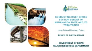
  • 1. CONDUCTING RIVER CROSS SECTION SURVEY OF MAHANANDA RIVER AND ITS TRIBUTARIES Under National Hydrology Project REVIEW OF SURVEY REPORT GOVERNMENT OF BIHAR WATER RESOURCES DEPARTMENT
  • 2. The river Mahananda is a major Northern tributary of the river Ganga. It originates in the Himalayas at Chimali near the town of Kurseng in Darjeeling District of West Bengal at an altitude of 2060 m. This river is flowing through Nepal, India and Bangladesh. In the plains of Bihar, flooding is experienced along both the banks of Mahananda all along its course starting from near Sonapurhatt up to its outfall in the Ganga. The river remains above the bankful level for 3 to 4 days. The problem of spilling is no less severe in the right bank tributaries of the Mahananda originating in Nepal, whose contribution to the flow of Mahananda exceeds that of main stream of Mahananda itself. Besides flooding, bank erosion is also a common feature of the Mahananda river system. In Bihar, erosion takes place at Dhabaul, Ajamnagar, Baharkhal and Gobindpur-Sikatiya. and in upper reaches also. In order to have a better water resources management of Mahananda basin, it is essential to go for mathematical modeling of this basin. The objective of the present assignment is to collect precise level data at close intervals across the selected river reaches and the associated embankments for creating high precise river cross sections from countryside Natural Surface Levels (NSL) on one bank to countryside NSL on the other bank including channel bed profile. © 2020 WeWork. Proprietary and Confidential. Project Overview
  • 3. Project Layout Map The prime objective of the assignment is to conduct river cross-section surveys along with embankment cross-section including the detail of structures across the river and on the Embankment/ Banks in Mahananda river basin including all its tributaries viz Parman, Kankai, Burhi Kankai, Mechi, Donk, Ratua and Bakra. The observed cross sectional data will be used for carrying out flood modelling exercises and flood forecasting in the state including generation of necessary alerts/warning system for the welfare of the people, maintenance of existing embankments, planning of new embankments in unprotected vulnerable areas, river training and flood fighting works.
  • 4. River Stretches as per TOR Sl. No. River Name River Length (km) Number of Cross- Section (Nos) Length of Cross-Section (km) Land Portion Water Portion Total 1 Mahananda 237 187 360 89 449 2 Parman 175 244 120 29 149 3 Kankai 96 56 39 10 49 4 Burhi Kankai 29 24 15 4 19 5 Mechi 47 25 25 7 32 6 Donk 67 47 58 15 73 7 Ratua 37 32 12 4 16 8 Bakra 120 111 34 9 43 Total:- 808 726 663 167 830
  • 5. River Stretches Submitted Sl. No. River Name Number of Cross- Section (Nos) Length of Cross-Section (km) Weighted % Land Portion Water Portion Total 1 Mahananda 60 97.64 6.28 103.92 12.52% 2 Parman 278 134.79 20.25 155.04 18.68% 3 Kankai 59 45.10 7.48 52.58 6.34% 4 Burhi Kankai 26 19.88 1.79 21.67 2.61% 5 Mechi 25 31.92 2.53 34.45 4.15% 6 Donk 51 66.51 6.16 72.67 8.75% 7 Ratua 35 15.50 2.00 17.50 2.11% 8 Bakra 125 38.34 6.16 44.49 5.36% Total:- 659 449.67 52.65 502.32 60.52 %
  • 6. Scope of Services PLANNING REPORT ● Conducting Reconnaissance Survey ● Finalization of Survey Plan ● Identification of Existing Survey of India GTS/GCP Benchmarks ● Preparation of Planning Report DETAIL TOPOGRAPHIC AND X-SECTION SURVEY ● Establishment of Primary Benchmarks through DGPS ● River Cross-Sectional survey extended upto 100-500 m beyond the NSL (Natural Surface Level ) on both the banks. ● Levels at 5 to 10 m interval on each cross-section. ● L-Section of deepest bed level
  • 7. Scope of Services RIVER/EMBANKMENT STRUCTURE SURVEY ● Collection of information of structures along/across the Mahananda River and its tributaries including geo-tagged photographs, location, design, drawings from different agencies (if available), measurement of visible dimensions and current status. ESTABLISHMENT OF MUSTO TYPE BENCHMARK ● Construction of Musto-Type Benchmarks ● Establishment of Secondary Benchmarks through engraving or paint on existing structures
  • 8. © 2020 WeWork. Proprietary and Confidential. Overview of Survey Report The Survey Report described in detail all the work activities that are foreseen for Detail Topographic and X-section Survey of Rivers. It is designed to give client confidence that the assignment will be carried out as agreed on in the contract and specifically to identify exactly what work is to be done. This shows the whole working mechanism to the respective client i.e. Water Resources Department, Bihar. Following activities are performed for preparation of Survey Report:  Collection of precise level data at close intervals to generate cross-section, contour and assisted with high resolution satellite images for precise targeting of crucial data collection point.  Carrying out Cross-section Survey using modern technology like DGPS linked RTK and ADCP devices for the development of an accurate and realistic cross-section.  Survey is conducted for both land and water portion of the Mahananda rivers along with its tributaries in the river length of nearly 808 kms from Indo Nepal Border upto the confluence of river Mahananda with river Ganga.  All topographic data has been acquired, stored and processed in a Geo-referenced manner in user friendly standard format that can be accessed both by CAD Programs such as AutoCAD and GIS programs such as Arc View, Geo media or Map Info etc. We have completed the fieldwork of taking cross-sections of river Mahananda and its tributaries. The draft river cross section report of 60% work of total was submitted on 30th May, 2022 through hard copies in 2 sets which was reviewed by FMISC and the concerning department of Water Resource Department. A site visit was conducted based upon the draft cross section report on 14th and 15th of June, 2022 by concerning officers of Water Resource Department. After the physical verification on site, the final cross section data has been submitted in hard copies in 5 sets of the rivers on 27th June, 2022.
  • 9. Survey Equipment Trimble RTK R12 LT Machine RiverRay ADCP Machine
  • 12. FIELD VALIDATION Field Validation of surveyed cross section of the Mahananda river and its tributaries were conducted on 14th and 15th June, 2022. The detailed approach and methodology adopted in the project was discussed and explained to the concerning officials. The ground levels taken by DGPS were verified by RTK equipment and found to be within permissible tolerance. The bathymetric cross-sections were also taken at field in presence of the concerning officers to co-relate with the submitted data.
  • 13. LEVELS VERIFIED AT CH. 60.135 KM OF MAHANANDA RIVER(X-50) Field Validation of surveyed cross section of the Mahananda river of Section no. 60 at Ch. 60.135 km. The ground levels taken by DGPS were verified by RTK equipment and verified with the data submitted. The hydrographic cross sections were also taken at field and verified with the data submitted. Differences between Submitted levels and observed levels are shown in images. Water level Ground level
  • 15. © 2020 WeWork. Proprietary and Confidential. Sample Survey of Parman River
  • 16. © 2020 WeWork. Proprietary and Confidential. Sample Survey of Parman River
  • 17. © 2020 WeWork. Proprietary and Confidential. Sample Survey of Bakra River
  • 18. © 2020 WeWork. Proprietary and Confidential. Sample Survey of Ratua River
  • 19. © 2020 WeWork. Proprietary and Confidential. Sample Survey of Kankai River
  • 20. © 2020 WeWork. Proprietary and Confidential. Sample Survey of Burhi Kankai River
  • 21. © 2020 WeWork. Proprietary and Confidential. Sample Survey of Mechi River
  • 22. © 2020 WeWork. Proprietary and Confidential. Sample Survey of Donk River
  • 23. © 2020 WeWork. Proprietary and Confidential. Sample Survey of Mahananda River
  • 24. © 2020 WeWork. Proprietary and Confidential. Sample Survey of Mahananda River