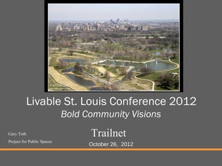
Livable St. Louis Conference 2012 Bold Community Visions
1. Livable St. Louis Conference 2012
Bold Community Visions
Gary Toth Trailnet
Project for Public Spaces
October 26, 2012
2. 34 years at the New Jersey Department of Transportation
5 Years Director of Transportation Initiatives at PPS
Invested Career working at the community/agency interface
PROJECT FOR PUBLIC SPACES
2
3. Is this the legacy that we want to
leave for our children?
PROJECT FOR PUBLIC SPACES
Slide courtesy of Dan Burden
4. We have been Building Transportation Through
Communities, not communities through transportation
PROJECT FOR PUBLIC SPACES
Slide courtesy of Dan Burden
5. Pre-Automobile Era
Street design HAD to accommodate all users
Relationship of land use to streets was critical for survival
PROJECT FOR PUBLIC SPACES
6. Pre-Automobile Era
City streets served as public places for economic and social
interaction
PROJECT FOR PUBLIC SPACES
7. Streets used to have many purposes
Street design HAD to accommodate all users
PROJECT FOR PUBLIC SPACES
10. The Automobile Age
The mobility provided by the automobile removed the need
for those exchanges to be made in compact, mixed use
cities and towns
Once we could drive to access goods, employment,
education and recreation, we were free to locate those
uses in distant and specialized locations…and we did
PROJECT FOR PUBLIC SPACES
11. Slide courtesy of Barbara Lawrence, NJ Future
The needs of the motoring public supersede all other contexts
PROJECT FOR PUBLIC SPACES
14. Focus on high speed
Speed / Proximity Balance
•Speed necessary at region and above
mobility
•Proximity viable option in sub-region
Proximity
Speed
Accessibility
Slide Courtesy of Chris Sinclair, Renaissance Planning Group
PROJECT FOR PUBLIC SPACES
15. PROJECT FOR PUBLIC SPACES
Slide courtesy of Ian Lockwood, Glatting Jackson
22. Two Steps to Fully Complete Our Streets
Reallocate space and adjust speeds
Address Land Use and Placemaking!
PROJECT FOR PUBLIC SPACES
23. Complete Streets
AARP Bulletin
A Complete Street is safe, comfortable &
convenient for travel by automobile, foot,
bicycle, & transit regardless of age or ability
PROJECT FOR PUBLIC SPACES
24. Traditional Highway Design Approach
Traffic Volume + Area Type (urban, rural) + Role in Network
Functional Classification
Design Speed + Design Vehicle
Alignment + Cross-Section + Intersection + Roadside
PROJECT FOR PUBLIC SPACES
25. Complete Streets
An Approach for Accomodating All Users
Cars Bikes Buses
Pedestrians Trucks/freight
Alignment + Cross-Section + Intersection + Roadside
PROJECT FOR PUBLIC SPACES
26. Two Steps to Fully Complete Our Streets
Reallocate space and adjust speeds
Address Land Use and Placemaking!
PROJECT FOR PUBLIC SPACES
27. Is this a Complete Street?
PROJECT FOR PUBLIC SPACES
28. Is this a Complete Street?
PROJECT FOR PUBLIC SPACES
29. Two Steps to Fully Complete Our Streets
Reallocate space and adjust speeds
Address Land Use and Placemaking!
PROJECT FOR PUBLIC SPACES
30. Proposed x-section alternatives on Foothill Blvd – S side
soft-surface trail section curb to median bike andlane lane
Sidewalk ½Sidewalk, Sidewalk and south (school) side
Sidewalk Soft surface trail and bike bike
landscape buffer, lane
shy zone
shy zone
shy zone
planting 13’
6’ 18’ 11’
6’
6’ 11’ 11.5’
11.5’
median/CTL
median/CTL
median/CTL
PROJECT FOR PUBLIC SPACES
new curb bike travel travel
new curb
new curb bike
bike travel travel
travel
31. 2nd Avenue, South PROJECT FOR PUBLIC SPACES
Photomorph courtesy of Dan Burden
32. Cahaba Road PROJECT FOR PUBLIC SPACES
Photomorph courtesy of Dan Burden
33. “This plan lays out a vision for New
York City of improved mobility, safer
streets and reduced impact on global
climate, all resulting in a world class
quality of life.”
Safety
Mobility
World Class Streets
Infrastructure
Greening
Global Leadership
Customer Service
April, 2008
Sustainable Streets Strategic Plan PROJECT FOR PUBLIC SPACES
http://www.nyc.gov/html/dot/html/about/stratplan.shtml
34. Images: NYC DOT Presentation to Manhattan CB8, PROJECT FOR PUBLIC SPACES
http://www.nyc.gov/html/dot/html/about/currentproj.shtml#complete
35. Flushing Ave, Brooklyn 9th Ave, Manhattan
PROJECT FOR PUBLIC SPACES
Lower East Side, Manhattan Smith Street, Brooklyn
36. West Side Highway, Manhattan Queens Boulevard, Queens
PROJECT FOR PUBLIC SPACES
Prospect Park West, Brooklyn Sands Street, Brooklyn
37. Prospect Park West
before after
Image: NYC DOT PROJECT FOR PUBLIC SPACES
http://www.nyc.gov/html/dot/html/bicyclists/prospectparkwest.shtml
49. Is this a Complete Street?
PROJECT FOR PUBLIC SPACES
50. A Complete Street is safe, comfortable &
convenient for travel by automobile, foot,
bicycle, & transit regardless of age or
ability
PROJECT FOR PUBLIC SPACES
51. Complete Streets
An Approach for Accomodating All Users
Cars Bikes Buses
Pedestrians Trucks/freight
Alignment + Cross-Section + Intersection + Roadside
PROJECT FOR PUBLIC SPACES
52. Placed Based Approach
Corridor/Community
Place
Roadway
Traveled Way Intersections Roadside
PROJECT FOR PUBLIC SPACES
53. Made possible by funding from the Department of Health and Human Services through the Los Angeles County Department of Public Health. PROJECT FOR PUBLIC SPACES
54. Two Steps to Fully Complete Our Streets
Reallocate space and adjust speeds
Address Land Use and Placemaking!
PROJECT FOR PUBLIC SPACES
55. Characteristics of
Streets as Places:
Design street elements
and adjacent buildings
for the human scale
Balances the going and
staying needs of users
Support and encourage
activities and
destinations
PROJECT FOR PUBLIC SPACES
56. Characteristics of
Streets as Places:
Provide a feeling of
safety
Invite activities on both
sides of the street
Reward slow
movement by lowering
speeds
PROJECT FOR PUBLIC SPACES
57. Characteristics of
Streets as Places:
Reflect community
identity
Move community
towards local
sustainability
Show a sense of
ownership
PROJECT FOR PUBLIC SPACES
58. Principles
• Compactness, connectivity, completeness & continuity
• Buildings should complete “the outdoor room” of the street
• Provide a mix of land uses
Outdoor room
Outdoor room
of the street
of the street
Made possible by funding from the Department of Health and Human Services through the Los Angeles County Department of Public Health.
59. Distribute land uses for easy access from homes & jobs
• Create social spaces where generations can mix
• Ground floors should be active and transparent on commercial
streets
Made possible by funding from the Department of Health and Human Services through the Los Angeles County Department of Public Health.
60. • Ground floors should allow for privacy while layering landscape, and
outdoor spaces on residential streets
• Setbacks will vary based on the street type and land use
• Make the land use changes necessary with specific plans or other
tools to reinforce the places the community desires
Made possible by funding from the Department of Health and Human Services through the Los Angeles County Department of Public Health.
62. Transforming ‘Gasoline Alley’
Medians and pedestrian improvements
Slide courtesy of Harrison Rue and ICF International
34 PROJECT FOR PUBLICSPACES
PROJECT FOR PUBLIC SPACES
63. Transforming ‘Gasoline Alley’
Continue public improvements
Slide courtesy of Harrison Rue and ICF International
35 PROJECT FOR PUBLICSPACES
PROJECT FOR PUBLIC SPACES
64. Transforming ‘Gasoline Alley’
Mixed-use infill development
Slide courtesy of Harrison Rue and ICF International
36 PROJECT FOR PUBLICSPACES
PROJECT FOR PUBLIC SPACES
65. Transforming ‘Gasoline Alley’
Continue infill development
Slide courtesy of Harrison Rue and ICF International
37 PROJECT FOR PUBLICSPACES
PROJECT FOR PUBLIC SPACES
66. Transforming ‘Gasoline Alley’
Landscape matures over time
Slide courtesy of Harrison Rue and ICF International
38 PROJECT FOR PUBLICSPACES
PROJECT FOR PUBLIC SPACES
67. Transforming ‘Gasoline Alley’
Add transit service as market grows
Slide courtesy of Harrison Rue and ICF International
39 PROJECT FOR PUBLICSPACES
PROJECT FOR PUBLIC SPACES
68. State Route 27 Edison, NJ
PROJECT FOR PUBLICSPACES
PROJECT FOR PUBLIC SPACES
70. What is Placemaking?
Placemaking is a dynamic human function: it
is an act of liberation, of staking claim, and
of beautification; it is true human
empowerment.
Placemaking is turning a neighborhood, town
or city from a place you can’t wait to get
through to one you never want to leave.
PROJECT FOR PUBLIC SPACES
71. “Placemaking” is an overarching idea
and a hands-on tool for improving a
Neighborhood, City or Region . It
has the potential to be one of the most
transformative ideas of this century
Metropolitan Planning Council
72. Social public spaces “are built of a set
of basics…”
Food
Seating
Triangulation
Sun/Shade
Places to People Watch
…it doesn’t take much…
PROJECT FOR PUBLIC SPACES
73. Key Attributes
What Makes a Great Place? Intangibles
Measurements
street life business ownership
evening use property values
volunteerism land-use patterns
Fun retail sales
Welcoming
Cooperative Active Vital
Neighborly Special Real
sociability uses & activities
PLACE
access & linkages comfort & image
Connected Safe
Walkable Charm Clean
Convenient Attractive
Accessible Historic crime stats
transit usage sanitation rating
pedestrian activity building conditions
parking usage patterns environmental data
74. The Benefits of Places-Place Governance
Nurtures & Defines Community
Builds & Supports the Identity Fosters More Frequent &
Local Economy • Greater community organization Meaningful Interaction
• Sense of dedication & volunteerism • Improved sociability
• Small-scale entrepreneurship • Perpetuation of integrity & values • Cultural exposure & interaction
• More quality goods available • “Mutual coercion, mutually agreed-upon” • Exchange & preservation of information,
• Higher real estate values • Reduced necessity for municipal control wisdom & values
• Local ownership, local value • Self-managing • Bolstered barter system
• More desirable jobs
• Reduced race & class barriers
• Increased currency velocity
• Feeling of interconnection
• Greater tax revenue
• Reduced need for municipal services
Place Draws a More Diverse
Population
Creates Improved • More women, elderly, and children
Accessibility • Greater ethnic & cultural pluralism
• More walkable Promotes Public Health • Support for wider range of activities & uses
• New service, retail and customer niches
• Safe for pedestrians
• Compatible with public transit & Comfort • Variation & character in built environment
• Less crime • Instilled confidence to create one’s reality
• Reduced need for cars & parking
• More efficient use of time & money • More outdoor physical activity
• Visually attractive destinations • Generally stimulating
• Greater connections between uses • Sense of belonging
• Improved environmental quality
• Feeling of freedom and limitlessness
75. Communities Today
Offices Churches
Hospital Theatres/
Coffee
Museums
Shops
Community
Parks Center
Transit
Libraries
Schools City Hall
76. Sustainable Communities
of the Future
Churches Schools
City Hall Community
Centers
Libraries
Civic Squares
Community Gathering Theatres/
Museums
Coffee Spaces/Parks
Shops
Offices
Hospitals Transit
77.
78. Local Placemaking Opportunities
Main Streets
Transportation & Local streets and roads
Downtowns Bus stops
Train Stations
Parks (greenways, recreation, play areas)
Parks & Squares Plazas & squares (performances, events)
Markets
Waterfronts
Libraries and hospitals
Civic Institutions Civic buildings
Schools (universities, primary schools)
Religious institutions
Cultural institutions (theaters, museums)
Private development Mixed-use – housing, retail and office
79. Why don’t we have better
Public Spaces today?
• Fear
• Narrow Development Goals
• Project-driven vs. Place-
driven Planning
• Discipline-Based
Planning/Design vs.
Community-Based
Placemaking
• Government Structure
80. Blank walls are an end in themselves. They declare the
supremacy of architecture over humanity, of a building
over a person.
Museum of Modern Art - NYC
81. Benches are artifacts, the purpose of which is to punctuate
architectural photographs. They are not so good for sitting.
96. 11 Principles of Creating Great Public Spaces
1. The community is the expert
Underlying Ideas 2. You are creating a place not just a design
3. You can’t do it alone
4. They always say it can’t be done
Planning & Outreach 5. You can see a lot just by observing
Techniques 6. Develop a placemaking vision
Translating Ideas Into 7. Power of 10/Triangulation
Action 8. Form supports function
9. Lighter, Quicker, Cheaper
Implementation 10. Money is not the issue
11. You are never finished
97. Place Based Transportation Process
Destination Mapping aka Power of Ten
Route Mapping aka Connectivity Exercise
Place Audits
Street Audits
Lighter Quicker Cheaper Interventions
98. The Power of Ten
Region/City/Town/N
eighborhood 10+ destinations
Destinations 10+ places
10+ things to do
Place
Layering of uses to create
synergy (Triangulation) =
District
109. Lighter, Quicker, Cheaper
Activation Events
Comfort, Amenities & Public Art
Interim Public Spaces
Light Development
PROJECT FOR PUBLIC SPACES
114. Power of Ten 7. Entrance to the Science Center
1. Gateway between the Plaza and 8. Tanner Fountain
Harvard Yard 9. Library Arcade
2. The South Fence and connection 10. NE Plaza Entrance
to Harvard Yard 11. Loker Bar and Beer Garden
3. NW Plaza Entrance 12. Memorial Walk
4. The “Great Lawn” 13. Main Walkway
5. Science Center Outdoor Terrace 14. Overlooks
6. The “Piazza”
PROJECT FOR PUBLIC SPACES
In our 30 years of work, we have found that people have never really lost their craving for great civic gathering spaces. People flock to civic spaces when they want to be with other people, to share ideas or become part of the collective expression of an idea or point of view. Uptown Waterloo ’ s public square has the potential to become such a great civic place and destination for the people of this City. As a parking lot, it ’ s opportunity to become a defining place for the city is quite limited. However, in either case, the space needs to be carefully planned and designed. But more than that, to be successful it must e actively programmed and managed on an ongoing basis and funds need to be set aside for that purpose NOW. That is why most if not all public spaces fail to realize their potential. Why parks sit empty; while plazas in the middle of busy commercial districts are unused except by skateboarders and the homeless; if you build it they will come, only if there is something to do there and a comfortable place to sit while you do it!
We can work with Township officials on plans to infill a suburban environment
But if we want to help our customers have the mobility and the quality of life that they have come to expect, maybe, just maybe, we will need to start thinking about land use
In our 30 years of work, we have found that people have never really lost their craving for great civic gathering spaces. People flock to civic spaces when they want to be with other people, to share ideas or become part of the collective expression of an idea or point of view. Uptown Waterloo ’ s public square has the potential to become such a great civic place and destination for the people of this City. As a parking lot, it ’ s opportunity to become a defining place for the city is quite limited. However, in either case, the space needs to be carefully planned and designed. But more than that, to be successful it must e actively programmed and managed on an ongoing basis and funds need to be set aside for that purpose NOW. That is why most if not all public spaces fail to realize their potential. Why parks sit empty; while plazas in the middle of busy commercial districts are unused except by skateboarders and the homeless; if you build it they will come, only if there is something to do there and a comfortable place to sit while you do it!
AARP printed a two-page spread using this graphic in its September 2007 Bulletin, a monthly newspaper that is received by more than 39 million members Wide, raised sidewalks Ramps to crosswalks Raised crosswalks Pedestrian-friendly medians Resting places May include recessed bus stops Bike lanes Visible signs Advanced stop lines On-street parking
Key Message: This is the traditional engineering approach to roadway design. It shows very little relationship to land use context. Background Information: The engineer starts out by looking at existing or forecast traffic volume, the type of area the road is in, and its role in the highway network –through route vs. local route, degree of access control desired, etc. These characteristics are used to develop a formal functional classification for the road. General classifications include freeways, major arterials, minor arterials, collector streets, and local roads. There are divisions of these categories for urban and rural. The functional classification is used to establish the design speed and design vehicle. For example, freeways and rural arterials may be assigned a design speed of 55 mph or more. An urban collector street may be assigned a design speed of 25 to 35 mph. Design vehicle is basically whether the road is designed to readily accommodate large trucks or buses. The design speed and vehicle lead to physical requirements or guidelines for alignment, cross-section, intersection design, and roadside treatment. For example, to allow a car to safely travel at 55 mph, a curve must be a certain radius. The radius may need to be greater if the design vehicle is larger. Cross-section elements include lane widths, shoulder widths, medians, and sidewalks. Examples of roadside elements include maximum sideslope and clear zone for obstacles. Interactivity: Ask: In what ways, if any, does this approach relate a street ’ s design to its land use context? The only relation to land use is whether it is urban or rural Notes:
Key Message: This is the traditional engineering approach to roadway design. It shows very little relationship to land use context. Background Information: The engineer starts out by looking at existing or forecast traffic volume, the type of area the road is in, and its role in the highway network –through route vs. local route, degree of access control desired, etc. These characteristics are used to develop a formal functional classification for the road. General classifications include freeways, major arterials, minor arterials, collector streets, and local roads. There are divisions of these categories for urban and rural. The functional classification is used to establish the design speed and design vehicle. For example, freeways and rural arterials may be assigned a design speed of 55 mph or more. An urban collector street may be assigned a design speed of 25 to 35 mph. Design vehicle is basically whether the road is designed to readily accommodate large trucks or buses. The design speed and vehicle lead to physical requirements or guidelines for alignment, cross-section, intersection design, and roadside treatment. For example, to allow a car to safely travel at 55 mph, a curve must be a certain radius. The radius may need to be greater if the design vehicle is larger. Cross-section elements include lane widths, shoulder widths, medians, and sidewalks. Examples of roadside elements include maximum sideslope and clear zone for obstacles. Interactivity: Ask: In what ways, if any, does this approach relate a street ’ s design to its land use context? The only relation to land use is whether it is urban or rural Notes:
Requested by the Community Board in order to: curb speeding, to provide a safe, two-way bike path along the park and to reduce sidewalk bike riding.
Key Message: This is the traditional engineering approach to roadway design. It shows very little relationship to land use context. Background Information: The engineer starts out by looking at existing or forecast traffic volume, the type of area the road is in, and its role in the highway network –through route vs. local route, degree of access control desired, etc. These characteristics are used to develop a formal functional classification for the road. General classifications include freeways, major arterials, minor arterials, collector streets, and local roads. There are divisions of these categories for urban and rural. The functional classification is used to establish the design speed and design vehicle. For example, freeways and rural arterials may be assigned a design speed of 55 mph or more. An urban collector street may be assigned a design speed of 25 to 35 mph. Design vehicle is basically whether the road is designed to readily accommodate large trucks or buses. The design speed and vehicle lead to physical requirements or guidelines for alignment, cross-section, intersection design, and roadside treatment. For example, to allow a car to safely travel at 55 mph, a curve must be a certain radius. The radius may need to be greater if the design vehicle is larger. Cross-section elements include lane widths, shoulder widths, medians, and sidewalks. Examples of roadside elements include maximum sideslope and clear zone for obstacles. Interactivity: Ask: In what ways, if any, does this approach relate a street ’ s design to its land use context? The only relation to land use is whether it is urban or rural Notes:
Key Message: Network and corridor-level planning can help set the context for addressing more specific street design issues. Background Information: Network planning can occur as part of the regional and community-level visioning and planning processes, as discussed in Lessons 5 and 8. The design of the network (connectivity, spacing of arterials, etc.) has implications for the design of individual roadway segments. Network level solutions – for example, where major traffic routes go in relationship to activity centers – are the first step in establishing street-land use compatibility. Corridor visioning and planning, as discussed in Lesson 6, determines how a community wants a corridor to develop. It may include conceptual plans for street cross-sections and local road networks. Roadway design includes three distinct aspects – the traveled way, intersections, and the roadside (e.g., sidewalks and planting strips) Interactivity: Notes: Adapted from: Institute of Transportation Engineers (2006). Context Sensitive Solutions in Designing Major Urban Thoroughfares for Walkable Communities: A Proposed Recommended Practice. RP-036. Washington, D.C.
… by putting themselves, and the going and staying needs of their bodies, in streets!
In our 30 years of work, we have found that people have never really lost their craving for great civic gathering spaces. People flock to civic spaces when they want to be with other people, to share ideas or become part of the collective expression of an idea or point of view. Uptown Waterloo ’ s public square has the potential to become such a great civic place and destination for the people of this City. As a parking lot, it ’ s opportunity to become a defining place for the city is quite limited. However, in either case, the space needs to be carefully planned and designed. But more than that, to be successful it must e actively programmed and managed on an ongoing basis and funds need to be set aside for that purpose NOW. That is why most if not all public spaces fail to realize their potential. Why parks sit empty; while plazas in the middle of busy commercial districts are unused except by skateboarders and the homeless; if you build it they will come, only if there is something to do there and a comfortable place to sit while you do it!
It is important that we think about public spaces in our community in terms of their potential to link important community institutions. Very often, these institutions operate on their own, without connecting with each other.
Public Spaces should bring all of these diverse institutions together! We always say “You Can’t Do it Alone,” meaning you need to work with all the nearby partners to get the help you may need, such as innovative ideas, additional financial resources or in-kind services, or volunteers to help with maintenance or short-term improvement projects. Partners also help to broaden the impact of a project by participating in activities such as joint programming, marketing, fundraising, and security. A strong partnership can also move a project forward by giving it political clout. The most obvious partners are the people and institutions that are located around a space. They have a major impact on whether a public space will be used and how it will be maintained. The outer "edges" of the public space are inextricably entwined with the "inner," or actual public space: Each is dependent on the other for its success.
This diagram shows the ten places and the activities that would go on in one of the places identified by Singapore stakeholder.
Dun Laoghaire, a suburb of Dublin, where PPS did the Power of Ten Exercise and Place and Street Audits in March of 2012. Kate, read the Dun Laoghaire blog before leaving: http://www.pps.org/how-to-turn-dun-laoghaire-around/
but when you get there, the only thing happening is people walking back and forth to class Exhibit on fence and/or in lawn area
What could be done? A stage/informal seating area Events Moveable seating
What could be done? Seating Flexible stage/seating area Tabling Interacting
Places in Harvard square... we all envision it as a world class place
Developed by stakeholders using POT and audit
An idea of how much space is available for both people AND vehicles
.
Key Message: Network and corridor-level planning can help set the context for addressing more specific street design issues. Background Information: Network planning can occur as part of the regional and community-level visioning and planning processes, as discussed in Lessons 5 and 8. The design of the network (connectivity, spacing of arterials, etc.) has implications for the design of individual roadway segments. Network level solutions – for example, where major traffic routes go in relationship to activity centers – are the first step in establishing street-land use compatibility. Corridor visioning and planning, as discussed in Lesson 6, determines how a community wants a corridor to develop. It may include conceptual plans for street cross-sections and local road networks. Roadway design includes three distinct aspects – the traveled way, intersections, and the roadside (e.g., sidewalks and planting strips) Interactivity: Notes: Adapted from: Institute of Transportation Engineers (2006). Context Sensitive Solutions in Designing Major Urban Thoroughfares for Walkable Communities: A Proposed Recommended Practice. RP-036. Washington, D.C.
In our 30 years of work, we have found that people have never really lost their craving for great civic gathering spaces. People flock to civic spaces when they want to be with other people, to share ideas or become part of the collective expression of an idea or point of view. Uptown Waterloo ’ s public square has the potential to become such a great civic place and destination for the people of this City. As a parking lot, it ’ s opportunity to become a defining place for the city is quite limited. However, in either case, the space needs to be carefully planned and designed. But more than that, to be successful it must e actively programmed and managed on an ongoing basis and funds need to be set aside for that purpose NOW. That is why most if not all public spaces fail to realize their potential. Why parks sit empty; while plazas in the middle of busy commercial districts are unused except by skateboarders and the homeless; if you build it they will come, only if there is something to do there and a comfortable place to sit while you do it!