SlideShare a Scribd company logo
1 of 15
BIGHORN BASIN,
WYOMING
Oil and Gas- an appraisal of Oregon Basin Field
ABSTRACT
The Oregon Basin field, comprising
northern and southern domes, is the
most prolific oil and gas producer in the
Bighorn basin, Wyoming. Oil is produced
from Tensleep sandstone, Embar and
Madison Formations. Gas is mostly
contributed by Chugwater, Embar and
Tensleep sandstone. Though production
of oil in the field has decreased since
1978, production has been around
2,000,000 barrels per year for the last 7
to 8 years and is likely to continue for
some more years. Gas production has
varied over the years reaching a peak in
1998 and has since declined. The
northern dome produced more oil
whereas, the southern dome produced
more gas. The source rock for these
hydrocarbons is Permian Phosphoria
Formation and most likely migrated
during Late Cretaceous to Early Eocene
Laramide orogeny and accumulated in
structural and stratigraphic traps. The
primary reservoir rocks in the Oregon
basin are Tensleep sandstone, Embar,
Madison and Chugwater Formations.
Dr. Venkataramana Pillarisetty
Wyoming
Wyoming, the 10th largest state by area (97,914 sq mi) in US, is a major coal (Powder River Basin),
coal bed methane, oil and natural gas producer. It is the 8th
largest producer of oil and natural gas in
US (https://www.eia.gov/state/rankings/#/series/47).
Choropleth Map showing Oil production in counties of Wyoming state
Choropleth Map showing Gas production in counties of Wyoming state
Within the state, Campbell, Park followed by Washakie and Sweetwater counties produce maximum
oil and Sublette and Sweetwater counties produce maximum natural gas.
Bighorn Basin, Wyoming
The Bighorn basin in north-central Wyoming and south-central Montana is an intermontane basin of
Rocky Mountain foreland. The basin is approximately 193 km long and 145 km wide and covers an
area of about 13,200 sq. mi. The Bighorn basin covering parts of Park, Big Horn, Hot Springs and
Washakie counties has been a major oil and gas producer in Wyoming. The region is generally flat and
surrounded by mountains on its eastern, western and southern borders. Towards north the basin
merges with the plains in Montana.
Oil and Gas wells in Bighorn Basin, Wyoming
Geology of Bighorn basin
The Bighorn basin is a structural basin comprising sedimentary rocks ranging in age from Cambrian
(541 - 485.5 mya) to Miocene (23.03 - 5.33 mya) and thickness of over 25,000 feet (7620 m). The
present structural configuration of the basin was the result of the Late Cretaceous to Early Eocene
Laramide orogeny (Blackstone, 1963). The folding and faulting that formed the present oil-producing
anticlines in the Bighorn Basin occurred during pulses of compressional stress, mainly oriented
northeast-southwest (http://www.wsgs.wyo.gov/energy/oil-gas-basins).
The Bighorn basin is primarily an oil-producing basin. Oil was first discovered here in 1904. The Garland
and Greybull fields were discovered in 1906 and 1907 respectively, both geological structures and
stratigraphy play an important role in localisation of oil in Bighorn basin (Fox and Dolton.1996).
Structural plays include basin margin sub-thrusts, basin margin anticlines, deep basin structures, and
sub-Absaroka-volcanics. Principal stratigraphic plays include Phosphoria pinchout (up-dip facies
change) and Tensleep paleogeography (dune fields versus interdune regions) (Fox and Dolton, 1996).
Significant potential plays include basin center/deep gas and coalbed natural gas
(http://www.wsgs.wyo.gov/energy/oil-gas-basins).
Although most of the basin's production comes from anticlinal or other structural traps, Lawson and
Smith (1966) suggested that many of the structurally-controlled traps are influenced by stratigraphic
effects, including intraformational variations in permeability and, as in the Bonanza and Nowood
fields, incised channels in the Tensleep surface that were later filled with impervious Goose Egg
sediments. Later Laramide folding may have been superimposed on or near these primary traps. Pure
stratigraphic traps are also productive within the Bighorn Basin. The largest of these is the Cottonwood
Creek field in the southeast corner of the basin, a trap resulting Rattlesnake Mountain from an
eastward, updip facies change from Phosphoria carbonate to the impermeable red shale and
anhydrite facies of the Goose Egg Formation (http://www.wsgs.wyo.gov/energy/oil-gas-basins).
The source of essentially all the oil and gas found in Palaeozoic reservoirs in the basin is the dark,
phosphatic, fine-grained, marine facies of the Phosphoria Formation (Stone, 1967). Primary migration
began immediately after deposition of Triassic sediments and was completed by Early Jurassic time.
Hydrocarbons accumulated in regional stratigraphic traps created by up-dip facies changes, pinch-
outs, or truncation of the reservoir rocks in the Phosphoria, and irregular truncation of thick Tensleep
Sandstone beds prior to the deposition of the impervious Phosphoria/Goose Egg Formation. This
situation is especially prevalent east of the area covered by marine carbonate facies of the Phosphoria
Formation (Stone, 1967). Oil and gas in some of these stratigraphic traps were later released by
fracturing and faulting associated with Laramide folding. During the Laramide orogeny, these
hydrocarbons moved into older Palaeozoic reservoir rocks and older structures where they were
trapped in common pools. The occurrence of a common oil-water contact, in many cases, is attributed
to fractures joining the reservoirs. Also, the oil-water contact is often tilted as a result of hydrodynamic
flow (Stone, 1967).
Generalised Stratigraphy of Bighorn Basin (http://www.wsgs.wyo.gov/energy/oil-gas-basins)
Oil and gas bearing formations in Bighorn basin
In the Bighorn basin, oil has been produced primarily from the eolian and marine Tensleep Sandstone
(Middle Pennsylvanian to Lower Permian age), production also comes from the Madison Limestone
(Mississippian), Phosphoria Formation (Early Permian) and Amsden Formation (Lower Pennsylvanian).
Oil and Gas Fields in Bighorn Basin
There are over 145 demarcated oil and gas fields in Bighorn basin. The major ones are Oregon Basin,
Grass Creek, Elk Basin, Garland, Hamilton Dome, Cottonwood Creek, Little Buffalo Basin, Byron and
Frannie.
Oil and Gas fields in the Bighorn Basin, Wyoming
Table showing the oil/gas fields in the western margin of Bighorn Basin
Field Name
Active
Oil
Wells
Active
Gas
wells
Average
Depth
Producing Formation
% Oil
Produced
% Gas
Produced
Elk Basin 172 168 4,023 Frontier, Tensleep 9.27 21.99
Silver Tip 39 88 6,348 Tensleep 0.20 3.25
Elk Basin South 4 24 6,466 Tensleep 0.43 1.53
Bearcat 1 4 6,961 Phosphoria 0.08 0.28
Shoshone 12 12 3,832 Amsden 0.42 0.00
Cody 12 12 7,747 Tensleep 0.96 0.04
Oregon Basin
494 267 3,729 Tensleep, Embar,
Madison, Chugwater 23.13 23.45
Half Moon 22 16 3,639 Tensleep, Phosphoria 0.88 0.11
Hunt 20 0 4,270 Tensleep 0.13 0.00
Ferguson Ranch 18 0 4,096 Tensleep 0.45 0.00
Spring Creek South 86 86 4,368 Tensleep/Phosphoria 3.02 0.23
Pitchfork 47 0 4,309 Tensleep 4.26 0.74
Fourbear 31 0 3,816 Madison 0.88 0.00
Sheep Point 7 0 3,839 Tensleep 0.06 0.00
Sunshine North 36 0 3,989 Tensleep 0.57 0.00
Little Buffalo Basin 78 68 4,835 Tensleep, Embar 7.46 2.80
Gooseberry 24 0 6,258 Amsden 1.01 0.02
Grass Creek 220 210 2,579 Tensleep 7.32 0.97
Golden Eagle 1 0 6,946 Phosphoria 0.20 0.20
Hamilton Dome 183 0 3,195 Tensleep, Phosphoria 8.69 0.24
Little Sand Draw 3 0 6,350 Tensleep 0.80 0.06
Gebo 35 35 5,097 Tensleep 1.38 0.06
Murphy Dome 27 0 4,785 Tensleep 0.74 0.14
Kirby Creek 16 0 1,862 Tensleep 0.15 0.07
Black Mountain 36 0 3,529 Madison 1.19 0.15
Heart Mountain 2 9 4,783 Fuson 0.01 2.47
Lake Creek 11 0 3,686 Tensleep 0.27 0.01
Neiber Dome 3 0 9,875 Tensleep 0.06 0.06
Packsaddle 1 0 4,000 Tensleep 0.05 0.05
Oregon Basin West 3 1 4,247 Tensleep 0.04 0.03
Oregon Basin
Southeast
0 5 6,985
Muddy 0.00 1.48
31 1644 1005 74.12 60.42
Table showing the oil/gas fields in the eastern margin of Bighorn Basin
Field Name
Active
Oil
Wells
Active
Gas
wells
Average
Depth
Producing Formation
% Oil
Produced
% Gas
Produced
Frannie 36 0 3,389 Tensleep 3.31 0.14
Sage Creek 19 0 3,651 Tensleep 0.61 0.00
Homestead 3 0 4,529 Tensleep 0.17 0.00
Byron
71 61 4,803 Tensleep, Peay, Madison,
Amsden 4.27 0.28
Garland 245 237 3,717 Madison 8.40 4.70
Alkali Anticline 7 0 5,485 Madison 0.26 0.02
Spence Dome 47 0 680 Madison 0.10 0.00
Greybull 0 0 1,038 Peay 0.03 0.00
Lamb 4 1 2,784 Madison 0.07 0.06
Torchlight 17 18 1,796 Madison 0.57 0.09
Manderson 36 26 6,230 Phosphoria 0.22 3.69
Bonanza 5 0 2,561 Tensleep 0.23 0.00
Enigma 8 0 4,860 Amsden 0.40 0.06
Five Mile 15 18 10,305 Thermop 0.12 6.43
Hidden Dome 21 1 3,099 Tensleep, Madison 0.64 0.20
Cottonwood
Creek
97 121 8,141
Phosphoria, Tensleep 2.76 3.61
Frisby South 11 6 10,981 Phosphoria 0.74 0.49
Rattlesnake 16 9 10,887 Phosphoria 0.59 0.66
Frisby South 11 6 10,981 Phosphoria 0.74 0.49
Slick Creek 4 3 10,026 Phosphoria 0.30 0.60
No Water
Creek
11 7 10,814
Phosphoria 0.31 0.29
South Fork 1 0 10,527 Phosphoria 0.08 0.04
Marshall 3 1 10,137 Phosphoria 0.08 0.29
23 688 515 25.00 22.14
The above two tables show that the oil fields in the western part of Bighorn Basin produced higher oil
and gas compared to the fields in the eastern flanks of the basin. In the western flanks oil and gas
occur at an average depth of 4500 ft., whereas in the eastern margins of the basin the average depth
at which oil and gas occurs is 6000 ft and in the southeast corner the depth is nearly 10,000 ft.
Oil Production in fields
The Oregon Basin field is the most prolific oil producer in the Bighorn Basin and accounts for nearly
24% of all the crude oil produced in the basin from 1978 to August 2018.
Gas production in fields
The Oregon Basin field is the most prolific natural gas producer in the Bighorn Basin and accounts for
nearly 25% of all the gas produced in the basin from 1978 to August 2018.
Oregon Basin oil/gas field
The Oregon Basin field is about 9 to 10 miles long and 5 miles wide. The basin comprises of North
dome and south dome.
Distribution of oil wells in the north and south domes of Oregon Basin field and the heat map
showing oil production
The heat map further shows that the north dome of Oregon basin yielded more oil compared to the
southern part. There are nearly 494 active oil and 267 active gas wells as on August 2018. Whereas
the southern dome recorded higher gas output.
Distribution of oil wells in the north and south domes of Oregon Basin field and the heat map
showing gas production
E-W Cross section across the northern dome of Oregon Basin field
Producing Formations in Oregon Basin Field
Producing Formation
Total
Wells
% Oil
produced
% Gas
Produced
TENSLEEP 403 45.87 14.13
EMBAR 440 42.17 23.94
MADISON 110 10.56 5.96
DARWIN 40 0.99 0.30
PHOSPHORIA 8 0.20 0.00
EMBAR-TENSLEEP 13 0.07 0.03
DARWIN-MADISON 1 0.04 0.01
EMBAR-TENSLEEP-DARWIN 2 0.03 0.01
CHUGWATER 60 0.02 42.92
TENSLEEP-MADISON 1 0.02 0.00
FLAT HEAD 5 0.01 0.75
GROS VENTRE 3 0.01 1.93
MUDDY 6 0.01 3.17
TENSLEEP-DARWIN 1 0.00 0.01
FRONTIER 12 0.00 3.96
CLOVERLY 5 0.00 1.62
FRONTIER 1-2-3 1 0.00 0.01
SUNDANCE 1 0.00 0.19
DAKOTA 3 0.00 0.14
FRONTIER & MUDDY 1 0.00 0.12
LAKOTA 6 0.00 0.77
Nearly 98 % of oil in Oregon Basin was produced from Tensleep sandstone, Embar and Madison
Formations. Whereas, 81 % of gas was produced from Chugwater, Embar Formations and Tansleep
sandstone.
Oil and Gas production in Oregon Basin field
Oil production in Oregon Basin has decreased over the years and is approximately producing
2,000,000 BBls per year for the last 7 to 8 years and is likely to continue producing the same amount
of oil for the next few years. Gas production, on the other hand, has varied over the years with a peak
in 1998.
Source Rock
Two distinct source rock systems have been identified for the oil in Bighorn basin: (1) Permian
Phosphoria Formation and (2) Cretaceous Mowry, Frontier, Mesaverde and Meeteetse Formations
(https://certmapper.cr.usgs.gov/data/ noga95/prov34/text/prov34.pdf). The Phosphoria sourced oil is
characterized by low API gravity and low to moderate sulfur whereas oils from Cretaceous and Tertiary
formations have higher API gravities and low to absent sulfur content
(https://pubs.usgs.gov/fs/2008/3050/pdf/FS08-3050_508.pdf). The oil from Oregon Basin has an
average API of 20.78. Studies on sulfur content and API values have suggested that the Oregon Basin
oils are Type-II Kerogen and are sourced from Permian Phosphoria Formation
(https://www.researchgate.net/figure/Sulfur-content-versus-gravity-of-oils-from-Bighorn-Basin-this-
study-and-Orr-1974_fig10_260725180).
Migration of Oil
The Phosphoria-derived oils largely migrated into the Bighorn Basin from the west and have partly
cracked to gas with increasing thermal maturity. The migration of oil is thought be during Late
Cretaceous to Early Eocene Laramide orogeny (Blackstone, 1963).
Reservoir Rocks
The primary reservoir rocks in the Oregon basin are Tensleep sandstone, Embar, Madison and
Chugwater Formations.
Trap Rocks
Phosphoria Formation-sourced hydrocarbons accumulated in the Bighorn Basin in stratigraphic traps
created primarily by up dip facies change, pinch out and truncation of reservoir carbonates, and by
uneven Phosphoria Goose Egg truncation of the underlying Pennsylvanian Tensleep Sandston (Lawson,
M., Formolo. M. J., Summa, L. & Eiler, J. M. 2018).
Oil & Gas Producing Companies in Oregon Basin
Operator
% Oil
Produced
% Gas
Produced
Total
Wells
Wells in
2018
Coastal Chem Inc 0.00 0.35 2 0
Cumberland Operating Llc 0.01 5.52 5 5
Husky Oil Company 0.00 0.00 1 0
Marathon Oil Company 1.15 1.62 36 0
Merit Energy Company 98.65 92.39 538 413
Phoenix Production Company 0.19 0.13 6 6
The Merit Energy Company of Texas is the major operator and accounts for 98.65 % of Oil and 92.39%
of Gas production in the Oregon Basin field.
Acknowledgement
All location, geological and production data is taken from Wyoming Oil & Gas Conservation
Commission website (http://pipeline.wyo.gov/).
References
Blackstone, D.L., Jr., 1963, Development of geologic structures in central Rocky Mountains, in Childs,
O.E., and Beebe, B.W., eds., Backbone of the Americas, Tectonic history from pole to pole: Tulsa, Ok.,
American Association of Petroleum Geologists Memoir, p. 160-179.
Fox, J.E., and Dolton, G.L., 1996, Petroleum geology of the Bighorn Basin, north-central Wyoming and
south-central Montana, in Bowen, C.E., Kirkwood, S.C., and Miller, T.S., eds., Resources of the Bighorn
Basin: Casper, Wy., Wyoming Geological Association, 47th annual field conference, Guidebook, p. 19-
39.
Lawson, D.E., and Smith, J.R., 1966, Pennsylvanian and Permian influence on Tensleep oil
accumulation, Bighorn Basin, Wyoming: American Association of Petroleum Geologists Bulletin, v. 50,
no. 10, p. 2197-2220.
Lawson, M., Formolo. M. J., Summa, L. & Eiler, J. M., 2018, Geochemical applications in petroleum
systems analysis: New constraints and the power of integration Geological Society London Special
Publications 468(1): SP 468.6
Stone, D.S, 1967, Theory of Palaeozoic oil and gas accumulation in Bighorn Basin, Wyoming: American
Association of Petroleum Geologists Bulletin, v. 51, no. 10, p. 2056-2114.

More Related Content

What's hot

GAS SWEETENING PROCESSES
GAS SWEETENING PROCESSESGAS SWEETENING PROCESSES
GAS SWEETENING PROCESSESRisman Hatibi
 
Basic-TEG Dehydration Glycol Regeneration Process
Basic-TEG Dehydration Glycol Regeneration ProcessBasic-TEG Dehydration Glycol Regeneration Process
Basic-TEG Dehydration Glycol Regeneration ProcessNgweMinThein1
 
Carinhoso - Solo - Fá maior
Carinhoso - Solo - Fá maiorCarinhoso - Solo - Fá maior
Carinhoso - Solo - Fá maiorAlex Santos
 
Echo in restrictive cardiomyopathy
Echo in restrictive cardiomyopathyEcho in restrictive cardiomyopathy
Echo in restrictive cardiomyopathysruthiMeenaxshiSR
 
Ammonia plant efficiency
Ammonia plant efficiencyAmmonia plant efficiency
Ammonia plant efficiencyHimanshu Sharma
 
Problemas de maduracion de la uva
Problemas de maduracion de la uvaProblemas de maduracion de la uva
Problemas de maduracion de la uvahosteleriayturismo
 
Manual do Usuário do CPE-Wireless Station 2.4 GHz com Antena Acoplada de 17 d...
Manual do Usuário do CPE-Wireless Station 2.4 GHz com Antena Acoplada de 17 d...Manual do Usuário do CPE-Wireless Station 2.4 GHz com Antena Acoplada de 17 d...
Manual do Usuário do CPE-Wireless Station 2.4 GHz com Antena Acoplada de 17 d...LojaTotalseg
 
Anatomy & physiology for the EP professional part II 8.4.14
Anatomy & physiology for the EP professional part II 8.4.14Anatomy & physiology for the EP professional part II 8.4.14
Anatomy & physiology for the EP professional part II 8.4.14lpesbens
 
technical aspect of Left ventricular lead placement for CRT
 technical aspect of Left ventricular lead placement for CRT technical aspect of Left ventricular lead placement for CRT
technical aspect of Left ventricular lead placement for CRTSR,CARDIOLOGY,JIPMER,PUDUCHERRY
 
Axens flexene artc_2012_cd-english
Axens flexene artc_2012_cd-englishAxens flexene artc_2012_cd-english
Axens flexene artc_2012_cd-englishAlbania Villarroel
 
Chapter 6a -_hydrotreating
Chapter 6a -_hydrotreatingChapter 6a -_hydrotreating
Chapter 6a -_hydrotreatingHelena Francis
 
Beyond the i iv-v
Beyond the i iv-vBeyond the i iv-v
Beyond the i iv-vRufus Jones
 

What's hot (20)

GAS SWEETENING PROCESSES
GAS SWEETENING PROCESSESGAS SWEETENING PROCESSES
GAS SWEETENING PROCESSES
 
Basic-TEG Dehydration Glycol Regeneration Process
Basic-TEG Dehydration Glycol Regeneration ProcessBasic-TEG Dehydration Glycol Regeneration Process
Basic-TEG Dehydration Glycol Regeneration Process
 
Ammonia
AmmoniaAmmonia
Ammonia
 
Carinhoso - Solo - Fá maior
Carinhoso - Solo - Fá maiorCarinhoso - Solo - Fá maior
Carinhoso - Solo - Fá maior
 
19662014 saxofone-metodo-amadeu-russo
19662014 saxofone-metodo-amadeu-russo19662014 saxofone-metodo-amadeu-russo
19662014 saxofone-metodo-amadeu-russo
 
Echo in restrictive cardiomyopathy
Echo in restrictive cardiomyopathyEcho in restrictive cardiomyopathy
Echo in restrictive cardiomyopathy
 
Properties of Ammonia
Properties of AmmoniaProperties of Ammonia
Properties of Ammonia
 
Ammonia plant efficiency
Ammonia plant efficiencyAmmonia plant efficiency
Ammonia plant efficiency
 
Problemas de maduracion de la uva
Problemas de maduracion de la uvaProblemas de maduracion de la uva
Problemas de maduracion de la uva
 
Manual do Usuário do CPE-Wireless Station 2.4 GHz com Antena Acoplada de 17 d...
Manual do Usuário do CPE-Wireless Station 2.4 GHz com Antena Acoplada de 17 d...Manual do Usuário do CPE-Wireless Station 2.4 GHz com Antena Acoplada de 17 d...
Manual do Usuário do CPE-Wireless Station 2.4 GHz com Antena Acoplada de 17 d...
 
CONGENITAL HEART DISEASE
CONGENITAL HEART DISEASECONGENITAL HEART DISEASE
CONGENITAL HEART DISEASE
 
Guitar chords2
Guitar chords2Guitar chords2
Guitar chords2
 
Ammonia plant
Ammonia plantAmmonia plant
Ammonia plant
 
Anatomy & physiology for the EP professional part II 8.4.14
Anatomy & physiology for the EP professional part II 8.4.14Anatomy & physiology for the EP professional part II 8.4.14
Anatomy & physiology for the EP professional part II 8.4.14
 
Partitura Set fire to the rain
Partitura Set fire to the rainPartitura Set fire to the rain
Partitura Set fire to the rain
 
technical aspect of Left ventricular lead placement for CRT
 technical aspect of Left ventricular lead placement for CRT technical aspect of Left ventricular lead placement for CRT
technical aspect of Left ventricular lead placement for CRT
 
Axens flexene artc_2012_cd-english
Axens flexene artc_2012_cd-englishAxens flexene artc_2012_cd-english
Axens flexene artc_2012_cd-english
 
Chapter 6a -_hydrotreating
Chapter 6a -_hydrotreatingChapter 6a -_hydrotreating
Chapter 6a -_hydrotreating
 
Fischer Trosph Process
Fischer Trosph  ProcessFischer Trosph  Process
Fischer Trosph Process
 
Beyond the i iv-v
Beyond the i iv-vBeyond the i iv-v
Beyond the i iv-v
 

Similar to Bighorn Basin, Wyoming

Comprehensive Assessment on the Dimsdale Oil Field
Comprehensive Assessment on the Dimsdale Oil FieldComprehensive Assessment on the Dimsdale Oil Field
Comprehensive Assessment on the Dimsdale Oil FieldArsalan Syed, PMP
 
Kashagan Oil Field - Analysis of Geology, Geophysics and Petroleum System
Kashagan Oil Field - Analysis of Geology, Geophysics and Petroleum SystemKashagan Oil Field - Analysis of Geology, Geophysics and Petroleum System
Kashagan Oil Field - Analysis of Geology, Geophysics and Petroleum SystemAkhil Prabhakar
 
Petroleum geologi of south australia
Petroleum geologi of south australiaPetroleum geologi of south australia
Petroleum geologi of south australiaIntan_AP
 
Illinois Petroleum
Illinois PetroleumIllinois Petroleum
Illinois PetroleumEd Stermer
 
3 petroleum geology of egypt
3  petroleum geology of egypt3  petroleum geology of egypt
3 petroleum geology of egyptElsayed Amer
 
Fossil Fuels
Fossil FuelsFossil Fuels
Fossil Fuelsjaisal1
 
Oil migration (pinacle reef)
Oil migration (pinacle reef) Oil migration (pinacle reef)
Oil migration (pinacle reef) Abzal Alpysbayev
 
USGS - Principal Oil and Gas Plays in the Appalachian Basin
USGS - Principal Oil and Gas Plays in the Appalachian BasinUSGS - Principal Oil and Gas Plays in the Appalachian Basin
USGS - Principal Oil and Gas Plays in the Appalachian BasinMarcellus Drilling News
 
Assignment of petroleum geology
Assignment of petroleum geologyAssignment of petroleum geology
Assignment of petroleum geologyuos
 
Assignment of petroleum geology
Assignment of petroleum geologyAssignment of petroleum geology
Assignment of petroleum geologyuos
 
Petroleum Geology of Wyoming - Rocky Mountain Landman Institute 2016
Petroleum Geology of Wyoming - Rocky Mountain Landman Institute 2016Petroleum Geology of Wyoming - Rocky Mountain Landman Institute 2016
Petroleum Geology of Wyoming - Rocky Mountain Landman Institute 2016Mike Bingle-Davis
 
37. If the material below the sandstone of problem 26 is a shale with.pdf
37. If the material below the sandstone of problem 26 is a shale with.pdf37. If the material below the sandstone of problem 26 is a shale with.pdf
37. If the material below the sandstone of problem 26 is a shale with.pdfnitinarora01
 
1- history of petroleum engineering and organic theory
1- history of petroleum engineering and organic theory1- history of petroleum engineering and organic theory
1- history of petroleum engineering and organic theoryElsayed Amer
 
Sullivan County Meaningful Watershed Education Experience
Sullivan County Meaningful Watershed Education ExperienceSullivan County Meaningful Watershed Education Experience
Sullivan County Meaningful Watershed Education ExperienceMichael Hewitt, GISP
 
Parry_2015_FORCE_Underexplored_Plays_Stavanger_Oil Seeps - the only real Dire...
Parry_2015_FORCE_Underexplored_Plays_Stavanger_Oil Seeps - the only real Dire...Parry_2015_FORCE_Underexplored_Plays_Stavanger_Oil Seeps - the only real Dire...
Parry_2015_FORCE_Underexplored_Plays_Stavanger_Oil Seeps - the only real Dire...Chris Parry
 
Basin evaluation individual report
Basin evaluation individual reportBasin evaluation individual report
Basin evaluation individual reportTomAdamson7
 
Royalle fact sheet 20150617 d
Royalle fact sheet 20150617 dRoyalle fact sheet 20150617 d
Royalle fact sheet 20150617 dJohn Chapman
 

Similar to Bighorn Basin, Wyoming (20)

Piceance yulini paper glgy699
Piceance yulini paper glgy699Piceance yulini paper glgy699
Piceance yulini paper glgy699
 
Comprehensive Assessment on the Dimsdale Oil Field
Comprehensive Assessment on the Dimsdale Oil FieldComprehensive Assessment on the Dimsdale Oil Field
Comprehensive Assessment on the Dimsdale Oil Field
 
Kashagan Oil Field - Analysis of Geology, Geophysics and Petroleum System
Kashagan Oil Field - Analysis of Geology, Geophysics and Petroleum SystemKashagan Oil Field - Analysis of Geology, Geophysics and Petroleum System
Kashagan Oil Field - Analysis of Geology, Geophysics and Petroleum System
 
Petroleum geologi of south australia
Petroleum geologi of south australiaPetroleum geologi of south australia
Petroleum geologi of south australia
 
Kashagan oil field
Kashagan oil fieldKashagan oil field
Kashagan oil field
 
Illinois Petroleum
Illinois PetroleumIllinois Petroleum
Illinois Petroleum
 
3 petroleum geology of egypt
3  petroleum geology of egypt3  petroleum geology of egypt
3 petroleum geology of egypt
 
Screening-v2
Screening-v2Screening-v2
Screening-v2
 
Fossil Fuels
Fossil FuelsFossil Fuels
Fossil Fuels
 
Oil migration (pinacle reef)
Oil migration (pinacle reef) Oil migration (pinacle reef)
Oil migration (pinacle reef)
 
USGS - Principal Oil and Gas Plays in the Appalachian Basin
USGS - Principal Oil and Gas Plays in the Appalachian BasinUSGS - Principal Oil and Gas Plays in the Appalachian Basin
USGS - Principal Oil and Gas Plays in the Appalachian Basin
 
Assignment of petroleum geology
Assignment of petroleum geologyAssignment of petroleum geology
Assignment of petroleum geology
 
Assignment of petroleum geology
Assignment of petroleum geologyAssignment of petroleum geology
Assignment of petroleum geology
 
Petroleum Geology of Wyoming - Rocky Mountain Landman Institute 2016
Petroleum Geology of Wyoming - Rocky Mountain Landman Institute 2016Petroleum Geology of Wyoming - Rocky Mountain Landman Institute 2016
Petroleum Geology of Wyoming - Rocky Mountain Landman Institute 2016
 
37. If the material below the sandstone of problem 26 is a shale with.pdf
37. If the material below the sandstone of problem 26 is a shale with.pdf37. If the material below the sandstone of problem 26 is a shale with.pdf
37. If the material below the sandstone of problem 26 is a shale with.pdf
 
1- history of petroleum engineering and organic theory
1- history of petroleum engineering and organic theory1- history of petroleum engineering and organic theory
1- history of petroleum engineering and organic theory
 
Sullivan County Meaningful Watershed Education Experience
Sullivan County Meaningful Watershed Education ExperienceSullivan County Meaningful Watershed Education Experience
Sullivan County Meaningful Watershed Education Experience
 
Parry_2015_FORCE_Underexplored_Plays_Stavanger_Oil Seeps - the only real Dire...
Parry_2015_FORCE_Underexplored_Plays_Stavanger_Oil Seeps - the only real Dire...Parry_2015_FORCE_Underexplored_Plays_Stavanger_Oil Seeps - the only real Dire...
Parry_2015_FORCE_Underexplored_Plays_Stavanger_Oil Seeps - the only real Dire...
 
Basin evaluation individual report
Basin evaluation individual reportBasin evaluation individual report
Basin evaluation individual report
 
Royalle fact sheet 20150617 d
Royalle fact sheet 20150617 dRoyalle fact sheet 20150617 d
Royalle fact sheet 20150617 d
 

Recently uploaded

Jpolillo Amazon PPC - Bid Optimization Sample
Jpolillo Amazon PPC - Bid Optimization SampleJpolillo Amazon PPC - Bid Optimization Sample
Jpolillo Amazon PPC - Bid Optimization SampleJames Polillo
 
Exploratory Data Analysis - Dilip S.pptx
Exploratory Data Analysis - Dilip S.pptxExploratory Data Analysis - Dilip S.pptx
Exploratory Data Analysis - Dilip S.pptxDilipVasan
 
Supply chain analytics to combat the effects of Ukraine-Russia-conflict
Supply chain analytics to combat the effects of Ukraine-Russia-conflictSupply chain analytics to combat the effects of Ukraine-Russia-conflict
Supply chain analytics to combat the effects of Ukraine-Russia-conflictJack Cole
 
一比一原版纽卡斯尔大学毕业证成绩单如何办理
一比一原版纽卡斯尔大学毕业证成绩单如何办理一比一原版纽卡斯尔大学毕业证成绩单如何办理
一比一原版纽卡斯尔大学毕业证成绩单如何办理cyebo
 
AI Imagen for data-storytelling Infographics.pdf
AI Imagen for data-storytelling Infographics.pdfAI Imagen for data-storytelling Infographics.pdf
AI Imagen for data-storytelling Infographics.pdfMichaelSenkow
 
Tabula.io Cheatsheet: automate your data workflows
Tabula.io Cheatsheet: automate your data workflowsTabula.io Cheatsheet: automate your data workflows
Tabula.io Cheatsheet: automate your data workflowsalex933524
 
一比一原版(Monash毕业证书)莫纳什大学毕业证成绩单如何办理
一比一原版(Monash毕业证书)莫纳什大学毕业证成绩单如何办理一比一原版(Monash毕业证书)莫纳什大学毕业证成绩单如何办理
一比一原版(Monash毕业证书)莫纳什大学毕业证成绩单如何办理pyhepag
 
How I opened a fake bank account and didn't go to prison
How I opened a fake bank account and didn't go to prisonHow I opened a fake bank account and didn't go to prison
How I opened a fake bank account and didn't go to prisonPayment Village
 
Fuzzy Sets decision making under information of uncertainty
Fuzzy Sets decision making under information of uncertaintyFuzzy Sets decision making under information of uncertainty
Fuzzy Sets decision making under information of uncertaintyRafigAliyev2
 
MALL CUSTOMER SEGMENTATION USING K-MEANS CLUSTERING.pptx
MALL CUSTOMER SEGMENTATION USING K-MEANS CLUSTERING.pptxMALL CUSTOMER SEGMENTATION USING K-MEANS CLUSTERING.pptx
MALL CUSTOMER SEGMENTATION USING K-MEANS CLUSTERING.pptxNidaFaviankaNawawi
 
2024 Q1 Tableau User Group Leader Quarterly Call
2024 Q1 Tableau User Group Leader Quarterly Call2024 Q1 Tableau User Group Leader Quarterly Call
2024 Q1 Tableau User Group Leader Quarterly Calllward7
 
how can i exchange pi coins for others currency like Bitcoin
how can i exchange pi coins for others currency like Bitcoinhow can i exchange pi coins for others currency like Bitcoin
how can i exchange pi coins for others currency like BitcoinDOT TECH
 
Pre-ProductionImproveddsfjgndflghtgg.pptx
Pre-ProductionImproveddsfjgndflghtgg.pptxPre-ProductionImproveddsfjgndflghtgg.pptx
Pre-ProductionImproveddsfjgndflghtgg.pptxStephen266013
 
2024 Q2 Orange County (CA) Tableau User Group Meeting
2024 Q2 Orange County (CA) Tableau User Group Meeting2024 Q2 Orange County (CA) Tableau User Group Meeting
2024 Q2 Orange County (CA) Tableau User Group MeetingAlison Pitt
 
Business update Q1 2024 Lar España Real Estate SOCIMI
Business update Q1 2024 Lar España Real Estate SOCIMIBusiness update Q1 2024 Lar España Real Estate SOCIMI
Business update Q1 2024 Lar España Real Estate SOCIMIAlejandraGmez176757
 
Atlantic Grupa Case Study (Mintec Data AI)
Atlantic Grupa Case Study (Mintec Data AI)Atlantic Grupa Case Study (Mintec Data AI)
Atlantic Grupa Case Study (Mintec Data AI)Jon Hansen
 
How can I successfully sell my pi coins in Philippines?
How can I successfully sell my pi coins in Philippines?How can I successfully sell my pi coins in Philippines?
How can I successfully sell my pi coins in Philippines?DOT TECH
 

Recently uploaded (20)

Jpolillo Amazon PPC - Bid Optimization Sample
Jpolillo Amazon PPC - Bid Optimization SampleJpolillo Amazon PPC - Bid Optimization Sample
Jpolillo Amazon PPC - Bid Optimization Sample
 
Exploratory Data Analysis - Dilip S.pptx
Exploratory Data Analysis - Dilip S.pptxExploratory Data Analysis - Dilip S.pptx
Exploratory Data Analysis - Dilip S.pptx
 
Supply chain analytics to combat the effects of Ukraine-Russia-conflict
Supply chain analytics to combat the effects of Ukraine-Russia-conflictSupply chain analytics to combat the effects of Ukraine-Russia-conflict
Supply chain analytics to combat the effects of Ukraine-Russia-conflict
 
Slip-and-fall Injuries: Top Workers' Comp Claims
Slip-and-fall Injuries: Top Workers' Comp ClaimsSlip-and-fall Injuries: Top Workers' Comp Claims
Slip-and-fall Injuries: Top Workers' Comp Claims
 
一比一原版纽卡斯尔大学毕业证成绩单如何办理
一比一原版纽卡斯尔大学毕业证成绩单如何办理一比一原版纽卡斯尔大学毕业证成绩单如何办理
一比一原版纽卡斯尔大学毕业证成绩单如何办理
 
AI Imagen for data-storytelling Infographics.pdf
AI Imagen for data-storytelling Infographics.pdfAI Imagen for data-storytelling Infographics.pdf
AI Imagen for data-storytelling Infographics.pdf
 
Tabula.io Cheatsheet: automate your data workflows
Tabula.io Cheatsheet: automate your data workflowsTabula.io Cheatsheet: automate your data workflows
Tabula.io Cheatsheet: automate your data workflows
 
一比一原版(Monash毕业证书)莫纳什大学毕业证成绩单如何办理
一比一原版(Monash毕业证书)莫纳什大学毕业证成绩单如何办理一比一原版(Monash毕业证书)莫纳什大学毕业证成绩单如何办理
一比一原版(Monash毕业证书)莫纳什大学毕业证成绩单如何办理
 
How I opened a fake bank account and didn't go to prison
How I opened a fake bank account and didn't go to prisonHow I opened a fake bank account and didn't go to prison
How I opened a fake bank account and didn't go to prison
 
Fuzzy Sets decision making under information of uncertainty
Fuzzy Sets decision making under information of uncertaintyFuzzy Sets decision making under information of uncertainty
Fuzzy Sets decision making under information of uncertainty
 
MALL CUSTOMER SEGMENTATION USING K-MEANS CLUSTERING.pptx
MALL CUSTOMER SEGMENTATION USING K-MEANS CLUSTERING.pptxMALL CUSTOMER SEGMENTATION USING K-MEANS CLUSTERING.pptx
MALL CUSTOMER SEGMENTATION USING K-MEANS CLUSTERING.pptx
 
2024 Q1 Tableau User Group Leader Quarterly Call
2024 Q1 Tableau User Group Leader Quarterly Call2024 Q1 Tableau User Group Leader Quarterly Call
2024 Q1 Tableau User Group Leader Quarterly Call
 
how can i exchange pi coins for others currency like Bitcoin
how can i exchange pi coins for others currency like Bitcoinhow can i exchange pi coins for others currency like Bitcoin
how can i exchange pi coins for others currency like Bitcoin
 
Machine Learning for Accident Severity Prediction
Machine Learning for Accident Severity PredictionMachine Learning for Accident Severity Prediction
Machine Learning for Accident Severity Prediction
 
Abortion pills in Dammam Saudi Arabia// +966572737505 // buy cytotec
Abortion pills in Dammam Saudi Arabia// +966572737505 // buy cytotecAbortion pills in Dammam Saudi Arabia// +966572737505 // buy cytotec
Abortion pills in Dammam Saudi Arabia// +966572737505 // buy cytotec
 
Pre-ProductionImproveddsfjgndflghtgg.pptx
Pre-ProductionImproveddsfjgndflghtgg.pptxPre-ProductionImproveddsfjgndflghtgg.pptx
Pre-ProductionImproveddsfjgndflghtgg.pptx
 
2024 Q2 Orange County (CA) Tableau User Group Meeting
2024 Q2 Orange County (CA) Tableau User Group Meeting2024 Q2 Orange County (CA) Tableau User Group Meeting
2024 Q2 Orange County (CA) Tableau User Group Meeting
 
Business update Q1 2024 Lar España Real Estate SOCIMI
Business update Q1 2024 Lar España Real Estate SOCIMIBusiness update Q1 2024 Lar España Real Estate SOCIMI
Business update Q1 2024 Lar España Real Estate SOCIMI
 
Atlantic Grupa Case Study (Mintec Data AI)
Atlantic Grupa Case Study (Mintec Data AI)Atlantic Grupa Case Study (Mintec Data AI)
Atlantic Grupa Case Study (Mintec Data AI)
 
How can I successfully sell my pi coins in Philippines?
How can I successfully sell my pi coins in Philippines?How can I successfully sell my pi coins in Philippines?
How can I successfully sell my pi coins in Philippines?
 

Bighorn Basin, Wyoming

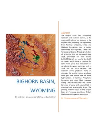
  • 1. BIGHORN BASIN, WYOMING Oil and Gas- an appraisal of Oregon Basin Field ABSTRACT The Oregon Basin field, comprising northern and southern domes, is the most prolific oil and gas producer in the Bighorn basin, Wyoming. Oil is produced from Tensleep sandstone, Embar and Madison Formations. Gas is mostly contributed by Chugwater, Embar and Tensleep sandstone. Though production of oil in the field has decreased since 1978, production has been around 2,000,000 barrels per year for the last 7 to 8 years and is likely to continue for some more years. Gas production has varied over the years reaching a peak in 1998 and has since declined. The northern dome produced more oil whereas, the southern dome produced more gas. The source rock for these hydrocarbons is Permian Phosphoria Formation and most likely migrated during Late Cretaceous to Early Eocene Laramide orogeny and accumulated in structural and stratigraphic traps. The primary reservoir rocks in the Oregon basin are Tensleep sandstone, Embar, Madison and Chugwater Formations. Dr. Venkataramana Pillarisetty
  • 2. Wyoming Wyoming, the 10th largest state by area (97,914 sq mi) in US, is a major coal (Powder River Basin), coal bed methane, oil and natural gas producer. It is the 8th largest producer of oil and natural gas in US (https://www.eia.gov/state/rankings/#/series/47). Choropleth Map showing Oil production in counties of Wyoming state Choropleth Map showing Gas production in counties of Wyoming state Within the state, Campbell, Park followed by Washakie and Sweetwater counties produce maximum oil and Sublette and Sweetwater counties produce maximum natural gas.
  • 3. Bighorn Basin, Wyoming The Bighorn basin in north-central Wyoming and south-central Montana is an intermontane basin of Rocky Mountain foreland. The basin is approximately 193 km long and 145 km wide and covers an area of about 13,200 sq. mi. The Bighorn basin covering parts of Park, Big Horn, Hot Springs and Washakie counties has been a major oil and gas producer in Wyoming. The region is generally flat and surrounded by mountains on its eastern, western and southern borders. Towards north the basin merges with the plains in Montana. Oil and Gas wells in Bighorn Basin, Wyoming
  • 4. Geology of Bighorn basin The Bighorn basin is a structural basin comprising sedimentary rocks ranging in age from Cambrian (541 - 485.5 mya) to Miocene (23.03 - 5.33 mya) and thickness of over 25,000 feet (7620 m). The present structural configuration of the basin was the result of the Late Cretaceous to Early Eocene Laramide orogeny (Blackstone, 1963). The folding and faulting that formed the present oil-producing anticlines in the Bighorn Basin occurred during pulses of compressional stress, mainly oriented northeast-southwest (http://www.wsgs.wyo.gov/energy/oil-gas-basins). The Bighorn basin is primarily an oil-producing basin. Oil was first discovered here in 1904. The Garland and Greybull fields were discovered in 1906 and 1907 respectively, both geological structures and stratigraphy play an important role in localisation of oil in Bighorn basin (Fox and Dolton.1996). Structural plays include basin margin sub-thrusts, basin margin anticlines, deep basin structures, and sub-Absaroka-volcanics. Principal stratigraphic plays include Phosphoria pinchout (up-dip facies change) and Tensleep paleogeography (dune fields versus interdune regions) (Fox and Dolton, 1996). Significant potential plays include basin center/deep gas and coalbed natural gas (http://www.wsgs.wyo.gov/energy/oil-gas-basins). Although most of the basin's production comes from anticlinal or other structural traps, Lawson and Smith (1966) suggested that many of the structurally-controlled traps are influenced by stratigraphic effects, including intraformational variations in permeability and, as in the Bonanza and Nowood fields, incised channels in the Tensleep surface that were later filled with impervious Goose Egg sediments. Later Laramide folding may have been superimposed on or near these primary traps. Pure stratigraphic traps are also productive within the Bighorn Basin. The largest of these is the Cottonwood Creek field in the southeast corner of the basin, a trap resulting Rattlesnake Mountain from an eastward, updip facies change from Phosphoria carbonate to the impermeable red shale and anhydrite facies of the Goose Egg Formation (http://www.wsgs.wyo.gov/energy/oil-gas-basins). The source of essentially all the oil and gas found in Palaeozoic reservoirs in the basin is the dark, phosphatic, fine-grained, marine facies of the Phosphoria Formation (Stone, 1967). Primary migration began immediately after deposition of Triassic sediments and was completed by Early Jurassic time. Hydrocarbons accumulated in regional stratigraphic traps created by up-dip facies changes, pinch- outs, or truncation of the reservoir rocks in the Phosphoria, and irregular truncation of thick Tensleep Sandstone beds prior to the deposition of the impervious Phosphoria/Goose Egg Formation. This situation is especially prevalent east of the area covered by marine carbonate facies of the Phosphoria Formation (Stone, 1967). Oil and gas in some of these stratigraphic traps were later released by fracturing and faulting associated with Laramide folding. During the Laramide orogeny, these hydrocarbons moved into older Palaeozoic reservoir rocks and older structures where they were trapped in common pools. The occurrence of a common oil-water contact, in many cases, is attributed to fractures joining the reservoirs. Also, the oil-water contact is often tilted as a result of hydrodynamic flow (Stone, 1967).
  • 5. Generalised Stratigraphy of Bighorn Basin (http://www.wsgs.wyo.gov/energy/oil-gas-basins) Oil and gas bearing formations in Bighorn basin In the Bighorn basin, oil has been produced primarily from the eolian and marine Tensleep Sandstone (Middle Pennsylvanian to Lower Permian age), production also comes from the Madison Limestone (Mississippian), Phosphoria Formation (Early Permian) and Amsden Formation (Lower Pennsylvanian). Oil and Gas Fields in Bighorn Basin There are over 145 demarcated oil and gas fields in Bighorn basin. The major ones are Oregon Basin, Grass Creek, Elk Basin, Garland, Hamilton Dome, Cottonwood Creek, Little Buffalo Basin, Byron and Frannie.
  • 6. Oil and Gas fields in the Bighorn Basin, Wyoming Table showing the oil/gas fields in the western margin of Bighorn Basin Field Name Active Oil Wells Active Gas wells Average Depth Producing Formation % Oil Produced % Gas Produced Elk Basin 172 168 4,023 Frontier, Tensleep 9.27 21.99 Silver Tip 39 88 6,348 Tensleep 0.20 3.25 Elk Basin South 4 24 6,466 Tensleep 0.43 1.53 Bearcat 1 4 6,961 Phosphoria 0.08 0.28 Shoshone 12 12 3,832 Amsden 0.42 0.00 Cody 12 12 7,747 Tensleep 0.96 0.04 Oregon Basin 494 267 3,729 Tensleep, Embar, Madison, Chugwater 23.13 23.45 Half Moon 22 16 3,639 Tensleep, Phosphoria 0.88 0.11 Hunt 20 0 4,270 Tensleep 0.13 0.00 Ferguson Ranch 18 0 4,096 Tensleep 0.45 0.00 Spring Creek South 86 86 4,368 Tensleep/Phosphoria 3.02 0.23 Pitchfork 47 0 4,309 Tensleep 4.26 0.74 Fourbear 31 0 3,816 Madison 0.88 0.00
  • 7. Sheep Point 7 0 3,839 Tensleep 0.06 0.00 Sunshine North 36 0 3,989 Tensleep 0.57 0.00 Little Buffalo Basin 78 68 4,835 Tensleep, Embar 7.46 2.80 Gooseberry 24 0 6,258 Amsden 1.01 0.02 Grass Creek 220 210 2,579 Tensleep 7.32 0.97 Golden Eagle 1 0 6,946 Phosphoria 0.20 0.20 Hamilton Dome 183 0 3,195 Tensleep, Phosphoria 8.69 0.24 Little Sand Draw 3 0 6,350 Tensleep 0.80 0.06 Gebo 35 35 5,097 Tensleep 1.38 0.06 Murphy Dome 27 0 4,785 Tensleep 0.74 0.14 Kirby Creek 16 0 1,862 Tensleep 0.15 0.07 Black Mountain 36 0 3,529 Madison 1.19 0.15 Heart Mountain 2 9 4,783 Fuson 0.01 2.47 Lake Creek 11 0 3,686 Tensleep 0.27 0.01 Neiber Dome 3 0 9,875 Tensleep 0.06 0.06 Packsaddle 1 0 4,000 Tensleep 0.05 0.05 Oregon Basin West 3 1 4,247 Tensleep 0.04 0.03 Oregon Basin Southeast 0 5 6,985 Muddy 0.00 1.48 31 1644 1005 74.12 60.42 Table showing the oil/gas fields in the eastern margin of Bighorn Basin Field Name Active Oil Wells Active Gas wells Average Depth Producing Formation % Oil Produced % Gas Produced Frannie 36 0 3,389 Tensleep 3.31 0.14 Sage Creek 19 0 3,651 Tensleep 0.61 0.00 Homestead 3 0 4,529 Tensleep 0.17 0.00 Byron 71 61 4,803 Tensleep, Peay, Madison, Amsden 4.27 0.28 Garland 245 237 3,717 Madison 8.40 4.70 Alkali Anticline 7 0 5,485 Madison 0.26 0.02 Spence Dome 47 0 680 Madison 0.10 0.00 Greybull 0 0 1,038 Peay 0.03 0.00 Lamb 4 1 2,784 Madison 0.07 0.06 Torchlight 17 18 1,796 Madison 0.57 0.09 Manderson 36 26 6,230 Phosphoria 0.22 3.69 Bonanza 5 0 2,561 Tensleep 0.23 0.00 Enigma 8 0 4,860 Amsden 0.40 0.06 Five Mile 15 18 10,305 Thermop 0.12 6.43
  • 8. Hidden Dome 21 1 3,099 Tensleep, Madison 0.64 0.20 Cottonwood Creek 97 121 8,141 Phosphoria, Tensleep 2.76 3.61 Frisby South 11 6 10,981 Phosphoria 0.74 0.49 Rattlesnake 16 9 10,887 Phosphoria 0.59 0.66 Frisby South 11 6 10,981 Phosphoria 0.74 0.49 Slick Creek 4 3 10,026 Phosphoria 0.30 0.60 No Water Creek 11 7 10,814 Phosphoria 0.31 0.29 South Fork 1 0 10,527 Phosphoria 0.08 0.04 Marshall 3 1 10,137 Phosphoria 0.08 0.29 23 688 515 25.00 22.14 The above two tables show that the oil fields in the western part of Bighorn Basin produced higher oil and gas compared to the fields in the eastern flanks of the basin. In the western flanks oil and gas occur at an average depth of 4500 ft., whereas in the eastern margins of the basin the average depth at which oil and gas occurs is 6000 ft and in the southeast corner the depth is nearly 10,000 ft. Oil Production in fields The Oregon Basin field is the most prolific oil producer in the Bighorn Basin and accounts for nearly 24% of all the crude oil produced in the basin from 1978 to August 2018.
  • 9. Gas production in fields The Oregon Basin field is the most prolific natural gas producer in the Bighorn Basin and accounts for nearly 25% of all the gas produced in the basin from 1978 to August 2018. Oregon Basin oil/gas field The Oregon Basin field is about 9 to 10 miles long and 5 miles wide. The basin comprises of North dome and south dome. Distribution of oil wells in the north and south domes of Oregon Basin field and the heat map showing oil production
  • 10. The heat map further shows that the north dome of Oregon basin yielded more oil compared to the southern part. There are nearly 494 active oil and 267 active gas wells as on August 2018. Whereas the southern dome recorded higher gas output. Distribution of oil wells in the north and south domes of Oregon Basin field and the heat map showing gas production E-W Cross section across the northern dome of Oregon Basin field
  • 11. Producing Formations in Oregon Basin Field Producing Formation Total Wells % Oil produced % Gas Produced TENSLEEP 403 45.87 14.13 EMBAR 440 42.17 23.94 MADISON 110 10.56 5.96 DARWIN 40 0.99 0.30 PHOSPHORIA 8 0.20 0.00 EMBAR-TENSLEEP 13 0.07 0.03 DARWIN-MADISON 1 0.04 0.01 EMBAR-TENSLEEP-DARWIN 2 0.03 0.01 CHUGWATER 60 0.02 42.92 TENSLEEP-MADISON 1 0.02 0.00 FLAT HEAD 5 0.01 0.75 GROS VENTRE 3 0.01 1.93 MUDDY 6 0.01 3.17 TENSLEEP-DARWIN 1 0.00 0.01 FRONTIER 12 0.00 3.96 CLOVERLY 5 0.00 1.62 FRONTIER 1-2-3 1 0.00 0.01 SUNDANCE 1 0.00 0.19 DAKOTA 3 0.00 0.14 FRONTIER & MUDDY 1 0.00 0.12 LAKOTA 6 0.00 0.77
  • 12. Nearly 98 % of oil in Oregon Basin was produced from Tensleep sandstone, Embar and Madison Formations. Whereas, 81 % of gas was produced from Chugwater, Embar Formations and Tansleep sandstone. Oil and Gas production in Oregon Basin field
  • 13. Oil production in Oregon Basin has decreased over the years and is approximately producing 2,000,000 BBls per year for the last 7 to 8 years and is likely to continue producing the same amount of oil for the next few years. Gas production, on the other hand, has varied over the years with a peak in 1998. Source Rock Two distinct source rock systems have been identified for the oil in Bighorn basin: (1) Permian Phosphoria Formation and (2) Cretaceous Mowry, Frontier, Mesaverde and Meeteetse Formations (https://certmapper.cr.usgs.gov/data/ noga95/prov34/text/prov34.pdf). The Phosphoria sourced oil is characterized by low API gravity and low to moderate sulfur whereas oils from Cretaceous and Tertiary formations have higher API gravities and low to absent sulfur content (https://pubs.usgs.gov/fs/2008/3050/pdf/FS08-3050_508.pdf). The oil from Oregon Basin has an average API of 20.78. Studies on sulfur content and API values have suggested that the Oregon Basin oils are Type-II Kerogen and are sourced from Permian Phosphoria Formation (https://www.researchgate.net/figure/Sulfur-content-versus-gravity-of-oils-from-Bighorn-Basin-this- study-and-Orr-1974_fig10_260725180). Migration of Oil The Phosphoria-derived oils largely migrated into the Bighorn Basin from the west and have partly cracked to gas with increasing thermal maturity. The migration of oil is thought be during Late Cretaceous to Early Eocene Laramide orogeny (Blackstone, 1963).
  • 14. Reservoir Rocks The primary reservoir rocks in the Oregon basin are Tensleep sandstone, Embar, Madison and Chugwater Formations. Trap Rocks Phosphoria Formation-sourced hydrocarbons accumulated in the Bighorn Basin in stratigraphic traps created primarily by up dip facies change, pinch out and truncation of reservoir carbonates, and by uneven Phosphoria Goose Egg truncation of the underlying Pennsylvanian Tensleep Sandston (Lawson, M., Formolo. M. J., Summa, L. & Eiler, J. M. 2018). Oil & Gas Producing Companies in Oregon Basin Operator % Oil Produced % Gas Produced Total Wells Wells in 2018 Coastal Chem Inc 0.00 0.35 2 0 Cumberland Operating Llc 0.01 5.52 5 5 Husky Oil Company 0.00 0.00 1 0 Marathon Oil Company 1.15 1.62 36 0 Merit Energy Company 98.65 92.39 538 413 Phoenix Production Company 0.19 0.13 6 6 The Merit Energy Company of Texas is the major operator and accounts for 98.65 % of Oil and 92.39% of Gas production in the Oregon Basin field. Acknowledgement All location, geological and production data is taken from Wyoming Oil & Gas Conservation Commission website (http://pipeline.wyo.gov/). References Blackstone, D.L., Jr., 1963, Development of geologic structures in central Rocky Mountains, in Childs, O.E., and Beebe, B.W., eds., Backbone of the Americas, Tectonic history from pole to pole: Tulsa, Ok., American Association of Petroleum Geologists Memoir, p. 160-179. Fox, J.E., and Dolton, G.L., 1996, Petroleum geology of the Bighorn Basin, north-central Wyoming and south-central Montana, in Bowen, C.E., Kirkwood, S.C., and Miller, T.S., eds., Resources of the Bighorn Basin: Casper, Wy., Wyoming Geological Association, 47th annual field conference, Guidebook, p. 19- 39.
  • 15. Lawson, D.E., and Smith, J.R., 1966, Pennsylvanian and Permian influence on Tensleep oil accumulation, Bighorn Basin, Wyoming: American Association of Petroleum Geologists Bulletin, v. 50, no. 10, p. 2197-2220. Lawson, M., Formolo. M. J., Summa, L. & Eiler, J. M., 2018, Geochemical applications in petroleum systems analysis: New constraints and the power of integration Geological Society London Special Publications 468(1): SP 468.6 Stone, D.S, 1967, Theory of Palaeozoic oil and gas accumulation in Bighorn Basin, Wyoming: American Association of Petroleum Geologists Bulletin, v. 51, no. 10, p. 2056-2114.