"West Houston (TX): An introduction to the plan that links people, places and communities."
•
1 j'aime•510 vues

"West Houston (TX): An introduction to the plan that links people, places and communities." Read along: http://www.energycorridor.org/…/med…/parks/WHTMP-8-Pager.pdf Photo credit: The Energy Corridor, Houston TX.

Recommandé
Contenu connexe
Tendances
Tendances (17)
Similaire à "West Houston (TX): An introduction to the plan that links people, places and communities."
Similaire à "West Houston (TX): An introduction to the plan that links people, places and communities." (20)
Plus de Champions Real Estate Group
Plus de Champions Real Estate Group (20)
Dernier
Dernier (20)
"West Houston (TX): An introduction to the plan that links people, places and communities."
- 1. An introduction to the plan that links people, places and communities.
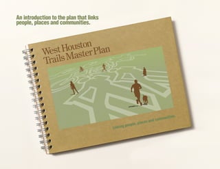
- 2. The West Houston Trails Master Plan is a big idea. It’s a vision for more than 100 miles of interconnected trails located in a 113,000-acre area in West Houston within a 6-mile radius centered at the intersec- tion of IH-10 and State Highway 6. It’s a plan for a shared-use trail system that will link business centers, residential neigh- borhoods and parks, providing alternative transportation and outdoor recreation. It’s a proposal that works with the shape and natural characteristics of the land to enhance the area’s natural beauty, that supports habitat preservation and sustain- ability, that maximizes compatible land uses and increases economic vitality. The West Houston Trails Master Plan is an initiative that originated as a joint venture of the Energy Cor- ridor District and the National Park Service, one that was realized with input from literally hundreds of people, guidance from multiple agencies, using data gathered during hundreds of hours of public forums and from thousands of surveys. The plan is the product of more than two years of volunteer effort – of countless hours of meetings, workshops and discus- sions. It is the tangible result of concen- trated effort by interested individuals and public and private entities. The brochure you are holding now is only an introduction to the West Houston Trails Master Plan, a comprehensive, 156-page document. This brochure offers an overview of the goals, objectives and benefits of a multi-use, interconnected trails system. The complete plan offers guidelines for design, construction and maintenance of trails. It identifies po- tential partners and revenue sources and includes detailed maps, recommendations for implementation, even historical and cultural data of the targeted area. It is the hope of the plan development team that, after reading this overview, you will be driven to review the full plan. We believe that a multi-use trails system will have a major positive impact on the health and happiness of residents as well as on the economic development of West Houston. We’d like your help in making the plan a reality. APlanBuiltbyCommunity
- 3. Visions, Goals&Objectives Vision Create a 100+ mile interconnected trail system within West Houston while respecting the natural ecosystems and cultural resources of the area. Goals ••Identify locations of future public trails and connecting routes. ••Provide outdoor recreation opportunities on trails through parks and conservation areas. ••Provide opportunities for bike-to-work commutes and safe routes for walking and cycling to schools and other locations. ••Increase conservation through reduced use of cars, fuel and roadways. ••Increase opportunities for health and fitness. ••Promote safety through proper design of trails and road crossings, construction of trails separated from roadways and education supporting safe use of trails. ••Provide connections to transit and on- road bikeways. Objectives ••Connect new miles of trail to 34+ existing miles of trail. ••Add at least 15 miles of new trail by 2015. ••Identify and promote an initial trail to demonstrate the importance of connectivity (targeting Patterson/North Eldridge Trail). ••Develop a strategic plan to prioritize implementation of trail projects, create partnerships for implementation and identify funding strategies. The vision of the many people who helped develop the West Houston Trails Master Plan is a system of trails that connect the parks and public lands of West Houston. The goal is to create a trail network that serves the greatest number of users while providing good stewardship of land and water resources. In order to achieve this goal, existing trails have been identified and proposed routes for new trails have been developed and prioritized. Once implemented, the West Houston Trails Master Plan will compliment the existing transportation corridors, increase commuter choices, provide greater outdoor recreational opportunities develop safe routes to schools and other public places. It will also provide an increased awareness of the storm- water management system and the importance of riparian restoration and protection.
- 4. Proposed Spine Trail System The West Houston Trails Master Plan development team recognizes the importance and value of public input and therefore has included all proposed trails, shown as red dashes. The development team recommends strongly those very important corridors referred to as spine trails, shown in black. A spine trail is defined as having substantial length and the potential to connect existing trails and destinations like parks, neighborhoods and businesses, creating the backbone of the interconnected system. The following list represents the priority recommendations in the WHTMP. Barker-Cypress Spine Trail »» 5.9 miles adjacent to Barker-Cypress Road Bear Creek Pioneers Park Spine Trail »» 2-mile multi-use trail through park Bear Creek Spine Trail »» 2.6 miles along creek on HCFCD right-of-way Bellaire Blvd Drainageway Spine Trail »» 5.2 miles on HCFCD right-of-way (2.3 miles completed) Brays Bayou/Barker Dam Spine Trail »» 6 miles along bayou on HCFCD right-of-way (1 mile completed) Clay Road Spine Trail »» 10.3 miles adjacent to road, part within Addicks Reservoir (1 mile completed) Patterson/N. Eldridge Spine Trail »» 3.5 miles within Addicks Reservoir Eldridge/Energy Corridor Spine Trail »» 2.8 miles adjacent to Eldridge Parkway (2 miles completed) Eldridge/South Spine Trail »» 2.9 miles adjacent to Eldridge Parkway George Bush Park Spine Trail »» 14.1 miles around and through Barker Reservoir (10.4 miles completed) Greenhouse Kingsland T109 Spine Trail »» 4.5 miles adjacent to Greenhouse & Kingsland Blvds. & HCFCD drainageway (2.6 miles completed) Grisby/ IH-10 Spine Trail »» 2 miles from Barker Dam along Grisby, SH6, and IH-10 to Eldridge (1.1 mile completed) Horsepen Creek Spine Trail »» 1 mile along creek on HCFCD right-of-way Langham Creek Spine Trail »» 4.9 miles along creek on HCFCD right-of- way plus inside Addicks Reservoir (.5 mile completed) Mason Creek Spine Trail »» 3.7 miles along creek on HCFCD right-of- way plus edge of Barker Reservoir (.9 mile underway) Noble Road Spine Trail »» 2.3 miles within Barker Reservoir S. Mayde Creek-Cullen Park Spine Trail »» 6.5 miles along creek on HCFCD right-of-way and inside Cullen Park (3.6 miles completed) SH-6 North Spine Trail »» 6 miles adjacent to SH-6, half within Addicks Reservoir (.4 completed) SH-6 South Spine Trail »» 1.2 miles adjacent to SH-6 Wycliff Highline Spine Trail »» 8.7 miles following overhead power line right- of-way
- 5. The Houston Energy Corridor Patterson/ N. Eldridge Spine Trail The WHTMP has identified this trail as top priority. The 3.5-mile corridor would begin at Patterson Road and SH-6 east of N. Eldridge Parkway and travel through the scenic, wooded Addicks reservoir, connecting to Terry Hershey North Trail, a METRO Park & Ride, the public transit system, a city bikeway and to the Energy Corridor District. Partners: USACE, TxDOT. Harris County Precinct 3, City of Houston, Energy Corridor District, and Energy Corridor businesses. ••This spine trail is proposed primarily within existing City of Houston roadway right-of-ways. ••The City of Houston and the Energy Corridor District have held meetings discussing strategies for moving this project forward pending final approvals by the U.S. Army Corps of Engineers. ••The project would be coordinated with the State Transportation Enhancement Program (STEP) and the trail development project for North Terry Hershey Park implemented by Harris County Precinct 3. ••City of Houston Parks & Recreation and local council members will be strong partners to help further this project. ••Trail may be eligible for Congested Mitigation & Air Quality Improvement (CMAQ) funding as well as other Pedestrian and Bikeways Transportation Enhancement funding. Current efforts are underway to acquire such funding and support.
- 6. Trails make our lives richer in a variety of ways. Not only do they allow people to connect with nature, they allow people to connect with one another. They provide a venue where neighbors meet, where children play, where families gather. Trails bring people out of their homes, out of their cars, and into their communities. Connectivity Trails connect people to the places they want to be. They offer routes between home and school, church, retail and business, between parks and open spaces. In the best of circumstances, trails also offer a stimulating and pleasurable outdoor experience and create places for social interacting. Alternative Transportation By providing a safe alternative to single- occupant car travel, trails alleviate the demands on public infrastructure and reduce the negative environmental impact of motorized commuting. Recreational Activities The desirability and economic strength of a community is often measured by the degree it supports and promotes outdoor recreation for its citizens, activities that contribute greatly to individual well-being and quality of life. Better Health Trail systems allow communities to engage in regular physical activity including walking, running and biking. Such activity can help lower rates of obesity, prevent and control heart disease and diabetes, decrease blood pressure, reduce symptoms of depression and decrease rates of aging. Studies clearly show that improved overall health levels result in increased educational achievement and reduced costs to the health care system. Economic Development Numerous studies have shown that having trails incorporated into residential developments helps sell properties and improve real estate values. In fact, trails are the second amenity preferred by potential homeowners, only after roadway access. Businesses prefer to locate in cities offering quality-of-life amenities such as recreational areas, short and alternative commutes and attractive urban design. Similarly, livable cities attract the creative class of workers who can choose where they live, work and play. Benefits ofTrails Turning the Plan Into Reality.
- 7. ••Developing a road- and bridge- abutment slope policy that supports future trail additions by providing a ledge under bridges or elevated roadways allowing a trail along drainageways. ••Developing recreational-use easements on all open and accessible areas currently slated as public maintenance easements. ••Adopting trail corridors in this and other regional plans and, when properties containing proposed trail corridors are submitted for development review, incorporating requirements for implementation responsibilities. ••Including a minimum 8-foot wide multi- use trail or a set aside easement in the design of new public road right-of-ways. ••Creating an advocacy organization, coalition or regional trail authority to promote the West Houston Trails System. ••Developing sustainable design practices to reduce the burden of future land maintenance costs. ••Evaluating vegetation management policies that surround drainage and riparian corridors to encourage appropriate vegetation growth, reforestation of the upper banks and habitat restoration, improved water quality and reduced maintenance costs. ••Removing unnecessary fencing surrounding detention basins, thus expanding amenity opportunities to allow trail access, wildlife reviewing and habitat development. An interconnected system of trails would be a boon for all of West Houston. It would further enhance the attractiveness of the area to residents and businesses alike. It would ease traffic congestion while improving the health and well-being of commuters. It would augment the beauty of the land, help to preserve the natural resources and advance the quality of life and economic vitality of the area. If you are interested in viewing the entire plan, please visit www. energycorridor.org/west-houston-trails/masterplan. We encourage you to become involved by volunteering your time or contributing funds. Call 281- 759-3800 for an appointment. With your help, we can make this plan a reality. Recommendations
- 8. The Houston Energy Corridor The best business center in the best business city in the United States. Located in West Houston along Interstate 10 from Barker Cypress to Kirkwood and along Eldridge Parkway to Briar Forest. Home to global energy and high technology companies with first-class hotels, convenient retail, attractive neighborhoods and the region’s best school districts. Energy Corridor District The 1,700 acre special district in The Houston Energy Corridor receives additional police protection, business development assistance, public space improvements and maintenance, multi-modal transportation choices and hike and bike access to the region’s best park system. For more information contact: Energy Corridor District, 14701 St. Mary’s Suite 290, Houston, Texas 77079, 281-759-3800 National Park Service Since its establishment in 1916, the National Park Service has been entrusted to care for special places saved by the American people so that all may experience their heritage. The National Park Service professionals and volunteers take the mission on the road offering advice, technical assistance and recognition to help communities across the country preserve and create close-to-home recreation opportunities. The National Park Service is honored to be invited into America’s towns and cities to work with those who share their commitment to conservation, preservation and recreation. They are proud to join forces with the state and local governments, nonprofit organizations and private citizens through programs like the Rivers, Trails and Conservation Assistance program to plan and build trails, protect rivers and watersheds, recognize and promote local history and introduce the next generation to stewardship opportunities and responsibilities. RTCA often acts as a catalyst to help assemble the necessary pieces to achieve on-the-ground conservation success, helping identify resources, navigate the planning process, and convert ideas into actions. By working side-by-side in partnership with communities throughout the country, the National Park Service is building a nationwide system of parks, open spaces, rivers, and trails. B R I A R F O R E S T G R I S B Y DAIRYASHFORD ENERGY CORRIDOR DISTRICT KIRKWOOD M E M O R I A L THE HOUSTON ENERGY CORRIDOR 10 P A R K R O W BARKERCYPRESS ELDRIDG E 6