Section 3 - Prioritization of Scenic Issues
•
0 j'aime•252 vues

Mohawk Towpath Byway, Scenic Conservation Action Plan, Section 3 - Prioritization of Scenic Issues. Also includes an introductory paragraph to the Tool Box in Section 4.

Recommandé
Recommandé
Contenu connexe
Tendances
Tendances (20)
Similaire à Section 3 - Prioritization of Scenic Issues
Similaire à Section 3 - Prioritization of Scenic Issues (20)
Plus de Mohawk Towpath Scenic Byway Coalition, Inc
Plus de Mohawk Towpath Scenic Byway Coalition, Inc (20)
Dernier
Dernier (20)
Section 3 - Prioritization of Scenic Issues
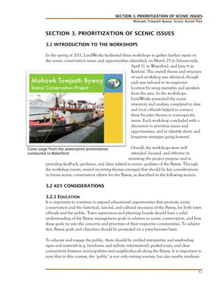
- 1. SECTION 3. PRIORITIZATION OF SCENIC ISSUES Mohawk Towpath Byway: Scenic Action Plan SECTION 3. PRIORITIZATION OF SCENIC ISSUES 3.1 INTRODUCTION TO THE WORKSHOPS In the spring of 2011, LandWorks facilitated three workshops to gather further input on the scenic conservation issues and opportunities identified: on March 25 in Schenectady, April 11 in Waterford, and June 6 in Rexford. The overall theme and structure of each workshop was identical, though each was tailored to its respective location by using examples and speakers from the area. In the workshops, LandWorks presented the scenic inventory and analysis completed to date and local officials helped to connect these broader themes to town-specific issues. Each workshop concluded with a discussion to prioritize issues and opportunities, and to identify short- and long-term strategies going forward. Overall, the workshops were well attended, focused, and effective in reviewing the project purpose and in providing feedback, guidance, and ideas related to scenic qualities of the Byway. Through the workshop events, several recurring themes emerged that should be key considerations in future scenic conservation efforts for the Byway, as described in the following section. Cover page from the powerpoint presentation conducted in Waterford 3.2 KEY CONSIDERATIONS 3.2.1 EDUCATION It is important to continue to expand educational opportunities that promote scenic conservation and the historical, natural, and cultural resources of the Byway, for both town officials and the public. Town supervisors and planning boards should have a solid understanding of the Byway management goals in relation to scenic conservation, and how these goals tie into the concerns and priorities of their respective communities. To achieve this, Byway goals and objectives should be promoted on a town-by-town basis. To educate and engage the public, there should be unified interpretive and wayfinding signs and materials (e.g. brochures and website information), guided tours, and clear connectivity between municipalities and neighborhoods along the Byway. It is important to note that in this context, the ‘public’ is not only visiting tourists, but also nearby residents. 3-1
- 2. SECTION 3. PRIORITIZATION OF SCENIC ISSUES Mohawk Towpath Byway: Scenic Action Plan Use of the Byway should be specifically promoted to local families, interest groups, and clubs, as a “treasure in their backyard.” Recommendations: 1. Promote understanding of scenic and landscape resource management by participating in development review or meeting with local planning boards. 2. Consider various initiatives to raise awareness of the Byway, in particular programs that involve students and schools. 3. Use multiple means and media to promote information and guidance about the Byway. 3.2.2 PROMOTION Infrastructure should be further developed to promote and connect the heritage tourism, agritourism, and ecotourism opportunities the Byway provides. The Discovery Guide now needs to be reinforced with additional signage and connectivity among the various parts of the Byway. An overall Byway sign and unified system of wayfinding and interpretive signs along the route has been initiated and helps give the Byway a clear identity and promote it as a tourist destination. Under-invested waterfront locations could be identified and developed to add to the existing attractions. In general, greater visibility and a more cohesive presence of Byway elements and attractions will help to promote tourism along the route. Recommendations: 1. Create scenic pull-offs along Crescent-Cohoes Road, Riverview Road and Aqueduct Road. 2. Promote the value of an online presence through the website, blog, etc. 3. Expand the number of fine historic, bike and river tours, festivals and events to attract, engage, and educate visitors. 4. Consider additional tourism infrastructure and amenities at key sites. 5. Create a master sign plan for the Byway, building off of the interpretive signs and kiosks already implemented. 3.2.3 ACCESS Visitors’ enjoyment of the Byway depends on having easy access to views of the canal and river and attractions along the route. Accordingly, access should be improved to both the river and canal sites along the Byway, as well as to other areas with views of the river and canal, such as overlooks or trails, and amenities offered at these locations should be expanded. Clear and cohesive wayfinding signage and traffic safety guidance will help visitors feel more comfortable and informed as they follow the Byway route and access the many attractions along the way. Specific projects to improve access may include: • Improving the state dock next to Crescent Bridge 3-2
- 3. SECTION 3. PRIORITIZATION OF SCENIC ISSUES Mohawk Towpath Byway: Scenic Action Plan • • • • • • • Widening shoulders of roads along the Byway A bike path on Rexford Bridge The planned construction of the new Roosevelt Bridge A bike path to connect the north/south trail systems Neighborhood walking guides, biking guides, and connectivity to support trails being developed in the East End New sites for formal scenic pull-offs Working with National Grid to promote multiple use of transmission corridors Recommendations: 1. Continue to develop and integrate recreational opportunities, amenities and infrastructure. 2. Consider additional locations for an observation deck or viewing areas of the river and canal infrastructure, such as those installed at Mohawk Landing or Falls View Park. Mohawk Landing Falls View Park 3. Work with developers for trail right-of-way, improvements, and connections to existing trails and bike paths. 4. Continue to develop and improve access areas to the canal and river. 3.2.4 SCENIC ENHANCEMENT, REDEVELOPMENT, AND PROTECTION There is a distinct need for scenic resource management at key sites and redevelopment areas along the Byway, and for scenic conservation to be recognized as a key goal in the future of the Byway. The aim is to not only protect but also add to the Byway’s existing scenic views and attractions, by improving existing amenities and guiding future development practices. To facilitate scenic conservation efforts, it is important to recognize the tools and resources that towns already have, add to or enhance these where appropriate, and to provide further examples that communities can refer to for guidance and inspiration. 3-3
- 4. SECTION 3. PRIORITIZATION OF SCENIC ISSUES Mohawk Towpath Byway: Scenic Action Plan Although overarching initiatives are important in maintaining the integrity of the natural and cultural landscapes along the Byway, coordinating efforts, and developing a cohesive identity, much of the action behind scenic enhancement and protection happens at the local level. To identify local issues and opportunities, it is important that communities along the Byway recognize their own qualities and character that they wish to maintain and promote, in addition to the overall identity of the Byway. Through this process of collective self-reflection and community exploration, new opportunities for enhancements can be discovered and pursued. Some specific concerns and opportunities related to scenic resource management include: • Consider the use and fate of historical buildings and pursue preservation and acquisition grants • Implement the Cohoes Crescent Road Improvements alternatives Analysis • Evaluate invasive species control measures including milfoil and water chestnuts • Expand riverside and roadside clean-up events like Canal Clean Sweep and Town Highway adoption programs • Mitigate run-off from development • Address use of Colonie landfill • Identify alternative fundraising possibilities • Promote open space or scenic preservation as a part of the development review and approval process Recommendations: 1. Open old canal or establish bike paths from north end of Albany City to Cohoes. 2. Re-vegetate and reuse the Colonie Landfill. 3. Work with NYS Power Authority and developers for access opportunities, improvements, and conservation or open space protection. 4. Create long-term management, maintenance, and use of historic sites and structures. 5. Develop scenic pull-offs. 6. Identify key viewsheds or scenic views to protect. 7. Develop a toolbox for scenic and landscape resource management. 3.2.5 COLLABORATION Forming partnerships can be highly valuable in tackling key projects and for coordinating materials for overall Byway interpretation and promotion. In this effort, it is important to understand the roles and relationships of all involved, as well as the goals and concerns of the organizations, towns, and individuals. These collaborative efforts are beneficial in all aspects of scenic conservation planning, including education, promotion, access, and scenic enhancement. The Mohawk Towpath Scenic Byway overlaps with a number of other municipalities and designations. The goals and priorities of the Byway must be considered alongside those of 3-4
- 5. SECTION 3. PRIORITIZATION OF SCENIC ISSUES Mohawk Towpath Byway: Scenic Action Plan the 8 different municipalities it passes through, the adjacent Lakes to Locks Passage, and the larger Erie Canalway National Heritage Corridor. Overlapping goals and priorities amongst the various municipalities and organizations can reveal valuable opportunities for collaboration and strengthen individual initiatives. Recommendations: 1. Further solidify existing partnerships and identify potential future collaborators 2. Identify all entities and organizations working in the Byway region to promote tourism, scenic resource and open space management, recreational options and amenities. 3. Maintain or establish relevant programs that provide opportunities for collaboration, such as grants and other initiatives. 3.3 IMPORTANT INITIATIVES Workshop participants identified many specific opportunities for improvement that should be prioritized. The toolbox of scenic conservation strategies outlined in the following chapter provides models and guidance for these important initiatives to improve the scenic qualities of the Byway: 3.3.1 URBAN STREETSCAPE CONSIDERATIONS AND OPPORTUNITIES • In Waterford and Schenectady there are too many signs: commercial signs, regulatory signs, wayfinding, real estate and more. 3.3.2 CRESCENT-COHOES ROAD • Widen road and add pull-offs at key scenic and historic location • Develop a park at the power plant • Add a bike/pedestrian path to discourage walking on the road shoulder • Repair and improve riverside scenic and safety issues • Improve drainage • Interpretation of military crossing 3.3.3 LANDFILL AT COLONIE • Evaluate timeframe for the redevelopment process and look at other relevant projects • Add roadside screening buffers to both minimize scenic impact and catch airborne debris • Improve runoff catchment • Revegetate with appropriate species, including dwarf flowering trees and wildflowers • Build pathways for recreation • Conduct semi-annual (or more often if necessary) roadside clean-up 3.3.4 ALCO INDUSTRIAL • Add vegetative softening and other roadside landscape elements • Create a small park with increased tree and grass areas 3-5
- 6. SECTION 3. PRIORITIZATION OF SCENIC ISSUES Mohawk Towpath Byway: Scenic Action Plan • • Add pull-offs with green space and interpretive signs Extend the character of neighboring communities with new construction 3.3.5 AQUEDUCT • Improve access to Aqueduct Park • Promote bicyclist and pedestrian use in the area and provide connections to the bikeway • Improve river access, including a boat launch • Use vegetative control on the aqueduct structure 3.3.6 HISTORIC AREAS AND RETAINING COMMUNITY CHARACTER • Review the inventory of historic areas in the Corridor Management Plan, and within individual municipal comprehensive plans • Formalize the “signage family” to unify adjacent communities and facilitate navigation • Collate community guidelines and projects that provide useful examples for historic resource management and preservation 3.3.7 SCENIC AREAS AND SUBURBAN SPRAWL ISSUES • Maintain open space buffers along roadways • Maintain character and architectural style in growing suburban areas • Plan new vista points, “refuge areas,” and pull-offs • Improve and add new trailheads, access signs, and foot trails 3.3.8 IMPROVE ACCESS TO RECREATIONAL FACILITIES AND OPPORTUNITIES • At Rexford Bridge, Power Authority, Ferry Drive, and Twin Bridges, among others 3.3.9 IMPROVE ROUTE 9 GATEWAY IN HALF MOON • Reinforce proposal to develop a boulevard appearance for the road, as set forth in the Town’s Comprehensive Master Plan. 3-6