SlideShare une entreprise Scribd logo
1  sur  34
Mapping and Diagramming
                                the City:
                                Rethinking cities in the 21st century: in
                                the wake of chaotic growth and universal
                                expansion of cities and megacities
                                around the world.

                                We need to become experimental by
                                playing with different ‘models’ and
                                methods of studying the city

                                Mapping and diagramming are two
                                methods of exploring the open-ended
                                complexity that is descriptive of the
                                contemporary urban terrain.

                                But what is a map and what is a
                                diagram? How is information
                                represented?
James Corner Field Operations
Diagrams: visualization can play a key role in the processes of understanding that take
place before form-making begins. *Diagrams” Visible Language 26, 3 & 4 (Summer/Autumn, 1993): 451 – 73. Vijay K.
Sivasankaran and Charles L. Owen, “Data Exploration: Transition Operation in Dynamic +


Tufte made Minard’s “Figuration Map famous in his 1983 book The Visual Display of
Quantitative Information. It shows the successive losses of men in the French army during
the Russian Campaign 1812 – 1813. It took him a long time to assemble the data: city
data, temperature data, the army data [survival, direction of movement, group] simplifying
all events; utilize thickness of lines to represent overall troop size therefore correlating
troop movements with temperature, and survival rates as well as direction of advance or
retreat.
Flowchart: It was John von Neumann (1903 – 57) who
identified the key components of the computer as an
information processor. (central processing
unit, memory to store information, and an
input/output device for bringing information into and
out of the machine)

He also developed the ‘flow diagram’ that charts the
course of information transfers and operations

Flow charts are dynamic and narrative: they describe
an actively pursued process with a clear beginning and
-- a sequential progression towards a specified goal.

In a directed graph the relations between points, the
flows of energy or the circulation of things between
points is the issue: be they
goods, people, vehicles, soldiers, or flows of
water, energy, messages and information.
Mapping the Urban Network:

                             One of the oldest flow charts is the
                             Peutingeriana map laying out roads
                             between cities --- depicting a Roman
                             postal system. Rome was the axis of this
                             entire system of intersections. Only one
                             level needed since no other system
                             intersected this one


                             The Tabula Peutingeriana or Peutinger
                             Map is a thirteenth-century reproduction
                             of one of the wonders of Roman
                             geographical scholarship, a map showing
                             the world from Morocco, Spain and Thule
                             (?) in the West to India and Sri Lanka in the
                             East. The most remarkable part is the
                             depiction of the main roads of the empire
Harry Beck’s map depicts stations, straight line segments connecting them, and the River
Thames; lines ran only vertically, horizontally, or on 45 degree diagonals. To make the map
clearer and to emphasize connections, Beck differentiated between ordinary stations (marked
with tick marks) and interchanges (marked with diamonds). The Underground was initially
skeptical of his proposal — it was an uncommissioned spare-time project, and it was
tentatively introduced to the public in a small pamphlet in 1933
The basic design concepts have been widely adopted for other network maps around the
world, especially that of mapping topologically rather than geographically.
Rome of Sixtus V (1585 – 1590)

Medieval Rome was a place of
pilgrimage – not a large city but a city of
disorderly streets and meanderings
ways. Sixtus V ploughed straight new
streets through old neighborhoods and
open countryside to provide links
between the major sections of the city
where the major basilicas lay: to
facilitate the movement of pilgrims
between the major religious sites and to
accommodate the new mode of travel
by coach, and to allow goods and
services to flow more freely through and
about the city,
In the Renaissance mathematics begins to rule the figuration of the city – linear perspective
and the grid effect of cartography control the accuracy of the view in this ideal city c 1470
[National Gallery Urbino]

-A perspectival grid and outlines of buildings in minute detail with bilateral symmetry
--A utopian view: an urban order ruled by the principles of linear perspective based on
horizontal lines, vanishing and distance point and the resulting grid of orthogonals and
horizontals.
--the urban environment is given center stage: considered utopian because the idea of
implementation was an unreal expectation, it was merely visionary of what might happen
one day, when perfection could be attained.
Leonardo da Vinci’s 1502 Map of Imola:
                                           based on the use of a horizontal surveying
                                           disk which allowed for accurate measuring
                                           of spatial dimensions of land and its objects.
                                           One of the first scaled and accurately
                                           measured maps from the Renaissance.

                                           It is a mathematical abstraction of spatial
                                           reality.

                                           Called ichnographic city plan from Greek
                                           “iknos” meaning tracing or outlining and
                                           “graphein” to write.


Isotropic space; uniform and continuous in all directions – utilizing a plurality of
hypothetical viewpoints all drawn perpendicular to the surface of the map.
The city plan becomes the mode of cartographic documentation for the
subsequent representation of European cities.
Kleanthes and Schaubert’s First plan of Athens 1833
These maps accompanied Booth’s Life
                                              and Labour of the People of London
                                              (1899) the first systematic a block by
                                              block investigation.

                                              There appears to be a relative amount
                                              of mixing of classes across the city with
                                              poverty concentrated near the river
                                              Thames and great wealth towards the
                                              West End of London.

                                              London appeared to be
                                              unreadable, everything mixed up.

Charles Booth’s London Map (1899)
color-coding of social classes in London --
yellow is upper middle and upper
classes, red is middle and well-to-do
class, pink is fairly comfortable , good
earners, and blue is poor…. Black is
‘criminal class’ of slum dwellers
Maps determine the manner in which we perceive reality and hence influence actions.


Buckminster Fuller’s Dymaxion Airocean World Map of 1943: cuts the earth into triangular
facets that are then unfolded as a flat polyhedron. Both northern and southern poles are
presented frontally and with little distortion. The map can be unfolding and re-oriented in a
number of different ways, Different places and regions are seen in different sets of
relationships [James Corner]
Joaquin Torres Garcia Inverted
Map of South America 1943.
Places the south at the top of
the map inverting the
convention of map making
established during the Age of
Discovery, when the center of
the earth shifted from the
Mediterranean and the Holy
Lands to the Atlantic ocean.

This map upsets normal view of
the world map from a Euro-
centric viewpoint.
The map of Paris, entitled “The Naked City” published summer of 1957, the creation of
Guy Debord just before the Situationist International was formed. His concerns: how is
space constructed and how does space affect the perception of users of urban space?

The Map: 19 cut-out sections of a map of Paris, printed in black and white ink with
directional arrows painted in red. It subverts the image of a map, destroys the
omnipresent view from nowhere – instead it tries to spatialize movement, actions around
certain psychological hubs.
Illustration of psychogeographical turntables:
describes the function of the red arrows by
comparing them to a railroad turntable --- the arrows
representing the spontaneous turns of direction
taken by a person moving through ‘different
atmospheres of Paris’, or any other city, in disregard
to the normal connections that ordinarily govern
one’s conduct. The railroad can only run on fixed
tacks, so too the subject under the reign of
capitalism, but turning tables or the turntable is also
a pun on playing tricks.

Each segment of the map is a ‘unity of atmosphere’
, a place of special attractions --- The title in red
letters is an appropriation of American film noir 1948
set in New York City and filmed in documentary style
[director Jules Dassin] it starred the landmark streets
and buildings so too the map’s cut-out segments star
Luxembourg Gardens, Les Halles, Gare de Lyon, etc. ]

In 1955 the structure of Paris was an obstacle that
offered tiny clues to a future organization of life.
The city map or city plan became an ideogram of how geometry measures and controls our
perception of what is the ‘urban’, ‘the world’, the ‘cityscape’. Maps project a power/knowledge.

Now there are revisions to this process of mapping the city as a creative practice: replacing the
map as a process that mathematically abstracts from reality with a process that engenders new
ways of viewing and mapping reality.
                                      Deleuze and Guattari’s definition of Mapping in A
                                      thousand Plateaus: 12 “The map is open and connectable
                                      in all of its dimensions; it is
                                      detachable, reversible, susceptible to constant
                                      modification. It can be torn, reversed, adapted to any kind
                                      of mounting, reworked by an individual, group, or social
                                      formation. It can be drawn on a wall. Conceived as a work
                                      of art, constructed as a political action or as a meditation.”

                                      They oppose mapping to tracing [i.e. the ichnographic
                                      method]: the latter is closed in upon itself, propagating
                                      redundancies while a mapping is open-ended
                                      , experimental, unfolding. It reformulates what already
                                      exists: looking for hidden logics underneath apparent
                                      forces [not just topography, rivers, roads, buildings but
                                      wind and sun, local stories and historical
  Tracing Summer Jonathan Kline
                                      events, regulatory forces and programmatic structures.”
James Corner states in the “Agency of
                                     Mapping” there is a double-sided
                                     characteristic of all maps to be both an
                                     analogue and an abstraction.

                                     He notes “First, their surfaces are directly
                                     analogous to actual ground conditions; as
                                     horizontal planes, they record the surface of
                                     the earth as direct impressions. …. One can
                                     put one’s finger on a map and trace out a
                                     particular route or itinerary, the map
                                     projecting a mental image into the spatial
                                     imagination ….

                                     By contrast, the other side of this analogous
                                     characteristic is the inevitable abstractness of
                                     maps, the result of
Thus a map is the surface where      selection, omission, isolation, distance and
facts and conditions are             codification. Map devices such as
collected, sorted, related to each   frame, scale, orientation, and
other and explored.                  projection, indexing and naming reveal
                                     artificial geographies that remains
                                     unavailable to human eyes.” *Corner “Agency”: 215+
FIELD OPERATIONS


                                                       Photo: Darrel Ronald


James Corner: operational structures of mapping

The Field:= a continuous surface, the paper on the table, any analogue equivalent of the actual
ground flattened and scaled.

The Graphic System:= the symbols imposed on the field

The Extracts: things and events observed, selected and then drawn on the field

Plotting: drawing out new and latent relationships among the various extracts. “To plot is to
track, to trace, to set-in-relation, to find and to found.” *James corner “Agency”: 230.+
Rem Koolhaas indirectly called for a
 new mode of mapping in the
 ‘Generic City’. “The stronger the
 identity [of a city], the more it
 imprisons, the more it resists
 expansion, interpretation, renewal, co
 ntradiction.…“ Koolhaas SMLXL: 1248.

 Layering: superimposition of
 independent layers of information
 constructs a field/ site – in which
 notions of
 centering, bounding, finished product
 are gone. Instead open-
 endedness, indeterminacy, complexit
 y allow many different
 interpretations.

 Each layer has a system of
 organization, an array of overlappings
 or stacks of these layers creates a
 series of interactions or amalgam of
 relationships
Rem Koolhaas Yokohama mapping SMLX
Raoul Bumschoten and “Chora Manifesto” Daidalos 72 (1999): 42 –
51.
1st skin of earth wraps the earth, shaped
by geological forces

2nd skin of earth are cities: this skin is so
complex that we need a new tool box, a
new practice to construct and manage
cities.
What forces shape the second skin? Need
to understand these proto-urban
conditions that are likened to emotions in
human beings: subliminal conditions that
strongly affect physical states and
behavior.

“Love, life, weather and seasons ripple the
second skin. But new techniques of
knowing and moving create different
ripples, pulses… The effect is a fluid
urbanity hard to express through static
models or identities. Increasingly, the city’s
only definable form, its only clear
identity, can be found in the manner in
which its changes evolve.”
The Networked City
“It is not that networks were not around before or that the structure
of the brain has changed. It is that network has become a common
form that tends to define our ways of understanding the world and
acting in it.” [Hardt and Negri, Multitudes]
Rethinking Networks: “Today the Mediterranean is no longer -if ever it was- a large and liquid
quot;lieu de rencontrequot;. It is no longer the generic space of a network of relations that unites distant
peoples linked by a common geographical condition; the quot;cradlequot; of different yet connected
cultures; a mobile and 'soft' area of hybridization, encounter, blending of traditions, cultures and
costumes. The Mediterranean is today a hard, solid space, ploughed by precise routes that move
from equally defined points: from Valona to Brindisi, from Malta to Portopalo, from Algeria to
Marseilles, from Suez to Gibraltar.” *Multiplicities 2002+
Solid Sea and Multiplicity: From: quot;Stefano boeriquot; <s.boeri {AT} iol.it> 2002 SOLID SEA
Documenta 11 - Kassel - June 8th until September 15th 2002
With “Solid Sea”, multiplicity intends to promote research into the new nature of the
Mediterranean, and to draw out an up to date atlas of its landscapes and the turbulence that
crosses it. The research on the “Solid Sea” starts introducing at Kassel “Solid Sea case 01 ¯ the
Ghost Ship”, the first case of the new research.
Multiplicity invites architects, artists, geographers, anthropologists, film makers to propose
stories and “phenomena” about the recent conditions of the Mediterranean and to take part to
the project.
                                                                           Dear friends, We would like
                                                                          you to join us for a public
                                                                          seminar where artists,
                                                                          geographers, photographers,
                                                                          thinkers, architects, film
                                                                          makers, photographers, social
                                                                          scientists and curators will
                                                                          discuss at a roundtable the new
                                                                          conditions of the
                                                                          Mediterranean Sea. Taking Case
                                                                          01- The Ghost Ship (produced
                                                                          on the occasion of Documenta
                                                                          11) as a starting point, the new
                                                                          geopolitical asset of the
                                                                          Mediterranean Sea will be
                                                                          debated.
                                                                          Multiplicity: Stefano Boeri
                                                                          Maddalena Bregani Francisca
                                                                          Insulza Francesco Jodice
                                                                          Giovanni La Varra John
                                                                          Palmesino Palo Vari Maki
                                                                          Gherzi Giovanni Maria Bellu
Identities

“Today, whoever enters into Mediterranean acquires, even if temporarily, a stable identity:
immigrant, fisherman, military, tourist on a cruise, oil derrick worker, seaside tourist ... the
�costume� will not be abandoned until the end of the journey across the water. Only
afterwards is it possible to, once again, take up those uncertain, shifting and multiple identities
that today characterise the citizens of the globalised world.

Not in the Mediterranean: you are either a tourist, or you are an immigrant; you either
transport containers, or use dragnets; routes can cross, overlap, yet rarely blend. And if and
when this does occur, it is only by accident: a short circuit that puts the different, yet
coexisting, depths of sea into contact one with each other. Unforeseen events that suddenly
unite distinct populations and isolated �corridors�: bombs dropped by NATO fighter planes
and recovered by oil derrick workers on the floor of the Adriatic Sea; Asiatic mussels attached to
the hulls of container ships; clandestine immigrants� corpses found in the nets of Sicilian
fishermen...

Only then, does the Sea show itself in its three-dimensional power, in its immense and vague
volume. A Sea that is able to cover up tragic stories for years and yet make them reappear by
surrendering a small clue.

Today the Mediterranean is a Solid Sea where, with incredible growing density and often at
various depths, the planned trajectories of exacerbated identities graze one another. A part of
the world that appears to be counter-current.”
In the 19th century “… the network became ‘the entanglement of objects
dispersed in lines’ and the term would be applied essentially to
railways, roads, and canals as well as the telegraph. Its meaning became
fixed around 1849.” *Armand Mattelart+
The modern city is made up of intersecting
networks ---
[water, gas, electricity, cable, mail, telephone
subways, bus lines, road systems, etc.] some
transmit information, some energy -- but they all
represent forms of information or communication.
And there are networks between cities which
overlap upon other networks --- railroads.
highway systems, and inter- intra-city networks.
Manuel Castells has been studying the shift from industrial to postindustrial society--- and the
creation of the network society where production depends on the ability to generate, process
and apply knowledge based information systems.
This mode of production again effects spatial relationships, power relations, and everyday
experiences and sets up a new problematic: how to understand and describe the space of
flows along a set of interconnected nodes, which results in the network society.

 Mapping the flows of
goods, people, diseases, and
the like between cities and
countries has long been an
important part of cartography.
If you look in any good atlas
you will find a range of
different flow maps, but what
you won't see are maps of the
communication flows of the
Net. This is because no one
really knows, comprehensively
and reliably, how much
information and
communications flows
between cities and countries
and few people have tried to
Look at any map of Europe, the space is divided into states, each
                          clearly delineated by linear boundary lines and blocked out from
                          adjacent areas by separate colors. In such a representation the
                          state is a unified territorial concept, a spatial container of people
                          and political authority.

                          .

  A network, on the other hand, configures
countries as a flat horizontal field of circulatory
movement: lines drawn across the land or through
the air, flows of messages, people, or ideas across
points in space.

So it is argued networks and processes have
replaced older cartographic conventions of
location analysis and fixity in place One group that
tries to map the space of flows is TeleGeography
producing this flow map of the Net based on the
volume of international telephone traffic between
nations.
Since the mid 19th century communications networks have spun ever larger cities and
geographies with ever larger investments of physical capital: infrastructure in
roads, bridges, skyscrapers, houses, cities and suburbs--- telegraph system, radio and television
transmitters, cable and satellite TV, mainframe computers


                                                                              Titan City 1920s


Cities and suburbs helped to create the mass media model of communication: spreading fixed
costs over larger geographical areas to ever-larger audiences: TV series, recorded music, movies
The Internet radically changes the mass media model of communication --- there are
thousands and thousands of independent producers of information, coexisting without knowing
each other, yet their distributed unrelated efforts are coordinated --- through Google
algorithm or some other algorithm – into a huge question and answer apparatus.

Wikipedia , for example, is a multilingual encyclopedia coauthored by 50,000 volunteers.
How does all this effect geography – or space and time?
In the 1990s and the early 2000s, advances in computers and telecommunications, and the
spread of the Internet, compounded the idea that distance and location were no longer relevant
concepts.
The 'end of geography' (O'Brien 1992), or the 'death of distance' (Cairncross 2001; The
Economist, 30 September 1995), received front coverage from magazines and books. Cyber-
utopianism even predicted the end of the city (Negroponte 1995).
“Mapping has emerged in the information age as a means to make the complex accessible, the
hidden visible, the unmappable mappable. As we struggle to steer through the torrent of data
unleashed by the Internet, and to situate ourselves in a world in which commerce and
community have been redefined in terms of networks, mapping has become a way of making
sense of things.” Janet Abrams and Peter Hall Else/Where: Mapping – New Cartographies of Networks and Territories (Minnesota: University of
Minnesota Design Institute, 2006):


     Using the map as an interface to
     geographic and other data sets – a
     visual bridge between disparate facts.

     Where are you? --
     iphone, blackberry, facebook – which
     space defines your location?

     How is time, memory, emotion
     navigated via mapping?
Overview: “PDPal is an ongoing series of public art
projects for the Palm™ PDA, mobile phone and the
web. It has pushed at the notion of
mapping, attempting to transform your everyday
activities and urban experiences into a dynamic city
that you write. PDPal engages the user through a visual
transformation that is meant to highlight the way
technologies that locate and orient are often static and
without reference to the lively nature of urban cultural
environments.
Your own city is the city composed of the places you
live, play, work, and remember. It is made of the routes
and paths through which you make connections. Your
city is also about the meanings you ascribe to the
places you inhabit, pass through, love or hate. You
imagine those places and routes as more than a street
address, or directions you may give. These places have
vivid, metaphorical meanings and histories that PDPal
allows you to capture and visualize
imaginatively, effectively writing your imaginary
city.”<www.o-matic.com/play/pdpal>
INFO “'Life: a user's manual' is a series of
public performances and online mappings
that examine the hidden stories captured
by private wireless CCTV streams and how
they intersect with the visible world around
us….Private use of wireless internet,
cordless phones, Bluetooth and wireless
surveillance cameras has turned the
average consumer into 'micro-broadcasters'
who transmit personal narratives through
the airwaves. The culmination of these
autonomous and synchronous acts
contributes to an invisible, ad-hoc network
of media overlaid within the socially
codified spaces of urban environments, the
café, the home, the apartment building, the
office, the store, the bar, the hallway, the
entrance, the parking lot and the street. “
<http://www.ubermatic.org/life>
Cinema and the City: the mobile
camera, the editing techniques, narrative
conventions, representation of space
offer cinematic, televisual, video
perceptions of the space of the city.

Cinema can be looked at as a mapping
process: mediation of place, of spatial
complexities, of conflicting
information, of hybrid locations.

Maps also appear in most films and a
film is a kind of mapping that plots and
captures the imagination of the viewer. A
film sets up ‘locational
imaging’, establishing a fictional territory
to explore – it is a cartographic diagram.

Contenu connexe

Tendances

Renzo piano POMPIDOU CENTRE PARIS
Renzo piano POMPIDOU CENTRE PARIS Renzo piano POMPIDOU CENTRE PARIS
Renzo piano POMPIDOU CENTRE PARIS Tanzil Faraz
 
Robie House and Bradley House by Sir F.L.Wright
Robie House and Bradley House by Sir F.L.WrightRobie House and Bradley House by Sir F.L.Wright
Robie House and Bradley House by Sir F.L.WrightViv S
 
Construction of Burj Al Arab, Dubai
Construction of Burj Al Arab, DubaiConstruction of Burj Al Arab, Dubai
Construction of Burj Al Arab, DubaiAr. Md Shahroz Alam
 
The Gherkin: Case Study
The Gherkin: Case StudyThe Gherkin: Case Study
The Gherkin: Case StudyVikram Bengani
 
Site B site analysis
Site B site analysisSite B site analysis
Site B site analysisAdelinetingg
 
Shanghai World Financial Center
Shanghai World Financial CenterShanghai World Financial Center
Shanghai World Financial CenterDeb Bee
 
Hearst Tower, Manhattan, Dubai.
Hearst Tower, Manhattan, Dubai.Hearst Tower, Manhattan, Dubai.
Hearst Tower, Manhattan, Dubai.Mayur Waghulde
 
Masters Thesis Report _ Skyscraper _ High rise Mixed use Development
Masters Thesis Report _ Skyscraper _ High rise Mixed use DevelopmentMasters Thesis Report _ Skyscraper _ High rise Mixed use Development
Masters Thesis Report _ Skyscraper _ High rise Mixed use DevelopmentAr. M. Senthil [ senthilmani ]
 
MIXED USE BUILDINGS CASE STUDIES.pptx
MIXED USE BUILDINGS CASE STUDIES.pptxMIXED USE BUILDINGS CASE STUDIES.pptx
MIXED USE BUILDINGS CASE STUDIES.pptxSOUMILSENAPATI2
 
case-study-sustainable-mixed-use-development-in-historic-urban-areas (2).pptx
case-study-sustainable-mixed-use-development-in-historic-urban-areas (2).pptxcase-study-sustainable-mixed-use-development-in-historic-urban-areas (2).pptx
case-study-sustainable-mixed-use-development-in-historic-urban-areas (2).pptxamatulwasey
 
David chipperfield
David chipperfieldDavid chipperfield
David chipperfieldGrkemDiken
 
MIXED USE HIGH RISE BUILDING RESEARCH - EGYPT
MIXED USE HIGH RISE BUILDING RESEARCH - EGYPTMIXED USE HIGH RISE BUILDING RESEARCH - EGYPT
MIXED USE HIGH RISE BUILDING RESEARCH - EGYPTSarah Amin
 
Disney Concert Hall - Frank Gehry
Disney Concert Hall - Frank GehryDisney Concert Hall - Frank Gehry
Disney Concert Hall - Frank GehryCityLabSarasota
 
5.1 Mixed use building
5.1 Mixed use building5.1 Mixed use building
5.1 Mixed use buildingshabbirtg
 

Tendances (20)

Renzo piano POMPIDOU CENTRE PARIS
Renzo piano POMPIDOU CENTRE PARIS Renzo piano POMPIDOU CENTRE PARIS
Renzo piano POMPIDOU CENTRE PARIS
 
Robie House and Bradley House by Sir F.L.Wright
Robie House and Bradley House by Sir F.L.WrightRobie House and Bradley House by Sir F.L.Wright
Robie House and Bradley House by Sir F.L.Wright
 
Construction of Burj Al Arab, Dubai
Construction of Burj Al Arab, DubaiConstruction of Burj Al Arab, Dubai
Construction of Burj Al Arab, Dubai
 
The Gherkin: Case Study
The Gherkin: Case StudyThe Gherkin: Case Study
The Gherkin: Case Study
 
MARINA BAY SINGAPORE - URBAN CASE STUDY
MARINA BAY SINGAPORE - URBAN CASE STUDYMARINA BAY SINGAPORE - URBAN CASE STUDY
MARINA BAY SINGAPORE - URBAN CASE STUDY
 
Site B site analysis
Site B site analysisSite B site analysis
Site B site analysis
 
Shanghai World Financial Center
Shanghai World Financial CenterShanghai World Financial Center
Shanghai World Financial Center
 
Hearst Tower, Manhattan, Dubai.
Hearst Tower, Manhattan, Dubai.Hearst Tower, Manhattan, Dubai.
Hearst Tower, Manhattan, Dubai.
 
Masters Thesis Report _ Skyscraper _ High rise Mixed use Development
Masters Thesis Report _ Skyscraper _ High rise Mixed use DevelopmentMasters Thesis Report _ Skyscraper _ High rise Mixed use Development
Masters Thesis Report _ Skyscraper _ High rise Mixed use Development
 
Gherkin london
Gherkin londonGherkin london
Gherkin london
 
MIXED USE BUILDINGS CASE STUDIES.pptx
MIXED USE BUILDINGS CASE STUDIES.pptxMIXED USE BUILDINGS CASE STUDIES.pptx
MIXED USE BUILDINGS CASE STUDIES.pptx
 
case-study-sustainable-mixed-use-development-in-historic-urban-areas (2).pptx
case-study-sustainable-mixed-use-development-in-historic-urban-areas (2).pptxcase-study-sustainable-mixed-use-development-in-historic-urban-areas (2).pptx
case-study-sustainable-mixed-use-development-in-historic-urban-areas (2).pptx
 
Johnson wax tower
Johnson wax towerJohnson wax tower
Johnson wax tower
 
David chipperfield
David chipperfieldDavid chipperfield
David chipperfield
 
CASE STUDY
CASE STUDYCASE STUDY
CASE STUDY
 
Site analysis
Site analysis Site analysis
Site analysis
 
MIXED USE HIGH RISE BUILDING RESEARCH - EGYPT
MIXED USE HIGH RISE BUILDING RESEARCH - EGYPTMIXED USE HIGH RISE BUILDING RESEARCH - EGYPT
MIXED USE HIGH RISE BUILDING RESEARCH - EGYPT
 
Disney Concert Hall - Frank Gehry
Disney Concert Hall - Frank GehryDisney Concert Hall - Frank Gehry
Disney Concert Hall - Frank Gehry
 
5.1 Mixed use building
5.1 Mixed use building5.1 Mixed use building
5.1 Mixed use building
 
Falling water
Falling waterFalling water
Falling water
 

En vedette

Mapping And The City
Mapping And The CityMapping And The City
Mapping And The CityLes Bicknell
 
Creative Writing: Get the Write Mind
Creative Writing: Get the Write MindCreative Writing: Get the Write Mind
Creative Writing: Get the Write MindJheng Reyes
 
Creative Commons: Design & Culture
Creative Commons: Design & CultureCreative Commons: Design & Culture
Creative Commons: Design & CultureJane Park
 
Techniques For Creative Problem Solving
Techniques For Creative Problem SolvingTechniques For Creative Problem Solving
Techniques For Creative Problem SolvingColin G Smith
 
Creativity Workshop for Professional Development
Creativity Workshop for Professional DevelopmentCreativity Workshop for Professional Development
Creativity Workshop for Professional DevelopmentCreativity Workshop
 
Image of the city
Image of the cityImage of the city
Image of the cityCoEP
 
Site analysis-example
Site analysis-exampleSite analysis-example
Site analysis-exampleAnu PA
 
Presentation RHIZOME
Presentation RHIZOMEPresentation RHIZOME
Presentation RHIZOMEHUBERTFERRAND
 
Image of the city, kevin lynch & case study.
Image of the city, kevin lynch & case study.Image of the city, kevin lynch & case study.
Image of the city, kevin lynch & case study.Prasenjit Karmakar
 

En vedette (13)

Mapping And The City
Mapping And The CityMapping And The City
Mapping And The City
 
Creative Writing: Get the Write Mind
Creative Writing: Get the Write MindCreative Writing: Get the Write Mind
Creative Writing: Get the Write Mind
 
Creative Commons: Design & Culture
Creative Commons: Design & CultureCreative Commons: Design & Culture
Creative Commons: Design & Culture
 
Rhizome Project: exploring digital identities
Rhizome Project: exploring digital identitiesRhizome Project: exploring digital identities
Rhizome Project: exploring digital identities
 
Techniques For Creative Problem Solving
Techniques For Creative Problem SolvingTechniques For Creative Problem Solving
Techniques For Creative Problem Solving
 
Creativity Workshop for Professional Development
Creativity Workshop for Professional DevelopmentCreativity Workshop for Professional Development
Creativity Workshop for Professional Development
 
Image of the City
Image of the CityImage of the City
Image of the City
 
Kevin Lynch. Mental maps
Kevin Lynch. Mental mapsKevin Lynch. Mental maps
Kevin Lynch. Mental maps
 
Image of the city
Image of the cityImage of the city
Image of the city
 
Site analysis-example
Site analysis-exampleSite analysis-example
Site analysis-example
 
Presentation RHIZOME
Presentation RHIZOMEPresentation RHIZOME
Presentation RHIZOME
 
Image of the city, kevin lynch & case study.
Image of the city, kevin lynch & case study.Image of the city, kevin lynch & case study.
Image of the city, kevin lynch & case study.
 
CREATIVITY POWERPOINT
CREATIVITY POWERPOINTCREATIVITY POWERPOINT
CREATIVITY POWERPOINT
 

Similaire à Mapping The City Maps And Plans

IMGIS - Brief History of Mapping
IMGIS - Brief History of MappingIMGIS - Brief History of Mapping
IMGIS - Brief History of MappingJohn Reiser
 
Basic geography (graphic presentation of the earth)
Basic geography (graphic presentation of the earth)Basic geography (graphic presentation of the earth)
Basic geography (graphic presentation of the earth)Dane Bacasno
 
History of Data Visualization
History of Data VisualizationHistory of Data Visualization
History of Data VisualizationManimaran A
 
Stephen graham lucy hewitt cities and verticality ppt
Stephen graham lucy hewitt cities and verticality pptStephen graham lucy hewitt cities and verticality ppt
Stephen graham lucy hewitt cities and verticality pptStephen Graham
 
Catalogo_del_Mapa_de_Urbano_Monte.pdf
Catalogo_del_Mapa_de_Urbano_Monte.pdfCatalogo_del_Mapa_de_Urbano_Monte.pdf
Catalogo_del_Mapa_de_Urbano_Monte.pdfDeividJPaio
 
Copy copy copy | Psychology of communications conference | 28 June 2018
Copy copy copy | Psychology of communications conference | 28 June 2018Copy copy copy | Psychology of communications conference | 28 June 2018
Copy copy copy | Psychology of communications conference | 28 June 2018CharityComms
 
2 SPACE POWER CINEMA
2 SPACE POWER CINEMA2 SPACE POWER CINEMA
2 SPACE POWER CINEMAShannon Walsh
 
Cross-Border Cartographic Imaginery
Cross-Border Cartographic ImagineryCross-Border Cartographic Imaginery
Cross-Border Cartographic ImagineryDivided Societies
 
03 b-maps&amp;diagrams
03 b-maps&amp;diagrams03 b-maps&amp;diagrams
03 b-maps&amp;diagramsPaul Kahn
 
Urbanisation ann talbot
Urbanisation ann talbotUrbanisation ann talbot
Urbanisation ann talbotAnn Talbot
 
Understanding through Visualization
Understanding through VisualizationUnderstanding through Visualization
Understanding through VisualizationStephan Thiel
 
Maps, Diagrams and Timelines, Inspiration for Interactive Design - Webinar 20...
Maps, Diagrams and Timelines, Inspiration for Interactive Design - Webinar 20...Maps, Diagrams and Timelines, Inspiration for Interactive Design - Webinar 20...
Maps, Diagrams and Timelines, Inspiration for Interactive Design - Webinar 20...Mad*Pow
 

Similaire à Mapping The City Maps And Plans (20)

IMGIS - Brief History of Mapping
IMGIS - Brief History of MappingIMGIS - Brief History of Mapping
IMGIS - Brief History of Mapping
 
World map report
World map reportWorld map report
World map report
 
World map report
World map reportWorld map report
World map report
 
History of cartography
History of cartographyHistory of cartography
History of cartography
 
Basic geography (graphic presentation of the earth)
Basic geography (graphic presentation of the earth)Basic geography (graphic presentation of the earth)
Basic geography (graphic presentation of the earth)
 
History of Data Visualization
History of Data VisualizationHistory of Data Visualization
History of Data Visualization
 
Stephen graham lucy hewitt cities and verticality ppt
Stephen graham lucy hewitt cities and verticality pptStephen graham lucy hewitt cities and verticality ppt
Stephen graham lucy hewitt cities and verticality ppt
 
Catalogo_del_Mapa_de_Urbano_Monte.pdf
Catalogo_del_Mapa_de_Urbano_Monte.pdfCatalogo_del_Mapa_de_Urbano_Monte.pdf
Catalogo_del_Mapa_de_Urbano_Monte.pdf
 
Chapter map
Chapter mapChapter map
Chapter map
 
Chapter map
Chapter mapChapter map
Chapter map
 
Copy copy copy | Psychology of communications conference | 28 June 2018
Copy copy copy | Psychology of communications conference | 28 June 2018Copy copy copy | Psychology of communications conference | 28 June 2018
Copy copy copy | Psychology of communications conference | 28 June 2018
 
2 SPACE POWER CINEMA
2 SPACE POWER CINEMA2 SPACE POWER CINEMA
2 SPACE POWER CINEMA
 
KaminskaWUFINAL
KaminskaWUFINALKaminskaWUFINAL
KaminskaWUFINAL
 
Cross-Border Cartographic Imaginery
Cross-Border Cartographic ImagineryCross-Border Cartographic Imaginery
Cross-Border Cartographic Imaginery
 
03 b-maps&amp;diagrams
03 b-maps&amp;diagrams03 b-maps&amp;diagrams
03 b-maps&amp;diagrams
 
Urbanisation ann talbot
Urbanisation ann talbotUrbanisation ann talbot
Urbanisation ann talbot
 
Understanding through Visualization
Understanding through VisualizationUnderstanding through Visualization
Understanding through Visualization
 
Deep Mapping
Deep MappingDeep Mapping
Deep Mapping
 
Maps
MapsMaps
Maps
 
Maps, Diagrams and Timelines, Inspiration for Interactive Design - Webinar 20...
Maps, Diagrams and Timelines, Inspiration for Interactive Design - Webinar 20...Maps, Diagrams and Timelines, Inspiration for Interactive Design - Webinar 20...
Maps, Diagrams and Timelines, Inspiration for Interactive Design - Webinar 20...
 

Dernier

"ML in Production",Oleksandr Bagan
"ML in Production",Oleksandr Bagan"ML in Production",Oleksandr Bagan
"ML in Production",Oleksandr BaganFwdays
 
SALESFORCE EDUCATION CLOUD | FEXLE SERVICES
SALESFORCE EDUCATION CLOUD | FEXLE SERVICESSALESFORCE EDUCATION CLOUD | FEXLE SERVICES
SALESFORCE EDUCATION CLOUD | FEXLE SERVICESmohitsingh558521
 
Visualising and forecasting stocks using Dash
Visualising and forecasting stocks using DashVisualising and forecasting stocks using Dash
Visualising and forecasting stocks using Dashnarutouzumaki53779
 
Ryan Mahoney - Will Artificial Intelligence Replace Real Estate Agents
Ryan Mahoney - Will Artificial Intelligence Replace Real Estate AgentsRyan Mahoney - Will Artificial Intelligence Replace Real Estate Agents
Ryan Mahoney - Will Artificial Intelligence Replace Real Estate AgentsRyan Mahoney
 
TeamStation AI System Report LATAM IT Salaries 2024
TeamStation AI System Report LATAM IT Salaries 2024TeamStation AI System Report LATAM IT Salaries 2024
TeamStation AI System Report LATAM IT Salaries 2024Lonnie McRorey
 
SIP trunking in Janus @ Kamailio World 2024
SIP trunking in Janus @ Kamailio World 2024SIP trunking in Janus @ Kamailio World 2024
SIP trunking in Janus @ Kamailio World 2024Lorenzo Miniero
 
DevoxxFR 2024 Reproducible Builds with Apache Maven
DevoxxFR 2024 Reproducible Builds with Apache MavenDevoxxFR 2024 Reproducible Builds with Apache Maven
DevoxxFR 2024 Reproducible Builds with Apache MavenHervé Boutemy
 
Rise of the Machines: Known As Drones...
Rise of the Machines: Known As Drones...Rise of the Machines: Known As Drones...
Rise of the Machines: Known As Drones...Rick Flair
 
How AI, OpenAI, and ChatGPT impact business and software.
How AI, OpenAI, and ChatGPT impact business and software.How AI, OpenAI, and ChatGPT impact business and software.
How AI, OpenAI, and ChatGPT impact business and software.Curtis Poe
 
Sample pptx for embedding into website for demo
Sample pptx for embedding into website for demoSample pptx for embedding into website for demo
Sample pptx for embedding into website for demoHarshalMandlekar2
 
WordPress Websites for Engineers: Elevate Your Brand
WordPress Websites for Engineers: Elevate Your BrandWordPress Websites for Engineers: Elevate Your Brand
WordPress Websites for Engineers: Elevate Your Brandgvaughan
 
Transcript: New from BookNet Canada for 2024: BNC CataList - Tech Forum 2024
Transcript: New from BookNet Canada for 2024: BNC CataList - Tech Forum 2024Transcript: New from BookNet Canada for 2024: BNC CataList - Tech Forum 2024
Transcript: New from BookNet Canada for 2024: BNC CataList - Tech Forum 2024BookNet Canada
 
What is Artificial Intelligence?????????
What is Artificial Intelligence?????????What is Artificial Intelligence?????????
What is Artificial Intelligence?????????blackmambaettijean
 
Tampa BSides - Chef's Tour of Microsoft Security Adoption Framework (SAF)
Tampa BSides - Chef's Tour of Microsoft Security Adoption Framework (SAF)Tampa BSides - Chef's Tour of Microsoft Security Adoption Framework (SAF)
Tampa BSides - Chef's Tour of Microsoft Security Adoption Framework (SAF)Mark Simos
 
The State of Passkeys with FIDO Alliance.pptx
The State of Passkeys with FIDO Alliance.pptxThe State of Passkeys with FIDO Alliance.pptx
The State of Passkeys with FIDO Alliance.pptxLoriGlavin3
 
How to write a Business Continuity Plan
How to write a Business Continuity PlanHow to write a Business Continuity Plan
How to write a Business Continuity PlanDatabarracks
 
Scale your database traffic with Read & Write split using MySQL Router
Scale your database traffic with Read & Write split using MySQL RouterScale your database traffic with Read & Write split using MySQL Router
Scale your database traffic with Read & Write split using MySQL RouterMydbops
 
What's New in Teams Calling, Meetings and Devices March 2024
What's New in Teams Calling, Meetings and Devices March 2024What's New in Teams Calling, Meetings and Devices March 2024
What's New in Teams Calling, Meetings and Devices March 2024Stephanie Beckett
 
A Deep Dive on Passkeys: FIDO Paris Seminar.pptx
A Deep Dive on Passkeys: FIDO Paris Seminar.pptxA Deep Dive on Passkeys: FIDO Paris Seminar.pptx
A Deep Dive on Passkeys: FIDO Paris Seminar.pptxLoriGlavin3
 
New from BookNet Canada for 2024: BNC CataList - Tech Forum 2024
New from BookNet Canada for 2024: BNC CataList - Tech Forum 2024New from BookNet Canada for 2024: BNC CataList - Tech Forum 2024
New from BookNet Canada for 2024: BNC CataList - Tech Forum 2024BookNet Canada
 

Dernier (20)

"ML in Production",Oleksandr Bagan
"ML in Production",Oleksandr Bagan"ML in Production",Oleksandr Bagan
"ML in Production",Oleksandr Bagan
 
SALESFORCE EDUCATION CLOUD | FEXLE SERVICES
SALESFORCE EDUCATION CLOUD | FEXLE SERVICESSALESFORCE EDUCATION CLOUD | FEXLE SERVICES
SALESFORCE EDUCATION CLOUD | FEXLE SERVICES
 
Visualising and forecasting stocks using Dash
Visualising and forecasting stocks using DashVisualising and forecasting stocks using Dash
Visualising and forecasting stocks using Dash
 
Ryan Mahoney - Will Artificial Intelligence Replace Real Estate Agents
Ryan Mahoney - Will Artificial Intelligence Replace Real Estate AgentsRyan Mahoney - Will Artificial Intelligence Replace Real Estate Agents
Ryan Mahoney - Will Artificial Intelligence Replace Real Estate Agents
 
TeamStation AI System Report LATAM IT Salaries 2024
TeamStation AI System Report LATAM IT Salaries 2024TeamStation AI System Report LATAM IT Salaries 2024
TeamStation AI System Report LATAM IT Salaries 2024
 
SIP trunking in Janus @ Kamailio World 2024
SIP trunking in Janus @ Kamailio World 2024SIP trunking in Janus @ Kamailio World 2024
SIP trunking in Janus @ Kamailio World 2024
 
DevoxxFR 2024 Reproducible Builds with Apache Maven
DevoxxFR 2024 Reproducible Builds with Apache MavenDevoxxFR 2024 Reproducible Builds with Apache Maven
DevoxxFR 2024 Reproducible Builds with Apache Maven
 
Rise of the Machines: Known As Drones...
Rise of the Machines: Known As Drones...Rise of the Machines: Known As Drones...
Rise of the Machines: Known As Drones...
 
How AI, OpenAI, and ChatGPT impact business and software.
How AI, OpenAI, and ChatGPT impact business and software.How AI, OpenAI, and ChatGPT impact business and software.
How AI, OpenAI, and ChatGPT impact business and software.
 
Sample pptx for embedding into website for demo
Sample pptx for embedding into website for demoSample pptx for embedding into website for demo
Sample pptx for embedding into website for demo
 
WordPress Websites for Engineers: Elevate Your Brand
WordPress Websites for Engineers: Elevate Your BrandWordPress Websites for Engineers: Elevate Your Brand
WordPress Websites for Engineers: Elevate Your Brand
 
Transcript: New from BookNet Canada for 2024: BNC CataList - Tech Forum 2024
Transcript: New from BookNet Canada for 2024: BNC CataList - Tech Forum 2024Transcript: New from BookNet Canada for 2024: BNC CataList - Tech Forum 2024
Transcript: New from BookNet Canada for 2024: BNC CataList - Tech Forum 2024
 
What is Artificial Intelligence?????????
What is Artificial Intelligence?????????What is Artificial Intelligence?????????
What is Artificial Intelligence?????????
 
Tampa BSides - Chef's Tour of Microsoft Security Adoption Framework (SAF)
Tampa BSides - Chef's Tour of Microsoft Security Adoption Framework (SAF)Tampa BSides - Chef's Tour of Microsoft Security Adoption Framework (SAF)
Tampa BSides - Chef's Tour of Microsoft Security Adoption Framework (SAF)
 
The State of Passkeys with FIDO Alliance.pptx
The State of Passkeys with FIDO Alliance.pptxThe State of Passkeys with FIDO Alliance.pptx
The State of Passkeys with FIDO Alliance.pptx
 
How to write a Business Continuity Plan
How to write a Business Continuity PlanHow to write a Business Continuity Plan
How to write a Business Continuity Plan
 
Scale your database traffic with Read & Write split using MySQL Router
Scale your database traffic with Read & Write split using MySQL RouterScale your database traffic with Read & Write split using MySQL Router
Scale your database traffic with Read & Write split using MySQL Router
 
What's New in Teams Calling, Meetings and Devices March 2024
What's New in Teams Calling, Meetings and Devices March 2024What's New in Teams Calling, Meetings and Devices March 2024
What's New in Teams Calling, Meetings and Devices March 2024
 
A Deep Dive on Passkeys: FIDO Paris Seminar.pptx
A Deep Dive on Passkeys: FIDO Paris Seminar.pptxA Deep Dive on Passkeys: FIDO Paris Seminar.pptx
A Deep Dive on Passkeys: FIDO Paris Seminar.pptx
 
New from BookNet Canada for 2024: BNC CataList - Tech Forum 2024
New from BookNet Canada for 2024: BNC CataList - Tech Forum 2024New from BookNet Canada for 2024: BNC CataList - Tech Forum 2024
New from BookNet Canada for 2024: BNC CataList - Tech Forum 2024
 

Mapping The City Maps And Plans

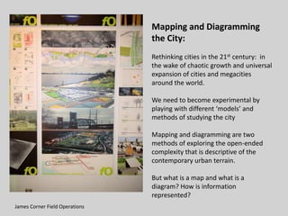
  • 1. Mapping and Diagramming the City: Rethinking cities in the 21st century: in the wake of chaotic growth and universal expansion of cities and megacities around the world. We need to become experimental by playing with different ‘models’ and methods of studying the city Mapping and diagramming are two methods of exploring the open-ended complexity that is descriptive of the contemporary urban terrain. But what is a map and what is a diagram? How is information represented? James Corner Field Operations
  • 2. Diagrams: visualization can play a key role in the processes of understanding that take place before form-making begins. *Diagrams” Visible Language 26, 3 & 4 (Summer/Autumn, 1993): 451 – 73. Vijay K. Sivasankaran and Charles L. Owen, “Data Exploration: Transition Operation in Dynamic + Tufte made Minard’s “Figuration Map famous in his 1983 book The Visual Display of Quantitative Information. It shows the successive losses of men in the French army during the Russian Campaign 1812 – 1813. It took him a long time to assemble the data: city data, temperature data, the army data [survival, direction of movement, group] simplifying all events; utilize thickness of lines to represent overall troop size therefore correlating troop movements with temperature, and survival rates as well as direction of advance or retreat.
  • 3. Flowchart: It was John von Neumann (1903 – 57) who identified the key components of the computer as an information processor. (central processing unit, memory to store information, and an input/output device for bringing information into and out of the machine) He also developed the ‘flow diagram’ that charts the course of information transfers and operations Flow charts are dynamic and narrative: they describe an actively pursued process with a clear beginning and -- a sequential progression towards a specified goal. In a directed graph the relations between points, the flows of energy or the circulation of things between points is the issue: be they goods, people, vehicles, soldiers, or flows of water, energy, messages and information.
  • 4. Mapping the Urban Network: One of the oldest flow charts is the Peutingeriana map laying out roads between cities --- depicting a Roman postal system. Rome was the axis of this entire system of intersections. Only one level needed since no other system intersected this one The Tabula Peutingeriana or Peutinger Map is a thirteenth-century reproduction of one of the wonders of Roman geographical scholarship, a map showing the world from Morocco, Spain and Thule (?) in the West to India and Sri Lanka in the East. The most remarkable part is the depiction of the main roads of the empire
  • 5. Harry Beck’s map depicts stations, straight line segments connecting them, and the River Thames; lines ran only vertically, horizontally, or on 45 degree diagonals. To make the map clearer and to emphasize connections, Beck differentiated between ordinary stations (marked with tick marks) and interchanges (marked with diamonds). The Underground was initially skeptical of his proposal — it was an uncommissioned spare-time project, and it was tentatively introduced to the public in a small pamphlet in 1933 The basic design concepts have been widely adopted for other network maps around the world, especially that of mapping topologically rather than geographically.
  • 6. Rome of Sixtus V (1585 – 1590) Medieval Rome was a place of pilgrimage – not a large city but a city of disorderly streets and meanderings ways. Sixtus V ploughed straight new streets through old neighborhoods and open countryside to provide links between the major sections of the city where the major basilicas lay: to facilitate the movement of pilgrims between the major religious sites and to accommodate the new mode of travel by coach, and to allow goods and services to flow more freely through and about the city,
  • 7. In the Renaissance mathematics begins to rule the figuration of the city – linear perspective and the grid effect of cartography control the accuracy of the view in this ideal city c 1470 [National Gallery Urbino] -A perspectival grid and outlines of buildings in minute detail with bilateral symmetry --A utopian view: an urban order ruled by the principles of linear perspective based on horizontal lines, vanishing and distance point and the resulting grid of orthogonals and horizontals. --the urban environment is given center stage: considered utopian because the idea of implementation was an unreal expectation, it was merely visionary of what might happen one day, when perfection could be attained.
  • 8. Leonardo da Vinci’s 1502 Map of Imola: based on the use of a horizontal surveying disk which allowed for accurate measuring of spatial dimensions of land and its objects. One of the first scaled and accurately measured maps from the Renaissance. It is a mathematical abstraction of spatial reality. Called ichnographic city plan from Greek “iknos” meaning tracing or outlining and “graphein” to write. Isotropic space; uniform and continuous in all directions – utilizing a plurality of hypothetical viewpoints all drawn perpendicular to the surface of the map. The city plan becomes the mode of cartographic documentation for the subsequent representation of European cities.
  • 9. Kleanthes and Schaubert’s First plan of Athens 1833
  • 10. These maps accompanied Booth’s Life and Labour of the People of London (1899) the first systematic a block by block investigation. There appears to be a relative amount of mixing of classes across the city with poverty concentrated near the river Thames and great wealth towards the West End of London. London appeared to be unreadable, everything mixed up. Charles Booth’s London Map (1899) color-coding of social classes in London -- yellow is upper middle and upper classes, red is middle and well-to-do class, pink is fairly comfortable , good earners, and blue is poor…. Black is ‘criminal class’ of slum dwellers
  • 11. Maps determine the manner in which we perceive reality and hence influence actions. Buckminster Fuller’s Dymaxion Airocean World Map of 1943: cuts the earth into triangular facets that are then unfolded as a flat polyhedron. Both northern and southern poles are presented frontally and with little distortion. The map can be unfolding and re-oriented in a number of different ways, Different places and regions are seen in different sets of relationships [James Corner]
  • 12. Joaquin Torres Garcia Inverted Map of South America 1943. Places the south at the top of the map inverting the convention of map making established during the Age of Discovery, when the center of the earth shifted from the Mediterranean and the Holy Lands to the Atlantic ocean. This map upsets normal view of the world map from a Euro- centric viewpoint.
  • 13. The map of Paris, entitled “The Naked City” published summer of 1957, the creation of Guy Debord just before the Situationist International was formed. His concerns: how is space constructed and how does space affect the perception of users of urban space? The Map: 19 cut-out sections of a map of Paris, printed in black and white ink with directional arrows painted in red. It subverts the image of a map, destroys the omnipresent view from nowhere – instead it tries to spatialize movement, actions around certain psychological hubs.
  • 14. Illustration of psychogeographical turntables: describes the function of the red arrows by comparing them to a railroad turntable --- the arrows representing the spontaneous turns of direction taken by a person moving through ‘different atmospheres of Paris’, or any other city, in disregard to the normal connections that ordinarily govern one’s conduct. The railroad can only run on fixed tacks, so too the subject under the reign of capitalism, but turning tables or the turntable is also a pun on playing tricks. Each segment of the map is a ‘unity of atmosphere’ , a place of special attractions --- The title in red letters is an appropriation of American film noir 1948 set in New York City and filmed in documentary style [director Jules Dassin] it starred the landmark streets and buildings so too the map’s cut-out segments star Luxembourg Gardens, Les Halles, Gare de Lyon, etc. ] In 1955 the structure of Paris was an obstacle that offered tiny clues to a future organization of life.
  • 15. The city map or city plan became an ideogram of how geometry measures and controls our perception of what is the ‘urban’, ‘the world’, the ‘cityscape’. Maps project a power/knowledge. Now there are revisions to this process of mapping the city as a creative practice: replacing the map as a process that mathematically abstracts from reality with a process that engenders new ways of viewing and mapping reality. Deleuze and Guattari’s definition of Mapping in A thousand Plateaus: 12 “The map is open and connectable in all of its dimensions; it is detachable, reversible, susceptible to constant modification. It can be torn, reversed, adapted to any kind of mounting, reworked by an individual, group, or social formation. It can be drawn on a wall. Conceived as a work of art, constructed as a political action or as a meditation.” They oppose mapping to tracing [i.e. the ichnographic method]: the latter is closed in upon itself, propagating redundancies while a mapping is open-ended , experimental, unfolding. It reformulates what already exists: looking for hidden logics underneath apparent forces [not just topography, rivers, roads, buildings but wind and sun, local stories and historical Tracing Summer Jonathan Kline events, regulatory forces and programmatic structures.”
  • 16. James Corner states in the “Agency of Mapping” there is a double-sided characteristic of all maps to be both an analogue and an abstraction. He notes “First, their surfaces are directly analogous to actual ground conditions; as horizontal planes, they record the surface of the earth as direct impressions. …. One can put one’s finger on a map and trace out a particular route or itinerary, the map projecting a mental image into the spatial imagination …. By contrast, the other side of this analogous characteristic is the inevitable abstractness of maps, the result of Thus a map is the surface where selection, omission, isolation, distance and facts and conditions are codification. Map devices such as collected, sorted, related to each frame, scale, orientation, and other and explored. projection, indexing and naming reveal artificial geographies that remains unavailable to human eyes.” *Corner “Agency”: 215+
  • 17. FIELD OPERATIONS Photo: Darrel Ronald James Corner: operational structures of mapping The Field:= a continuous surface, the paper on the table, any analogue equivalent of the actual ground flattened and scaled. The Graphic System:= the symbols imposed on the field The Extracts: things and events observed, selected and then drawn on the field Plotting: drawing out new and latent relationships among the various extracts. “To plot is to track, to trace, to set-in-relation, to find and to found.” *James corner “Agency”: 230.+
  • 18. Rem Koolhaas indirectly called for a new mode of mapping in the ‘Generic City’. “The stronger the identity [of a city], the more it imprisons, the more it resists expansion, interpretation, renewal, co ntradiction.…“ Koolhaas SMLXL: 1248. Layering: superimposition of independent layers of information constructs a field/ site – in which notions of centering, bounding, finished product are gone. Instead open- endedness, indeterminacy, complexit y allow many different interpretations. Each layer has a system of organization, an array of overlappings or stacks of these layers creates a series of interactions or amalgam of relationships Rem Koolhaas Yokohama mapping SMLX
  • 19. Raoul Bumschoten and “Chora Manifesto” Daidalos 72 (1999): 42 – 51. 1st skin of earth wraps the earth, shaped by geological forces 2nd skin of earth are cities: this skin is so complex that we need a new tool box, a new practice to construct and manage cities. What forces shape the second skin? Need to understand these proto-urban conditions that are likened to emotions in human beings: subliminal conditions that strongly affect physical states and behavior. “Love, life, weather and seasons ripple the second skin. But new techniques of knowing and moving create different ripples, pulses… The effect is a fluid urbanity hard to express through static models or identities. Increasingly, the city’s only definable form, its only clear identity, can be found in the manner in which its changes evolve.”
  • 20. The Networked City “It is not that networks were not around before or that the structure of the brain has changed. It is that network has become a common form that tends to define our ways of understanding the world and acting in it.” [Hardt and Negri, Multitudes]
  • 21. Rethinking Networks: “Today the Mediterranean is no longer -if ever it was- a large and liquid quot;lieu de rencontrequot;. It is no longer the generic space of a network of relations that unites distant peoples linked by a common geographical condition; the quot;cradlequot; of different yet connected cultures; a mobile and 'soft' area of hybridization, encounter, blending of traditions, cultures and costumes. The Mediterranean is today a hard, solid space, ploughed by precise routes that move from equally defined points: from Valona to Brindisi, from Malta to Portopalo, from Algeria to Marseilles, from Suez to Gibraltar.” *Multiplicities 2002+
  • 22. Solid Sea and Multiplicity: From: quot;Stefano boeriquot; <s.boeri {AT} iol.it> 2002 SOLID SEA Documenta 11 - Kassel - June 8th until September 15th 2002 With “Solid Sea”, multiplicity intends to promote research into the new nature of the Mediterranean, and to draw out an up to date atlas of its landscapes and the turbulence that crosses it. The research on the “Solid Sea” starts introducing at Kassel “Solid Sea case 01 ¯ the Ghost Ship”, the first case of the new research. Multiplicity invites architects, artists, geographers, anthropologists, film makers to propose stories and “phenomena” about the recent conditions of the Mediterranean and to take part to the project. Dear friends, We would like you to join us for a public seminar where artists, geographers, photographers, thinkers, architects, film makers, photographers, social scientists and curators will discuss at a roundtable the new conditions of the Mediterranean Sea. Taking Case 01- The Ghost Ship (produced on the occasion of Documenta 11) as a starting point, the new geopolitical asset of the Mediterranean Sea will be debated. Multiplicity: Stefano Boeri Maddalena Bregani Francisca Insulza Francesco Jodice Giovanni La Varra John Palmesino Palo Vari Maki Gherzi Giovanni Maria Bellu
  • 23. Identities “Today, whoever enters into Mediterranean acquires, even if temporarily, a stable identity: immigrant, fisherman, military, tourist on a cruise, oil derrick worker, seaside tourist ... the �costume� will not be abandoned until the end of the journey across the water. Only afterwards is it possible to, once again, take up those uncertain, shifting and multiple identities that today characterise the citizens of the globalised world. Not in the Mediterranean: you are either a tourist, or you are an immigrant; you either transport containers, or use dragnets; routes can cross, overlap, yet rarely blend. And if and when this does occur, it is only by accident: a short circuit that puts the different, yet coexisting, depths of sea into contact one with each other. Unforeseen events that suddenly unite distinct populations and isolated �corridors�: bombs dropped by NATO fighter planes and recovered by oil derrick workers on the floor of the Adriatic Sea; Asiatic mussels attached to the hulls of container ships; clandestine immigrants� corpses found in the nets of Sicilian fishermen... Only then, does the Sea show itself in its three-dimensional power, in its immense and vague volume. A Sea that is able to cover up tragic stories for years and yet make them reappear by surrendering a small clue. Today the Mediterranean is a Solid Sea where, with incredible growing density and often at various depths, the planned trajectories of exacerbated identities graze one another. A part of the world that appears to be counter-current.”
  • 24. In the 19th century “… the network became ‘the entanglement of objects dispersed in lines’ and the term would be applied essentially to railways, roads, and canals as well as the telegraph. Its meaning became fixed around 1849.” *Armand Mattelart+
  • 25. The modern city is made up of intersecting networks --- [water, gas, electricity, cable, mail, telephone subways, bus lines, road systems, etc.] some transmit information, some energy -- but they all represent forms of information or communication. And there are networks between cities which overlap upon other networks --- railroads. highway systems, and inter- intra-city networks.
  • 26. Manuel Castells has been studying the shift from industrial to postindustrial society--- and the creation of the network society where production depends on the ability to generate, process and apply knowledge based information systems. This mode of production again effects spatial relationships, power relations, and everyday experiences and sets up a new problematic: how to understand and describe the space of flows along a set of interconnected nodes, which results in the network society. Mapping the flows of goods, people, diseases, and the like between cities and countries has long been an important part of cartography. If you look in any good atlas you will find a range of different flow maps, but what you won't see are maps of the communication flows of the Net. This is because no one really knows, comprehensively and reliably, how much information and communications flows between cities and countries and few people have tried to
  • 27. Look at any map of Europe, the space is divided into states, each clearly delineated by linear boundary lines and blocked out from adjacent areas by separate colors. In such a representation the state is a unified territorial concept, a spatial container of people and political authority. . A network, on the other hand, configures countries as a flat horizontal field of circulatory movement: lines drawn across the land or through the air, flows of messages, people, or ideas across points in space. So it is argued networks and processes have replaced older cartographic conventions of location analysis and fixity in place One group that tries to map the space of flows is TeleGeography producing this flow map of the Net based on the volume of international telephone traffic between nations.
  • 28. Since the mid 19th century communications networks have spun ever larger cities and geographies with ever larger investments of physical capital: infrastructure in roads, bridges, skyscrapers, houses, cities and suburbs--- telegraph system, radio and television transmitters, cable and satellite TV, mainframe computers Titan City 1920s Cities and suburbs helped to create the mass media model of communication: spreading fixed costs over larger geographical areas to ever-larger audiences: TV series, recorded music, movies
  • 29. The Internet radically changes the mass media model of communication --- there are thousands and thousands of independent producers of information, coexisting without knowing each other, yet their distributed unrelated efforts are coordinated --- through Google algorithm or some other algorithm – into a huge question and answer apparatus. Wikipedia , for example, is a multilingual encyclopedia coauthored by 50,000 volunteers.
  • 30. How does all this effect geography – or space and time? In the 1990s and the early 2000s, advances in computers and telecommunications, and the spread of the Internet, compounded the idea that distance and location were no longer relevant concepts. The 'end of geography' (O'Brien 1992), or the 'death of distance' (Cairncross 2001; The Economist, 30 September 1995), received front coverage from magazines and books. Cyber- utopianism even predicted the end of the city (Negroponte 1995).
  • 31. “Mapping has emerged in the information age as a means to make the complex accessible, the hidden visible, the unmappable mappable. As we struggle to steer through the torrent of data unleashed by the Internet, and to situate ourselves in a world in which commerce and community have been redefined in terms of networks, mapping has become a way of making sense of things.” Janet Abrams and Peter Hall Else/Where: Mapping – New Cartographies of Networks and Territories (Minnesota: University of Minnesota Design Institute, 2006): Using the map as an interface to geographic and other data sets – a visual bridge between disparate facts. Where are you? -- iphone, blackberry, facebook – which space defines your location? How is time, memory, emotion navigated via mapping?
  • 32. Overview: “PDPal is an ongoing series of public art projects for the Palm™ PDA, mobile phone and the web. It has pushed at the notion of mapping, attempting to transform your everyday activities and urban experiences into a dynamic city that you write. PDPal engages the user through a visual transformation that is meant to highlight the way technologies that locate and orient are often static and without reference to the lively nature of urban cultural environments. Your own city is the city composed of the places you live, play, work, and remember. It is made of the routes and paths through which you make connections. Your city is also about the meanings you ascribe to the places you inhabit, pass through, love or hate. You imagine those places and routes as more than a street address, or directions you may give. These places have vivid, metaphorical meanings and histories that PDPal allows you to capture and visualize imaginatively, effectively writing your imaginary city.”<www.o-matic.com/play/pdpal>
  • 33. INFO “'Life: a user's manual' is a series of public performances and online mappings that examine the hidden stories captured by private wireless CCTV streams and how they intersect with the visible world around us….Private use of wireless internet, cordless phones, Bluetooth and wireless surveillance cameras has turned the average consumer into 'micro-broadcasters' who transmit personal narratives through the airwaves. The culmination of these autonomous and synchronous acts contributes to an invisible, ad-hoc network of media overlaid within the socially codified spaces of urban environments, the café, the home, the apartment building, the office, the store, the bar, the hallway, the entrance, the parking lot and the street. “ <http://www.ubermatic.org/life>
  • 34. Cinema and the City: the mobile camera, the editing techniques, narrative conventions, representation of space offer cinematic, televisual, video perceptions of the space of the city. Cinema can be looked at as a mapping process: mediation of place, of spatial complexities, of conflicting information, of hybrid locations. Maps also appear in most films and a film is a kind of mapping that plots and captures the imagination of the viewer. A film sets up ‘locational imaging’, establishing a fictional territory to explore – it is a cartographic diagram.

Notes de l'éditeur

  1. Peutinger’s Table:In the 16th century an antique dealer in Augsburg, Konrad Peutinger received a map of questionable date showing the routes linking all the Roman cities --- 6,000 proper names and 550 sketched vignettes.... It was at once a map, a road plan, and a travel guide. extending to the edges of the Empire [from Bordeaux all the way to CeylonIt is the key to the “Roman System” = the city as an articulated system of movements in all directions, and its bldgs spread out like relay points: “... it is like a prefiguration of the atlases of cyberspace” [from Atalli, Mutations}
  2. 11/The Networked City Kasyz Varnelis (ed.) The Infrastructural City; Networked Ecologies in Los Angeles Barcelona: Acktar,2008 pp 104 – 129, 148-155.Stephan Graham and Simon Marvin, “Introduction and Prologue” Splintering Urbanism London: Routledge, 2001 http://www.geography.dur.ac.uk/information/staff/personal/graham/pdf_files/22.pdfStephan Graham and Simon Marvin, “The Collapse of the Integrated Idea,’ “Practice of Splintering Urbanism” Splintering Urbanism London: Routledge, 2001 pp 90-135, 137-177.
  3. Ghost Ship ”The night of December 26, 1996, a 'ghost' ship with 283 Singhaleseclandestine immigrants on board and on route from Malta towards the Italian coast, sank, a few miles off South-eastern Sicily, carrying with it its load of life. For five long years, the relatives' and survivors' invocations were answered by contemptuous denials and ironies from the Italian Authorities, who repeated with certainty that \"the shipwreck had never occurred\". Meanwhile, fishermen from Portopalo continuously found corpses in their nets. For 60 long months, the Sea slowly returned the traces of a tragedy consistently denied by the military and removed by the fishermen. Neither the fishermen, nor the local Authorities had the courage to denounce the truth, until the recovery of an ID belonging to a young man from Ceylon suddenly created an breach thanks to the meticulous work of Giovanni Maria Bellu, a reporter for the Italian newspaper 'la Repubblica'. Today, almost 2000 days after the shipwreck, the 'ghost ship', with its load, re-emerges, visible to everyone.  ”
  4. Digital is often associated with network(ed), post-industrial, cognitive, creative, virtual, information, new, knowledge, etc. ‘The information age’ used to describe the period that we now find ourselves living in is open to misinterpretation. Society has always been based on exchanging information and, it has always been based on flows, networks, as well as creative people. Hence Castells’ ''space of flows', 'informational city' (1989), and 'network society' (1996) are somewhat 'loose' concepts.
  5. Castells positions this space of flow in opposition to the space of places of the geographers, arguing that a placeless culture has evolved out of the increasing interconnectedness between local, regional and national communities.
  6. For example: Newspapers exchanged information, their management required substantial capital investment. They established one-way communication, a model adopted by radio, television and later cable and satellite communication
  7. Now distributed networks based on free open software, Wikipedia built and accessed via personal computers with a network connection--- link together nonmarket collaborations… open sharing for all others to build on, extend, make their own.
  8. Geographers have played a strong role in this debate (Brunn and Leinbach 1991; Graham 1998; May and Thrift 2001). Pioneered by Janelle (1968), time–space analysis is closely linked to the study of globalization, What is new is the ‘digital revolution’ : the fact that networks, information, knowledge, and cognition are now increasingly processed and transacted in digital form, using digital devices and infrastructures.