SlideShare a Scribd company logo
1 of 23
LANDSAT - 8 OLI
Presented By
Muhammad Haris
Overview
 Background
 Introduction
 Sensors:
Operational Land Imager (OLI)
Thermal Infrared Sensors (TIRS)
 Resolutions :
Spatial Resolution
Spectral Resolution
Temporal Resolution
Radiometric Resolution
 Comparison
 Sample Images
Background
 First Surveying Satellite (Landsat)
The first Landsat satellite was called the Earth
ResourcesTechnology Satellite, or ERTS. Since its
launch on July 23, 1972, seven Landsats have
followed, with the latest, Landsat 8, lifting off on
February 11, 2013. Over the years successive
Landsats have not only carried better land-viewing
sensors, but they have created a valuable archive
of images that are being used to see how the land
is changing over the years. Landsat 8 carries
Operational Land Imager (OPI) andThermal
Infrared Sensor (TIRS) , which scans the Earth in
Eleven bands of visible and invisible light
Introduction
• Spacecraft: Landsat 8
• Carrier rocket: Atlas -V Rocket
• Launch date: 11th February 2013
• Launch site: Vandenberg Air Force
Base California
• Orbit: Sun-synchronous orbit at an
altitude of 705 km (438 mi)
• Equatorial crossing time: 10:00 a.m. +/-
15 minutes
Introduction Continue
 The Landsat program offers the longest
continuous global record of the Earth’s
surface
 Joint operation between NASA and USGS
 Landsat 8 officially began normal operations
on May 30, 2013
 Landsat 8 has collected about 400 scenes of
the Earth’s surface per day.
 Global coverage in 8 bands
 Swath width of Landsat 8 is 185km (115Miles)
Sensors
 The Landsat 8 satellite payload consists of
two specific sensors;
Operational Land Imager (OLI)
Thermal Infrared Sensor (TIRS)
Operational Land Imager (OLI)
 OLI will collect images using
nine spectral bands in different
wavelengths of visible, near-
infrared, and shortwave light to
observe a 185 kilometer (115
mile) wide swath of the Earth in
15-30 meter resolution covering
wide areas of the Earth's
landscape while providing
sufficient resolution to
distinguish features like urban
centers, farms, forests and
other land uses.
Thermal Infrared Sensor (TIRS)
 TheThermal Infrared Sensor
(TIRS) contains two thermal bands
(10 and 11), which measure land
surface temperature at 100-meter
resolution. (The product provided
is resampled and delivered as a 30-
meter image). In theTIRS thermal
bands, dark pixels represent cool
temperatures; light pixels
represent hot temperatures.
Thermal band data provide
important information about
water irrigation use in arid land, as
well as heat units in urban areas.
Resolutions
 Spatial Resolution
 Spectral Resolution
 Temporal Resolution
 Radiometric Resolution
Spatial Resolution
 9 spectral = 30 meters for Bands 1 to 7 and 9.
 Band 8 (panchromatic) = 15 meters.
 Thermal bands 10 , 11 = 100 meters
 New band 1 (ultra-blue) is useful for coastal
and aerosol studies.
 New band 9 is useful for cirrus cloud
detection.
 10 and 11 are useful in providing more
accurate surface temperatures
Spectral Resolution
Band Band Name Spectral
range (nm)
Use Of Data Resolution
1 New Deep Blue 433-453 Aerosol/ Coastal zone 30m
2 Blue 450-515 Pigments/scatter/Coastal
30m (TM
heritage
Bands)
3 Green 525-600 Pigments/Coastal
4 Red 630-680 Pigments/Coastal
5 NIR 845-885 Foliage/Coastal
6 SWIR2 1560-1660 Foliage
7 SWIR3 2100-2300 Minerals/Litter/no scatter
8 PAN 500-680 Image sharpening 15 m
9 SWIR 1360-1390 Cirrus Cloud Detection 30 m
10 TIRS1 10060-
11190
SurfaceTemperature 100*(30)
11 TIRS2 11500-12510 100*(30)
Temporal Resolution
 The entire Earth will fall within view once
every 16 days. I does Mean that Temporal
Resolution of Landsat 8 is 16 days. It
complete its ! Successive round in 16 days
Radiometric Resolution
 Radiometric resolution of Landsat 8 is 16 Bits.
Landsat 8 Enhancement
Landsat 8
images
normally looks
hazy before
processing.
Please have a
look of Landsat
8 images of Inle
Lake before and
after
processing.
Comparison with Landsat 7
The spectral bands (1 - 9) of the OLI sensor, while similar to Landsat 7’s ETM+
sensor, provide enhancement from prior Landsat instruments, with the addition of
two new spectral bands: a deep blue visible channel (band 1) specifically designed
for water resources and coastal zone investigation, and a new infrared channel
(band 9) for the detection of cirrus clouds. A new QualityAssurance band is also
included with each data product.This provides information on the presence of
features such as clouds, water, and snow.
Comparison Continue
Image of Landsat 7 ETM+
Image of Landsat 8 OLI
Sample Images
1. Natural Hazard Recovery
Before After
2.With Landsat 8's improved ability to detect variations in colors, the
waters of Lake Ontario can show sediment patterns as well as
potentially problematic algae, indicated by higher chlorophyll
concentrations.
3. his Landsat 8 satellite image of some southern Japanese islands
includes Tanegashima (far right), from where the Global Precipitation
Measurement, or GPM, mission's Core Observatory is scheduled to
blast into orbit aboard a Japanese H-IIA rocket. This image was taken
on April 13, 2013
4. Forest Cover Loss
5.Random Regions captured from landsat 8.
Thank You
References
 http://www.nasa.gov/content/goddard/lands
at-eyes-japan-gpm-launch-
site/#.VHHRCjTF_Xk
 http://landsat.usgs.gov/about_ldcm.php
 http://www.satimagingcorp.com/satellite-
sensors/other-satellite-sensors/landsat-8/

More Related Content

What's hot

Indian Remote Sensing satellites (IRS).pptx
Indian Remote Sensing satellites (IRS).pptxIndian Remote Sensing satellites (IRS).pptx
Indian Remote Sensing satellites (IRS).pptx
sapna kinattinkara
 
Aerial photography abraham thomas
Aerial photography abraham thomasAerial photography abraham thomas
Aerial photography abraham thomas
Sumant Diwakar
 
Geometric correction
Geometric correctionGeometric correction
Geometric correction
DocumentStory
 

What's hot (20)

Indian Remote Sensing satellites (IRS).pptx
Indian Remote Sensing satellites (IRS).pptxIndian Remote Sensing satellites (IRS).pptx
Indian Remote Sensing satellites (IRS).pptx
 
Thermal remote sensing and environmental applications
Thermal remote sensing and environmental applicationsThermal remote sensing and environmental applications
Thermal remote sensing and environmental applications
 
Thermal remote sensing
Thermal remote sensingThermal remote sensing
Thermal remote sensing
 
Thermal remote sensing and its applications
Thermal remote sensing and its applicationsThermal remote sensing and its applications
Thermal remote sensing and its applications
 
Microwave remote sensing
Microwave remote sensingMicrowave remote sensing
Microwave remote sensing
 
Spot satellite
Spot satelliteSpot satellite
Spot satellite
 
Remote sensing and image interpretation
Remote sensing and image interpretationRemote sensing and image interpretation
Remote sensing and image interpretation
 
landsat (9).pdf
landsat (9).pdflandsat (9).pdf
landsat (9).pdf
 
Band combinations (1)
Band combinations (1)Band combinations (1)
Band combinations (1)
 
Digital Elevation Models
Digital Elevation ModelsDigital Elevation Models
Digital Elevation Models
 
Thermal remote sensing
Thermal remote sensing   Thermal remote sensing
Thermal remote sensing
 
Indian remote sensing satellites
Indian remote sensing satellitesIndian remote sensing satellites
Indian remote sensing satellites
 
LANDSAT
LANDSATLANDSAT
LANDSAT
 
Commonly used ground truth equipments
Commonly used ground truth equipmentsCommonly used ground truth equipments
Commonly used ground truth equipments
 
Lecture for landsat
Lecture for landsatLecture for landsat
Lecture for landsat
 
introduction-of-GNSS-1
introduction-of-GNSS-1introduction-of-GNSS-1
introduction-of-GNSS-1
 
Ikonos
IkonosIkonos
Ikonos
 
Aerial photography abraham thomas
Aerial photography abraham thomasAerial photography abraham thomas
Aerial photography abraham thomas
 
Geometric correction
Geometric correctionGeometric correction
Geometric correction
 
Spatial interpolation techniques
Spatial interpolation techniquesSpatial interpolation techniques
Spatial interpolation techniques
 

Viewers also liked

Satellite photos of landmark on Earth
Satellite photos of landmark on EarthSatellite photos of landmark on Earth
Satellite photos of landmark on Earth
kleow0
 
Vien tham - 4 ve tinh vien tham
Vien tham - 4 ve tinh vien thamVien tham - 4 ve tinh vien tham
Vien tham - 4 ve tinh vien tham
ttungbmt
 
Bài giảng viễn thám
Bài giảng viễn thámBài giảng viễn thám
Bài giảng viễn thám
trankha8792
 
Aerial photography and remote sensing
Aerial photography and remote sensingAerial photography and remote sensing
Aerial photography and remote sensing
akshitakohli
 
Earth's layers power point notes
Earth's layers power point notesEarth's layers power point notes
Earth's layers power point notes
trtkaren
 
Lesson 1 - 'Layers of the Earth' PowerPoint
Lesson 1 - 'Layers of the Earth' PowerPointLesson 1 - 'Layers of the Earth' PowerPoint
Lesson 1 - 'Layers of the Earth' PowerPoint
Karlee K
 

Viewers also liked (18)

Landsat program
Landsat programLandsat program
Landsat program
 
Landsat seminar
Landsat seminarLandsat seminar
Landsat seminar
 
Unsupervised Building Extraction from High Resolution Satellite Images Irresp...
Unsupervised Building Extraction from High Resolution Satellite Images Irresp...Unsupervised Building Extraction from High Resolution Satellite Images Irresp...
Unsupervised Building Extraction from High Resolution Satellite Images Irresp...
 
M.Phil Geomatics Defense (10May2016)
M.Phil Geomatics Defense (10May2016)M.Phil Geomatics Defense (10May2016)
M.Phil Geomatics Defense (10May2016)
 
Landsat
LandsatLandsat
Landsat
 
Satellite photos of landmark on Earth
Satellite photos of landmark on EarthSatellite photos of landmark on Earth
Satellite photos of landmark on Earth
 
Vien tham - 4 ve tinh vien tham
Vien tham - 4 ve tinh vien thamVien tham - 4 ve tinh vien tham
Vien tham - 4 ve tinh vien tham
 
High resolution dem dtm
High resolution dem dtmHigh resolution dem dtm
High resolution dem dtm
 
Bài giảng viễn thám
Bài giảng viễn thámBài giảng viễn thám
Bài giảng viễn thám
 
Aerial photography and remote sensing
Aerial photography and remote sensingAerial photography and remote sensing
Aerial photography and remote sensing
 
Satellite image processing
Satellite image processingSatellite image processing
Satellite image processing
 
Introduce variable/ Indices using landsat image
Introduce variable/ Indices using landsat imageIntroduce variable/ Indices using landsat image
Introduce variable/ Indices using landsat image
 
A Brief Introduction to Remote Sensing Satellites
A Brief Introduction to Remote Sensing Satellites A Brief Introduction to Remote Sensing Satellites
A Brief Introduction to Remote Sensing Satellites
 
Introduction to Earth
Introduction to EarthIntroduction to Earth
Introduction to Earth
 
Earth's layers power point notes
Earth's layers power point notesEarth's layers power point notes
Earth's layers power point notes
 
Lesson 1 - 'Layers of the Earth' PowerPoint
Lesson 1 - 'Layers of the Earth' PowerPointLesson 1 - 'Layers of the Earth' PowerPoint
Lesson 1 - 'Layers of the Earth' PowerPoint
 
Principle of aerial photography and types.ppt
Principle of aerial photography and types.pptPrinciple of aerial photography and types.ppt
Principle of aerial photography and types.ppt
 
Remote Sensing PPT
Remote Sensing PPTRemote Sensing PPT
Remote Sensing PPT
 

Similar to Landsat 8 OLI (Operational Land Imager)

LANDSAT_OBSERVAT_ON_SATELITE_SYSTEM_odewwwwww.ppt
LANDSAT_OBSERVAT_ON_SATELITE_SYSTEM_odewwwwww.pptLANDSAT_OBSERVAT_ON_SATELITE_SYSTEM_odewwwwww.ppt
LANDSAT_OBSERVAT_ON_SATELITE_SYSTEM_odewwwwww.ppt
MrLove13
 
Satellite Mapping
Satellite MappingSatellite Mapping
Satellite Mapping
Pinus57
 
Remote Sensing fundamentals
Remote Sensing fundamentalsRemote Sensing fundamentals
Remote Sensing fundamentals
Mohammed_82
 
Remote sensing with all fundamentals
Remote sensing with all  fundamentalsRemote sensing with all  fundamentals
Remote sensing with all fundamentals
Mohammed_82
 
WE2.L10.1: LANDSAT DATA PRODUCTS, FREE AND CLEAR
WE2.L10.1: LANDSAT DATA PRODUCTS, FREE AND CLEARWE2.L10.1: LANDSAT DATA PRODUCTS, FREE AND CLEAR
WE2.L10.1: LANDSAT DATA PRODUCTS, FREE AND CLEAR
grssieee
 
Lrm 111 intro remote sensing lesson iv
Lrm 111 intro remote sensing lesson ivLrm 111 intro remote sensing lesson iv
Lrm 111 intro remote sensing lesson iv
musadoto
 
4_REMOTE SENSING PLATFORMS.ppt
4_REMOTE SENSING PLATFORMS.ppt4_REMOTE SENSING PLATFORMS.ppt
4_REMOTE SENSING PLATFORMS.ppt
DivyaPriya700213
 
1 IGARSS 2011 JPSS Monday Goldberg.pptx
1 IGARSS 2011 JPSS Monday Goldberg.pptx1 IGARSS 2011 JPSS Monday Goldberg.pptx
1 IGARSS 2011 JPSS Monday Goldberg.pptx
grssieee
 

Similar to Landsat 8 OLI (Operational Land Imager) (20)

Setellite image sensors
Setellite image sensorsSetellite image sensors
Setellite image sensors
 
LANDSAT_OBSERVAT_ON_SATELITE_SYSTEM_odewwwwww.ppt
LANDSAT_OBSERVAT_ON_SATELITE_SYSTEM_odewwwwww.pptLANDSAT_OBSERVAT_ON_SATELITE_SYSTEM_odewwwwww.ppt
LANDSAT_OBSERVAT_ON_SATELITE_SYSTEM_odewwwwww.ppt
 
Satellite Mapping
Satellite MappingSatellite Mapping
Satellite Mapping
 
03 Landsat Legacy.pptx
03 Landsat Legacy.pptx03 Landsat Legacy.pptx
03 Landsat Legacy.pptx
 
Remote Sensing fundamentals
Remote Sensing fundamentalsRemote Sensing fundamentals
Remote Sensing fundamentals
 
Rs fundamentals
Rs fundamentalsRs fundamentals
Rs fundamentals
 
Remote sensing with all fundamentals
Remote sensing with all  fundamentalsRemote sensing with all  fundamentals
Remote sensing with all fundamentals
 
Types of satellite metrological & resource satellites
Types of satellite metrological & resource satellitesTypes of satellite metrological & resource satellites
Types of satellite metrological & resource satellites
 
THE THERMAL INFRARED SENSOR ON THE LANDSAT DATA CONTINUITY MISSION.pdf
THE THERMAL INFRARED SENSOR ON THE LANDSAT DATA CONTINUITY MISSION.pdfTHE THERMAL INFRARED SENSOR ON THE LANDSAT DATA CONTINUITY MISSION.pdf
THE THERMAL INFRARED SENSOR ON THE LANDSAT DATA CONTINUITY MISSION.pdf
 
Landsat calibration summary_rse
Landsat calibration summary_rseLandsat calibration summary_rse
Landsat calibration summary_rse
 
Landsat calibration summary_rse
Landsat calibration summary_rseLandsat calibration summary_rse
Landsat calibration summary_rse
 
Landsat data and its application in landuse and landcover .(NIT ROURKELA)
Landsat data and its application in landuse and landcover .(NIT ROURKELA)Landsat data and its application in landuse and landcover .(NIT ROURKELA)
Landsat data and its application in landuse and landcover .(NIT ROURKELA)
 
Landsat.pptx
Landsat.pptxLandsat.pptx
Landsat.pptx
 
WE2.L10.1: LANDSAT DATA PRODUCTS, FREE AND CLEAR
WE2.L10.1: LANDSAT DATA PRODUCTS, FREE AND CLEARWE2.L10.1: LANDSAT DATA PRODUCTS, FREE AND CLEAR
WE2.L10.1: LANDSAT DATA PRODUCTS, FREE AND CLEAR
 
Lrm 111 intro remote sensing lesson iv
Lrm 111 intro remote sensing lesson ivLrm 111 intro remote sensing lesson iv
Lrm 111 intro remote sensing lesson iv
 
Scanners, image resolution, orbit in remote sensing, pk mani
Scanners, image resolution, orbit in remote sensing, pk maniScanners, image resolution, orbit in remote sensing, pk mani
Scanners, image resolution, orbit in remote sensing, pk mani
 
REMOTE SENSING PLATFORMS.ppt
REMOTE SENSING PLATFORMS.pptREMOTE SENSING PLATFORMS.ppt
REMOTE SENSING PLATFORMS.ppt
 
4_REMOTE SENSING PLATFORMS.ppt
4_REMOTE SENSING PLATFORMS.ppt4_REMOTE SENSING PLATFORMS.ppt
4_REMOTE SENSING PLATFORMS.ppt
 
remote sensing platforms materials for student
remote sensing platforms materials for studentremote sensing platforms materials for student
remote sensing platforms materials for student
 
1 IGARSS 2011 JPSS Monday Goldberg.pptx
1 IGARSS 2011 JPSS Monday Goldberg.pptx1 IGARSS 2011 JPSS Monday Goldberg.pptx
1 IGARSS 2011 JPSS Monday Goldberg.pptx
 

Recently uploaded

Presentation Vikram Lander by Vedansh Gupta.pptx
Presentation Vikram Lander by Vedansh Gupta.pptxPresentation Vikram Lander by Vedansh Gupta.pptx
Presentation Vikram Lander by Vedansh Gupta.pptx
gindu3009
 
Discovery of an Accretion Streamer and a Slow Wide-angle Outflow around FUOri...
Discovery of an Accretion Streamer and a Slow Wide-angle Outflow around FUOri...Discovery of an Accretion Streamer and a Slow Wide-angle Outflow around FUOri...
Discovery of an Accretion Streamer and a Slow Wide-angle Outflow around FUOri...
Sérgio Sacani
 
Pests of cotton_Borer_Pests_Binomics_Dr.UPR.pdf
Pests of cotton_Borer_Pests_Binomics_Dr.UPR.pdfPests of cotton_Borer_Pests_Binomics_Dr.UPR.pdf
Pests of cotton_Borer_Pests_Binomics_Dr.UPR.pdf
PirithiRaju
 
Biopesticide (2).pptx .This slides helps to know the different types of biop...
Biopesticide (2).pptx  .This slides helps to know the different types of biop...Biopesticide (2).pptx  .This slides helps to know the different types of biop...
Biopesticide (2).pptx .This slides helps to know the different types of biop...
RohitNehra6
 
Pests of cotton_Sucking_Pests_Dr.UPR.pdf
Pests of cotton_Sucking_Pests_Dr.UPR.pdfPests of cotton_Sucking_Pests_Dr.UPR.pdf
Pests of cotton_Sucking_Pests_Dr.UPR.pdf
PirithiRaju
 
GUIDELINES ON SIMILAR BIOLOGICS Regulatory Requirements for Marketing Authori...
GUIDELINES ON SIMILAR BIOLOGICS Regulatory Requirements for Marketing Authori...GUIDELINES ON SIMILAR BIOLOGICS Regulatory Requirements for Marketing Authori...
GUIDELINES ON SIMILAR BIOLOGICS Regulatory Requirements for Marketing Authori...
Lokesh Kothari
 
Formation of low mass protostars and their circumstellar disks
Formation of low mass protostars and their circumstellar disksFormation of low mass protostars and their circumstellar disks
Formation of low mass protostars and their circumstellar disks
Sérgio Sacani
 
Asymmetry in the atmosphere of the ultra-hot Jupiter WASP-76 b
Asymmetry in the atmosphere of the ultra-hot Jupiter WASP-76 bAsymmetry in the atmosphere of the ultra-hot Jupiter WASP-76 b
Asymmetry in the atmosphere of the ultra-hot Jupiter WASP-76 b
Sérgio Sacani
 

Recently uploaded (20)

Presentation Vikram Lander by Vedansh Gupta.pptx
Presentation Vikram Lander by Vedansh Gupta.pptxPresentation Vikram Lander by Vedansh Gupta.pptx
Presentation Vikram Lander by Vedansh Gupta.pptx
 
GBSN - Biochemistry (Unit 1)
GBSN - Biochemistry (Unit 1)GBSN - Biochemistry (Unit 1)
GBSN - Biochemistry (Unit 1)
 
Discovery of an Accretion Streamer and a Slow Wide-angle Outflow around FUOri...
Discovery of an Accretion Streamer and a Slow Wide-angle Outflow around FUOri...Discovery of an Accretion Streamer and a Slow Wide-angle Outflow around FUOri...
Discovery of an Accretion Streamer and a Slow Wide-angle Outflow around FUOri...
 
Chemistry 4th semester series (krishna).pdf
Chemistry 4th semester series (krishna).pdfChemistry 4th semester series (krishna).pdf
Chemistry 4th semester series (krishna).pdf
 
Nightside clouds and disequilibrium chemistry on the hot Jupiter WASP-43b
Nightside clouds and disequilibrium chemistry on the hot Jupiter WASP-43bNightside clouds and disequilibrium chemistry on the hot Jupiter WASP-43b
Nightside clouds and disequilibrium chemistry on the hot Jupiter WASP-43b
 
Pulmonary drug delivery system M.pharm -2nd sem P'ceutics
Pulmonary drug delivery system M.pharm -2nd sem P'ceuticsPulmonary drug delivery system M.pharm -2nd sem P'ceutics
Pulmonary drug delivery system M.pharm -2nd sem P'ceutics
 
COST ESTIMATION FOR A RESEARCH PROJECT.pptx
COST ESTIMATION FOR A RESEARCH PROJECT.pptxCOST ESTIMATION FOR A RESEARCH PROJECT.pptx
COST ESTIMATION FOR A RESEARCH PROJECT.pptx
 
Kochi ❤CALL GIRL 84099*07087 ❤CALL GIRLS IN Kochi ESCORT SERVICE❤CALL GIRL
Kochi ❤CALL GIRL 84099*07087 ❤CALL GIRLS IN Kochi ESCORT SERVICE❤CALL GIRLKochi ❤CALL GIRL 84099*07087 ❤CALL GIRLS IN Kochi ESCORT SERVICE❤CALL GIRL
Kochi ❤CALL GIRL 84099*07087 ❤CALL GIRLS IN Kochi ESCORT SERVICE❤CALL GIRL
 
Pests of cotton_Borer_Pests_Binomics_Dr.UPR.pdf
Pests of cotton_Borer_Pests_Binomics_Dr.UPR.pdfPests of cotton_Borer_Pests_Binomics_Dr.UPR.pdf
Pests of cotton_Borer_Pests_Binomics_Dr.UPR.pdf
 
Biopesticide (2).pptx .This slides helps to know the different types of biop...
Biopesticide (2).pptx  .This slides helps to know the different types of biop...Biopesticide (2).pptx  .This slides helps to know the different types of biop...
Biopesticide (2).pptx .This slides helps to know the different types of biop...
 
SAMASTIPUR CALL GIRL 7857803690 LOW PRICE ESCORT SERVICE
SAMASTIPUR CALL GIRL 7857803690  LOW PRICE  ESCORT SERVICESAMASTIPUR CALL GIRL 7857803690  LOW PRICE  ESCORT SERVICE
SAMASTIPUR CALL GIRL 7857803690 LOW PRICE ESCORT SERVICE
 
Pests of cotton_Sucking_Pests_Dr.UPR.pdf
Pests of cotton_Sucking_Pests_Dr.UPR.pdfPests of cotton_Sucking_Pests_Dr.UPR.pdf
Pests of cotton_Sucking_Pests_Dr.UPR.pdf
 
Isotopic evidence of long-lived volcanism on Io
Isotopic evidence of long-lived volcanism on IoIsotopic evidence of long-lived volcanism on Io
Isotopic evidence of long-lived volcanism on Io
 
Stunning ➥8448380779▻ Call Girls In Panchshil Enclave Delhi NCR
Stunning ➥8448380779▻ Call Girls In Panchshil Enclave Delhi NCRStunning ➥8448380779▻ Call Girls In Panchshil Enclave Delhi NCR
Stunning ➥8448380779▻ Call Girls In Panchshil Enclave Delhi NCR
 
Green chemistry and Sustainable development.pptx
Green chemistry  and Sustainable development.pptxGreen chemistry  and Sustainable development.pptx
Green chemistry and Sustainable development.pptx
 
GUIDELINES ON SIMILAR BIOLOGICS Regulatory Requirements for Marketing Authori...
GUIDELINES ON SIMILAR BIOLOGICS Regulatory Requirements for Marketing Authori...GUIDELINES ON SIMILAR BIOLOGICS Regulatory Requirements for Marketing Authori...
GUIDELINES ON SIMILAR BIOLOGICS Regulatory Requirements for Marketing Authori...
 
GBSN - Microbiology (Unit 1)
GBSN - Microbiology (Unit 1)GBSN - Microbiology (Unit 1)
GBSN - Microbiology (Unit 1)
 
Formation of low mass protostars and their circumstellar disks
Formation of low mass protostars and their circumstellar disksFormation of low mass protostars and their circumstellar disks
Formation of low mass protostars and their circumstellar disks
 
Asymmetry in the atmosphere of the ultra-hot Jupiter WASP-76 b
Asymmetry in the atmosphere of the ultra-hot Jupiter WASP-76 bAsymmetry in the atmosphere of the ultra-hot Jupiter WASP-76 b
Asymmetry in the atmosphere of the ultra-hot Jupiter WASP-76 b
 
Nanoparticles synthesis and characterization​ ​
Nanoparticles synthesis and characterization​  ​Nanoparticles synthesis and characterization​  ​
Nanoparticles synthesis and characterization​ ​
 

Landsat 8 OLI (Operational Land Imager)

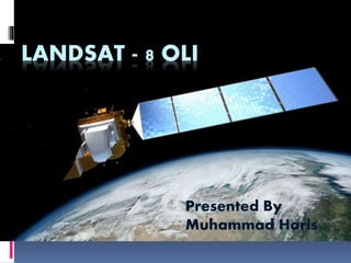
  • 1. LANDSAT - 8 OLI Presented By Muhammad Haris
  • 2. Overview  Background  Introduction  Sensors: Operational Land Imager (OLI) Thermal Infrared Sensors (TIRS)  Resolutions : Spatial Resolution Spectral Resolution Temporal Resolution Radiometric Resolution  Comparison  Sample Images
  • 3. Background  First Surveying Satellite (Landsat) The first Landsat satellite was called the Earth ResourcesTechnology Satellite, or ERTS. Since its launch on July 23, 1972, seven Landsats have followed, with the latest, Landsat 8, lifting off on February 11, 2013. Over the years successive Landsats have not only carried better land-viewing sensors, but they have created a valuable archive of images that are being used to see how the land is changing over the years. Landsat 8 carries Operational Land Imager (OPI) andThermal Infrared Sensor (TIRS) , which scans the Earth in Eleven bands of visible and invisible light
  • 4. Introduction • Spacecraft: Landsat 8 • Carrier rocket: Atlas -V Rocket • Launch date: 11th February 2013 • Launch site: Vandenberg Air Force Base California • Orbit: Sun-synchronous orbit at an altitude of 705 km (438 mi) • Equatorial crossing time: 10:00 a.m. +/- 15 minutes
  • 5. Introduction Continue  The Landsat program offers the longest continuous global record of the Earth’s surface  Joint operation between NASA and USGS  Landsat 8 officially began normal operations on May 30, 2013  Landsat 8 has collected about 400 scenes of the Earth’s surface per day.  Global coverage in 8 bands  Swath width of Landsat 8 is 185km (115Miles)
  • 6. Sensors  The Landsat 8 satellite payload consists of two specific sensors; Operational Land Imager (OLI) Thermal Infrared Sensor (TIRS)
  • 7. Operational Land Imager (OLI)  OLI will collect images using nine spectral bands in different wavelengths of visible, near- infrared, and shortwave light to observe a 185 kilometer (115 mile) wide swath of the Earth in 15-30 meter resolution covering wide areas of the Earth's landscape while providing sufficient resolution to distinguish features like urban centers, farms, forests and other land uses.
  • 8. Thermal Infrared Sensor (TIRS)  TheThermal Infrared Sensor (TIRS) contains two thermal bands (10 and 11), which measure land surface temperature at 100-meter resolution. (The product provided is resampled and delivered as a 30- meter image). In theTIRS thermal bands, dark pixels represent cool temperatures; light pixels represent hot temperatures. Thermal band data provide important information about water irrigation use in arid land, as well as heat units in urban areas.
  • 9. Resolutions  Spatial Resolution  Spectral Resolution  Temporal Resolution  Radiometric Resolution
  • 10. Spatial Resolution  9 spectral = 30 meters for Bands 1 to 7 and 9.  Band 8 (panchromatic) = 15 meters.  Thermal bands 10 , 11 = 100 meters  New band 1 (ultra-blue) is useful for coastal and aerosol studies.  New band 9 is useful for cirrus cloud detection.  10 and 11 are useful in providing more accurate surface temperatures
  • 11. Spectral Resolution Band Band Name Spectral range (nm) Use Of Data Resolution 1 New Deep Blue 433-453 Aerosol/ Coastal zone 30m 2 Blue 450-515 Pigments/scatter/Coastal 30m (TM heritage Bands) 3 Green 525-600 Pigments/Coastal 4 Red 630-680 Pigments/Coastal 5 NIR 845-885 Foliage/Coastal 6 SWIR2 1560-1660 Foliage 7 SWIR3 2100-2300 Minerals/Litter/no scatter 8 PAN 500-680 Image sharpening 15 m 9 SWIR 1360-1390 Cirrus Cloud Detection 30 m 10 TIRS1 10060- 11190 SurfaceTemperature 100*(30) 11 TIRS2 11500-12510 100*(30)
  • 12. Temporal Resolution  The entire Earth will fall within view once every 16 days. I does Mean that Temporal Resolution of Landsat 8 is 16 days. It complete its ! Successive round in 16 days
  • 13. Radiometric Resolution  Radiometric resolution of Landsat 8 is 16 Bits.
  • 14. Landsat 8 Enhancement Landsat 8 images normally looks hazy before processing. Please have a look of Landsat 8 images of Inle Lake before and after processing.
  • 15. Comparison with Landsat 7 The spectral bands (1 - 9) of the OLI sensor, while similar to Landsat 7’s ETM+ sensor, provide enhancement from prior Landsat instruments, with the addition of two new spectral bands: a deep blue visible channel (band 1) specifically designed for water resources and coastal zone investigation, and a new infrared channel (band 9) for the detection of cirrus clouds. A new QualityAssurance band is also included with each data product.This provides information on the presence of features such as clouds, water, and snow.
  • 16. Comparison Continue Image of Landsat 7 ETM+ Image of Landsat 8 OLI
  • 17. Sample Images 1. Natural Hazard Recovery Before After
  • 18. 2.With Landsat 8's improved ability to detect variations in colors, the waters of Lake Ontario can show sediment patterns as well as potentially problematic algae, indicated by higher chlorophyll concentrations.
  • 19. 3. his Landsat 8 satellite image of some southern Japanese islands includes Tanegashima (far right), from where the Global Precipitation Measurement, or GPM, mission's Core Observatory is scheduled to blast into orbit aboard a Japanese H-IIA rocket. This image was taken on April 13, 2013
  • 21. 5.Random Regions captured from landsat 8.