GIS and GPS - Presentation to 4th graders at King Kaumualii Elementary School
•Download as PPSX, PDF•
1 like•1,315 views

GIS, GPS presentation to 4th graders at King Kaumualii Elementary School, Lihue, Kauai

Recommended
More Related Content
What's hot
What's hot (20)
Viewers also liked
Viewers also liked (15)
Similar to GIS and GPS - Presentation to 4th graders at King Kaumualii Elementary School
Similar to GIS and GPS - Presentation to 4th graders at King Kaumualii Elementary School (20)
More from Hawaii Geographic Information Coordinating Council
More from Hawaii Geographic Information Coordinating Council (20)
Recently uploaded
Recently uploaded (20)
GIS and GPS - Presentation to 4th graders at King Kaumualii Elementary School
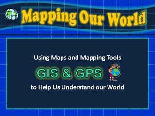
- 1. Mapping Our World Using Maps and Mapping Tools to Help Us Understand our World GIS & GPS
- 2. Wonderful, Useful Maps! Maps have always been used by people, even in ancient times, to study the heavens, earth and daily life. There are even maps of the solar system and of the known Universe!
- 3. Wonderful, Useful Maps! Maps are used to show the location of a place or thing.
- 4. Wonderful, Useful Maps! Some maps show changes of a place over time.
- 5. Wonderful, Useful Maps! There are maps used to compare informationfrom different place to show their differences and similarities.
- 6. Wonderful, Useful Maps! And some maps tell stories or record journeys that people have taken.
- 7. Wonderful, Useful Maps! Then there are maps whose main purpose is to show us the beauty of the world around us. Malaspina Glacier, Alaska Florida Everglades
- 8. Today’s Activities! How do GPS Units work with satellites in space to gather information about the location of things. 2. Scavenger hunt But first, a little about maps…
- 9. Important Parts of a Map Legend North Arrow Scale Bar
- 10. Tools for Mapping Global Positioning Systems GPS Unit we use to gather information about our world that we put into the GIS program.
- 11. Tools for Mapping Geographic Information Systems GIS Computer mapping program
- 12. Can you find your school?
- 13. Scavenger Hunt!
- 14. Mahalo!! Have fun making maps!!
Editor's Notes
- Hi, we’re Garrett & Lea and in our jobs at the County we make maps. Do you know anyone that works for the County? Maybe your mom or dad or uncle or Aunt? What do they do there? The maps we make help people who work at the County do their job. For example, there is an emergency, we can make maps or help them use mapping programs to find the location of an emergency and plan a strategy to help or mitigate the problem. We’re happy to be meeting with you today to chat about why making and sharing maps is fun and very useful. Can anyone give us some reasons maps are useful?
- [Read from slide]
- [Read from slide]
- [Read from slide]
- [Read from slide]
- [Read from slide]
- [Read from slide]
- Need to add pix of trees, benches, etc.After scavenger hunt, thought the kids could map their journey and add north arrow, etc
- Besides the map itself and a title, there are 3 main parts of any good map: the legend, the north arrow, and the scale bar.This is the General Plan map for the island of…? This map helps community planners like me identify areas where certain activities are allowed to happen. A map’s legend is useful for identifying what colors or symbols mean on a map. For example, the hot pink areas are for resort uses, like hotels. What areas have the most hot pink areas? Can anyone tell me why a north arrow is important? A north arrow will tell you what direction a location is. It also tells you what direction or orientation you are facing, so you will know if you have to turn in order to be walking in the right direction.Does anyone know what a scale bar is? A scale bar helps map users figure out how big or small something is on a map. For example, a tree or even a building. In the example one inch on a ruler equals Keep these 3 things in mind for the scavenger hunt activity we will be doing.
- [Garrett’s slides]
- Map 1 – Find King KOkay, now that you learned a little something about GPS. Take a look at the first map we handed out. This map shows a legend, scale bar and north arrow. It also shows an INSET MAP. An inset map helps us familiarize ourselves with location even better. Can you find the location of your school on the map? If so, draw a circle around it or put a dot on it. What else can you find on the map? How about Hanamā‘ulu Bay? Speaking of satellites, this picture of the area was taken by satellites. What else could be added to the map to make it more useful to us? How about a label on the airport?
- Map 2 – Scavenger HuntYour quest for today young adventurers is to go on a scavenger hunt to find 4 special points around your school. Garrett will tell you more about this assignment. There will be a reward for the first five people who find all the points and meet us back at the starting point. When we get back to class, your job will be to map your journey to find the points and answer some questions on a handout. If we have time, we can go over the hand out together.
- Hi, we’re Garrett & Lea and in our jobs at the County we make maps. Do you know anyone that works for the County? Maybe your mom or dad or uncle or Aunt? What do they do there? The maps we make help people who work at the County do their job. For example, there is an emergency, we can make maps or help them use mapping programs to find the location of an emergency and plan a strategy to help or mitigate the problem. We’re happy to be meeting with you today to chat about why making and sharing maps is fun and very useful. Can anyone give us some reasons maps are useful?