INSPIRE Flyer
•
1 like•300 views

Flyer giving a quick overview of the EU INSPIRE Directive. Produced by the JISC GECO project team at EDINA.

Recommended
Recommended
More Related Content
What's hot
What's hot (20)
Viewers also liked
Viewers also liked (9)
Similar to INSPIRE Flyer
Similar to INSPIRE Flyer (20)
More from JISC GECO
More from JISC GECO (20)
Recently uploaded
Recently uploaded (20)
INSPIRE Flyer
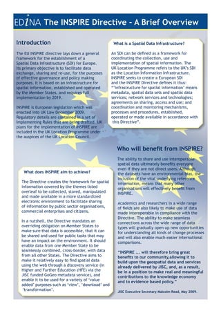
- 1. The INSPIRE Directive – A Brief Overview Introduction What is a Spatial Data Infrastructure? The EU INSPIRE directive lays down a general An SDI can be defined as a framework for framework for the establishment of a coordinating the collection, use and Spatial Data Infrastructure (SDI) for Europe. implementation of spatial information. The Its primary objective is to facilitate data UK Location Programme refers to the UK’s SDI exchange, sharing and re-use, for the purposes as the Location Information Infrastructure. of effective governance and policy making INSPIRE seeks to create a European SDI purposes. It is based on an infrastructure for and the INSPIRE Directive defines it thus: spatial information, established and operated “’infrastructure for spatial information’ means by the Member States, and requires full metadata, spatial data sets and spatial data implementation by 2019. services; network services and technologies; agreements on sharing, access and use; and INSPIRE is European legislation which was coordination and monitoring mechanisms, enacted into UK Law December 2009. processes and procedures, established, Regulatory details are contained in a set of operated or made available in accordance with Implementing Rules that are being drafted. UK this Directive”. plans for the implementation of INSPIRE are included in the UK Location Programme under the auspices of the UK Location Council. Who will benefit from INSPIRE? The ability to share and use interoperable spatial data ultimately benefits everyone even if they are not direct users. Although What does INSPIRE aim to achieve? the datasets have an environmental bias, the inclusion of the vital underlying reference The Directive creates the framework for spatial information, means that many other information covered by the themes listed organisations will effectively benefit from overleaf to be collected, stored, manipulated INSPIRE. and made available in a more standardized electronic environment to facilitate sharing Academics and researchers in a wide range of information by public sector organisations, of fields are also likely to make use of data commercial enterprises and citizens. made interoperable in compliance with the Directive. The ability to make seamless In a nutshell, the Directive mandates an connections across the wide range of data overriding obligation on Member States to types will gradually open up new opportunities make sure that data is accessible, that it can for understanding all kinds of change processes be shared and used for public tasks that may and will also enable much easier international have an impact on the environment. It should comparisons. enable data from one Member State to be seamlessly combined, cross-border, with data “INSPIRE ... will therefore bring great from all other States. The Directive aims to benefits to our community,allowing it to make it relatively easy to find spatial data build upon the geospatial data and services using the web through a discovery service (in already delivered by JISC, and, as a result, Higher and Further Education (HFE) via the be in a position to make real and meaningful JISC funded GoGeo metadata service), and contributions to the knowledge economy enable it to be used for a variety of ‘value and to evidence based policy.” added’ purposes such as ‘view’, ‘download’ and ‘transformation’. JISC Executive Secretary Malcolm Read, May 2009.
- 2. Whilst academic establishments such as universities are covered by the definition of public authority it is unlikely that much of the geospatial data they hold would fall under Annex I or II. Annex III themes are more likely to be in scope. “Whether or not a data set falls under the INSPIRE obligations does not depend on the scale, the specificity of the data sets, or the level of government involved in their management. When the data sets, at any level of government, are relevant for developing, implementing or monitoring laws or regulations which may have an impact on the environment, INSPIRE obligations should apply. Such conditions could equally apply to data sets collected by a research project activity as the INSPIRE Directive makes no distinction between ‘operational’ and ‘research’ data sets. INSPIRE could be considered a positive incentive to safeguard valuable research data sets after the ending of a project.” INSPIRE Themes Where are we now? ANNEX I ANNEX II The HFE sector and Higher Education • Coordinate reference • Elevation Institutions (HEIs) generally have been systems • Land cover slow to recognise their obligations and the • Geographical grid • Orthoimagery opportunities afforded by INSPIRE. systems • Geology • Geographical names • Administrative units The Research Councils (especially NERC and • Addresses ESRC) have been more proactive and are • Cadastral parcels developing their own strategies. • Transport networks • Hydrography The University of Edinburgh (EDINA and • Protected sites Records Management) are currently planning a project to assess the level of INSPIRE ANNEX III awareness and readiness across a sample of • Statistical units half a dozen HEIs. • Buildings • Soil Critical aspects of the required • Land use infrastructure are already in place -the • Human health and safety GoGeo Portal provides INSPIRE discovery • Utility and government services services and the facility to create INSPIRE • Environmental monitoring facilities compliant metadata. Plans for View and • Production and industrial facilities Download services to support HEIs are under • Agricultural and aquaculture facilities development. • Population distribution & demography • Area management/restriction/regulation zones and reporting units In conjunction with JISC, EDINA are • Natural risk zones spearheading briefing and awareness events • Atmospheric conditions and are engaging with the wider INSPIRE • Meteorological geographical features community and UK Location Strategy to • Oceonographic geographical features ensure that the HFE sector is prepared. • Sea regions • Bio-geographical regions • Habitats and biotopes • Species distribution • Energy resources • Mineral resources http://inspire.jrc.ec.europa.eu/ http://www.ed.ac.uk http://www.jisc.ac.uk/ http://www.gogeo.ac.uk http://location.defra.gov.uk/