The document summarizes a presentation on using mapping to advocate for equity and social justice. It discusses how maps can effectively display spatial inequities related to issues like race, region, and social factors. It provides examples of opportunity mapping projects conducted by the Kirwan Institute to analyze access to education, jobs, housing and other opportunities across different areas. The presentation highlights case studies where these maps have guided policy decisions and program implementations to promote more equitable communities.
How to Troubleshoot Apps for the Modern Connected Worker
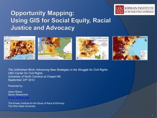
Opportunity Mapping: Using GIS for Social Equity, Racial Justice and Advocacy
1. The Unfinished Work: Advancing New Strategies in the Struggle for Civil Rights
UNC Center for Civil Rights
University of North Carolina at Chapel Hill
September 24th 2010
Presented by:
Jason Reece
Senior Researcher
Reece.35@osu.edu
The Kirwan Institute for the Study of Race & Ethnicity
The Ohio State University
1
3. Using Mapping For Advocacy:
Space and Regional Equity
Why are maps particularly effective in
dealing with issues of equity?
Regional, racial and social inequity often
manifest as spatial inequity
Maps are naturally the best tools to display this
spatial phenomena
Other disciplines and sectors are using
multivariate mapping to problem solve
Private industry
NGO’s (Non Profit Sector)
○ Long history in the environmental field
Public sector
○ Local Government
○ Federal Government
Recent interest in mapping by HUD for supporting
sustainable communities
3
4. Why Mapping?
Communications
Why is a map an excellent
visual tool to inform
someone about an
issue/problem or solution?
Maps are incredibly efficient,
compacting volumes of data
into single pictures that can be
understood at a glance
○ One map may contain tens of
thousands of pieces of
information than can be
understood in seconds
A good map can enable you to
tell a story or solve a problem
○ Research has shown that
people can solve problems
faster with map based
information, than by looking at
charts, tables or graphs
4
5. GIS/Mapping = Powerful Analysis
The power of GIS
Overlays of data/information
○ Depth of analysis – because of its
storage and overlay capabilities,
GIS allows analysis which would
be difficult or impossible without
GIS technology
○ Interaction of variables: GIS allows
for extensive exploration of the
interaction between various factors,
primarily the focusing on
correlation and relationships
(spatial)
5
6. Think of Mapping as a Tool:
It can be used for positive or negative purposes.
E.g. Mapping for Inequity – Redlining to support
institutionalized disinvestment
How can we use this tool and
effectively use maps to advocate for
equity?
6
8. Opportunity Matters: Space, Place, and Life
Outcomes
“Opportunity” is a situation or condition that places individuals in a position
to be more likely to succeed or excel.
Opportunity structures are critical to opening pathways to success:
High-quality education
Healthy and safe environment
Stable housing
Sustainable employment
Political empowerment
Outlets for wealth-building
Positive social networks
8
9. Systems Thinking: We are all situated within
“opportunity structures”
Physical
Social Cultural
Outcomes
&
Behaviors
These structures interact in ways that produce racialized outcomes for different groups, but also
in ways that influence identity
9
10. The Communities of Opportunity Model
and Fair Housing
Everyone should have fair access to the
critical opportunity structures needed to
succeed in life.
Low Opportunity neighborhoods limit the
development of human capital
A Community of Opportunity approach
can develop pathways that result in
increased social and economic health,
benefiting everyone
Looking at people, places and linkages
○ Linkages = building connections to areas of
opportunity
○ Example: Opportunity based fair housing
10
11. Mapping Opportunity: Why and How
The Kirwan Institute has conducted
“opportunity mapping” for states and
metropolitan regions across the US
Projects in at least a dozen states
○ Full State Analysis: MA, CT, OH, FL
○ Regions: Seattle, San Francisco, Chicago, Atlanta,
Baltimore, Washington D.C., Detroit, Austin,
Sacramento, Los Angeles, New York, Houston, New
Orleans
Why identify the “State of Opportunity”
How are low-income groups situated in the State?
How are racial and ethnic groups situated?
How does housing intersect with race, class and
opportunity
What can be done to improve the opportunity
landscape?
11
12. Sample Indicators: From Recent King
County Opportunity Mapping Analysis
Education
Housing & Neighborhood
Student poverty rates Health
Reading/Math test scores Home ownership rates
Adult educational attainment Crime incidence
Teacher qualifications Vacancy rates
Graduation rate Home value appreciation
Neighborhood poverty rates
Population change
ECONOMIC HEALTH Proximity to parks/open space
Proximity to employment Proximity to toxic waste release sites
Commute times
Job growth trends
Business start trends
Unemployment rate All indicators grounded in social science research
Public assistance rate literature, also indicators can be more narrowly
tailored to meet the needs of particular populations
(e.g. public housing residents).
12
14. Example of an Opportunity Map:
Detroit MI
(Dark Areas = Most Opportunity
Rich Communities)
(Light Areas = Most Opportunity
Deprived Areas)
14
15. MA Legal Services and
Opportunity Communities
Background on this project
Originated from effort to incorporate
mapping analysis into legal services
Partners
Massachusetts Law Reform Institute,
MA Legal Assistance Corp (foundation)
and other Legal Services Entities
Year long process of meeting with
stakeholders to understand mapping
needs and issues
Training with service providers &
agencies (using mapping for
programming)
15
20. Applications and Impact
Program design and use within legal services
New programming – proposed “Adopt A Zip Code”
program
Use in exploring client concerns/challenges
State level program design (public sector)
New $5 million state affordable housing program,
targeted to high opportunity communities (see press
release)
Targeting of $21 million in NSP funds to low opportunity
communities by the MA Department of Housing and
Community Development
Implementation still unfolding
20
22. Other Project Impacts: CT
Connecticut
“The mapping is guiding our next round of
fair housing testing…our mapping report has
been identified by the CT Department of
Economic and Community Development as
one of the three central principles that will
guide its planning over the next five years.”
○ Erin Boggs, CT Fair Housing Center
22
23. Other Projects Impacts &
Activities
Baltimore
Remedial proposal in Thompson v. HUD
Chicago (Leadership Council for Metropolitan Open Communities)
Use in advising voucher holders in neighborhood selection
Austin
Use in evaluating city’s affordable housing investments
Related Project: Washington County, OR
Advised on opportunity map created by the County included in recent
consolidated plan for County
○ Exploring application in planning activities for the broader Portland region
Child Development
Jacksonville, FL & the Duvall County children’s commission
Evaluation of stimulus/NSP activities
Florida
23
24. Web Based and Interactive Opportunity Maps
http://www.kirwaninstitute.org/connect/king-county-wa-opportunity-mapping.html
24
25. Want to Learn More?
Resources & Reference Materials
Mapping for Social Justice
The Kirwan Institute Study:
○ Utilizing GIS to Support Advocacy and
Social Justice
More on Opportunity Mapping
The Kirwan Institute Reports
○ Communities of Opportunity: A
Framework for an Equitable &
Sustainable Future
○ The Geography of Opportunity: A Review
of Opportunity Mapping Research
Initiatives
All Available on-line at: kirwaninstitute.org
25
26. Want to Learn More?
Resources & Reference Materials
Mapping & Advocacy – Two recent
articles from Clearinghouse Review
Jason Reece and Eric Schultheis. Poverty’s Place:
The Use of Geographic Information Systems in
Poverty Advocacy. Clearinghouse Review Journal of
Poverty Law and Policy. January-February 2009.
Maya Roy and Jason Reece. Poverty’s Place
Revisited: Mapping for Justice & Democratizing Data
to Combat Poverty. Clearinghouse Review Journal of
Poverty Law and Policy. July/August 2010.
To access, visit Clearinghouse
Review at:
www.povertylaw.org/clearinghouse-review
26