
Recommended
More Related Content
What's hot
What's hot (20)
Similar to URBAN LANDSCAPE
Similar to URBAN LANDSCAPE (20)
More from nirali vaghela
Recently uploaded
Recently uploaded (20)
URBAN LANDSCAPE
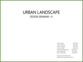
- 1. DESIGN SEMINAR – II Hiren Kheni AR 1614 Pravin Mistry AR 1814 Sukirti Sirupa AR 3214 Sonu Suthar AR 3514 Harnsiha Vaghasiya AR 3814 Nirali Vaghela AR 3914 Gauri Agarwal AR 0213 School of Architecture Vadodara Design Academy URBAN LANDSCAPE
- 2. CONTENT S 1. INTRODUCTION 2. CASE STUDIES • CENTRAL PARK, NEW YORK • YERBA BUENA GARDEN, CALIFORNIA • LA PROMINADE PLANTEE, PARIS • OLYMPIC SCULPTURE PARK, WASHINGTON • GOVERNORS ISLAND, NEW YORK • THE HIGH LINE, NEW YORK • BISHAN-ANG MO KIO PARK, SINGAPORE • BHADRA SQUARE REDEVELOPMENT, GUJARAT • GARDENS BY THE BAY, SINGAPORE • KLYDE WARREN PARK, TEXAS
- 3. INTRODUCTIO N Landscape architecture is a profession that combines art and science to shape and manage the physical world and the systems that we are part of. It is a design profession that creatively responds to the challenges of man’s interaction with the land to propose new possibilities for sites. Landscape architecture also requires a strong understanding of natural systems and sciences, such as geology and soils; plants and climatic and water systems. Industrial Revolution was a time of conclusive, and the larger landscape began to take on the forms we could recognise in modernity. LANDSCAPE MAN-MADENATURA LForests, rivers, mountains Parks, squares, streets, etc
- 4. THEOR Y• Landscape Urbanism is a theory of urban landscape. • The phrase Landscape Urbanism first appeared in mid 1990’s • The best way to organise cities is through the design of the city’s landscape. From the late 1990’s, the phrase was used by landscape architects in the United States to refer to the re-organisation of declining post-industrial cities, such as Detroit. • From the 2000s, it was used in Europe by architects to mean a highly flexible way of integrating large-scale infrastructure, housing and open space. • By the late 2000s, the phrase became associated with highly commercialized, multi-phase urban parks, such as Olympic park design. • The first major event to do with ‘landscape urbanism’ conference held in Chicago in April 1997. Characteristics 1. Broad scale context: Landscape urbanism does not belong to a specific scale. It can be considered in small or large scale projects. 2. Landscape is a context which contains architecture and civil engineering. 3. Landscape urbanism projects can provide the opportunity of increasing the social interactions. 4. Function is the most significant concern in Landscape urbanism, which gives the appearance of a project less importance. 5. Landscape urbanism discovers the potentials and opportunities in landscapes. 6. The infrastructure are highlighted in Landscape urbanism projects. 7. Landscape urbanism projects will develop the interrelationship between natural and engineered systems. 8. Landscape urbanism will break the boundary between the landscape and the city and will organize them as one.
- 5. CENTRAL PARK Manhattan, New York City, U.S. 1857 Frederick Law Olmsted (1822–1903) Calvert Vaux (1824–1895) 843 acres The history of Central Park is, all about the creation of the most famous city park in America, the role of open space on the island of Manhattan: The dynamic tension between pavement and pasture, city noise and rural quiet, fresh air and foul, private and public land, city and state government, city square and urban park
- 6. BACKGROUND New York City's need for a great public park was resounded by the famed poet and editor of the Evening Post (now the New York Post), William Cullen Bryant, as well as by the first American landscape architect, Andrew Jackson Downing, who predicted and began to publicize the city's need for a public park in 1844. Central Park is a magisterial composition, whose landscapes and structural features are placed to take advantage of the natural topography of the site
- 7. PROPOSAL In the competition of Central park, Frederick Law Olmsted and Calvert Vaux developed what came to be known as the "Greensward Plan", According to Olmsted, the park was "of great importance as the first real Park made in this country – a democratic development of the highest significance..."
- 8. CONCEP T This plan featured an English style landscape with large meadows, several lakes and hills. Winding pedestrian roads were separated from main roads and the huge number of trees the park is a kind of social experiment where people from both upper and lower classes would meet, a rather revolutionary idea at that time.
- 9. Bethesda Terrace, a two-tiered esplanade featuring elaborate carvings and a central sculptural fountain PECULARITIES OF THE PROJECT
- 10. Great lawn The Ramble Sheep meadow The Central park zoo North Meadow The Reservoir PECULARITIES OF THE PROJECT
- 11. Greywacke ArchWinterdale Arch 110th Street Arch Gapstow BridgeBow Bridge Gothic Bridge Greywacke Arch The plan consists of 36 Bridges, no two are alike.
- 12. First decline and renovation Around the turn of the 20th century, the park faced several new challenges. Cars were becoming common place, bringing with them their burden of pollution, and people's attitudes were beginning to change. Major redesigning and construction was carried out: for instance, the Croton Lower Reservoir was filled in so the Great Lawn was created. He also created the 67th Street Transverse, widened West Drive, and evicted the sheep from Sheep Meadow. In 1934 the focus of the park shifted from relaxation to recreation. Construction of many sports facilities, playgrounds and the Wollman rink. Renovation of the Zoo, and installation of several sculptures including 'Alice in Wonderland 1970 – condition of the the park.
- 13. The "Events Era" and second decline 1960 reflected the widespread cultural and political trends of the period. The Public Theater's annual Shakespeare in the Park festival was settled in the Delacorte Theater in 1961, Restoration and second renovation small restoration staff to reconstruct and repair unique rustic features, undertaking horticultural projects, and removing graffiti.Restored oak bridge
- 14. 1980s–90s renovations The first landscape to be restored was the Sheep Meadow, primarily with funds provided by New York State. During the next few years, Bethesda Terrace and Fountain, Belvedere Castle, and the East Green were restored. In 1996, the Conservancy embarked on its most ambitious landscape restoration: the overhaul of the 55 acres (22 hectares) including and surrounding the Great Lawn and Turtle Pond (formerly the Great Lawn and the Belvedere Lake) Sheep Meadow before renovation
- 15. 2000s renovations In 2000 the Conservatory Water opened after a six- month restoration effort Bank Rock Bridge, also called Cabinet Bridge, across the mouth of the cove was recreated in carved oak with cast-iron panels and pine decking Restoration of further sections of the Lake's shoreline landscapes was undertaken
- 16. YERBA BUENA GARDEN SOUTH OF MARKET, SAN FRANCISCO, CALIFORNIA 1960 – 1999 24,500 sq.m Kenzo Tange and Gerald McCue, architects of the first redevelopment plans. Mitchell Giurgola, Mallas & Foote, Omi Lang, Paul Friedberg, and Hargreaves Associates, designers of Garden / Esplanade. Adele Santos, Adele Santos Architects, architects for the children’s facilities. • In the mid-19 century, San Francisco’s South of Market area evolved after the Civil War into an important service sector, geared largely to the city’s port. • Young, single, and often immigrant, workers and merchant seamen formed a majority of the population, and industrial infrastructure and workers’ housing came to dominate the landscape. • In 1953, 19.5 blocks South of Market were designated a redevelopment zone by one of the nation’s first redevelopment agencies.
- 17. BACKGROUND 1960 Redevelopment area shifted, becoming smaller (87 acres) and moving closer to Market Street. Design theme of convention centre and sports-related facilities chosen. 1964 Livingston / Blayney and John Carl Warnecke produce preliminary concept and design plan, named Yerba Buena Gardens, for a “protected environment.” 1966-1967 Yerba Buena Center officially designated an urban renewal area. In 1967 The Redevelopment Agency initiated demolition. 1967-1969 Kenzo Tange and then Gerald M. McCue and Associates chosen to produce the first plan for central blocks, based on the Livingston / Blayney and Warnecke concept. 1982 Moscone Center opens. 1986-1989 Marriott Hotel is constructed. Early conceptions of Yerba Buena Gardens envisioned a complex of high-rise buildings in almost a fortress fashion (1995). Over the years the Yerba Buena Gardens master plan softened its edges, opening it to the surrounding neighbourhood(1995). Project was long drawn out over 3 decades. FIRST STAGE SECOND STAGE
- 18. 1987-1990 San Francisco Museum of Modern Art decides to relocate to Yerba Buena. 1993 Gardens and Center for the Arts open. Moscone expansion completed. 1998 Children’s facilities open. 1999 Sony’s Metreon opens. 1991 Yerba Buena Alliance formed. Central children’s area, including ice rink, Childcare Center, and Zeum, planned. 2010 1977 1984 • Yerba Buena Center, however, did not succeed. It was nearly a complete failure. Indeed, within five years of its inception, the project had essentially been abandoned amidst an avalanche of citizen opposition and lawsuits. • Resistance culminated in a 1970 lawsuit filed by Tenants and Owners in Opposition to Redevelopment (TOOR) that successfully forced the Redevelopment Agency to acknowledge its legal obligation to provide housing for displaced residents. THIRD STAGE
- 19. PROPOSAL • The goal was to reverse the decay that post-war economic changes had visited upon the “South of Market” neighbourhood adjacent to San Francisco’s financial district. • The old vision mixed commercial use, convention centre, and public garden but also added essential new elements, such as subsidized low-income housing, public and cultural as well as a retail centre, and other amenities to be located atop an underground convention centre expansion. • The Yerba Buena Street Life Plan, first published in 2010, that identified 36 projects to improve the beauty and functionality of the District’s public streets, alleys, and public spaces.
- 20. CONCEPT • Identify criteria and projects that would improve the mobility, sustainability, and beauty of the District. • the creation of the gardens, as well as its inclusiveness in terms of the population it serves and its neighbourhood: "The mixed-use development enables cultural, social justice, and economic development agendas to coexist within a network of collaborative management practices.”
- 21. THE GARDEN Public space • 5.5-acre central garden linked to an extensive open space network. Commercial development • Convention Centre: an original “big box” building and a two part underground expansion, • Hotels: a Marriott, W Hotel, Four Seasons Hotel and Tower, and a Carpenter and Company project. These are mostly high-end facilities, some with condominiums and commercial venues at ground level. • Entertainment: the centrepiece is Sony’s “Metreon,” its first largescale urban entertainment centre. Museums and cultural facilities • Centre for the Arts: two buildings designed by James Polshek (the theatre) and Fumihiko Maki (the galleries and forum). • San Francisco Museum of Modern Art, designed by Mario Botta. • Children’s Centre for Technology and the Arts (“Zeum”): a studio for technology and the arts targeting older youth. • Other youth facilities: a historic carousel, bowling alley, ice skating rink, child care centre, and children’s garden. Housing • TODCO homes: four housing projects providing units for 1700 low-income, disabled, and elderly residents. • Other housing: a mix ranging from SRO projects to 1500 market rate units (20% subsidized low mod) to the high-end condos at the hotels.
- 22. Martin Luther King Memorial facing the garden. Gardeners work in plots provided by the San Francisco Redevelopment Authority as part of the low and moderate-income housing provided in the immediate area surrounding Yerba Buena Gardens. Even when fully programmed there are opportunities for passive recreation in the gardens. To the left is Fumihiko Maki’s Centre for the Arts Galleries and Forum and John Ploshek’s performance facility is to the right. Both facilities create a framed view of Mario Botta’s San Francisco Museum of Modern Art from the Garden. The historic carousel relocated from San Francisco’s Play land- at-the-Beach is an important part of the intergenerational mix of activity at the Gardens. The SONY Metreon is a retail and entertainment centre facing the Gardens. It was redesigned following a public design review to allow additional light into the gardens through additional roof glazing. The Zeum is a children’s arts facility where teens from all over San Francisco experiment with video and digital arts. Here is a class gathered in the courtyard adjacent to the Zeum entrance.
- 23. NEW INSERTS
- 24. Coulée verte René-Dumont or La Prominade Plantee FRANCE PARIS LA PROMENADE PLANTEE AERIAL VIEW “The first elevated park in the world” 1993 Landscape architect Jacques Vergely and architect Philippe Mathieux
- 25. Built on the former train tracks of the Vincennes railway, it was resurrected in 1990 as an extensive urban green belt which runs about 4.7 kms along nearly the entire length of Paris’s 12th arrondissement, from the Bois de Vincennes on one end to the Place de la Bastille on the other, its last hundred yards opening onto the Opéra Bastille. The elevated part of the route, on the viaduct, has some enclosed sections, as when it passes between modern buildings, and some open sections with expansive views. INTRODUCTIO N Access Archways Promenade park
- 26. Sheltered part Part located at street level Sliced part Access to gardens Access to the promenade Handicap acces Beginning of the bike path Accessible part for dogs Games for children Lawn accessible to the public
- 27. BACKGROUND 1859 Vincennes railway line 1969 Railway closed 1984 Demolished Bastille station 1986 Reuilly area was designed 1993 La Promenade Plantee SUCCESIVE PROJECTS Manhattan’s The High Line, Chicago’s Bloomingdale Trail, Philadelphia’s Reading Viaduct, Rotterdam’s Hofplein station
- 28. O L Y M P I C S C U L P T U R E P A R K 2007 WEISS/MANFREDI 36,000 m2 Seattle, Washington
- 29. the astounding result of a major partnership between SAM and the Trust for Public Land to reclaim downtown Seattle’s last undeveloped waterfront property as a public space for art. SAM had resolved to return the site as much as possible to a functioning ecosystem, while providing a unique setting for outdoor sculpture and public recreation. Starting in 1910, the grounds that would become the Olympic Sculpture Park were operated as a fuel-storage and transfer facility, activities that contaminated the soil and groundwater BACKGROUND CONCEPT developed an innovative Z-shaped configuration to connect three parcels of land into a series of four distinct landscapes. This design afforded a wide range of environmental restoration processes, including brownfield redevelopment, salmon habitat restoration, native plantings, and sustainable design strategies.
- 31. Envisioned as a new model for an urban sculpture park, the project is located on a industrial site at the water's edge. The design creates a continuous constructed landscape for art, forms an uninterrupted Z-shaped "green" platform, and descends 40 feet from the city to the water, capitalizing on views of the skyline and Elliot Bay and rising over the existing infrastructure to reconnect the urban core to the revitalized waterfront. An exhibition pavilion provides space for art, performances and educational programming. From this pavilion, the pedestrian route descends to the water, linking three new archetypal landscapes of the northwest: a dense temperate evergreen forest, a deciduous forest and a shoreline garden. The design not only brings sculpture outside of the museum walls but brings the park itself into the landscape of the city. PROPOSAL Green area circulation services
- 34. GOVERNORS ISLAND ‘THE HILLS’ NEW YORK, USA (Located in the heart of New York Harbour between Lower Manhattan and the Brooklyn waterfront, Governors Island.) 2007 WEST 8 172 acres MAP SHOWING NEW YORK, USA MAP SHOWING NEW YORK HARBOR MAP SHOWING GOVERNORS ISLAND ARIAL VIEW OF GOVERNORS ISLAND
- 35. BACKGROUND 1811 1911 1996 ADDITION OF THE SOUTH ISLAND END OF THE MILITARY ERAEARLY SHAPE Constructed by the colonial militia
- 36. 2003 BECOMING A PUBLIC PLACE 2014 PARK PHASE 1 OPENS Transforming abandoned military base to vibrant public destination BACKGROUND
- 37. 2016 FUTURE THE HILLS OPEN Rising up to 70 feet above sea level THE NEXT CHAPTER BACKGROUND
- 38. MASTER PLAN Rising up to 70 feet above sea level GRASSY HILL SLIDE HILL DISCOVERY HILL OUTLOOK HILL
- 40. CONCEPT, CONSTRUCTION & ANALYSIS EXISTING TOPOGRAPHY EDGING CIRCULATION & PAVING PLANTING
- 41. HIGH POINT VIEW GUIDED VIEW
- 44. THE HIGH LINE NEW YORK MANHATTAN HIGH LINE 2009 James Corner Field Operations (Landscape architecture) 29,000 sq. m AERIAL VIEW “a symbol and catalyst”
- 45. The High Line (also known as High Line Park) is a 2.33 km long elevated linear park, greenway and rail trail. It was created on a former New York Central Railroad spur on the west side of Manhattan in New York City. The abandoned spur has been redesigned as a "living system" drawing from multiple disciplines which include landscape architecture, urban design, and ecology. Since opening in 2009, the High Line has become an icon of contemporary landscape architecture. The High Line at west INTRODUCTIO N Vegetation Pavement Stay Activity 29,000 sq.m 11516.2 sq.m Resting areas Open Theatre
- 46. 1847 Construction of rail road tracks 1910 Major accidents 1929 West side elevated highway 1933 First train on West side rail line Massive demolition (640 buildings) BACKGROUND 1950 Drop in rail traffic Due to other modes of transport 1960 Demolished southern section 1995 Abandoned rail track 1999 Residents wanted to re-use the structure for recreational purpose Similar to Promenade Plantee in Paris 2006 Construction of The High Line 1991 Reconstruction of small section Rail Line Reconstruction of rail line
- 47. 1st Phase 2nd Phase 3rd Phase Staircase Elevator Ramp The Spur 2009 1st Phase 2011 2nd Phase 2014 3rd Phase 2018 The Spur
- 48. The activity is extended throughout the tour. Activities occur under the buildings that cross creating viewpoints and scenarios for cultural activity. The project has a program related to which includes exhibitions, performance and light ACTIVIT Y Zones are distributed that promote the meeting and contemplation meeting along the route. Solarium, viewpoints are included. fibs and mobile seats. ZONE S PAVEMEN T The High Line is the only project in NY that allows pedestrians to run uninterruptedly for 22 blocks. Visual privileged of the city for its elevated condition The paths with change of texture of pisa prefabricated in concrete that separate it from the vegetation.
- 49. BUILDINGS VEGETATION PAVEMENT The project passes in front of buildings but does not generate any kind of relationship with them. Drought-resistant plants appeared and those capable of spreading their seeds by themselves. Plants that spontaneously were already inside the abandoned structure were used. In the planning of the High Line it is considered to establish flood zones where the abandoned structure could be seen through the transparency of the water. However, in its subsequent execution it was not carried out.
- 50. CONCEPT The Spur The Spur is located on 30th Street close to 10th Avenue (circled area in red). As noted, the piazza of the Spur will allow unprecedented views east, west, north, and south In the current design, the 30th Street Passage passes under the first building in Hudson Yards Includes built-in lounge seating, movable tables and chairs, and open space for free programming and public art. Visitors to the Spur will be able to look to the north and south along 10th Avenue, west to the Hudson River, and east into the heart of New York City. View
- 51. • Revitalized Chelsea, which was "gritty" and in generally poor condition during the late twentieth century. • It has also spurred real-estate development in the neighborhoods along the line. • Crime has been low in the park. • There have been several proposals for museums along its path. One such museum Whitney Museum was designed by Renzo Piano. IMPACT
- 52. BISHAN-ANG MO KIO PARK SINGAPORE 2009 RAMBOLL STUDIO DREISEITL (SINGAPORE) 62000 SQ. M FROM CONCRETE CANAL TO NATURAL WONDERLAND
- 53. BACKGROUND Singapore concrete drains and canals were built to alleviate widespread flooding The kallang river Was set within a concrete channel to prevent flooding. the park was built around the canal The Active, Beautiful, Clean Waters (ABC Waters) Programme was launched to transform the country’s water bodies into beautiful and clean rivers and lakes with new spaces for community bonding and recreation. The redesign to keep the functionality, but also to bring the river into the park, where people can interact with the water. 1960s 1980s 1988 2006 2009
- 54. MORE RIVE , MORE PARK CONCEPT PROPOSAL • The idea of using the parkland to serve as a flood plain when little water is running through the river, • the riverbanks, which are covered in vegetation and grass, provide recreational areas. • When water levels are high, the surrounding parkland is inundated and serves as flood zones. • provides flood prevention, with the ability to carry 40% more water than the previous channel • Multiple uses of the space in the park, with more opportunities for people to interact with the water
- 55. A combination of vegetation, natural materials and civil engineering technique to stabilize the river banks and prevent erosion, A test bed for selection of appropriate techniques and plants measuring the depth and tenacity of root development, as well as the most effective construction SOIL BIOENGINEERING EROSION CONTROL
- 56. WATER TREATMENT CLEANSING BIOTOPE The dense planting filters out sediment while partially feeding off and removing nitrates in the water The layers of substrate filter out particulates and have mineral composites that bind and remove phosphates After the surface runoff and river water are channeled through multiple wetland cells, the water is subjected to an ultraviolet treatment to remove bacteria. A system of filtration through phytoremediation and sedimentation
- 57. WATER FILTRATION VEGETATED BIOSWALES Water is filtered on site at the park is through the use of a network of vegetated bioswales These bioswales help capture storm water runoff from the surrounding area, filtering it to some extent, and then channeling it into the river.
- 58. DESIGN APPROCH Concrete river was torn down and merged with the park to create a naturalized meandering river A 2.7 km straight concrete drainage channel has been converted into a sinuous, 3.2 km long natural The longer course helps slow the flow of water through the park, aiding in water treatment, filtration, and safety Integrate into the system or environment of usage The park is divided with the blue-green area and the river on the southern part of the park, and green area on the northern side Increase sustainability or improved environmental impact in Singapore
- 60. BHADRA SQUARE REDEVELOPMENT AHEMDABAD, GUJARAT, INDIA 26 Jan, 2011 – Nov. 2014 BALKRISHNA DOSHI • The space between Bhadra Fort, built by Ahmad Shah, the founder of the city in 1411. • Located on the bank of the Sabarmati river, this area included the Azam Khan Palace and the Bhadrakali Temple. • Opposite this place was the central open area and on the axis leading to the east are the three gates. • In between the Palace and the gates was the Great Maidan. • This Maidan was gradually encroached upon by shopping activities and bazaar and in due course housing were also added.
- 61. BACKGROUND • The Bhadra Fort is a citadel and the ceremonial centre of the city of Ahmedabad. • Over the years, even as the city of Ahmedabad grew and expanded its city limits, the inner core of the city or the walled city came to be perceived as a site of disease, communal conflict and general residential decline. • This perception of the area’s lack in terms of value and relevance to the social imagination of the city is reflected in the substantial decline in population of the walled city between the 1981 and 2001 censuses. • For a long period of time, the walled city was largely neglected in terms of urban planning but figured extensively in narratives of communal violence. • However, in the last two decades and more, interest in the walled city revived, with great attention being paid to the history, traditions and the conservation of the walled city’s domestic architecture, accompanied by the city government’s efforts to ‘revitalize’ the walled city. Bhadra Area, development from 1400s to 1900s, showing linkages and spatial hierarch
- 62. EXISTING SITUATION • Bhadra and places nearby have been closely linked to the history of the city. Apart from the monuments, in modern times the same areas and the nearby Lal Darwaja became important in the city life, as the first banks came up in the area and Premabhai Hall, an important cultural hub and extension of Gujarat Vernacular Society. • Himabhai Institute, the city's first library also came up there.
- 63. PROPOSAL • In plan, proposed relocation of these activities at different places within the same area giving the municipality or the developing authority more are for use and revenue and also to provide the city with a breathing space it so badly needed. • And also aspiring to bring the old grandeur of this Maidan which in the early days inspired most of the community activities, recreations and pastimes. • We are also aspiring to revive the original grandeur around the palace
- 64. CONCEPT • Design a new scheme with due considerations to the present activities and the revival of the past functions of this area. • While the city aspires to get World Heritage City status, a well-planned square at the heart of the Walled City will not only attract tourists but would also prove that the city can revitalize public squares in a planned way. • proposed multi-level parking near Lal Darwaja. Stages of Development: Bhadra Square Redevelopment
- 65. MAJOR DESIGN ASPECT THE HOWKER SOLUTION The historic square has 1,580 registered hawkers of whom 690 will get space at the square itself kiosks at given spaces alongside the promenade.
- 67. GARDENS BY THE BAY Gardens by the bay is an integral part of Singapore's ‘city in a garden’ vision, designed to raise the profile of the city Globally (in 2012 it was voted the 4th most visited attraction on the planet) whilst showcasing the best of horticulture and Garden artistry INTRODUCTION: LOCATION: MARINA BAY Singapore YEAR: 2012 ARCHITECT/FIRM: Grant Associates AREA: 101 HECTARES (250 ACRES) View of garden by the bay Map of marina bay Map of Singapore View of garden by the bay Dome and the Cloud Forest Architecture: Wilkinson Eyre Architects ingenious structural and environmental engineering: Atelier One and Atelier Ten
- 68. BACKGROUND GARDENS BY THE BAY BRINGS TO LIFE THE NATIONAL PARKS BOARD SINGAPORE'S VISION OF CREATING A CITY IN A GARDEN. THE GARDENS CAPTURES THE ESSENCE OF SINGAPORE AS THE PREMIER TROPICAL GARDEN CITY WITH THE PERFECT ENVIRONMENT IN WHICH TO LIVE AND WORK - MAKING SINGAPORE A LEADING GLOBAL CITY OF THE 21ST CENTURY CONCEPT THE 54 HECTARE MASTERPLAN TAKES ITS INSPIRATION FROM THE ORGANISATION AND PHYSIOLOGY OF THE ORCHID. THE ORCHID IS THE NATIONAL FLOWER OF SINGAPORE AND IS THE MOST COSMOPOLITAN SPECIES OF FLOWERING PLANT IN THE WORLD. AT THE SAME TIME IT IS TYPICALLY EPIPHYTIC OR TRANSIENT IN ITS COLONISATION OF HABITATS. Conceptual drawing Isometric view
- 69. SUSTAINABILITY EFFORTS UNDERLYING THE CONCEPT OF GARDENS BY THE BAY ARE THE PRINCIPLES OF ENVIRONMENTAL SUSTAINABILITY. MUCH EFFORT WAS MADE TO PLAN AND DESIGN FOR SUSTAINABLE CYCLES IN ENERGY AND WATER THROUGHOUT BAY SOUTH GARDEN Conceptual drawing
- 70. Conceptual drawing of SUPERTREE GROVE
- 71. SUSTAINABILITY EFFORTS UNDERLYING THE CONCEPT OF GARDENS BY THE BAY ARE THE PRINCIPLES OF ENVIRONMENTAL SUSTAINABILITY. MUCH EFFORT WAS MADE TO PLAN AND DESIGN FOR SUSTAINABLE CYCLES IN ENERGY AND WATER THROUGHOUT BAY SOUTH GARDEN
- 72. PROPOSAL THE GARDENS IS LED BY A MULTIDISCIPLINARY TEAM OF PROFESSIONALS WHO HAVE BEEN INVOLVED IN GREENING OF SINGAPORE AND HAD WORKED ALONGSIDE INTERNATIONAL AND LOCAL EXPERTS TO DEVELOP THE GARDENS. IT HAS AN IN-HOUSE TEAM OF SKILLED LANDSCAPE DESIGNERS, HORTICULTURISTS, ARBORISTS, PLANT HEALTH, GARDEN AND TURF MANAGEMENT EXPERTS, AS WELL AS PLANT RESEARCH AND BREEDING PROFESSIONALS, WHO LEVERAGE ON THE EXTENSIVE GLOBAL NETWORK OF PLANT SOURCES CULTIVATED DURING THE DEVELOPMENT DAYS, TO CONTINUOUSLY CURATE AND GROW THE GARDENS.
- 73. MAJOR DESIGN ASPECT •Cooled Conservatories house 226,000 plants from every continent except Antarctica •1.2 hectare Flower Dome replicates a cool-dry Mediterranean climate •Giant flower field with changing seasonal displays •Raised walkways to explore exotic planting •0.8 hectare Cloud Forest recreates cool-moist climates of Tropical Montane regions •35 metre high epiphyte clad mountain with waterfall •The Mountain houses galleries and a black box media exhibition themed around climate change and habitat loss •Powered sustainably via horticultural waste, efficient de- humification and thermal stratification
- 74. FLOWER DOME IT IS THE LARGEST GLASS GREENHOUSE IN THE WORLD . CLOUD FOREST MOUNTAIN VIEWS SURROUNDED BY DIVERSE VEGETATION AND HIDDEN FLORAL GEMS. VIEW OF CLOUD FOREST SECTION OF CLOUD FOREST OCBC SKYWAY At a height of 22 metres and surrounded by panoramic vistas of the Gardens and Marina Bay skyline, 128-metre-long aerial walkway
- 75. SUPERTREE GROVE Measuring between 25 and 50 metres tall, iconic tree- like vertical gardens are designed with large canopies that provide shade in the day and come alive with an exhilarating display of light and sound at night FAR EAST ORGANIZATION CHILDREN'S GARDEN Have a fun-filled family day with interactive play delights, water play features and educational programmes in a lush natural setting at Far East Organization Children’s Garden
- 76. BAY EAST GARDEN beautiful pavilions, lush wide-open lawns and elegant palm trees With views of the Marina Bay skyline DRAGONFLY & KINGFISHER LAKES rich with aquatic life, Dragonfly and Kingfisher Lakes
- 77. HERITAGE GARDENS about Singapore's diverse history and culture, through the fascinating story of plants in the Heritage Gardens. WORLD OF PLANTS World of Plants about the myriad of tropical plants and the systems these plants support.
- 78. THE CANYON The largest collection of sculptural rocks along a 400-metre-long dragon-shaped trail. Architect junichi inada brings together more than 60 one-of-a-kind ancient rock forms sourced from Shandong, china. SUN PAVILION The sun pavilion has desert-like landscapes. With over 1,000 desert plants comprising some 100 different species and varieties
- 79. ART SCULPTURES Gardens by the bay is home to more than 40 sculptures from around the world. Featuring unique pieces, intriguing crafts and stone works, these sculptures complement the beauty of the plant displays and add a new dimension to the landscape.
- 80. Peculiarity of project 18 super trees (25-50m high) to act as iconic vertical gardens Aerial walkway and treetop bar offers unique views of the gardens Giant cooled conservatories housing plants from Mediterranean and tropical montane regions of the world Indoor mountain offering tropical rainforest experience Spectacular nightly light and sound shows Heritage gardens reflecting Singapore's cultural links with plants World of plants gardens showcasing the biodiversity of plant life on our planet Dragonfly lake and dragonfly bridge Numerous sculptures and architectural structures Intelligent environmental infrastructure
- 81. KLYDE WARREN PARK DALLAS, TEXAS 2012 JIM BURNETT 20234.3 SQ. M
- 82. BACKGROUND The concept of deck park over woodall rodgers freeway originated when dallas mayor J. Erik jonsson decided to recess the freeway. The idea resurfaced in the real estate community and john zogg began to rally support for the project. The real estate council provided $1 million grant to fund feasibility studies and provide staff support during the incubator stage. Construction on the deck The park opened 1960s 2002 2004 2009 2012 PROGRAM BACKGROUND • Modern children’s play area • Water fountains, • An off-leash dog pen, • An outdoor reading room, • Ping pong tables and mini-golf, • And wide lawns • The entire park is wheelchair accessible. The park has ongoing family- friendly programming and features. Concerts, markets, athletic races, and other events are scheduled throughout the year
- 83. CONCEPT PROPOSAL • Provide better quality of life. • An epicenter of activity in the heart of our city • Creating an accessible urban park with-out barriers • Eliminate the barrier of the highway trench and to connect uptown and downtown Construct a deck park over woodall rodgers freeway • Connect downtown, uptown and the arts district of dallas, texas.
- 84. LAYERS OF DECK PARK The beams were arranged in groups of three or more, and concrete panels were placed between the beam groups to form trenches.
- 85. The café and restaurant use geothermal energy for cooling and heating Space for musical concert and dance performance Children play area Pedestrian into the park Lawn for informal play and relaxing space Lawn for informal play and relaxing space DESIGN APPROCH