SlideShare une entreprise Scribd logo
1  sur  61
Télécharger pour lire hors ligne
Thesis / Terminal Project
                 Bachelors in Planning

GENERATING PUBLIC SPACE THROUGH CANAL
 FRONT DEVELOPMENT: VIJAYAWADA CITY
                             May 2012


By:                                                                Main Guide:
Nitish Kumar                                                      M. V. Sarma,
Reg. No. 2080200012
2008 - 2012                                                   Co-Guide:
                                            Asst. Prof. Bhaskar Gowd S.


          Department of Planning
          School of Planning & Architecture, Vijayawada
          Under the Ministry of Human Resource development, Government of India.
(To be on Printed on SPAV Letterhead)


                           CERTIFICATE


  This is to certify that the thesis titled “GENERATING PUBLIC SPACE THROUGH
 CANAL FRONT DEVELOPMENT: VIJAYAWADA CITY”, has been submitted by Mr.
Nitish kumar (Reg. No. 2080200012, Batch 2008-12) at the Department of Planning,
towards partial fulfillment of the requirements for the award of Bachelor’s Degree in
                    Planning. This is a bonafide work of the student.


 ……………………………….                                           …………………….……………….
 Dr. Ayon K. Tarafdar                                                  Main Guide:
 Head, Department of                                                  M. V. Sarma
 Planning                                                Retired Assistant Planner
                                                                       VGTM UDA


                                                         ……………………………………..
                                                                        Co-Guide:
                                                               Bhaskar Gowd S.
Date: 22nd June 2012                                          Assistant Professor
                                                          Department of Planning
Seal:


                                                                                    i
UNDERTAKING


I, Mr. Nitish Kumar, the author of the thesis titled “GENERATING PUBLIC SPACE
THROUGH CANAL FRONT DEVELOPMENT: VIJAYAWADA CITY”, hereby declare
that this is an independent work of mine, carried out towards partial fulfillment of
the requirements for the award o the Bachelor’s Degree in Planning at the
Department of Planning, School of Planning and Architecture, Vijayawada. The work
has not been submitted to any other organization / institution for the award of any
Degree/Diploma.


                                                        ………………….……………….
                                                                 Nitish Kumar
                                                          Reg. No. 2080200012
                                                                    2008-2012
                                                           Bachelor of Planning
                                                        Department of Planning

                                                            Date: 22nd June 2012


                                                                                   ii
DISCLAIMER


The content produced in the thesis report is an original piece of work and takes due
acknowledgement of referred content, wherever applicable. The thoughts expressed
herein remain the responsibility of the undersigned author and have no bearing on
or does not represent those of School of Planning and Architecture, Vijayawada.


                                                       ……………………….……………….
                                                                   Nitish Kumar
                                                           Reg. No. 2080200012
                                                                     2008-2012
                                                            Bachelor of Planning
                                                         Department of Planning


                                                                                  iii
ACKNOWLEDGEMENT


I have completed my thesis for bachelor degree with the help of my faculties, govt.
authorities, my dearest friend and family members, without their this work was like
to search water in the desert.

First and foremost I offer my sincerest gratitude to my Main guide, M.V. Sarma, and
co-guide, Bhaskar Gowd S., who have supported me throughout my thesis.

I thank to the HOD of planning department Dr. Ayon K. Tarafdar and thesis
coordinator Mr. Valliapan AL sir for his valuable suggestion, precious time for the
discussion and his support in completion of this thesis.

I would like to thank to the officers/staff of VGTMUDA, VMC and Irrigation
department who helped me in the secondary data collection.

I would like to express my gratitude to my friends and special thanks to Mr. Suraj
Kumar, Mr. Amber Anand, Mr. Ajay Kumar, Mr. Rashid MKC, Mr. Rajiv R. Nair, Mr.
Ashish Mohan, Miss. Sonika Rajput, Miss. Harshbir Kaur Dhaul and all my friends for
their possible support in primary data collection and their suggestion to complete
this thesis.

I would like to thank to computer lab in charge Mr. Suresh and Mr. Mallesh to
provide all printing materials on time and to Mr. Durga for his help.

Finally I offer my sincerest gratitude to my parents and brothers for their love and
their support which helped me to cross all the hurdles coming in my successful
education life.


                                                                                  iv
ABSTRACT

Vijayawada, Class 1 city having a population of 10, 48.000 (Census 2011) is the fast
growing and the 3rd largest city in the state of Andhra Pradesh spread over the area
62 km2, spreading along northern side of the River Krishna.

There are three canals in Vijayawada municipality namely Eluru canal, Ryves canal
and Bandar canal. For the study purpose Ryves canal has been taken among 3 canals
of the city. The purpose of the study is to generate more open space for the city
people. Since as in the master plan 2021, only 0.61% (i.e. 38 Ha) of total municipal
area was used for recreational purpose by 2004 and 3.33% (i.e. 205.82 Ha) of total
municipal area will be used for recreational purpose by 2021.

For the study, measurement survey on the land available along the canal berms has
been carried out and different analysis like Landuse analysis, accessibility analysis
and area analysis have been done. After that land allocation on the basis of different
activities has been done.

Along the Ryves canal common issues and problems were found like canal berms are
converted in to a dump yard, berms encroached upon by poor people, stagnated
water in canal becoming breeding grounds of mosquitoes, flies and other insects.
This polluted canal water goes to agricultural land for irrigation purpose. Over all
one can say that instead of giving benefit to the city people, canals are the cause for
the degrading city environment. It is also the cause of health issues occurring among
the city people.

After this study total available land for the development along the canal is 37.17 Ha
which includes 9.9 Ha of land as reclaimed land and rest land includes vacant land,
developed parks and encroachments. Recreational area will increase by two times
(i.e. from 38 Ha to 75.17 Ha) in other words recreational area will be 1.2 % of the
total municipal area, in the proposed recreational space there will be 5% of
increment. Other than this city would not have hazardous settlements along the
Ryves canal, recreational spaces and some economic generating activities would be
increased. This canal can be the medium for the social integration (i.e. integration of
people coming from different region, religion, cast etc.). This development will also
promote pedestrian movement by reducing the use of motorized vehicle.


                                                                                      v
CONTENTS
Certificate                                                           i
Undertaking                                                          Ii
Disclaimer                                                           iii
Acknowledgements                                                     iv
Abstract                                                              v
Contents                                                             vi
List of Tables                                                      viii
List of Figures                                                     viii
List of Plates                                                       ix

Chapter 1: Introduction                                              1
1.1 Importance of public space in urban areas                        1
1.2 Canal front development                                          2
1.3 Introduction of Vijayawada                                       2
     1.3.1 About the Vijayawada city                                 2
     1.3.2 Location of Vijayawada city                               2
     1.3.3 History                                                   3
     1.3.4 Geography arrangement                                     3
     1.3.5 Climatic condition                                        3
1.4 Canals of Vijayawada                                             4
1.5 Growth of the city                                               5

Chapter 2: Research Background                                       6
2.1 Need of the research                                             6
     2.1.1 Lack of Recreational area                                 6
     2.1.2 Underutilization of canal berms                           6
     2.1.3 Canal: causes of Disease of Vijayawada                    7
     2.1.4 Scorching summer climate                                  7
2.2 Potential of the city                                            7
2.3 Issues and Problems                                              8

Chapter 3: Aim, Objective and Methodology of the study              11
3.1 Aim                                                             11
3.2 Objective                                                       11
3.3 Methodology                                                     12

Chapter 4: Literature study                                         13
4.1 Kuching waterfront, Sarawak, Malaysia                           13
4.2 Sabarmati river front development, Ahmadabad city, India        14
4.3 Floating Market, Bangkok                                        17


                                                               vi
4.4   Conclusion                                                                      18

Chapter 5: Identification of the Potential Government land                            19
5.1 Canal details                                                                     19
5.2 Surrounding Landuse detail along the canal                                        20
5.3 Existing Recreational area                                                        22
5.4 Reason behind the selection of Ryves canal                                        22
5.5 Delineation of the study area                                                     23
     5.5.1 Existing area classification under the delineated study area               23
     5.5.2 Existing slum settlements within the delineated area                       26
     5.5.3 Rehabilitation plan by VMC for the existing slum along Ryves canal         27
     5.5.4 VAMBAY Scheme                                                              29

Chapter 6: Analysis                                                                   30
6.1 Perspective behind the proposal                                                   30
6.2 Available land along the canal for development                                    32
6.3 Slum Settlement analysis along the Ryves canal                                    41


Chapter 7: Proposals and Recommendations                                              42
7.1 Perspective behind the land allocation                                            42
7.2 Potential of developable land for different activities                            42
7.3 Comparison: Existing Landuse vs. Proposed Landuse                                 45
7.4 Proposed activities: permitted and non-permitted                                  46
7.5 Overview of cost estimation                                                       47
     7.5.1 Market value of available land along the canal                             47
     7.5.2 Cost estimation for the land development                                   48
7.6 Boating in canal                                                                  49
7.7 Recommendation                                                                    50


                                                                                vii
LIST OF TABLES

No.   Table Title                                                      Page No.

1.1   Hydraulic particulars of all canals                                 4
2.1   Comparison between Vijayawada and Raipur city                       6
5.1   Hydraulic particulars of all canals                                 20
5.2   Collection of revenue from the parks: Vijayawada                    22
5.3   Stretch wise area calculation of Ryves canal                        25
5.4   Stretch wise slum detail                                            26
5.5   Detail of Jakkampudi housing project (under JnNURM)                 28
6.1   Proposed activities and their benefits for recreation purpose       31
6.2   Stretch wise area classification of land along the Ryves canal      33
6.3   Slum rehabilitation within the study area                           41
7.1   Proposed area classification                                        44
7.2   Compared situation before and after the project                     45
7.3   Proposed activities classification                                  46
7.4   Market value of available land along the canal 2011-12              47
7.5   Overview of the cost estimation for the land development            48


LIST OF FIGURES

No.    Figure Title                                                    Page No.

1.1    Location of Vijayawada                                             2
1.2    Canal network                                                      4
3.1    Methodology diagram                                                12
5.1    Canal network                                                      19
5.2    Surrounding Landuse detail along the Ryves canal                   21
5.3    Existing area classification under the delineated study area       24
5.4    Percentage distribution of available land                          25
5.5    Slum settlements along the Ryves canal                             27
5.6    Location of Jakkampudi housing                                     28
5.7    Location of VAMBAY Colony project                                  29
6.1    Perspective diagram for proposal                                   30
6.2    Area classification without retaining wall: Existing               34
6.3    Area classification after retaining wall: Existing                 34
6.4    Area analysis                                                      35
6.5    Area analysis                                                      36
6.6    Area analysis                                                      37
6.7    Area analysis                                                      38
6.8    Area analysis                                                      39
6.9    Area analysis                                                      40
7.1    Perspective diagram for land allocation                            42
7.2    Identification of Potential land for the Development               43
7.3    Area classification: proposed                                      44
7.4    Proposed design of access point to the canal                       49


                                                                                  viii
LIST OF PLATES

No.     Figure Title                                                        Page No.

2.1.A   Direct dumping of solid waste on the berms                              9
2.1.B   Direct dumping of solid waste on the berms                              9
2.2.A   Direct discharge of black water                                         9
2.2.B   Direct discharge of city sewage                                         9
2.2.C   Direct discharge of household waste                                     9
2.3.A   Encroached shops                                                        9
2.3.B   Encroached shops                                                        9
2.4.A   Slum houses close to electric sub station                               10
2.4.B   Slum houses under the high tension line                                 10
4.1     Cross section of the developed land, Kuching waterfront                 13
4.2     Proposed public space along the Sabarmati River Ahmadabad               15
4.3     Vibrant activities for recreation along Sabarmati river                 16
4.4     Informal markets along the Sabarmati River                              16
4.5     Klong Lad Mayom Floating Market, Bangkok                                17
4.6     Bang Phli Floating Market, Bangkok                                      17
4.7     Floating Market, Damnoen Saduak, Thailand                               18


  Note: All photographs (plates) have been taken by the author unless until it is not
                                    mentioned.


                                                                                        ix
Generating Public Space Through Canal Front Development: Vijayawada City       Chapter 1


                     Chapter 1: Introduction

1.1 Importance of public space in urban areas
       Urban area is more vibrant in terms of activities. Because of urbanisation,
cities having high population densities, there is busy life, heavy traffic movement on
roads, polluted urban environment, people having packed schedule. To minimise the
stress full life of city dwellers it is necessary to have open spaces where people can
spend some leisure time out of their busy or tiring life.

       Public places are the places where public communication and social
interaction among large numbers of people occur. Their main role is being loci of
socialization in the city and also they are the stages where alternative public
cultures perform in the public realm of the city. They are dynamic urban spaces
which are always subjected to transformations of the city and its inhabitants.

       Space created for public use where people can enter for individual or public
interests without social discrimination. If well organised, it will help to enhance
cohesion of community life, positively change the public behaviour, and increase the
community awareness, promote individual identity and have a certain degree of
local cultural meanings.

       Definition of public space:

       « Public space is, by definition, space used by those who do not individually
control it » (Habraken, 1998)

       « The space that appears to the whole community » (Drummond, 2000)

       « The place that all residents have the right to use » (PuMiao, 2001)

       In conclusion, public spaces function as an element that links the places and
people. Public spaces are always shared in use by the whole community.


Nitish Kumar (Regn. no. 2080200012; B. Planning; Batch: 2008-2012)                     1
Generating Public Space Through Canal Front Development: Vijayawada City            Chapter 1


 1.2 Canal front development
          Before knowing canal front it is necessary to know what is waterfront. The
 answer is ‘’land abutting a body of water’’, water body can be pond, canal, river,
 ocean etc. in the same way the land abutting a canal is known as water front. To
 make canal front more active for the city people in terms of different activities is
 known as canal front development.


 1.3 Introduction of Vijayawada

 1.3.1 About the Vijayawada city
          It is the 3rd largest city of Andhra Pradesh, spread over 61.88 sqkm, with
 population of 10, 48,000 as per the Census- 2011

 It is well connected by Air, domestic airport located at Gannavaram. It is the head
 quarter of South-Central railway and busiest and biggest railway station situated
 along Chennai-Howrah and Chennai-Delhi rail route. It is also well connected by
 road network to the rest of the nation by NH-5, NH-9 and NH-221.

 1.3.2 Location of Vijayawada
                                Figure1.1


Source:
http://www.24point0.co
m                                                                           Source:http://maps.google.co.in


 Nitish Kumar (Regn. no. 2080200012; B. Planning; Batch: 2008-2012)                            2
Generating ublic Space Through Canal Front Development: Vijayawada City     Chapter 1


1.3.3 History
       Settlements started during 5th or 6th A.D around the Indrakiladri hill. History
tells that the vengi, chola, chalukya, kakathiyas&muslimdynesties gave their
contribution in the growth of city around the hills near Krishna River. In 1800 A.D.
britishers came and they constructed railway bridge across the River Krishna
subsequently in 1855 they constructed Prakasham barrage & three canals for
irrigation and navigation purpose and the rail bridge over the river Krishna in 1892.
During 1888, Vijayawada was constituted as a Municipality and became Municipal
Corporation in 1981.

Today NH-5, NH-9, Krishna River and three canals (namely Eluru canal, Ryves canal
and Bandar canal) are the backbones of the development of urban sprawl of
Vijayawada.


1.3.4 Geography arrangement

       Vijayawada city is surrounded by the Krishna River on the southern side and
by the Budameru River on the north. The northern and north-western parts of the
city are covered by a low range of hills, while the central, south-western and north-
eastern parts are covered by rich and fertile agriculture lands with three major
irrigation canals. The topography of Vijayawada is flat, with a few small to medium
sized hills. Three canals originated from Krishna River run through the city. Due to
the presence of the Krishna River the soil around here is very fertile and cultivated
intensively. Slope of the city is from west to east direction.


1.3.5 Climatic condition
       The climate is tropical, specifically a tropical wet and dry climate, with hot
summers and moderate winters. The peak temperature reaches 47 °C (117 °F) in
May–June, while the winter during december and january maximum temperature is
about 29 °C and minimum temperature is about 19 °C. The average humidity is 78%
and the average annual rainfall is 103 cm. Vijayawada gets its rainfall from both the
south-west monsoon (from June to September) and north-east monsoon (October to

Nitish Kumar (Regn. no. 2080200012; B. Planning; Batch: 2008-2012)                  3
Generating Public Space Through Canal Front Development: Vijayawada City         Chapter 1


December). It's nicknamed "Blaze-wada" for its scorching summer heat
by CattamanchiRamalinga Reddy.


1.4 Canals of Vijayawada

         There are three canals originating from the northern side of the Prakasham
barrage reservoir, namely Eluru canal (~7.5 KM), Bandar canal (~8KM) and Ryves
canal (~7 KM), run through the city. The Prakasham Barrage and canal channels
were constructed in 1855 for the irrigation & navigation purpose.

Figure 1.2: Canals Network:

                       Eluru canal

 Krishna main
 canal

                                             Ryves canal


                                                    Bandar canal

                            KRISHNA
                             RIVER

                                                                             source:Google earth


Table 1.1, Hydraulic particulars of all Canals:

          Name of the            Length within         Width       Depth     Discharge in
Sl no.
             canal           Municipal limits (m)       in m.        in m.     CUSECS
         K.E. Main canal             1,000              58.00        5.00       10,600
  1      Eluru canal                 7,500              18.29        3.63       1,643
  2      Ryves canal                 7,000              32.00        3.97       5,236
  3      Bandar canal                8.000              24.38        3.68       5,007
                                                 Source: Irrigation Department, Vijayawada.
There is a Prakasham barrage reservoir on the Northern bank of the River Krishna;
from this reservoir Krishna eastern main canal is originated further this canal


Nitish Kumar (Regn. no. 2080200012; B. Planning; Batch: 2008-2012)                          4
Generating Public Space Through Canal Front Development: Vijayawada City   Chapter 1


divided in two three canals namely Eluru, Ryves and Bandar canal. Now a days these
canals are using for irrigation purpose only.


1.5 Growth of the city

The growth of the town during 1855 AD was along the bank of River Krishna
abutting Indrakiladri hills around the temple of Lord Malleswara. During 1905 AD,
the growth started along the canals and areas abutting Indrakiladri and Gandhi hills.
The city grew further along the three canals with more growth along the Bandar
road. As the city grew further along the Eluru roads towards Gunadala hills, because
of better infrastructure and transportation facilities, it added many of the
surrounding villages and the area of jurisdiction of the municipalities has increased
from around 30 sqkm in 1888 to 58 sqkm in 2004.


Nitish Kumar (Regn. no. 2080200012; B. Planning; Batch: 2008-2012)                  5
Generating Public Space Through Canal Front Development: Vijayawada City        Chapter 2


             Chapter 2: Research Background

2.1 Need of the Research

2.1.1 Lack of Recreational area

       As per the size of the city, it comes under the category class-I city. But as seen
from the Zonal development plan-2021, approved for Vijayawada city zone (within
municipal corporation limits as on 2006) there is lack of open spaces; only 3.33% of
total area was shown for recreation purpose since no government lands available.
Hence, to overcome the shortage of open space within corporation limits, it is
identified that the city is having potential for development of recreation space in
terms of the area under canals berms since 3 canals are passing through the city.

       Comparison with UDPFI: according to UDPFI 20-22% area of the large city
should be used for the recreational purpose.
       In comparison to Raipur city, Vijayawada city is having very less percentage
of recreational area i.e. it will be only 3.3 % as per the Master plan 2021.
       Table 2.1, Comparison between Vijayawada and Raipur
    Sl no.       Population      Total area        Recreational area %         Source area
   Raipur         1064045        10276 Ha           2168 Ha (21.1 %)           CDP 2006-13
                                                 38 Ha. (0.61%) in 2004,
                                                                               Master plan
Vijayawada       10,48,000      6188.10 Ha        205.82 Ha (3.33%) in
                                                                                  2021
                                                           2021
 Note: Recreational spaces in Raipur: 211 Ha per 1000 persons; and in Vijayawada: 0.2
                                     Ha per 1000 persons.


2.1.2 Underutilization of Canal berms

       The present scenario is such that the canal berms instead of giving benefits to
the city, they became major cause for degrading the city environment as the canals
are polluted due to the solid waste & sewage coming from city households as well as
slums located on canal berms. Open berms are used by poor people for defecation as


Nitish Kumar (Regn. no. 2080200012; B. Planning; Batch: 2008-2012)                       6
Generating Public Space Through Canal Front Development: Vijayawada City       Chapter 2


well as they are using this berms for their living. Due to the lack of enforcement of
law, poor people has encroached open land which is the major cause of forming
hazardous slums along the canal berms. These slum people are directly discharging
black water to the canal.


2.1.3 Canal: Cause of Diseases

       Due to the waste disposal, water get polluted which is the major cause of
transmitted diseases i.e. diarrhea, malaria, filariasis, dengue fever, yellow fever etc.
during off season stagnated water also the major cause for the breeding of
mosquitoes & flies. This polluted water goes to agricultural land for irrigation
purpose. While canal is being used for drinking purpose in downstream beyond the
Municipal Corporation limits.

                          Source: Health Department, Vijayawada Municipal Corporation


2.1.4 Scorching summer climate

       Since the climate is tropical wet and dry, with hot summers and moderate
winters, city becomes heat island. Its nick name is ‘’Blaze-wada’’ for its scorching
summer heat. People hesitate to spend some leaser time due to the lack of
recreational area.
                                                 Source: Master Plan of Vijayawada- 2021


2.2 Potential of the city
       City is bounded by Krishna River in southern side, Indrakiladri and Gunadala
hills in western and eastern side respectively. Due to these natural barriers
horizontal expansion of the city is limited. Even though Vijayawada city is fastest
growing city in the state of Andhra Pradesh due to the presence of three canals, NH
5, NH 9 and its good road network. All these three canals can participate in the city
growth after giving some following consideration.
   1. Krishna River and three canals (namely Eluru canal, Ryves canal and Bandar
       canal) passing through the city are the backbones of the development of
       urban sprawl of Vijayawada.


Nitish Kumar (Regn. no. 2080200012; B. Planning; Batch: 2008-2012)                    7
Generating Public Space Through Canal Front Development: Vijayawada City    Chapter 2


   2. Land abutting canals can be developed for the recreation purpose for the city
       people.
   3. Availability of water in the canal is around 9 to 10 months in a year which can
       be used for boating.
   4. Plantation and maintenance of berms can create fresh environment.
   5. Easily accessible through roads.
   6. Developed canal front can attract people from commercial and residential
       zones for their recreation purpose.
   7. Since, Ryves canal is having high depth and widest canal among all available
       canals; it can be used for boating purpose.


2.3 Issues and Problems
       Due to the lack of waste management system, vacant land along the canal is
used as a dumping site. Generally dumping wastes are coming from shops,
households and small scale industries. There is direct discharge of city sewage in to
the canals. Poor people are using canal berms for open defecation or for
construction of small huts for their livelihoods. Poor people are encroached canal
berms for the settlements. These slums are considered as hazardous slum by VMC
authorities. These slums are prone to flood.
       Other than these problems there are some environmental issues like Canal
creates unhygienic environment due to the degradation of organic waste existing in
the canal and canal also becomes a breeding of mosquitoes, flies etc.

       Flooding of roads by sewage occurs due to encroachment, silting and solid
waste dumping on the drainage channels, which leads to the canals in the city.

       The drains empty themselves in to the canals polluting the canals and also
the environment along the canals.


Nitish Kumar (Regn. no. 2080200012; B. Planning; Batch: 2008-2012)                 8
Generating Public Space Through Canal Front Development: Vijayawada City             Chapter 2


    Plate 2.1.A: Direct dumping                              Plate 2.1.B: Direct dumping
    of solid waste on the berms                              of solid waste on the berms


  Plate 2.2.A: Direct discharge          Plate 2.2.B:                Plate 2.2.C: Direct discharge
  of black water                         Direct discharge            of household waste
                                         of city sewage


Plate 2.3.A: Encroached shops (small                  Plate 2.3.B: Encroached shops (tailor,
carpenter shops, blacksmith, painter                  bicycle repair shops, electronic shops,
              shops etc.)                                garment shops, book shops etc.)


Nitish Kumar (Regn. no. 2080200012; B. Planning; Batch: 2008-2012)                           9
Generating Public Space Through Canal Front Development: Vijayawada City        Chapter 2


Plate 2.4.A: Slum houses close to                      Plate 2.4.B: Slum houses under
       electric sub-station                                 the high tension line


Nitish Kumar (Regn. no. 2080200012; B. Planning; Batch: 2008-2012)                      10
Generating Public Space Through Canal Front Development: Vijayawada City        Chapter 3


Chapter3: Aim, Objective and Methodology

3.1 Aim
        Enhance the share of public spaces by effective utilization of available
government land along the canal by restoring the natural canal waterfront:
Vijayawada


3.2 Objectives

   1.      Identification of the potential government land along the canal

   2.      Creation of usable open space for recreational purpose

   3. Identify the suitable recreational facilities to be proposed on the developed
        land


3.3 Methodology
        Vijayawada as the case area has been selected because there are three canals.
After that selection of stretch has been done based upon the width, location,
surrounding activities etc. than area was delineated to carry out the study, in data
collection has primary survey and secondary data collection has been done. After
that in analysis mapping, identification of issues and problems, area analysis,
surrounding Landuse analysis has been done. In next stage after identification of
strategies proposal has been given. The Proposal consists for the development of
land along the canal and the potential identification for different activities. Main idea
behind the proposal is to provide vibrant recreational activities to the city people.
Mainly proposal based for pedestrian and ecofriendly use of activities.


Nitish Kumar (Regn. no. 2080200012; B. Planning; Batch: 2008-2012)                    11
Generating Public Space Through Canal Front Development: Vijayawada City                                                            Chapter 3

                                                   FIGURE 3.1 METHODOLOGY DIAGRAM
Basis: Location, Width, Depth,                                                                          Identification of potential govt.
                                                                      Selection of Case Area                          land
    Surrounding Landuse,

   Delineation of Canal Fronts                                                                          Creation of usable Recreational
                                                                           Aim & Objectives
   (Land available in between                                                                                        space
    canal and adjacent road)

Mapping: Landuse detail, Area                                                                              Identification of suitable
                                                                           Selection of Stretch          activities for developed land
   analysis, Ownership &
  Encroachments details

     Identification of Issues &                                              Data Collection
                                                                                                            Primary (Landuse survey,
              Problems                                                                                       measurement survey)
                                                                                                        Secondary (data collection from
Under utilization of land, Waste                                                Analysis               Irrigation dept. VMC, VGTMUDA,
  disposal, Encroachments,                                                                                       Revenue dept.
      Health issues etc.

                                                                                 Proposals

     Construction of                               Recreational                                                    Revenue Generation
                                                                               Pedestrian lane    Navigation
     Retaining Wall                                   Areas                                                             Activities

                                                                                                   Commercial shops, Advertisements,
                                                Parks, Gardens,                   Footpath,
          Land filling                                                                              Gaming Zones, Bar & Restaurants,
                                                 Tree farming                      Jogging
                                                                                                             sport center
Nitish Kumar (Regd. no. 2080200012; B. Planning; Batch: 2008-2012)                                                                        12
Generating Public Space Through Canal Front Development: Vijayawada City           Chapter 4


                 Chapter 4: Literature Study
4.1 Kuching waterfront, Sarawak, Malaysia

Proposed landscape redevelopment for commercial
riverside marketplace along Jalan Gambier
                                                            (Source: http://fabserver.utm.my)
                                   Plate no 4.1 Cross section of the developed land,
                                   Kuching waterfront
Kuching's waterfront is a
significant     commercial
area     where      trading
activities    concentrated
along Main Bazaar and
Gambier Street areas on
the south bank, with the
Astana and Malay villages
around it on the north
bank of Sarawak River.
This project studies the
landscape redevelopment
of      the        riverside
marketplace to revitalize
the    environment        for
commercial,      recreation
and tourism benefits. The
marketplace      serves   as
                                                            Source: http://fabserver.utm.my
public realm that displays
local characters and helps to promote the place to outsider. However, the issue of
duplication and homogenization of waterfronts have result the development do not
fits well into the city and meets the needs of the people. Moreover, the marketplace
faces traffic congestion, poor facilities and illegal structure construction, which


Nitish Kumar (Regn. no. 2080200012; B. Planning; Batch: 2008-2012)                        13
Generating Public Space Through Canal Front Development: Vijayawada City          Chapter 4


disturbs the visual quality of the place. The main objective of this redevelopment
proposal is to

strengthen the commercial and recreational activities which reflects character,
social, culture and identity of the place. The design considers visual character and
quality of the place as a riverside marketplace. Social and cultural events and
festivals as well as history and architecture of the place are the important aspects of
the design. The design concept is festive market which represents the positive
cultural traits, trading activities for seasonal and diurnal times displaying a variety
of daily and local products in the colonial buildings, Chinese shop houses and also
the new amenities provided. The master plan comprises of three zones including
transition area, dry market and wet market that reflects different characters and
functions in each location. The design applies a metaphor of ripple originating at a
square (Teluk Sampan) and the development spreads to east and west in Dayak art
motives. The wet market is comprised of meat and vegetable markets and a
traditional market. At the traditional market the spatial arrangement is derived from
longhouse architecture where the apartment and loft stand for the market historic
building, the gallery (Ruai) and (Barok) stand for the semi open market stores, and
the deck (Tanju) stand for the open spaces towards the river. In addition, the
extension bridges enclosed the jetty that served as viewing platform and linkage to
the promenade. Finally, the lookout tower as a focal point at (Teluk Sampan)
allowed viewing vistas to all over the waterfront compound. This project will
revitalize the waterfront, enhance the quality of life and meet the demand of healthy
environment for public involvement.


4.2 Sabarmati river front development, Ahmadabad
city, India
                                                       (Source: www.sabarmatiriverfront.com)

The Sabarmati Riverfront Development Project began as an urban renewal project
to significantly improve the spatial structure and habitat conditions of the river and
adjoining areas. This project aims to transform Ahmedabad’s historic yet neglected
river into a vibrant and vital focus for the city.

Nitish Kumar (Regn. no. 2080200012; B. Planning; Batch: 2008-2012)                       14
Generating Public Space Through Canal Front Development: Vijayawada City         Chapter 4


The development project encompasses both banks of the Sabarmati for a 10.5 kms
Stretch, which creating approximately 185 hectares of reclaimed land. The project
includes water management systems to minimize flooding in traditionally flood-
prone areas and to clean up the Sabarmati with new sewage treatment
infrastructure. A key element of the project is a new linear two-level promenade.

Plate no: 4.2 Proposed public space along the Sabarmati River Ahmadabad


                                               Source: http://www.sabarmatiriverfront.com


The Riverfront Development reclaims the banks of the Sabarmati, making the entire
stretch of river publicly accessible. The project provides more than ten kilometers of
uninterrupted pedestrian promenade on each bank and public Ghats for direct
access to the water.

Land reclaimed by riverfront development will largely be allocated for free and open
public use; more than 85% of riverfront land will become public infrastructure,
recreational parks, sports facilities, and vast new gardens.

Parts of these public areas will include new space for cultural and civic institutions:
including museums, monuments, performance venues, and exhibition space to
significantly enhance the availability of civic amenities.

The Sabarmati Riverfront will also permanently upgrade iconic informal markets,
create vibrant new spaces for residents and tourists to converge, attend outdoor
events, participate in water-related recreation, and enjoy leisure activities.


Nitish Kumar (Regn. no. 2080200012; B. Planning; Batch: 2008-2012)                     15
Generating Public Space Through Canal Front Development: Vijayawada City         Chapter 4


Plate no. 4.3 Vibrant activities for recreation along the Sabarmati River


                                              Source: http://www.sabarmatiriverfront.com

The Sabarmati Riverfront Project will enhance the distinctive character of
Ahmedabad, significantly improving the quality of life for residents and enhancing
Ahmedabad’s value as a destination for new employers, institutions, investment,
education opportunities, and tourism.

Plate no. 4.4 Informal markets along the Sabarmati River


                                                        http://www.sabarmatiriverfront.com
The riverfront project creates intrinsic value for all residents of Ahmedabad by
making the banks of the Sabarmati free and accessible to the public. The river banks
will evolve continually, adapting to the diverse interests of a rapidly transforming
city.

Slum residents on the riverbed, once vulnerable to seasonal flooding, are being
rehabilitated under direct supervision of the High Court of Gujarat, to permanent,
titled housing units in communities within Ahmedabad city limits. The project is also


Nitish Kumar (Regn. no. 2080200012; B. Planning; Batch: 2008-2012)                     16
Generating Public Space Through Canal Front Development: Vijayawada City         Chapter 4


creating infrastructure to provide more organized facilities to informal markets that
drive local trade.


4.3 Floating Market, Bangkok
                     (Source: http://www.bangkok-city.com/shop/floatingmarket.html)
Established more than 150 years ago by Chinese traders, the traditional floating
market at Bang Phli is still going strong. Unlike some other examples in Thailand,
this floating market has managed to escape the pressures of tourism and remain
close to its roots. Rather than cheap souvenirs and Western snacks, visitors will find
traditional Thai food here, as well as locally produced fruit and vegetables and other
food products. Not many Westerners make it to the Bang Phli Floating Market, and
this remains a real gem for visitors who are searching for the "real" Thailand.


  Plate no. 4.5 Klong Lad Mayom                       Plate no. 4.6 Bang Phli Floating
  Floating Market, Bangkok                            Market, Bangkok


  Source: http://www.bangkok-city.com                Source: http://www.bangkok-city.com


Nitish Kumar (Regn. no. 2080200012; B. Planning; Batch: 2008-2012)                       17
Generating Public Space Through Canal Front Development: Vijayawada City        Chapter 4


  Plate no.4.7 Floating Market, Damnoen Saduak, Thailand


                                       Source: http://www.masterfile.com/stock-photography


4.4 Conclusion

After the study of all above case areas, it is clear that water bodies can be used for
social purpose, along the Ryves canal vibrant activities can be developed for public
use, which includes waterfront parks, pedestrian lane, markets, some activities for
the generation revenue, boating etc. Development of land along the Ryves canal will
helpful in social integration, cultural development, can change the character of the
city.


Nitish Kumar (Regn. no. 2080200012; B. Planning; Batch: 2008-2012)                    18
Generating Public Space Through Canal Front Development: Vijayawada City        Chapter 5


   Chapter 5: Identification of the Potential
                           Government Land

5.1 Canal details:

The Prakasham Barrage and canal channels were constructed in 1855 AD for the
irrigation & navigation purpose.Krishna River section has been divided in to two
section A) Krishna Eastern bank river section and B) Krishna Western bank river
section.


        From Krishna western bank river section, Buckingham canal is originating
which goes to Chennai and from Krishna bank river section three canals are
originating i.e. Eluru canal (~7.5 KM), Bandar canal (~8KM) and Ryves canal (~7
KM), run through the city.

Figure 5.1: Showing Canal Network:


                                                                     Source: google earth


Nitish Kumar (Regn. no. 2080200012; B. Planning; Batch: 2008-2012)                    19
Generating Public Space Through Canal Front Development: Vijayawada City          Chapter 5


Table 5.1, Hydraulic particulars of all Canals:

           Name of the         Length within        Width      Depth in     Discharge in
Sl no.
              canal         municipal limits (m)     in m.           m.       CUSECS
         K.E. Main canal           1,000            58.00        5.00          10,600
  1      Eluru canal               7,250            18.29        3.63          1,643
  2      Ryves canal               7,000            32.00        3.97          5,236
  3      Bandar canal              6,600            24.38        3.68          5,007
                                               Source: Irrigation Department, Vijayawada.
Among all three canals Ryves canal is having highest depth, width and with highest
water discharge, this canal is passing through the core area with major land use i.e.
Residential and commercial Landuse (Figure 5.2). This canal is accessible by roads.
Parcel of lands along the canal is occupied by slum people


5.2 Surrounding Landuse detail along the Ryves
canal
One town and two town area is known as major retail commercial zone in the city.
Autonagar is known for workshop and production of Automobiles. Residential
Landuse is dominant in the other parts of the city (Figure 5.2). Due to the presence
of hills and Krishna River in southern part city has limited land for the expansion of
the city or one can say that presence of hills and Krishna River restrict the growth of
Vijayawada even though this city is politically active and 3 rd largest city of the state.

Three canals namely Eluru, Ryves and Bandar canal and NH 5 & 9 are the backbone
for the growth of the city. Among all three canals, Ryves canal is passing through the
core area of the city with major Landuse of commercial and Residential. Maximum
lands abutting canal is either occupied by slums or used as dumping place. Few plots
are developed as park which is not properly maintained. Total length of the canal
coming under municipal area is around 7 km: which can be divided in to three zones
(Figure 5.2) under which around 2 km of canal length is passes through the major
commercial zone; around 2.2 km of canal is passes through residential zone and rest
2.8 km length is mainly occupied by slum people. This canal is accessible by roads.


Nitish Kumar (Regn. no. 2080200012; B. Planning; Batch: 2008-2012)                         20
Thesis report Nitish Kumar

Contenu connexe

Tendances

Kochi city study(intro, history, demography, infrastructure, economy, tourism)
Kochi  city study(intro, history, demography, infrastructure, economy, tourism)Kochi  city study(intro, history, demography, infrastructure, economy, tourism)
Kochi city study(intro, history, demography, infrastructure, economy, tourism)Arun Chandra Babu
 
Bhopal city planning
Bhopal city planningBhopal city planning
Bhopal city planningsonika patel
 
Development plan case study (nagpur & lasvegas)
Development plan  case study (nagpur & lasvegas)Development plan  case study (nagpur & lasvegas)
Development plan case study (nagpur & lasvegas)ABHI PATEL
 
46721953 magarpatta-city
46721953 magarpatta-city46721953 magarpatta-city
46721953 magarpatta-cityBhairavi Gupta
 
River front development
River front developmentRiver front development
River front developmentBismi S
 
Critical Analysis of the Planning scenario in Hyderabad City
Critical Analysis of the Planning scenario in Hyderabad CityCritical Analysis of the Planning scenario in Hyderabad City
Critical Analysis of the Planning scenario in Hyderabad CityMaitreyi Yellapragada
 
CHENNAI CITY -URBAN SPRAWL
CHENNAI CITY -URBAN  SPRAWL CHENNAI CITY -URBAN  SPRAWL
CHENNAI CITY -URBAN SPRAWL Manju Arjunan
 
Architecture and Planning of jaipur
Architecture and Planning of jaipurArchitecture and Planning of jaipur
Architecture and Planning of jaipursaumyakohli
 
Chandigarh city planning by Le Corbusier
Chandigarh city planning by Le CorbusierChandigarh city planning by Le Corbusier
Chandigarh city planning by Le CorbusierAs Per Design
 
Varanasi -town planning pdf
Varanasi -town planning  pdfVaranasi -town planning  pdf
Varanasi -town planning pdfAayushiMalviya4
 
Ancient town classifications
Ancient town classificationsAncient town classifications
Ancient town classificationsHareem Sheikh
 
Urban Haat Navi-Mumbai case study.
Urban Haat Navi-Mumbai case study.Urban Haat Navi-Mumbai case study.
Urban Haat Navi-Mumbai case study.Sunjay Gangeria
 
Chandigarh City Planning
Chandigarh City Planning Chandigarh City Planning
Chandigarh City Planning SandeEp VeRma
 
UTTIPEC STREET DESIGN GUIDELINES
UTTIPEC STREET DESIGN GUIDELINESUTTIPEC STREET DESIGN GUIDELINES
UTTIPEC STREET DESIGN GUIDELINESUttipec Dda
 
Gandhinagar town planning and master plan study
Gandhinagar town planning and master plan studyGandhinagar town planning and master plan study
Gandhinagar town planning and master plan studyAnoushka Tyagi
 
Urban renewal heritage city
Urban renewal heritage cityUrban renewal heritage city
Urban renewal heritage citykvn virinchi
 
Sabarmati riverfront
Sabarmati riverfrontSabarmati riverfront
Sabarmati riverfrontshiv404
 
Panaji muncipal market – goa casestudy
Panaji muncipal market – goa casestudyPanaji muncipal market – goa casestudy
Panaji muncipal market – goa casestudyAr. Sahid Akhtar
 

Tendances (20)

Kochi city study(intro, history, demography, infrastructure, economy, tourism)
Kochi  city study(intro, history, demography, infrastructure, economy, tourism)Kochi  city study(intro, history, demography, infrastructure, economy, tourism)
Kochi city study(intro, history, demography, infrastructure, economy, tourism)
 
Bhopal city planning
Bhopal city planningBhopal city planning
Bhopal city planning
 
Development plan case study (nagpur & lasvegas)
Development plan  case study (nagpur & lasvegas)Development plan  case study (nagpur & lasvegas)
Development plan case study (nagpur & lasvegas)
 
46721953 magarpatta-city
46721953 magarpatta-city46721953 magarpatta-city
46721953 magarpatta-city
 
River front development
River front developmentRiver front development
River front development
 
Critical Analysis of the Planning scenario in Hyderabad City
Critical Analysis of the Planning scenario in Hyderabad CityCritical Analysis of the Planning scenario in Hyderabad City
Critical Analysis of the Planning scenario in Hyderabad City
 
CHENNAI CITY -URBAN SPRAWL
CHENNAI CITY -URBAN  SPRAWL CHENNAI CITY -URBAN  SPRAWL
CHENNAI CITY -URBAN SPRAWL
 
TEMPLE TOWN - Madurai and Omkareswar, India
TEMPLE TOWN - Madurai and Omkareswar, IndiaTEMPLE TOWN - Madurai and Omkareswar, India
TEMPLE TOWN - Madurai and Omkareswar, India
 
Architecture and Planning of jaipur
Architecture and Planning of jaipurArchitecture and Planning of jaipur
Architecture and Planning of jaipur
 
Chandigarh city planning by Le Corbusier
Chandigarh city planning by Le CorbusierChandigarh city planning by Le Corbusier
Chandigarh city planning by Le Corbusier
 
Varanasi -town planning pdf
Varanasi -town planning  pdfVaranasi -town planning  pdf
Varanasi -town planning pdf
 
Ancient town classifications
Ancient town classificationsAncient town classifications
Ancient town classifications
 
MARINA BAY SINGAPORE - URBAN CASE STUDY
MARINA BAY SINGAPORE - URBAN CASE STUDYMARINA BAY SINGAPORE - URBAN CASE STUDY
MARINA BAY SINGAPORE - URBAN CASE STUDY
 
Urban Haat Navi-Mumbai case study.
Urban Haat Navi-Mumbai case study.Urban Haat Navi-Mumbai case study.
Urban Haat Navi-Mumbai case study.
 
Chandigarh City Planning
Chandigarh City Planning Chandigarh City Planning
Chandigarh City Planning
 
UTTIPEC STREET DESIGN GUIDELINES
UTTIPEC STREET DESIGN GUIDELINESUTTIPEC STREET DESIGN GUIDELINES
UTTIPEC STREET DESIGN GUIDELINES
 
Gandhinagar town planning and master plan study
Gandhinagar town planning and master plan studyGandhinagar town planning and master plan study
Gandhinagar town planning and master plan study
 
Urban renewal heritage city
Urban renewal heritage cityUrban renewal heritage city
Urban renewal heritage city
 
Sabarmati riverfront
Sabarmati riverfrontSabarmati riverfront
Sabarmati riverfront
 
Panaji muncipal market – goa casestudy
Panaji muncipal market – goa casestudyPanaji muncipal market – goa casestudy
Panaji muncipal market – goa casestudy
 

En vedette

En vedette (7)

Shyam Thesis Report
Shyam Thesis ReportShyam Thesis Report
Shyam Thesis Report
 
Thesis presentation 2013
Thesis presentation 2013Thesis presentation 2013
Thesis presentation 2013
 
Shopping Mall - Thesis 2016
Shopping Mall - Thesis 2016Shopping Mall - Thesis 2016
Shopping Mall - Thesis 2016
 
school of architecture case study
school of architecture case study school of architecture case study
school of architecture case study
 
Shopping mall.
Shopping mall.Shopping mall.
Shopping mall.
 
SYNOPSIS WRITING
SYNOPSIS WRITINGSYNOPSIS WRITING
SYNOPSIS WRITING
 
2010 Thesis Project
2010 Thesis Project2010 Thesis Project
2010 Thesis Project
 

Similaire à Thesis report Nitish Kumar

PLANNING PRINCIPLES OF LE CORBUSIER – A CASE STUDY OF CHANDIGARH CITY”
PLANNING PRINCIPLES OF LE CORBUSIER – A CASE STUDY OF CHANDIGARH CITY”PLANNING PRINCIPLES OF LE CORBUSIER – A CASE STUDY OF CHANDIGARH CITY”
PLANNING PRINCIPLES OF LE CORBUSIER – A CASE STUDY OF CHANDIGARH CITY”Yash Shah
 
INTERNSHIP REPORT ON FLEXIBLE PAVEMENT by SANJAY ACHARYA.pdf
INTERNSHIP REPORT ON FLEXIBLE PAVEMENT by SANJAY ACHARYA.pdfINTERNSHIP REPORT ON FLEXIBLE PAVEMENT by SANJAY ACHARYA.pdf
INTERNSHIP REPORT ON FLEXIBLE PAVEMENT by SANJAY ACHARYA.pdfSANJAY ACHARYA
 
HYDERABAD METRO RAIL - IMPACT ON EXISTING TRAFFIC, FUTURE TRAFFIC AND SUSTAIN...
HYDERABAD METRO RAIL - IMPACT ON EXISTING TRAFFIC, FUTURE TRAFFIC AND SUSTAIN...HYDERABAD METRO RAIL - IMPACT ON EXISTING TRAFFIC, FUTURE TRAFFIC AND SUSTAIN...
HYDERABAD METRO RAIL - IMPACT ON EXISTING TRAFFIC, FUTURE TRAFFIC AND SUSTAIN...L&W BUILDING SOLUTIONS PVT. LMT.
 
Report on Planning & scheduling of a Minor bridge
Report on Planning & scheduling of a Minor bridgeReport on Planning & scheduling of a Minor bridge
Report on Planning & scheduling of a Minor bridgeKundan Sanap
 
Portfolio_NADIA_DAIRY OF A NARCISSIST
Portfolio_NADIA_DAIRY OF A NARCISSISTPortfolio_NADIA_DAIRY OF A NARCISSIST
Portfolio_NADIA_DAIRY OF A NARCISSISTSyeda Hossain
 
Design Intze Water tank mazor project Report
 Design Intze Water tank mazor project Report Design Intze Water tank mazor project Report
Design Intze Water tank mazor project Reportarnav singh
 
" Design of Flexible Pavement "
" Design of Flexible Pavement "" Design of Flexible Pavement "
" Design of Flexible Pavement "Nishant Pandey
 
Training report on highway project
Training report on highway projectTraining report on highway project
Training report on highway projectTarunSaini93
 
jain university Project Report
jain university Project Reportjain university Project Report
jain university Project ReportSukesh Shetty
 
Dhruv atal 030
Dhruv atal 030Dhruv atal 030
Dhruv atal 030DRatal2505
 
Downtown San Antonio Transportation Study
Downtown San Antonio Transportation StudyDowntown San Antonio Transportation Study
Downtown San Antonio Transportation StudyBecentro Bedowntown
 
Staad.Pro Training Report or Summer Internship
Staad.Pro Training Report or Summer Internship  Staad.Pro Training Report or Summer Internship
Staad.Pro Training Report or Summer Internship Ravi Kant Sahu
 
Computer aided analysis_and_design_of_multi-storeyed_buildings
Computer aided analysis_and_design_of_multi-storeyed_buildingsComputer aided analysis_and_design_of_multi-storeyed_buildings
Computer aided analysis_and_design_of_multi-storeyed_buildingsV.m. Rajan
 
A report on use of waste plastic in concrete
A report on use of waste plastic in concreteA report on use of waste plastic in concrete
A report on use of waste plastic in concreteVed Jangid
 
TOWN PLANNING AND LAYOUT DESIGNING
TOWN PLANNING AND LAYOUT DESIGNINGTOWN PLANNING AND LAYOUT DESIGNING
TOWN PLANNING AND LAYOUT DESIGNINGIRJET Journal
 
How Urban Design can Improve Qatar's 2022 World Cup Program
How Urban Design can Improve Qatar's 2022 World Cup ProgramHow Urban Design can Improve Qatar's 2022 World Cup Program
How Urban Design can Improve Qatar's 2022 World Cup ProgramPaul Gogulski
 
Highway construction Report
Highway construction Report Highway construction Report
Highway construction Report Vikas Sukhwal
 

Similaire à Thesis report Nitish Kumar (20)

Curriculum Vitae
Curriculum VitaeCurriculum Vitae
Curriculum Vitae
 
PLANNING PRINCIPLES OF LE CORBUSIER – A CASE STUDY OF CHANDIGARH CITY”
PLANNING PRINCIPLES OF LE CORBUSIER – A CASE STUDY OF CHANDIGARH CITY”PLANNING PRINCIPLES OF LE CORBUSIER – A CASE STUDY OF CHANDIGARH CITY”
PLANNING PRINCIPLES OF LE CORBUSIER – A CASE STUDY OF CHANDIGARH CITY”
 
INTERNSHIP REPORT ON FLEXIBLE PAVEMENT by SANJAY ACHARYA.pdf
INTERNSHIP REPORT ON FLEXIBLE PAVEMENT by SANJAY ACHARYA.pdfINTERNSHIP REPORT ON FLEXIBLE PAVEMENT by SANJAY ACHARYA.pdf
INTERNSHIP REPORT ON FLEXIBLE PAVEMENT by SANJAY ACHARYA.pdf
 
HYDERABAD METRO RAIL - IMPACT ON EXISTING TRAFFIC, FUTURE TRAFFIC AND SUSTAIN...
HYDERABAD METRO RAIL - IMPACT ON EXISTING TRAFFIC, FUTURE TRAFFIC AND SUSTAIN...HYDERABAD METRO RAIL - IMPACT ON EXISTING TRAFFIC, FUTURE TRAFFIC AND SUSTAIN...
HYDERABAD METRO RAIL - IMPACT ON EXISTING TRAFFIC, FUTURE TRAFFIC AND SUSTAIN...
 
Report on Planning & scheduling of a Minor bridge
Report on Planning & scheduling of a Minor bridgeReport on Planning & scheduling of a Minor bridge
Report on Planning & scheduling of a Minor bridge
 
Portfolio_NADIA_DAIRY OF A NARCISSIST
Portfolio_NADIA_DAIRY OF A NARCISSISTPortfolio_NADIA_DAIRY OF A NARCISSIST
Portfolio_NADIA_DAIRY OF A NARCISSIST
 
Design Intze Water tank mazor project Report
 Design Intze Water tank mazor project Report Design Intze Water tank mazor project Report
Design Intze Water tank mazor project Report
 
" Design of Flexible Pavement "
" Design of Flexible Pavement "" Design of Flexible Pavement "
" Design of Flexible Pavement "
 
Training report on highway project
Training report on highway projectTraining report on highway project
Training report on highway project
 
jain university Project Report
jain university Project Reportjain university Project Report
jain university Project Report
 
Dhruv atal 030
Dhruv atal 030Dhruv atal 030
Dhruv atal 030
 
Downtown San Antonio Transportation Study
Downtown San Antonio Transportation StudyDowntown San Antonio Transportation Study
Downtown San Antonio Transportation Study
 
Staad.Pro Training Report or Summer Internship
Staad.Pro Training Report or Summer Internship  Staad.Pro Training Report or Summer Internship
Staad.Pro Training Report or Summer Internship
 
Rajender Singh 2015
Rajender Singh 2015Rajender Singh 2015
Rajender Singh 2015
 
Computer aided analysis_and_design_of_multi-storeyed_buildings
Computer aided analysis_and_design_of_multi-storeyed_buildingsComputer aided analysis_and_design_of_multi-storeyed_buildings
Computer aided analysis_and_design_of_multi-storeyed_buildings
 
A report on use of waste plastic in concrete
A report on use of waste plastic in concreteA report on use of waste plastic in concrete
A report on use of waste plastic in concrete
 
TOWN PLANNING AND LAYOUT DESIGNING
TOWN PLANNING AND LAYOUT DESIGNINGTOWN PLANNING AND LAYOUT DESIGNING
TOWN PLANNING AND LAYOUT DESIGNING
 
PWD, national highway
PWD, national highwayPWD, national highway
PWD, national highway
 
How Urban Design can Improve Qatar's 2022 World Cup Program
How Urban Design can Improve Qatar's 2022 World Cup ProgramHow Urban Design can Improve Qatar's 2022 World Cup Program
How Urban Design can Improve Qatar's 2022 World Cup Program
 
Highway construction Report
Highway construction Report Highway construction Report
Highway construction Report
 

Dernier

Unraveling Hypertext_ Analyzing Postmodern Elements in Literature.pptx
Unraveling Hypertext_ Analyzing  Postmodern Elements in  Literature.pptxUnraveling Hypertext_ Analyzing  Postmodern Elements in  Literature.pptx
Unraveling Hypertext_ Analyzing Postmodern Elements in Literature.pptxDhatriParmar
 
Grade 9 Quarter 4 Dll Grade 9 Quarter 4 DLL.pdf
Grade 9 Quarter 4 Dll Grade 9 Quarter 4 DLL.pdfGrade 9 Quarter 4 Dll Grade 9 Quarter 4 DLL.pdf
Grade 9 Quarter 4 Dll Grade 9 Quarter 4 DLL.pdfJemuel Francisco
 
Tree View Decoration Attribute in the Odoo 17
Tree View Decoration Attribute in the Odoo 17Tree View Decoration Attribute in the Odoo 17
Tree View Decoration Attribute in the Odoo 17Celine George
 
MS4 level being good citizen -imperative- (1) (1).pdf
MS4 level   being good citizen -imperative- (1) (1).pdfMS4 level   being good citizen -imperative- (1) (1).pdf
MS4 level being good citizen -imperative- (1) (1).pdfMr Bounab Samir
 
ESP 4-EDITED.pdfmmcncncncmcmmnmnmncnmncmnnjvnnv
ESP 4-EDITED.pdfmmcncncncmcmmnmnmncnmncmnnjvnnvESP 4-EDITED.pdfmmcncncncmcmmnmnmncnmncmnnjvnnv
ESP 4-EDITED.pdfmmcncncncmcmmnmnmncnmncmnnjvnnvRicaMaeCastro1
 
How to Fix XML SyntaxError in Odoo the 17
How to Fix XML SyntaxError in Odoo the 17How to Fix XML SyntaxError in Odoo the 17
How to Fix XML SyntaxError in Odoo the 17Celine George
 
Using Grammatical Signals Suitable to Patterns of Idea Development
Using Grammatical Signals Suitable to Patterns of Idea DevelopmentUsing Grammatical Signals Suitable to Patterns of Idea Development
Using Grammatical Signals Suitable to Patterns of Idea Developmentchesterberbo7
 
CLASSIFICATION OF ANTI - CANCER DRUGS.pptx
CLASSIFICATION OF ANTI - CANCER DRUGS.pptxCLASSIFICATION OF ANTI - CANCER DRUGS.pptx
CLASSIFICATION OF ANTI - CANCER DRUGS.pptxAnupam32727
 
4.9.24 School Desegregation in Boston.pptx
4.9.24 School Desegregation in Boston.pptx4.9.24 School Desegregation in Boston.pptx
4.9.24 School Desegregation in Boston.pptxmary850239
 
Team Lead Succeed – Helping you and your team achieve high-performance teamwo...
Team Lead Succeed – Helping you and your team achieve high-performance teamwo...Team Lead Succeed – Helping you and your team achieve high-performance teamwo...
Team Lead Succeed – Helping you and your team achieve high-performance teamwo...Association for Project Management
 
How to Manage Buy 3 Get 1 Free in Odoo 17
How to Manage Buy 3 Get 1 Free in Odoo 17How to Manage Buy 3 Get 1 Free in Odoo 17
How to Manage Buy 3 Get 1 Free in Odoo 17Celine George
 
4.16.24 21st Century Movements for Black Lives.pptx
4.16.24 21st Century Movements for Black Lives.pptx4.16.24 21st Century Movements for Black Lives.pptx
4.16.24 21st Century Movements for Black Lives.pptxmary850239
 
Expanded definition: technical and operational
Expanded definition: technical and operationalExpanded definition: technical and operational
Expanded definition: technical and operationalssuser3e220a
 
BIOCHEMISTRY-CARBOHYDRATE METABOLISM CHAPTER 2.pptx
BIOCHEMISTRY-CARBOHYDRATE METABOLISM CHAPTER 2.pptxBIOCHEMISTRY-CARBOHYDRATE METABOLISM CHAPTER 2.pptx
BIOCHEMISTRY-CARBOHYDRATE METABOLISM CHAPTER 2.pptxSayali Powar
 
Daily Lesson Plan in Mathematics Quarter 4
Daily Lesson Plan in Mathematics Quarter 4Daily Lesson Plan in Mathematics Quarter 4
Daily Lesson Plan in Mathematics Quarter 4JOYLYNSAMANIEGO
 
Congestive Cardiac Failure..presentation
Congestive Cardiac Failure..presentationCongestive Cardiac Failure..presentation
Congestive Cardiac Failure..presentationdeepaannamalai16
 
Decoding the Tweet _ Practical Criticism in the Age of Hashtag.pptx
Decoding the Tweet _ Practical Criticism in the Age of Hashtag.pptxDecoding the Tweet _ Practical Criticism in the Age of Hashtag.pptx
Decoding the Tweet _ Practical Criticism in the Age of Hashtag.pptxDhatriParmar
 
Blowin' in the Wind of Caste_ Bob Dylan's Song as a Catalyst for Social Justi...
Blowin' in the Wind of Caste_ Bob Dylan's Song as a Catalyst for Social Justi...Blowin' in the Wind of Caste_ Bob Dylan's Song as a Catalyst for Social Justi...
Blowin' in the Wind of Caste_ Bob Dylan's Song as a Catalyst for Social Justi...DhatriParmar
 
4.11.24 Poverty and Inequality in America.pptx
4.11.24 Poverty and Inequality in America.pptx4.11.24 Poverty and Inequality in America.pptx
4.11.24 Poverty and Inequality in America.pptxmary850239
 

Dernier (20)

Unraveling Hypertext_ Analyzing Postmodern Elements in Literature.pptx
Unraveling Hypertext_ Analyzing  Postmodern Elements in  Literature.pptxUnraveling Hypertext_ Analyzing  Postmodern Elements in  Literature.pptx
Unraveling Hypertext_ Analyzing Postmodern Elements in Literature.pptx
 
Grade 9 Quarter 4 Dll Grade 9 Quarter 4 DLL.pdf
Grade 9 Quarter 4 Dll Grade 9 Quarter 4 DLL.pdfGrade 9 Quarter 4 Dll Grade 9 Quarter 4 DLL.pdf
Grade 9 Quarter 4 Dll Grade 9 Quarter 4 DLL.pdf
 
Tree View Decoration Attribute in the Odoo 17
Tree View Decoration Attribute in the Odoo 17Tree View Decoration Attribute in the Odoo 17
Tree View Decoration Attribute in the Odoo 17
 
MS4 level being good citizen -imperative- (1) (1).pdf
MS4 level   being good citizen -imperative- (1) (1).pdfMS4 level   being good citizen -imperative- (1) (1).pdf
MS4 level being good citizen -imperative- (1) (1).pdf
 
ESP 4-EDITED.pdfmmcncncncmcmmnmnmncnmncmnnjvnnv
ESP 4-EDITED.pdfmmcncncncmcmmnmnmncnmncmnnjvnnvESP 4-EDITED.pdfmmcncncncmcmmnmnmncnmncmnnjvnnv
ESP 4-EDITED.pdfmmcncncncmcmmnmnmncnmncmnnjvnnv
 
How to Fix XML SyntaxError in Odoo the 17
How to Fix XML SyntaxError in Odoo the 17How to Fix XML SyntaxError in Odoo the 17
How to Fix XML SyntaxError in Odoo the 17
 
Using Grammatical Signals Suitable to Patterns of Idea Development
Using Grammatical Signals Suitable to Patterns of Idea DevelopmentUsing Grammatical Signals Suitable to Patterns of Idea Development
Using Grammatical Signals Suitable to Patterns of Idea Development
 
CLASSIFICATION OF ANTI - CANCER DRUGS.pptx
CLASSIFICATION OF ANTI - CANCER DRUGS.pptxCLASSIFICATION OF ANTI - CANCER DRUGS.pptx
CLASSIFICATION OF ANTI - CANCER DRUGS.pptx
 
4.9.24 School Desegregation in Boston.pptx
4.9.24 School Desegregation in Boston.pptx4.9.24 School Desegregation in Boston.pptx
4.9.24 School Desegregation in Boston.pptx
 
Team Lead Succeed – Helping you and your team achieve high-performance teamwo...
Team Lead Succeed – Helping you and your team achieve high-performance teamwo...Team Lead Succeed – Helping you and your team achieve high-performance teamwo...
Team Lead Succeed – Helping you and your team achieve high-performance teamwo...
 
How to Manage Buy 3 Get 1 Free in Odoo 17
How to Manage Buy 3 Get 1 Free in Odoo 17How to Manage Buy 3 Get 1 Free in Odoo 17
How to Manage Buy 3 Get 1 Free in Odoo 17
 
4.16.24 21st Century Movements for Black Lives.pptx
4.16.24 21st Century Movements for Black Lives.pptx4.16.24 21st Century Movements for Black Lives.pptx
4.16.24 21st Century Movements for Black Lives.pptx
 
Expanded definition: technical and operational
Expanded definition: technical and operationalExpanded definition: technical and operational
Expanded definition: technical and operational
 
BIOCHEMISTRY-CARBOHYDRATE METABOLISM CHAPTER 2.pptx
BIOCHEMISTRY-CARBOHYDRATE METABOLISM CHAPTER 2.pptxBIOCHEMISTRY-CARBOHYDRATE METABOLISM CHAPTER 2.pptx
BIOCHEMISTRY-CARBOHYDRATE METABOLISM CHAPTER 2.pptx
 
Daily Lesson Plan in Mathematics Quarter 4
Daily Lesson Plan in Mathematics Quarter 4Daily Lesson Plan in Mathematics Quarter 4
Daily Lesson Plan in Mathematics Quarter 4
 
Congestive Cardiac Failure..presentation
Congestive Cardiac Failure..presentationCongestive Cardiac Failure..presentation
Congestive Cardiac Failure..presentation
 
Decoding the Tweet _ Practical Criticism in the Age of Hashtag.pptx
Decoding the Tweet _ Practical Criticism in the Age of Hashtag.pptxDecoding the Tweet _ Practical Criticism in the Age of Hashtag.pptx
Decoding the Tweet _ Practical Criticism in the Age of Hashtag.pptx
 
Blowin' in the Wind of Caste_ Bob Dylan's Song as a Catalyst for Social Justi...
Blowin' in the Wind of Caste_ Bob Dylan's Song as a Catalyst for Social Justi...Blowin' in the Wind of Caste_ Bob Dylan's Song as a Catalyst for Social Justi...
Blowin' in the Wind of Caste_ Bob Dylan's Song as a Catalyst for Social Justi...
 
4.11.24 Poverty and Inequality in America.pptx
4.11.24 Poverty and Inequality in America.pptx4.11.24 Poverty and Inequality in America.pptx
4.11.24 Poverty and Inequality in America.pptx
 
Paradigm shift in nursing research by RS MEHTA
Paradigm shift in nursing research by RS MEHTAParadigm shift in nursing research by RS MEHTA
Paradigm shift in nursing research by RS MEHTA
 

Thesis report Nitish Kumar

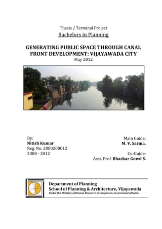
  • 1. Thesis / Terminal Project Bachelors in Planning GENERATING PUBLIC SPACE THROUGH CANAL FRONT DEVELOPMENT: VIJAYAWADA CITY May 2012 By: Main Guide: Nitish Kumar M. V. Sarma, Reg. No. 2080200012 2008 - 2012 Co-Guide: Asst. Prof. Bhaskar Gowd S. Department of Planning School of Planning & Architecture, Vijayawada Under the Ministry of Human Resource development, Government of India.
  • 2. (To be on Printed on SPAV Letterhead) CERTIFICATE This is to certify that the thesis titled “GENERATING PUBLIC SPACE THROUGH CANAL FRONT DEVELOPMENT: VIJAYAWADA CITY”, has been submitted by Mr. Nitish kumar (Reg. No. 2080200012, Batch 2008-12) at the Department of Planning, towards partial fulfillment of the requirements for the award of Bachelor’s Degree in Planning. This is a bonafide work of the student. ………………………………. …………………….………………. Dr. Ayon K. Tarafdar Main Guide: Head, Department of M. V. Sarma Planning Retired Assistant Planner VGTM UDA …………………………………….. Co-Guide: Bhaskar Gowd S. Date: 22nd June 2012 Assistant Professor Department of Planning Seal: i
  • 3. UNDERTAKING I, Mr. Nitish Kumar, the author of the thesis titled “GENERATING PUBLIC SPACE THROUGH CANAL FRONT DEVELOPMENT: VIJAYAWADA CITY”, hereby declare that this is an independent work of mine, carried out towards partial fulfillment of the requirements for the award o the Bachelor’s Degree in Planning at the Department of Planning, School of Planning and Architecture, Vijayawada. The work has not been submitted to any other organization / institution for the award of any Degree/Diploma. ………………….………………. Nitish Kumar Reg. No. 2080200012 2008-2012 Bachelor of Planning Department of Planning Date: 22nd June 2012 ii
  • 4. DISCLAIMER The content produced in the thesis report is an original piece of work and takes due acknowledgement of referred content, wherever applicable. The thoughts expressed herein remain the responsibility of the undersigned author and have no bearing on or does not represent those of School of Planning and Architecture, Vijayawada. ……………………….………………. Nitish Kumar Reg. No. 2080200012 2008-2012 Bachelor of Planning Department of Planning iii
  • 5. ACKNOWLEDGEMENT I have completed my thesis for bachelor degree with the help of my faculties, govt. authorities, my dearest friend and family members, without their this work was like to search water in the desert. First and foremost I offer my sincerest gratitude to my Main guide, M.V. Sarma, and co-guide, Bhaskar Gowd S., who have supported me throughout my thesis. I thank to the HOD of planning department Dr. Ayon K. Tarafdar and thesis coordinator Mr. Valliapan AL sir for his valuable suggestion, precious time for the discussion and his support in completion of this thesis. I would like to thank to the officers/staff of VGTMUDA, VMC and Irrigation department who helped me in the secondary data collection. I would like to express my gratitude to my friends and special thanks to Mr. Suraj Kumar, Mr. Amber Anand, Mr. Ajay Kumar, Mr. Rashid MKC, Mr. Rajiv R. Nair, Mr. Ashish Mohan, Miss. Sonika Rajput, Miss. Harshbir Kaur Dhaul and all my friends for their possible support in primary data collection and their suggestion to complete this thesis. I would like to thank to computer lab in charge Mr. Suresh and Mr. Mallesh to provide all printing materials on time and to Mr. Durga for his help. Finally I offer my sincerest gratitude to my parents and brothers for their love and their support which helped me to cross all the hurdles coming in my successful education life. iv
  • 6. ABSTRACT Vijayawada, Class 1 city having a population of 10, 48.000 (Census 2011) is the fast growing and the 3rd largest city in the state of Andhra Pradesh spread over the area 62 km2, spreading along northern side of the River Krishna. There are three canals in Vijayawada municipality namely Eluru canal, Ryves canal and Bandar canal. For the study purpose Ryves canal has been taken among 3 canals of the city. The purpose of the study is to generate more open space for the city people. Since as in the master plan 2021, only 0.61% (i.e. 38 Ha) of total municipal area was used for recreational purpose by 2004 and 3.33% (i.e. 205.82 Ha) of total municipal area will be used for recreational purpose by 2021. For the study, measurement survey on the land available along the canal berms has been carried out and different analysis like Landuse analysis, accessibility analysis and area analysis have been done. After that land allocation on the basis of different activities has been done. Along the Ryves canal common issues and problems were found like canal berms are converted in to a dump yard, berms encroached upon by poor people, stagnated water in canal becoming breeding grounds of mosquitoes, flies and other insects. This polluted canal water goes to agricultural land for irrigation purpose. Over all one can say that instead of giving benefit to the city people, canals are the cause for the degrading city environment. It is also the cause of health issues occurring among the city people. After this study total available land for the development along the canal is 37.17 Ha which includes 9.9 Ha of land as reclaimed land and rest land includes vacant land, developed parks and encroachments. Recreational area will increase by two times (i.e. from 38 Ha to 75.17 Ha) in other words recreational area will be 1.2 % of the total municipal area, in the proposed recreational space there will be 5% of increment. Other than this city would not have hazardous settlements along the Ryves canal, recreational spaces and some economic generating activities would be increased. This canal can be the medium for the social integration (i.e. integration of people coming from different region, religion, cast etc.). This development will also promote pedestrian movement by reducing the use of motorized vehicle. v
  • 7. CONTENTS Certificate i Undertaking Ii Disclaimer iii Acknowledgements iv Abstract v Contents vi List of Tables viii List of Figures viii List of Plates ix Chapter 1: Introduction 1 1.1 Importance of public space in urban areas 1 1.2 Canal front development 2 1.3 Introduction of Vijayawada 2 1.3.1 About the Vijayawada city 2 1.3.2 Location of Vijayawada city 2 1.3.3 History 3 1.3.4 Geography arrangement 3 1.3.5 Climatic condition 3 1.4 Canals of Vijayawada 4 1.5 Growth of the city 5 Chapter 2: Research Background 6 2.1 Need of the research 6 2.1.1 Lack of Recreational area 6 2.1.2 Underutilization of canal berms 6 2.1.3 Canal: causes of Disease of Vijayawada 7 2.1.4 Scorching summer climate 7 2.2 Potential of the city 7 2.3 Issues and Problems 8 Chapter 3: Aim, Objective and Methodology of the study 11 3.1 Aim 11 3.2 Objective 11 3.3 Methodology 12 Chapter 4: Literature study 13 4.1 Kuching waterfront, Sarawak, Malaysia 13 4.2 Sabarmati river front development, Ahmadabad city, India 14 4.3 Floating Market, Bangkok 17 vi
  • 8. 4.4 Conclusion 18 Chapter 5: Identification of the Potential Government land 19 5.1 Canal details 19 5.2 Surrounding Landuse detail along the canal 20 5.3 Existing Recreational area 22 5.4 Reason behind the selection of Ryves canal 22 5.5 Delineation of the study area 23 5.5.1 Existing area classification under the delineated study area 23 5.5.2 Existing slum settlements within the delineated area 26 5.5.3 Rehabilitation plan by VMC for the existing slum along Ryves canal 27 5.5.4 VAMBAY Scheme 29 Chapter 6: Analysis 30 6.1 Perspective behind the proposal 30 6.2 Available land along the canal for development 32 6.3 Slum Settlement analysis along the Ryves canal 41 Chapter 7: Proposals and Recommendations 42 7.1 Perspective behind the land allocation 42 7.2 Potential of developable land for different activities 42 7.3 Comparison: Existing Landuse vs. Proposed Landuse 45 7.4 Proposed activities: permitted and non-permitted 46 7.5 Overview of cost estimation 47 7.5.1 Market value of available land along the canal 47 7.5.2 Cost estimation for the land development 48 7.6 Boating in canal 49 7.7 Recommendation 50 vii
  • 9. LIST OF TABLES No. Table Title Page No. 1.1 Hydraulic particulars of all canals 4 2.1 Comparison between Vijayawada and Raipur city 6 5.1 Hydraulic particulars of all canals 20 5.2 Collection of revenue from the parks: Vijayawada 22 5.3 Stretch wise area calculation of Ryves canal 25 5.4 Stretch wise slum detail 26 5.5 Detail of Jakkampudi housing project (under JnNURM) 28 6.1 Proposed activities and their benefits for recreation purpose 31 6.2 Stretch wise area classification of land along the Ryves canal 33 6.3 Slum rehabilitation within the study area 41 7.1 Proposed area classification 44 7.2 Compared situation before and after the project 45 7.3 Proposed activities classification 46 7.4 Market value of available land along the canal 2011-12 47 7.5 Overview of the cost estimation for the land development 48 LIST OF FIGURES No. Figure Title Page No. 1.1 Location of Vijayawada 2 1.2 Canal network 4 3.1 Methodology diagram 12 5.1 Canal network 19 5.2 Surrounding Landuse detail along the Ryves canal 21 5.3 Existing area classification under the delineated study area 24 5.4 Percentage distribution of available land 25 5.5 Slum settlements along the Ryves canal 27 5.6 Location of Jakkampudi housing 28 5.7 Location of VAMBAY Colony project 29 6.1 Perspective diagram for proposal 30 6.2 Area classification without retaining wall: Existing 34 6.3 Area classification after retaining wall: Existing 34 6.4 Area analysis 35 6.5 Area analysis 36 6.6 Area analysis 37 6.7 Area analysis 38 6.8 Area analysis 39 6.9 Area analysis 40 7.1 Perspective diagram for land allocation 42 7.2 Identification of Potential land for the Development 43 7.3 Area classification: proposed 44 7.4 Proposed design of access point to the canal 49 viii
  • 10. LIST OF PLATES No. Figure Title Page No. 2.1.A Direct dumping of solid waste on the berms 9 2.1.B Direct dumping of solid waste on the berms 9 2.2.A Direct discharge of black water 9 2.2.B Direct discharge of city sewage 9 2.2.C Direct discharge of household waste 9 2.3.A Encroached shops 9 2.3.B Encroached shops 9 2.4.A Slum houses close to electric sub station 10 2.4.B Slum houses under the high tension line 10 4.1 Cross section of the developed land, Kuching waterfront 13 4.2 Proposed public space along the Sabarmati River Ahmadabad 15 4.3 Vibrant activities for recreation along Sabarmati river 16 4.4 Informal markets along the Sabarmati River 16 4.5 Klong Lad Mayom Floating Market, Bangkok 17 4.6 Bang Phli Floating Market, Bangkok 17 4.7 Floating Market, Damnoen Saduak, Thailand 18 Note: All photographs (plates) have been taken by the author unless until it is not mentioned. ix
  • 11. Generating Public Space Through Canal Front Development: Vijayawada City Chapter 1 Chapter 1: Introduction 1.1 Importance of public space in urban areas Urban area is more vibrant in terms of activities. Because of urbanisation, cities having high population densities, there is busy life, heavy traffic movement on roads, polluted urban environment, people having packed schedule. To minimise the stress full life of city dwellers it is necessary to have open spaces where people can spend some leisure time out of their busy or tiring life. Public places are the places where public communication and social interaction among large numbers of people occur. Their main role is being loci of socialization in the city and also they are the stages where alternative public cultures perform in the public realm of the city. They are dynamic urban spaces which are always subjected to transformations of the city and its inhabitants. Space created for public use where people can enter for individual or public interests without social discrimination. If well organised, it will help to enhance cohesion of community life, positively change the public behaviour, and increase the community awareness, promote individual identity and have a certain degree of local cultural meanings. Definition of public space: « Public space is, by definition, space used by those who do not individually control it » (Habraken, 1998) « The space that appears to the whole community » (Drummond, 2000) « The place that all residents have the right to use » (PuMiao, 2001) In conclusion, public spaces function as an element that links the places and people. Public spaces are always shared in use by the whole community. Nitish Kumar (Regn. no. 2080200012; B. Planning; Batch: 2008-2012) 1
  • 12. Generating Public Space Through Canal Front Development: Vijayawada City Chapter 1 1.2 Canal front development Before knowing canal front it is necessary to know what is waterfront. The answer is ‘’land abutting a body of water’’, water body can be pond, canal, river, ocean etc. in the same way the land abutting a canal is known as water front. To make canal front more active for the city people in terms of different activities is known as canal front development. 1.3 Introduction of Vijayawada 1.3.1 About the Vijayawada city It is the 3rd largest city of Andhra Pradesh, spread over 61.88 sqkm, with population of 10, 48,000 as per the Census- 2011 It is well connected by Air, domestic airport located at Gannavaram. It is the head quarter of South-Central railway and busiest and biggest railway station situated along Chennai-Howrah and Chennai-Delhi rail route. It is also well connected by road network to the rest of the nation by NH-5, NH-9 and NH-221. 1.3.2 Location of Vijayawada Figure1.1 Source: http://www.24point0.co m Source:http://maps.google.co.in Nitish Kumar (Regn. no. 2080200012; B. Planning; Batch: 2008-2012) 2
  • 13. Generating ublic Space Through Canal Front Development: Vijayawada City Chapter 1 1.3.3 History Settlements started during 5th or 6th A.D around the Indrakiladri hill. History tells that the vengi, chola, chalukya, kakathiyas&muslimdynesties gave their contribution in the growth of city around the hills near Krishna River. In 1800 A.D. britishers came and they constructed railway bridge across the River Krishna subsequently in 1855 they constructed Prakasham barrage & three canals for irrigation and navigation purpose and the rail bridge over the river Krishna in 1892. During 1888, Vijayawada was constituted as a Municipality and became Municipal Corporation in 1981. Today NH-5, NH-9, Krishna River and three canals (namely Eluru canal, Ryves canal and Bandar canal) are the backbones of the development of urban sprawl of Vijayawada. 1.3.4 Geography arrangement Vijayawada city is surrounded by the Krishna River on the southern side and by the Budameru River on the north. The northern and north-western parts of the city are covered by a low range of hills, while the central, south-western and north- eastern parts are covered by rich and fertile agriculture lands with three major irrigation canals. The topography of Vijayawada is flat, with a few small to medium sized hills. Three canals originated from Krishna River run through the city. Due to the presence of the Krishna River the soil around here is very fertile and cultivated intensively. Slope of the city is from west to east direction. 1.3.5 Climatic condition The climate is tropical, specifically a tropical wet and dry climate, with hot summers and moderate winters. The peak temperature reaches 47 °C (117 °F) in May–June, while the winter during december and january maximum temperature is about 29 °C and minimum temperature is about 19 °C. The average humidity is 78% and the average annual rainfall is 103 cm. Vijayawada gets its rainfall from both the south-west monsoon (from June to September) and north-east monsoon (October to Nitish Kumar (Regn. no. 2080200012; B. Planning; Batch: 2008-2012) 3
  • 14. Generating Public Space Through Canal Front Development: Vijayawada City Chapter 1 December). It's nicknamed "Blaze-wada" for its scorching summer heat by CattamanchiRamalinga Reddy. 1.4 Canals of Vijayawada There are three canals originating from the northern side of the Prakasham barrage reservoir, namely Eluru canal (~7.5 KM), Bandar canal (~8KM) and Ryves canal (~7 KM), run through the city. The Prakasham Barrage and canal channels were constructed in 1855 for the irrigation & navigation purpose. Figure 1.2: Canals Network: Eluru canal Krishna main canal Ryves canal Bandar canal KRISHNA RIVER source:Google earth Table 1.1, Hydraulic particulars of all Canals: Name of the Length within Width Depth Discharge in Sl no. canal Municipal limits (m) in m. in m. CUSECS K.E. Main canal 1,000 58.00 5.00 10,600 1 Eluru canal 7,500 18.29 3.63 1,643 2 Ryves canal 7,000 32.00 3.97 5,236 3 Bandar canal 8.000 24.38 3.68 5,007 Source: Irrigation Department, Vijayawada. There is a Prakasham barrage reservoir on the Northern bank of the River Krishna; from this reservoir Krishna eastern main canal is originated further this canal Nitish Kumar (Regn. no. 2080200012; B. Planning; Batch: 2008-2012) 4
  • 15. Generating Public Space Through Canal Front Development: Vijayawada City Chapter 1 divided in two three canals namely Eluru, Ryves and Bandar canal. Now a days these canals are using for irrigation purpose only. 1.5 Growth of the city The growth of the town during 1855 AD was along the bank of River Krishna abutting Indrakiladri hills around the temple of Lord Malleswara. During 1905 AD, the growth started along the canals and areas abutting Indrakiladri and Gandhi hills. The city grew further along the three canals with more growth along the Bandar road. As the city grew further along the Eluru roads towards Gunadala hills, because of better infrastructure and transportation facilities, it added many of the surrounding villages and the area of jurisdiction of the municipalities has increased from around 30 sqkm in 1888 to 58 sqkm in 2004. Nitish Kumar (Regn. no. 2080200012; B. Planning; Batch: 2008-2012) 5
  • 16. Generating Public Space Through Canal Front Development: Vijayawada City Chapter 2 Chapter 2: Research Background 2.1 Need of the Research 2.1.1 Lack of Recreational area As per the size of the city, it comes under the category class-I city. But as seen from the Zonal development plan-2021, approved for Vijayawada city zone (within municipal corporation limits as on 2006) there is lack of open spaces; only 3.33% of total area was shown for recreation purpose since no government lands available. Hence, to overcome the shortage of open space within corporation limits, it is identified that the city is having potential for development of recreation space in terms of the area under canals berms since 3 canals are passing through the city. Comparison with UDPFI: according to UDPFI 20-22% area of the large city should be used for the recreational purpose. In comparison to Raipur city, Vijayawada city is having very less percentage of recreational area i.e. it will be only 3.3 % as per the Master plan 2021. Table 2.1, Comparison between Vijayawada and Raipur Sl no. Population Total area Recreational area % Source area Raipur 1064045 10276 Ha 2168 Ha (21.1 %) CDP 2006-13 38 Ha. (0.61%) in 2004, Master plan Vijayawada 10,48,000 6188.10 Ha 205.82 Ha (3.33%) in 2021 2021 Note: Recreational spaces in Raipur: 211 Ha per 1000 persons; and in Vijayawada: 0.2 Ha per 1000 persons. 2.1.2 Underutilization of Canal berms The present scenario is such that the canal berms instead of giving benefits to the city, they became major cause for degrading the city environment as the canals are polluted due to the solid waste & sewage coming from city households as well as slums located on canal berms. Open berms are used by poor people for defecation as Nitish Kumar (Regn. no. 2080200012; B. Planning; Batch: 2008-2012) 6
  • 17. Generating Public Space Through Canal Front Development: Vijayawada City Chapter 2 well as they are using this berms for their living. Due to the lack of enforcement of law, poor people has encroached open land which is the major cause of forming hazardous slums along the canal berms. These slum people are directly discharging black water to the canal. 2.1.3 Canal: Cause of Diseases Due to the waste disposal, water get polluted which is the major cause of transmitted diseases i.e. diarrhea, malaria, filariasis, dengue fever, yellow fever etc. during off season stagnated water also the major cause for the breeding of mosquitoes & flies. This polluted water goes to agricultural land for irrigation purpose. While canal is being used for drinking purpose in downstream beyond the Municipal Corporation limits. Source: Health Department, Vijayawada Municipal Corporation 2.1.4 Scorching summer climate Since the climate is tropical wet and dry, with hot summers and moderate winters, city becomes heat island. Its nick name is ‘’Blaze-wada’’ for its scorching summer heat. People hesitate to spend some leaser time due to the lack of recreational area. Source: Master Plan of Vijayawada- 2021 2.2 Potential of the city City is bounded by Krishna River in southern side, Indrakiladri and Gunadala hills in western and eastern side respectively. Due to these natural barriers horizontal expansion of the city is limited. Even though Vijayawada city is fastest growing city in the state of Andhra Pradesh due to the presence of three canals, NH 5, NH 9 and its good road network. All these three canals can participate in the city growth after giving some following consideration. 1. Krishna River and three canals (namely Eluru canal, Ryves canal and Bandar canal) passing through the city are the backbones of the development of urban sprawl of Vijayawada. Nitish Kumar (Regn. no. 2080200012; B. Planning; Batch: 2008-2012) 7
  • 18. Generating Public Space Through Canal Front Development: Vijayawada City Chapter 2 2. Land abutting canals can be developed for the recreation purpose for the city people. 3. Availability of water in the canal is around 9 to 10 months in a year which can be used for boating. 4. Plantation and maintenance of berms can create fresh environment. 5. Easily accessible through roads. 6. Developed canal front can attract people from commercial and residential zones for their recreation purpose. 7. Since, Ryves canal is having high depth and widest canal among all available canals; it can be used for boating purpose. 2.3 Issues and Problems Due to the lack of waste management system, vacant land along the canal is used as a dumping site. Generally dumping wastes are coming from shops, households and small scale industries. There is direct discharge of city sewage in to the canals. Poor people are using canal berms for open defecation or for construction of small huts for their livelihoods. Poor people are encroached canal berms for the settlements. These slums are considered as hazardous slum by VMC authorities. These slums are prone to flood. Other than these problems there are some environmental issues like Canal creates unhygienic environment due to the degradation of organic waste existing in the canal and canal also becomes a breeding of mosquitoes, flies etc. Flooding of roads by sewage occurs due to encroachment, silting and solid waste dumping on the drainage channels, which leads to the canals in the city. The drains empty themselves in to the canals polluting the canals and also the environment along the canals. Nitish Kumar (Regn. no. 2080200012; B. Planning; Batch: 2008-2012) 8
  • 19. Generating Public Space Through Canal Front Development: Vijayawada City Chapter 2 Plate 2.1.A: Direct dumping Plate 2.1.B: Direct dumping of solid waste on the berms of solid waste on the berms Plate 2.2.A: Direct discharge Plate 2.2.B: Plate 2.2.C: Direct discharge of black water Direct discharge of household waste of city sewage Plate 2.3.A: Encroached shops (small Plate 2.3.B: Encroached shops (tailor, carpenter shops, blacksmith, painter bicycle repair shops, electronic shops, shops etc.) garment shops, book shops etc.) Nitish Kumar (Regn. no. 2080200012; B. Planning; Batch: 2008-2012) 9
  • 20. Generating Public Space Through Canal Front Development: Vijayawada City Chapter 2 Plate 2.4.A: Slum houses close to Plate 2.4.B: Slum houses under electric sub-station the high tension line Nitish Kumar (Regn. no. 2080200012; B. Planning; Batch: 2008-2012) 10
  • 21. Generating Public Space Through Canal Front Development: Vijayawada City Chapter 3 Chapter3: Aim, Objective and Methodology 3.1 Aim Enhance the share of public spaces by effective utilization of available government land along the canal by restoring the natural canal waterfront: Vijayawada 3.2 Objectives 1. Identification of the potential government land along the canal 2. Creation of usable open space for recreational purpose 3. Identify the suitable recreational facilities to be proposed on the developed land 3.3 Methodology Vijayawada as the case area has been selected because there are three canals. After that selection of stretch has been done based upon the width, location, surrounding activities etc. than area was delineated to carry out the study, in data collection has primary survey and secondary data collection has been done. After that in analysis mapping, identification of issues and problems, area analysis, surrounding Landuse analysis has been done. In next stage after identification of strategies proposal has been given. The Proposal consists for the development of land along the canal and the potential identification for different activities. Main idea behind the proposal is to provide vibrant recreational activities to the city people. Mainly proposal based for pedestrian and ecofriendly use of activities. Nitish Kumar (Regn. no. 2080200012; B. Planning; Batch: 2008-2012) 11
  • 22. Generating Public Space Through Canal Front Development: Vijayawada City Chapter 3 FIGURE 3.1 METHODOLOGY DIAGRAM Basis: Location, Width, Depth, Identification of potential govt. Selection of Case Area land Surrounding Landuse, Delineation of Canal Fronts Creation of usable Recreational Aim & Objectives (Land available in between space canal and adjacent road) Mapping: Landuse detail, Area Identification of suitable Selection of Stretch activities for developed land analysis, Ownership & Encroachments details Identification of Issues & Data Collection Primary (Landuse survey, Problems measurement survey) Secondary (data collection from Under utilization of land, Waste Analysis Irrigation dept. VMC, VGTMUDA, disposal, Encroachments, Revenue dept. Health issues etc. Proposals Construction of Recreational Revenue Generation Pedestrian lane Navigation Retaining Wall Areas Activities Commercial shops, Advertisements, Parks, Gardens, Footpath, Land filling Gaming Zones, Bar & Restaurants, Tree farming Jogging sport center Nitish Kumar (Regd. no. 2080200012; B. Planning; Batch: 2008-2012) 12
  • 23. Generating Public Space Through Canal Front Development: Vijayawada City Chapter 4 Chapter 4: Literature Study 4.1 Kuching waterfront, Sarawak, Malaysia Proposed landscape redevelopment for commercial riverside marketplace along Jalan Gambier (Source: http://fabserver.utm.my) Plate no 4.1 Cross section of the developed land, Kuching waterfront Kuching's waterfront is a significant commercial area where trading activities concentrated along Main Bazaar and Gambier Street areas on the south bank, with the Astana and Malay villages around it on the north bank of Sarawak River. This project studies the landscape redevelopment of the riverside marketplace to revitalize the environment for commercial, recreation and tourism benefits. The marketplace serves as Source: http://fabserver.utm.my public realm that displays local characters and helps to promote the place to outsider. However, the issue of duplication and homogenization of waterfronts have result the development do not fits well into the city and meets the needs of the people. Moreover, the marketplace faces traffic congestion, poor facilities and illegal structure construction, which Nitish Kumar (Regn. no. 2080200012; B. Planning; Batch: 2008-2012) 13
  • 24. Generating Public Space Through Canal Front Development: Vijayawada City Chapter 4 disturbs the visual quality of the place. The main objective of this redevelopment proposal is to strengthen the commercial and recreational activities which reflects character, social, culture and identity of the place. The design considers visual character and quality of the place as a riverside marketplace. Social and cultural events and festivals as well as history and architecture of the place are the important aspects of the design. The design concept is festive market which represents the positive cultural traits, trading activities for seasonal and diurnal times displaying a variety of daily and local products in the colonial buildings, Chinese shop houses and also the new amenities provided. The master plan comprises of three zones including transition area, dry market and wet market that reflects different characters and functions in each location. The design applies a metaphor of ripple originating at a square (Teluk Sampan) and the development spreads to east and west in Dayak art motives. The wet market is comprised of meat and vegetable markets and a traditional market. At the traditional market the spatial arrangement is derived from longhouse architecture where the apartment and loft stand for the market historic building, the gallery (Ruai) and (Barok) stand for the semi open market stores, and the deck (Tanju) stand for the open spaces towards the river. In addition, the extension bridges enclosed the jetty that served as viewing platform and linkage to the promenade. Finally, the lookout tower as a focal point at (Teluk Sampan) allowed viewing vistas to all over the waterfront compound. This project will revitalize the waterfront, enhance the quality of life and meet the demand of healthy environment for public involvement. 4.2 Sabarmati river front development, Ahmadabad city, India (Source: www.sabarmatiriverfront.com) The Sabarmati Riverfront Development Project began as an urban renewal project to significantly improve the spatial structure and habitat conditions of the river and adjoining areas. This project aims to transform Ahmedabad’s historic yet neglected river into a vibrant and vital focus for the city. Nitish Kumar (Regn. no. 2080200012; B. Planning; Batch: 2008-2012) 14
  • 25. Generating Public Space Through Canal Front Development: Vijayawada City Chapter 4 The development project encompasses both banks of the Sabarmati for a 10.5 kms Stretch, which creating approximately 185 hectares of reclaimed land. The project includes water management systems to minimize flooding in traditionally flood- prone areas and to clean up the Sabarmati with new sewage treatment infrastructure. A key element of the project is a new linear two-level promenade. Plate no: 4.2 Proposed public space along the Sabarmati River Ahmadabad Source: http://www.sabarmatiriverfront.com The Riverfront Development reclaims the banks of the Sabarmati, making the entire stretch of river publicly accessible. The project provides more than ten kilometers of uninterrupted pedestrian promenade on each bank and public Ghats for direct access to the water. Land reclaimed by riverfront development will largely be allocated for free and open public use; more than 85% of riverfront land will become public infrastructure, recreational parks, sports facilities, and vast new gardens. Parts of these public areas will include new space for cultural and civic institutions: including museums, monuments, performance venues, and exhibition space to significantly enhance the availability of civic amenities. The Sabarmati Riverfront will also permanently upgrade iconic informal markets, create vibrant new spaces for residents and tourists to converge, attend outdoor events, participate in water-related recreation, and enjoy leisure activities. Nitish Kumar (Regn. no. 2080200012; B. Planning; Batch: 2008-2012) 15
  • 26. Generating Public Space Through Canal Front Development: Vijayawada City Chapter 4 Plate no. 4.3 Vibrant activities for recreation along the Sabarmati River Source: http://www.sabarmatiriverfront.com The Sabarmati Riverfront Project will enhance the distinctive character of Ahmedabad, significantly improving the quality of life for residents and enhancing Ahmedabad’s value as a destination for new employers, institutions, investment, education opportunities, and tourism. Plate no. 4.4 Informal markets along the Sabarmati River http://www.sabarmatiriverfront.com The riverfront project creates intrinsic value for all residents of Ahmedabad by making the banks of the Sabarmati free and accessible to the public. The river banks will evolve continually, adapting to the diverse interests of a rapidly transforming city. Slum residents on the riverbed, once vulnerable to seasonal flooding, are being rehabilitated under direct supervision of the High Court of Gujarat, to permanent, titled housing units in communities within Ahmedabad city limits. The project is also Nitish Kumar (Regn. no. 2080200012; B. Planning; Batch: 2008-2012) 16
  • 27. Generating Public Space Through Canal Front Development: Vijayawada City Chapter 4 creating infrastructure to provide more organized facilities to informal markets that drive local trade. 4.3 Floating Market, Bangkok (Source: http://www.bangkok-city.com/shop/floatingmarket.html) Established more than 150 years ago by Chinese traders, the traditional floating market at Bang Phli is still going strong. Unlike some other examples in Thailand, this floating market has managed to escape the pressures of tourism and remain close to its roots. Rather than cheap souvenirs and Western snacks, visitors will find traditional Thai food here, as well as locally produced fruit and vegetables and other food products. Not many Westerners make it to the Bang Phli Floating Market, and this remains a real gem for visitors who are searching for the "real" Thailand. Plate no. 4.5 Klong Lad Mayom Plate no. 4.6 Bang Phli Floating Floating Market, Bangkok Market, Bangkok Source: http://www.bangkok-city.com Source: http://www.bangkok-city.com Nitish Kumar (Regn. no. 2080200012; B. Planning; Batch: 2008-2012) 17
  • 28. Generating Public Space Through Canal Front Development: Vijayawada City Chapter 4 Plate no.4.7 Floating Market, Damnoen Saduak, Thailand Source: http://www.masterfile.com/stock-photography 4.4 Conclusion After the study of all above case areas, it is clear that water bodies can be used for social purpose, along the Ryves canal vibrant activities can be developed for public use, which includes waterfront parks, pedestrian lane, markets, some activities for the generation revenue, boating etc. Development of land along the Ryves canal will helpful in social integration, cultural development, can change the character of the city. Nitish Kumar (Regn. no. 2080200012; B. Planning; Batch: 2008-2012) 18
  • 29. Generating Public Space Through Canal Front Development: Vijayawada City Chapter 5 Chapter 5: Identification of the Potential Government Land 5.1 Canal details: The Prakasham Barrage and canal channels were constructed in 1855 AD for the irrigation & navigation purpose.Krishna River section has been divided in to two section A) Krishna Eastern bank river section and B) Krishna Western bank river section. From Krishna western bank river section, Buckingham canal is originating which goes to Chennai and from Krishna bank river section three canals are originating i.e. Eluru canal (~7.5 KM), Bandar canal (~8KM) and Ryves canal (~7 KM), run through the city. Figure 5.1: Showing Canal Network: Source: google earth Nitish Kumar (Regn. no. 2080200012; B. Planning; Batch: 2008-2012) 19
  • 30. Generating Public Space Through Canal Front Development: Vijayawada City Chapter 5 Table 5.1, Hydraulic particulars of all Canals: Name of the Length within Width Depth in Discharge in Sl no. canal municipal limits (m) in m. m. CUSECS K.E. Main canal 1,000 58.00 5.00 10,600 1 Eluru canal 7,250 18.29 3.63 1,643 2 Ryves canal 7,000 32.00 3.97 5,236 3 Bandar canal 6,600 24.38 3.68 5,007 Source: Irrigation Department, Vijayawada. Among all three canals Ryves canal is having highest depth, width and with highest water discharge, this canal is passing through the core area with major land use i.e. Residential and commercial Landuse (Figure 5.2). This canal is accessible by roads. Parcel of lands along the canal is occupied by slum people 5.2 Surrounding Landuse detail along the Ryves canal One town and two town area is known as major retail commercial zone in the city. Autonagar is known for workshop and production of Automobiles. Residential Landuse is dominant in the other parts of the city (Figure 5.2). Due to the presence of hills and Krishna River in southern part city has limited land for the expansion of the city or one can say that presence of hills and Krishna River restrict the growth of Vijayawada even though this city is politically active and 3 rd largest city of the state. Three canals namely Eluru, Ryves and Bandar canal and NH 5 & 9 are the backbone for the growth of the city. Among all three canals, Ryves canal is passing through the core area of the city with major Landuse of commercial and Residential. Maximum lands abutting canal is either occupied by slums or used as dumping place. Few plots are developed as park which is not properly maintained. Total length of the canal coming under municipal area is around 7 km: which can be divided in to three zones (Figure 5.2) under which around 2 km of canal length is passes through the major commercial zone; around 2.2 km of canal is passes through residential zone and rest 2.8 km length is mainly occupied by slum people. This canal is accessible by roads. Nitish Kumar (Regn. no. 2080200012; B. Planning; Batch: 2008-2012) 20