Najafgarh Jheel (Lake) Revival, Delhi (India)

Najafgarh Jheel & Najafgarh drain is historical water body existing since the times of the Mughals on the south-west periphery of Delhi City (India)Najfafgarh lake, Najafgarh marsh or Najafgarh jheel (Jheel in Hindi means a lake) used to be a vast lake in the South West of Delhi in India near the town of Najafgarh from which it takes its name, it was connected to the river Yamuna by a natural shallow nullah or drain called the Najafgarh nullah. However after the 1960s the Flood Control Department of Delhi kept widening the Najfagarh drain and eventually quickly drained the once huge and ecologically rich Najafgarh lake completely.It was also a major source of ground water recharge for entire Delhi. Over the period of time and due to urbanization, this revulate got converted into a drain due to constant release of untreated waste from the surrounding areas and the industries. The draining of this vast lake affected the entire climate of this important region that is India’s capital territory of Delhi and its neighborhood, it also led to the underground water-table going down leading to water scarcity for this densely populated region.

Recommandé
Recommandé
Contenu connexe
Tendances
Tendances (20)
En vedette
En vedette (20)
Similaire à Najafgarh Jheel (Lake) Revival, Delhi (India)
Similaire à Najafgarh Jheel (Lake) Revival, Delhi (India) (20)
Plus de Purushottam Uttarwar
Plus de Purushottam Uttarwar (9)
Dernier
Dernier (20)
Najafgarh Jheel (Lake) Revival, Delhi (India)
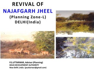
- 1. REVIVAL OF NAJAFGARH JHEEL (Planning Zone-L) DELHI(India) P.S.UTTARWAR, Adviser (Planning) DELHI DEVELOPMENT AUTHORITY New Delhi ,India (psuttarwar@gmail.com)
- 3. BACKGROUND • Najafgarh Jheel & Najafgarh drain is historical water body existing since the times of the Mughals on the south-west periphery of Delhi City (India) • Najfafgarh lake, Najafgarh marsh or Najafgarh jheel (Jheel in Hindi means a lake) used to be a vast lake in the South West of Delhi in India near the town of Najafgarh from which it takes its name, it was connected to the river Yamuna by a natural shallow nullah or drain called the Najafgarh nullah. • However after the 1960s the Flood Control Department of Delhi kept widening the Najfagarh drain and eventually quickly drained the once huge and ecologically rich Najafgarh lake completely.
- 4. • Rainwater accumulating in the Najafgarh lake or jheel basin had been recorded to have occupied more than 300 square kilometers in many years before its unfortunate draining. • It was also a major source of ground water recharge for entire Delhi. • Over the period of time and due to urbanization, this revulate got converted into a drain due to constant release of untreated waste from the surrounding areas and the industries. • The draining of this vast lake affected the entire climate of this important region that is India’s capital territory of Delhi and its neighborhood, it also led to the underground water-table going down leading to water scarcity for this densely populated region.
- 5. • The complete draining of the lake caused the great loss of a rich wetland ecosystem and wildlife habitat and led to the water-table in the entire region to go down which has in turn led to the area becoming more and more arid. • If such natural water body and the drain is revived it can recharge the ground water of large parts of North, South & West Delhi to the large extent.
- 6. PRESENT STATUS • At present the Najafgarh Jheel and Najafgarh drain is highly polluted and periphery of the natural Najafgarh Jheel is shrinking fast. • Part of this Najafgarh Jheel also falls in Haryana State (Gurgaon). • If timely efforts are not taken, this natural body will vanish in near future due to encroachment and growth of villages in the surrounding area. • Before the unfortunate complete draining of this lake in the 1960s by widening of the Najafgarh drain by the Flood control and irrigation department of Delhi the lake in many years filledup a depression more than 300 sq.km. in rural Delhi. It had an extremely rich wetland ecosystem forming a refuge for vast quantities of water birds and local wildlife.
- 7. • It is the Indian Capital’s most polluted water body due to direct inflow of untreated sewage from surrounding populated areas. • A January 2005 report by the Central Pollution Control Board clubs this drain with 13 other highly polluted wetlands under category ‘D’ for assessing the water quality of wetlands in wildlife habitats. • Recognizing the importance of this natural body, the Zonal Plan for Zone – L has made provision under para 2.14.
- 8. PROVISIONS OF MPD-2021 “PRESENT WATER AVAILABILITY The Delhi Jal Board has an installed capacity of 805 MGD against which on an average 800 to 820 MGD potable water is expected to be produced by optimization of Water Treatment Plants. PRESENT WATER DEMAND The present water demand for potable water in Delhi has been assessed as 990 MGD @ 60 gpcd for all uses. No allowance is made for use of potable water for parks & lawns/horticulture/agriculture purposes due to water shortage. PROJECTED WATER DEMAND IN 2021 The Delhi Jal Board anticipates that by the year 2021 about 1380 MGD potable water@ 60 gpcd for a population of 230 lacs shall be required. However, the DDA has projected the 2021 water demand as 1840 MGD @ 80 gpcd”.
- 9. PROVISIONS OF ZONAL DEVELOPMENT PLAN 2.14 Water bodies and revival of Najafgarh Jheel “In the zone there about 58 urban villages, out of which 21 fall in the area designated as the green belt. Almost in all the villages either in the extended Lal Dora or within the distance of 1.52 km. from the abadi area village pond are existing. These water bodies have been indicated on the zonal plan and are proposed to be conserved as per the directions of the court and the policy framed of developing water bodies and the green area falls around. Low lying area in the revenue village of Raota, Gumanhera, Jainpur, Shikarpur, & jhatikara measuring about 356 Ha. (890 acres) adjoining Najafgarh Drain has potentially for the developing it as a lake which is to be utilized for the recreational activities as well as water recharging area. The development of the lake shall be taken up in a comprehensive manner by Govt. of Delhi, MCD, DDA along with the Haryana Urban Development Authority as part of the area of the proposed lake is falling in the Haryana Tourist infrastructure would be permitted on the banks of lake/artificial islands”.
- 10. Issues Involved There is a need to formulate the purpose and scope of the detail study, the following initial parameters are suggested below for such study. a) Delineation of the boundary of natural water body in view of the proposed boundary by the ZDP for Zone – L on the basis of contour study and water basin etc. b) The catchment area of the Najafgarh Jheel and Najafgarh drain. c) Some re-charge area around Najafgarh Jheel and Najafgarh drain and its buffer zone. d) Periphery control zone to desired land uses. In order to stop the pollution of natural water body and drain. e) Study and conservation of flora and funa. f) Study and conservation of wild life.
- 11. Newspaper Clipping regarding Scarcity of Water in adjoining Dwarka Zone K-II
- 12. All plans are co-ordinated with sector plans in an elaborated procedure. Sector planning in environmental protection and natural resource management is likewise far developed. Here also the spatial dimension is appropriately considered. The approach of river co-operatives managing water resources in one watershed is one example. Another example is the spatial planning tool of the Water Protection Zones which exists over 40 years. BEST PRACTICES IN GERMANY - Water Protection Zones
- 13. BEST PRACTICES IN GERMANY - Water Protection Zones
- 14. This planning tool regulates the use of lands with important functions mainly for water supply. Protected are groundwater resources near wells serving potable water supply systems but also surface waters. Within a Water Protection Zone all activities that eventually may lead to contamination of waters are regulated, eventually prohibited. The zones are classified according to the protection need expressed in percolation distance from the source to be protected. In the strictest protection Zone even access is prohibited (only allowed to the workers of the waterworks). Another example are sites for industrial development (large scale industrial development) offered by the State in form of a State Development Plan. BEST PRACTICES IN GERMANY - Water Protection Zones
- 15. Google Earth Imagery (Year 2012)
- 16. Google Earth Imagery (Year 2013)
- 17. Google Earth Imagery (Year 2014)