2. • Ocean: >3 million sq km
– Pacific, Atlantic, Indian, Arctic
– all are actually connected
• Sea:<3 million sq km, partly
enclosed by land
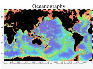
3. Measuring Ocean Depth:
• First done with knotted ropes
• later, sonar (SOund NAvigation
Ranging) used sound waves
• most ocean mapping now done
with satellites
6. Marine Geology
• Many seafloor features are
caused by plate tectonics; others
by erosion and deposition
• 2 sections of seafloor
– 1. ocean basin: deep; oceanic
crust
7. • 2. continental margins:
shallow; cont. crust covered
by water
–active margins: have a trench
or MOR
–passive margins: none
10. Passive Margin (Atlantic-Type Margin)
• continental margin moving away from the
mid-ocean spreading center;
• these margins have no mountain building
activities;
• get thick sediment deposits here that cover
up the oceanic crust and the boundary
between oceanic and continental crust
12. Active Margin (Pacific-Type Margin)
•
•
•
•
•
•
continental margin is moving toward a subduction zone; is marked by active
volcanoes, many earthquakes, and young mountains and elevation of land
(because overlying plate is pushed up by subducting plate)
oceanic crust and overlying sediment are partially melted at an active margin as
plate is pulled downward;
continents can grow here as ocean-bottom structures melt and weld onto the
continental plate and as volcanoes erupt and spew lava
area of intense earthquakes because friction builds up when upper plate scraps
across subducting plate (like a up-down transform fault); strain on the rocks
build up and eventually the rocks fail (get a fault zone)
where subducting plate is old, cold and dense, it sinks into the mantle as a
steeply dipping slab (occurs in western Pacific) -- can get volcanic activity here
that will create new, small spreading centers (back-arc spreading centers);
continental plate will retreat from these small spreading centers (low stress
convergence)
where subducting plate is young, warm and buoyant, slab dips at a gentle angle,
resulting in volcanic activity that erupts on land; continental plate will advance
here (high stress convergence)
19. • 2. Continental slope: steep
boundary between oceanic
(thin) and continental (thick)
crust
– active margin: slope ends at
trench
20. • 3. Continental rise: gently
sloping, thick pile of sediments
at base of continental slope
– passive margins only
21. • Submarine Canyon: deep cut
at right angle to shelf
– may be a drowned river valley
– may be formed by fast-moving
currents that create landslides
that erode the canyon
23. B. Ocean Basin
• 5. Abyssal plains: flat, thick
layers of sediments.
• 6. Abyssal hills: small hills;
probably parts of crust not yet
covered by sediments.
28. • MOR’s have active hydrothermal
vents or “black smokers” where
mineral-rich, superheated water
comes out
• site of chemosynthetic ecosystems
where life is not based on sunlight
but on the chemicals in the water