SlideShare a Scribd company logo
1 of 35
Air and Waste Management Association Professional Development Course AIR-257: Satellite Detection of Aerosols Concepts and Theory Instructor: Rudolf Husar, Ph.D. Professor of Mechanical Engineering Washington University, St. Louis, MO October 25, 2004, 9:00 a.m. - 12:00 p.m.  Asheville, NC
Syllabus ,[object Object],[object Object],[object Object],[object Object],[object Object],[object Object],[object Object]
Radiation detected by satellites ,[object Object],[object Object],[object Object],[object Object]
Just like the human eye, satellite sensors detect the total amount of solar radiation that is reflected from the earth’s surface ( R o ) and backscattered  by the atmosphere from aerosol, pure air, and clouds. A simplified expression for the relative radiatioin detected by a satellite sensor (I/I o ) is: I / I o  = R o  e -    + (1- e -  ) P Satellite Detection of Aerosols Today, geo-synchronous and polar orbiting satellites can detect different aspects of aerosols over the globe daily. where    is the aerosol optical thickness and P the angular light scattering probability.
SeaWiFS Satellite Platform and Sensors ,[object Object],[object Object],[object Object],Chlorophyll Absorption Designed for Vegetation Detection Swath 2300 KM 24/day Polar Orbit: ~ 1000 km, 100 min. Equator Crossing: Local Noon
Key aerosol microphysical parameters Particle size and size distribution Aerosol particles > 1   m in size are produced by windblown dust and sea salt from  sea spray and bursting bubbles. Aerosols  smaller than 1   m are mostly formed by  condensation processes such as conversion of sulfur dioxide (SO 2 ) gas to sulfate  particles and by formation of soot and smoke during burning processes Effective radius Moment of size distribution weighted by particle area and number density distribution Complex refractive index The real part mainly affects scattering and the imaginary part mainly affects absorption Particle shape Aerosol particles can be liquid or solid, and therefore spherical or nonspherical. The most common nonspherical particles are dust and cirrus
Key aerosol optical parameters Optical depth  negative logarithm of the direct-beam transmittance  column integrated measure of the amount of extinction (absorption + scattering) Single-scattering albedo   0  given an interaction between a photon and a particle, the probability that the photon is scattered in some direction, rather than absorbed Scattering phase function  probability per unit solid angle that a photon is scattered into a particular  direction relative to the direction of the incident beam Angstrom exponent    exponent of power law representation of extinction vs. wavelength
Remote Sensing Overview ,[object Object],[object Object],[object Object],[object Object],[object Object],[object Object],[object Object],[object Object],[object Object],[object Object]
Remote Sensing Applications to be Covered in this Course ,[object Object],[object Object],[object Object],[object Object],[object Object],[object Object],[object Object],[object Object],[object Object],[object Object],[object Object],[object Object],[object Object],[object Object],[object Object],[object Object]
[object Object],[object Object],[object Object],The Electromagnetic Spectrum Michael D. King, EOS Senior Project Scientist
Atmospheric Absorption in the Wavelength Range from 0-15 µm Michael D. King, EOS Senior Project Scientist
Generalized Spectral Reflectance Envelopes for Deciduous and Coniferous Trees Michael D. King, EOS Senior Project Scientist
Typical Spectral Reflectance Curves for Vegetation, Soil, and Water Michael D. King, EOS Senior Project Scientist
Different Types of Reflectors Specular reflector (mirror) diffuse reflector (lambertian) nearly diffuse reflector Nearly Specular reflector (water) E. Vermote, 2002 Hot spot reflection
Sun glint as seen by MODIS Hot hot-spot over dense vegetation E. Vermote, 2002
Scattering of Sunlight by the Earth-Atmosphere-Surface System A = radiation transmitted through the atmosphere and reflected by the surface B = radiation scattered by the atmosphere and reflected by the surface C = radiation scattered by the atmosphere and into the ‘radiometer’ G = radiation transmitted through the atmosphere, reflected by background objects, and subsequently reflected by the surface towards the ‘radiometer’ I = ‘adjacency effect’ of reflectance from a surface outside the field of view of the sensor into its field of view Michael D. King, EOS Senior Project Scientist
Solar Energy Paths
Aerosol and Surface Radiative Transfer   ,[object Object],[object Object],[object Object],[object Object],I 0   – Intensity of   the incoming radiation.  R 0 -  surface reflectance. Depends on surface type as well as the incoming and outgoing angles  R-  surface reflectance sensed at the top of the atmosphere as perturbed by the atmosphere P  - aerosol angular reflectance function; includes absorption,  P =  ω  p
Apparent Surface Reflectance, R ,[object Object],[object Object],Aerosol as Reflector:  R a  = ( e -  –  1 )  P R =  ( R 0  +  ( e -  –  1 )  P )  e -  Aerosol as Filter:  T a  =  e -  Surface reflectance  R 0 ,[object Object],[object Object],[object Object],[object Object]
Apparent Surface Reflectance, R   Aerosols will increase the apparent surface reflectance, R,  if  P/R 0  < 1.  For this reason, the reflectance of ocean and dark vegetation increases with τ. When  P/R 0  > 1,  aerosols will decrease the surface reflectance. Accordingly, the brightness of clouds is reduced by overlying aerosols.  At  P~ R 0  the reflectance is unchanged by haze aerosols (e.g. soil and vegetation at 0.8 um). .   At large τ (radiation equilibrium), both dark and bright surfaces asymptotically approach the ‘aerosol reflectance’, P  The critical parameter whether aerosols will increase or decrease the apparent reflectance, R,  is the ratio of aerosol angular reflectance,  P,  to bi-directional surface reflectance,  R 0 , P/ R 0
Reduced Reflectance Reflectance Reflectance Increased Reflectance
Loss of Contrast The aerosol τ can also be estimated from the loss of surface contrast.  Whether contrast decays fast or slow with increasing τ depends on the ratio of aerosol to surface reflectance,  P/ R 0 Note: For horizontal vision against the horizon sky, P/R 0  = 1,   contrast decays exponentially with τ,  C/C 0 =e -τ .
Obtaining Aerosol Optical Thickness from Excess Reflectance The perturbed surface reflectance, R, can be used to derive the the aerosol optical thickness, τ , provided that the true surface reflectance R 0  and the aerosol reflectance function, P are known. The excess reflectance due to aerosol is : R- R 0  = (P- R 0 )(1-e - τ ) and the optical depth is: For a black surface, R 0  =0 and optically thin aerosol, τ < 0.1, τ is proportional to excess radiance, τ =R/P. For τ > 0.1, the full logarithmic expression is needed. As R 0  increases, the same excess reflectance corresponds to increasing values of τ.  When R 0  ~P the aerosol τ can not be retrieved since the excess reflectance is zero. For R 0  > P, the surface reflectance actually decreases with τ, so τ could be retrieved from the loss of reflectance, e.g. over bright clouds. The value of P is derived from fitting the observed and retrieved surface reflectance spectra. For summer light haze at 0.412 μm, P=0.38. Accurate and automatic retrieval of the relevant aerosol P is the most difficult part of the co-retrieval process. Iteratively calculating P from the estimated  τ( λ) is one possibility.
Aerosol Effects on Surface Color and Surface Effects on Aerosol Color ,[object Object]
Aerosol Effect on Surface Color and Surface Effect on Aerosol ,[object Object],[object Object],[object Object],[object Object],[object Object]
SeaWiFS Images and Spectra at Four Wavelengths  (Click on the Images to View) At  blue (0.412)  wavelength, the  haze reflectance dominates  over land surface reflectance. The surface features are obscured by haze. Air scattering (not included) would add further reflectance in the blue. The  blue  wavelength  is well suited for aerosol detection over land  but surface detection is difficult.  At  green (0.555)  over land, the  haze is reduced and the vegetation reflectance is increased . The surface features are obscured by haze but discernable. Due to the low reflectance of the sea, haze reflectance dominates. The green not well suited for haze detection over land but appropriate for haze detection over the ocean and for the detection of surface features. At  red (0.67)  wavelength over land, dark vegetation is distinctly different from brighter yellow-gray soil. The surface features, particularly water (R 0 <0.01), vegetation (R 0 <0.04), and  soil (R 0 <0.30) are are easily distinguishable. Haze reflectance dominates over the ocean. Hence, the  red is suitable for haze detection over dark vegetation and the ocean  as well as for surface detection over land. In the  near IR (0.865)  over land, the surface reflectance is uniformly high (R 0 >0.30) over both vegetation and soil and  haze is not discernable . Water is completely dark (R 0 <0.01) making land and water clearly distinguishable. The excess haze reflectance over land is barely perceptible but measurable over water. Hence, the near IR is suitable for haze detection over water and land-water differentiation.
Aerosol effects on surface color and Surface effects on aerosol color The image was synthesized from the  blue  (0.412 μm),  green  (0.555 μm), and  red  (0.67 μm) channels of the 8 channel SeaWiFS sensor.  Air scattering has been removed to highlight the haze and surface reflectance.
Preprocessing ,[object Object],[object Object],[object Object],[object Object],[object Object],[object Object]
General Approach:  Co-Retrieval of Surface and Aerosol Reflectance ,[object Object],[object Object],[object Object],[object Object],[object Object],[object Object]
Approach – Time Series Analysis ,[object Object],[object Object],[object Object],[object Object],[object Object]
Methodology – Cloud shadows ,[object Object],[object Object],[object Object],[object Object]
Methodology – Preliminary anchor days ,[object Object],[object Object],[object Object],[object Object]
Results – Seasonal surface reflectance, Eastern US April 29, 2000, Day 120 July 18, 2000,  Day 200 October 16, 2000,  Day 290
Results – Eight month animation
Retrieval Procedures ,[object Object],[object Object],[object Object],[object Object]

More Related Content

What's hot

. Atmospheric window and reflectance curve
. Atmospheric window and  reflectance curve. Atmospheric window and  reflectance curve
. Atmospheric window and reflectance curve
marutiChilame
 

What's hot (19)

Spectral signatures
Spectral signaturesSpectral signatures
Spectral signatures
 
Surveying ii ajith sir class6
Surveying ii ajith sir class6Surveying ii ajith sir class6
Surveying ii ajith sir class6
 
Remote Sensing
Remote SensingRemote Sensing
Remote Sensing
 
Surveying ii ajith sir class3
Surveying ii ajith sir class3Surveying ii ajith sir class3
Surveying ii ajith sir class3
 
Remote Sensing
Remote SensingRemote Sensing
Remote Sensing
 
Introduction to Remote Sensing
Introduction to Remote SensingIntroduction to Remote Sensing
Introduction to Remote Sensing
 
Microwave remote sensing
Microwave remote sensingMicrowave remote sensing
Microwave remote sensing
 
Microwave remote sensing
Microwave remote sensingMicrowave remote sensing
Microwave remote sensing
 
.remote sensing.Ece 402 unit-2
.remote sensing.Ece 402 unit-2.remote sensing.Ece 402 unit-2
.remote sensing.Ece 402 unit-2
 
ENERGY INTERACTIONS WITH EARTH SURFACE FEATURES
 ENERGY INTERACTIONS WITH EARTH SURFACE FEATURES  ENERGY INTERACTIONS WITH EARTH SURFACE FEATURES
ENERGY INTERACTIONS WITH EARTH SURFACE FEATURES
 
Chapter 1 (Introduction to remote sensing)
Chapter 1 (Introduction to remote sensing)Chapter 1 (Introduction to remote sensing)
Chapter 1 (Introduction to remote sensing)
 
INTRODUCTION TO REMOTE SENSING
 INTRODUCTION TO REMOTE SENSING INTRODUCTION TO REMOTE SENSING
INTRODUCTION TO REMOTE SENSING
 
Remote sensing
Remote sensingRemote sensing
Remote sensing
 
Atmospheric windows
Atmospheric windowsAtmospheric windows
Atmospheric windows
 
chapter2: Remote sensing
chapter2: Remote sensingchapter2: Remote sensing
chapter2: Remote sensing
 
. Atmospheric window and reflectance curve
. Atmospheric window and  reflectance curve. Atmospheric window and  reflectance curve
. Atmospheric window and reflectance curve
 
Scattering
ScatteringScattering
Scattering
 
Remote sensing
Remote sensingRemote sensing
Remote sensing
 
L3 emr
L3 emrL3 emr
L3 emr
 

Viewers also liked

what is atmosphere by mehrabudin wakman
what is atmosphere by mehrabudin wakmanwhat is atmosphere by mehrabudin wakman
what is atmosphere by mehrabudin wakman
Mehrabudin Wakman
 
7.3 star groups
7.3 star groups7.3 star groups
7.3 star groups
mojavehack
 
PriorInformationSupportedAerosolOpticalDepthRetrievalUsingGeostationarySatell...
PriorInformationSupportedAerosolOpticalDepthRetrievalUsingGeostationarySatell...PriorInformationSupportedAerosolOpticalDepthRetrievalUsingGeostationarySatell...
PriorInformationSupportedAerosolOpticalDepthRetrievalUsingGeostationarySatell...
grssieee
 
2.3 theory of plate tectonics
2.3 theory of plate tectonics2.3 theory of plate tectonics
2.3 theory of plate tectonics
mojavehack
 
Eumetsat 09 2005(30mb+) 2
Eumetsat 09 2005(30mb+) 2Eumetsat 09 2005(30mb+) 2
Eumetsat 09 2005(30mb+) 2
guestaf9e3
 
6.4 condensed characteristics atmosphere review
6.4 condensed characteristics atmosphere review6.4 condensed characteristics atmosphere review
6.4 condensed characteristics atmosphere review
mojavehack
 
Remote Sensing of Aerosols
Remote Sensing of AerosolsRemote Sensing of Aerosols
Remote Sensing of Aerosols
Kalaivanan Murthy
 
Optical properties of nanomaterials
Optical properties of nanomaterialsOptical properties of nanomaterials
Optical properties of nanomaterials
udhay roopavath
 

Viewers also liked (15)

what is atmosphere by mehrabudin wakman
what is atmosphere by mehrabudin wakmanwhat is atmosphere by mehrabudin wakman
what is atmosphere by mehrabudin wakman
 
Haze removal for a single remote sensing image based on deformed haze imaging...
Haze removal for a single remote sensing image based on deformed haze imaging...Haze removal for a single remote sensing image based on deformed haze imaging...
Haze removal for a single remote sensing image based on deformed haze imaging...
 
Atmoshpheric effect on remote sensing data
Atmoshpheric effect on remote sensing dataAtmoshpheric effect on remote sensing data
Atmoshpheric effect on remote sensing data
 
7.3 star groups
7.3 star groups7.3 star groups
7.3 star groups
 
PriorInformationSupportedAerosolOpticalDepthRetrievalUsingGeostationarySatell...
PriorInformationSupportedAerosolOpticalDepthRetrievalUsingGeostationarySatell...PriorInformationSupportedAerosolOpticalDepthRetrievalUsingGeostationarySatell...
PriorInformationSupportedAerosolOpticalDepthRetrievalUsingGeostationarySatell...
 
Scientific platforms
Scientific platformsScientific platforms
Scientific platforms
 
2.3 theory of plate tectonics
2.3 theory of plate tectonics2.3 theory of plate tectonics
2.3 theory of plate tectonics
 
Eumetsat 09 2005(30mb+) 2
Eumetsat 09 2005(30mb+) 2Eumetsat 09 2005(30mb+) 2
Eumetsat 09 2005(30mb+) 2
 
6.4 condensed characteristics atmosphere review
6.4 condensed characteristics atmosphere review6.4 condensed characteristics atmosphere review
6.4 condensed characteristics atmosphere review
 
Raleigh and Mie scattering in remote sensing,
Raleigh and Mie scattering in remote sensing,Raleigh and Mie scattering in remote sensing,
Raleigh and Mie scattering in remote sensing,
 
Meterology
MeterologyMeterology
Meterology
 
Remote Sensing of Aerosols
Remote Sensing of AerosolsRemote Sensing of Aerosols
Remote Sensing of Aerosols
 
Microwaves Applications
Microwaves ApplicationsMicrowaves Applications
Microwaves Applications
 
Intro to GIS and Remote Sensing
Intro to GIS and Remote SensingIntro to GIS and Remote Sensing
Intro to GIS and Remote Sensing
 
Optical properties of nanomaterials
Optical properties of nanomaterialsOptical properties of nanomaterials
Optical properties of nanomaterials
 

Similar to 2004-10-14 AIR-257: Satellite Detection of Aerosols Concepts and Theory

2005-02-01 Co-Retrieval of Aerosol Color and Surface Color from SeaWiFS Satel...
2005-02-01 Co-Retrieval of Aerosol Color and Surface Color from SeaWiFS Satel...2005-02-01 Co-Retrieval of Aerosol Color and Surface Color from SeaWiFS Satel...
2005-02-01 Co-Retrieval of Aerosol Color and Surface Color from SeaWiFS Satel...
Rudolf Husar
 
2004-10-03 Co-retrieval of Aerosol and Surface Reflectance: Analysis of Daily...
2004-10-03 Co-retrieval of Aerosol and Surface Reflectance: Analysis of Daily...2004-10-03 Co-retrieval of Aerosol and Surface Reflectance: Analysis of Daily...
2004-10-03 Co-retrieval of Aerosol and Surface Reflectance: Analysis of Daily...
Rudolf Husar
 
2005-12-05 Aerosol Characterization Using the SeaWiFS Sensor and Surface Data
2005-12-05 Aerosol Characterization Using the SeaWiFS Sensor and Surface Data2005-12-05 Aerosol Characterization Using the SeaWiFS Sensor and Surface Data
2005-12-05 Aerosol Characterization Using the SeaWiFS Sensor and Surface Data
Rudolf Husar
 
Interaction between electromagnetic radiation and matter
Interaction between electromagnetic radiation and matterInteraction between electromagnetic radiation and matter
Interaction between electromagnetic radiation and matter
Abdullah Khan
 
Emr intraction with atmosphere
Emr intraction with atmosphereEmr intraction with atmosphere
Emr intraction with atmosphere
Rahat Hasan
 
Madagascar2011 - 07 - OTB radiometry processing
Madagascar2011 - 07 -  OTB radiometry processingMadagascar2011 - 07 -  OTB radiometry processing
Madagascar2011 - 07 - OTB radiometry processing
otb
 

Similar to 2004-10-14 AIR-257: Satellite Detection of Aerosols Concepts and Theory (20)

Co Retriaval2
Co Retriaval2Co Retriaval2
Co Retriaval2
 
2005-02-01 Co-Retrieval of Aerosol Color and Surface Color from SeaWiFS Satel...
2005-02-01 Co-Retrieval of Aerosol Color and Surface Color from SeaWiFS Satel...2005-02-01 Co-Retrieval of Aerosol Color and Surface Color from SeaWiFS Satel...
2005-02-01 Co-Retrieval of Aerosol Color and Surface Color from SeaWiFS Satel...
 
2004-10-03 Co-retrieval of Aerosol and Surface Reflectance: Analysis of Daily...
2004-10-03 Co-retrieval of Aerosol and Surface Reflectance: Analysis of Daily...2004-10-03 Co-retrieval of Aerosol and Surface Reflectance: Analysis of Daily...
2004-10-03 Co-retrieval of Aerosol and Surface Reflectance: Analysis of Daily...
 
061018 Sea Wi Fs Work
061018 Sea Wi Fs Work061018 Sea Wi Fs Work
061018 Sea Wi Fs Work
 
2005-12-05 Aerosol Characterization Using the SeaWiFS Sensor and Surface Data
2005-12-05 Aerosol Characterization Using the SeaWiFS Sensor and Surface Data2005-12-05 Aerosol Characterization Using the SeaWiFS Sensor and Surface Data
2005-12-05 Aerosol Characterization Using the SeaWiFS Sensor and Surface Data
 
2 Intro RS.pdf
2 Intro RS.pdf2 Intro RS.pdf
2 Intro RS.pdf
 
Emr and atmosphere
Emr and atmosphereEmr and atmosphere
Emr and atmosphere
 
07 big skyearth_dlr_7_april_2016
07 big skyearth_dlr_7_april_201607 big skyearth_dlr_7_april_2016
07 big skyearth_dlr_7_april_2016
 
Interaction between electromagnetic radiation and matter
Interaction between electromagnetic radiation and matterInteraction between electromagnetic radiation and matter
Interaction between electromagnetic radiation and matter
 
Emr intraction with atmosphere
Emr intraction with atmosphereEmr intraction with atmosphere
Emr intraction with atmosphere
 
Madagascar2011 - 07 - OTB radiometry processing
Madagascar2011 - 07 -  OTB radiometry processingMadagascar2011 - 07 -  OTB radiometry processing
Madagascar2011 - 07 - OTB radiometry processing
 
Unit iv remote sensing
Unit iv remote sensingUnit iv remote sensing
Unit iv remote sensing
 
6 f-radiation-absorptions
6 f-radiation-absorptions6 f-radiation-absorptions
6 f-radiation-absorptions
 
Basic of Remote Sensing
Basic of Remote SensingBasic of Remote Sensing
Basic of Remote Sensing
 
APPLICATION OF REMOTE SENSING AND GIS IN AGRICULTURE
APPLICATION OF REMOTE SENSING AND GIS IN AGRICULTUREAPPLICATION OF REMOTE SENSING AND GIS IN AGRICULTURE
APPLICATION OF REMOTE SENSING AND GIS IN AGRICULTURE
 
Geoinformatics(nce 402)
Geoinformatics(nce 402)Geoinformatics(nce 402)
Geoinformatics(nce 402)
 
remote sensing-converted.pptx
remote sensing-converted.pptxremote sensing-converted.pptx
remote sensing-converted.pptx
 
Solar radiation saliter 1306770119596
Solar radiation saliter 1306770119596Solar radiation saliter 1306770119596
Solar radiation saliter 1306770119596
 
Remote sensing concept, history and principles
Remote sensing  concept, history and principlesRemote sensing  concept, history and principles
Remote sensing concept, history and principles
 
Radar
RadarRadar
Radar
 

More from Rudolf Husar

100528 satellite obs_china_husar
100528 satellite obs_china_husar100528 satellite obs_china_husar
100528 satellite obs_china_husar
Rudolf Husar
 
2013-04-30 EE DSS Approach and Demo
2013-04-30 EE DSS Approach and Demo2013-04-30 EE DSS Approach and Demo
2013-04-30 EE DSS Approach and Demo
Rudolf Husar
 
130205 epa exc_event_seminar
130205 epa exc_event_seminar130205 epa exc_event_seminar
130205 epa exc_event_seminar
Rudolf Husar
 
130205 epa ee_presentation_subm
130205 epa ee_presentation_subm130205 epa ee_presentation_subm
130205 epa ee_presentation_subm
Rudolf Husar
 
111018 geo sif_aq_interop
111018 geo sif_aq_interop111018 geo sif_aq_interop
111018 geo sif_aq_interop
Rudolf Husar
 
110823 solta11 intro
110823 solta11 intro110823 solta11 intro
110823 solta11 intro
Rudolf Husar
 
110823 data fed_solta11
110823 data fed_solta11110823 data fed_solta11
110823 data fed_solta11
Rudolf Husar
 
110510 aq co_p_network
110510 aq co_p_network110510 aq co_p_network
110510 aq co_p_network
Rudolf Husar
 
110509 aq co_p_solta
110509 aq co_p_solta110509 aq co_p_solta
110509 aq co_p_solta
Rudolf Husar
 
110421 exploration of_pm_networks_and_data_over_the_us-_aqs_and_views
110421 exploration of_pm_networks_and_data_over_the_us-_aqs_and_views110421 exploration of_pm_networks_and_data_over_the_us-_aqs_and_views
110421 exploration of_pm_networks_and_data_over_the_us-_aqs_and_views
Rudolf Husar
 
110410 aq user_req_methodology_sydney_subm
110410 aq user_req_methodology_sydney_subm110410 aq user_req_methodology_sydney_subm
110410 aq user_req_methodology_sydney_subm
Rudolf Husar
 
110408 aq co_p_uic_sydney_husar
110408 aq co_p_uic_sydney_husar110408 aq co_p_uic_sydney_husar
110408 aq co_p_uic_sydney_husar
Rudolf Husar
 
110105 htap pilot_aqco_p_esip_dc
110105 htap pilot_aqco_p_esip_dc110105 htap pilot_aqco_p_esip_dc
110105 htap pilot_aqco_p_esip_dc
Rudolf Husar
 
100615 htap network_brussels
100615 htap network_brussels100615 htap network_brussels
100615 htap network_brussels
Rudolf Husar
 
121117 eedss briefing_nasa_epa
121117 eedss briefing_nasa_epa121117 eedss briefing_nasa_epa
121117 eedss briefing_nasa_epa
Rudolf Husar
 
120910 nasa satellite_outline
120910 nasa satellite_outline120910 nasa satellite_outline
120910 nasa satellite_outline
Rudolf Husar
 
120612 geia closure_ofeo_ms_soa_subm
120612 geia closure_ofeo_ms_soa_subm120612 geia closure_ofeo_ms_soa_subm
120612 geia closure_ofeo_ms_soa_subm
Rudolf Husar
 
110414 extreme dustsmokesulfate
110414 extreme dustsmokesulfate110414 extreme dustsmokesulfate
110414 extreme dustsmokesulfate
Rudolf Husar
 
Aq Gci Infrastructure
Aq Gci InfrastructureAq Gci Infrastructure
Aq Gci Infrastructure
Rudolf Husar
 

More from Rudolf Husar (20)

100528 satellite obs_china_husar
100528 satellite obs_china_husar100528 satellite obs_china_husar
100528 satellite obs_china_husar
 
2013-04-30 EE DSS Approach and Demo
2013-04-30 EE DSS Approach and Demo2013-04-30 EE DSS Approach and Demo
2013-04-30 EE DSS Approach and Demo
 
Exceptional Event Decision Support System Description
Exceptional Event Decision Support System DescriptionExceptional Event Decision Support System Description
Exceptional Event Decision Support System Description
 
130205 epa exc_event_seminar
130205 epa exc_event_seminar130205 epa exc_event_seminar
130205 epa exc_event_seminar
 
130205 epa ee_presentation_subm
130205 epa ee_presentation_subm130205 epa ee_presentation_subm
130205 epa ee_presentation_subm
 
111018 geo sif_aq_interop
111018 geo sif_aq_interop111018 geo sif_aq_interop
111018 geo sif_aq_interop
 
110823 solta11 intro
110823 solta11 intro110823 solta11 intro
110823 solta11 intro
 
110823 data fed_solta11
110823 data fed_solta11110823 data fed_solta11
110823 data fed_solta11
 
110510 aq co_p_network
110510 aq co_p_network110510 aq co_p_network
110510 aq co_p_network
 
110509 aq co_p_solta
110509 aq co_p_solta110509 aq co_p_solta
110509 aq co_p_solta
 
110421 exploration of_pm_networks_and_data_over_the_us-_aqs_and_views
110421 exploration of_pm_networks_and_data_over_the_us-_aqs_and_views110421 exploration of_pm_networks_and_data_over_the_us-_aqs_and_views
110421 exploration of_pm_networks_and_data_over_the_us-_aqs_and_views
 
110410 aq user_req_methodology_sydney_subm
110410 aq user_req_methodology_sydney_subm110410 aq user_req_methodology_sydney_subm
110410 aq user_req_methodology_sydney_subm
 
110408 aq co_p_uic_sydney_husar
110408 aq co_p_uic_sydney_husar110408 aq co_p_uic_sydney_husar
110408 aq co_p_uic_sydney_husar
 
110105 htap pilot_aqco_p_esip_dc
110105 htap pilot_aqco_p_esip_dc110105 htap pilot_aqco_p_esip_dc
110105 htap pilot_aqco_p_esip_dc
 
100615 htap network_brussels
100615 htap network_brussels100615 htap network_brussels
100615 htap network_brussels
 
121117 eedss briefing_nasa_epa
121117 eedss briefing_nasa_epa121117 eedss briefing_nasa_epa
121117 eedss briefing_nasa_epa
 
120910 nasa satellite_outline
120910 nasa satellite_outline120910 nasa satellite_outline
120910 nasa satellite_outline
 
120612 geia closure_ofeo_ms_soa_subm
120612 geia closure_ofeo_ms_soa_subm120612 geia closure_ofeo_ms_soa_subm
120612 geia closure_ofeo_ms_soa_subm
 
110414 extreme dustsmokesulfate
110414 extreme dustsmokesulfate110414 extreme dustsmokesulfate
110414 extreme dustsmokesulfate
 
Aq Gci Infrastructure
Aq Gci InfrastructureAq Gci Infrastructure
Aq Gci Infrastructure
 

Recently uploaded

Finding Java's Hidden Performance Traps @ DevoxxUK 2024
Finding Java's Hidden Performance Traps @ DevoxxUK 2024Finding Java's Hidden Performance Traps @ DevoxxUK 2024
Finding Java's Hidden Performance Traps @ DevoxxUK 2024
Victor Rentea
 
Cloud Frontiers: A Deep Dive into Serverless Spatial Data and FME
Cloud Frontiers:  A Deep Dive into Serverless Spatial Data and FMECloud Frontiers:  A Deep Dive into Serverless Spatial Data and FME
Cloud Frontiers: A Deep Dive into Serverless Spatial Data and FME
Safe Software
 
Modular Monolith - a Practical Alternative to Microservices @ Devoxx UK 2024
Modular Monolith - a Practical Alternative to Microservices @ Devoxx UK 2024Modular Monolith - a Practical Alternative to Microservices @ Devoxx UK 2024
Modular Monolith - a Practical Alternative to Microservices @ Devoxx UK 2024
Victor Rentea
 
+971581248768>> SAFE AND ORIGINAL ABORTION PILLS FOR SALE IN DUBAI AND ABUDHA...
+971581248768>> SAFE AND ORIGINAL ABORTION PILLS FOR SALE IN DUBAI AND ABUDHA...+971581248768>> SAFE AND ORIGINAL ABORTION PILLS FOR SALE IN DUBAI AND ABUDHA...
+971581248768>> SAFE AND ORIGINAL ABORTION PILLS FOR SALE IN DUBAI AND ABUDHA...
?#DUbAI#??##{{(☎️+971_581248768%)**%*]'#abortion pills for sale in dubai@
 
Architecting Cloud Native Applications
Architecting Cloud Native ApplicationsArchitecting Cloud Native Applications
Architecting Cloud Native Applications
WSO2
 
Cloud Frontiers: A Deep Dive into Serverless Spatial Data and FME
Cloud Frontiers:  A Deep Dive into Serverless Spatial Data and FMECloud Frontiers:  A Deep Dive into Serverless Spatial Data and FME
Cloud Frontiers: A Deep Dive into Serverless Spatial Data and FME
Safe Software
 

Recently uploaded (20)

Finding Java's Hidden Performance Traps @ DevoxxUK 2024
Finding Java's Hidden Performance Traps @ DevoxxUK 2024Finding Java's Hidden Performance Traps @ DevoxxUK 2024
Finding Java's Hidden Performance Traps @ DevoxxUK 2024
 
ICT role in 21st century education and its challenges
ICT role in 21st century education and its challengesICT role in 21st century education and its challenges
ICT role in 21st century education and its challenges
 
DEV meet-up UiPath Document Understanding May 7 2024 Amsterdam
DEV meet-up UiPath Document Understanding May 7 2024 AmsterdamDEV meet-up UiPath Document Understanding May 7 2024 Amsterdam
DEV meet-up UiPath Document Understanding May 7 2024 Amsterdam
 
Strategies for Landing an Oracle DBA Job as a Fresher
Strategies for Landing an Oracle DBA Job as a FresherStrategies for Landing an Oracle DBA Job as a Fresher
Strategies for Landing an Oracle DBA Job as a Fresher
 
Cloud Frontiers: A Deep Dive into Serverless Spatial Data and FME
Cloud Frontiers:  A Deep Dive into Serverless Spatial Data and FMECloud Frontiers:  A Deep Dive into Serverless Spatial Data and FME
Cloud Frontiers: A Deep Dive into Serverless Spatial Data and FME
 
[BuildWithAI] Introduction to Gemini.pdf
[BuildWithAI] Introduction to Gemini.pdf[BuildWithAI] Introduction to Gemini.pdf
[BuildWithAI] Introduction to Gemini.pdf
 
Corporate and higher education May webinar.pptx
Corporate and higher education May webinar.pptxCorporate and higher education May webinar.pptx
Corporate and higher education May webinar.pptx
 
Apidays New York 2024 - The Good, the Bad and the Governed by David O'Neill, ...
Apidays New York 2024 - The Good, the Bad and the Governed by David O'Neill, ...Apidays New York 2024 - The Good, the Bad and the Governed by David O'Neill, ...
Apidays New York 2024 - The Good, the Bad and the Governed by David O'Neill, ...
 
DBX First Quarter 2024 Investor Presentation
DBX First Quarter 2024 Investor PresentationDBX First Quarter 2024 Investor Presentation
DBX First Quarter 2024 Investor Presentation
 
Modular Monolith - a Practical Alternative to Microservices @ Devoxx UK 2024
Modular Monolith - a Practical Alternative to Microservices @ Devoxx UK 2024Modular Monolith - a Practical Alternative to Microservices @ Devoxx UK 2024
Modular Monolith - a Practical Alternative to Microservices @ Devoxx UK 2024
 
Apidays New York 2024 - Passkeys: Developing APIs to enable passwordless auth...
Apidays New York 2024 - Passkeys: Developing APIs to enable passwordless auth...Apidays New York 2024 - Passkeys: Developing APIs to enable passwordless auth...
Apidays New York 2024 - Passkeys: Developing APIs to enable passwordless auth...
 
Exploring Multimodal Embeddings with Milvus
Exploring Multimodal Embeddings with MilvusExploring Multimodal Embeddings with Milvus
Exploring Multimodal Embeddings with Milvus
 
+971581248768>> SAFE AND ORIGINAL ABORTION PILLS FOR SALE IN DUBAI AND ABUDHA...
+971581248768>> SAFE AND ORIGINAL ABORTION PILLS FOR SALE IN DUBAI AND ABUDHA...+971581248768>> SAFE AND ORIGINAL ABORTION PILLS FOR SALE IN DUBAI AND ABUDHA...
+971581248768>> SAFE AND ORIGINAL ABORTION PILLS FOR SALE IN DUBAI AND ABUDHA...
 
Web Form Automation for Bonterra Impact Management (fka Social Solutions Apri...
Web Form Automation for Bonterra Impact Management (fka Social Solutions Apri...Web Form Automation for Bonterra Impact Management (fka Social Solutions Apri...
Web Form Automation for Bonterra Impact Management (fka Social Solutions Apri...
 
CNIC Information System with Pakdata Cf In Pakistan
CNIC Information System with Pakdata Cf In PakistanCNIC Information System with Pakdata Cf In Pakistan
CNIC Information System with Pakdata Cf In Pakistan
 
Apidays New York 2024 - Scaling API-first by Ian Reasor and Radu Cotescu, Adobe
Apidays New York 2024 - Scaling API-first by Ian Reasor and Radu Cotescu, AdobeApidays New York 2024 - Scaling API-first by Ian Reasor and Radu Cotescu, Adobe
Apidays New York 2024 - Scaling API-first by Ian Reasor and Radu Cotescu, Adobe
 
Architecting Cloud Native Applications
Architecting Cloud Native ApplicationsArchitecting Cloud Native Applications
Architecting Cloud Native Applications
 
AWS Community Day CPH - Three problems of Terraform
AWS Community Day CPH - Three problems of TerraformAWS Community Day CPH - Three problems of Terraform
AWS Community Day CPH - Three problems of Terraform
 
Exploring the Future Potential of AI-Enabled Smartphone Processors
Exploring the Future Potential of AI-Enabled Smartphone ProcessorsExploring the Future Potential of AI-Enabled Smartphone Processors
Exploring the Future Potential of AI-Enabled Smartphone Processors
 
Cloud Frontiers: A Deep Dive into Serverless Spatial Data and FME
Cloud Frontiers:  A Deep Dive into Serverless Spatial Data and FMECloud Frontiers:  A Deep Dive into Serverless Spatial Data and FME
Cloud Frontiers: A Deep Dive into Serverless Spatial Data and FME
 

2004-10-14 AIR-257: Satellite Detection of Aerosols Concepts and Theory

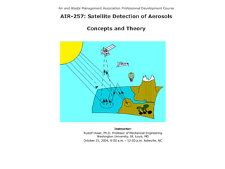
  • 1. Air and Waste Management Association Professional Development Course AIR-257: Satellite Detection of Aerosols Concepts and Theory Instructor: Rudolf Husar, Ph.D. Professor of Mechanical Engineering Washington University, St. Louis, MO October 25, 2004, 9:00 a.m. - 12:00 p.m. Asheville, NC
  • 2.
  • 3.
  • 4. Just like the human eye, satellite sensors detect the total amount of solar radiation that is reflected from the earth’s surface ( R o ) and backscattered by the atmosphere from aerosol, pure air, and clouds. A simplified expression for the relative radiatioin detected by a satellite sensor (I/I o ) is: I / I o = R o e -  + (1- e -  ) P Satellite Detection of Aerosols Today, geo-synchronous and polar orbiting satellites can detect different aspects of aerosols over the globe daily. where  is the aerosol optical thickness and P the angular light scattering probability.
  • 5.
  • 6. Key aerosol microphysical parameters Particle size and size distribution Aerosol particles > 1  m in size are produced by windblown dust and sea salt from sea spray and bursting bubbles. Aerosols smaller than 1  m are mostly formed by condensation processes such as conversion of sulfur dioxide (SO 2 ) gas to sulfate particles and by formation of soot and smoke during burning processes Effective radius Moment of size distribution weighted by particle area and number density distribution Complex refractive index The real part mainly affects scattering and the imaginary part mainly affects absorption Particle shape Aerosol particles can be liquid or solid, and therefore spherical or nonspherical. The most common nonspherical particles are dust and cirrus
  • 7. Key aerosol optical parameters Optical depth  negative logarithm of the direct-beam transmittance  column integrated measure of the amount of extinction (absorption + scattering) Single-scattering albedo  0  given an interaction between a photon and a particle, the probability that the photon is scattered in some direction, rather than absorbed Scattering phase function  probability per unit solid angle that a photon is scattered into a particular direction relative to the direction of the incident beam Angstrom exponent   exponent of power law representation of extinction vs. wavelength
  • 8.
  • 9.
  • 10.
  • 11. Atmospheric Absorption in the Wavelength Range from 0-15 µm Michael D. King, EOS Senior Project Scientist
  • 12. Generalized Spectral Reflectance Envelopes for Deciduous and Coniferous Trees Michael D. King, EOS Senior Project Scientist
  • 13. Typical Spectral Reflectance Curves for Vegetation, Soil, and Water Michael D. King, EOS Senior Project Scientist
  • 14. Different Types of Reflectors Specular reflector (mirror) diffuse reflector (lambertian) nearly diffuse reflector Nearly Specular reflector (water) E. Vermote, 2002 Hot spot reflection
  • 15. Sun glint as seen by MODIS Hot hot-spot over dense vegetation E. Vermote, 2002
  • 16. Scattering of Sunlight by the Earth-Atmosphere-Surface System A = radiation transmitted through the atmosphere and reflected by the surface B = radiation scattered by the atmosphere and reflected by the surface C = radiation scattered by the atmosphere and into the ‘radiometer’ G = radiation transmitted through the atmosphere, reflected by background objects, and subsequently reflected by the surface towards the ‘radiometer’ I = ‘adjacency effect’ of reflectance from a surface outside the field of view of the sensor into its field of view Michael D. King, EOS Senior Project Scientist
  • 18.
  • 19.
  • 20. Apparent Surface Reflectance, R Aerosols will increase the apparent surface reflectance, R, if P/R 0 < 1. For this reason, the reflectance of ocean and dark vegetation increases with τ. When P/R 0 > 1, aerosols will decrease the surface reflectance. Accordingly, the brightness of clouds is reduced by overlying aerosols. At P~ R 0 the reflectance is unchanged by haze aerosols (e.g. soil and vegetation at 0.8 um). . At large τ (radiation equilibrium), both dark and bright surfaces asymptotically approach the ‘aerosol reflectance’, P The critical parameter whether aerosols will increase or decrease the apparent reflectance, R, is the ratio of aerosol angular reflectance, P, to bi-directional surface reflectance, R 0 , P/ R 0
  • 21. Reduced Reflectance Reflectance Reflectance Increased Reflectance
  • 22. Loss of Contrast The aerosol τ can also be estimated from the loss of surface contrast. Whether contrast decays fast or slow with increasing τ depends on the ratio of aerosol to surface reflectance, P/ R 0 Note: For horizontal vision against the horizon sky, P/R 0 = 1, contrast decays exponentially with τ, C/C 0 =e -τ .
  • 23. Obtaining Aerosol Optical Thickness from Excess Reflectance The perturbed surface reflectance, R, can be used to derive the the aerosol optical thickness, τ , provided that the true surface reflectance R 0 and the aerosol reflectance function, P are known. The excess reflectance due to aerosol is : R- R 0 = (P- R 0 )(1-e - τ ) and the optical depth is: For a black surface, R 0 =0 and optically thin aerosol, τ < 0.1, τ is proportional to excess radiance, τ =R/P. For τ > 0.1, the full logarithmic expression is needed. As R 0 increases, the same excess reflectance corresponds to increasing values of τ. When R 0 ~P the aerosol τ can not be retrieved since the excess reflectance is zero. For R 0 > P, the surface reflectance actually decreases with τ, so τ could be retrieved from the loss of reflectance, e.g. over bright clouds. The value of P is derived from fitting the observed and retrieved surface reflectance spectra. For summer light haze at 0.412 μm, P=0.38. Accurate and automatic retrieval of the relevant aerosol P is the most difficult part of the co-retrieval process. Iteratively calculating P from the estimated τ( λ) is one possibility.
  • 24.
  • 25.
  • 26. SeaWiFS Images and Spectra at Four Wavelengths (Click on the Images to View) At blue (0.412) wavelength, the haze reflectance dominates over land surface reflectance. The surface features are obscured by haze. Air scattering (not included) would add further reflectance in the blue. The blue wavelength is well suited for aerosol detection over land but surface detection is difficult. At green (0.555) over land, the haze is reduced and the vegetation reflectance is increased . The surface features are obscured by haze but discernable. Due to the low reflectance of the sea, haze reflectance dominates. The green not well suited for haze detection over land but appropriate for haze detection over the ocean and for the detection of surface features. At red (0.67) wavelength over land, dark vegetation is distinctly different from brighter yellow-gray soil. The surface features, particularly water (R 0 <0.01), vegetation (R 0 <0.04), and soil (R 0 <0.30) are are easily distinguishable. Haze reflectance dominates over the ocean. Hence, the red is suitable for haze detection over dark vegetation and the ocean as well as for surface detection over land. In the near IR (0.865) over land, the surface reflectance is uniformly high (R 0 >0.30) over both vegetation and soil and haze is not discernable . Water is completely dark (R 0 <0.01) making land and water clearly distinguishable. The excess haze reflectance over land is barely perceptible but measurable over water. Hence, the near IR is suitable for haze detection over water and land-water differentiation.
  • 27. Aerosol effects on surface color and Surface effects on aerosol color The image was synthesized from the blue (0.412 μm), green (0.555 μm), and red (0.67 μm) channels of the 8 channel SeaWiFS sensor. Air scattering has been removed to highlight the haze and surface reflectance.
  • 28.
  • 29.
  • 30.
  • 31.
  • 32.
  • 33. Results – Seasonal surface reflectance, Eastern US April 29, 2000, Day 120 July 18, 2000, Day 200 October 16, 2000, Day 290
  • 34. Results – Eight month animation
  • 35.