SlideShare une entreprise Scribd logo
1  sur  24
Télécharger pour lire hors ligne
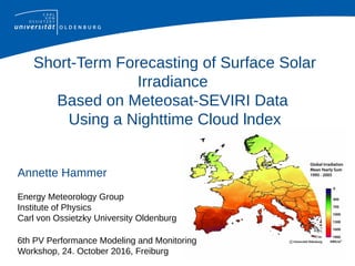
Short-Term Forecasting of Surface Solar
Irradiance
Based on Meteosat-SEVIRI Data
Using a Nighttime Cloud lndex
Annette Hammer
Energy Meteorology Group
Institute of Physics
Carl von Ossietzky University Oldenburg
6th PV Performance Modeling and Monitoring
Workshop, 24. October 2016, Freiburg
Overview
1. Motivation and aim
2. Define cloud classes in brightness temperature
difference images
3. Derivation of cloud index for each cloud class
4. Validation
5. Summary
2
Motivation
Satellite images are operationally used to forecast surface
solar irradiance within the next hours:
1. Meteosat Second generation
HRVIS images
(300-700nm, 1km*1km)
1. Heliosat Method:
cloud index → solar irradiance
2. Cloud motion vectors
3
Cloudindex n(VIS)
2014-11-02 0600 UTC
?
at night no HRVIS information
--> short term forecasting only possible after sunrise
4
Aim: define a nighttime cloud index!

Meteosat infrared channels (here 10.8 and 3.9 µm)
Effective Brightness Temperatures T10.8, T3.9
and their Difference BTD=T3.9 − T10.8

well known quantities in nighttime cloud and fog
detection

up to now not used to calculate a cloud index
(Note: BTD is different for day and night, T3.9 consists
of reflected solar and emitted thermal radiation) 5
BTD image observations
6
BTD image observations
limb cooling
7
BTD image observations
Noise: very cold clouds
8
BTD image observations
Noise: very cold clouds
Fog and Low Stratus
9
Observations

Cloud free land and cloud free ocean surfaces
have a similar shade of grey

limb cooling

Fog and low stratus look dark

Other clouds look bright

Very cold thick clouds show noise (opaque ==
high cloud index)
10
Satellite viewing angle correction (BTD→BTD*)
Shift of peaks:
limb cooling
11
Cloud classes in BTD*-histogram
P
cloud
free
other cloudsFLS
- δ -
12
Definition of cloud classes in BTD* image
P: Position of cloud free ocean or land peak in BTD* frequency distribution
13
Map T10.8 or BTD* to cloud index n

For each cloud class a different transformation is used
cloud free: nnight = 0
FLS: nnight = f1(BTD*)
other: nnight = f2(T10.8)
very cold: nnight = f3(T10.8)

night values are related to cloud index values a few hours later,

not pixel-by-pixel but statistically regarding their cumulative
frequenqy distributions
14
Illustration of transformation
Illustration: map T10.8 to cloud index n
F3 (T10.8) N3 (nday)
15
Map T10.8 / BTD* to cloud index n
1. Cumulative frequency distributions
2. Transformation that maps each T10.8 / BTD* value to
the daytime cloud index with the same quantile
F1 (BTD*) ≡ N1 (nday)
F3 (T10.8) ≡ N3 (nday)
nnight = f1 (BTD*) = (N1) ¹⁻ F1 (BTD*)
nnight = f3 (T10.8) = (N3) ¹⁻ F3 (BTD*)
16
Transformations f1(BTD*) and f3(T10.8)
FLS f1 very cold f3
17
Training of transformations f1, f2 and f3
f1(BTD*) for fog and low stratus and
f3(T10.8) for very cold clouds
have been trained in months with a lot of such clouds
(f1: April 2013, 29 nights and f2: Feb 2013, 15 nights)
f2(T10.8) for other clouds
is taken from yesterday for today, to follow seasonal
temperature changes
18
Cloudindex n(VIS)
2014-11-02 0600 UTC
Composite
Cloudindex n(BTD) Cloudindex n(VIS)
2014-11-02 0600 UTC
?
19
Validation
Quality of daytime cloud index can be validated with
global horiziontal irradiance (compare result of
Heliosat method with measurements)
But: Nighttime cloud index can not be validated in this
way → Validate forecasted irradiance!
20
Germany, 116 stations, Sep 2014 to Feb 2015,
hourly values of global horizontal irradiance
21
Summary
With a nighttime cloud index it is possible to forecast
global horizontal irradiance for the next hours before
sunrise
Effective brightness temperature values and brightness
temperature differences are used to classify clouds
and are mapped to cloud index values with a
statistical transformation (QuantileQuantilePlot)
For three cloud classes such transformations have been
developed 22
Reference
Hammer, A.; Kühnert, J.; Weinreich, K.; Lorenz, E.:
Short-Term Forecasting of Surface Solar Irradiance Based on
Meteosat-SEVIRI Data Using a Nighttime Cloud Index.
Remote Sensing, 2015, 7, 9070-9090; doi:10.3390/rs70709070
23
Acknowledgements
This work has been supported by the German Federal Environmental
Foundation DBU (Deutsche Bundesstiftung Umwelt) and the German
Federal Ministry of Economics and Technology BMWi (Bundesministerium
für Wirtschaft und Technologie). We thank the German Weather Service
(DWD) and meteogroup GmbH for providing global horizontal irradiance
measurement data.
24

Contenu connexe

Tendances

Notarnicola_TH2_TO4.2.ppt
Notarnicola_TH2_TO4.2.pptNotarnicola_TH2_TO4.2.ppt
Notarnicola_TH2_TO4.2.pptgrssieee
 
Snow accumulation and ge neration
Snow accumulation and ge nerationSnow accumulation and ge neration
Snow accumulation and ge nerationYuanhui Chen
 
Dengue Vector Population Forecasting Using Multisource Earth Observation Prod...
Dengue Vector Population Forecasting Using Multisource Earth Observation Prod...Dengue Vector Population Forecasting Using Multisource Earth Observation Prod...
Dengue Vector Population Forecasting Using Multisource Earth Observation Prod...University of Pavia
 
cloud_futures_2.0_Papazachos
cloud_futures_2.0_Papazachoscloud_futures_2.0_Papazachos
cloud_futures_2.0_PapazachosGeorge Spyrou
 
OpenLayers Feature Frenzy
OpenLayers Feature FrenzyOpenLayers Feature Frenzy
OpenLayers Feature FrenzyAndreas Hocevar
 
2018 GIS in Development: Grass GIS Striking Terrain Visualizations in the Roc...
2018 GIS in Development: Grass GIS Striking Terrain Visualizations in the Roc...2018 GIS in Development: Grass GIS Striking Terrain Visualizations in the Roc...
2018 GIS in Development: Grass GIS Striking Terrain Visualizations in the Roc...GIS in the Rockies
 
4_Presentation.DE+EnVA.20110727.ppt
4_Presentation.DE+EnVA.20110727.ppt4_Presentation.DE+EnVA.20110727.ppt
4_Presentation.DE+EnVA.20110727.pptgrssieee
 
OL3-Cesium: 3D for OpenLayers maps
OL3-Cesium: 3D for OpenLayers mapsOL3-Cesium: 3D for OpenLayers maps
OL3-Cesium: 3D for OpenLayers mapsAndreas Hocevar
 
Manning_3D_Cloud_AGU_Poster
Manning_3D_Cloud_AGU_PosterManning_3D_Cloud_AGU_Poster
Manning_3D_Cloud_AGU_PosterJohn Pham
 
DM Measurement with CHIME
DM Measurement with CHIMEDM Measurement with CHIME
DM Measurement with CHIMEBen Izmirli
 
Raznjevic, Anja: Comparison of large eddy simulation of a point source methan...
Raznjevic, Anja: Comparison of large eddy simulation of a point source methan...Raznjevic, Anja: Comparison of large eddy simulation of a point source methan...
Raznjevic, Anja: Comparison of large eddy simulation of a point source methan...Integrated Carbon Observation System (ICOS)
 
Pulvirenti_IGARSS2011.ppt
Pulvirenti_IGARSS2011.pptPulvirenti_IGARSS2011.ppt
Pulvirenti_IGARSS2011.pptgrssieee
 
Discovering human places of interest from multimodal mobile phone data
Discovering human places of interest from multimodal mobile phone dataDiscovering human places of interest from multimodal mobile phone data
Discovering human places of interest from multimodal mobile phone dataWei-Yuan Chang
 
How to Master Raster (Faster) - Tips and Examples
How to Master Raster (Faster) - Tips and ExamplesHow to Master Raster (Faster) - Tips and Examples
How to Master Raster (Faster) - Tips and ExamplesSafe Software
 

Tendances (20)

15 sengupta next_generation_satellite_modelling
15 sengupta next_generation_satellite_modelling15 sengupta next_generation_satellite_modelling
15 sengupta next_generation_satellite_modelling
 
Notarnicola_TH2_TO4.2.ppt
Notarnicola_TH2_TO4.2.pptNotarnicola_TH2_TO4.2.ppt
Notarnicola_TH2_TO4.2.ppt
 
Wind Map
Wind MapWind Map
Wind Map
 
Snow accumulation and ge neration
Snow accumulation and ge nerationSnow accumulation and ge neration
Snow accumulation and ge neration
 
Dengue Vector Population Forecasting Using Multisource Earth Observation Prod...
Dengue Vector Population Forecasting Using Multisource Earth Observation Prod...Dengue Vector Population Forecasting Using Multisource Earth Observation Prod...
Dengue Vector Population Forecasting Using Multisource Earth Observation Prod...
 
cloud_futures_2.0_Papazachos
cloud_futures_2.0_Papazachoscloud_futures_2.0_Papazachos
cloud_futures_2.0_Papazachos
 
Report
ReportReport
Report
 
OpenLayers Feature Frenzy
OpenLayers Feature FrenzyOpenLayers Feature Frenzy
OpenLayers Feature Frenzy
 
2018 GIS in Development: Grass GIS Striking Terrain Visualizations in the Roc...
2018 GIS in Development: Grass GIS Striking Terrain Visualizations in the Roc...2018 GIS in Development: Grass GIS Striking Terrain Visualizations in the Roc...
2018 GIS in Development: Grass GIS Striking Terrain Visualizations in the Roc...
 
4_Presentation.DE+EnVA.20110727.ppt
4_Presentation.DE+EnVA.20110727.ppt4_Presentation.DE+EnVA.20110727.ppt
4_Presentation.DE+EnVA.20110727.ppt
 
OL3-Cesium: 3D for OpenLayers maps
OL3-Cesium: 3D for OpenLayers mapsOL3-Cesium: 3D for OpenLayers maps
OL3-Cesium: 3D for OpenLayers maps
 
20 bethke hammer_timeseries_of_spectrally_resolved_solar_irradiance_data_from...
20 bethke hammer_timeseries_of_spectrally_resolved_solar_irradiance_data_from...20 bethke hammer_timeseries_of_spectrally_resolved_solar_irradiance_data_from...
20 bethke hammer_timeseries_of_spectrally_resolved_solar_irradiance_data_from...
 
GeoCAPE Strategies
GeoCAPE StrategiesGeoCAPE Strategies
GeoCAPE Strategies
 
Manning_3D_Cloud_AGU_Poster
Manning_3D_Cloud_AGU_PosterManning_3D_Cloud_AGU_Poster
Manning_3D_Cloud_AGU_Poster
 
DM Measurement with CHIME
DM Measurement with CHIMEDM Measurement with CHIME
DM Measurement with CHIME
 
Raznjevic, Anja: Comparison of large eddy simulation of a point source methan...
Raznjevic, Anja: Comparison of large eddy simulation of a point source methan...Raznjevic, Anja: Comparison of large eddy simulation of a point source methan...
Raznjevic, Anja: Comparison of large eddy simulation of a point source methan...
 
JGrass-Newage SWRB
JGrass-Newage SWRBJGrass-Newage SWRB
JGrass-Newage SWRB
 
Pulvirenti_IGARSS2011.ppt
Pulvirenti_IGARSS2011.pptPulvirenti_IGARSS2011.ppt
Pulvirenti_IGARSS2011.ppt
 
Discovering human places of interest from multimodal mobile phone data
Discovering human places of interest from multimodal mobile phone dataDiscovering human places of interest from multimodal mobile phone data
Discovering human places of interest from multimodal mobile phone data
 
How to Master Raster (Faster) - Tips and Examples
How to Master Raster (Faster) - Tips and ExamplesHow to Master Raster (Faster) - Tips and Examples
How to Master Raster (Faster) - Tips and Examples
 

Similaire à Nighttime Cloud Index Forecasting Solar Irradiance

IRJET- Implementation of IoT based Dual Axis Photo-Voltaic Solar Tracker ...
IRJET-  	  Implementation of IoT based Dual Axis Photo-Voltaic Solar Tracker ...IRJET-  	  Implementation of IoT based Dual Axis Photo-Voltaic Solar Tracker ...
IRJET- Implementation of IoT based Dual Axis Photo-Voltaic Solar Tracker ...IRJET Journal
 
Narayan Shrestha [ACCURACY OF X-BAND LOCAL AREA WEATHER RADAR (LAWR) OF LEUVE...
Narayan Shrestha [ACCURACY OF X-BAND LOCAL AREA WEATHER RADAR (LAWR) OF LEUVE...Narayan Shrestha [ACCURACY OF X-BAND LOCAL AREA WEATHER RADAR (LAWR) OF LEUVE...
Narayan Shrestha [ACCURACY OF X-BAND LOCAL AREA WEATHER RADAR (LAWR) OF LEUVE...Narayan Shrestha
 
meteodynWT meso coupling downscaling regional planing
meteodynWT meso coupling downscaling regional planingmeteodynWT meso coupling downscaling regional planing
meteodynWT meso coupling downscaling regional planingJean-Claude Meteodyn
 
Solar Resource Assessment - How to get bankable meteo data
Solar Resource Assessment - How to get bankable meteo dataSolar Resource Assessment - How to get bankable meteo data
Solar Resource Assessment - How to get bankable meteo dataSolarReference
 
Deriving environmental indicators from massive spatial time series using open...
Deriving environmental indicators from massive spatial time series using open...Deriving environmental indicators from massive spatial time series using open...
Deriving environmental indicators from massive spatial time series using open...Markus Neteler
 
RE.SUN Validation (March 2013)
RE.SUN Validation (March 2013)RE.SUN Validation (March 2013)
RE.SUN Validation (March 2013)Carlos Pinto
 
Use of satellite imageries in weather forecasting
Use of satellite imageries in weather forecastingUse of satellite imageries in weather forecasting
Use of satellite imageries in weather forecastingDK27497
 
Hottel's Clear Day Model for a typical arid city - Jeddah
Hottel's Clear Day Model for a typical arid city - JeddahHottel's Clear Day Model for a typical arid city - Jeddah
Hottel's Clear Day Model for a typical arid city - Jeddahinventionjournals
 
Future guidelines on solar forecasting the research view - David Pozo (Univer...
Future guidelines on solar forecasting the research view - David Pozo (Univer...Future guidelines on solar forecasting the research view - David Pozo (Univer...
Future guidelines on solar forecasting the research view - David Pozo (Univer...IrSOLaV Pomares
 
Kush Defense
Kush DefenseKush Defense
Kush Defensekbhusal
 
Automatic Classification Satellite images for weather Monitoring
Automatic Classification Satellite images for weather MonitoringAutomatic Classification Satellite images for weather Monitoring
Automatic Classification Satellite images for weather Monitoringguest7782414
 
Night Water Vapor Borel Spie 8 12 08 White
Night Water Vapor Borel Spie 8 12 08 WhiteNight Water Vapor Borel Spie 8 12 08 White
Night Water Vapor Borel Spie 8 12 08 WhiteChristoph Borel
 
Night Water Vapor Borel Spie 8 12 08 White
Night Water Vapor Borel Spie 8 12 08 WhiteNight Water Vapor Borel Spie 8 12 08 White
Night Water Vapor Borel Spie 8 12 08 Whiteguest0030172
 
Chini_NN_IGARSS2011.pptx
Chini_NN_IGARSS2011.pptxChini_NN_IGARSS2011.pptx
Chini_NN_IGARSS2011.pptxgrssieee
 
EMPLOYING MULTI CORE ARCHITECTURE TO OPTIMIZE ON PERFORMANCE, FOR APPROACH IN...
EMPLOYING MULTI CORE ARCHITECTURE TO OPTIMIZE ON PERFORMANCE, FOR APPROACH IN...EMPLOYING MULTI CORE ARCHITECTURE TO OPTIMIZE ON PERFORMANCE, FOR APPROACH IN...
EMPLOYING MULTI CORE ARCHITECTURE TO OPTIMIZE ON PERFORMANCE, FOR APPROACH IN...IAEME Publication
 
Meteorological measurements for solar energy
Meteorological measurements for solar energyMeteorological measurements for solar energy
Meteorological measurements for solar energyPeter Kalverla
 

Similaire à Nighttime Cloud Index Forecasting Solar Irradiance (20)

IRJET- Implementation of IoT based Dual Axis Photo-Voltaic Solar Tracker ...
IRJET-  	  Implementation of IoT based Dual Axis Photo-Voltaic Solar Tracker ...IRJET-  	  Implementation of IoT based Dual Axis Photo-Voltaic Solar Tracker ...
IRJET- Implementation of IoT based Dual Axis Photo-Voltaic Solar Tracker ...
 
AIAA Paper dlt228
AIAA Paper dlt228AIAA Paper dlt228
AIAA Paper dlt228
 
Narayan Shrestha [ACCURACY OF X-BAND LOCAL AREA WEATHER RADAR (LAWR) OF LEUVE...
Narayan Shrestha [ACCURACY OF X-BAND LOCAL AREA WEATHER RADAR (LAWR) OF LEUVE...Narayan Shrestha [ACCURACY OF X-BAND LOCAL AREA WEATHER RADAR (LAWR) OF LEUVE...
Narayan Shrestha [ACCURACY OF X-BAND LOCAL AREA WEATHER RADAR (LAWR) OF LEUVE...
 
meteodynWT meso coupling downscaling regional planing
meteodynWT meso coupling downscaling regional planingmeteodynWT meso coupling downscaling regional planing
meteodynWT meso coupling downscaling regional planing
 
Solar Resource Assessment - How to get bankable meteo data
Solar Resource Assessment - How to get bankable meteo dataSolar Resource Assessment - How to get bankable meteo data
Solar Resource Assessment - How to get bankable meteo data
 
Deriving environmental indicators from massive spatial time series using open...
Deriving environmental indicators from massive spatial time series using open...Deriving environmental indicators from massive spatial time series using open...
Deriving environmental indicators from massive spatial time series using open...
 
RE.SUN Validation (March 2013)
RE.SUN Validation (March 2013)RE.SUN Validation (March 2013)
RE.SUN Validation (March 2013)
 
Use of satellite imageries in weather forecasting
Use of satellite imageries in weather forecastingUse of satellite imageries in weather forecasting
Use of satellite imageries in weather forecasting
 
Hottel's Clear Day Model for a typical arid city - Jeddah
Hottel's Clear Day Model for a typical arid city - JeddahHottel's Clear Day Model for a typical arid city - Jeddah
Hottel's Clear Day Model for a typical arid city - Jeddah
 
Future guidelines on solar forecasting the research view - David Pozo (Univer...
Future guidelines on solar forecasting the research view - David Pozo (Univer...Future guidelines on solar forecasting the research view - David Pozo (Univer...
Future guidelines on solar forecasting the research view - David Pozo (Univer...
 
Kush Defense
Kush DefenseKush Defense
Kush Defense
 
Automatic Classification Satellite images for weather Monitoring
Automatic Classification Satellite images for weather MonitoringAutomatic Classification Satellite images for weather Monitoring
Automatic Classification Satellite images for weather Monitoring
 
11 schroedter homscheidt_satellite_and_camera
11 schroedter homscheidt_satellite_and_camera11 schroedter homscheidt_satellite_and_camera
11 schroedter homscheidt_satellite_and_camera
 
Night Water Vapor Borel Spie 8 12 08 White
Night Water Vapor Borel Spie 8 12 08 WhiteNight Water Vapor Borel Spie 8 12 08 White
Night Water Vapor Borel Spie 8 12 08 White
 
Night Water Vapor Borel Spie 8 12 08 White
Night Water Vapor Borel Spie 8 12 08 WhiteNight Water Vapor Borel Spie 8 12 08 White
Night Water Vapor Borel Spie 8 12 08 White
 
Chini_NN_IGARSS2011.pptx
Chini_NN_IGARSS2011.pptxChini_NN_IGARSS2011.pptx
Chini_NN_IGARSS2011.pptx
 
Deep 3D Analysis - Javier Ruiz-Hidalgo - UPC Barcelona 2018
Deep 3D Analysis - Javier Ruiz-Hidalgo - UPC Barcelona 2018Deep 3D Analysis - Javier Ruiz-Hidalgo - UPC Barcelona 2018
Deep 3D Analysis - Javier Ruiz-Hidalgo - UPC Barcelona 2018
 
Deep 3D Visual Analysis - Javier Ruiz-Hidalgo - UPC Barcelona 2017
Deep 3D Visual Analysis - Javier Ruiz-Hidalgo - UPC Barcelona 2017Deep 3D Visual Analysis - Javier Ruiz-Hidalgo - UPC Barcelona 2017
Deep 3D Visual Analysis - Javier Ruiz-Hidalgo - UPC Barcelona 2017
 
EMPLOYING MULTI CORE ARCHITECTURE TO OPTIMIZE ON PERFORMANCE, FOR APPROACH IN...
EMPLOYING MULTI CORE ARCHITECTURE TO OPTIMIZE ON PERFORMANCE, FOR APPROACH IN...EMPLOYING MULTI CORE ARCHITECTURE TO OPTIMIZE ON PERFORMANCE, FOR APPROACH IN...
EMPLOYING MULTI CORE ARCHITECTURE TO OPTIMIZE ON PERFORMANCE, FOR APPROACH IN...
 
Meteorological measurements for solar energy
Meteorological measurements for solar energyMeteorological measurements for solar energy
Meteorological measurements for solar energy
 

Plus de Sandia National Laboratories: Energy & Climate: Renewables

Plus de Sandia National Laboratories: Energy & Climate: Renewables (20)

M4 sf 18sn010303061 8th us german 020918 lac reduced sand2018-1339r
M4 sf 18sn010303061 8th us german 020918 lac reduced sand2018-1339rM4 sf 18sn010303061 8th us german 020918 lac reduced sand2018-1339r
M4 sf 18sn010303061 8th us german 020918 lac reduced sand2018-1339r
 
Sand2018 0581 o metadata for presentations 011918 lac
Sand2018 0581 o metadata for presentations 011918 lacSand2018 0581 o metadata for presentations 011918 lac
Sand2018 0581 o metadata for presentations 011918 lac
 
11 Testing Shear Strength and Deformation along Discontinuities in Salt
11 Testing Shear Strength and Deformation along Discontinuities in Salt11 Testing Shear Strength and Deformation along Discontinuities in Salt
11 Testing Shear Strength and Deformation along Discontinuities in Salt
 
10 Current status of research in the Joint Project WEIMOS
10 Current status of research in the Joint Project WEIMOS10 Current status of research in the Joint Project WEIMOS
10 Current status of research in the Joint Project WEIMOS
 
26 Current research on deep borehole disposal of nuclear spent fuel and high-...
26 Current research on deep borehole disposal of nuclear spent fuel and high-...26 Current research on deep borehole disposal of nuclear spent fuel and high-...
26 Current research on deep borehole disposal of nuclear spent fuel and high-...
 
25 Basin-Scale Density-Dependent Groundwater Flow Near a Salt Repository
25 Basin-Scale Density-Dependent  Groundwater Flow Near a Salt Repository25 Basin-Scale Density-Dependent  Groundwater Flow Near a Salt Repository
25 Basin-Scale Density-Dependent Groundwater Flow Near a Salt Repository
 
24 Actinide and brine chemistry in salt repositories: Updates from ABC Salt (V)
24 Actinide and brine chemistry in salt repositories: Updates from ABC Salt (V)24 Actinide and brine chemistry in salt repositories: Updates from ABC Salt (V)
24 Actinide and brine chemistry in salt repositories: Updates from ABC Salt (V)
 
23 Sandia’s Salt Design Concept for High Level Waste and Defense Spent Nuclea...
23 Sandia’s Salt Design Concept for High Level Waste and Defense Spent Nuclea...23 Sandia’s Salt Design Concept for High Level Waste and Defense Spent Nuclea...
23 Sandia’s Salt Design Concept for High Level Waste and Defense Spent Nuclea...
 
22 WIPP Future Advancements and Operational Safety
22 WIPP Future Advancements and Operational Safety22 WIPP Future Advancements and Operational Safety
22 WIPP Future Advancements and Operational Safety
 
21 WIPP recovery and Operational Safety
21 WIPP recovery and Operational Safety21 WIPP recovery and Operational Safety
21 WIPP recovery and Operational Safety
 
20 EPA Review of DOE’s 2014 Compliance Recertification Application for WIPP
20 EPA Review of DOE’s 2014 Compliance Recertification Application for WIPP20 EPA Review of DOE’s 2014 Compliance Recertification Application for WIPP
20 EPA Review of DOE’s 2014 Compliance Recertification Application for WIPP
 
19 Repository designs in bedded salt, the KOSINA-Project
19 Repository designs in bedded salt, the KOSINA-Project19 Repository designs in bedded salt, the KOSINA-Project
19 Repository designs in bedded salt, the KOSINA-Project
 
18 Interaction between Operational Safety and Long-Term Safety (Project BASEL)
18 Interaction between Operational Safety and Long-Term Safety (Project BASEL)18 Interaction between Operational Safety and Long-Term Safety (Project BASEL)
18 Interaction between Operational Safety and Long-Term Safety (Project BASEL)
 
17 Salt Reconsolidation
17 Salt Reconsolidation17 Salt Reconsolidation
17 Salt Reconsolidation
 
16 Reconsolidation of granular salt (DAEF report)
16 Reconsolidation of granular salt (DAEF report)16 Reconsolidation of granular salt (DAEF report)
16 Reconsolidation of granular salt (DAEF report)
 
15 Outcome of the Repoperm Project
15 Outcome of the Repoperm Project15 Outcome of the Repoperm Project
15 Outcome of the Repoperm Project
 
14 Radiological Consequences Analysis for a HLW Repository in Bedded Salt in ...
14 Radiological Consequences Analysis for a HLW Repository in Bedded Salt in ...14 Radiological Consequences Analysis for a HLW Repository in Bedded Salt in ...
14 Radiological Consequences Analysis for a HLW Repository in Bedded Salt in ...
 
13 "New results of the KOSINA project - Generic geological models / Integrity...
13 "New results of the KOSINA project - Generic geological models / Integrity...13 "New results of the KOSINA project - Generic geological models / Integrity...
13 "New results of the KOSINA project - Generic geological models / Integrity...
 
12 Salt testing: Low deviatoric stress data
12 Salt testing: Low deviatoric stress data12 Salt testing: Low deviatoric stress data
12 Salt testing: Low deviatoric stress data
 
09 Invited Lecture: Salt Creep at Low Deviatoric Stress
09 Invited Lecture: Salt Creep at Low Deviatoric Stress09 Invited Lecture: Salt Creep at Low Deviatoric Stress
09 Invited Lecture: Salt Creep at Low Deviatoric Stress
 

Dernier

Merck Moving Beyond Passwords: FIDO Paris Seminar.pptx
Merck Moving Beyond Passwords: FIDO Paris Seminar.pptxMerck Moving Beyond Passwords: FIDO Paris Seminar.pptx
Merck Moving Beyond Passwords: FIDO Paris Seminar.pptxLoriGlavin3
 
Moving Beyond Passwords: FIDO Paris Seminar.pdf
Moving Beyond Passwords: FIDO Paris Seminar.pdfMoving Beyond Passwords: FIDO Paris Seminar.pdf
Moving Beyond Passwords: FIDO Paris Seminar.pdfLoriGlavin3
 
Connecting the Dots for Information Discovery.pdf
Connecting the Dots for Information Discovery.pdfConnecting the Dots for Information Discovery.pdf
Connecting the Dots for Information Discovery.pdfNeo4j
 
Emixa Mendix Meetup 11 April 2024 about Mendix Native development
Emixa Mendix Meetup 11 April 2024 about Mendix Native developmentEmixa Mendix Meetup 11 April 2024 about Mendix Native development
Emixa Mendix Meetup 11 April 2024 about Mendix Native developmentPim van der Noll
 
Use of FIDO in the Payments and Identity Landscape: FIDO Paris Seminar.pptx
Use of FIDO in the Payments and Identity Landscape: FIDO Paris Seminar.pptxUse of FIDO in the Payments and Identity Landscape: FIDO Paris Seminar.pptx
Use of FIDO in the Payments and Identity Landscape: FIDO Paris Seminar.pptxLoriGlavin3
 
How AI, OpenAI, and ChatGPT impact business and software.
How AI, OpenAI, and ChatGPT impact business and software.How AI, OpenAI, and ChatGPT impact business and software.
How AI, OpenAI, and ChatGPT impact business and software.Curtis Poe
 
UiPath Community: Communication Mining from Zero to Hero
UiPath Community: Communication Mining from Zero to HeroUiPath Community: Communication Mining from Zero to Hero
UiPath Community: Communication Mining from Zero to HeroUiPathCommunity
 
TeamStation AI System Report LATAM IT Salaries 2024
TeamStation AI System Report LATAM IT Salaries 2024TeamStation AI System Report LATAM IT Salaries 2024
TeamStation AI System Report LATAM IT Salaries 2024Lonnie McRorey
 
A Deep Dive on Passkeys: FIDO Paris Seminar.pptx
A Deep Dive on Passkeys: FIDO Paris Seminar.pptxA Deep Dive on Passkeys: FIDO Paris Seminar.pptx
A Deep Dive on Passkeys: FIDO Paris Seminar.pptxLoriGlavin3
 
Bridging Between CAD & GIS: 6 Ways to Automate Your Data Integration
Bridging Between CAD & GIS:  6 Ways to Automate Your Data IntegrationBridging Between CAD & GIS:  6 Ways to Automate Your Data Integration
Bridging Between CAD & GIS: 6 Ways to Automate Your Data Integrationmarketing932765
 
Design pattern talk by Kaya Weers - 2024 (v2)
Design pattern talk by Kaya Weers - 2024 (v2)Design pattern talk by Kaya Weers - 2024 (v2)
Design pattern talk by Kaya Weers - 2024 (v2)Kaya Weers
 
Varsha Sewlal- Cyber Attacks on Critical Critical Infrastructure
Varsha Sewlal- Cyber Attacks on Critical Critical InfrastructureVarsha Sewlal- Cyber Attacks on Critical Critical Infrastructure
Varsha Sewlal- Cyber Attacks on Critical Critical Infrastructureitnewsafrica
 
A Journey Into the Emotions of Software Developers
A Journey Into the Emotions of Software DevelopersA Journey Into the Emotions of Software Developers
A Journey Into the Emotions of Software DevelopersNicole Novielli
 
Potential of AI (Generative AI) in Business: Learnings and Insights
Potential of AI (Generative AI) in Business: Learnings and InsightsPotential of AI (Generative AI) in Business: Learnings and Insights
Potential of AI (Generative AI) in Business: Learnings and InsightsRavi Sanghani
 
Unleashing Real-time Insights with ClickHouse_ Navigating the Landscape in 20...
Unleashing Real-time Insights with ClickHouse_ Navigating the Landscape in 20...Unleashing Real-time Insights with ClickHouse_ Navigating the Landscape in 20...
Unleashing Real-time Insights with ClickHouse_ Navigating the Landscape in 20...Alkin Tezuysal
 
Time Series Foundation Models - current state and future directions
Time Series Foundation Models - current state and future directionsTime Series Foundation Models - current state and future directions
Time Series Foundation Models - current state and future directionsNathaniel Shimoni
 
[Webinar] SpiraTest - Setting New Standards in Quality Assurance
[Webinar] SpiraTest - Setting New Standards in Quality Assurance[Webinar] SpiraTest - Setting New Standards in Quality Assurance
[Webinar] SpiraTest - Setting New Standards in Quality AssuranceInflectra
 
Passkey Providers and Enabling Portability: FIDO Paris Seminar.pptx
Passkey Providers and Enabling Portability: FIDO Paris Seminar.pptxPasskey Providers and Enabling Portability: FIDO Paris Seminar.pptx
Passkey Providers and Enabling Portability: FIDO Paris Seminar.pptxLoriGlavin3
 
Modern Roaming for Notes and Nomad – Cheaper Faster Better Stronger
Modern Roaming for Notes and Nomad – Cheaper Faster Better StrongerModern Roaming for Notes and Nomad – Cheaper Faster Better Stronger
Modern Roaming for Notes and Nomad – Cheaper Faster Better Strongerpanagenda
 
TrustArc Webinar - How to Build Consumer Trust Through Data Privacy
TrustArc Webinar - How to Build Consumer Trust Through Data PrivacyTrustArc Webinar - How to Build Consumer Trust Through Data Privacy
TrustArc Webinar - How to Build Consumer Trust Through Data PrivacyTrustArc
 

Dernier (20)

Merck Moving Beyond Passwords: FIDO Paris Seminar.pptx
Merck Moving Beyond Passwords: FIDO Paris Seminar.pptxMerck Moving Beyond Passwords: FIDO Paris Seminar.pptx
Merck Moving Beyond Passwords: FIDO Paris Seminar.pptx
 
Moving Beyond Passwords: FIDO Paris Seminar.pdf
Moving Beyond Passwords: FIDO Paris Seminar.pdfMoving Beyond Passwords: FIDO Paris Seminar.pdf
Moving Beyond Passwords: FIDO Paris Seminar.pdf
 
Connecting the Dots for Information Discovery.pdf
Connecting the Dots for Information Discovery.pdfConnecting the Dots for Information Discovery.pdf
Connecting the Dots for Information Discovery.pdf
 
Emixa Mendix Meetup 11 April 2024 about Mendix Native development
Emixa Mendix Meetup 11 April 2024 about Mendix Native developmentEmixa Mendix Meetup 11 April 2024 about Mendix Native development
Emixa Mendix Meetup 11 April 2024 about Mendix Native development
 
Use of FIDO in the Payments and Identity Landscape: FIDO Paris Seminar.pptx
Use of FIDO in the Payments and Identity Landscape: FIDO Paris Seminar.pptxUse of FIDO in the Payments and Identity Landscape: FIDO Paris Seminar.pptx
Use of FIDO in the Payments and Identity Landscape: FIDO Paris Seminar.pptx
 
How AI, OpenAI, and ChatGPT impact business and software.
How AI, OpenAI, and ChatGPT impact business and software.How AI, OpenAI, and ChatGPT impact business and software.
How AI, OpenAI, and ChatGPT impact business and software.
 
UiPath Community: Communication Mining from Zero to Hero
UiPath Community: Communication Mining from Zero to HeroUiPath Community: Communication Mining from Zero to Hero
UiPath Community: Communication Mining from Zero to Hero
 
TeamStation AI System Report LATAM IT Salaries 2024
TeamStation AI System Report LATAM IT Salaries 2024TeamStation AI System Report LATAM IT Salaries 2024
TeamStation AI System Report LATAM IT Salaries 2024
 
A Deep Dive on Passkeys: FIDO Paris Seminar.pptx
A Deep Dive on Passkeys: FIDO Paris Seminar.pptxA Deep Dive on Passkeys: FIDO Paris Seminar.pptx
A Deep Dive on Passkeys: FIDO Paris Seminar.pptx
 
Bridging Between CAD & GIS: 6 Ways to Automate Your Data Integration
Bridging Between CAD & GIS:  6 Ways to Automate Your Data IntegrationBridging Between CAD & GIS:  6 Ways to Automate Your Data Integration
Bridging Between CAD & GIS: 6 Ways to Automate Your Data Integration
 
Design pattern talk by Kaya Weers - 2024 (v2)
Design pattern talk by Kaya Weers - 2024 (v2)Design pattern talk by Kaya Weers - 2024 (v2)
Design pattern talk by Kaya Weers - 2024 (v2)
 
Varsha Sewlal- Cyber Attacks on Critical Critical Infrastructure
Varsha Sewlal- Cyber Attacks on Critical Critical InfrastructureVarsha Sewlal- Cyber Attacks on Critical Critical Infrastructure
Varsha Sewlal- Cyber Attacks on Critical Critical Infrastructure
 
A Journey Into the Emotions of Software Developers
A Journey Into the Emotions of Software DevelopersA Journey Into the Emotions of Software Developers
A Journey Into the Emotions of Software Developers
 
Potential of AI (Generative AI) in Business: Learnings and Insights
Potential of AI (Generative AI) in Business: Learnings and InsightsPotential of AI (Generative AI) in Business: Learnings and Insights
Potential of AI (Generative AI) in Business: Learnings and Insights
 
Unleashing Real-time Insights with ClickHouse_ Navigating the Landscape in 20...
Unleashing Real-time Insights with ClickHouse_ Navigating the Landscape in 20...Unleashing Real-time Insights with ClickHouse_ Navigating the Landscape in 20...
Unleashing Real-time Insights with ClickHouse_ Navigating the Landscape in 20...
 
Time Series Foundation Models - current state and future directions
Time Series Foundation Models - current state and future directionsTime Series Foundation Models - current state and future directions
Time Series Foundation Models - current state and future directions
 
[Webinar] SpiraTest - Setting New Standards in Quality Assurance
[Webinar] SpiraTest - Setting New Standards in Quality Assurance[Webinar] SpiraTest - Setting New Standards in Quality Assurance
[Webinar] SpiraTest - Setting New Standards in Quality Assurance
 
Passkey Providers and Enabling Portability: FIDO Paris Seminar.pptx
Passkey Providers and Enabling Portability: FIDO Paris Seminar.pptxPasskey Providers and Enabling Portability: FIDO Paris Seminar.pptx
Passkey Providers and Enabling Portability: FIDO Paris Seminar.pptx
 
Modern Roaming for Notes and Nomad – Cheaper Faster Better Stronger
Modern Roaming for Notes and Nomad – Cheaper Faster Better StrongerModern Roaming for Notes and Nomad – Cheaper Faster Better Stronger
Modern Roaming for Notes and Nomad – Cheaper Faster Better Stronger
 
TrustArc Webinar - How to Build Consumer Trust Through Data Privacy
TrustArc Webinar - How to Build Consumer Trust Through Data PrivacyTrustArc Webinar - How to Build Consumer Trust Through Data Privacy
TrustArc Webinar - How to Build Consumer Trust Through Data Privacy
 

Nighttime Cloud Index Forecasting Solar Irradiance

  • 1. Short-Term Forecasting of Surface Solar Irradiance Based on Meteosat-SEVIRI Data Using a Nighttime Cloud lndex Annette Hammer Energy Meteorology Group Institute of Physics Carl von Ossietzky University Oldenburg 6th PV Performance Modeling and Monitoring Workshop, 24. October 2016, Freiburg
  • 2. Overview 1. Motivation and aim 2. Define cloud classes in brightness temperature difference images 3. Derivation of cloud index for each cloud class 4. Validation 5. Summary 2
  • 3. Motivation Satellite images are operationally used to forecast surface solar irradiance within the next hours: 1. Meteosat Second generation HRVIS images (300-700nm, 1km*1km) 1. Heliosat Method: cloud index → solar irradiance 2. Cloud motion vectors 3
  • 4. Cloudindex n(VIS) 2014-11-02 0600 UTC ? at night no HRVIS information --> short term forecasting only possible after sunrise 4
  • 5. Aim: define a nighttime cloud index!  Meteosat infrared channels (here 10.8 and 3.9 µm) Effective Brightness Temperatures T10.8, T3.9 and their Difference BTD=T3.9 − T10.8  well known quantities in nighttime cloud and fog detection  up to now not used to calculate a cloud index (Note: BTD is different for day and night, T3.9 consists of reflected solar and emitted thermal radiation) 5
  • 8. BTD image observations Noise: very cold clouds 8
  • 9. BTD image observations Noise: very cold clouds Fog and Low Stratus 9
  • 10. Observations  Cloud free land and cloud free ocean surfaces have a similar shade of grey  limb cooling  Fog and low stratus look dark  Other clouds look bright  Very cold thick clouds show noise (opaque == high cloud index) 10
  • 11. Satellite viewing angle correction (BTD→BTD*) Shift of peaks: limb cooling 11
  • 12. Cloud classes in BTD*-histogram P cloud free other cloudsFLS - δ - 12
  • 13. Definition of cloud classes in BTD* image P: Position of cloud free ocean or land peak in BTD* frequency distribution 13
  • 14. Map T10.8 or BTD* to cloud index n  For each cloud class a different transformation is used cloud free: nnight = 0 FLS: nnight = f1(BTD*) other: nnight = f2(T10.8) very cold: nnight = f3(T10.8)  night values are related to cloud index values a few hours later,  not pixel-by-pixel but statistically regarding their cumulative frequenqy distributions 14
  • 15. Illustration of transformation Illustration: map T10.8 to cloud index n F3 (T10.8) N3 (nday) 15
  • 16. Map T10.8 / BTD* to cloud index n 1. Cumulative frequency distributions 2. Transformation that maps each T10.8 / BTD* value to the daytime cloud index with the same quantile F1 (BTD*) ≡ N1 (nday) F3 (T10.8) ≡ N3 (nday) nnight = f1 (BTD*) = (N1) ¹⁻ F1 (BTD*) nnight = f3 (T10.8) = (N3) ¹⁻ F3 (BTD*) 16
  • 17. Transformations f1(BTD*) and f3(T10.8) FLS f1 very cold f3 17
  • 18. Training of transformations f1, f2 and f3 f1(BTD*) for fog and low stratus and f3(T10.8) for very cold clouds have been trained in months with a lot of such clouds (f1: April 2013, 29 nights and f2: Feb 2013, 15 nights) f2(T10.8) for other clouds is taken from yesterday for today, to follow seasonal temperature changes 18
  • 19. Cloudindex n(VIS) 2014-11-02 0600 UTC Composite Cloudindex n(BTD) Cloudindex n(VIS) 2014-11-02 0600 UTC ? 19
  • 20. Validation Quality of daytime cloud index can be validated with global horiziontal irradiance (compare result of Heliosat method with measurements) But: Nighttime cloud index can not be validated in this way → Validate forecasted irradiance! 20
  • 21. Germany, 116 stations, Sep 2014 to Feb 2015, hourly values of global horizontal irradiance 21
  • 22. Summary With a nighttime cloud index it is possible to forecast global horizontal irradiance for the next hours before sunrise Effective brightness temperature values and brightness temperature differences are used to classify clouds and are mapped to cloud index values with a statistical transformation (QuantileQuantilePlot) For three cloud classes such transformations have been developed 22
  • 23. Reference Hammer, A.; Kühnert, J.; Weinreich, K.; Lorenz, E.: Short-Term Forecasting of Surface Solar Irradiance Based on Meteosat-SEVIRI Data Using a Nighttime Cloud Index. Remote Sensing, 2015, 7, 9070-9090; doi:10.3390/rs70709070 23
  • 24. Acknowledgements This work has been supported by the German Federal Environmental Foundation DBU (Deutsche Bundesstiftung Umwelt) and the German Federal Ministry of Economics and Technology BMWi (Bundesministerium für Wirtschaft und Technologie). We thank the German Weather Service (DWD) and meteogroup GmbH for providing global horizontal irradiance measurement data. 24