Cascade chennai 29 dec 2012
•Télécharger en tant que PPTX, PDF•
0 j'aime•317 vues

On Saturday, 29 December 2012, children from Cascade Resource Centre participated in a 'Roadside Geography!' interaction. Here are glimpses of the activity.

Recommandé
Contenu connexe
En vedette
En vedette (16)
Similaire à Cascade chennai 29 dec 2012
Similaire à Cascade chennai 29 dec 2012 (20)
Dernier
Dernier (20)
Cascade chennai 29 dec 2012
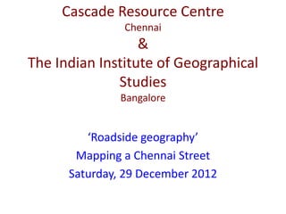
- 1. Cascade Resource Centre Chennai & The Indian Institute of Geographical Studies Bangalore ‘Roadside geography’ Mapping a Chennai Street Saturday, 29 December 2012
- 2. What we did indoors (1) • We studied a small extract from a topographic map in a school atlas. • We learned how features are shown using – Points – Lines – Areas
- 3. What we did outdoors • We oriented ourselves and the page on which the map is to be drawn using a magnetic compass. • We started from one end of our street and started plotting buildings, trees (points), roads (lines), and empty plots (areas).
- 4. What we did indoors (2) • We filled in the legend box on the map sheet showing the symbols and their meanings • Earlier in the morning, we had watched a documentary (‘The Paradox of the Andes’) • So, at the end, each kid chose one concept or idea that s/he had learned from the documentary. A word related to it was painted on the kid. • We all had a lot of fun … and learned so much that textbooks don’t teach us!
- 26. Organizer: Ms Vidya Shankar, Montessorian educator, Founder + Chairperson, Relief Foundation, parent organization of Cascade Resource Centre, Chennai Presenter: Dr Chandra Shekhar Balachandran, Geographer. Founder/Director, The Indian Institute of Geographical Studies, Bangalore Field help + photo credits (parents): • Ms Malathi Mahadevan • Ms Sandhiya Venkatesan • Ms Rajeswari Bakkiyaraj
- 27. This was the first of many forthcoming collaborative workshops between Cascade and TIIGS to be held in Chennai and other places. To organize such interactions in your neighborhood, contact: relieffoundationindia@gmail.com or geo@tiigs.org