SlideShare a Scribd company logo
1 of 40
Download to read offline
Outlines of a Journey in Palestine in 1852
Author(s): E. Robinson and E. Smith
Reviewed work(s):
Source: Journal of the Royal Geographical Society of London, Vol. 24 (1854), pp. 1-35
Published by: Blackwell Publishing on behalf of The Royal Geographical Society (with the Institute of
British Geographers)
Stable URL: http://www.jstor.org/stable/3698103 .
Accessed: 20/03/2012 15:56
Your use of the JSTOR archive indicates your acceptance of the Terms & Conditions of Use, available at .
http://www.jstor.org/page/info/about/policies/terms.jsp
JSTOR is a not-for-profit service that helps scholars, researchers, and students discover, use, and build upon a wide range of
content in a trusted digital archive. We use information technology and tools to increase productivity and facilitate new forms
of scholarship. For more information about JSTOR, please contact support@jstor.org.
Blackwell Publishing and The Royal Geographical Society (with the Institute of British Geographers) are
collaborating with JSTOR to digitize, preserve and extend access to Journal of the Royal Geographical Society
of London.
http://www.jstor.org
PAPERS READ
BEFORE THE
ROYALGEOGRAPHICALSOCIETY.
I.-Outlines of a Journey in Palestine in 1852. By the Rev. Dr.
E. ROBINSOn, E. SMITH, and others.
Communicated by the DUKE of NORTHUMBERLAND.
Read December 13, 1852.
EVER since the publication of my work on Palestine I had
cherishedthe desire of once more visiting that interesting country,
partly for the purpose of examining some points anew, but still
more in the hope of extending my researches into those portions
whichhad not yet been explored.
In March of the present year (1852) I arrivedat Beirfit, on
my way to carrythese plans into execution. Here I was detained
for some time-at first by the unsettled state of the weather,
which continuedvariablemuch later than usual, some of the most
violent stormsof the seasonhaving occurredafter my arrival; and
then in orderto be presentat the annual meeting of the American
Mission in Syria, which was held this year at Beirfit. I desire
here to express my deep feeling of obligationto the Mission for
the interest manifested by them in my undertaking,and for the
arrangements adopted to secure to me the aid and companyof
some one of the missionariesduring the wholejourney.
It had alreadybeen arrangedthat, before the meeting, I should
accompanyMr. Thomsonto Hasbeiya, and from thence visit the
region of Banias and Phiala. But just at that time the move-
ments of the Druses, to evade the threatened conscription,made
those districtsinsecure. I was thereforeobliged to contentmyself
with shortexcursionsto the mouth of the Nahr el-Kelb, with its
Egyptian and Assyriantablets; to the remarkabletemple at Deir
el-Kll'ah; and to 'Abeih, the seat of the Boys' Seminarybelong-
ing to the Mission. To the latter place, under the guidance of
Dr. De Forest, we took a less usual road, and visited a spot on a
rocky ledge between two valleys, where there are many ancient
sarcophagicut in the scattered rocks. Their huge lids have been
VOL. XXIV. B
B
35 316 c tel l
MAP
to illustrate fa reIa
"OUTLINES OF A JOURNEY IN PALESTINE IN 1852,"
by the
Rev4 I)TE.Robinson.
Ppqeonlf'.
-LaaarJeae
z0-r
ConvwentA
1obison e-routeciscoloLral RecL -Ras es Shakaor2adorwac
ararSawma
Ich
Jeball c
Naplrai7.m
34
e'y
Ammai 0 cR
!" Q7
A /
ay of
ASC
Va Arrabehi
ke
Bay of Acre
VRI-~
C.Carxuet z~":`
NahrelleDamfw/
SIDON V- A
I(,?, -?' jhye
NYahrelZ Z d y 1 i ;
NanhreiAhiaMAS
R.I
RLit~tny
l
b~
TYRE CI?~
-7t "A
A.nariyehBRange,
33_5 316 ctelTi sp
MAP
illu strate Nahrd kka L.Hms
OURNEY IN PALESTINE IN 1852,"
by the hreAr
IT E.Robinson.
cPioeoll o
u -dTAe kka.r'
aaoAarcne TRIPOLYh
0riZug mm
Caaarxu ett
-B
atrtin
(W ti
Burys etBi Kald(
-Dair-Moqa A<)
JeballInVs
Shef et Zaher
Nahr~ et~s Aswa
hhr
134
C.b Cneir
F,
;K4
~N
et Eai Pl
U13R~
Nahr al -D ami;
nw
0b~
Neb~y Yt~ws
Aluktai- at yako?",Tt
jE 0.~ ~SW(IL jima
Nahr elgaheptz?, ' !I : utk?L
P('abyP~c~z~ ?eh
Nahr d hia
cu
Nahret~diwad ashez a
e
yat
NahrlZa~ny:~!I~suAilbUTYRE~ A~i~?IAL~i 7t 55~Itf a . ,
ei
.t Litvr"-
SIDON t1
,: ahi"el
Zah, w
Jahb c AhiaAMASC
(j yI-YE~~.
NahreiJWldA i e
D ? ,el.
R.Ltedny
-
7t
32o jjee3bbaAmnw)
TYRE iic
A",
tille.R it'Zd
-cis
el
-,
by
...
•eitJifit
J
b. id•.
-
35
.36
KAO•C•rRE thJ
BayofAc~reC.Carmeli ir?d?;
Sef-01AOdb&
ieh
Telkl'wnr~n;Yu,,lE~9mp
ki,?,f I, IeZ~a141
Telels,W, kil
lkill,
I~i;M (Jab'~ a Jao~
Nahr-drj-?f 0Jeras
30ii
Rasletit'a IM/14? Ihi~~ElphaBlrrjA
-Z-Tdo32?yaaa Jell-:thl llbat~mo-Phiidelphi
-ffb
3/5~~~ilHebr~'ebJ~ btfrteJLm~oho/ZGorpi~.oYyJM~ryBbmreSro~o~84
SIDON -M.
CNarxuel f. 4 -fV "T
4"4S~A-rS ,9U
Nah ?ea ehia 'V zif
I1 N
"Y"Wi
Nahreldi~wad tiskyo
P,.Lit~ny ~ 3~~ "`
ft7
TYThb
Ile,
lift",
B oieasi
RooI
- 44 -
C.Ca~Ink - -= -
Sh'If k4-'
/4Hu
tObt mXeb
yO~ ff4-f+
TelJ bYzii.-id
Bf of Acre~44 PV/44
C.Carmel
41n'e'L' 14
"eTabm-ez
o ra,!!nof Ww
hrl ?,4'exun ;,
35, EIh0'NI
elr
e l g yL
T e- SF-gqMCK
.:--fuk at'aW(-ellaLd";; fbet . Vs-----
j rt, Mo (0,Plant, 0Je4ras:I,V~aih
et OW
EAM
e~.rab,?
Mw?-i.Tb`",-"";?~~:;ura e8-1140huhet~ BB;rdo~c~me~;~ .--YI
W Itoai(ebol) /
_75-Musrith
M?,tfrteJLm~oho/negahcZoYyJM~ralea~t~,o~o~84
2 Journey in Palestine in 1852.
removed,and lie mostly nearby. The place is utterly lonely, and
almost desolate, a few patches of wheat only being interspersed
among the rocks.
On the 5th of April, the Rev. Dr. E. Smith and myself found
ourselves once more on the way fromBeirfit to Jerusalem. On
the 26th of June, 1838, we had together arrived at Beiruit from
our formertravels, and we were now setting off from the same
point to continue our explorations. We encamped for the night
at Neby Yiinas (Porphyrion), more than halfway to Sidon.
After the tent was pitched, the beds arranged, and the frugal
meal ended, it was with an overpoweringfeeling that we compared
the presentwith the past. Here we were in our tent, not the
same indeed as formerly,but yet so like it as hardly to be distin-
guished-the furniture and all our travelling apparatus were
similar-several things were the very same-and ourplaces in the
tent were as of old. The intervening fourteen years seemed to
vanishaway, as if we were but continuinga journey of yesterday.
And when we reverted to the reality, we could not but gratefully
acknowledge the mercy of God in preserving our lives, and per-
mitting us once more, after so long an interval,to prosecutetoge-
therthe researcheswhichwe had together begun. We could not
but regard it as a high, and certainly an unusual,privilege, thus,
after fourteen long years, again to take up the thread of our
investigations.
Under other circumstanceswe might, perhaps,have regarded it
as an unpropitiousomen, when,during the night, a violent sirocco
wind arose, and blew downour tent upon us as we slept. It was
pitched upon the sand, the only foundationwhich the neighbour-
hood afforded. At first we tried to sleep on beneath the fallen
tent, but the flappingof the canvas compelledus to rise; and as
the day was already breakingin the east, we decided to make an
early start. This we did; and, fording the Auwaly near its
mouth,reached Sidon soon after 7 o'clock.
The observationswe made along the coast were not many; but
they serve to correct the maps in a few particulars. We were
now struck with the remainsof the ancient Roman road, traces of
whichare visible from near the river Damfir for most of the way
to the Auwaly.*
From Sidon we turned eastward towardsLebanon, and after a
ride of more than 2 hours pitched our tent at Kefr Falfis. For
some distance onthe N. and E. of Sidon the mountainsretire, and
the interval is an open, uneven, rolling tract, highly cultivated,
* It is singular that no regular survey has ever yet been made of the Syrian
coast; and it therefore gives us the more pleasure to learn from the highest
authority that such a survey will probablybe undertaken by orderof the British
Governmentduring the next year.
Journey in Palestine in 1852. 3
and abounding in the finest fruit. From Sidon to the roots of
Lebanonis about 3 hours, and then the mountain ridges rise by
degrees.
The next day, our plan was to have kept on to Rfim and the
high conical point of Ruweiset RUim;then to have ascended and
travelled along the high ridge of Jebel Rihan, S. of the angle of
the Auwaly, until, reaching the road fromJezzin to Jerjfi'a, we
could descend to the latter village, situated high up on the flank
of the mountain, on the N.W. brink of the great gorge of the
river Zaherany. We accordinglysent off our baggage-mules by
the direct road to Jerjfi'a, there to await our arrival. But we
had proceededhardly an hour on the way to Rfim beforeit began
to rain, and, after waitingfor a time in a peasant'shouse at Rfim,
we were compelledto forego ourpurposeand take the nearestway
to Jerjfi'a. We reachedthatplace by wayofJeb'a, aftera long and
dreary ride in the rain, and took refuge for the night and next
day, in a dark and smokyroom in one of the hovels of the town.
This was the only time that our plan of travelling was frustrated
by bad weather.
While lying next day at Jerjfi'a we descended into the chasm
of the Zaherany, and visited its highest perennialfountain. Here
we were surprisedto find the remainsof an ancientchannelcut in
the rock, and connectedwith an aqueductfurtherdown,by which
the waterof this fountainwas carriedbelowthe village aroundthe
flankof the mountain,and so to Sidon; many remainsof such an
aqueduct having already been known along the way to Sidon,
though its beginning had not been found. The Sidonians had
aqueducts fromthe Auwaly, much nearer, forirrigation; but they
must have preferred this water for drinking. Even now, water
fordrinkingis broughtto the city fromfountains,an hour or more
distant. From Jerjfi'a, Sidon bore N. 420 W.
From this high positionthe whole country, W. and S.W., was
visiblequite to the sea. It is rolling, uneven,andsometimesrocky,
made up of hills and valleys and plains, but no mountains. The
gorge of the Zaheranyhere runs S.W., and turns nearly S. just
below, along the W. base of Jebel Rihhn, for a short distance,
when the river suddenly breaksthroughthe lowridge whichthere
forms its western bank, and runs off W. to the sea. But the
valley along the base of Rihan continueson, as Wady Jermfik,
quite down to the Litany; and one might be almost tempted to
suppose that the ZaherAnyonce kept on its course to the latter
stream. On the right bank of the Litany, just below the entrance
of Wady JermCik,on a high cliff, in no connectionwith Lebanon,
stands the magnificent but deserted fortress,Ki~lat esh-Shiikif,
the Belfort of thleCrusaders. It was in sight from Jerjfi'a, bear-
ing directly S., and a visit.to it was included in our plan.
B2
4 Journey in Palestine in 1852.
The next day (April 9th) we proceeded througha fertile and
well-cultivated region, by way of the market-townNiib'atiyeh,to
Arnuin,a poor village below the ridge of the castle. Here are a
few ancient sarcophaaicut in isolated rocks. The ridge on this
side is neither very steep nor high; we rode the distance in 20
minutes from the village, half of it being level ground. But, on
arrivingat the top, one looks down on the other side almost per-
pendicularly into the abyss of the Litany, 1500 feet, as measured
by Dr. De Forest with the aneroid. The top of the ridge is very
narrow,and the castle occupiesits whole breadthand more, being
in someplaces built up from lowerprecipices. Its length is hence
greatly disproportionedto its narrowbreadth. On the S. of the
castle the top of the ridge is levelled off, as a fine esplanadeor
parade-ground.
This fortressis knownto us fromthe historiansof the Crusades;
but it needs only a glance to see that it dates froma much higher
antiquity, and that the Crusadersdid nothing morethan repairit.
The ancient portion,which still formsthe main body of the build-
ing, is built with bevelledstones; not large stones, like those at
Jerusalem, nor with a bevel so regular as is found in the tower of
Hippicus, but yet of the same general character,though coarser.
The sloping foundationsof the towersare also seen here, and, in-
deed, some of the square towers may be said to be almostfac
similes of Hippicus. The repairs of the Crusaders are every-
where easily to be distinguished,they have a totally differentcha-
racter. The chief workof theirs which remains is a fine Latin
chapel, along the eastern wall. Perhaps some historical notice
may yet be found, to fix the date of this fortress; but, at any rate,
it cannotbe later than the times of the Byzantine, or perhaps,the
Roman dominionin Syria. Here was always an important pass
from Sidon eastward. Nothing overshadowsthe castle except
Jebel Rihan on the N. and N.E., so that it formsa conspicuous
object, visible at a great distancein all other directions. From it
the castle above Banias bore S. 600 E.
From esh-Shiikif we turned our course about W. by S. to the
bridge over the Litany (here running westward),near the village
K 'ki'iyeh. This bridge is in part an ancient structure,but the
whole is very rickety. Here we encampedfor the night.
Our next day'sjourney broughtus to the castle of Tibnin, the
Toron or Turinumof the Crusaders. Our direct road to this
place led up through the Wady Hujeir for nearly the whole dis-
tance; but, after an hour, we turned to the left up anotherdeep
valley, Wady Selbky, which has its beginning in the S.W. of
Hinin, and drainsthe whole region. On the high southernbrow
of this valley we came, after another hour, to the hamlet Kuibri-
khah, where are the remains of a temple, with several columns
Journey in Palestine in 1852. 5
still standing, with Ionic capitals. Hence we struck off again
obliquely to Wady Hujeir, at a point where another temple once
stood on its western side, of which only one or two columns
remain.
The fortressof Tibnin is on the summitof an isolated hill, and
covers much more ground than that of esh Shuikif. It is also
much morea work of the Crusaders; though several courses of
bevelled stones on the outside show that they built it upon earlier
foundations. It is now in ruins, except the gateway, where a
family of Metawileh Sheikhs have built a house within the walls,
whichthey make their home. Here Jerjfi'a bore N. 24' E. and
the castle esh-Shiikif N. 42' E.
From Tibnin we took a course S. 600 W., crossingour former
route at Haris (not Hadith); and, after another hour, turned up
the ridge on the right side of Wady el-'Ain, on the road from
Rumeish to Tyre, to Yatir, a village overlooking the plain of
Tyre, and evidently occupying an ancient site. Retracing our
steps, we followed up Wady el-'Ain for a time S.E. and then
turned to the right to a site of ruins called Haztir, and also HIa-
ziry, but not the Hazor of Scripture and Josephus. Hence we
proceeded S.W. to Rameb, on an isolated hill in the midst of a
basin shut in by other high hills. This is, unquestionably,the
Ramah of Asher, a different place from Ramah of Naphtali.
Here are quite a numberof ancient sarcophagi.
Half an hour W. of Ramah is a high hill, on which are seen
from afar the columns and part of the architrave of an ancient
temple. We visited the spot, but the columnsare all too much
weather-worn to distinguish the order of their capitals. The
place is called Belat. From this high point we could look down
over the whole mountainous and broken region intervening be-
tween it and the sea from Ras el-Abyad to 'Akka, and could trace
the course of the ridges and valleys. Of the latter the great
Wady el-Kiirn is the principal; it was described by our
guides as so deep and precipitous,that even eagles could not fly
acrossit.
We learned afterwardsthat both Rameh and Belat had been
visited a few weeks previouslyby Mr. Van de Velde.
From Rameh we turned our course to Rumeish, and thence to
Kefr Bir'im, on the road to Safed, half an hour E. of Sa'sa'.
Here are the remains of two singular edifices. Of one a large
part of the body is yet standing, with a portico of columns in
front, of no Greek order. Behind the columnsis a large portal in
the middle, with a smaller door on each side. The whole is very
elaboratelydecorated with sculptured ornaments. Of the other
building only a portionof the frontremains,standing alone in the
fields. It is similar to the front of the other edifice, except that
6 Journey in Palestine in 1852.
on the sculptured entablature of the middle portal is a Hebrew
inscriptionin the ordinarysquarecharacterof the presentday. It
is much defaced; and so far as it can be read, merely invokes
" peace
"
upon the founder of the edifice, but withoutlegible
name or date. If the inscription be coeval with the building, it
marksit as a Jewish synagogue. That it and the other building
actually were such is also evident from their resemblance to the
ruined building at Meir6n, whichthe Jews still hold to be a syna-
gogue of their fathers. We afterwards found the remains of
similar edifices,markedby a very peculiar architecture,and some
of them quite large, at Irbid, Tell 'Hfim, Kedes, and perhaps
other places in Galilee. All this would seem to mark a condition
of prosperity, wealth, and influence, among the Jews of Ga-
lilee during the early centuries of the Christian era, of which,
neither their own historians, nor any other, have given us any
account. These edifices must have been coeval with their flourish-
ing schoolsat Tiberias.
The next day (April 14th) took us first to Meiron, whence,
after examining the sepulchres and the ancient synagogue, we
turned our course up the mountain W., and crossed the high
ridge of Jebel Jermilk and the next valley to Beit Jenn. This
village lies high up on the declivity of the ridge W. of the great
valley, here running N.W. and forming one of the main heads of
Wady el-Kilrn. Beyond this western ridge, in a basin from
which goes out another great branch of Wady el-Kuirn, is the
village Bukei'a, inhabitedin part by Jews occupied with agricul-
ture. On this account they are supposed by some to be a rem-
nant of the ancient Jewish inhabitantsof the land, who have never
been driven out by the later masters of the country, whether
Christiansor Muhammedans.
Turning S. from Beit Jenn we came out, after half an hour,
upon the brow of a pass in the ridge of mountains,here running
from E. to W., looking out over the whole of southern Galilee.
This point affordsone of the widest and finest views we met with
in our wholejourney. Some 1500 or 2000 feet below us was the
splendid plain of Ra^meh(the Ramah of Naphtali), coveredwith
groves of olive-trees and fields of grain, while beyond were other
ridges and plains, through whichwe were to pass. Through this
long plain of RAmehruns the great road from 'Akka to Da-
mascus.
Singularly enough this plain has no outlet at either end. Its
eastern part is drained througha gap in the southern ridge into
the next plain, and so through Wady Sellameh to the lake of
Tiberias. The westernportionis in like mannerdrainedthrough
a similar gap in the same ridge into Wady Sha'ab, which runs
down W. to the plain of 'Akka. On the southernridge, E. of the
Journey in Palestine in 1852. 7
formergap, is a high roundedeminence,called Tell Hazdr, from
a small ruin on its N.W. declivity. This also cannot be the
Hazor of Scripture and Josephus, for that was adjacent,not (like
this) to the lake of Tiberias, but to the waters of Merom or Sa-
mochonitis,now the Hfileh.
We descended to Rameh, lying still high on the lower and
cultivated declivity of the mountain. It has few traces of anti-
quity. We then crossed the plain obliquely S.E. and ascended
the southernridge, aroundthe eastern side of Tell Haz-fr, to the
large village el-MuighArupon its south-east side, overlooking the
plain below. This place is probablyancient, but no corresponding
name is found in ancient writers. From this point we visited the
ruin of Hazfi^r,and also ascendedthe Tell.
The plain now before us does not, like that of Rameh, extend
unbroken between the ridges on the N. and S. throughouttheir
whole length, but is divided near the middle by a lower ridge
running obliquely across it from N.W. to S.E. between the two
parallel ridges. The eastern part was now before us, drained
eastward by Wady Sellameh, which comes in from the plain of
Rameh, and enters the lake of Tiberias as Wady er-Riibfidlyeh.
It has its name from an ancient site, Sellameh, on the western
side of this part of the plain, the Selameor Selamis of Josephus.
From el-Miighir we made a short day's journey, descending
and crossing the plain on a S.W. course, and then crossing the
oblique ridge into the westernportionof the plain. A large part
of this is so level that a lake is formeduponit in therainy season,
while the part furtherW. is drainedby the Wady Sha'ab to the
westernplain. Keeping along on high ground near the southern
hills, we came to 'Arribeh, lying in a nook among these hills. It
is doubtless the Araba of Josephus. One hour furtherW., and
in full view, is Siikhnin, the Soganeof that writer, and mentioned
by him in connectionwith Araba. These names, as also Selame,
are foundin the map of Galilee, by Schultz,but are not correctly
placed.
At 'Arribeh we were detained two nights, mainly on account
of the lameness of one of our horses. This at last compelledus
to turn down to 'Akka, which did not lie in our original plan.
We thereforewent to Suikhnin,where are some ancient remains
with bevelled stones. From hencethe direct roadto 'Akka passes
by Mi'ar, on the browof the hills overlookingthe westernplain.
We, however,turned more to the right, in orderto visit a ruin of
which we had heard, called Kiibarah. In this name may be re-
cognized the Gabara of Josephus, which he mentions along with
Tiberias and Sepphoris,as one of the three principal towns of
Galilee. We made a great descent to the bottom of Wady
Sha'ab, at a point whence a good and level road led to 'Akka,
8 Journey in Palestine in 1852.
and then turned N.E. up thenorthernridge, and across table land
to the browlooking downinto the plain of Rameh. Here are the
remains of Gabara, consisting of the ruins of a large and strong
fortress,with the walls and foundations of houses and cisterns,
indicating an importantplace. The remains of antiquity found
here are much more extensive than those existing at Seffiirich.
Rameh was here in sight, bearing N. 75' E.
On the way to 'Akka we sawon our left, amongthe lower hills,
the village of Kabfil; and afterwards,far on our right, another
village on the declivity of the hills called 'Amkah, on the S. side
of the deep ravinenow called Wady Jiddin, fromthe ruined castle
of that name on its N. bank. These villages correspondin name
to the Cabuland Beth Emek, of the tribe of Asher, and the deep
valley may then perhapsbe that of Jiphthah-el. Boththese places
had been seen and recognized by Dr. Smith during a former
journey.
We remained in 'Akka over Sunday, and starting again on
Mondaymorning(April 19th) we took the roadfor the hills again,
by way of 'Abilin. Our guide, however,finding that we desired
to visit Jefat (Jotapata), proposed to take us a shorter way by
Tiiinrah and Kaukab. To this we assented, and climbed the
rough acclivity back of Tiimrah bya blindand unfrequentedpath.
Jefat is E. of Kaukab: we reached it in 40 minutes, also by a
blind path. This isolated Tell, first visited by Mr. Schultz, cor-
respondsin every particular to the description of Josephus, but
there exists not the slightest indicationthat a fortressor anything
else ever stood uponit. The surface is naked rock, with one or
two small cisternsnow used for flocks; but not a trace of a wall
or foundation of any kind. It is shut out from any prospectby
high hills on all sides, except that, through a narrow valley
running down S.E., a small strip of the plain el-Biittanf is
visible.
Down this valley we proceededto the ruinsof Cana,of Galilee,
which lie at its mouth, on the edge of the hills which skirt the
Biittanf on the N. The remainsare those of a large village with
well built houses, but without any special marks of antiquity.
T'heplace is knownas Kdna and Khirbet Kdna to all the people
of the region round about, both Christians and Muslims. We
turned now westwardalong the base of the northernhills to Kefr
Menda, and encampedfor the night.
The next day (April 20th) we passed through Seff-frich,with
its ancient tower, and leaving its great fountain on our left, a
favourite camping-ground of the hosts of the crusaders,we kept
on S.W. to Beit Lahm, the Bethlehemof Zebulon, a miserable
village, with no trace of antiquity but its name. It had already
been visited by Dr. Kally. We continuedon to Jeida, and then
Journey in Palestine in 1852. 9
crossedthe great plain of Esdraelon in the directionof Lejjlin,
encampingfor the nightin the middle of the plain. Here we had
on our right the mouth of Wady Milh, at the base of Carmel, up
whichvalley a road from 'Akka leads, and crossesthe ridge to the
plain of Sharon. Just at the mouthis a hill called Tell Kaimon,
in which is to be recognized the Camonof Eusebius, situated six
Roman miles from Legio towards Ptolemais. It is still near the
road from Lejjdn to Akka. May it also perhapsonce have been
the Johneamof Carmel?
The next morningwe crossed the Mukiitta (Kishon), running
over a gravelly bed between banks from 15 to 20 feet high.
Passing throughtracts of the utmost fertility, we came at last to
the great Tell el-Mutesellim, whichstands out in front of the hill,
on the back of which LejjAinis situated. This Tell affords a
magnificent view of the rich plain; and as we looked towards
Taanach, we became fully persuaded that we had before us the
battle-field of Deborah and Barak. Whether Megiddo lay upon
this Tell, as some suppose,but of which there is now no trace ; or
whether it lay upon the hill back, the S. side of which is now
occupied by Lejjiin; it was at any rate a sightly and important
place, and might well give nameto the plain. The stream flowing
down from Lejjiin is still the largest perennialtributaryof the
Kishon.
That Lejjdn is the representativeof the more ancientMegiddo,
there can be little doubt. Maximianopolis, to which Raumer
assigns the succession,partlybecause it is markedas on the route
from Cesarea to Jezreel (Zer'in), must have lain more to the E.
We saw afterwards the course of that route through the hills,
more eastward,and saw too that for it to pass through Lejje-n
would be a large circuit towards the W. Maximianopolis may
not improbablyhave lain at or near the large village Salim.
Near Lejjhn passes the great road from Damascus to Ramleh
and Egypt. We followed it to the top of the pass, and then,
without descending, took a more south-easterly course to Um
el-Fahm, on the browof a hill looking towardsthe westernplain.
Hence we proceeded on high ground south-eastwardsalong the
watershedbetween the heads of valleys running to the northern
and the western plains, and came for the night to Ya'bud, on a
hill overlooking another beautiful plain, extending far to the E.
and N.E., and bending round Ya'bud towardthe West. Far in
the N.E. we had beforeseen KiibAtiyeh,and in the northernpart
lies Kefr Kfid, the ancient Capharcotiaof Ptolemy. Here too, in
the middle of the eastern plain, we were delighted to find the
name of Dothan (Dothan); it is now a fine green Tell, with a
fountainon its southernbase, correspondingentirelywiththe posi-
tion assigned to it by Eusebius, 12 Roman miles N. of Samaria.
10 Journey in Palestine in 1852.
We learnedafterwardsfrom Mr. Van de Velde, that he too had
unexpectedly lighted upon the place some weeks earlier.
In this connection,we were told at Ya'bud, that the great road
from Beisan and Zer'in to Ramleh and Egypt still leads through
this plain; entering it W. of Jenin, passing near Kefr Kfid, and
bending south-westwardsaroundYa'bud to the westernplain. It
is easy to see, therefore,that the Midianites to whomJoseph was
sold in Dothan, had crossed the Jordan at Beisan, and were pro-
ceeding to Egypt along the ordinaryroad. It is obvioustoo that
Joseph's brethrenwell knew the best places of pasturage. They
had exhaustedthat of the Miikhnaby Shechem (Nablus), and had
afterwardsrepairedto the still finer pastureshere around Dothan.
On the day after (April 22nd) we followed down the road by
which Joseph was carried away to Egypt, to Zeita and 'Attil on
the bordersof the western plain, and then turned up again into
the mountainsonthe way to SebiistiehandNablus. We supposed
we were here upon Herod's road from Cesarea to these places,
and in many parts there were evident traces of an ancient road,
but wesawnowhereanypavedway. We spentthe nightat Ramin.
The next day, in crossinga rockyridge somedistance S. of Sebils-
tieh, and before we struck again our route of 1838, we found
evident remains of the ancient road over the ridge; here were
also columns and other traces of an ancient site, now called
Dibb^rieh.
We spent the day in Nablus, and again visited the Samaritans.
Both the priests,father and son, whom we saw before,are still
living; but the elderseemedto besuperannuated,andthe younger
is now the acting head of his people. Learning that we desired
to see him, he came to us, conductedus to their place of worship,
showed us their manuscripts,and loaned of his ownaccordto Dr.
Smith a fine copy of their Arabic versionof the Pentateuch,to be
used by him in the new Arabic version,in whichhe is engaged.
From Nablus we bentour courseagain S.W., on the direct road
to Ramleb. We turned around the shoulderof Mount Gerizim
by Rafidieh, and passed by Kuryet Jit (the ancient Gitta) and
Funduk, leaving Fer'ata (Pirathon) at no great distance on our
left. As we began gradually to descend towards the plain, we
had on our left a large and deep valley called Wady Kanah,
which we may with probabilityregard as the brookKanah of the
book of Joshua (xvii. 9), the boundary between Ephraim and
Manasseh. Lower down it takes a different local name. We
passed on by 'Azziin, and down the long Wady of that name to
its entrance into the plain, opposite Kilkiliehl and Kefr S ba.
Turning left a little to Hableh on the low hills S. of the Wady,
we encampedover Sunday, in full view of Kefr Shba, and also of
Jiljhlieh furtherS. These are the Antipatris and western Gilgal
Journey in Palestine in 1852. 11
of Scripture; and were visited and described by Dr. Smith in
1844.
At Hableh I was gratifiedatfindingclose by our tent an ancient
wine-press hewn in the rock. It was complete, with the upper
shallow vat for treading the grapes, and the lower deeper one to
receive the liquid,and might still be used, were there here grapes
to tread. At presentthere are no vineyardsin all this region. I
wouldhave given much to transport this wine-press in natura to
London or New York.
On the following Monday (April 26th) we proceeded south-
wardsalong the foot of the hills; crossingin a quarterof an hour
from Hableh the continuation of the great Wady Kanah here
called Wady Zakitr and Wady Khureish, from two sites of ruins
on its banks. It was here said to come from the S. end of the
plain el-Milkhna. It passes off S. of Jiljfilieh, and joining the
Wady from Kefr Shba, goes to the Aujeh. We had the great
fountain of the Aujeh, at Ras el-'Ain, on our right in the low
plain. From Mejdel Yabawe turnedS.W. into the plain,entered
the Damascus road, and came on it to Renthieh. This village,
so far as the name is concerned,might well be held to be the
ancient Arimathea; but the historical notices seem to fix that
place, not in the toparchyof Lydda, where this village lies, but in
that of Fibneh (Timnath Thamna),farthereastward.
We came to Lydda, and passed on by way of Kubhb to Yalo,
the ancient Ajalon. The road lay much of the way along the
Wady 'Atallah, whichdrainsthe plain of Merj Jbn 'Omeir, and
runs downon the E. and N. of Lydda. Yalo we formerlysaw
from the upper Bethhoron,and our view of it and the adjacent
region was correct, except that the plain of Merj Jbn 'Omeir is
bounded by the ridge, on the N. side of whichYalo lies, and does
not extend itself towards the S.W. beyond Kubab, as we then
supposed. The name Jbn 'Omeir belongs to the district, and not
specially to the plain. We were told afterwardsof a ruined place
in the mountainsE. of Yalo, and not very far off, called Kefir. It
probablyis the site of the ancient Chephiraof the Gibeonites;
but we heard of it only too late to visit it.
We proceededthe next day to 'Amwas,the ancient Emmausor
Nicopolis, situated betweenYalo and the Jerusalem road, twenty
minutesN. of thelatter. It is a poorvillage, witha fountain,andthe
ruins of an ancient church,a fine structure of large hewn stones.
It lies on a declivity, looking westwardout over the great plain.
Close upon the S. side of the Jerusalem road is the Tell and
ruin of Latron. The ruin is that of a fortress,some of the lower
partsof whichappearto be Roman work. This is the place which
formerlywaspointedoutto us at Tell es-Safiehas 'Amwas. From
it the latter Tell is visible. The Wady 'Aly, along which the
12 Journey in Palestine in 1852.
Jerusalem roadleads upthe mountainto Saris, here bends around
on the S. of Latron, and then turning N.W. it passes downE. of
Kubhb to Wady 'Atallah.
We now kept on southwardsto Stir'a, the ancient Zorah, the
birth-placeand residence of Samson. We saw it from the S. on
our former journey, on a high peak overlooking the fine plain of
Bethshemesh. We approachedit now fromthe N., on whichside
the elevation is not more than half as great. Some 20 minutes
before reaching Zorah, we came to a noble fountain, and after-
wards passed no less than twelve women toiling up to the village
with jars of water on their heads. This is a very common sight
in Palestine; but in the presentcase the hill was very steep; and
we remembered, that in all probability the mother of Samson
must often have visited this fountain,and toiled homewardwith
her jar of waterin like manner.
Our objectin visiting Zorahwas to obtaina viewof the country
between it and Jerusalem, and especially to ascertain the course
of the great valleys. We found the plainof Bethshemeshextend-
ing up some distance N.E. of Zorah into the mountains,and could
see the chasmsof two great valleys running down into it. About
E.S.E. of us was the mouth of the great Wady, whichcomesdown
by Kulonieh, and furtherN. that of Wady Gh'irAb,one branchof
whichbegins near Saris, and anotheraboveKuryet el-'Euab. On
the high ridge between this latter and the Wady of Kulknieh, lie
Soba and Kiistiil.
We wished to proceed to Jerusalem along this same ridge by
Kesla and S6ba, but, after starting, learned that the road was
impracticable. The usual road from Siir'a is along the western
declivity of the ridge of Saris to Wady 'Aly. We took this route
at first,but turnedup bya verysteepanddifficultascent,andgained
the top of the ridge at Mihsir, a flourishing village, surrounded
by olive-groves, an hour W.S.W. of Saris. We kept along on
the top of the ridge, having a branchof Wady Ghiirab below us
on the right, to Saris, and thence took the ordinary and very
drearyroadto Jerusalemby Kuryet el-'Enab, the ancientKiijath
Jearim. We reached the city at 8 o'clock on the morning of
April 28th, having been more than three weeks on the way fi-om
Beirut.
In Jerusalem and the vicinity we remained twelve days, dili-
gently occupiedin examining the objects of interest, and investi-
gating the various questions connectedwith ancient topography.
Weconstantlyenjoyedthe kind attentionsand ready assistanceof
Dr. M'Gowan and other gentlemen connectedwith the English
Missions,as also those of our own countryman,Dr. Barclay, now
residing in Jerusalem. For all these our best thanks are due.
Bishop Gobat had already left the countryon a visit to England.
Journey in Palestine in 1852. 13
This is not the place to enter upona discussion of the vexed
questions connected with the historical topographyof the Holy
City. I may, however,be permittedto refer to a few particulars,
which may serve to show how the public mind has been misled by
statements and conclusions not founded on careful and correct
observation.
First. In a publishedPlan of Jerusalem, to whichare attached
the names of the English engineers, Colonel Aldrich and Lieute-
nant Symonds, the western wall of the Karam, or enclosure of the
great Mosk, is laid down with two retiring angles towards.its
southernend, that is, so that it does not continuestraight through
its whole length, but on its southern part, first turnseastward by
a right angle, and then again by a second right angle. Great
stress has been laid upon-this Plan, as constructed from actual
survey by scientific engineers, and therefore decisive as to the
point in question. Yet it contradictsthe Plan of Mr. Catherwood,
made fromactual measurements in the interiorof the Haram, as
well as all other Plans of the city beforeor since.
Through the kindnessof Dr. M'Gowan we were able to make
some observationshaving a bearing on the subject. He and Mr.
Colman accompanied us to the barracks, the residence of the
military governorof the city, at the N.W. cornerof the Haram,
from the roof of which there is a near view of the whole interior.
Here, not only the general view showed that the westernwall is
straight throughout,but a special circumstanceadded strength to
the conviction. We had alreadynoticed two cypress-treesstand-
ing just inside of this wall near the S.W. corner of the Haram
and S. of the house of Abu Sa'fid, so called. These two trees we
could now see standing in a line with the northern part of the
wall as we looked along the latter. We afterwards repaired to
the house of Abu Sa'fid, to whichthe professional services of Dr.
M'Gowan had procured for us a ready admission. It is built
directlyupon the westernwall,at some distancefrom the southern
end, andis partlywithoutandpartlywithintheenclosureof the Ha-
ram, a passage being brokenthroughthe wall in each story. We
were introducedinto the uppermostroom,wherefromthe windows
there is a view of the wall further N. and of the southernpart of
the enclosure. We were also conductedthroughthe buildings in
the S.W. cornerof the H-aram,but not, of course, to any place
where we should be exposed to public view. The result wasas
before, that the western wall is straight throughout. Such too
was the testimonyof the very intelligent ownersof the house, one
of whom occupied the post of Secretaryunder the Government,
and had charge of the Census.
After all this I can only repeat the expressionof my surprise,
that the namesof scientificengineerscouldever havebeen attached
to the publicationof so manifestan error.
14 Journey in Palestine in 1852.
Second. In respect to the Valley of the Tyropcon, so called by
Josephus, the new theory, first broached since 1840, and contra-
dictory to the current views of all former centuries, transfersthe
beginning of this valley from theYafa gate to the Damascus gate.
This is really a questionof interpretationbetween the supporters
of this hypothesisand Josephus. But so long as with one voice
they follow him in making Zion terminate at the street leading
down from the Y fa gate, all the laws of philology and herme-
neuties require that they should follow him further,and like him,
make the Tyropoeon,and then Akra, lie adjacentto Zion. By no
law of language can it be justified that one part of the historian's
descriptionshould be followedand anotherpart left out of view.
Third. In connectionwith this transferof the Tyropceonit has
been asserted that there is no ridge N. of Zion, and no rise of
ground in that direction. This statement needs correction. The
street which runs N. in the rear of the Churchof the Sepulchre
rises very considerablyin that portionof it, although at its south-
ern end it appearsto decline northwards.But just at thissouthern
end is the Greek church of St. John, beneath which there has
been dug out a chapel, standing on ground at least 25 feet
below the present level of the two streets at that point. In the
Bazdrs the water is conductedoff by a sewer runningtowards the
S.; and furtherN., oppositeto the Churchof the Sepulchre,the
main street is carried.along a coveredpassage cut througha ridge
of solid rock. Turning downat the S. end of this covered pas-
sage, along the street leading by Helena's Hospital, so called, we
enter on the left the court of the PrussianConsul, and ascend by
two flights of steps to his garden and dwelling (formerlyMr. Lan-
neau's) on the same ridge. Following the same street further
down we findit crossingvery obliquelythe crest of the descending
ridge. If, again, fromthe street running S. along the bottomof
the depressionor valley, one enters the street next S. of the one
just described, he firstascends W rather steeply; the street then
turns N., and he ascends quite as steeply until it turns W. again.
Here another street comes into it from the S. up a rathersteep
ascent. From all this, it appears that there is on the N. of Zion
a rockyridge, on whichthe Churchof the Holy Sepulchrestands,
and which ends below in a rather broad point, about in a line
betweenthe said churchand the great Mosk. This is the ridge,
which, with the adjacent tract, accordingto the descriptionof Jo-
sephus, must be regardedas Akra.
That the Tyropceonitself, probablya narrowravine, should no
longer exist at its formerdepth is not surprisingwhen we consider
the immense masses of rubbishwith which the city is everywhere
covered. The excavated chapel under the church of St. John
shows how enormoushas been the accumulation along the very
line in question.
Journey in Palestine in 1852. 15
Fourth. In connectionwith the same transferof the Tyropoeon
have been adduced the channelsof living water said to enter the
city by the Damascus gate. That a reportis current among the
native inhabitants, that a trickling of water may sometimes be
heard at that gate, we formerlylearnedand have related, and the
same story is now repeated every day. But we never found a
personwhoprofessedthat he himselfhad everheardthis trickling,
neither a native nor muchless a Frank. Yet it maywell be true,
and that without being wonderful,seeing there are two large cis-
ternsjust by the gate. But, in additionto this supposedchannel,
one writerasserts that just outside of the Damascus gate, on the
right hand, is a large reservoir of living water flowing into the
city, fromwhichmany fountainswere formerlysupplied. Another
writer speaks of a well of living water in the Churchof the Fla-
gellation, and regards it as connected with this channel at the
Damascus gate. Both writers appeal also to the taste of these
waters, as resemblingthat of the watersof Siloam.
It seemed importantto provethe accuracyof these statements.
We went, therefore,to the Damascus gate, in companywith some
of our friends,and found not only a cistern on the right side of
the gate, but also one on the left side. They are both, however,
merely ordinarycisterns of rain-water,filled by the water which
runs from the road and fields above, and is conducted into them
by small channelsor furrowson the surface of the ground-these
we saw. We tasted of the waterin the right-handcistern; it had,
indeed, a flavour somewhat like that of Siloam, but it was here
merely the taste of impurewater. We then tasted of water from
the other cistern, and found it almost putrid. We afterwardsre-
paired to the Churchof the Flagellation. In the outer court is a
large cistern of good rain-water, collected from the roofs and
courts. In an innercourtis a smallerreservoir,andthe attendant
began to relate how the water in it was never exhausted, and
never stood higher nor lower in the reservoir. We tasted it, and
found again the Siloam flavour. But, looking at the water which
had just been drawn up, we perceived that it was full of the
wriggling worms and other animalculhefound in impure rain-
water. Here then was anotherordinarycistern, and the peculiar
taste was accountedfor.
Fifth. Of the second wall of the city, Josephus says that it
began at the " Gate Gennath" in the firstwall, and ran " cir-
cling around" to the fortressAntonia. The Gate Gennath has,
therefore,usually and naturally been regarded as situated near
the tower of Hippicus. But the moderntheoryremovesthis gate
eastwardto a pointin the wall along the browof Zion,fromwhich
the said second wall would run northwardsalong the street of the
Bazars. The groundsand argumentsbroughtforwardin aid of this
16 Journey in Palestine in 1852.
view by twoof its earliest supportershave all been rightly rejected
by the latest, with the exception of two, and these would seem to
be hardlymore tenable than the rest. These are the traditionof
two gates along this line, one the Portajudiciaria, so called, on
the Via dolorosa,the other on the brow of Zion. Now, as to the
Portajudiciaria, without which the whole argument falls to the
ground, there is no appearance nor evidence that a gate ever
stood in that spot-a single lone column does not of itself imply a
gate. And further, of the Via dolorosaitself, now held to be so
authenticated by tradition,there is no historical trace until long
after the Crusades. On the contrary,historicaldocumentsclearly
show that in the thirteenthcentury the streets now so called were
knownamong the Christiansby other names.
In oppositionto such a course of the secondwall, we have, first,
the manifestabsurdityof supposingthat a wall for the defence of
the city would be carriedalong the middle of a declivity, whereit
would everywhere be commanded by higher ground outside.
Then, too, we knowfrom Josephus, that there was a gate, by
which water was broughtinto the towerof Hippicus; of course,it
was near Hippicus. in describingthe approachesof ritus, after
he had taken the third or outer wall, the historianspeaks of the
next wall (the second) as extending up to that gate. Hence we
have the second wall describedintwooppositedirections;once, as
beginning at thegate Gennath,andrunningnorthwards,andagain,
as runningsouthwardsup to the gate near Hippicus. The infer-
ence is conclusive,that the gate Gennath and the gate by Hip-
picus were identical.
Sixth. One writer regards the course of the third or outer
wall of Josephus as having been in the main the same with
that of the present northern wall, and denies that the ancient
city extended fartherN. than the limits of the modernone. But
the multitude of ancient cisterns existing over a large tract out-
side of the present wall on the N., and in no other quarter,
proves, conclusively, that a very considerable extent of ground
was here occupied of old by the streets and dwellings of a portion
of Jerusalem.
From these six specimensit will be obviousthat I did not find
the statements and hypotheses of recent writers sufficientlysup-
ported by observation,to lead me to any importantchange in the
views of the topography of Jerusalem expressed in my former
work,and current for centuries. I might go on to add other like
examples, but must leave them for anotheropportunity.
From these specimens, too, it might possibly be inferred,
that these recent inquiries have been carried on, not so much
with a desire to arrive at the simple truth, as to find support for
preconceivedopinionsor favourite hypotheses. The authorityof
Journey in Palestine in 1852. 17
tradition, it might be said, was, at all events, to be sustained,
even when unsupportedby any evidence from history.
From Jerusalem we made an excursion of a day to the Wady
el-Werd (Valley of Roses) and its three fountains, S.W. from
the city. One of its main heads is in the Plain of Rephaim,and
the valley enters the great Wady of KulEnieh, near a village
called 'Akfir. The valley has its name from the extensive fields
of roses cultivated in it. The fountains are 'Ain Y0lo, 'Ain
Iliiniyeh (St. Philip's), and that of Bittir; the latter being much
the largest. We passed near the Convent of the Cross in going
out, and returnedby Welejeb and the ridge above the village and
conventof 'Ain Karim.
Another excursion, of 2 days, took us to the neighbourhoodof
Hebron. In our formerjourney we had been compelledto hasten
over the road between Hebron and Jerusalem without a guide,
and hence it had been in some respects our least satisfactoryday
in Palestine. We now took the same road, stopping at Urtas on
our way, where Mr. Meshullam now cultivates rich and well-
watered fields along the bottom of the valley. The German
colonists,who were here two years ago, were in his employ, but
are since scattered. We went also to Bethzur, and visited again
the vast and inexplicable foundations at Rameh; as also the
remains upon the hill. Thence returning to Halhfil, we en-
campedfor the night near its sightly mosk.
On our return to Jerusalem, next day, we kept along as near
as possible to the western browof the mountains. We passed
through Beit Ummar and near to Jedcir,and afterwards came to
Beit Sakarieh, on a high and almost isolated promontory, over-
looking the westernregion of lower hills. It bears every appear-
ance of having once been a strong and impregnable fortress. It
is, withoutdoubt, the site of the ancientBethzacharia of Josephus
and the historianof the Maccabees; since, besides the identity of
name, its positionrelative to Bethzur is precisely the one required
by the accounts of those writers. We'passed on through the little
village el-Khiidr, and struck the road from Hebron to Jerusalem
just W.of Bethlehem,
On the 10th of May we left Jerusalem to proceednorthwards,
and reachingthe browof Scopus, I turned and looked upon the
Holy City for the last time. We hasten on, leaving on our right
the conspicuousTuleil el-FlUl,the ancient Gibeah of Saul, and
came to Ramah of Benjamin. Thence we turned eastwardto the
Tombs of the Amalekites, so called, in the low plain in the valley
N. of Hizmeh. These are merely four low heaps of rough stones,
in the form of long parallelograms; the largest is 102 feet long
by 27 feet broad, and 3 or 4 feet high. There is no appearance
of antiquity about them, nor of any sepulchral character. Our
VOL. XXIV. C
18 Journey in Palestine in 1852.
guide from er-Ram called them Kuboir Isra'in (Tombs of the
Israelites); but we heard also the other name.
We kept on in the same direction to Khirbet el-Haiyeh (Ser-
pent), on the ridge between this valley and Wady Suweinit, near
the southern browof the latter. This place, on account of the
name, has recently been brought forwardas the site of the ancient
Ai. But there is no affinitybetween the two names; since Ai
containsthe tenaciousletter Ayin, whichthe otherhas not. And
further, Ai was near to Bethel, and of easy access fromit; but
this spot is at least nearly 3 hours distant from Bethel; and the
deep and difficultWady es-Suweinit lies between. There is here
no valley on the W., except the low openplain we had traversed,
whilst towardsJeb'a there is a ridge.
We turned now to Jeb'a, the ancient Geba,and again crossed
the deep valley to Mfikhmrs, passing in it the two steep hills, the
scene of Jonathan's adventure with the Philistines' garrison:
they struck us now, more than before, as well adapted for such
outposts. At Milkhmas we encamped, and next day passed on
over the rocky Tell of Rilmmon,and along the declivity below
Taiyibeh on the W., to Deir Jerir. Here we entered upon new
ground, which as yet is a blank in the maps. We crossed
obliquely a very high ridge, and came in about an hour to Kefr
Malik, on a high point overlooking the deep Wady, going down
to the Aujeh. Crossing this, anid ascending again to a higher,
uneven plateau, we came in an hour more to el-Mughaiyir, a
large village, and in another hour to Daumeh, the Eduma of
Eusebius: here we encamped. Froma hill just by we had a wide
view of the Ghor directly below us, and of the ridge of Kuirn
es-Suirtabeh,not far distant in the E.N.E. Just under our feet,
in an offset from the Gh6r, was Fushil, the site of the ancient
Phasaelis.
The next morning, after crossing the branchof the greatWady
Fusail, we came to Mejdel, a very old place, with an extensive
view of the Ghor, and a nearer one of Kuirnes-Siirtabeh. An
hour and a half brought us nowto 'Akrabeh,a large and flourish-
ing town, whichof old gave its namneto the toparchyof Acra-
battene. The situationis fine, on the base of a high ridge on the
northern side of an open valley or plain, which just here has its
watershed,running down E. to Wady Ahmar, under KUirnSiir-
tabeh; and also W., as Wady Bir Jenhb, by Kilbelan to the
westernplain. From 'Akrabehwe took a circuitous route north-
wards,by Yanjin to the S.E. cornerof the little plain of Salim,
E. of Nablus; and then descending and passing through Beit
Fiurik,we crossedthe waterbedof the Mtikhna, runningthrough
the W. end of the little plain, and came to Nablus for the night.
The followingday (May 13th) we turned again N.E., towards
Journey in Palestine in 1852. 19
the Ghbr. At the mouth of the valley of Nablus, on the N. side,
are the ruins of a village called 'Askar, which name has some-
times been comparedwith the Sychar of the New Testament. It
has, however,the letter Ayin, which precludes any such affinity.
We passed on northwards along the plain, whichis here narrow,
and soon breaks downby a deep and singular gorge to the Wady
Faria and its wide rolling tract. We turnedmore to the left and
ascended steeply to Tiillfizah, lying N. of Mount Ebal, and
surrounded by immense olive-groves. This seems to be the
ancient Tirzah, for a time the residence of the kings of Israel;
though it now bears few marksof a royal metropolis. Hence we
crossedthe branchesand interveninghigher plains of Wady Faria
to Thbabs,in 22 hours. This is the Thebez of Scripture,where
Abimelech met his death. It lies on a declivity looking E., and
has a fine plain, with olive-grovesbeforeit. We kept on for less
thanan hourfurtherto Teyasir, a small village, and there stopped
for the night.
This village is near the head of Wady el-Malih, which we fol-
lowed next day down to the Ghbr, climbing on our way to the
ruins of a fortress,of moderate size, K'isr el-Malih, once com-
manding a pass. The descent is here very gradual, the hills
become lower and lower, and gradually lose themselves in the
plain. In Wady el-Mhlih are springs of saltish water, blood-
warm; and in its lower part is a running stream. As it crosses
the Ghor to the Jordan,there is on its northernside a broadlow
swell, extending fromthe westernhills quite to the upper banks
of the Jordan; the river being here crowdedquite to the eastern
part of the Ghor. We kept along uponthis swell, and came at its
extremity to a low hill, on whichare the slight remainsof Sakiit,
a name correspondingto theancientSuccoth. It looks downupon
the lower valley of the Jordan, here a plain of some width; the
place and banksof the streamare seen, but not the water itself.
We now turned N.W., througha lower portion of the plain,
exhibiting the utmost fertility, and coveredwith the rankestvege-
tation. The grass and weeds came up to our horses'backs, and
the taller thistles often rose above ourheads as we rode along.
On the higher plateau, nearer the western mountains, the in-
habitants of Ti'bas and other villages cultivate wheat. They
were now in mid-harvest; and we pitched our tent by the side of
a colonyfromThbas, who were dwelling in tents and booths, with
their women and children,horses and donkeys, dogs and poultry.
What struck us here especially were the many fountains and
brooksin this part of the Ghor, furnishingan abundantsupply of
water, and giving rise to a most luxuriant fertility.
Here we bargainedwith two young Sheikhs fromTibais, active
and intelligent men, to take us on an excursion of a day across
c2
20 Journey in Palestine in 1852.
the Jordan. Our object was to ascertain whether any place or
ruin called Yabis (Jabesh) still existed on or near Wady Yabis;
and in that way determine, if possible, whether the ruins at
Tiibiikat Fahil were those of Pella. Eusebius gives the distance
of Jabesh from Pella at 6 Roman miles, on the way to Gerasa
(Jerash). We proposedto go first to Kefr Abil (not Bil), which
lies high on the side of the mountain,not very far distant from the
probable positionof Jabesh Gilead; since the men of Jabesh had
gone downby night to Beishn, and carriedoff the bodies of Saul
and Jonathan.
We rose very early (May 15th), and sending our muleteers
to Beisan, directed our course to the ford not far N. of Sakfit.
Descending the steep upper bank of the Jordan, here 150 feet
high, and crossing the low alluvial plain, which our guides said
was never overflowed,we came to the ford. A narrow island,
covered with rank vegetation, here divides the river into two
branches; the eastern one being much the largest. The stream
was rapid, and the water came up high on the sides of the horses.
Having got safelyover,we ascendedat oncethe steep easternupper
bank, and crossed obliquely the narrow plain to the foot of the
mountains,to reach the mouthof Wady Yabis. As we approached
the firsthills we foundourselvessuddenly surroundedbytwenty or
thirty armed men. They proved to be fromthe village of Farah
on the mountain, and were here to harvest their wheat in the
plain. They had recently helped to drive away the officersent to
enforce the conscriptionin their district; and they had now been
watching us, thinking we might perhaps be coming from the
government on a like errand. They were acquainted with our
Sheikhs, and, finding all right, they took us to their encampment
on the S. bank of Wady Yabis, gave us coffee,and broughtus
bread and leben,which we left to our guides.
We now began to ascend the mountainbya smaller Wady just
N."of the Yabis. After half an hour the hills becamehigher and
greener; and oak trees, the oaks of Bashan, began to appear,
scattered like orchardsupon the hills. After more than an hour
we came out upon a prominentpoint, affordingan extensive view
over the whole northernGh6r fromKiirn es-Suirtabehtothe Lake
of Tiberias. The whole southernpart,fromthe KUirnto the Dead
Sea, I had already seen. This eminenceprovedto be the browof
the first plateau of the mountain,along whichwe ascended very
gradually through a region of the utmost verdure, and beauty,
and fertility, to Kefr Abil, near the foot of the next high
ridge.
We found it deserted. The inhabitants had been implicated
with those of Farah in the matter of the conscription; and seeing
Franks approaching,(an event of unusual occurrence,)they had
Journey in Palestine in 1852. 21
all left the village. They were, however, not far off, and soon
returned.
Wady Yabis is a mile or more S. of this village. It breaks
downfrom the higher ridge by a deep glen, in whichis a place of
ruins called Maklfhb,as having been " overturned." It was said
to have no columns. Lower down on the Wady, about S. from
us, and on a hill on the S. side of the valley, is another ruin called
ed-Deir; it is on the road from Beisan to Helaweh and Jerash,
and has columns. This latter ruin seems to correspondwell to
the site of ancient Jabesh Gilead; but the name Ya^bisnowexists
only as applied to the Wady.
We now turned to descend the mountainby a more northern
path leading directly towardsBeishn, computing, that if the ruins
at Fiibiikah Fahil were those of Pella, we ought to reach the spot
in about 2 hours. Our road to Beis^n passed 10 minutes N. of
the ruins, and we were oppositeto them in just 2 hours. But our
guides knew them only as el-Jerm, and we went on 10 minutes
furtherbefore turning off to them. They lie upon a low hill or
mound,having a broadarea on its top, surroundedby higher hills
except on the W., where is a plain, which also runs up on the N.
side of the hill or mound described. As we approachedfrom the
N., we came upon ruins in the low plain, with manyfragments
of columns. The area on the hill is covered with like remains,
and others are also seen below in the westernplain. Below the
hill, on the S.E. quarter,there is a large fountain, which sends off
a stream towardsthe S.W. Near it wasa small temple, of which
two columns are still standing, and the valley below is full of
oleanders. From men on the spot, we learned that the name of
the place itself is Fahil, the word Fibiikah (meaning a story of a
house, a terrace) being here applied to the narrow plain which
stands out like a terrace in front of the hills, several hundredfeet
above the valley of the Jordan below.
The situationof this spotin relationto Beishn and Wady Yabis,
the extensiveremainsobviouslyof a large city, the copiousfountain,
and also the name, left no doubt upon our minds, that we were
standing on the site of ancient Pella. The ruins were discovered
and visited by Irby and Mangles in 1817; but no idea of any
connectionwith Pella suggested itself to their minds. Since that
time no Frank traveller has visited the spot. The first public
suggestion of the identity of the place with Pella, was given in
Kiepert's map of Palestine, in which the name of Pella is inserted
with a query. Our main object was now accomplished,in thus
verifying the correctness of Kiepert's suggestion. Mr. Van de
Velde, whomwe had met again at Nablus, accompaniedus on
this excursion at our invitation.
Descending fromthe terrace 500 or600 feet to the plain below,
22 Journey in Palestine in 1852.
we came to the fordof the Jordan. Here are in fact threefording
places, of whichthat lowest downis said to be the easiest; but we
found it deeper and more rapid than the ford of the morning.
The Sheikhs proposed,and we assented, that one of them on foot
should lead our horsesone by one across. In this way we crossed
safely, the water coming up almost to the horses' backs. We
pushed on rapidly through the glorious plain to Beisan, whereour
tent was pitched, and we remained over Sunday. This was our
hardest day's workin Palestine.
Beishnhas a splendid position,just where the great valley or
plain of Jezreel sinks down by an offset or gradual declivity of
100 feet or more to the Gh6r. Just on the brow of this de-
clivity is the village, and also many remains of the ancient city.
But the Tell or acropolis is 10 minutes further N., near the
stream of Jalid coming from the W., whichpasses down at the
N. foot of the Tell. On the S. of the Tell arenumerouscolumns
still standing,andthe very perfectremainsof a large amphitheatre.
All the ruins (except the columns)are of black basaltic stones,
and the Tell is also of the same character,and black.
On Monday morningwe left the direct road to Zer'in on our
right, and struck off to the foot of the mountainsof Gilboa, to a
site of ruins called Belt Ilfa, which had been already visited by
Schultz. The remainsare those of a small place: there are two
or three ancient sarcophagi. It could never have been a fortress
of importance,since it lies in the plain directly at the foot of the
high mountain. Whether it was the Bethulia of the book of
Judith is at least doubtful.
We now passed on across the plain to Kuimieh,and were near
getting our animals mired in the soft bottom of the Ialfd. At
Tiimrah we crossed the line of hills extending from the Little
Hermon eastwardto Kaukab, and descended so as to pass along
the eastern foot of Tabor to the Khan and L-ibieh. Here we
encamped.
From LUibiehwe came next morningto the Hajar en-Nuisrany,
where our Lord is said (in monkish tradition) to have fed the
4000. My object at this place was to obtainthe view of Caper-
naum described by Arculfus, as this seemed naturally to be the
point of which he speaks.- Thence we descended to Irbid at the
upper end of Wady Hamahm. The remains are not important;
but among them are the columns and some other portionsof an
ancient Jewish synagogue, of the same type with those at Kefr
Bir'imandMeiron. We nowpassed downWady HamhAm,beneath
its frowningprecipiceswith the cavernsof the fortressKill'at Ibn
Ma'an, and entering our formerroute at the Round Fountain,
followed it to Khan Minyeh. Here I was more impressed than
formerlywith the extent and character of the adjacent ancient
Journey in Palestine in 1852. 23
site; and the neighbouring fountain, 'Ain el-Tin, is fine and
cold.
On the promontorybeyond is a deep channelcut in the rock,
now serving as a road, but obviouslyonce an aqueduct conveying
water from Tibighah to irrigate the plain. At Thbighah the
water was formerlyraised to an elevated head in a massive reser-
voir; but there are no traces of the intermediatechannel. At
Tell HI-m we at once recognizedin the sculpturedremains,which
formerlyhad puzzled us, another ancient Jewish structure, like
those at Meir6n and Kefr Bir'im, and the largest and most ela-
borate of all.
At Tell HdImwe turned up from the lake along a shallow
Wady coming down from the N.W., in order to visit a site of
ruins called Kerazeh. An hour brought us to the place. The
remains are merely the basaltic foundations and walls of a poor
village. In a side valley, 5 minutes N.E., is a small fountain
called Bir Kerazeh. This name may be compared with the
ancient Chorazin; but the latter place, according to Jerome,
appears to have been situated on the shore of the lake (in litore
maris sita), and the remainsseem too unimportant.
We now struck up into the road running N. from the Khan
Jubb Y-isuf along the eastern foot of the Safed hills to the HUileh.
After a long hour, we turned upfor the night to Jafneh, a village
lying high on the declivityof the westernhills and overlookingthe
Hftleh; but still at some distance S. of the lake.
Our road next day continued along this declivity, passing
through or near several villages and places of ruins. Among the
latter was KUisydin,of whichwe had before heard. Coming at
length to the deep Wady Hendaj, we were obliged to descend to
the plainand crossits mouth. But we soonagain began to ascend
on the road to Kedes, and coming out upon the plateau on which
Kedes lies, we turned off S.W. to visit el-Khureibeh, a Tell with
ruins S. of Kedes, and overlooking the gorge of Wady Hendaj
from the N. I have formerlysuggested, that possibly this spot
may have been the Hazor of Scripture, which is twice mentioned
as on the S. of Kedesh, nor have I since found any more probable
site.
We passed on to Kedes over the fine plain, in which,below the
village, are some remarkable sarcophagi,and two ruined struc-
tures. The easternmost of these is of the Jewish type already
mentioned. The situation of Kedes is splendid; but the water of
its copiousfountains is regarded as unhealthy, and the place was
now deserted. We encampedfor the night at the large village of
Meis.
The next morningbrought us to Hllnin, the road affordingon
the way extensive views, as far as to Tibnin on our left, and over
24 Journey in Palestine in 1852.
the lake and plain of the Hfileh on our right. HThninis evidently
an ancient site; but there are no data by which to ascertain its
ancient name. It lies in a notch of the ridge, looking towardsthe
E., whiletowardsthe W. a valley runsdownfromit to the Litany.
Our way now continuedN. along the high ground,leaving 'Abil
and Muttillah on our right, and Kefr Kily on our left, until we
descendedinto the fine oval basin of Merj 'Ayfin. Crossingthis,
we came to Tell Dibbin in its northern part, so called from a
neighbouring village. There are remainsof an ancient townat
its northernbase; and there seem to be good reasonsfor regard-
ing it as the site of ancient Ifjon. The Tell is 90 feet high.
We here fell into the road from Sidon by the Jisr Khiirdelah
to Hasbeiya, and continued on over a high plain till it descended
into Wady el-Teim at the Khan. Here this valley opens out to a
very fertile oval basin, full of tillage and fruit trees. Three
quartersof an hour from the Khan broughtus to the ford of the
Hasbany, leading to Hasbeiya. The bridge lies 10 minutes
higher up, and the great fountain some 30 rods above the
bridge. The river was running with a fine full stream, coming
wholly from the fountain. We passed up the rough and rocky
Wady Busis, and came in 35 minutes to Hasbeiya, situated
in the S.W. quarter of the great amphitheatre,which forms the
head of that valley. This was on Thursday,May 20th.
Here the Rev. W. M. Thomson,from Sidon, was awaiting us,
and Dr. Smith left me and returnedto Beirftt. But the exhaus-
tion caused by rapid travelling during the excessive heat had
brought on an illness, which detained me at Hasbeiya until the
next Tuesday.
On that day (May 25th) Mr. Thomson and myself set off for
Banias by way of the chasmof the Litany below Biirghbiz. There
had been reportsof robberiescommitted by Druzes in the vicinity
of Banias, and we took the precautionto obtain a letter from the
principal Druze Sheikh in Hasbeiya, who also sent with us three
of his men. But we heard nothing more of robbers,though there
was no questionbut that the reportswere true.
We struck first by Kaukaba over to the bridge of Biirghliz.
Below this bridge the river meets a ridge or spur running out
fromLebanon, and cleaves it obliquely and almost lengthwise to
its base. We kept along without path, as near as we could on
the top of the thin left-hand ridge above the chasm, to Belat.
The depth below us as we rode along was from1000 to 1200 feet.
At Belat Mr. Thomsonhad a few days before foundthe height of
the precipitous bank alone to be 800 feet by the aneroid. The
whole chasm bears a great resemblanceto that of the river Sal-
zach at the Pass Lueg, on the way from Salzburg to Gastein.
At Belaztthe chasm turnsS.W. at a right angle, and becomesstill
Journey in Palestine in 1852. 25
more precipitous. After cutting thus through the ridge the river
again turns S. and flowson by Kiil'at esh-Shuikif.
We now kept along by way of Dibbin and Judeideh, visited
again Tell Dibbin, and then ascended the easternhill to Khiyam,
the chief place of Merj 'Aydin,where we encamped. It commands
a view both of the Merj on the W., and of Wady et-Teim and the
upper portionof the Hfileh on the E. Here, as in all the region
round about, the traveller has continuallybefore him the lofty
ridges and snowy summits of Jebel esh-Sheikh, the Hermon of
Scripture. There are two summits,of whichthe north-easternone
is the highest.
From Khiyam our course was to Tell el-Kady, fording the
Hasbany in its deep channel just N. of Ghiijar on its E. bank.
The bridge of that name is some distance fartherdown the river.
Tell el-Kady is apparentlythe crater of an extinct volcano; por-
tions of the rim are still visible. From under its S.W. side gushes
out at once an immensestream of the purest water, while another
smaller one rises within the crater, and rushes down furtherS.
through a break in the rim. These streams together form the
middle and largest arm of the Jordan, called Leddan, equal, in-
deed, in the volume of its water to both the other branches.
From this point we made an excursion into the lower Hfleh,
in orderto ascertainwhethertherewas anyjunctionof the streams
before entering the lake. We expected to traversemuchmarshy
ground, and were surprisedto find only a most beautiful tract of
plain, superabundantly watered indeed by channels from the
variousstreamsofthe Jordan, but not now miry, and the whole of
exuberant fertility, like the Ghbr aroundBeisan. But the Hihleh
exhibits far more tillage. We came first upon the stream from
Banias, and forded it twice in its windings, then to its junction
with the Leddan, which came down in two arms, and lastly, fur-
ther down, came in the Hasbany. From this point, which is
some distanceabovethe lake, the river runs to the latter as one
stream. We returned,and pitched our tent at Baniis.
Bani^s lies in the angle of the mountains,on a beautiful ter-
race, 500 feet higher than Tell el-Kady. The browof the terrace
is nearly 20 minutes W. of the town, and extends as far as to
the great chasmof the Wady 'Asal, coming downfromJebel esh-
Sheikh. E. of the town runs up a high and thin ridge, which
seems cut off from the shoulderof Jebel esh-Sheikh by the deep
and wild gorge of Wady Khushabeh,which comes out upon the
terrace around the W. end of the said ridge. Just here, from
under the lower extremity of this ridge, and in no direct connec-
tion with Hermon, bursts forththe famousfountain,of the purest
and most sparklingwater, and sending forth a stream two-thirds
as large as the Leddain. On a high point of the same ascending
26 Journey in Palestine in 1852.
ridge stands the ruined castle of Banias, the Kill'at es-Subeibeh
of Arabian writers. On the S. side of the town comes down
Wady Za'arah with a brook,whichunites below with the stream
from the fountain.
The following day was devoted to an excursion to the lake
Phiala, now Birket er-Ram, returning by way of the castle. At
firstwe passedup along Wady Za'arah, then in a direct courseby
'Ain Kiinyeh over the high ridge above that village, whence we
again descended and crossed Wady Za'arah, here coming from
the N.E., and sweeping round in a circuit through the ridge
till it turns N.W. The lake is a short distance beyond, just 2
hours from Banias, in a direction nearly E. by S. It lies in a
depression like a bowl, 200 or 250 feet lower than the adjacent
tract, and is not less than a mile in diameter. It was probably
once a crater; the shores are everywhere volcanic. Millions of
frogs and innumerable leeches are the tenants of its stagnant,
slimy waters. Some ducks were swimming on its surface, and a
hawk was pursuingthem.
We struck off now N.N.W., without path, to gain the top of
the ridge before-mentioned,crossingon our way the lower end of
Merj Sheikh Yaffiry, a little plain coming downS.W. fromunder
the very base of Jebel esh-Sheikh,which here dropsdownat once
precipitouslyfrom its south-westernsummitto this plain, 3500 to
4000 feet. The plain formsthe head of Wady Za'arah. Having
gained the top of the ridge, we descended and passed along a
lower neck or cross-ridge, extending from it to that on which the
castle stands. On this, 25 minutes E.S.E. of the castle, we
came to a grove of venerable oaks, among which is the tomb of
Sheikh OthmanHaz-iry. This spot has also been assumedas the
site of the ancient Hazor, but the groundis in its native state, and
was obviously never built upon. This was the third Haz-ir, or
Haz~iry,which I had visited, neither of which can possibly have
been the Hazor of Scripture.
The castle is the most extensive and best-preservedancient for-
tress in all Palestine. It is very long, though narrow,and the
eastern and highest part forms of itself a separate citadel, with
walls and towersmore massiveand impregnablethan the rest. It
was originally wholly built of stones finely bevelled, and in the
eastern portion especially there has been little change. The
patch-workof the times of the Crusades is visible in manyparts,
but other portionsof earlier ruin remainuntouched. A very steep
and rapid descent from the castle, down the S. side of the ridge
and along its base, took us to Banias in 50 minutes.
We returned next day (May 28th) to Hasbeiya. The road
keeps along the southernbase of esh-Sheikh to the mouthor plain
of Wady el-Teim, and then turnsN. by E. In a little more than
Journey in Palestine in 1852. 27
half-an-hour from this point we turned off and climbed for 40
minutes the almostprecipitousmountainon our right to a place of
ruins called Kul'at Bustra. This is a singularspot; it was not a
fortress nor a town, but rather a religious site, a collection of
temples. These were small indeed and rude, but we made out
not less than four distinctly, and there must probablyhave been
more.
Our road lay by Rasheiyat el-F-ikhbr,renownedfor its pottery,
and thence to Hibbariyeh, situated at the mouth of the great
chasm of Wady Shib'ah,whereit issues fromthe W. side of Jebel
esh-Sheikh. In this enormous gorge, high up in Hermon, lies
the village of Shib'ah,whichsends out its 25,000 goats to pasture
throughoutthe higher parts of the mountain. In Hibbarlyeh,and
fronting this magnificentchasm,stands a beautiful and well-pre-
served ancient temple, built of large bevelled stones,some of them
fifteen feet long. It is of the same general type with that at
Deir el-Kiil'ah, but less massiveand less simple.
We came by 'Ain Jiirfato Hasbeiya, crossingthe high ridge on
the S. of thetown. From the bed of Wady Shib'ah, below 'Ain
Jiirfa, we ascended 992 feet to the top of this ridge, and then
descended 550 feet to Hasbeiya. These measurementshad been
made by Dr. De Forest with the aneroida few days previously.
On the following Monday (May 31st) we started again on the
way to Damascus, accompanied by Mr. John Wortabet. We
crossed the bed of the Hasbany, above the fountain,where only a
smallthreadof water wastrickling among the stones,andascended
the ridge ed-Dahar, which divides Wady el-Teim fromthe valley
of the Litany. Along the top of this ridge runs a road,which
we took for an hour north-easterly and then left it, and de-
scended obliquely to Yiihmur on the E. bank of the Litany. Half
an hour up the river from this village is the Keiweh, a natural
bridge over the Litany, at the bottomof a wild chasm. The road
to it is now not moredifficult than many others, and leads fromit
up to Jezzln. The bridge appears to have been formed by the
fall of rocksfrom above, and has some resemblance to the Oefen,
at the Pass Lueg., From the Kfiweh, we turned again obliquely
to the ridge ed-Dahar, and came to Libbeiya, on its eastern brow,
andpassed on to Neby Siifa for thenight. Here is anothertemple,
not unlike that at Ilibbariyeh, but less well preserved.
We came next day to R^sheiya, situated high on the north
flankof Jebel esh-Sheikh,and strictlyuponthefirstorwesternridge
of Anti-Lebanon. Hence, we followedthegreat Damascusroadfor
half an hour to 'Aiha, where also are the now scattered remains
of an ancient temple. Hence we struck down across the fine
round basin of Kefr Kfik to that village. This plain has nooutlet,
and becomes a lake in the rainy season. We then took another
28 Journey in Palestine in 1852.
cross-road,in order to reach Rilkhleb, situated E. of the water-
shed, on the road which passes by 'Aiha. Here, in the deepest
recesses of Hermon, is (or rather was) one of the finest ancient
temples-massive, and yet simple and beautiful, with nothing of
the later more floridstyle. The ground is strewed withits ruins.
We now turned about N.N.E., and came in an hour and three
quarters to Deir el-'Ashayir, situated on the upper plateau of
Anti-Lebanon, S. of Zebedany. Here too is an ancient temple,
more elaborate and ornate than that at Riikhleh, and standing on
a platform. Here we stoppedfor the night.
The next morning Mr. Thomson left us to return to Hasbeiya
and Sidon. Our road led along a shallow valley, through an
open region to the fountainand ruined Khbnof Meithelfin, where
a road fromBeirfit comesin, whichpassesthroughWady el-Kuirn.
We came to Dimas, and followed the usual road by Mezzeh to
Damascus. It is barren and dreary enough. The only point of
interest on it is the viewfrom the browaboveMezzeh; andthis is
far inferiorto the celebrated one fromthe Wely, above Salihiyeh.
In Damascus, it had been arranged by the missionariesthat I
should find a home in the dwelling of Mr. Robson, of the Irish
Presbyterian Church,and that he would accompany me on my
furtherjourney. From him and his colleague, Mr. Porter, I re-
ceived the kindest attentions. The American missionaries were
mostly absent at B!fidau, near Zebedany, preparing a summer
residence; but Dr. Paulding returnedbeforeI left. To him and
Mr. Porter I amalso indebtedformuchtopographicalinformation.
Damascus is an oriental city; but it is one of the mostregular
and least filthy of oriental cities. It has many more remainsof
antiquity than I had supposed,thoughfew of themgo back beyond
the Roman period. It is likewisea very old city, being mentioned
in the time of Abraham,and being, too, the only known city of
that period whichis now inhabitedand flourishing. The glory of
Damascus is itssplendidplain,wateredabundantlyby the channels
of the Berada. Without the waters of this stream,the plainwould
be a desert; with them it is an earthly paradise, luxuriating with
fields of the heaviest grain, and trees of the finest fruit.
We heard here (though not for the first time) of a valley de-
scending fromAnti-Lebanon,N. of the Berada, and parallelto it,
which takes the name of a village situated in the upper part of it,
called Helb6n. I'his valley is celebrated for its fine grapes and
vineyards; and fromthemis made the best and most famouswine
of the country. Our friends had repeatedly visited the place.
They are probablyright in regardingthis as the Helbonof Scrip-
ture, rather thanAleppo (Haleb). The "wineof Helbon" is still
celebrated; while Aleppo, if it produceswine at all, has none of
any special reputation.
Journey in Palestine in 1852. 29
On the Monday following (June 7th), Mr. Robson and myself
left Damascus for Ba'albek, by the circuitous route of 'Anjar.
We ascended the ridge back of Salihliyeh,and enjoyed,from the
Wely at the top, the glorious prospectof the city and plain, so
justly celebrated ; and also looked down into the remarkable
gorge by which the river here breaks through the last ridge of
Anti-Lebanon. At Dummar,thedirectroadtoZebedanyleadsover
the bridge, and strikes acrossthe great northernbend in the river.
We, however,withoutcrossingthe bridge,took a road moreto the
right, which led us away from the river, until we turned and
reached it again at Bessima; whencewe followedits left bank up
to the great fountainof el-Fijeh. The stream fromthis fountain
is about the size of that at Bania^s;it foams and tumbles downa
rocky channel for about 120 yards, andjoins the Berada. Here
it is larger than the latter; its water is limpid, while that of the
Berada is turbid. At the fountainare the remainsof two ancient
temples, one of themquite small.
We came afterwards to el-Kefr, also on the N. side of the
stream, where,near by, are the ruinsof a small temple, apparently
Greek, the capitals of the columnsbeing Corinthian.
Here we crossed to the S. bank of the stream, and came soon
to the village of Sik el-Berada, near the mouthof the long gorge
through whichthe river flows from above, and directly underthe
high cliff (800 feet) on whichstands the Wely of Neby Abil. In
the lower part of this gorge, and extending probablydownto this
village, was the site of the ancient Abila. It is marked by
columns and other remains,while above are many tombshewn in
the rocks, and the ancient excavated Roman road withthe inscrip-
tions. Here the road again crosses for the last time to the left
bank of the stream. Just beyond the chasm, a smaller stream
comes in from the S.W. from Wady el-KUirn,which drains the
plain of Judeideh, lying beyond a ridge in the S.W. from Zebe-
dany. Turning more to the right, the roadsoonenters the beautiful
plain of Zebedany, so called fromthe large village in its northern
part. The great fountain of the Berada is in the S.W. corner
of the broader portion of the plain, and the stream meanders
through the narrower portionbelow. We pitched our tent here
upon its green bank, not far from a mill and bridge. The plain
is shut in by a steep ridge on the W., and by anotheron the E.,
which, opposite Zebedany, rises into the highest peaks of Anti-
Lebanon. On its declivity is the village of Blfidau.
The next morning we made a circuit northwardsto reach the
great fountain. It forms a small narrow lake, out of whichthe
streamruns,firsteastwardsand then turns southwardsthroughthe
narrowpart of the plain. Thence we passed onS.S.W., along the
base of the westernridge to Batriny andits basin,at the extremity
of which the road ascends in an angle formedby a spur. We came
30 Journey in Palestine in 1852.
out on the top of the high westernridge, and lookeddowninto the
plainor basin of Judeideh below. The view extended also over
and beyondthe lowerridge, still further W., and took in the snow-
capped summits of Lebanon. As we looked down, we could see
the outlet of the basin, the beginning of W-adyel-Kiirn, at some
distance on our left.
Descending into the plain,we found it a perfect desert. Not a
drop of water, not a spot of verdure, not a tree, not a human
dwelling was anywhereto be seen. How differentfromthe green
plain of Zebediny, whichwe had just left! We crossedthebasin
obliquely, andonits westernside, at the mouthof Wady Zariry, fell
into the usual road from Damascus to Beiruft. A short and
gentle acclivity brought us to the watershed,whencewedescended
very gradually by the much longer and somewhatwinding Wady
Harlry to the Bilka'a, oppositethe village of Mejdel 'Anjar.
Here terminatesa rangeof elevatedhills,which,runningfromthe
S. along the easternside of theBiika'a,parallelwithAnti-Lebanon,
encloses between the two a narrow and somewhathigher valley.
This may be considered strictly as a continuationof Wady el-
Teim; the hills on the W. of that valley running on and termi-
nating here. Further S., and opposite to the village of Sultan
Ya'kob, there is a depressionor basin in this higher valley, which
is drained,through a gap in the western hills, into the Biika'a.
This gap is knownas Wady Flfij.
Mejdel is remarkablefor one of the finest antique temples now
existing. It stands on the summit of the northernmosthill, look-
ing northwardsalong the magnificentvista of the Bilka'a, having
the lofty wall of Anti-Lebanon on the right, and the still loftier
snow-cappedridges of Lebanon on the left. The temple is simple,
massive, and beautiful, and obviouslyof a severerand earlier type
than those at Ba'albek. Nothing can be finerthan its position.
Forty minutes N.E. of Mejdel lie the ruins now called 'Anjar;
they are in the plain, whichslopes gently to the N. towards the
stream from the great fountain of 'Anjar. Here are the ruined
walls and towers of an ancient fortifiedcity or citadel, in the form
of a square, about a quarterof an English mile on each side. An
examinationof the place left no doubt onmy mind that, as I have
formerlysuggested, this was the site of Chalcis,in Lebanon,the
seat of Agrippa's kingdom, before he was transferred to more
southern territories. We encamped at the great fountain, 15
minutes distant, at the foot of Anti-Lebanon.
FurtherN. anotherline of hills begins,parallelto Anti-Lebanon,
and near it, whichrunsonwithlittle interruptionquite to Ba'albek.
They seem almost a continuationof the hills furtherS., as if the
latter only terminated here for a time, in order that the low
meadow-like tract from the Biikh'a might set up between, and
receive the watersof the two great fountains, 'Anjar and Shemsin.
Journey in Palestine in 1852. 31
Neba' Shemsinis 20 minutes N. of Neba' 'Anjar, and is much
less copious. Beyond it, our road lay next day (June 9th) be-
tween the line of hills and Anti-Lebanon; the slope of the narrow
valley at firstascendingand then descendingfora time,with occa-
sional intervals between the hills, affordingfine views of the great
plain in the W. After 3 hours, we saw at Deir el-GhiizAl
the massive substructions and scattered ruins of another temple.
An hour further was the stream of Wady Yathfeifeh,coming down
fromSerghaya, and here breaking through the last low ridge of
Anti-Lebanonby a deep chasm to the Biiki'a. Not far N. of the
chasmthis lowridge of Anti-Lebanon has its end in a promontory,
which we crossedto reach the village of Neby Shit. Still further
N., the high ridge which we had seen on the E. of Zebedany
comes out, and formsthe eastern wall of the great valley. N. of
Neby Shit, the space E. of the line of hills becomesrathera high
plain, through which several ravines from the mountain break
downto the great plain below. Around the last of the hills, the
great plain sendsup an arm to the fountainof Ba'albek; and the
city itself, with its gorgeous temples, is situated at the N.W. base
of the samenorthernmosthill. The quarry,in which the immense
block lies hewn out, is scarcely 10 minutes S.
This is not the place to speak of Ba'albek. Its temples have
been the wonder of past centuries, and will continue to be the
wonder of future generations. In vastness of plan, combined
with elaboratenessof execution, they seem to surpass all others
in Western Asia and the adjacent regions. Such massive gran-
deur, and at the same time such airy lightness,seem nowhereelse
to exist together-certainly not in Egypt. Yet the very elaborate
and highly ornate character of the structuresappears to militate
against the idea of any remote antiquity. The simplicity and
severity whichreign in the temple at Mejdel are here no longer
seen.
N. of Ba'albek the Biikh^'abecomes gradually narroweras far
as to Ras Ba'albek, and its character changes. The fertile por-
tion becomes contractedto a narrowstrip near the westernmoun-
tain; while from the eastern side an immense slope of hard
gravelly soil extends down more than half across the valley,
broken occasionallybyravines fromthe mountainand small offsets
from the lower plain. This gravelly tract is everywhere little
more than a desert, and this character became more and more
marked as we advancednorthwards,almost to Ribleh.
We startednext day much later than usual, and came in less
than an hour and a half to Nahleh, whereis a temple, older appa-
rently than those at Ba'albek. The way was dreary, and we
stopped for the night at the great fountain of Lebweh. An hour
previouslywe had passed the watershedin the Bi~ka'a,on a ridge
where we found the waters of a brook carried along so as to run
32 Journey in Palestine in 1852.
offin both directions,N. and S., and where, too, we obtainedour
first extensive view northwards. The fountain of Lebweh is as
large apparentlyas that of 'Anjar. It risesoutof a tractof gravel
at the foot of a ledge of limestone rocks, and several streams are
carried off from it in various directions. One of them is con-
ducted along the hard and barren slope northwardsfor a great
distance. The main bed of the stream runs off N.W., and keeps
along not far from the western mountain. Farther north the
desert slope extendsquite acrossthe wholevalley; and the stream
findsits way through it by a deep and narrowchasm. At least,
this is its characterin the neighbourhoodof the fountainsof the
Orontes.
We passed next morning for some time along the canal from
the Lebweh, and then turned more to the right, between still an-
other line of hills and Anti-Lebanon. Ras Ba'albeklies near the
northernextremity of these hills. In it are the remainsof two
ancient churches,showing it to have been once a place of im-
portance, under a name now probablylost. Here the eastern
mountainbegins to retire, and sweeps roundin a curve on the E.
of Ribleh and the plain.
From this place we took a course about N. by W., and crossed
the Biika'a obliquely to thefountainsof theOrontes,andthe monu-
mentof Hiurmul. Fromthe momentwe left the gardensof er-Ras
until we reached the said fountains every step of the way was a
rockydesert. We crossedthe canalfromthe Lebweh, here as large
as at first, and driving three mills; but the soil was too hard and
stonytobe affectedby the water, andnot a traceof verdureclothed
even its banks. It runsonto the vicinityof el-Ka'a. We followed
the road to HIirmul, and after 2 hours turned more to the left,
withouta path, for half an hour, and so came to the chasmof the
Lebweh and the fountainsof the Orontes.
These burstforthwithinthe chasm fromunder its eastern wall.
The Lebweh is here no mean stream. It seemed to us larger
than at its source, and may receive accessions from fountainsin
its course under Lebanon. But here the size of the stream be-
comes at least three-fold greater. From the largest fountainit
sweeps round a high rocky point. In the precipice on the other
side of this high point, on the S. side of the stream, and looking
northwards,is the excavated conventof MarMarBu,nowdeserted.
The river continues in its rugged chasm northwardsfor a con-
siderable distance,then sweeps round eastwards into the lower
plain, and passesnear Ribleh.
We took a direct course, without a path, to the monument,an
hour distant. It is a remarkablestructure, square and solid, ter-
minating abovein a pyramid,the whole being from 60 to 70 feet
high. On the four sides hunting scenes are sculptured in relief,
of which the drawing borders on the grotesque. They are too
Journey in Palestine in 1852. 33
much defacedto be fully made out. We looked forsome inscrip-
tions, but not a trace of any exists. The monumentstandshere
on a lone projectinghill, far out in frontof the westernmountain;
but its founder,and the event it was intended to commemorate,
are alike unknown. From the monument, we struck a direct
course, withoutany road, and througha regionof trap, forRibleh,
whichwe reached after dark. It is a poorvillage, on the S. bank
of the Orontes,here running E.
From Ribleh we would gladly have extended our journey
northwards to Hums, Hamah, and even to Antioch. But the
season of heat was already at hand, and, under existing circum-
stances, it was advisablefor me to leave Beirsftby the steamer of
June 22nd. Very reluctantly, therefore, on my part, we turned
next day towardsthe coast by way of the great fortressel-H'isn,
bearing fromRibleh about N. 300 W.
Having crossed the great plain of the Orontes, we ascended
very gradually the low, broadslope here running down north-
wardsfrom the end of Lebanon. Further N., about oppositethe
lake of Hums, the ground is much lower. We struck at length
the right bank of Wady Khblid, a deep ravine coming down
on our left from the S.W., with a stream, the remotest source of
Nahr el-Kebir. Following downthis valley, it broughtus to the
south-eastern part of the beautiful oval basin, called el-Biikei'a,
3 hours or more in length from N.E. to S.W., and an hour and
a half in breadth. It is skirtedon the S.E. by the last low points
of Lebanon and the west side of the great slope we had crossed,
and on its N.W. side by a ridgerunningS.W. fromthe Ansarlyeh
mountains. At its S.W. end, this ridge sinks to low hills; and
here the river el-Kebir breaksthroughinto the westernplain. In
the northern part of this ridge there is a gap formed by two
Wadies runningout, one on each side, with a low watershedbe-
tween, affording a very convenient and easy passage for a road.
Here is still the road from Hamah to Tripoly and the S. ; and it
must always have been a pass of much importance. Above it, on
the S. side, standsthe fortress el-Htisn, completely commanding
it. The castle has no very definite mark of high antiquity, yet
we can hardly doubt that so importanta position was very early
occupied. From the castle there is a view of the waterson both
sides-the lake of Hums on the E. and the Mediterranean on
the W.
A little more than half an hour downthe westernvalley stands
the great Greek convent of Mar Jirjis (St. George), where we
stopped for a few minutes, and were very courteouslyreceived.
Twenty minutes further westward down the valley is the great
intermittingfountain. This is unquestionablythe Sabbaticalriver
describedby Josephus, which Titus saw on his marchfromArka
VOL. XXIV. D
34 Journey in Palestine in 1852.
to RaphanaeatowardsHamath. The Roman general naturally
led his army through this pass. According to Josephus, the foun-
tain ceased to flowon the Jewish Sabbath; the present popular
belief of Muslims regards it as resting on the Muslim Sabbath, or
Friday. It was firstidentifiedby Mr. Thomson.
Our wish had been to proceed from el-Hisu to Ehden and the
cedars of Lebanon, by some direct route leading up through the
northern parts of the mountain. But we were not able to find
that any such road exists, on accountof the sharpridges and deep
chasmswhichintervene. Even to reach 'Akkar, it was necessary
to make a circuit to the Jisr el-Aswad, far in the S.W. As our
time was limited, we felt constrained to give up even this route.
Nothing thereforewas left for us but to proceedfor a time on the
way to Tripoly, and then strike across to the usual road from the
latter place to the cedars. This we did, visiting on the way the
site of Arka, and passingE. of Jebel Turbulto ZUigharta,situated
on the said road an hourand a half from Tripoly.
This road follows up at first the Ju'ait, the middle branchof
the Kadisha, then leads up a steep ascent to the firstplateau of
the mountain,and afterwards up another still steeper, along the
wild and difficultWady Harfny, to the second plateau, on which
is Ehden: this extends to the base of the highunbrokenridge, the
backboneof Lebanon. W'e encampedfor the night by a solitary
fountain in Wady Har-fny, a little offthe road, and enjoyedthe
cooler and delicious climate, which we had already reached.
Ehden has a fine situation, and the tract around it was well
tilled. The harvest in the plains below was over; here it would
not begin for two or three weeks. The silk-harvestwas equally
behind that of the plains. In these high parts of the mountain
the potatois cultivated; we sawseveralfieldsof this plantarranged
and irrigated like gardens.
The cedars are not less remarkable for their position,than for
their size and beauty. They are situated at the head of a vast
amphitheatre looking W., surrounded by the loftiest ridges of
Lebanon,which rise from 2000 to 3000 feet above them, partly
covered with snow. From this amphitheatre issues the great
chasm of Bsherreh,perhaps the wildest and grandest of all the
gorges of Lebanon. In the midst of this vast temple of nature
the cedars standas the lonely tenants, with not a tree nor scarcely
a green thing besides. We passed on, and encampedat HasrOai,
on the southernbrinkof the great chasm of Bsherreh.
Our road next day (June 17th) kept along as nearlyas possible
to the base of the high ridge, crossing the heads of deep valleys,
and also the ridges and spurs which lay between. We came at
last to the highest spur of all, where our road led over snow, and
then descendedat once into the great basinof 'Ak-fra, where are
Journey in Palestine in 1852. 35
the sourcesof the Nahr Ibrahim, the Adonis of the ancients. We
came for the night to Afka, situated in the S.E. branch of the
basin, in an amphitheatreresembling that of the cedars; not so
vast indeed, but verdant and beautiful. Here a fine fountain
bursts forth in cascades from a cavern, and directly in front of
these are the shapeless ruins of a large temple. This was the
temple of Venus at Apheca. In it were two massive columns of
Syenite granite; but how they could ever have been broughtto
this high part of the mountainis a mystery.
Our route next day was similar, keeping along as high as
possible, and crossinga very steep and high ridge into the basin
in which are the fountains of the Nahr es-Sfilib, the northern
branchof the Nahr el-Kelb. There are two of these fountains,
Neba' el-Asal and Neba' el-Leben, both of themlarge, and send-
ing forth copious streams from under the foot of a ridge close
under Jebel SuTnnin. The stream from the latter fountain very
soon enters a deep chasm in the table land, the sides of which
have almost an architectural regularity. Over this chasm is a
natural bridge, having on the S. side a perfectarch of more than
150 feet span, and 70 or 80 feet above the stream. The width of
the bridge on the top at the narrowestpoint is 120 feet. Our
road lay acrossthis bridge, and a traveller might easily pass this
way without becomingaware of this wonderof nature.
We passed on to the ruins of Fukra, situated in anothervalley
which runs to the southern branchof Nahr el-Kelb. Here are
the remainsof anothertemple, and also a square towerapparently
intended for a military purpose. The road now led in a very
direct course towards the mnouthof Nahr el-Kelb. W. of the
long straggling village Mizra'ah, we descended into and crossed
the very deep chasm of the northernbranch es-Sillib, resembling
greatly the gorge of the Lithny above Belht. Beyond this chasm,
we pitchedourtent forthe last time in the westernpart of 'Ajelt-hn.
The next morning(June 19th) we continuedto descend gradu-
ally, till coming out on the high northernbank of the valley of el-
Kelb, we found a very steep and difficult pass, which broughtus
down to the stream, 5 minutes above the bridge. We reached
Beirtit soon after noon. On the 22nd of June, I embarkedto pro-
ceed by way of Smyrnato Trieste.
Such is an outline of the second journey which I have been
permitted to make in the Holy Land. I desire it to be distinctly
understood,that the one great object of all these investigations
has been the historical topographyof that country, in its relations
especially to the Holy Scriptures,and less directly to the writings
of Josephus: to this one object, all our other observationshave
been only subsidiary.
D2

More Related Content

What's hot

Red Sea Crossing
Red Sea CrossingRed Sea Crossing
Red Sea CrossingMei Su
 
Red Sea Crossing
Red Sea CrossingRed Sea Crossing
Red Sea CrossingJazzme Beth
 
Red Sea Crossing
Red Sea CrossingRed Sea Crossing
Red Sea CrossingWinson Ng
 
Journey 1 - Egypt to Mount Sinai
Journey 1 - Egypt to Mount SinaiJourney 1 - Egypt to Mount Sinai
Journey 1 - Egypt to Mount SinaiMaralyn Dyck
 
6 trabzon (comenius)
6 trabzon (comenius)6 trabzon (comenius)
6 trabzon (comenius)dimsal
 
Red Sea Crossing
Red Sea CrossingRed Sea Crossing
Red Sea Crossingmiranja
 
seven wonders of world
seven wonders of worldseven wonders of world
seven wonders of worldOd-fa13-020
 
Acts 21 commentary
Acts 21 commentaryActs 21 commentary
Acts 21 commentaryGLENN PEASE
 
Nehemiah 3 commentary
Nehemiah 3 commentaryNehemiah 3 commentary
Nehemiah 3 commentaryGLENN PEASE
 
APAH Ch 3 egypt
APAH Ch 3 egyptAPAH Ch 3 egypt
APAH Ch 3 egyptapahjones
 
Acts 27-28, Malta, anchors, Roman Road, Syrtis Sands, driven along, Why doesn...
Acts 27-28, Malta, anchors, Roman Road, Syrtis Sands, driven along, Why doesn...Acts 27-28, Malta, anchors, Roman Road, Syrtis Sands, driven along, Why doesn...
Acts 27-28, Malta, anchors, Roman Road, Syrtis Sands, driven along, Why doesn...Valley Bible Fellowship
 
Ancient egyptian
Ancient egyptianAncient egyptian
Ancient egyptianaddierprice
 

What's hot (16)

Red Sea Crossing
Red Sea CrossingRed Sea Crossing
Red Sea Crossing
 
Red Sea Crossing
Red Sea CrossingRed Sea Crossing
Red Sea Crossing
 
Red Sea Crossing
Red Sea CrossingRed Sea Crossing
Red Sea Crossing
 
Red Sea Crossing
Red Sea CrossingRed Sea Crossing
Red Sea Crossing
 
Red Sea Crossing
Red Sea CrossingRed Sea Crossing
Red Sea Crossing
 
Journey 1 - Egypt to Mount Sinai
Journey 1 - Egypt to Mount SinaiJourney 1 - Egypt to Mount Sinai
Journey 1 - Egypt to Mount Sinai
 
Red seacrossing
Red seacrossingRed seacrossing
Red seacrossing
 
6 trabzon (comenius)
6 trabzon (comenius)6 trabzon (comenius)
6 trabzon (comenius)
 
Red Sea Crossing
Red Sea CrossingRed Sea Crossing
Red Sea Crossing
 
seven wonders of world
seven wonders of worldseven wonders of world
seven wonders of world
 
Acts 21 commentary
Acts 21 commentaryActs 21 commentary
Acts 21 commentary
 
Nehemiah 3 commentary
Nehemiah 3 commentaryNehemiah 3 commentary
Nehemiah 3 commentary
 
APAH Ch 3 egypt
APAH Ch 3 egyptAPAH Ch 3 egypt
APAH Ch 3 egypt
 
Acts 27-28, Malta, anchors, Roman Road, Syrtis Sands, driven along, Why doesn...
Acts 27-28, Malta, anchors, Roman Road, Syrtis Sands, driven along, Why doesn...Acts 27-28, Malta, anchors, Roman Road, Syrtis Sands, driven along, Why doesn...
Acts 27-28, Malta, anchors, Roman Road, Syrtis Sands, driven along, Why doesn...
 
Week 6 and 7 110 11
Week 6 and 7 110 11Week 6 and 7 110 11
Week 6 and 7 110 11
 
Ancient egyptian
Ancient egyptianAncient egyptian
Ancient egyptian
 

Similar to Iiiiiiiii

The black carolina indians and others)
The black carolina indians and others)The black carolina indians and others)
The black carolina indians and others)SonniBlaq
 
Joshua 3 commentary
Joshua 3 commentaryJoshua 3 commentary
Joshua 3 commentaryGLENN PEASE
 
public-gdcmassbookdig-geographyofbible01
public-gdcmassbookdig-geographyofbible01public-gdcmassbookdig-geographyofbible01
public-gdcmassbookdig-geographyofbible01JacquesTwubahimana1
 
Freemasonry 232 the new atlantis - francis bacon
Freemasonry 232 the new atlantis -   francis bacon Freemasonry 232 the new atlantis -   francis bacon
Freemasonry 232 the new atlantis - francis bacon ColinJxxx
 
Exodus 16 commentary
Exodus 16 commentaryExodus 16 commentary
Exodus 16 commentaryGLENN PEASE
 
DatabaseRecord 1Discovery of the New World. By Colu.docx
DatabaseRecord 1Discovery of the New World. By Colu.docxDatabaseRecord 1Discovery of the New World. By Colu.docx
DatabaseRecord 1Discovery of the New World. By Colu.docxrandyburney60861
 
Francis bacon the new atlantis
Francis bacon   the new atlantisFrancis bacon   the new atlantis
Francis bacon the new atlantisRuben Sakma
 
The vigil , a poem in memoriam of the rev. william pomeroy ogle
The vigil , a poem in memoriam of the rev. william pomeroy ogleThe vigil , a poem in memoriam of the rev. william pomeroy ogle
The vigil , a poem in memoriam of the rev. william pomeroy ogleComing Up
 
Introduction to African Historiography and Philosophy of History.pdf
Introduction to African Historiography and Philosophy of History.pdfIntroduction to African Historiography and Philosophy of History.pdf
Introduction to African Historiography and Philosophy of History.pdfAfrican History Project
 
Billing S. Red Sea Peril, 2002.pdf
Billing S. Red Sea Peril, 2002.pdfBilling S. Red Sea Peril, 2002.pdf
Billing S. Red Sea Peril, 2002.pdfVitBar
 
Of plymouth plantation
Of plymouth plantationOf plymouth plantation
Of plymouth plantationHank Maine
 
Excerpts from bradfords_of_plymouth_plantation_with_text-dependent_questions
Excerpts from bradfords_of_plymouth_plantation_with_text-dependent_questionsExcerpts from bradfords_of_plymouth_plantation_with_text-dependent_questions
Excerpts from bradfords_of_plymouth_plantation_with_text-dependent_questionsHank Maine
 
Excerpts from bradfords_of_plymouth_plantation_with_text-dependent_questions (1)
Excerpts from bradfords_of_plymouth_plantation_with_text-dependent_questions (1)Excerpts from bradfords_of_plymouth_plantation_with_text-dependent_questions (1)
Excerpts from bradfords_of_plymouth_plantation_with_text-dependent_questions (1)Hank Maine
 
Darwins excerpts
Darwins excerptsDarwins excerpts
Darwins excerptsmartagar78
 
Your daily itinerary for israel 2012 (3)
Your daily itinerary for israel 2012 (3)Your daily itinerary for israel 2012 (3)
Your daily itinerary for israel 2012 (3)David Allen
 

Similar to Iiiiiiiii (20)

The black carolina indians and others)
The black carolina indians and others)The black carolina indians and others)
The black carolina indians and others)
 
RESEARCHES IN SINAI.pdf
RESEARCHES IN SINAI.pdfRESEARCHES IN SINAI.pdf
RESEARCHES IN SINAI.pdf
 
Wells of water
Wells of waterWells of water
Wells of water
 
Joshua 3 commentary
Joshua 3 commentaryJoshua 3 commentary
Joshua 3 commentary
 
Acts; Chapter 27
Acts; Chapter 27Acts; Chapter 27
Acts; Chapter 27
 
public-gdcmassbookdig-geographyofbible01
public-gdcmassbookdig-geographyofbible01public-gdcmassbookdig-geographyofbible01
public-gdcmassbookdig-geographyofbible01
 
Freemasonry 232 the new atlantis - francis bacon
Freemasonry 232 the new atlantis -   francis bacon Freemasonry 232 the new atlantis -   francis bacon
Freemasonry 232 the new atlantis - francis bacon
 
Exodus 16 commentary
Exodus 16 commentaryExodus 16 commentary
Exodus 16 commentary
 
DatabaseRecord 1Discovery of the New World. By Colu.docx
DatabaseRecord 1Discovery of the New World. By Colu.docxDatabaseRecord 1Discovery of the New World. By Colu.docx
DatabaseRecord 1Discovery of the New World. By Colu.docx
 
Francis bacon the new atlantis
Francis bacon   the new atlantisFrancis bacon   the new atlantis
Francis bacon the new atlantis
 
The vigil , a poem in memoriam of the rev. william pomeroy ogle
The vigil , a poem in memoriam of the rev. william pomeroy ogleThe vigil , a poem in memoriam of the rev. william pomeroy ogle
The vigil , a poem in memoriam of the rev. william pomeroy ogle
 
Introduction to African Historiography and Philosophy of History.pdf
Introduction to African Historiography and Philosophy of History.pdfIntroduction to African Historiography and Philosophy of History.pdf
Introduction to African Historiography and Philosophy of History.pdf
 
What To Complete In Jordan
What To Complete In JordanWhat To Complete In Jordan
What To Complete In Jordan
 
Billing S. Red Sea Peril, 2002.pdf
Billing S. Red Sea Peril, 2002.pdfBilling S. Red Sea Peril, 2002.pdf
Billing S. Red Sea Peril, 2002.pdf
 
Of plymouth plantation
Of plymouth plantationOf plymouth plantation
Of plymouth plantation
 
Excerpts from bradfords_of_plymouth_plantation_with_text-dependent_questions
Excerpts from bradfords_of_plymouth_plantation_with_text-dependent_questionsExcerpts from bradfords_of_plymouth_plantation_with_text-dependent_questions
Excerpts from bradfords_of_plymouth_plantation_with_text-dependent_questions
 
Excerpts from bradfords_of_plymouth_plantation_with_text-dependent_questions
Excerpts from bradfords_of_plymouth_plantation_with_text-dependent_questionsExcerpts from bradfords_of_plymouth_plantation_with_text-dependent_questions
Excerpts from bradfords_of_plymouth_plantation_with_text-dependent_questions
 
Excerpts from bradfords_of_plymouth_plantation_with_text-dependent_questions (1)
Excerpts from bradfords_of_plymouth_plantation_with_text-dependent_questions (1)Excerpts from bradfords_of_plymouth_plantation_with_text-dependent_questions (1)
Excerpts from bradfords_of_plymouth_plantation_with_text-dependent_questions (1)
 
Darwins excerpts
Darwins excerptsDarwins excerpts
Darwins excerpts
 
Your daily itinerary for israel 2012 (3)
Your daily itinerary for israel 2012 (3)Your daily itinerary for israel 2012 (3)
Your daily itinerary for israel 2012 (3)
 

More from tyghj

Licenseb
LicensebLicenseb
Licensebtyghj
 
Jstor terms_and_conditions_of_use
Jstor  terms_and_conditions_of_useJstor  terms_and_conditions_of_use
Jstor terms_and_conditions_of_usetyghj
 
License
LicenseLicense
Licensetyghj
 
Jjjjjjjjjjk
JjjjjjjjjjkJjjjjjjjjjk
Jjjjjjjjjjktyghj
 
30200734
3020073430200734
30200734tyghj
 
Copyright clearance centerz
Copyright clearance centerzCopyright clearance centerz
Copyright clearance centerztyghj
 
Copyrights der presse
Copyrights der presseCopyrights der presse
Copyrights der pressetyghj
 
Gedi
GediGedi
Gedityghj
 
224 summary of_a_testimony_by_amnon_neumann
224 summary of_a_testimony_by_amnon_neumann224 summary of_a_testimony_by_amnon_neumann
224 summary of_a_testimony_by_amnon_neumanntyghj
 
B g letter translation
B g letter translationB g letter translation
B g letter translationtyghj
 
Yyyyyyyyyyy
YyyyyyyyyyyYyyyyyyyyyy
Yyyyyyyyyyytyghj
 
Welcome to duke_university_press
Welcome to duke_university_pressWelcome to duke_university_press
Welcome to duke_university_presstyghj
 
303855
303855303855
303855tyghj
 
20607230
2060723020607230
20607230tyghj
 
Darwish undici astri_sullepilogo_andaluso
Darwish undici astri_sullepilogo_andalusoDarwish undici astri_sullepilogo_andaluso
Darwish undici astri_sullepilogo_andalusotyghj
 
Xxxxxxxx
XxxxxxxxXxxxxxxx
Xxxxxxxxtyghj
 
Aaaaaaaaaa
AaaaaaaaaaAaaaaaaaaa
Aaaaaaaaaatyghj
 

More from tyghj (20)

Licenseb
LicensebLicenseb
Licenseb
 
Jstor terms_and_conditions_of_use
Jstor  terms_and_conditions_of_useJstor  terms_and_conditions_of_use
Jstor terms_and_conditions_of_use
 
License
LicenseLicense
License
 
Tf
TfTf
Tf
 
Jjjjjjjjjjk
JjjjjjjjjjkJjjjjjjjjjk
Jjjjjjjjjjk
 
30200734
3020073430200734
30200734
 
Copyright clearance centerz
Copyright clearance centerzCopyright clearance centerz
Copyright clearance centerz
 
Copyrights der presse
Copyrights der presseCopyrights der presse
Copyrights der presse
 
Gedi
GediGedi
Gedi
 
224 summary of_a_testimony_by_amnon_neumann
224 summary of_a_testimony_by_amnon_neumann224 summary of_a_testimony_by_amnon_neumann
224 summary of_a_testimony_by_amnon_neumann
 
B g letter translation
B g letter translationB g letter translation
B g letter translation
 
Yyyyyyyyyyy
YyyyyyyyyyyYyyyyyyyyyy
Yyyyyyyyyyy
 
ref
refref
ref
 
ttt
tttttt
ttt
 
Welcome to duke_university_press
Welcome to duke_university_pressWelcome to duke_university_press
Welcome to duke_university_press
 
303855
303855303855
303855
 
20607230
2060723020607230
20607230
 
Darwish undici astri_sullepilogo_andaluso
Darwish undici astri_sullepilogo_andalusoDarwish undici astri_sullepilogo_andaluso
Darwish undici astri_sullepilogo_andaluso
 
Xxxxxxxx
XxxxxxxxXxxxxxxx
Xxxxxxxx
 
Aaaaaaaaaa
AaaaaaaaaaAaaaaaaaaa
Aaaaaaaaaa
 

Recently uploaded

From Event to Action: Accelerate Your Decision Making with Real-Time Automation
From Event to Action: Accelerate Your Decision Making with Real-Time AutomationFrom Event to Action: Accelerate Your Decision Making with Real-Time Automation
From Event to Action: Accelerate Your Decision Making with Real-Time AutomationSafe Software
 
SQL Database Design For Developers at php[tek] 2024
SQL Database Design For Developers at php[tek] 2024SQL Database Design For Developers at php[tek] 2024
SQL Database Design For Developers at php[tek] 2024Scott Keck-Warren
 
Pigging Solutions Piggable Sweeping Elbows
Pigging Solutions Piggable Sweeping ElbowsPigging Solutions Piggable Sweeping Elbows
Pigging Solutions Piggable Sweeping ElbowsPigging Solutions
 
SIEMENS: RAPUNZEL – A Tale About Knowledge Graph
SIEMENS: RAPUNZEL – A Tale About Knowledge GraphSIEMENS: RAPUNZEL – A Tale About Knowledge Graph
SIEMENS: RAPUNZEL – A Tale About Knowledge GraphNeo4j
 
Salesforce Community Group Quito, Salesforce 101
Salesforce Community Group Quito, Salesforce 101Salesforce Community Group Quito, Salesforce 101
Salesforce Community Group Quito, Salesforce 101Paola De la Torre
 
08448380779 Call Girls In Civil Lines Women Seeking Men
08448380779 Call Girls In Civil Lines Women Seeking Men08448380779 Call Girls In Civil Lines Women Seeking Men
08448380779 Call Girls In Civil Lines Women Seeking MenDelhi Call girls
 
Benefits Of Flutter Compared To Other Frameworks
Benefits Of Flutter Compared To Other FrameworksBenefits Of Flutter Compared To Other Frameworks
Benefits Of Flutter Compared To Other FrameworksSoftradix Technologies
 
Integration and Automation in Practice: CI/CD in Mule Integration and Automat...
Integration and Automation in Practice: CI/CD in Mule Integration and Automat...Integration and Automation in Practice: CI/CD in Mule Integration and Automat...
Integration and Automation in Practice: CI/CD in Mule Integration and Automat...Patryk Bandurski
 
Maximizing Board Effectiveness 2024 Webinar.pptx
Maximizing Board Effectiveness 2024 Webinar.pptxMaximizing Board Effectiveness 2024 Webinar.pptx
Maximizing Board Effectiveness 2024 Webinar.pptxOnBoard
 
Transforming Data Streams with Kafka Connect: An Introduction to Single Messa...
Transforming Data Streams with Kafka Connect: An Introduction to Single Messa...Transforming Data Streams with Kafka Connect: An Introduction to Single Messa...
Transforming Data Streams with Kafka Connect: An Introduction to Single Messa...HostedbyConfluent
 
Neo4j - How KGs are shaping the future of Generative AI at AWS Summit London ...
Neo4j - How KGs are shaping the future of Generative AI at AWS Summit London ...Neo4j - How KGs are shaping the future of Generative AI at AWS Summit London ...
Neo4j - How KGs are shaping the future of Generative AI at AWS Summit London ...Neo4j
 
08448380779 Call Girls In Friends Colony Women Seeking Men
08448380779 Call Girls In Friends Colony Women Seeking Men08448380779 Call Girls In Friends Colony Women Seeking Men
08448380779 Call Girls In Friends Colony Women Seeking MenDelhi Call girls
 
The 7 Things I Know About Cyber Security After 25 Years | April 2024
The 7 Things I Know About Cyber Security After 25 Years | April 2024The 7 Things I Know About Cyber Security After 25 Years | April 2024
The 7 Things I Know About Cyber Security After 25 Years | April 2024Rafal Los
 
04-2024-HHUG-Sales-and-Marketing-Alignment.pptx
04-2024-HHUG-Sales-and-Marketing-Alignment.pptx04-2024-HHUG-Sales-and-Marketing-Alignment.pptx
04-2024-HHUG-Sales-and-Marketing-Alignment.pptxHampshireHUG
 
Install Stable Diffusion in windows machine
Install Stable Diffusion in windows machineInstall Stable Diffusion in windows machine
Install Stable Diffusion in windows machinePadma Pradeep
 
How to Remove Document Management Hurdles with X-Docs?
How to Remove Document Management Hurdles with X-Docs?How to Remove Document Management Hurdles with X-Docs?
How to Remove Document Management Hurdles with X-Docs?XfilesPro
 
How to Troubleshoot Apps for the Modern Connected Worker
How to Troubleshoot Apps for the Modern Connected WorkerHow to Troubleshoot Apps for the Modern Connected Worker
How to Troubleshoot Apps for the Modern Connected WorkerThousandEyes
 
GenCyber Cyber Security Day Presentation
GenCyber Cyber Security Day PresentationGenCyber Cyber Security Day Presentation
GenCyber Cyber Security Day PresentationMichael W. Hawkins
 
Factors to Consider When Choosing Accounts Payable Services Providers.pptx
Factors to Consider When Choosing Accounts Payable Services Providers.pptxFactors to Consider When Choosing Accounts Payable Services Providers.pptx
Factors to Consider When Choosing Accounts Payable Services Providers.pptxKatpro Technologies
 
Unblocking The Main Thread Solving ANRs and Frozen Frames
Unblocking The Main Thread Solving ANRs and Frozen FramesUnblocking The Main Thread Solving ANRs and Frozen Frames
Unblocking The Main Thread Solving ANRs and Frozen FramesSinan KOZAK
 

Recently uploaded (20)

From Event to Action: Accelerate Your Decision Making with Real-Time Automation
From Event to Action: Accelerate Your Decision Making with Real-Time AutomationFrom Event to Action: Accelerate Your Decision Making with Real-Time Automation
From Event to Action: Accelerate Your Decision Making with Real-Time Automation
 
SQL Database Design For Developers at php[tek] 2024
SQL Database Design For Developers at php[tek] 2024SQL Database Design For Developers at php[tek] 2024
SQL Database Design For Developers at php[tek] 2024
 
Pigging Solutions Piggable Sweeping Elbows
Pigging Solutions Piggable Sweeping ElbowsPigging Solutions Piggable Sweeping Elbows
Pigging Solutions Piggable Sweeping Elbows
 
SIEMENS: RAPUNZEL – A Tale About Knowledge Graph
SIEMENS: RAPUNZEL – A Tale About Knowledge GraphSIEMENS: RAPUNZEL – A Tale About Knowledge Graph
SIEMENS: RAPUNZEL – A Tale About Knowledge Graph
 
Salesforce Community Group Quito, Salesforce 101
Salesforce Community Group Quito, Salesforce 101Salesforce Community Group Quito, Salesforce 101
Salesforce Community Group Quito, Salesforce 101
 
08448380779 Call Girls In Civil Lines Women Seeking Men
08448380779 Call Girls In Civil Lines Women Seeking Men08448380779 Call Girls In Civil Lines Women Seeking Men
08448380779 Call Girls In Civil Lines Women Seeking Men
 
Benefits Of Flutter Compared To Other Frameworks
Benefits Of Flutter Compared To Other FrameworksBenefits Of Flutter Compared To Other Frameworks
Benefits Of Flutter Compared To Other Frameworks
 
Integration and Automation in Practice: CI/CD in Mule Integration and Automat...
Integration and Automation in Practice: CI/CD in Mule Integration and Automat...Integration and Automation in Practice: CI/CD in Mule Integration and Automat...
Integration and Automation in Practice: CI/CD in Mule Integration and Automat...
 
Maximizing Board Effectiveness 2024 Webinar.pptx
Maximizing Board Effectiveness 2024 Webinar.pptxMaximizing Board Effectiveness 2024 Webinar.pptx
Maximizing Board Effectiveness 2024 Webinar.pptx
 
Transforming Data Streams with Kafka Connect: An Introduction to Single Messa...
Transforming Data Streams with Kafka Connect: An Introduction to Single Messa...Transforming Data Streams with Kafka Connect: An Introduction to Single Messa...
Transforming Data Streams with Kafka Connect: An Introduction to Single Messa...
 
Neo4j - How KGs are shaping the future of Generative AI at AWS Summit London ...
Neo4j - How KGs are shaping the future of Generative AI at AWS Summit London ...Neo4j - How KGs are shaping the future of Generative AI at AWS Summit London ...
Neo4j - How KGs are shaping the future of Generative AI at AWS Summit London ...
 
08448380779 Call Girls In Friends Colony Women Seeking Men
08448380779 Call Girls In Friends Colony Women Seeking Men08448380779 Call Girls In Friends Colony Women Seeking Men
08448380779 Call Girls In Friends Colony Women Seeking Men
 
The 7 Things I Know About Cyber Security After 25 Years | April 2024
The 7 Things I Know About Cyber Security After 25 Years | April 2024The 7 Things I Know About Cyber Security After 25 Years | April 2024
The 7 Things I Know About Cyber Security After 25 Years | April 2024
 
04-2024-HHUG-Sales-and-Marketing-Alignment.pptx
04-2024-HHUG-Sales-and-Marketing-Alignment.pptx04-2024-HHUG-Sales-and-Marketing-Alignment.pptx
04-2024-HHUG-Sales-and-Marketing-Alignment.pptx
 
Install Stable Diffusion in windows machine
Install Stable Diffusion in windows machineInstall Stable Diffusion in windows machine
Install Stable Diffusion in windows machine
 
How to Remove Document Management Hurdles with X-Docs?
How to Remove Document Management Hurdles with X-Docs?How to Remove Document Management Hurdles with X-Docs?
How to Remove Document Management Hurdles with X-Docs?
 
How to Troubleshoot Apps for the Modern Connected Worker
How to Troubleshoot Apps for the Modern Connected WorkerHow to Troubleshoot Apps for the Modern Connected Worker
How to Troubleshoot Apps for the Modern Connected Worker
 
GenCyber Cyber Security Day Presentation
GenCyber Cyber Security Day PresentationGenCyber Cyber Security Day Presentation
GenCyber Cyber Security Day Presentation
 
Factors to Consider When Choosing Accounts Payable Services Providers.pptx
Factors to Consider When Choosing Accounts Payable Services Providers.pptxFactors to Consider When Choosing Accounts Payable Services Providers.pptx
Factors to Consider When Choosing Accounts Payable Services Providers.pptx
 
Unblocking The Main Thread Solving ANRs and Frozen Frames
Unblocking The Main Thread Solving ANRs and Frozen FramesUnblocking The Main Thread Solving ANRs and Frozen Frames
Unblocking The Main Thread Solving ANRs and Frozen Frames
 

Iiiiiiiii

  • 1. Outlines of a Journey in Palestine in 1852 Author(s): E. Robinson and E. Smith Reviewed work(s): Source: Journal of the Royal Geographical Society of London, Vol. 24 (1854), pp. 1-35 Published by: Blackwell Publishing on behalf of The Royal Geographical Society (with the Institute of British Geographers) Stable URL: http://www.jstor.org/stable/3698103 . Accessed: 20/03/2012 15:56 Your use of the JSTOR archive indicates your acceptance of the Terms & Conditions of Use, available at . http://www.jstor.org/page/info/about/policies/terms.jsp JSTOR is a not-for-profit service that helps scholars, researchers, and students discover, use, and build upon a wide range of content in a trusted digital archive. We use information technology and tools to increase productivity and facilitate new forms of scholarship. For more information about JSTOR, please contact support@jstor.org. Blackwell Publishing and The Royal Geographical Society (with the Institute of British Geographers) are collaborating with JSTOR to digitize, preserve and extend access to Journal of the Royal Geographical Society of London. http://www.jstor.org
  • 2. PAPERS READ BEFORE THE ROYALGEOGRAPHICALSOCIETY. I.-Outlines of a Journey in Palestine in 1852. By the Rev. Dr. E. ROBINSOn, E. SMITH, and others. Communicated by the DUKE of NORTHUMBERLAND. Read December 13, 1852. EVER since the publication of my work on Palestine I had cherishedthe desire of once more visiting that interesting country, partly for the purpose of examining some points anew, but still more in the hope of extending my researches into those portions whichhad not yet been explored. In March of the present year (1852) I arrivedat Beirfit, on my way to carrythese plans into execution. Here I was detained for some time-at first by the unsettled state of the weather, which continuedvariablemuch later than usual, some of the most violent stormsof the seasonhaving occurredafter my arrival; and then in orderto be presentat the annual meeting of the American Mission in Syria, which was held this year at Beirfit. I desire here to express my deep feeling of obligationto the Mission for the interest manifested by them in my undertaking,and for the arrangements adopted to secure to me the aid and companyof some one of the missionariesduring the wholejourney. It had alreadybeen arrangedthat, before the meeting, I should accompanyMr. Thomsonto Hasbeiya, and from thence visit the region of Banias and Phiala. But just at that time the move- ments of the Druses, to evade the threatened conscription,made those districtsinsecure. I was thereforeobliged to contentmyself with shortexcursionsto the mouth of the Nahr el-Kelb, with its Egyptian and Assyriantablets; to the remarkabletemple at Deir el-Kll'ah; and to 'Abeih, the seat of the Boys' Seminarybelong- ing to the Mission. To the latter place, under the guidance of Dr. De Forest, we took a less usual road, and visited a spot on a rocky ledge between two valleys, where there are many ancient sarcophagicut in the scattered rocks. Their huge lids have been VOL. XXIV. B
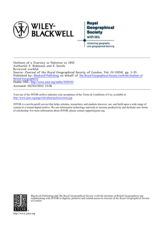
  • 3. B 35 316 c tel l MAP to illustrate fa reIa "OUTLINES OF A JOURNEY IN PALESTINE IN 1852," by the Rev4 I)TE.Robinson. Ppqeonlf'. -LaaarJeae z0-r ConvwentA 1obison e-routeciscoloLral RecL -Ras es Shakaor2adorwac ararSawma Ich Jeball c Naplrai7.m 34 e'y Ammai 0 cR !" Q7 A / ay of ASC Va Arrabehi ke Bay of Acre VRI-~ C.Carxuet z~":` NahrelleDamfw/ SIDON V- A I(,?, -?' jhye NYahrelZ Z d y 1 i ; NanhreiAhiaMAS R.I RLit~tny l b~ TYRE CI?~ -7t "A
  • 4. A.nariyehBRange, 33_5 316 ctelTi sp MAP illu strate Nahrd kka L.Hms OURNEY IN PALESTINE IN 1852," by the hreAr IT E.Robinson. cPioeoll o u -dTAe kka.r' aaoAarcne TRIPOLYh 0riZug mm Caaarxu ett -B atrtin (W ti Burys etBi Kald( -Dair-Moqa A<) JeballInVs Shef et Zaher Nahr~ et~s Aswa hhr 134 C.b Cneir F, ;K4 ~N et Eai Pl U13R~ Nahr al -D ami; nw 0b~ Neb~y Yt~ws Aluktai- at yako?",Tt jE 0.~ ~SW(IL jima Nahr elgaheptz?, ' !I : utk?L P('abyP~c~z~ ?eh Nahr d hia cu Nahret~diwad ashez a e yat NahrlZa~ny:~!I~suAilbUTYRE~ A~i~?IAL~i 7t 55~Itf a . ,
  • 5. ei .t Litvr"- SIDON t1 ,: ahi"el Zah, w Jahb c AhiaAMASC (j yI-YE~~. NahreiJWldA i e D ? ,el. R.Ltedny - 7t 32o jjee3bbaAmnw) TYRE iic A", tille.R it'Zd -cis el -, by ... •eitJifit J b. id•. - 35 .36 KAO•C•rRE thJ BayofAc~reC.Carmeli ir?d?; Sef-01AOdb& ieh Telkl'wnr~n;Yu,,lE~9mp ki,?,f I, IeZ~a141 Telels,W, kil lkill, I~i;M (Jab'~ a Jao~ Nahr-drj-?f 0Jeras 30ii Rasletit'a IM/14? Ihi~~ElphaBlrrjA -Z-Tdo32?yaaa Jell-:thl llbat~mo-Phiidelphi -ffb 3/5~~~ilHebr~'ebJ~ btfrteJLm~oho/ZGorpi~.oYyJM~ryBbmreSro~o~84
  • 6. SIDON -M. CNarxuel f. 4 -fV "T 4"4S~A-rS ,9U Nah ?ea ehia 'V zif I1 N "Y"Wi Nahreldi~wad tiskyo P,.Lit~ny ~ 3~~ "` ft7 TYThb Ile, lift", B oieasi RooI - 44 - C.Ca~Ink - -= - Sh'If k4-' /4Hu tObt mXeb yO~ ff4-f+ TelJ bYzii.-id Bf of Acre~44 PV/44 C.Carmel 41n'e'L' 14 "eTabm-ez o ra,!!nof Ww hrl ?,4'exun ;, 35, EIh0'NI elr e l g yL T e- SF-gqMCK .:--fuk at'aW(-ellaLd";; fbet . Vs----- j rt, Mo (0,Plant, 0Je4ras:I,V~aih et OW EAM e~.rab,? Mw?-i.Tb`",-"";?~~:;ura e8-1140huhet~ BB;rdo~c~me~;~ .--YI W Itoai(ebol) / _75-Musrith M?,tfrteJLm~oho/negahcZoYyJM~ralea~t~,o~o~84
  • 7. 2 Journey in Palestine in 1852. removed,and lie mostly nearby. The place is utterly lonely, and almost desolate, a few patches of wheat only being interspersed among the rocks. On the 5th of April, the Rev. Dr. E. Smith and myself found ourselves once more on the way fromBeirfit to Jerusalem. On the 26th of June, 1838, we had together arrived at Beiruit from our formertravels, and we were now setting off from the same point to continue our explorations. We encamped for the night at Neby Yiinas (Porphyrion), more than halfway to Sidon. After the tent was pitched, the beds arranged, and the frugal meal ended, it was with an overpoweringfeeling that we compared the presentwith the past. Here we were in our tent, not the same indeed as formerly,but yet so like it as hardly to be distin- guished-the furniture and all our travelling apparatus were similar-several things were the very same-and ourplaces in the tent were as of old. The intervening fourteen years seemed to vanishaway, as if we were but continuinga journey of yesterday. And when we reverted to the reality, we could not but gratefully acknowledge the mercy of God in preserving our lives, and per- mitting us once more, after so long an interval,to prosecutetoge- therthe researcheswhichwe had together begun. We could not but regard it as a high, and certainly an unusual,privilege, thus, after fourteen long years, again to take up the thread of our investigations. Under other circumstanceswe might, perhaps,have regarded it as an unpropitiousomen, when,during the night, a violent sirocco wind arose, and blew downour tent upon us as we slept. It was pitched upon the sand, the only foundationwhich the neighbour- hood afforded. At first we tried to sleep on beneath the fallen tent, but the flappingof the canvas compelledus to rise; and as the day was already breakingin the east, we decided to make an early start. This we did; and, fording the Auwaly near its mouth,reached Sidon soon after 7 o'clock. The observationswe made along the coast were not many; but they serve to correct the maps in a few particulars. We were now struck with the remainsof the ancient Roman road, traces of whichare visible from near the river Damfir for most of the way to the Auwaly.* From Sidon we turned eastward towardsLebanon, and after a ride of more than 2 hours pitched our tent at Kefr Falfis. For some distance onthe N. and E. of Sidon the mountainsretire, and the interval is an open, uneven, rolling tract, highly cultivated, * It is singular that no regular survey has ever yet been made of the Syrian coast; and it therefore gives us the more pleasure to learn from the highest authority that such a survey will probablybe undertaken by orderof the British Governmentduring the next year.
  • 8. Journey in Palestine in 1852. 3 and abounding in the finest fruit. From Sidon to the roots of Lebanonis about 3 hours, and then the mountain ridges rise by degrees. The next day, our plan was to have kept on to Rfim and the high conical point of Ruweiset RUim;then to have ascended and travelled along the high ridge of Jebel Rihan, S. of the angle of the Auwaly, until, reaching the road fromJezzin to Jerjfi'a, we could descend to the latter village, situated high up on the flank of the mountain, on the N.W. brink of the great gorge of the river Zaherany. We accordinglysent off our baggage-mules by the direct road to Jerjfi'a, there to await our arrival. But we had proceededhardly an hour on the way to Rfim beforeit began to rain, and, after waitingfor a time in a peasant'shouse at Rfim, we were compelledto forego ourpurposeand take the nearestway to Jerjfi'a. We reachedthatplace by wayofJeb'a, aftera long and dreary ride in the rain, and took refuge for the night and next day, in a dark and smokyroom in one of the hovels of the town. This was the only time that our plan of travelling was frustrated by bad weather. While lying next day at Jerjfi'a we descended into the chasm of the Zaherany, and visited its highest perennialfountain. Here we were surprisedto find the remainsof an ancientchannelcut in the rock, and connectedwith an aqueductfurtherdown,by which the waterof this fountainwas carriedbelowthe village aroundthe flankof the mountain,and so to Sidon; many remainsof such an aqueduct having already been known along the way to Sidon, though its beginning had not been found. The Sidonians had aqueducts fromthe Auwaly, much nearer, forirrigation; but they must have preferred this water for drinking. Even now, water fordrinkingis broughtto the city fromfountains,an hour or more distant. From Jerjfi'a, Sidon bore N. 420 W. From this high positionthe whole country, W. and S.W., was visiblequite to the sea. It is rolling, uneven,andsometimesrocky, made up of hills and valleys and plains, but no mountains. The gorge of the Zaheranyhere runs S.W., and turns nearly S. just below, along the W. base of Jebel Rihhn, for a short distance, when the river suddenly breaksthroughthe lowridge whichthere forms its western bank, and runs off W. to the sea. But the valley along the base of Rihan continueson, as Wady Jermfik, quite down to the Litany; and one might be almost tempted to suppose that the ZaherAnyonce kept on its course to the latter stream. On the right bank of the Litany, just below the entrance of Wady JermCik,on a high cliff, in no connectionwith Lebanon, stands the magnificent but deserted fortress,Ki~lat esh-Shiikif, the Belfort of thleCrusaders. It was in sight from Jerjfi'a, bear- ing directly S., and a visit.to it was included in our plan. B2
  • 9. 4 Journey in Palestine in 1852. The next day (April 9th) we proceeded througha fertile and well-cultivated region, by way of the market-townNiib'atiyeh,to Arnuin,a poor village below the ridge of the castle. Here are a few ancient sarcophaaicut in isolated rocks. The ridge on this side is neither very steep nor high; we rode the distance in 20 minutes from the village, half of it being level ground. But, on arrivingat the top, one looks down on the other side almost per- pendicularly into the abyss of the Litany, 1500 feet, as measured by Dr. De Forest with the aneroid. The top of the ridge is very narrow,and the castle occupiesits whole breadthand more, being in someplaces built up from lowerprecipices. Its length is hence greatly disproportionedto its narrowbreadth. On the S. of the castle the top of the ridge is levelled off, as a fine esplanadeor parade-ground. This fortressis knownto us fromthe historiansof the Crusades; but it needs only a glance to see that it dates froma much higher antiquity, and that the Crusadersdid nothing morethan repairit. The ancient portion,which still formsthe main body of the build- ing, is built with bevelledstones; not large stones, like those at Jerusalem, nor with a bevel so regular as is found in the tower of Hippicus, but yet of the same general character,though coarser. The sloping foundationsof the towersare also seen here, and, in- deed, some of the square towers may be said to be almostfac similes of Hippicus. The repairs of the Crusaders are every- where easily to be distinguished,they have a totally differentcha- racter. The chief workof theirs which remains is a fine Latin chapel, along the eastern wall. Perhaps some historical notice may yet be found, to fix the date of this fortress; but, at any rate, it cannotbe later than the times of the Byzantine, or perhaps,the Roman dominionin Syria. Here was always an important pass from Sidon eastward. Nothing overshadowsthe castle except Jebel Rihan on the N. and N.E., so that it formsa conspicuous object, visible at a great distancein all other directions. From it the castle above Banias bore S. 600 E. From esh-Shiikif we turned our course about W. by S. to the bridge over the Litany (here running westward),near the village K 'ki'iyeh. This bridge is in part an ancient structure,but the whole is very rickety. Here we encampedfor the night. Our next day'sjourney broughtus to the castle of Tibnin, the Toron or Turinumof the Crusaders. Our direct road to this place led up through the Wady Hujeir for nearly the whole dis- tance; but, after an hour, we turned to the left up anotherdeep valley, Wady Selbky, which has its beginning in the S.W. of Hinin, and drainsthe whole region. On the high southernbrow of this valley we came, after another hour, to the hamlet Kuibri- khah, where are the remains of a temple, with several columns
  • 10. Journey in Palestine in 1852. 5 still standing, with Ionic capitals. Hence we struck off again obliquely to Wady Hujeir, at a point where another temple once stood on its western side, of which only one or two columns remain. The fortressof Tibnin is on the summitof an isolated hill, and covers much more ground than that of esh Shuikif. It is also much morea work of the Crusaders; though several courses of bevelled stones on the outside show that they built it upon earlier foundations. It is now in ruins, except the gateway, where a family of Metawileh Sheikhs have built a house within the walls, whichthey make their home. Here Jerjfi'a bore N. 24' E. and the castle esh-Shiikif N. 42' E. From Tibnin we took a course S. 600 W., crossingour former route at Haris (not Hadith); and, after another hour, turned up the ridge on the right side of Wady el-'Ain, on the road from Rumeish to Tyre, to Yatir, a village overlooking the plain of Tyre, and evidently occupying an ancient site. Retracing our steps, we followed up Wady el-'Ain for a time S.E. and then turned to the right to a site of ruins called Haztir, and also HIa- ziry, but not the Hazor of Scripture and Josephus. Hence we proceeded S.W. to Rameb, on an isolated hill in the midst of a basin shut in by other high hills. This is, unquestionably,the Ramah of Asher, a different place from Ramah of Naphtali. Here are quite a numberof ancient sarcophagi. Half an hour W. of Ramah is a high hill, on which are seen from afar the columns and part of the architrave of an ancient temple. We visited the spot, but the columnsare all too much weather-worn to distinguish the order of their capitals. The place is called Belat. From this high point we could look down over the whole mountainous and broken region intervening be- tween it and the sea from Ras el-Abyad to 'Akka, and could trace the course of the ridges and valleys. Of the latter the great Wady el-Kiirn is the principal; it was described by our guides as so deep and precipitous,that even eagles could not fly acrossit. We learned afterwardsthat both Rameh and Belat had been visited a few weeks previouslyby Mr. Van de Velde. From Rameh we turned our course to Rumeish, and thence to Kefr Bir'im, on the road to Safed, half an hour E. of Sa'sa'. Here are the remains of two singular edifices. Of one a large part of the body is yet standing, with a portico of columns in front, of no Greek order. Behind the columnsis a large portal in the middle, with a smaller door on each side. The whole is very elaboratelydecorated with sculptured ornaments. Of the other building only a portionof the frontremains,standing alone in the fields. It is similar to the front of the other edifice, except that
  • 11. 6 Journey in Palestine in 1852. on the sculptured entablature of the middle portal is a Hebrew inscriptionin the ordinarysquarecharacterof the presentday. It is much defaced; and so far as it can be read, merely invokes " peace " upon the founder of the edifice, but withoutlegible name or date. If the inscription be coeval with the building, it marksit as a Jewish synagogue. That it and the other building actually were such is also evident from their resemblance to the ruined building at Meir6n, whichthe Jews still hold to be a syna- gogue of their fathers. We afterwards found the remains of similar edifices,markedby a very peculiar architecture,and some of them quite large, at Irbid, Tell 'Hfim, Kedes, and perhaps other places in Galilee. All this would seem to mark a condition of prosperity, wealth, and influence, among the Jews of Ga- lilee during the early centuries of the Christian era, of which, neither their own historians, nor any other, have given us any account. These edifices must have been coeval with their flourish- ing schoolsat Tiberias. The next day (April 14th) took us first to Meiron, whence, after examining the sepulchres and the ancient synagogue, we turned our course up the mountain W., and crossed the high ridge of Jebel Jermilk and the next valley to Beit Jenn. This village lies high up on the declivity of the ridge W. of the great valley, here running N.W. and forming one of the main heads of Wady el-Kilrn. Beyond this western ridge, in a basin from which goes out another great branch of Wady el-Kuirn, is the village Bukei'a, inhabitedin part by Jews occupied with agricul- ture. On this account they are supposed by some to be a rem- nant of the ancient Jewish inhabitantsof the land, who have never been driven out by the later masters of the country, whether Christiansor Muhammedans. Turning S. from Beit Jenn we came out, after half an hour, upon the brow of a pass in the ridge of mountains,here running from E. to W., looking out over the whole of southern Galilee. This point affordsone of the widest and finest views we met with in our wholejourney. Some 1500 or 2000 feet below us was the splendid plain of Ra^meh(the Ramah of Naphtali), coveredwith groves of olive-trees and fields of grain, while beyond were other ridges and plains, through whichwe were to pass. Through this long plain of RAmehruns the great road from 'Akka to Da- mascus. Singularly enough this plain has no outlet at either end. Its eastern part is drained througha gap in the southern ridge into the next plain, and so through Wady Sellameh to the lake of Tiberias. The westernportionis in like mannerdrainedthrough a similar gap in the same ridge into Wady Sha'ab, which runs down W. to the plain of 'Akka. On the southernridge, E. of the
  • 12. Journey in Palestine in 1852. 7 formergap, is a high roundedeminence,called Tell Hazdr, from a small ruin on its N.W. declivity. This also cannot be the Hazor of Scripture and Josephus, for that was adjacent,not (like this) to the lake of Tiberias, but to the waters of Merom or Sa- mochonitis,now the Hfileh. We descended to Rameh, lying still high on the lower and cultivated declivity of the mountain. It has few traces of anti- quity. We then crossed the plain obliquely S.E. and ascended the southernridge, aroundthe eastern side of Tell Haz-fr, to the large village el-MuighArupon its south-east side, overlooking the plain below. This place is probablyancient, but no corresponding name is found in ancient writers. From this point we visited the ruin of Hazfi^r,and also ascendedthe Tell. The plain now before us does not, like that of Rameh, extend unbroken between the ridges on the N. and S. throughouttheir whole length, but is divided near the middle by a lower ridge running obliquely across it from N.W. to S.E. between the two parallel ridges. The eastern part was now before us, drained eastward by Wady Sellameh, which comes in from the plain of Rameh, and enters the lake of Tiberias as Wady er-Riibfidlyeh. It has its name from an ancient site, Sellameh, on the western side of this part of the plain, the Selameor Selamis of Josephus. From el-Miighir we made a short day's journey, descending and crossing the plain on a S.W. course, and then crossing the oblique ridge into the westernportionof the plain. A large part of this is so level that a lake is formeduponit in therainy season, while the part furtherW. is drainedby the Wady Sha'ab to the westernplain. Keeping along on high ground near the southern hills, we came to 'Arribeh, lying in a nook among these hills. It is doubtless the Araba of Josephus. One hour furtherW., and in full view, is Siikhnin, the Soganeof that writer, and mentioned by him in connectionwith Araba. These names, as also Selame, are foundin the map of Galilee, by Schultz,but are not correctly placed. At 'Arribeh we were detained two nights, mainly on account of the lameness of one of our horses. This at last compelledus to turn down to 'Akka, which did not lie in our original plan. We thereforewent to Suikhnin,where are some ancient remains with bevelled stones. From hencethe direct roadto 'Akka passes by Mi'ar, on the browof the hills overlookingthe westernplain. We, however,turned more to the right, in orderto visit a ruin of which we had heard, called Kiibarah. In this name may be re- cognized the Gabara of Josephus, which he mentions along with Tiberias and Sepphoris,as one of the three principal towns of Galilee. We made a great descent to the bottom of Wady Sha'ab, at a point whence a good and level road led to 'Akka,
  • 13. 8 Journey in Palestine in 1852. and then turned N.E. up thenorthernridge, and across table land to the browlooking downinto the plain of Rameh. Here are the remains of Gabara, consisting of the ruins of a large and strong fortress,with the walls and foundations of houses and cisterns, indicating an importantplace. The remains of antiquity found here are much more extensive than those existing at Seffiirich. Rameh was here in sight, bearing N. 75' E. On the way to 'Akka we sawon our left, amongthe lower hills, the village of Kabfil; and afterwards,far on our right, another village on the declivity of the hills called 'Amkah, on the S. side of the deep ravinenow called Wady Jiddin, fromthe ruined castle of that name on its N. bank. These villages correspondin name to the Cabuland Beth Emek, of the tribe of Asher, and the deep valley may then perhapsbe that of Jiphthah-el. Boththese places had been seen and recognized by Dr. Smith during a former journey. We remained in 'Akka over Sunday, and starting again on Mondaymorning(April 19th) we took the roadfor the hills again, by way of 'Abilin. Our guide, however,finding that we desired to visit Jefat (Jotapata), proposed to take us a shorter way by Tiiinrah and Kaukab. To this we assented, and climbed the rough acclivity back of Tiimrah bya blindand unfrequentedpath. Jefat is E. of Kaukab: we reached it in 40 minutes, also by a blind path. This isolated Tell, first visited by Mr. Schultz, cor- respondsin every particular to the description of Josephus, but there exists not the slightest indicationthat a fortressor anything else ever stood uponit. The surface is naked rock, with one or two small cisternsnow used for flocks; but not a trace of a wall or foundation of any kind. It is shut out from any prospectby high hills on all sides, except that, through a narrow valley running down S.E., a small strip of the plain el-Biittanf is visible. Down this valley we proceededto the ruinsof Cana,of Galilee, which lie at its mouth, on the edge of the hills which skirt the Biittanf on the N. The remainsare those of a large village with well built houses, but without any special marks of antiquity. T'heplace is knownas Kdna and Khirbet Kdna to all the people of the region round about, both Christians and Muslims. We turned now westwardalong the base of the northernhills to Kefr Menda, and encampedfor the night. The next day (April 20th) we passed through Seff-frich,with its ancient tower, and leaving its great fountain on our left, a favourite camping-ground of the hosts of the crusaders,we kept on S.W. to Beit Lahm, the Bethlehemof Zebulon, a miserable village, with no trace of antiquity but its name. It had already been visited by Dr. Kally. We continuedon to Jeida, and then
  • 14. Journey in Palestine in 1852. 9 crossedthe great plain of Esdraelon in the directionof Lejjlin, encampingfor the nightin the middle of the plain. Here we had on our right the mouth of Wady Milh, at the base of Carmel, up whichvalley a road from 'Akka leads, and crossesthe ridge to the plain of Sharon. Just at the mouthis a hill called Tell Kaimon, in which is to be recognized the Camonof Eusebius, situated six Roman miles from Legio towards Ptolemais. It is still near the road from Lejjdn to Akka. May it also perhapsonce have been the Johneamof Carmel? The next morningwe crossed the Mukiitta (Kishon), running over a gravelly bed between banks from 15 to 20 feet high. Passing throughtracts of the utmost fertility, we came at last to the great Tell el-Mutesellim, whichstands out in front of the hill, on the back of which LejjAinis situated. This Tell affords a magnificent view of the rich plain; and as we looked towards Taanach, we became fully persuaded that we had before us the battle-field of Deborah and Barak. Whether Megiddo lay upon this Tell, as some suppose,but of which there is now no trace ; or whether it lay upon the hill back, the S. side of which is now occupied by Lejjiin; it was at any rate a sightly and important place, and might well give nameto the plain. The stream flowing down from Lejjiin is still the largest perennialtributaryof the Kishon. That Lejjdn is the representativeof the more ancientMegiddo, there can be little doubt. Maximianopolis, to which Raumer assigns the succession,partlybecause it is markedas on the route from Cesarea to Jezreel (Zer'in), must have lain more to the E. We saw afterwards the course of that route through the hills, more eastward,and saw too that for it to pass through Lejje-n would be a large circuit towards the W. Maximianopolis may not improbablyhave lain at or near the large village Salim. Near Lejjhn passes the great road from Damascus to Ramleh and Egypt. We followed it to the top of the pass, and then, without descending, took a more south-easterly course to Um el-Fahm, on the browof a hill looking towardsthe westernplain. Hence we proceeded on high ground south-eastwardsalong the watershedbetween the heads of valleys running to the northern and the western plains, and came for the night to Ya'bud, on a hill overlooking another beautiful plain, extending far to the E. and N.E., and bending round Ya'bud towardthe West. Far in the N.E. we had beforeseen KiibAtiyeh,and in the northernpart lies Kefr Kfid, the ancient Capharcotiaof Ptolemy. Here too, in the middle of the eastern plain, we were delighted to find the name of Dothan (Dothan); it is now a fine green Tell, with a fountainon its southernbase, correspondingentirelywiththe posi- tion assigned to it by Eusebius, 12 Roman miles N. of Samaria.
  • 15. 10 Journey in Palestine in 1852. We learnedafterwardsfrom Mr. Van de Velde, that he too had unexpectedly lighted upon the place some weeks earlier. In this connection,we were told at Ya'bud, that the great road from Beisan and Zer'in to Ramleh and Egypt still leads through this plain; entering it W. of Jenin, passing near Kefr Kfid, and bending south-westwardsaroundYa'bud to the westernplain. It is easy to see, therefore,that the Midianites to whomJoseph was sold in Dothan, had crossed the Jordan at Beisan, and were pro- ceeding to Egypt along the ordinaryroad. It is obvioustoo that Joseph's brethrenwell knew the best places of pasturage. They had exhaustedthat of the Miikhnaby Shechem (Nablus), and had afterwardsrepairedto the still finer pastureshere around Dothan. On the day after (April 22nd) we followed down the road by which Joseph was carried away to Egypt, to Zeita and 'Attil on the bordersof the western plain, and then turned up again into the mountainsonthe way to SebiistiehandNablus. We supposed we were here upon Herod's road from Cesarea to these places, and in many parts there were evident traces of an ancient road, but wesawnowhereanypavedway. We spentthe nightat Ramin. The next day, in crossinga rockyridge somedistance S. of Sebils- tieh, and before we struck again our route of 1838, we found evident remains of the ancient road over the ridge; here were also columns and other traces of an ancient site, now called Dibb^rieh. We spent the day in Nablus, and again visited the Samaritans. Both the priests,father and son, whom we saw before,are still living; but the elderseemedto besuperannuated,andthe younger is now the acting head of his people. Learning that we desired to see him, he came to us, conductedus to their place of worship, showed us their manuscripts,and loaned of his ownaccordto Dr. Smith a fine copy of their Arabic versionof the Pentateuch,to be used by him in the new Arabic version,in whichhe is engaged. From Nablus we bentour courseagain S.W., on the direct road to Ramleb. We turned around the shoulderof Mount Gerizim by Rafidieh, and passed by Kuryet Jit (the ancient Gitta) and Funduk, leaving Fer'ata (Pirathon) at no great distance on our left. As we began gradually to descend towards the plain, we had on our left a large and deep valley called Wady Kanah, which we may with probabilityregard as the brookKanah of the book of Joshua (xvii. 9), the boundary between Ephraim and Manasseh. Lower down it takes a different local name. We passed on by 'Azziin, and down the long Wady of that name to its entrance into the plain, opposite Kilkiliehl and Kefr S ba. Turning left a little to Hableh on the low hills S. of the Wady, we encampedover Sunday, in full view of Kefr Shba, and also of Jiljhlieh furtherS. These are the Antipatris and western Gilgal
  • 16. Journey in Palestine in 1852. 11 of Scripture; and were visited and described by Dr. Smith in 1844. At Hableh I was gratifiedatfindingclose by our tent an ancient wine-press hewn in the rock. It was complete, with the upper shallow vat for treading the grapes, and the lower deeper one to receive the liquid,and might still be used, were there here grapes to tread. At presentthere are no vineyardsin all this region. I wouldhave given much to transport this wine-press in natura to London or New York. On the following Monday (April 26th) we proceeded south- wardsalong the foot of the hills; crossingin a quarterof an hour from Hableh the continuation of the great Wady Kanah here called Wady Zakitr and Wady Khureish, from two sites of ruins on its banks. It was here said to come from the S. end of the plain el-Milkhna. It passes off S. of Jiljfilieh, and joining the Wady from Kefr Shba, goes to the Aujeh. We had the great fountain of the Aujeh, at Ras el-'Ain, on our right in the low plain. From Mejdel Yabawe turnedS.W. into the plain,entered the Damascus road, and came on it to Renthieh. This village, so far as the name is concerned,might well be held to be the ancient Arimathea; but the historical notices seem to fix that place, not in the toparchyof Lydda, where this village lies, but in that of Fibneh (Timnath Thamna),farthereastward. We came to Lydda, and passed on by way of Kubhb to Yalo, the ancient Ajalon. The road lay much of the way along the Wady 'Atallah, whichdrainsthe plain of Merj Jbn 'Omeir, and runs downon the E. and N. of Lydda. Yalo we formerlysaw from the upper Bethhoron,and our view of it and the adjacent region was correct, except that the plain of Merj Jbn 'Omeir is bounded by the ridge, on the N. side of whichYalo lies, and does not extend itself towards the S.W. beyond Kubab, as we then supposed. The name Jbn 'Omeir belongs to the district, and not specially to the plain. We were told afterwardsof a ruined place in the mountainsE. of Yalo, and not very far off, called Kefir. It probablyis the site of the ancient Chephiraof the Gibeonites; but we heard of it only too late to visit it. We proceededthe next day to 'Amwas,the ancient Emmausor Nicopolis, situated betweenYalo and the Jerusalem road, twenty minutesN. of thelatter. It is a poorvillage, witha fountain,andthe ruins of an ancient church,a fine structure of large hewn stones. It lies on a declivity, looking westwardout over the great plain. Close upon the S. side of the Jerusalem road is the Tell and ruin of Latron. The ruin is that of a fortress,some of the lower partsof whichappearto be Roman work. This is the place which formerlywaspointedoutto us at Tell es-Safiehas 'Amwas. From it the latter Tell is visible. The Wady 'Aly, along which the
  • 17. 12 Journey in Palestine in 1852. Jerusalem roadleads upthe mountainto Saris, here bends around on the S. of Latron, and then turning N.W. it passes downE. of Kubhb to Wady 'Atallah. We now kept on southwardsto Stir'a, the ancient Zorah, the birth-placeand residence of Samson. We saw it from the S. on our former journey, on a high peak overlooking the fine plain of Bethshemesh. We approachedit now fromthe N., on whichside the elevation is not more than half as great. Some 20 minutes before reaching Zorah, we came to a noble fountain, and after- wards passed no less than twelve women toiling up to the village with jars of water on their heads. This is a very common sight in Palestine; but in the presentcase the hill was very steep; and we remembered, that in all probability the mother of Samson must often have visited this fountain,and toiled homewardwith her jar of waterin like manner. Our objectin visiting Zorahwas to obtaina viewof the country between it and Jerusalem, and especially to ascertain the course of the great valleys. We found the plainof Bethshemeshextend- ing up some distance N.E. of Zorah into the mountains,and could see the chasmsof two great valleys running down into it. About E.S.E. of us was the mouth of the great Wady, whichcomesdown by Kulonieh, and furtherN. that of Wady Gh'irAb,one branchof whichbegins near Saris, and anotheraboveKuryet el-'Euab. On the high ridge between this latter and the Wady of Kulknieh, lie Soba and Kiistiil. We wished to proceed to Jerusalem along this same ridge by Kesla and S6ba, but, after starting, learned that the road was impracticable. The usual road from Siir'a is along the western declivity of the ridge of Saris to Wady 'Aly. We took this route at first,but turnedup bya verysteepanddifficultascent,andgained the top of the ridge at Mihsir, a flourishing village, surrounded by olive-groves, an hour W.S.W. of Saris. We kept along on the top of the ridge, having a branchof Wady Ghiirab below us on the right, to Saris, and thence took the ordinary and very drearyroadto Jerusalemby Kuryet el-'Enab, the ancientKiijath Jearim. We reached the city at 8 o'clock on the morning of April 28th, having been more than three weeks on the way fi-om Beirut. In Jerusalem and the vicinity we remained twelve days, dili- gently occupiedin examining the objects of interest, and investi- gating the various questions connectedwith ancient topography. Weconstantlyenjoyedthe kind attentionsand ready assistanceof Dr. M'Gowan and other gentlemen connectedwith the English Missions,as also those of our own countryman,Dr. Barclay, now residing in Jerusalem. For all these our best thanks are due. Bishop Gobat had already left the countryon a visit to England.
  • 18. Journey in Palestine in 1852. 13 This is not the place to enter upona discussion of the vexed questions connected with the historical topographyof the Holy City. I may, however,be permittedto refer to a few particulars, which may serve to show how the public mind has been misled by statements and conclusions not founded on careful and correct observation. First. In a publishedPlan of Jerusalem, to whichare attached the names of the English engineers, Colonel Aldrich and Lieute- nant Symonds, the western wall of the Karam, or enclosure of the great Mosk, is laid down with two retiring angles towards.its southernend, that is, so that it does not continuestraight through its whole length, but on its southern part, first turnseastward by a right angle, and then again by a second right angle. Great stress has been laid upon-this Plan, as constructed from actual survey by scientific engineers, and therefore decisive as to the point in question. Yet it contradictsthe Plan of Mr. Catherwood, made fromactual measurements in the interiorof the Haram, as well as all other Plans of the city beforeor since. Through the kindnessof Dr. M'Gowan we were able to make some observationshaving a bearing on the subject. He and Mr. Colman accompanied us to the barracks, the residence of the military governorof the city, at the N.W. cornerof the Haram, from the roof of which there is a near view of the whole interior. Here, not only the general view showed that the westernwall is straight throughout,but a special circumstanceadded strength to the conviction. We had alreadynoticed two cypress-treesstand- ing just inside of this wall near the S.W. corner of the Haram and S. of the house of Abu Sa'fid, so called. These two trees we could now see standing in a line with the northern part of the wall as we looked along the latter. We afterwards repaired to the house of Abu Sa'fid, to whichthe professional services of Dr. M'Gowan had procured for us a ready admission. It is built directlyupon the westernwall,at some distancefrom the southern end, andis partlywithoutandpartlywithintheenclosureof the Ha- ram, a passage being brokenthroughthe wall in each story. We were introducedinto the uppermostroom,wherefromthe windows there is a view of the wall further N. and of the southernpart of the enclosure. We were also conductedthroughthe buildings in the S.W. cornerof the H-aram,but not, of course, to any place where we should be exposed to public view. The result wasas before, that the western wall is straight throughout. Such too was the testimonyof the very intelligent ownersof the house, one of whom occupied the post of Secretaryunder the Government, and had charge of the Census. After all this I can only repeat the expressionof my surprise, that the namesof scientificengineerscouldever havebeen attached to the publicationof so manifestan error.
  • 19. 14 Journey in Palestine in 1852. Second. In respect to the Valley of the Tyropcon, so called by Josephus, the new theory, first broached since 1840, and contra- dictory to the current views of all former centuries, transfersthe beginning of this valley from theYafa gate to the Damascus gate. This is really a questionof interpretationbetween the supporters of this hypothesisand Josephus. But so long as with one voice they follow him in making Zion terminate at the street leading down from the Y fa gate, all the laws of philology and herme- neuties require that they should follow him further,and like him, make the Tyropoeon,and then Akra, lie adjacentto Zion. By no law of language can it be justified that one part of the historian's descriptionshould be followedand anotherpart left out of view. Third. In connectionwith this transferof the Tyropceonit has been asserted that there is no ridge N. of Zion, and no rise of ground in that direction. This statement needs correction. The street which runs N. in the rear of the Churchof the Sepulchre rises very considerablyin that portionof it, although at its south- ern end it appearsto decline northwards.But just at thissouthern end is the Greek church of St. John, beneath which there has been dug out a chapel, standing on ground at least 25 feet below the present level of the two streets at that point. In the Bazdrs the water is conductedoff by a sewer runningtowards the S.; and furtherN., oppositeto the Churchof the Sepulchre,the main street is carried.along a coveredpassage cut througha ridge of solid rock. Turning downat the S. end of this covered pas- sage, along the street leading by Helena's Hospital, so called, we enter on the left the court of the PrussianConsul, and ascend by two flights of steps to his garden and dwelling (formerlyMr. Lan- neau's) on the same ridge. Following the same street further down we findit crossingvery obliquelythe crest of the descending ridge. If, again, fromthe street running S. along the bottomof the depressionor valley, one enters the street next S. of the one just described, he firstascends W rather steeply; the street then turns N., and he ascends quite as steeply until it turns W. again. Here another street comes into it from the S. up a rathersteep ascent. From all this, it appears that there is on the N. of Zion a rockyridge, on whichthe Churchof the Holy Sepulchrestands, and which ends below in a rather broad point, about in a line betweenthe said churchand the great Mosk. This is the ridge, which, with the adjacent tract, accordingto the descriptionof Jo- sephus, must be regardedas Akra. That the Tyropceonitself, probablya narrowravine, should no longer exist at its formerdepth is not surprisingwhen we consider the immense masses of rubbishwith which the city is everywhere covered. The excavated chapel under the church of St. John shows how enormoushas been the accumulation along the very line in question.
  • 20. Journey in Palestine in 1852. 15 Fourth. In connectionwith the same transferof the Tyropoeon have been adduced the channelsof living water said to enter the city by the Damascus gate. That a reportis current among the native inhabitants, that a trickling of water may sometimes be heard at that gate, we formerlylearnedand have related, and the same story is now repeated every day. But we never found a personwhoprofessedthat he himselfhad everheardthis trickling, neither a native nor muchless a Frank. Yet it maywell be true, and that without being wonderful,seeing there are two large cis- ternsjust by the gate. But, in additionto this supposedchannel, one writerasserts that just outside of the Damascus gate, on the right hand, is a large reservoir of living water flowing into the city, fromwhichmany fountainswere formerlysupplied. Another writer speaks of a well of living water in the Churchof the Fla- gellation, and regards it as connected with this channel at the Damascus gate. Both writers appeal also to the taste of these waters, as resemblingthat of the watersof Siloam. It seemed importantto provethe accuracyof these statements. We went, therefore,to the Damascus gate, in companywith some of our friends,and found not only a cistern on the right side of the gate, but also one on the left side. They are both, however, merely ordinarycisterns of rain-water,filled by the water which runs from the road and fields above, and is conducted into them by small channelsor furrowson the surface of the ground-these we saw. We tasted of the waterin the right-handcistern; it had, indeed, a flavour somewhat like that of Siloam, but it was here merely the taste of impurewater. We then tasted of water from the other cistern, and found it almost putrid. We afterwardsre- paired to the Churchof the Flagellation. In the outer court is a large cistern of good rain-water, collected from the roofs and courts. In an innercourtis a smallerreservoir,andthe attendant began to relate how the water in it was never exhausted, and never stood higher nor lower in the reservoir. We tasted it, and found again the Siloam flavour. But, looking at the water which had just been drawn up, we perceived that it was full of the wriggling worms and other animalculhefound in impure rain- water. Here then was anotherordinarycistern, and the peculiar taste was accountedfor. Fifth. Of the second wall of the city, Josephus says that it began at the " Gate Gennath" in the firstwall, and ran " cir- cling around" to the fortressAntonia. The Gate Gennath has, therefore,usually and naturally been regarded as situated near the tower of Hippicus. But the moderntheoryremovesthis gate eastwardto a pointin the wall along the browof Zion,fromwhich the said second wall would run northwardsalong the street of the Bazars. The groundsand argumentsbroughtforwardin aid of this
  • 21. 16 Journey in Palestine in 1852. view by twoof its earliest supportershave all been rightly rejected by the latest, with the exception of two, and these would seem to be hardlymore tenable than the rest. These are the traditionof two gates along this line, one the Portajudiciaria, so called, on the Via dolorosa,the other on the brow of Zion. Now, as to the Portajudiciaria, without which the whole argument falls to the ground, there is no appearance nor evidence that a gate ever stood in that spot-a single lone column does not of itself imply a gate. And further, of the Via dolorosaitself, now held to be so authenticated by tradition,there is no historical trace until long after the Crusades. On the contrary,historicaldocumentsclearly show that in the thirteenthcentury the streets now so called were knownamong the Christiansby other names. In oppositionto such a course of the secondwall, we have, first, the manifestabsurdityof supposingthat a wall for the defence of the city would be carriedalong the middle of a declivity, whereit would everywhere be commanded by higher ground outside. Then, too, we knowfrom Josephus, that there was a gate, by which water was broughtinto the towerof Hippicus; of course,it was near Hippicus. in describingthe approachesof ritus, after he had taken the third or outer wall, the historianspeaks of the next wall (the second) as extending up to that gate. Hence we have the second wall describedintwooppositedirections;once, as beginning at thegate Gennath,andrunningnorthwards,andagain, as runningsouthwardsup to the gate near Hippicus. The infer- ence is conclusive,that the gate Gennath and the gate by Hip- picus were identical. Sixth. One writer regards the course of the third or outer wall of Josephus as having been in the main the same with that of the present northern wall, and denies that the ancient city extended fartherN. than the limits of the modernone. But the multitude of ancient cisterns existing over a large tract out- side of the present wall on the N., and in no other quarter, proves, conclusively, that a very considerable extent of ground was here occupied of old by the streets and dwellings of a portion of Jerusalem. From these six specimensit will be obviousthat I did not find the statements and hypotheses of recent writers sufficientlysup- ported by observation,to lead me to any importantchange in the views of the topography of Jerusalem expressed in my former work,and current for centuries. I might go on to add other like examples, but must leave them for anotheropportunity. From these specimens, too, it might possibly be inferred, that these recent inquiries have been carried on, not so much with a desire to arrive at the simple truth, as to find support for preconceivedopinionsor favourite hypotheses. The authorityof
  • 22. Journey in Palestine in 1852. 17 tradition, it might be said, was, at all events, to be sustained, even when unsupportedby any evidence from history. From Jerusalem we made an excursion of a day to the Wady el-Werd (Valley of Roses) and its three fountains, S.W. from the city. One of its main heads is in the Plain of Rephaim,and the valley enters the great Wady of KulEnieh, near a village called 'Akfir. The valley has its name from the extensive fields of roses cultivated in it. The fountains are 'Ain Y0lo, 'Ain Iliiniyeh (St. Philip's), and that of Bittir; the latter being much the largest. We passed near the Convent of the Cross in going out, and returnedby Welejeb and the ridge above the village and conventof 'Ain Karim. Another excursion, of 2 days, took us to the neighbourhoodof Hebron. In our formerjourney we had been compelledto hasten over the road between Hebron and Jerusalem without a guide, and hence it had been in some respects our least satisfactoryday in Palestine. We now took the same road, stopping at Urtas on our way, where Mr. Meshullam now cultivates rich and well- watered fields along the bottom of the valley. The German colonists,who were here two years ago, were in his employ, but are since scattered. We went also to Bethzur, and visited again the vast and inexplicable foundations at Rameh; as also the remains upon the hill. Thence returning to Halhfil, we en- campedfor the night near its sightly mosk. On our return to Jerusalem, next day, we kept along as near as possible to the western browof the mountains. We passed through Beit Ummar and near to Jedcir,and afterwards came to Beit Sakarieh, on a high and almost isolated promontory, over- looking the westernregion of lower hills. It bears every appear- ance of having once been a strong and impregnable fortress. It is, withoutdoubt, the site of the ancientBethzacharia of Josephus and the historianof the Maccabees; since, besides the identity of name, its positionrelative to Bethzur is precisely the one required by the accounts of those writers. We'passed on through the little village el-Khiidr, and struck the road from Hebron to Jerusalem just W.of Bethlehem, On the 10th of May we left Jerusalem to proceednorthwards, and reachingthe browof Scopus, I turned and looked upon the Holy City for the last time. We hasten on, leaving on our right the conspicuousTuleil el-FlUl,the ancient Gibeah of Saul, and came to Ramah of Benjamin. Thence we turned eastwardto the Tombs of the Amalekites, so called, in the low plain in the valley N. of Hizmeh. These are merely four low heaps of rough stones, in the form of long parallelograms; the largest is 102 feet long by 27 feet broad, and 3 or 4 feet high. There is no appearance of antiquity about them, nor of any sepulchral character. Our VOL. XXIV. C
  • 23. 18 Journey in Palestine in 1852. guide from er-Ram called them Kuboir Isra'in (Tombs of the Israelites); but we heard also the other name. We kept on in the same direction to Khirbet el-Haiyeh (Ser- pent), on the ridge between this valley and Wady Suweinit, near the southern browof the latter. This place, on account of the name, has recently been brought forwardas the site of the ancient Ai. But there is no affinitybetween the two names; since Ai containsthe tenaciousletter Ayin, whichthe otherhas not. And further, Ai was near to Bethel, and of easy access fromit; but this spot is at least nearly 3 hours distant from Bethel; and the deep and difficultWady es-Suweinit lies between. There is here no valley on the W., except the low openplain we had traversed, whilst towardsJeb'a there is a ridge. We turned now to Jeb'a, the ancient Geba,and again crossed the deep valley to Mfikhmrs, passing in it the two steep hills, the scene of Jonathan's adventure with the Philistines' garrison: they struck us now, more than before, as well adapted for such outposts. At Milkhmas we encamped, and next day passed on over the rocky Tell of Rilmmon,and along the declivity below Taiyibeh on the W., to Deir Jerir. Here we entered upon new ground, which as yet is a blank in the maps. We crossed obliquely a very high ridge, and came in about an hour to Kefr Malik, on a high point overlooking the deep Wady, going down to the Aujeh. Crossing this, anid ascending again to a higher, uneven plateau, we came in an hour more to el-Mughaiyir, a large village, and in another hour to Daumeh, the Eduma of Eusebius: here we encamped. Froma hill just by we had a wide view of the Ghor directly below us, and of the ridge of Kuirn es-Suirtabeh,not far distant in the E.N.E. Just under our feet, in an offset from the Gh6r, was Fushil, the site of the ancient Phasaelis. The next morning, after crossing the branchof the greatWady Fusail, we came to Mejdel, a very old place, with an extensive view of the Ghor, and a nearer one of Kuirnes-Siirtabeh. An hour and a half brought us nowto 'Akrabeh,a large and flourish- ing town, whichof old gave its namneto the toparchyof Acra- battene. The situationis fine, on the base of a high ridge on the northern side of an open valley or plain, which just here has its watershed,running down E. to Wady Ahmar, under KUirnSiir- tabeh; and also W., as Wady Bir Jenhb, by Kilbelan to the westernplain. From 'Akrabehwe took a circuitous route north- wards,by Yanjin to the S.E. cornerof the little plain of Salim, E. of Nablus; and then descending and passing through Beit Fiurik,we crossedthe waterbedof the Mtikhna, runningthrough the W. end of the little plain, and came to Nablus for the night. The followingday (May 13th) we turned again N.E., towards
  • 24. Journey in Palestine in 1852. 19 the Ghbr. At the mouth of the valley of Nablus, on the N. side, are the ruins of a village called 'Askar, which name has some- times been comparedwith the Sychar of the New Testament. It has, however,the letter Ayin, which precludes any such affinity. We passed on northwards along the plain, whichis here narrow, and soon breaks downby a deep and singular gorge to the Wady Faria and its wide rolling tract. We turnedmore to the left and ascended steeply to Tiillfizah, lying N. of Mount Ebal, and surrounded by immense olive-groves. This seems to be the ancient Tirzah, for a time the residence of the kings of Israel; though it now bears few marksof a royal metropolis. Hence we crossedthe branchesand interveninghigher plains of Wady Faria to Thbabs,in 22 hours. This is the Thebez of Scripture,where Abimelech met his death. It lies on a declivity looking E., and has a fine plain, with olive-grovesbeforeit. We kept on for less thanan hourfurtherto Teyasir, a small village, and there stopped for the night. This village is near the head of Wady el-Malih, which we fol- lowed next day down to the Ghbr, climbing on our way to the ruins of a fortress,of moderate size, K'isr el-Malih, once com- manding a pass. The descent is here very gradual, the hills become lower and lower, and gradually lose themselves in the plain. In Wady el-Mhlih are springs of saltish water, blood- warm; and in its lower part is a running stream. As it crosses the Ghor to the Jordan,there is on its northernside a broadlow swell, extending fromthe westernhills quite to the upper banks of the Jordan; the river being here crowdedquite to the eastern part of the Ghor. We kept along uponthis swell, and came at its extremity to a low hill, on whichare the slight remainsof Sakiit, a name correspondingto theancientSuccoth. It looks downupon the lower valley of the Jordan, here a plain of some width; the place and banksof the streamare seen, but not the water itself. We now turned N.W., througha lower portion of the plain, exhibiting the utmost fertility, and coveredwith the rankestvege- tation. The grass and weeds came up to our horses'backs, and the taller thistles often rose above ourheads as we rode along. On the higher plateau, nearer the western mountains, the in- habitants of Ti'bas and other villages cultivate wheat. They were now in mid-harvest; and we pitched our tent by the side of a colonyfromThbas, who were dwelling in tents and booths, with their women and children,horses and donkeys, dogs and poultry. What struck us here especially were the many fountains and brooksin this part of the Ghor, furnishingan abundantsupply of water, and giving rise to a most luxuriant fertility. Here we bargainedwith two young Sheikhs fromTibais, active and intelligent men, to take us on an excursion of a day across c2
  • 25. 20 Journey in Palestine in 1852. the Jordan. Our object was to ascertain whether any place or ruin called Yabis (Jabesh) still existed on or near Wady Yabis; and in that way determine, if possible, whether the ruins at Tiibiikat Fahil were those of Pella. Eusebius gives the distance of Jabesh from Pella at 6 Roman miles, on the way to Gerasa (Jerash). We proposedto go first to Kefr Abil (not Bil), which lies high on the side of the mountain,not very far distant from the probable positionof Jabesh Gilead; since the men of Jabesh had gone downby night to Beishn, and carriedoff the bodies of Saul and Jonathan. We rose very early (May 15th), and sending our muleteers to Beisan, directed our course to the ford not far N. of Sakfit. Descending the steep upper bank of the Jordan, here 150 feet high, and crossing the low alluvial plain, which our guides said was never overflowed,we came to the ford. A narrow island, covered with rank vegetation, here divides the river into two branches; the eastern one being much the largest. The stream was rapid, and the water came up high on the sides of the horses. Having got safelyover,we ascendedat oncethe steep easternupper bank, and crossed obliquely the narrow plain to the foot of the mountains,to reach the mouthof Wady Yabis. As we approached the firsthills we foundourselvessuddenly surroundedbytwenty or thirty armed men. They proved to be fromthe village of Farah on the mountain, and were here to harvest their wheat in the plain. They had recently helped to drive away the officersent to enforce the conscriptionin their district; and they had now been watching us, thinking we might perhaps be coming from the government on a like errand. They were acquainted with our Sheikhs, and, finding all right, they took us to their encampment on the S. bank of Wady Yabis, gave us coffee,and broughtus bread and leben,which we left to our guides. We now began to ascend the mountainbya smaller Wady just N."of the Yabis. After half an hour the hills becamehigher and greener; and oak trees, the oaks of Bashan, began to appear, scattered like orchardsupon the hills. After more than an hour we came out upon a prominentpoint, affordingan extensive view over the whole northernGh6r fromKiirn es-Suirtabehtothe Lake of Tiberias. The whole southernpart,fromthe KUirnto the Dead Sea, I had already seen. This eminenceprovedto be the browof the first plateau of the mountain,along whichwe ascended very gradually through a region of the utmost verdure, and beauty, and fertility, to Kefr Abil, near the foot of the next high ridge. We found it deserted. The inhabitants had been implicated with those of Farah in the matter of the conscription; and seeing Franks approaching,(an event of unusual occurrence,)they had
  • 26. Journey in Palestine in 1852. 21 all left the village. They were, however, not far off, and soon returned. Wady Yabis is a mile or more S. of this village. It breaks downfrom the higher ridge by a deep glen, in whichis a place of ruins called Maklfhb,as having been " overturned." It was said to have no columns. Lower down on the Wady, about S. from us, and on a hill on the S. side of the valley, is another ruin called ed-Deir; it is on the road from Beisan to Helaweh and Jerash, and has columns. This latter ruin seems to correspondwell to the site of ancient Jabesh Gilead; but the name Ya^bisnowexists only as applied to the Wady. We now turned to descend the mountainby a more northern path leading directly towardsBeishn, computing, that if the ruins at Fiibiikah Fahil were those of Pella, we ought to reach the spot in about 2 hours. Our road to Beis^n passed 10 minutes N. of the ruins, and we were oppositeto them in just 2 hours. But our guides knew them only as el-Jerm, and we went on 10 minutes furtherbefore turning off to them. They lie upon a low hill or mound,having a broadarea on its top, surroundedby higher hills except on the W., where is a plain, which also runs up on the N. side of the hill or mound described. As we approachedfrom the N., we came upon ruins in the low plain, with manyfragments of columns. The area on the hill is covered with like remains, and others are also seen below in the westernplain. Below the hill, on the S.E. quarter,there is a large fountain, which sends off a stream towardsthe S.W. Near it wasa small temple, of which two columns are still standing, and the valley below is full of oleanders. From men on the spot, we learned that the name of the place itself is Fahil, the word Fibiikah (meaning a story of a house, a terrace) being here applied to the narrow plain which stands out like a terrace in front of the hills, several hundredfeet above the valley of the Jordan below. The situationof this spotin relationto Beishn and Wady Yabis, the extensiveremainsobviouslyof a large city, the copiousfountain, and also the name, left no doubt upon our minds, that we were standing on the site of ancient Pella. The ruins were discovered and visited by Irby and Mangles in 1817; but no idea of any connectionwith Pella suggested itself to their minds. Since that time no Frank traveller has visited the spot. The first public suggestion of the identity of the place with Pella, was given in Kiepert's map of Palestine, in which the name of Pella is inserted with a query. Our main object was now accomplished,in thus verifying the correctness of Kiepert's suggestion. Mr. Van de Velde, whomwe had met again at Nablus, accompaniedus on this excursion at our invitation. Descending fromthe terrace 500 or600 feet to the plain below,
  • 27. 22 Journey in Palestine in 1852. we came to the fordof the Jordan. Here are in fact threefording places, of whichthat lowest downis said to be the easiest; but we found it deeper and more rapid than the ford of the morning. The Sheikhs proposed,and we assented, that one of them on foot should lead our horsesone by one across. In this way we crossed safely, the water coming up almost to the horses' backs. We pushed on rapidly through the glorious plain to Beisan, whereour tent was pitched, and we remained over Sunday. This was our hardest day's workin Palestine. Beishnhas a splendid position,just where the great valley or plain of Jezreel sinks down by an offset or gradual declivity of 100 feet or more to the Gh6r. Just on the brow of this de- clivity is the village, and also many remains of the ancient city. But the Tell or acropolis is 10 minutes further N., near the stream of Jalid coming from the W., whichpasses down at the N. foot of the Tell. On the S. of the Tell arenumerouscolumns still standing,andthe very perfectremainsof a large amphitheatre. All the ruins (except the columns)are of black basaltic stones, and the Tell is also of the same character,and black. On Monday morningwe left the direct road to Zer'in on our right, and struck off to the foot of the mountainsof Gilboa, to a site of ruins called Belt Ilfa, which had been already visited by Schultz. The remainsare those of a small place: there are two or three ancient sarcophagi. It could never have been a fortress of importance,since it lies in the plain directly at the foot of the high mountain. Whether it was the Bethulia of the book of Judith is at least doubtful. We now passed on across the plain to Kuimieh,and were near getting our animals mired in the soft bottom of the Ialfd. At Tiimrah we crossed the line of hills extending from the Little Hermon eastwardto Kaukab, and descended so as to pass along the eastern foot of Tabor to the Khan and L-ibieh. Here we encamped. From LUibiehwe came next morningto the Hajar en-Nuisrany, where our Lord is said (in monkish tradition) to have fed the 4000. My object at this place was to obtainthe view of Caper- naum described by Arculfus, as this seemed naturally to be the point of which he speaks.- Thence we descended to Irbid at the upper end of Wady Hamahm. The remains are not important; but among them are the columns and some other portionsof an ancient Jewish synagogue, of the same type with those at Kefr Bir'imandMeiron. We nowpassed downWady HamhAm,beneath its frowningprecipiceswith the cavernsof the fortressKill'at Ibn Ma'an, and entering our formerroute at the Round Fountain, followed it to Khan Minyeh. Here I was more impressed than formerlywith the extent and character of the adjacent ancient
  • 28. Journey in Palestine in 1852. 23 site; and the neighbouring fountain, 'Ain el-Tin, is fine and cold. On the promontorybeyond is a deep channelcut in the rock, now serving as a road, but obviouslyonce an aqueduct conveying water from Tibighah to irrigate the plain. At Thbighah the water was formerlyraised to an elevated head in a massive reser- voir; but there are no traces of the intermediatechannel. At Tell HI-m we at once recognizedin the sculpturedremains,which formerlyhad puzzled us, another ancient Jewish structure, like those at Meir6n and Kefr Bir'im, and the largest and most ela- borate of all. At Tell HdImwe turned up from the lake along a shallow Wady coming down from the N.W., in order to visit a site of ruins called Kerazeh. An hour brought us to the place. The remains are merely the basaltic foundations and walls of a poor village. In a side valley, 5 minutes N.E., is a small fountain called Bir Kerazeh. This name may be compared with the ancient Chorazin; but the latter place, according to Jerome, appears to have been situated on the shore of the lake (in litore maris sita), and the remainsseem too unimportant. We now struck up into the road running N. from the Khan Jubb Y-isuf along the eastern foot of the Safed hills to the HUileh. After a long hour, we turned upfor the night to Jafneh, a village lying high on the declivityof the westernhills and overlookingthe Hftleh; but still at some distance S. of the lake. Our road next day continued along this declivity, passing through or near several villages and places of ruins. Among the latter was KUisydin,of whichwe had before heard. Coming at length to the deep Wady Hendaj, we were obliged to descend to the plainand crossits mouth. But we soonagain began to ascend on the road to Kedes, and coming out upon the plateau on which Kedes lies, we turned off S.W. to visit el-Khureibeh, a Tell with ruins S. of Kedes, and overlooking the gorge of Wady Hendaj from the N. I have formerlysuggested, that possibly this spot may have been the Hazor of Scripture, which is twice mentioned as on the S. of Kedesh, nor have I since found any more probable site. We passed on to Kedes over the fine plain, in which,below the village, are some remarkable sarcophagi,and two ruined struc- tures. The easternmost of these is of the Jewish type already mentioned. The situation of Kedes is splendid; but the water of its copiousfountains is regarded as unhealthy, and the place was now deserted. We encampedfor the night at the large village of Meis. The next morningbrought us to Hllnin, the road affordingon the way extensive views, as far as to Tibnin on our left, and over
  • 29. 24 Journey in Palestine in 1852. the lake and plain of the Hfileh on our right. HThninis evidently an ancient site; but there are no data by which to ascertain its ancient name. It lies in a notch of the ridge, looking towardsthe E., whiletowardsthe W. a valley runsdownfromit to the Litany. Our way now continuedN. along the high ground,leaving 'Abil and Muttillah on our right, and Kefr Kily on our left, until we descendedinto the fine oval basin of Merj 'Ayfin. Crossingthis, we came to Tell Dibbin in its northern part, so called from a neighbouring village. There are remainsof an ancient townat its northernbase; and there seem to be good reasonsfor regard- ing it as the site of ancient Ifjon. The Tell is 90 feet high. We here fell into the road from Sidon by the Jisr Khiirdelah to Hasbeiya, and continued on over a high plain till it descended into Wady el-Teim at the Khan. Here this valley opens out to a very fertile oval basin, full of tillage and fruit trees. Three quartersof an hour from the Khan broughtus to the ford of the Hasbany, leading to Hasbeiya. The bridge lies 10 minutes higher up, and the great fountain some 30 rods above the bridge. The river was running with a fine full stream, coming wholly from the fountain. We passed up the rough and rocky Wady Busis, and came in 35 minutes to Hasbeiya, situated in the S.W. quarter of the great amphitheatre,which forms the head of that valley. This was on Thursday,May 20th. Here the Rev. W. M. Thomson,from Sidon, was awaiting us, and Dr. Smith left me and returnedto Beirftt. But the exhaus- tion caused by rapid travelling during the excessive heat had brought on an illness, which detained me at Hasbeiya until the next Tuesday. On that day (May 25th) Mr. Thomson and myself set off for Banias by way of the chasmof the Litany below Biirghbiz. There had been reportsof robberiescommitted by Druzes in the vicinity of Banias, and we took the precautionto obtain a letter from the principal Druze Sheikh in Hasbeiya, who also sent with us three of his men. But we heard nothing more of robbers,though there was no questionbut that the reportswere true. We struck first by Kaukaba over to the bridge of Biirghliz. Below this bridge the river meets a ridge or spur running out fromLebanon, and cleaves it obliquely and almost lengthwise to its base. We kept along without path, as near as we could on the top of the thin left-hand ridge above the chasm, to Belat. The depth below us as we rode along was from1000 to 1200 feet. At Belat Mr. Thomsonhad a few days before foundthe height of the precipitous bank alone to be 800 feet by the aneroid. The whole chasm bears a great resemblanceto that of the river Sal- zach at the Pass Lueg, on the way from Salzburg to Gastein. At Belaztthe chasm turnsS.W. at a right angle, and becomesstill
  • 30. Journey in Palestine in 1852. 25 more precipitous. After cutting thus through the ridge the river again turns S. and flowson by Kiil'at esh-Shuikif. We now kept along by way of Dibbin and Judeideh, visited again Tell Dibbin, and then ascended the easternhill to Khiyam, the chief place of Merj 'Aydin,where we encamped. It commands a view both of the Merj on the W., and of Wady et-Teim and the upper portionof the Hfileh on the E. Here, as in all the region round about, the traveller has continuallybefore him the lofty ridges and snowy summits of Jebel esh-Sheikh, the Hermon of Scripture. There are two summits,of whichthe north-easternone is the highest. From Khiyam our course was to Tell el-Kady, fording the Hasbany in its deep channel just N. of Ghiijar on its E. bank. The bridge of that name is some distance fartherdown the river. Tell el-Kady is apparentlythe crater of an extinct volcano; por- tions of the rim are still visible. From under its S.W. side gushes out at once an immensestream of the purest water, while another smaller one rises within the crater, and rushes down furtherS. through a break in the rim. These streams together form the middle and largest arm of the Jordan, called Leddan, equal, in- deed, in the volume of its water to both the other branches. From this point we made an excursion into the lower Hfleh, in orderto ascertainwhethertherewas anyjunctionof the streams before entering the lake. We expected to traversemuchmarshy ground, and were surprisedto find only a most beautiful tract of plain, superabundantly watered indeed by channels from the variousstreamsofthe Jordan, but not now miry, and the whole of exuberant fertility, like the Ghbr aroundBeisan. But the Hihleh exhibits far more tillage. We came first upon the stream from Banias, and forded it twice in its windings, then to its junction with the Leddan, which came down in two arms, and lastly, fur- ther down, came in the Hasbany. From this point, which is some distanceabovethe lake, the river runs to the latter as one stream. We returned,and pitched our tent at Baniis. Bani^s lies in the angle of the mountains,on a beautiful ter- race, 500 feet higher than Tell el-Kady. The browof the terrace is nearly 20 minutes W. of the town, and extends as far as to the great chasmof the Wady 'Asal, coming downfromJebel esh- Sheikh. E. of the town runs up a high and thin ridge, which seems cut off from the shoulderof Jebel esh-Sheikh by the deep and wild gorge of Wady Khushabeh,which comes out upon the terrace around the W. end of the said ridge. Just here, from under the lower extremity of this ridge, and in no direct connec- tion with Hermon, bursts forththe famousfountain,of the purest and most sparklingwater, and sending forth a stream two-thirds as large as the Leddain. On a high point of the same ascending
  • 31. 26 Journey in Palestine in 1852. ridge stands the ruined castle of Banias, the Kill'at es-Subeibeh of Arabian writers. On the S. side of the town comes down Wady Za'arah with a brook,whichunites below with the stream from the fountain. The following day was devoted to an excursion to the lake Phiala, now Birket er-Ram, returning by way of the castle. At firstwe passedup along Wady Za'arah, then in a direct courseby 'Ain Kiinyeh over the high ridge above that village, whence we again descended and crossed Wady Za'arah, here coming from the N.E., and sweeping round in a circuit through the ridge till it turns N.W. The lake is a short distance beyond, just 2 hours from Banias, in a direction nearly E. by S. It lies in a depression like a bowl, 200 or 250 feet lower than the adjacent tract, and is not less than a mile in diameter. It was probably once a crater; the shores are everywhere volcanic. Millions of frogs and innumerable leeches are the tenants of its stagnant, slimy waters. Some ducks were swimming on its surface, and a hawk was pursuingthem. We struck off now N.N.W., without path, to gain the top of the ridge before-mentioned,crossingon our way the lower end of Merj Sheikh Yaffiry, a little plain coming downS.W. fromunder the very base of Jebel esh-Sheikh,which here dropsdownat once precipitouslyfrom its south-westernsummitto this plain, 3500 to 4000 feet. The plain formsthe head of Wady Za'arah. Having gained the top of the ridge, we descended and passed along a lower neck or cross-ridge, extending from it to that on which the castle stands. On this, 25 minutes E.S.E. of the castle, we came to a grove of venerable oaks, among which is the tomb of Sheikh OthmanHaz-iry. This spot has also been assumedas the site of the ancient Hazor, but the groundis in its native state, and was obviously never built upon. This was the third Haz-ir, or Haz~iry,which I had visited, neither of which can possibly have been the Hazor of Scripture. The castle is the most extensive and best-preservedancient for- tress in all Palestine. It is very long, though narrow,and the eastern and highest part forms of itself a separate citadel, with walls and towersmore massiveand impregnablethan the rest. It was originally wholly built of stones finely bevelled, and in the eastern portion especially there has been little change. The patch-workof the times of the Crusades is visible in manyparts, but other portionsof earlier ruin remainuntouched. A very steep and rapid descent from the castle, down the S. side of the ridge and along its base, took us to Banias in 50 minutes. We returned next day (May 28th) to Hasbeiya. The road keeps along the southernbase of esh-Sheikh to the mouthor plain of Wady el-Teim, and then turnsN. by E. In a little more than
  • 32. Journey in Palestine in 1852. 27 half-an-hour from this point we turned off and climbed for 40 minutes the almostprecipitousmountainon our right to a place of ruins called Kul'at Bustra. This is a singularspot; it was not a fortress nor a town, but rather a religious site, a collection of temples. These were small indeed and rude, but we made out not less than four distinctly, and there must probablyhave been more. Our road lay by Rasheiyat el-F-ikhbr,renownedfor its pottery, and thence to Hibbariyeh, situated at the mouth of the great chasm of Wady Shib'ah,whereit issues fromthe W. side of Jebel esh-Sheikh. In this enormous gorge, high up in Hermon, lies the village of Shib'ah,whichsends out its 25,000 goats to pasture throughoutthe higher parts of the mountain. In Hibbarlyeh,and fronting this magnificentchasm,stands a beautiful and well-pre- served ancient temple, built of large bevelled stones,some of them fifteen feet long. It is of the same general type with that at Deir el-Kiil'ah, but less massiveand less simple. We came by 'Ain Jiirfato Hasbeiya, crossingthe high ridge on the S. of thetown. From the bed of Wady Shib'ah, below 'Ain Jiirfa, we ascended 992 feet to the top of this ridge, and then descended 550 feet to Hasbeiya. These measurementshad been made by Dr. De Forest with the aneroida few days previously. On the following Monday (May 31st) we started again on the way to Damascus, accompanied by Mr. John Wortabet. We crossed the bed of the Hasbany, above the fountain,where only a smallthreadof water wastrickling among the stones,andascended the ridge ed-Dahar, which divides Wady el-Teim fromthe valley of the Litany. Along the top of this ridge runs a road,which we took for an hour north-easterly and then left it, and de- scended obliquely to Yiihmur on the E. bank of the Litany. Half an hour up the river from this village is the Keiweh, a natural bridge over the Litany, at the bottomof a wild chasm. The road to it is now not moredifficult than many others, and leads fromit up to Jezzln. The bridge appears to have been formed by the fall of rocksfrom above, and has some resemblance to the Oefen, at the Pass Lueg., From the Kfiweh, we turned again obliquely to the ridge ed-Dahar, and came to Libbeiya, on its eastern brow, andpassed on to Neby Siifa for thenight. Here is anothertemple, not unlike that at Ilibbariyeh, but less well preserved. We came next day to R^sheiya, situated high on the north flankof Jebel esh-Sheikh,and strictlyuponthefirstorwesternridge of Anti-Lebanon. Hence, we followedthegreat Damascusroadfor half an hour to 'Aiha, where also are the now scattered remains of an ancient temple. Hence we struck down across the fine round basin of Kefr Kfik to that village. This plain has nooutlet, and becomes a lake in the rainy season. We then took another
  • 33. 28 Journey in Palestine in 1852. cross-road,in order to reach Rilkhleb, situated E. of the water- shed, on the road which passes by 'Aiha. Here, in the deepest recesses of Hermon, is (or rather was) one of the finest ancient temples-massive, and yet simple and beautiful, with nothing of the later more floridstyle. The ground is strewed withits ruins. We now turned about N.N.E., and came in an hour and three quarters to Deir el-'Ashayir, situated on the upper plateau of Anti-Lebanon, S. of Zebedany. Here too is an ancient temple, more elaborate and ornate than that at Riikhleh, and standing on a platform. Here we stoppedfor the night. The next morning Mr. Thomson left us to return to Hasbeiya and Sidon. Our road led along a shallow valley, through an open region to the fountainand ruined Khbnof Meithelfin, where a road fromBeirfit comesin, whichpassesthroughWady el-Kuirn. We came to Dimas, and followed the usual road by Mezzeh to Damascus. It is barren and dreary enough. The only point of interest on it is the viewfrom the browaboveMezzeh; andthis is far inferiorto the celebrated one fromthe Wely, above Salihiyeh. In Damascus, it had been arranged by the missionariesthat I should find a home in the dwelling of Mr. Robson, of the Irish Presbyterian Church,and that he would accompany me on my furtherjourney. From him and his colleague, Mr. Porter, I re- ceived the kindest attentions. The American missionaries were mostly absent at B!fidau, near Zebedany, preparing a summer residence; but Dr. Paulding returnedbeforeI left. To him and Mr. Porter I amalso indebtedformuchtopographicalinformation. Damascus is an oriental city; but it is one of the mostregular and least filthy of oriental cities. It has many more remainsof antiquity than I had supposed,thoughfew of themgo back beyond the Roman period. It is likewisea very old city, being mentioned in the time of Abraham,and being, too, the only known city of that period whichis now inhabitedand flourishing. The glory of Damascus is itssplendidplain,wateredabundantlyby the channels of the Berada. Without the waters of this stream,the plainwould be a desert; with them it is an earthly paradise, luxuriating with fields of the heaviest grain, and trees of the finest fruit. We heard here (though not for the first time) of a valley de- scending fromAnti-Lebanon,N. of the Berada, and parallelto it, which takes the name of a village situated in the upper part of it, called Helb6n. I'his valley is celebrated for its fine grapes and vineyards; and fromthemis made the best and most famouswine of the country. Our friends had repeatedly visited the place. They are probablyright in regardingthis as the Helbonof Scrip- ture, rather thanAleppo (Haleb). The "wineof Helbon" is still celebrated; while Aleppo, if it produceswine at all, has none of any special reputation.
  • 34. Journey in Palestine in 1852. 29 On the Monday following (June 7th), Mr. Robson and myself left Damascus for Ba'albek, by the circuitous route of 'Anjar. We ascended the ridge back of Salihliyeh,and enjoyed,from the Wely at the top, the glorious prospectof the city and plain, so justly celebrated ; and also looked down into the remarkable gorge by which the river here breaks through the last ridge of Anti-Lebanon. At Dummar,thedirectroadtoZebedanyleadsover the bridge, and strikes acrossthe great northernbend in the river. We, however,withoutcrossingthe bridge,took a road moreto the right, which led us away from the river, until we turned and reached it again at Bessima; whencewe followedits left bank up to the great fountainof el-Fijeh. The stream fromthis fountain is about the size of that at Bania^s;it foams and tumbles downa rocky channel for about 120 yards, andjoins the Berada. Here it is larger than the latter; its water is limpid, while that of the Berada is turbid. At the fountainare the remainsof two ancient temples, one of themquite small. We came afterwards to el-Kefr, also on the N. side of the stream, where,near by, are the ruinsof a small temple, apparently Greek, the capitals of the columnsbeing Corinthian. Here we crossed to the S. bank of the stream, and came soon to the village of Sik el-Berada, near the mouthof the long gorge through whichthe river flows from above, and directly underthe high cliff (800 feet) on whichstands the Wely of Neby Abil. In the lower part of this gorge, and extending probablydownto this village, was the site of the ancient Abila. It is marked by columns and other remains,while above are many tombshewn in the rocks, and the ancient excavated Roman road withthe inscrip- tions. Here the road again crosses for the last time to the left bank of the stream. Just beyond the chasm, a smaller stream comes in from the S.W. from Wady el-KUirn,which drains the plain of Judeideh, lying beyond a ridge in the S.W. from Zebe- dany. Turning more to the right, the roadsoonenters the beautiful plain of Zebedany, so called fromthe large village in its northern part. The great fountain of the Berada is in the S.W. corner of the broader portion of the plain, and the stream meanders through the narrower portionbelow. We pitched our tent here upon its green bank, not far from a mill and bridge. The plain is shut in by a steep ridge on the W., and by anotheron the E., which, opposite Zebedany, rises into the highest peaks of Anti- Lebanon. On its declivity is the village of Blfidau. The next morning we made a circuit northwardsto reach the great fountain. It forms a small narrow lake, out of whichthe streamruns,firsteastwardsand then turns southwardsthroughthe narrowpart of the plain. Thence we passed onS.S.W., along the base of the westernridge to Batriny andits basin,at the extremity of which the road ascends in an angle formedby a spur. We came
  • 35. 30 Journey in Palestine in 1852. out on the top of the high westernridge, and lookeddowninto the plainor basin of Judeideh below. The view extended also over and beyondthe lowerridge, still further W., and took in the snow- capped summits of Lebanon. As we looked down, we could see the outlet of the basin, the beginning of W-adyel-Kiirn, at some distance on our left. Descending into the plain,we found it a perfect desert. Not a drop of water, not a spot of verdure, not a tree, not a human dwelling was anywhereto be seen. How differentfromthe green plain of Zebediny, whichwe had just left! We crossedthebasin obliquely, andonits westernside, at the mouthof Wady Zariry, fell into the usual road from Damascus to Beiruft. A short and gentle acclivity brought us to the watershed,whencewedescended very gradually by the much longer and somewhatwinding Wady Harlry to the Bilka'a, oppositethe village of Mejdel 'Anjar. Here terminatesa rangeof elevatedhills,which,runningfromthe S. along the easternside of theBiika'a,parallelwithAnti-Lebanon, encloses between the two a narrow and somewhathigher valley. This may be considered strictly as a continuationof Wady el- Teim; the hills on the W. of that valley running on and termi- nating here. Further S., and opposite to the village of Sultan Ya'kob, there is a depressionor basin in this higher valley, which is drained,through a gap in the western hills, into the Biika'a. This gap is knownas Wady Flfij. Mejdel is remarkablefor one of the finest antique temples now existing. It stands on the summit of the northernmosthill, look- ing northwardsalong the magnificentvista of the Bilka'a, having the lofty wall of Anti-Lebanon on the right, and the still loftier snow-cappedridges of Lebanon on the left. The temple is simple, massive, and beautiful, and obviouslyof a severerand earlier type than those at Ba'albek. Nothing can be finerthan its position. Forty minutes N.E. of Mejdel lie the ruins now called 'Anjar; they are in the plain, whichslopes gently to the N. towards the stream from the great fountain of 'Anjar. Here are the ruined walls and towers of an ancient fortifiedcity or citadel, in the form of a square, about a quarterof an English mile on each side. An examinationof the place left no doubt onmy mind that, as I have formerlysuggested, this was the site of Chalcis,in Lebanon,the seat of Agrippa's kingdom, before he was transferred to more southern territories. We encamped at the great fountain, 15 minutes distant, at the foot of Anti-Lebanon. FurtherN. anotherline of hills begins,parallelto Anti-Lebanon, and near it, whichrunsonwithlittle interruptionquite to Ba'albek. They seem almost a continuationof the hills furtherS., as if the latter only terminated here for a time, in order that the low meadow-like tract from the Biikh'a might set up between, and receive the watersof the two great fountains, 'Anjar and Shemsin.
  • 36. Journey in Palestine in 1852. 31 Neba' Shemsinis 20 minutes N. of Neba' 'Anjar, and is much less copious. Beyond it, our road lay next day (June 9th) be- tween the line of hills and Anti-Lebanon; the slope of the narrow valley at firstascendingand then descendingfora time,with occa- sional intervals between the hills, affordingfine views of the great plain in the W. After 3 hours, we saw at Deir el-GhiizAl the massive substructions and scattered ruins of another temple. An hour further was the stream of Wady Yathfeifeh,coming down fromSerghaya, and here breaking through the last low ridge of Anti-Lebanonby a deep chasm to the Biiki'a. Not far N. of the chasmthis lowridge of Anti-Lebanon has its end in a promontory, which we crossedto reach the village of Neby Shit. Still further N., the high ridge which we had seen on the E. of Zebedany comes out, and formsthe eastern wall of the great valley. N. of Neby Shit, the space E. of the line of hills becomesrathera high plain, through which several ravines from the mountain break downto the great plain below. Around the last of the hills, the great plain sendsup an arm to the fountainof Ba'albek; and the city itself, with its gorgeous temples, is situated at the N.W. base of the samenorthernmosthill. The quarry,in which the immense block lies hewn out, is scarcely 10 minutes S. This is not the place to speak of Ba'albek. Its temples have been the wonder of past centuries, and will continue to be the wonder of future generations. In vastness of plan, combined with elaboratenessof execution, they seem to surpass all others in Western Asia and the adjacent regions. Such massive gran- deur, and at the same time such airy lightness,seem nowhereelse to exist together-certainly not in Egypt. Yet the very elaborate and highly ornate character of the structuresappears to militate against the idea of any remote antiquity. The simplicity and severity whichreign in the temple at Mejdel are here no longer seen. N. of Ba'albek the Biikh^'abecomes gradually narroweras far as to Ras Ba'albek, and its character changes. The fertile por- tion becomes contractedto a narrowstrip near the westernmoun- tain; while from the eastern side an immense slope of hard gravelly soil extends down more than half across the valley, broken occasionallybyravines fromthe mountainand small offsets from the lower plain. This gravelly tract is everywhere little more than a desert, and this character became more and more marked as we advancednorthwards,almost to Ribleh. We startednext day much later than usual, and came in less than an hour and a half to Nahleh, whereis a temple, older appa- rently than those at Ba'albek. The way was dreary, and we stopped for the night at the great fountain of Lebweh. An hour previouslywe had passed the watershedin the Bi~ka'a,on a ridge where we found the waters of a brook carried along so as to run
  • 37. 32 Journey in Palestine in 1852. offin both directions,N. and S., and where, too, we obtainedour first extensive view northwards. The fountain of Lebweh is as large apparentlyas that of 'Anjar. It risesoutof a tractof gravel at the foot of a ledge of limestone rocks, and several streams are carried off from it in various directions. One of them is con- ducted along the hard and barren slope northwardsfor a great distance. The main bed of the stream runs off N.W., and keeps along not far from the western mountain. Farther north the desert slope extendsquite acrossthe wholevalley; and the stream findsits way through it by a deep and narrowchasm. At least, this is its characterin the neighbourhoodof the fountainsof the Orontes. We passed next morning for some time along the canal from the Lebweh, and then turned more to the right, between still an- other line of hills and Anti-Lebanon. Ras Ba'albeklies near the northernextremity of these hills. In it are the remainsof two ancient churches,showing it to have been once a place of im- portance, under a name now probablylost. Here the eastern mountainbegins to retire, and sweeps roundin a curve on the E. of Ribleh and the plain. From this place we took a course about N. by W., and crossed the Biika'a obliquely to thefountainsof theOrontes,andthe monu- mentof Hiurmul. Fromthe momentwe left the gardensof er-Ras until we reached the said fountains every step of the way was a rockydesert. We crossedthe canalfromthe Lebweh, here as large as at first, and driving three mills; but the soil was too hard and stonytobe affectedby the water, andnot a traceof verdureclothed even its banks. It runsonto the vicinityof el-Ka'a. We followed the road to HIirmul, and after 2 hours turned more to the left, withouta path, for half an hour, and so came to the chasmof the Lebweh and the fountainsof the Orontes. These burstforthwithinthe chasm fromunder its eastern wall. The Lebweh is here no mean stream. It seemed to us larger than at its source, and may receive accessions from fountainsin its course under Lebanon. But here the size of the stream be- comes at least three-fold greater. From the largest fountainit sweeps round a high rocky point. In the precipice on the other side of this high point, on the S. side of the stream, and looking northwards,is the excavated conventof MarMarBu,nowdeserted. The river continues in its rugged chasm northwardsfor a con- siderable distance,then sweeps round eastwards into the lower plain, and passesnear Ribleh. We took a direct course, without a path, to the monument,an hour distant. It is a remarkablestructure, square and solid, ter- minating abovein a pyramid,the whole being from 60 to 70 feet high. On the four sides hunting scenes are sculptured in relief, of which the drawing borders on the grotesque. They are too
  • 38. Journey in Palestine in 1852. 33 much defacedto be fully made out. We looked forsome inscrip- tions, but not a trace of any exists. The monumentstandshere on a lone projectinghill, far out in frontof the westernmountain; but its founder,and the event it was intended to commemorate, are alike unknown. From the monument, we struck a direct course, withoutany road, and througha regionof trap, forRibleh, whichwe reached after dark. It is a poorvillage, on the S. bank of the Orontes,here running E. From Ribleh we would gladly have extended our journey northwards to Hums, Hamah, and even to Antioch. But the season of heat was already at hand, and, under existing circum- stances, it was advisablefor me to leave Beirsftby the steamer of June 22nd. Very reluctantly, therefore, on my part, we turned next day towardsthe coast by way of the great fortressel-H'isn, bearing fromRibleh about N. 300 W. Having crossed the great plain of the Orontes, we ascended very gradually the low, broadslope here running down north- wardsfrom the end of Lebanon. Further N., about oppositethe lake of Hums, the ground is much lower. We struck at length the right bank of Wady Khblid, a deep ravine coming down on our left from the S.W., with a stream, the remotest source of Nahr el-Kebir. Following downthis valley, it broughtus to the south-eastern part of the beautiful oval basin, called el-Biikei'a, 3 hours or more in length from N.E. to S.W., and an hour and a half in breadth. It is skirtedon the S.E. by the last low points of Lebanon and the west side of the great slope we had crossed, and on its N.W. side by a ridgerunningS.W. fromthe Ansarlyeh mountains. At its S.W. end, this ridge sinks to low hills; and here the river el-Kebir breaksthroughinto the westernplain. In the northern part of this ridge there is a gap formed by two Wadies runningout, one on each side, with a low watershedbe- tween, affording a very convenient and easy passage for a road. Here is still the road from Hamah to Tripoly and the S. ; and it must always have been a pass of much importance. Above it, on the S. side, standsthe fortress el-Htisn, completely commanding it. The castle has no very definite mark of high antiquity, yet we can hardly doubt that so importanta position was very early occupied. From the castle there is a view of the waterson both sides-the lake of Hums on the E. and the Mediterranean on the W. A little more than half an hour downthe westernvalley stands the great Greek convent of Mar Jirjis (St. George), where we stopped for a few minutes, and were very courteouslyreceived. Twenty minutes further westward down the valley is the great intermittingfountain. This is unquestionablythe Sabbaticalriver describedby Josephus, which Titus saw on his marchfromArka VOL. XXIV. D
  • 39. 34 Journey in Palestine in 1852. to RaphanaeatowardsHamath. The Roman general naturally led his army through this pass. According to Josephus, the foun- tain ceased to flowon the Jewish Sabbath; the present popular belief of Muslims regards it as resting on the Muslim Sabbath, or Friday. It was firstidentifiedby Mr. Thomson. Our wish had been to proceed from el-Hisu to Ehden and the cedars of Lebanon, by some direct route leading up through the northern parts of the mountain. But we were not able to find that any such road exists, on accountof the sharpridges and deep chasmswhichintervene. Even to reach 'Akkar, it was necessary to make a circuit to the Jisr el-Aswad, far in the S.W. As our time was limited, we felt constrained to give up even this route. Nothing thereforewas left for us but to proceedfor a time on the way to Tripoly, and then strike across to the usual road from the latter place to the cedars. This we did, visiting on the way the site of Arka, and passingE. of Jebel Turbulto ZUigharta,situated on the said road an hourand a half from Tripoly. This road follows up at first the Ju'ait, the middle branchof the Kadisha, then leads up a steep ascent to the firstplateau of the mountain,and afterwards up another still steeper, along the wild and difficultWady Harfny, to the second plateau, on which is Ehden: this extends to the base of the highunbrokenridge, the backboneof Lebanon. W'e encampedfor the night by a solitary fountain in Wady Har-fny, a little offthe road, and enjoyedthe cooler and delicious climate, which we had already reached. Ehden has a fine situation, and the tract around it was well tilled. The harvest in the plains below was over; here it would not begin for two or three weeks. The silk-harvestwas equally behind that of the plains. In these high parts of the mountain the potatois cultivated; we sawseveralfieldsof this plantarranged and irrigated like gardens. The cedars are not less remarkable for their position,than for their size and beauty. They are situated at the head of a vast amphitheatre looking W., surrounded by the loftiest ridges of Lebanon,which rise from 2000 to 3000 feet above them, partly covered with snow. From this amphitheatre issues the great chasm of Bsherreh,perhaps the wildest and grandest of all the gorges of Lebanon. In the midst of this vast temple of nature the cedars standas the lonely tenants, with not a tree nor scarcely a green thing besides. We passed on, and encampedat HasrOai, on the southernbrinkof the great chasm of Bsherreh. Our road next day (June 17th) kept along as nearlyas possible to the base of the high ridge, crossing the heads of deep valleys, and also the ridges and spurs which lay between. We came at last to the highest spur of all, where our road led over snow, and then descendedat once into the great basinof 'Ak-fra, where are
  • 40. Journey in Palestine in 1852. 35 the sourcesof the Nahr Ibrahim, the Adonis of the ancients. We came for the night to Afka, situated in the S.E. branch of the basin, in an amphitheatreresembling that of the cedars; not so vast indeed, but verdant and beautiful. Here a fine fountain bursts forth in cascades from a cavern, and directly in front of these are the shapeless ruins of a large temple. This was the temple of Venus at Apheca. In it were two massive columns of Syenite granite; but how they could ever have been broughtto this high part of the mountainis a mystery. Our route next day was similar, keeping along as high as possible, and crossinga very steep and high ridge into the basin in which are the fountains of the Nahr es-Sfilib, the northern branchof the Nahr el-Kelb. There are two of these fountains, Neba' el-Asal and Neba' el-Leben, both of themlarge, and send- ing forth copious streams from under the foot of a ridge close under Jebel SuTnnin. The stream from the latter fountain very soon enters a deep chasm in the table land, the sides of which have almost an architectural regularity. Over this chasm is a natural bridge, having on the S. side a perfectarch of more than 150 feet span, and 70 or 80 feet above the stream. The width of the bridge on the top at the narrowestpoint is 120 feet. Our road lay acrossthis bridge, and a traveller might easily pass this way without becomingaware of this wonderof nature. We passed on to the ruins of Fukra, situated in anothervalley which runs to the southern branchof Nahr el-Kelb. Here are the remainsof anothertemple, and also a square towerapparently intended for a military purpose. The road now led in a very direct course towards the mnouthof Nahr el-Kelb. W. of the long straggling village Mizra'ah, we descended into and crossed the very deep chasm of the northernbranch es-Sillib, resembling greatly the gorge of the Lithny above Belht. Beyond this chasm, we pitchedourtent forthe last time in the westernpart of 'Ajelt-hn. The next morning(June 19th) we continuedto descend gradu- ally, till coming out on the high northernbank of the valley of el- Kelb, we found a very steep and difficult pass, which broughtus down to the stream, 5 minutes above the bridge. We reached Beirtit soon after noon. On the 22nd of June, I embarkedto pro- ceed by way of Smyrnato Trieste. Such is an outline of the second journey which I have been permitted to make in the Holy Land. I desire it to be distinctly understood,that the one great object of all these investigations has been the historical topographyof that country, in its relations especially to the Holy Scriptures,and less directly to the writings of Josephus: to this one object, all our other observationshave been only subsidiary. D2