
Recommandé
Recommandé
Contenu connexe
Tendances
Tendances (20)
Similaire à Our Future Valley - May 25, 2021 Committee of the Whole
Similaire à Our Future Valley - May 25, 2021 Committee of the Whole (20)
Dernier
Dernier (20)
Our Future Valley - May 25, 2021 Committee of the Whole
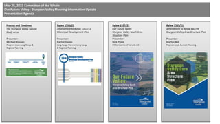
- 1. Bylaw 1556/21 Amendment to Bylaw 1313/13 Municipal Development Plan Bylaw 1555/21 Amendment to Bylaw 882/99 Sturgeon Valley Area Structure Plan Bylaw 1557/21 Our Future Valley Sturgeon Valley South Area Structure Plan Process and Timelines The Sturgeon Valley Special Study Area May 25, 2021 Committee of the Whole Our Future Valley - Sturgeon Valley Planning Information Update Presentation Agenda Presenter: Rachel Davies Long Range Planner, Long Range & Regional Planning Presenter: Nick Pryce V3 Companies of Canada Ltd. Presenter: Martyn Bell Program Lead, Current Planning Presenter: Michael Klassen Program Lead, Long Range & Regional Planning
- 2. Presentation #1 Process and Timelines Sturgeon Valley Special Study Area
- 3. (2017-2019) – Valley Regional Approvals SVSSA Terms of Reference approved at EMR Board meeting Sept 2017 SVSSA Policies approved at EMR Board Meeting Dec 2018 EMRB Growth Plan amended to include SVSSA policies - Overall minimum density of 35 du/nrha established for the area March 2019 • The development of Sturgeon Valley Special Study Area (SVSSA) policies was a multi-year intermunicipal collaborative effort that spanned across multiple Council terms. • Policies are the Terms of Reference that future development in and around the Sturgeon Valley must adhere to.
- 4. (2019-2020) - Valley Growth Framework Analysis Nov thru Dec - Developer Check-in Nov - Intermunicipal Check-in Q3-Q4 2019: General Plan Area Review Plan Area Land Use and Servicing Analysis Jan-Feb 2020 Feb-March 2020: Preliminary Financial Assessment, Traffic Impact Analysis Developer and Landowner Expectations Land Use Analysis Fiscal Impact Analysis Transportation Analysis April 28 2020: Council Workshop: Land Use Analysis Fiscal Impact Analysis Transportation Analysis June 2020: Additional Developer Engagement Presentation to Council of feedback from additional developer engagement June 19 2020: Council Presentation of Growth Framework Report Presentation of Options for progression to Phase II Area Structure Planning July 14 2020: Council Direction from Council for progression to Phase II Area Structure Planning August 11 2020: Council • Detailed analysis of the planning area was completed in 2019 through 2020 in consultation with landowners and the development community. • Key intermunicipal planning partners including the cities of Edmonton and St. Albert, along with CFB Edmonton were kept informed on the progress of the project.
- 5. Council direction on project Communication and Engagement Plan Oct 26 2020 Dec 2 - Developer Information Session Dec 3 - Public Information Session “Call-a-Planner” Sessions Dec 2020 Developer Engagement Session Jan 2021 Public Engagement Session “Call-a-Planner” Engagement Sessions Feb 2021 Home-Owners Association Engagement Session March 2021 March 18 2021 Committee of the Whole “What We Heard Report” Public presentation of key themes and comments heard to-date Public Engagement Session “Call-the-Panel” Engagement Session April 2021 May 25 2021 Committee of the Whole “Valley Planning Information Update” Public presentation on draft bylaws (2020-2021) - Valley Area Structure Plan Process • Engagement with both the public and area developers was completed in 2020 through 2021. • Key intermunicipal planning partners including the cities of Edmonton and St. Albert, along with CFB Edmonton were kept informed on the progress of the project.
- 6. First Reading of 3 Bylaws June 8 Council June 28 Public Hearing for 3 Bylaws (with continuation on June 29 if required) June 28/29 (tentative) Council authorization of REF submittal of 3 Bylaws. July 13 Council (tentative) REF Review Period July-August (tentative) Second and Third Reading of 3 Bylaws Aug 24 Council (tentative) Additional opportunity for Second and Third Reading of 3 Bylaws pending outcomes of REF review period Sept 14 Last Council Date (2020-2021) - Valley Bylaw Process • All appliable external stakeholders will be provided with a formal intermunicipal referral in accordance with County referral policies. • Check-in dates with key intermunicipal planning partners including the cities of Edmonton and St. Albert, EMRB Administration in mid-June to comments/concerns (if any) of the 3 bylaws.
- 7. Future NSP/Outline Plans subject to Council approval •- Detailed Land Use and Phasing Plan •- Detailed Servicing Plan (water, sanitary, stormwater) •- Traffic Impact Assessment •- Fiscal Impact Assessment •- Detailed wetlands/natural areas assessment •- Any other specific requirements Submittal of NSP/Outline Plan Applications General Municipal Servicing Standards Land Use Bylaw Amendments Offsite Levy Bylaw updates Valley Design Standards County Implementation Items Subject to REF process Future ASP Amendments (2021 and beyond) - Valley Implementation Items • Upon finalization of bylaw amendments for Valley planning documents, significant work needs to be completed prior to receipt of applications for subdivision and development in the Valley.
- 8. Questions Process and Timelines Sturgeon Valley Special Study Area
- 9. Presentation #2 Valley MDP Amendments Bylaw 1556/21
- 10. Overview of Municipal Development Plan Amendment Adjustments of neighborhood boundaries to account for City of St. Albert annexation and approval of EMRB SVSSA policies (impacted Neighbourhoods B, C, H and G). Adjustments to Figure 3 – Growth Strategy Concept map to account for future non-residential along HWY 28. Textural amendments in section 2.3 to reference SVSSA. Removal of outdated maps in Appendix A-3. Complete re-write of Neighbourhood G to be in compliance with SVSSA policies. Municipal Development Amendment
- 11. Neighbourhood G • Same style as existing MDP, Neighbourhood G brought up to date. • Neighbourhood G map area has also been brought up to date. • The Neighbourhood role reflects the Our Future Valley project and public consultations findings.
- 12. Placemaking Principles • Strong placemaking principles to embed what we have learned during the Our Future Valley Process and public consultation. • Best practice approach, upfront about the County’s expectations for the area. • Placemaking Principles cover the whole of the Valley, not just the ASP areas.
- 13. Implementation of Placemaking Principles • Direction on implementation is critical. Clearly sets out what developers need to know and what the County expects. • Implementation includes Sturgeon Valley heritage/identity, trails, championing natural features and other key points risen during the process and public consultation.
- 14. Strategic Sites • Strategic Sites are the key in guiding future development in the Valley, provides overarching context for the new ASP. • Informed through consultation with public, stakeholders and the development community, as well as key studies. • A unique to Sturgeon planning policy approach.
- 15. Strategic Site A • Each Strategic Site has a unique vision and a preamble that sets the aspirations for the area. • Upfront development expectations the county has are clear for each site, covering important site-specific issues such as specific roads, trails, natural features, servicing and development mix.
- 16. Strategic Site B • Key purpose is to define the areas where growth is expected, and to delineate and positively shape the nature of that growth. • The areas themselves are Informed by regional policy, various studies, servicing realities, natural features and developers. • The Development Expectations have been greatly shaped by the public consultation.
- 17. Strategic Site C • MDP highlights and sets expectation to implement key regional policy/infrastructure, such as a future transit hub. • Even though site specific, all Strategic Sites contribute to the wider Neighbourhood G vision and the Placemaking Principles are embedded using site specific knowledge.
- 18. Strategic Site D • Balancing development pressures, with what we heard during consultation and the County’s expectations. • Whilst applying the overarching Placemaking Principles, the Strategic Sites Development Expectations sets the scene for the new ASP and any future NASPs
- 19. Strategic Site E • Carefully considered commercial development principles and market analysis for each site, unique/appropriate opportunities differ between the sites. • Placemaking Principles, combined with Strategic Sites focus on preventing a juxtaposition of uses. • The Strategic Site areas line up with the new ASP areas.
- 21. Presentation #3 Our Future Valley Sturgeon Valley South Area Structure Plan Bylaw 1557/21
- 22. Area Structure Plan - Vision The Our Future Valley Area – Sturgeon Valley South Area Structure Plan was developed in partnership with key area stakeholders between Dec 2020 through May 2021. The Plan details unique development guidance that is sensitive to the surrounding natural environment, whilst being cognitive of the various urban and rural neighbours. Sturgeon Valley South is a place where identity is maintained and strengthen through showcasing its history, while capitalizing on innovative future technological advancements and embracing different approaches throughout the many years of the Plan’s implementation. The Plan will be developed in a fiscally responsible manner that creates long term resilience through managing the varying phases of development. The Sturgeon Valley South Plan area is a place where people want to visit, play, work, live and be part of a strong community.
- 23. Area Structure Plan Content The Our Future Valley - Sturgeon Valley South Area Structure Plan includes an overview of the following key items: 1. Introductory Information 2. Planning Process 3. Area Context 4. Vision 5. Area Structure Plan Policies 6. Implementation Report is supported with studies related to: 1. Traffic Impact Analysis 2. Fiscal Impact Analysis 3. Environmental Analysis 4. Agricultural Impact Assessment 5. Infrastructure Master Plan
- 24. Area Structure Plan – Planning Areas Planning Areas provide the structure and policy to guide the development of Neighbourhood Area Structure Plans (NASPs). As part of the process, County Council provided initial direction on future development of residential/mixed-use and non-residential Planning Areas (Planning Areas 1 and 2). While the Plan’s primary focus is on these two Planning Areas, the Plan serves as a framework for all other areas to ensure that development can be responsive to future servicing needs, market demands, changes in technology and growth opportunities. The remaining areas will be considered as future Planning Areas that will require an amendment. Areas will be required to meet the criteria outlined in the implementation section prior to moving forward with the development of a Neighbourhood Area Structure Plan (NASP).
- 25. Concept Plan - Full Build Out Projected build out of the entire area with the main purpose to establish the projected population over the long term and understand how this influences transportation in the area.
- 26. Concept Plan – Planning Area 1 (Residential Mixed-Use) This Plan recognizes that overall development of the Plan area is projected to occur over a significant period and in recognizing changes that will occur over this time; the core focus has been related to the Planning Areas 1 and 2.
- 27. Concept Plan – Planning Area 2 (non-residential HWY 28) This Plan recognizes that overall development of the Plan area is projected to occur over a significant period and in recognizing changes that will occur over this time; the core focus has been related to the Planning Areas 1 and 2.
- 28. TRANSITIONAL DEVELOPMENT 5.2.1 Objective To be sensitive of the density and development form within the Plan areas that border established Sturgeon Valley Core community. Policies 5.2.1.1 Transitional density levels shall be in general accordance with the Figure. 5.2.1.2 Where possible, the development of roads, parks and/or green corridors may be used to offset the built form of varying densities. 5.2.1.3 Landscaping, the use of berms and existing natural features may be leveraged as an important tool to assist with transitioning from higher to lower urban densities through buffering. 5.2.2 Objective To be sensitive of the potential impacts light industrial development may have on residential development and the operations within CFB. Policies 5.2.2.1 The development of the Neighbourhood Area Structure Plan (NASP) for Planning Area 2 (Light Industrial) shall be carried out in consultation with CFB to avoid any potential conflicts relating to operations. 5.2.2.2 The development of the NASP for Planning Area 2 should seek to protect wetlands and natural water features indicated in the Figure as Environmental Reserve based on the recommendations of the outcomes of a detailed biophysical assessment.
- 29. RESIDENTIAL 5.3.1 Objective To create a residential community that meets the overall 35du/nrha within the Plan while respecting established communities by creating transitional densities. Policies 5.3.1.1 Density levels shall be in general accordance with the Figure, with each NASP for Planning Areas 1, 3, 4 & 5 demonstrating compliance with meeting the overall average density of 35du/nrha. 5.3.1.2 Alternative/innovative housing should be encouraged. 5.3.1.3 Clustering together of more than four multi unit residential dwellings shall be encouraged, only if integrated within a mixed-use area, adjoining a commercial area or located along a public transit route. 5.3.1.4 Sturgeon County shall record and monitor the densities as development unfolds to confirm compliance with the EMRGP density policies. 5.3.2 Objective To create a residential community that is unique and consists of character that reflects the history of the Plan area while incorporating innovative technologies that create a modern, resilient, and functioning community. Policies 5.3.2.1 The NASPs should be designed in a manner that reflects the Sturgeon Valley’s unique character through design elements of dwellings, street signage, and community public spaces. 5.3.2.2 Development within the Plan should incorporate Smart City concepts.
- 30. COMMERCIAL/MIXED-USE DEVELOPMENT 5.4.1 Objective To create a unique commercial destination that focuses on small to medium sized boutique businesses. Policies 5.4.1.1 thru 5.4.1.3 5.4.2 Objective To enable the ability to develop local corner commercial stores within residential communities. Policies 5.4.2.1 thru 5.4.2.3 5.4.3 Objective To create a commercial node that is focused on servicing highway traffic and the surrounding community. Policies 5.4.3.1 thru 5.4.3.3 5.4.4 Objective To create mixed-use nodes comprised of small to medium sized retail stores. Policies 5.4.4.1 thru 5.4.4.6
- 31. LIGHT INDUSTRIAL 5.5.1 Objective To enable the light industrial development that could include warehousing, logistics, flex industrial and light manufacturing activities along Highway 28. Policies 5.5.1.1 Light industrial development shall occur on the lands designated as Light Industrial in the Figure. 5.5.1.2 Development within the light industrial area shall be carried out in consultation with Alberta Transportation and CFB. 5.5.1.3 The lands should be developed to accommodate light industrial activities that support CFB operations. 5.5.1.4 The NASP for Planning Area 2 shall include community architectural and landscape design standards that focus on mitigating the visual impact of the lands when viewed from Highway 28, CFB and surrounding residential areas. 5.5.1.5 The development of the industrial lands shall comply with all requirements regarding aerodromes in consultation with CFB at the time of preparing the NASP for Planning Area 2.
- 32. AGRICULTURE 5.6.1 Objective To continue the productive use of agricultural lands until the market determines the lands are needed for development. Policies 5.6.1.1 Existing agricultural lands within the Plan area should remain as agricultural until development is approved by the County. 5.6.1.2 In preparing a NASP, development staging shall be carried out in a manner to avoid impacts on agricultural operations so as not to constrain or restrict existing agricultural lands until the demands requires the lands to be developed. 5.6.1.3 In preparing a NASP, areas of land may be retained for urban agriculture. The development of a NASP should identify opportunities to incorporate agricultural elements into new development, examples include: community gardens, greenhouses etc. 5.6.1.4 The development of a NASP located within the Planning Areas 3 through to 5 (see Figure) shall require an amendment to this Plan in accordance with the criteria outlined in section 6.1.
- 33. PARKS, SCHOOLS, OPEN SPACE AND ENVIRONMENTAL RESERVE 5.7.1 Objective To designate lands to accommodate future schools. Policies 5.7.1.1 thru 5.7.1.4 5.7.2 Objective To champion the protection of key environmental and heritage sensitive areas within the Plan. Policies 5.7.3.1 thru 5.7.3.5
- 34. COMMUNITY SERVICES 5.8.2 Objective To work cooperatively with neighbouring municipalities, CFB, private, public, and non-profit groups to provide community services in the most cost-effective manner possible. Policies 5.8.1.1 The County shall require future subdivision and development in the Plan area to meet all fire protection requirements as outlined in the National Building Code – Alberta Edition & National Fire Code - Alberta Edition. 5.8.1.2 The County shall encourage homeowners to install and/or implement additional fire protection parameters if required. 5.8.1.3 The County shall use the RCMP to provide policing services in the Plan area, until such a time other services are needed. 5.8.1.4 The County shall continue to use the County’s bylaw enforcement officers to enforce municipal bylaws within the Plan area. 5.8.1.5 The County shall continue to work with Alberta Health Services to provide ambulance services to the Plan area. 5.8.1.6 The County should continue to look for opportunities for providing shared protective and preventative services with neighbouring municipalities, other groups, or on their own. 5.8.1.7 The County shall, through the NASP process, identify if any community facilities, such as libraries, community halls, police, fire or recreational facilities that are needed to service the overall community. This may be achieved through negotiations with the developer via land acquisition, construction of such facilities and/or collection of off- site levies in accordance with the Municipal Government Act (Section 648).
- 35. GREEN DEVELOPMENT 5.9.1 Objective To provide leadership in the incorporation of green development techniques and technologies that reduce the overall impact on the natural environment. Policies 5.9.1.1 The County shall encourage the installation of energy efficient technology (e.g. LED lighting). 5.9.1.2 The County shall encourage the inclusion of low impact design into the development of the Plan area. 5.9.1.3 The County shall encourage the development of net zero carbon buildings. 5.9.1.4 The County shall support the ability to utilize greywater for other household and business uses subject to compliance with provincial and federal health regulations. 5.9.1.5 The County shall work with developers on incorporating climate adaptation design standards and initiatives. 5.9.1.5 The development of a NASP should consider EV charging stations and other alternative energy charging facilities to support the transportation network. 5.9.1.6 The County shall encourage the incorporation of solar and other renewable technologies.
- 36. TRANSPORTATION 5.10.1 Objective To create a safe and efficient road network system that ties into the surrounding road network. Policies 5.10.1.1 thru 5.10.1.9 5.10.2 Objective To work with other government agencies on funding support and collaboration relating to major transportation infrastructure that benefits the Plan area and other communities. Policies 5.10.2.1 thru 5.10.1.2 5.10.3 Objective To create a higher density mixed use hub within the Plan area that would support transit orientated development when determined necessary. Policies 5.10.3.1 thru 5.10.3.4 5.10.4 Objective To create an active transportation network system that is attractive, functional, and useable. Policies 5.10.4.1 thru 5.10.4.2 5.10.5 Objective To balance the interface of residential development around the existing railway corridor that passes through the Plan area. Policies 5.10.5.1 thru 5.10.5.2
- 37. WATER DISTRIBUTION 5.11.1 Objective To provide sufficient water supply to the Plan area to meet the needs of development in a cost-efficient manner. Policies 5.11.1.1 thru 5.11.1.7 WASTEWATER 5.11.2 Objective To provide adequate wastewater servicing to the Plan area to meet the needs of development in a cost-efficient manner. Policies 5.11.2.1 thru 5.11.2.7 STORMWATER 5.11.3 Objective To provide adequate stormwater servicing to the Plan area to meet the needs of development in a cost-efficient manner. Policies 5.11.3.1 thru 5.11.2.5
- 38. UTILITY SERVICES 5.11.4 Objective To enable the provision for telecommunications, gas and power services to be provided to the residents and businesses located within the Plan area. Policies 5.11.4.1 thru 5.11.4.2 OIL AND GAS INFRASTRUCTURE 5.11.5 Objective To manage the transition of development throughout the Plan area with the phasing out of existing oil and gas infrastructure. Policies 5.11.5.1 thru 5.11.5.2
- 39. INTERMUNICIPAL COORDINATION 5.12.1 Objective To enable development of the Plan areas in coordination and collaboration with adjoining municipalities where services and benefit may extend across boundaries. Policies 5.12.1.1A NASP shall be referred to the adjoining municipalities for review and comment. 5.12.1.2 Where applicable, a NASP shall include a referral policy for amendments to the NASP. A policy shall also be included for referral of any rezoning that are within the Plan areas. 5.12.1.3 The County shall continue to work with neighboring municipalities to identify opportunities that provide cost efficiencies to development and ongoing servicing of the Plan area. 5.12.1.4 The County shall work with regional partners in identifying funding sources and establishing a cost sharing framework for the development of 127 Street across the Sturgeon River when traffic demand identifies its need.
- 40. PLAN IMPLEMENTATION 6.1.1 Objective To accommodate for the future development of NASPs that are located within the Planning Areas 3, 4 & 5. Policies 6.1.1.1 thru 6.1.1.3 6.1.2 Objective To enable amendments to the objectives and policies contained within this Plan. Policies 6.1.2.1 thru 6.1.2.4 6.2.1 Objective To enable development to occur in a contiguous manner within the Plan area that aligns with the policy. Policies 6.2.2.1 thru 6.2.2.2 6.3.1 Objective To develop new standards to enable the implementation of the residential densities required by the Plan. Policies 6.3.2.1 thru 6.2.2.3 6.4.1 Objective To establish levy options and arrangements between benefitting municipalities for intermunicipal, regional, and provincial infrastructure projects, where mutual benefit is determined. Policies 6.4.1.1 thru 6.4.1.2
- 41. REF Submittals Area Structure Plan Land Use Planning Phase I Growth Framework Land Use Analysis Utility Planning Sept 2019 Infrastructure Master Plan Servicing Design Brief Transportation Traffic Impact Analysis Report Fiscal Fiscal Impact Analysis Report Environmental Influencing Environmental Features Report Biophysical Assessment Commercial Needs Commercial Development Analysis Agriculture Agriculture Impact Assessment
- 42. Questions Our Future Valley Sturgeon Valley South Area Structure Plan Bylaw 1557/21
- 43. Presentation #4 Our Future Valley Sturgeon Valley Core Area Structure Plan Bylaw 1555/21
- 51. Sturgeon Valley Area Structure Plan Amendment Planning Pathway • Outline Plan Submission • Site Concept • Development Density • Servicing and Transportation Analyses • Financial Impact Assessment • Phase 1 – Environmental Site Assessment • Biophysical and Wetland Assessment • Heritage Assessment • Geotechnical and Soil Analysis
- 52. REF Submittals Area Structure Plan Amendment Stormwater Management Plan Utility Planning Transportation -Traffic Impact Analysis Report
- 53. Questions Our Future Valley Sturgeon Valley Core Area Structure Plan Bylaw 1555/21
- 54. Bylaw 1556/21 Amendment to Bylaw 1313/13 Municipal Development Plan Bylaw 1555/21 Amendment to Bylaw 882/99 Sturgeon Valley Area Structure Plan Bylaw 1557/21 Our Future Valley Sturgeon Valley South Area Structure Plan June 8 2021 First Reading of 3 Bylaws
Notes de l'éditeur
- Michael
- Michael
- Michael
- Michael
- Michael
- Michael
- Michael
- Michael
- Michael
- Michael
- Michael
- Nick
- Nick
- Nick
- Nick
- Nick
- Nick
- Nick
- Nick
- Nick
- Nick
- Nick
- Nick
- Nick
- Nick
- Nick
- Nick
- Nick
- Nick
- Speaker (Nick) Put into boxes
- Thank you Nick. Good afternoon Council, colleagues in Administration, and members of the Public. For the record my name is Martyn Bell and I’m the Program Lead for Current Planning within Planning and Development Services. The final area of the Our Future Valley project to be discussed today is the amendment to the existing Sturgeon Valley Area Structure Plan – which is to be known as the Sturgeon Valley Core - Area Structure Plan.
- This Plan came into effect in 1999 and has provided the planning framework for the growth and development of the Sturgeon Valley for the last 22 years. While periodic amendments have occurred to the document during that time, mostly to accommodate Outline Plans for new development, a full review of the Plan hasn’t occurred. As has been mentioned previously, the impetus behind the proposed amendments to this Area Structure Plan are rooted in the recent changes made to the Edmonton Metro Region Growth Plan, specifically the adoption of the Sturgeon Valley Special Study Area policies. While amendments are being proposed – they are not wholesale. The key policy differences are focused on the reduction in size of the plan area and an increase to permitted residential densities for the limited greenfield opportunities – also known as Valley Core Reserve, within the newly proposed plan area. Many of the policies contained within the existing Area Structure Plan have served the plan area well and are to be incorporated within the new document.
- The plan area is proposed to be reduced in size from approximately 5,060ha (50.60 km²) to 1,750 hectares (17.5 km²), a reduction of almost two-thirds. While the lands to the south, as well as some land to the west and east are to be included as part of the Sturgeon Valley South – Area Structure Plan, much of the agricultural land between Highways 2, 28, and 37 will no longer be within a defined plan area and will revert back to the policies as outlined within the Municipal Development Plan.
- This approach will focus the plan area on the existing residential communities established within the Sturgeon Valley, while allowing for potential residential growth in the north, east, and south of the proposed plan area. These greenfield areas, also known as Valley Core Reserve will benefit from updated policies within the EMRB Growth Plan, specifically the increase in density to a maximum of 20 dwelling units per net residential hectare. It is important to note that no changes are being proposed to existing residential communities. Infill subdivision will continue to be considered based on the minimum size requirements of a parcel within the land use district that the parcel resides. For example, the R2 – Country Estate Residential land use district which covers the majority of parcels within the plan area requires a minimum parcel size of half an acre. Therefore a one acre parcel could theoretically be split in two, subject to approval from the relevant subdivision authority and consideration of servicing capacity.
- Areas identified as Valley Core Reserve within the new plan area include this area to the north. These lands are to be included as they can be serviced in a fiscally responsible manner. Land immediately beyond the northern boundary include the Richfield Estates and Green Acres subdivisions – these are older country residential areas that have private servicing – this area was considered to be included, but the cost of extending servicing (including the construction of a lift station) was deemed to be prohibitive, thus resulting it its exclusion from the proposed plan area.
- A parcel to the east of the plan area, immediately south of Sturgeon Road East is proposed to be included. This parcel benefits from the R2 – Country Residential Estate land use district, but no subdivision plan has been approved for the site. Including this parcel within this plan area recognizes it’s current land use district – which will likely require amending at a future date to in order to comply with the density requirements of the relevant statutory plans.
- A final parcel to the south is also proposed to be included within the plan area. This parcel has already been subject to a Regional Evaluation Framework – or REF review. While the proposal was ultimately refused at the regional level, the reason for its refusal was that it exceeded the density requirements, which at the time established a density ceiling, as opposed to a minimum. As it also sits on the southern boundary of the proposed plan area it will also help serve as a transition between the lower densities established within the existing residential communities, and the 35 dwellings per net residential hectare contemplated by the Sturgeon Valley South – Area Structure Plan.
- These Valley Core Reserve parcels will remain zoned as Agriculture until such time as Outline Plans are approved and the redistricting process is complete.
- As with policy, very few changes are being contemplated for the planning process. Currently, developers are required to submit an Outline Plan indicating how their development will align with the Area Structure Plan (and in turn the Municipal Development Plan and Regional Growth Plan). This process will continue for those areas identified as Valley Core Reserve. Developers will still be required to provide documentation that supports the Outline Plan submission – the reports and studies shown on the slide is not an exhaustive list (as all parcels have unique site characteristics) but indicate the typical information that is required. The only small change in the process is that developer’s will be required to provide a Fiscal Impact Analysis. This is a document that will identify the ongoing maintenance and replacement costs of the infrastructure that is required to serve the development. This will help Administration budget accordingly, both from a maintenance and Capital Plan perspective.
- In regards to the Regional Evaluation Framework submission, the proposed amendments have been supported by those documents and focus areas shown on the slide and will form key role in the package to be reviewed by the EMRB. Developers will need to review these documents and focus areas as they prepare future Outline Plan submissions. Servicing is a key component of any future growth and while the Infrastructure Master Plan, completed in September 2019 didn’t contemplate any growth to the north, but did consider lands to the south of the proposed Plan. It also provides key information regarding existing capacity. Developer’s and their consultants should review the information of this document prior to developing their concepts. Likewise for the Traffic Impact Analysis that has been prepared by Bunt and Associates. Finally, a high-level stormwater management plan has also been prepared for the lands to the north and will be incorporated into the Sturgeon Valley Core – Area Structure Plan allowing developer’s within that area to build off the information to create more detailed stormwater management plans for their proposed developments.
- That concludes this portion of the presentation, and I - along with the rest of the Project Team, are available to answer any questions that Council may have in respect to the amendment of the existing Area Structure Plan. Thank you.