Distributed Hydrological Models Simplified for Humid Areas
•Télécharger en tant que PPT, PDF•
2 j'aime•833 vues

Presented by Seifu Tilahun and Tammo Steenhuism at the Nile BDC Symposium on Modeling in the Blue Nile Basin, Addis Ababa, 12 November 2012

Recommandé
Recommandé
Contenu connexe
En vedette
En vedette (15)
Similaire à Distributed Hydrological Models Simplified for Humid Areas
Similaire à Distributed Hydrological Models Simplified for Humid Areas (20)
Plus de International Water Management Institute (IWMI)
Plus de International Water Management Institute (IWMI) (20)
Dernier
Dernier (20)
Distributed Hydrological Models Simplified for Humid Areas
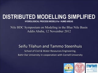
- 1. DISTRIBUTED MODELLING SIMPLIFIED HYDROLOGICAL PROCESS MODELS for HUMID AREAS Nile BDC Symposium on Modeling in the Blue Nile Basin Addis Ababa, 12 November 2012 Seifu Tilahun and Tammo Steenhuis School of Civil & Water Resources Engineering, Bahir Dar University in cooperation with Cornell University
- 2. DISTRIBUTED HYDROLOGICAL MODELS: AN OVERVIEW • Usually require hundreds of distributed parameters that are validated with the outflow hydrograph and in many More input parameters not cases calibration is time consuming necessarily Ethiopian highlands give • Models are based on infiltration excess while saturation excess is dominant in (semi) humid • Downhill water better results flows through the soil is neglected in many distributed modelsmore flexibility in applications but give
- 3. OVERVIEW OF PRESENTATION 1. Experimental a) Data shows that infiltration is greater than rainfall intensity for well vegetated watersheds b) Soils need to wet up before runoff occcurs c) Runoff and erosion occurs from saturated bottom lands and degraded hillsides with shallow soils 2. Modeling a) Show simulations for runoff and erosion with saturated contributing areas 3. Applications
- 4. Experimental Watersheds Cornell, BDU and IWMI started research in 2008 employing many students. ARARI cooperation since 2002
- 5. Debra Mawi • 1 Automatic Rain Gauge • 4 weirs installed & measured storm runoff (40 -50 events) • 1 weir at the outlet (Adet Research Center) • 19 piezometers to measure ground Water level • 14 infiltration test • Sediment concentration from 5 weirs (40 -50 events) • Rill measurement from 10 agricultural fields • 4 Gully profile measurement
- 6. Infiltration Rate vs. Rainfall Intensity Maybar Debre Mawi Bayabil et al. 2010
- 7. Saturated Areas As = 10% Weir-1 Saturation
- 8. Location of runoff source and infiltrating areas Hill slope infiltration Areas interflow Surface runoff v
- 9. RUNOFF PLOTS (MAYBAR) SURFACE RUNOFF DECREASES WITH STEEPNESS Runoff Coefficients 16 37 43 64 slope of land
- 10. 1 Runoff 2 3 4 5
- 11. Modeling LOOKS COMPLICATED Constant area for storm outflow from two zones BUT MODEL HAS ONLY after the threshold is exceeded NINE INPUT PARAMETERS Rain infiltrates in the remaining area and AND CAN BE RUN becomes subsurface flow Amount of runoff andIN A SPREADSHEET recharge can be simulated by a water balance
- 12. Discharge Anjeni 113 ha
- 13. Discharge Enkulal watershed, 400 ha
- 14. 1 2 Debra Mawi 4 3 5 Area Area Area Locations Parameters Smax in A1 Smax in A2 Smax in A3 BSmax t½ τ* A1 A2 A3 Weir Unit % mm % mm % mm mm days days 5 15 80 30 30 55 60 80 70 5 4 20 80 30 30 25 60 80 70 5 Magnitude 3 5 80 30 30 15 60 80 70 5 1 10 80 20 30 40 60 80 70 5
- 15. Gumura Nash Sutcliff = 0.74 on daily values Time of calibration: 1200 km2 Bahir Dar to Addis Ababa by plane
- 16. Discharge Blue Nile watershed, 180,000 km2 Nash Sutcliff 0.95 for 10-day runoff
- 17. SUMMARY HYDROLOGY MODEL • Predicting runoff for vegetated and sloping watershed with rainfall in excess of 600 mm/year can be accomplished with a distributed model with two areas that represent the shallow soils and potentially saturated soil that produce runoff, In the remaining part of the watershed where water that infiltrates and that flows out slowly. • Other biological processes and implementation of Soil and water conservation practices will require smaller scales that can be superimposed. SWAT with HRU’s that can account for topography can be empoyed for these smaller scales
- 18. Er osion {
- 19. Sediment Concentration: Debre Mawi
- 20. Rill & Gully erosion Debre Mawi 625m2 in 2011 321m2 in 2010 81m2 in 2005 – 120 ton ha -1 yr-1 in 2010
- 21. EROSION PREDICTION MODELED AFTER HAIRSHINE AND ROSE • Concentration Cr in overland flow is proportional to velocity V, Cr= a V
- 22. EROSION PREDICTION Cr= a V MODELED AFTER HAIRSHINE AND ROSE • Transport limiting (rill formation) – a=aT Surface runoff carries all the sediment it can ----- • Source limiting (splash erosion) – a = aS Concentration is limited by sediment delivered to rill • Transport limited after plowing and source limited after soils are permanently wet around August 1
- 23. INPUT DATA FOR SEDIMENT MODELING Surface runoff interflow and baseflow from three areas from model <30 days; 30 - 60 days >60 days H=1 H decreases 1→0 H=0
- 24. Calibrated Values Component Description parameters Unit Debre Anjeni Enkulal Blue Nile Mawi Saturated Area A1 fraction 0 0.1 0.2 0.15 area Smax in A1 mm - 50 200 80 Degraded Area A2 fraction 0.15 0.2 0.2 0.30 area Smax in A2 mm 10 10 25 30 Hydrology Area A3 fraction 0.5 0.3 0.6 0.55 Hillside Smax in A3 mm 100 50 250 60 t½ days 70 120 80 70 Subsurface τ* days 10 100 200 5 Sediment transport limit at see text 4.5 17 1.2 14 Sediment Source limit as see text 3 5 0.5 3 Time step days 1 7 10 1 calibration none 0.84 0.75 0.95 0.82 Hydrology Nash Sutcliffe validation none 0.80 0.92 - Efficiencies calibration none 0.70 0.76 0.86 0.75 Erosion validation none 0.75 0.72
- 25. Sediment predictions ANJENI 113 ha Nash Sutcliff 0.75 on daily values
- 26. Sediment concentration Enkulal watershed, 400 ha Nash Sutcliff = 0.76
- 27. Sediment Concentration Debre Mawi 95 ha
- 28. Blue Nile Basin 180,000 km 2
- 29. WHAT ABOUT WATERSHED MANAGEMENT? Runoff from • degraded areas, • farmland that saturate, • saturated bottom lands
- 30. Management for reducing soil loss Plant Elephant grass GULLY Treat Degraded Area where runoff is generated
- 31. question: Fall upland Fall Bottom land Traditional water managemnt practices appropriate? { Do we need to store more water on land where the farmer carries off excess water?
- 32. Keeping saturation below the gully bottom is important Do we know how to stop the gully process?
- 33. Conclusion Most effective best management take climate and lands ape position in to account Saturation excess models for (semi) humid areas perform better than infiltration excess models
- 34. Many publications are at http://soilandwater.bee.cornell.edu/ or google: soil and water cornell ethiopia Thank You!!