Mcm demo glasgow - august 11
•Télécharger en tant que PPT, PDF•
0 j'aime•549 vues

On/Off Road Cycle Infrastructure Review - Urban Venue: Glasgow - Cycling Scotland Office Site Visit: Glasgow Connect 2 Cycle Infrastructure Date: Wednesday 31st August 2011 Start Time 9.30am Brief Description: Review of Connect 2 infrastructure installed within Glasgow. This will be completed by a series of workshops on designing for cyclists looking in depth at current design manuals and providing a more technical review of current standards. Site visits will be used to review the infrastructure completing the day with a feedback session on the installed infrastructure.

Recommandé
Recommandé
Contenu connexe
Tendances
Tendances (13)
En vedette
En vedette (19)
Similaire à Mcm demo glasgow - august 11
Similaire à Mcm demo glasgow - august 11 (20)
Plus de Cycling Scotland
Plus de Cycling Scotland (13)
Dernier
Dernier (20)
Mcm demo glasgow - august 11
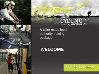
- 1. WELCOME A tailor made local authority training package
- 2. Glasgow Connect 2 - TRAINING DAY Providing training to deliver solutions
- 4. WHAT WILL YOU LEARN TODAY?
- 10. Questions? Name Job Description Describe your journey here this morning Question on Learning Point
- 11. Connect2 - Big Lottery Funded Sustrans' Connect2 is part funded by the Big Lottery Fund grant after the UK public voted the scheme the winner of the People's Millions Lottery contest on ITV1 in December 2007. http://www.youtube.com/user/SustransLibrary?blend=2&ob=5#p/u/12/vc9qH9t8HYg
- 12. Headline Objective •will overcome major barriers such as roads, rivers, and railways •will create new bridges and crossings linking to walking and cycling networks in 79 communities UK-wide
- 13. Usage Objective 6 million people within one mile as many as 1 million pupils will benefit over a million journeys a week potentially saving 70,000 tonnes CO2/yr
- 14. Scotland’s Involvement 4 Local Authorities Dumfries and Galloway South Lanarkshire Glasgow City Council Perth and Kinross
- 15. Completion Routes are due to be completed by March 2013
- 16. “ Bridge to Nowhere” Built 1960 Anderston Shopping Complex Never Completed
- 17. Start/End Point -- Central Station -- Kelvingrove Park
- 18. Workshop 1 – Route Objectives
- 19. Workshop 1 – Route Objectives – 5 minutes You are the Local Authority Who would you design it for? What would be your 3 main objectives of the project? Using the manuals - Can you identify what they promote as the main route objectives?
- 30. Introduction to first chapters on cycle route design manuals
- 31. PLANNING AND DESIGNING FOR CYCLISTS
- 42. Exercise Capture your thoughts Design Principles
- 43. Introduction to design chapters within cycle route design manuals
- 48. Existing Route - Characteristics Town Centre Grid Plan Main East / West Links Origin / Destination Route set by Bridge and Station
- 51. REDISTRIBUTION OF THE CARRIAGEWAY Lane Width?
- 52. REDISTRIBUTION OF THE CARRIAGEWAY Lane Width?
- 53. REDISTRIBUTION OF THE CARRIAGEWAY Lane Width?
- 54. REDISTRIBUTION OF THE CARRIAGEWAY Lane Width?
- 55. REDISTRIBUTION OF THE CARRIAGEWAY Lane Width?
- 56. Tables and Design Aids
- 58. Cycle Lane Through Bus Stop Dublin, Ireland Photo: Tom Bertulis
- 67. 2 metre wide Cycle Logo Copenhagen, Netherlands Photo: Tom Bertulis
- 68. 2 metre wide Cycle Logo Copenhagen, Netherlands Photo: Tom Bertulis
- 70. Cycle Lane along Motor Vehicle Lane and Tram line Amsterdam, Netherlands Photo: Tom Bertulis
- 71. Cycle Lane through Road Junction Berlin, Germany Photo: Tom Bertulis
- 72. Cycle lane Crossing with Elephant’s Feet Markings Amsterdam, Netherlands Photo: Tom Bertulis
- 74. Cycle lane Amsterdam, Netherlands Photo: Tom Bertulis
- 75. What are the main issues for Cyclists?
- 78. THE HIERARCHY OF PROVISION Stakeholders and Users – Wish us to invest money in segregated networks
- 82. IN THE HIERARCHY OF PROVISION …
- 85. SIDE ROAD CROSSING – DANGER!
- 86. Photo by Rob Marshall, ERCDT
- 87. Photo by Rob Marshall, ERCDT
- 88. Photo by Patrick Lingwood, ERCDT
- 89. Other Options Cycling by Design Side Road Crossing – Bend Out There are other options but due to it being adjacent to a trunk road this was preferred
- 90. Other Options Side Road Crossing – Bend In Raise Table crossing with no give way markings
- 91. Other Options Side Road Crossing – Bend In Raise Table crossing both with give way markings
- 92. Other Options Side Road Crossing – Surfacing On Road Give Way Markings
- 93. Other Options Side Road Crossing – Bend out Raise Table crossing both with on road give way markings
- 96. Other Options Main Road Crossing – Traffic Island
- 97. Crossings Design Site Specific One size does not fit all Crossing Attributes Simple Field of Vision for All users Decision Making Cycling by Design Transport for London
- 102. Contra Flow Cycle lane Geneva, Switzerland Photo: Alex Bertulis
- 110. Unsegregated Contra-Flow cycle facility Munich, Germany Photo: Tom Bertulis
- 117. Contra Flow lane Copenhagen, Denmark Photo: Tom Bertulis
- 118. Segregated Contra Flow Cycle Way Madison, Wisconsin, USA Photo: Tom Bertulis
- 122. Home Zone with gateway Nottingham, England Photo: Tom Bertulis
- 126. Directional signing with route number for cyclists Glasgow, Scotland Photo: Tom Bertulis
- 133. LUNCH
- 134. SITE VISIT
- 138. SITE REVIEW
- 139. SITE REVIEW
- 140. SITE REVIEW
- 141. SITE REVIEW
- 142. SITE REVIEW
- 144. FINAL QUESTIONS? Providing training to deliver solutions
- 145. THANK YOU TO GLASGOW CITY COUNCIL AND SUSTRANS Providing training to deliver solutions
Notes de l'éditeur
- 1
- 1
- Each trainer is to complete this section for the specific training activity
- These are the subjects we will be covering today
- These are the subjects we will be covering today
- These are the subjects we will be covering today
- These are the subjects we will be covering today
- So why should we design for cyclists? Why not let them just be part of the road network or path network. Touch on a module presented by Jim Riach on Policy.
- Money is no issue, Scotland Obesity, You need to change behaviour 3 main objectives, modal split, European experience CBD – LTN 2/08
- 1. Mitigate the physical severance caused by the M8 Anderston Interchange by the creation of a traffic free route for pedestrians and cyclists travelling from Anderston and the West End into the heart of the City Centre 2. Segregating cyclists and pedestrians from traffic by creating a traffic free route to encourage lapsed cyclists, children and less confident cyclists to try cycling in what they perceive to be a safer environment 3. Significantly improving multi-modal transport interchange by delivering a quality walking and cycling route to Glasgow Central Rail Station 4. Improve access to jobs, education, leisure by low cost and sustainable travel modes for residents living in Anderston, one of the most deprived areas of the country 5. Expand and enhance the local cycle network, connecting into the quality existing routes such as The Colleges Cycle Route, the Forth & Clyde Canal and NCN 7 and provide opportunities for healthy active travel and reduce carbon emissions associated with trips under 5km between the West End and the City Centre
- Peter to Read out Groups Split into your groups a joint exercise first – Just shout out design manuals you know of and use at present. Summarise the flip chart by grouping the manuals Then split into your groups I would ask within your field how would you use the manuals?
- List of the manuals above So how do I use them? Again an information sheet is available and will be sent out and is available on our web
- Over the years Sustrans has developed guidelines for the design and construction of off road cycle ways. These tend to be philosophical as well as specifications. The greenway guide was developed primarily to be used by partners on the connect 2 projects although it is fully relevant to any other greenway project. The guide covers technical aspects such as designing of gradients etc and also talks about wider aspects such as monitoring and land arrangements. The NCN guidelines in muchly superseded by the likes of cycling by design it was written to provide a standard for the development of the NCN and still has uses in the standards to be used for NCN routes. Making ways for the bicycle is the early Sustrans design and construction guidance and has useful information on path construction techniques.
- List of the manuals above So how do I use them? Again an information sheet is available and will be sent out and is available on our web
- Sustrans produces a range a TINs designed for internal use – however many of these are available for partners from Sustrans staff. The information sheets are availible on the Sustrans website under resources but many of these are out dated and superseded by other guidance. TINs cover a range of subjects: Speed humps for motorcycles Alternatives to statutory guidance Signing – which has lots of examples and standards Aggregates for paths Path surfaces – discussing the merits and problems of different types of materials Access controls and barriers Trees Side road crossings Zebra Crossing Toucan Crossings
- List of the manuals above So how do I use them? Again an information sheet is available and will be sent out and is available on our web
- Hierarchy of Provisions
- Hierarchy of Provisions
- Flip Chart – Using roads and footways?
- The wider range of disabilities and access requirements is included in the first category. Question: do you agree with this hierarchy? Question: motorcycles are not included – where do you think they might fit? There is no right model as some authorities may choose to change the order of the first three depending on such issues as topography etc
- Flip Chart – Name types of users we design for.
- Cyclists – come in all shapes and sizes – The question is can we be grouped into one design group? Discuss? Discuss on Flip Chart – Points for grouping them together – Points for not grouping them together
- Specialist Equipment
- Note: Local transport Notes (LTN) are not policy within Scotland but nevertheless provide a good source of guidance reflecting the best practice to be adopted when providing for cyclists. See also Cycling to the Future and Cycling by Design for additional policy and guidance. What are their characteristics? – shout them out It is important to understand that cyclists are not an homogenous group and their needs will differ accordingly: Confident in most on-road situations May seek some segregation at difficult junctions and on link with high speed traffic May be willing to sacrifice directness to avoid difficult traffic conditions by using lighter trafficked routes and may well travel more slowly than regular cyclists. May require segregated direct of-road routes between residential areas and schools where suitable on-road solutions are not available This category includes disabled people using hand cranked machines and others using tricycles, child buggies tandems etc. It is important to recognise that all of the above categories may be found on the same route at the same time, for example on a housing estate road at the beginning of their journey or where a number of routes pass through a complex junction. Equally, more vulnerable users, such as elderly cyclists whose ability to compete with other traffic is declining but whose mobility depends on their use of a bike, may welcome the opportunity to stay off busy roads in much the same way as inexperienced cyclists. It should not, therefore, be assumed that cyclists are always a homogeneous group or that a route has a single journey purpose. Similarly, it can not be assumed that traffic safety and personal security are always the most important design requirements when dealing with journeys that have a time-critical purpose such as catching a train or bus.
- Flip Chart – Name types of users we design for.
- Specialist Equipment
- The five core principles are set out here and explored in more detail in the following slides. They may be found in Local transport Note 02/08 DfT 2008 Note: this is almost identical to guidance contained within Cycling by Design. The order and wording is slightly different but the principles remain the same. Exercise – What do they mean?
- Hierarchy of Provisions
- Hierarchy of Provisions
- But first consider this: A truly cycle friendly environment does not depend upon ‘visible’ cycle-specific measures such as cycle lanes and advance stop lines. It is created by the reduction of traffic speeds and volumes within an area to the point that the road network is suitable for all users without fear or intimidation by other users. So how do we provide this kind of environment? …
- 1. Mitigate the physical severance caused by the M8 Anderston Interchange by the creation of a traffic free route for pedestrians and cyclists travelling from Anderston and the West End into the heart of the City Centre 2. Segregating cyclists and pedestrians from traffic by creating a traffic free route to encourage lapsed cyclists, children and less confident cyclists to try cycling in what they perceive to be a safer environment 3. Significantly improving multi-modal transport interchange by delivering a quality walking and cycling route to Glasgow Central Rail Station 4. Improve access to jobs, education, leisure by low cost and sustainable travel modes for residents living in Anderston, one of the most deprived areas of the country 5. Expand and enhance the local cycle network, connecting into the quality existing routes such as The Colleges Cycle Route, the Forth & Clyde Canal and NCN 7 and provide opportunities for healthy active travel and reduce carbon emissions associated with trips under 5km between the West End and the City Centre
- Yes or No – No sitting on the fence
- How do we improve on road cycling within the road of Edinburgh Discuss 20mph zones being promoted by Edinburgh. So we have highlighted the hierarchy of provision but we still require to install lanes on some of the roads within Edinburgh. In your groups can you take the following 4 roads One – Standard 7.3m wide road – no on road parking Two – New housing estate (designing streets) Three – Two lane traffic with the promotion of a bus lane Four – 9m wide road with on street parking
- Maximum Width 2.5* Lanes of this width should be used where cycle flows are expected to be >150 cycles/peak hour and therefore cycles overtaking within the lane can be expected. Desirable Minimum Width 2.0* The minimum width that should be considered for a cycle lane with width for cyclists to pass each other. Absolute Minimum Width 1.5** The running width of the lane should be free from obstructions such as debris and unsafe gullies.
- Optimal Width 4.6 This width allows a bus to pass a cyclist within the bus lane. A 1.5m wide advisory cycle lane may be provided within the bus lane if considered desirable. Desirable Minimum Width 4.25 Although a bus is still able to pass a cyclist within the bus lane, safe passing width is affected and this width of lane should only be provided over short distances. A 1.2m wide advisory cycle lane may be provided within the bus lane If desirable. Absolute Minimum Width 4.0** An absolute minimum width of 4.0m allows cyclists to pass stopped buses within the bus lane but may encourage unsafe overtaking of cyclists by buses, particularly where the adjacent traffic lane has queuing traffic. Limiting Width 3.0 – 3.2** The width of the bus lane to prevent overtaking within the lane itself. A bus will be required to straddle adjacent lanes
- Kerb-segregated cycle lane Standard Width (m)* Comments Desirable Minimum Width 2.0 Typically operates satisfactorily for flows of up to 200 cycles per hour. The minimum width that should be considered to permit cyclists to pass each other. With-flow or contra-flow lane Absolute Minimum Width 1.5 Typically operates satisfactorily for flows of up to 100 cycles per hour. Desirable Minimum Width 3.0 Typically operates satisfactorily for two-way flows of up to 300 cycles per hour and will permit some overtaking. Two-way lane Absolute Minimum Width 2.0 The minimum width that should be considered to permit cyclists travelling in opposite directions to pass each other. Operates satisfactorily for twoway flows of up to 200 cycles per hour.
- Maximum Width 2.5* Lanes of this width should be used where cycle flows are expected to be >150 cycles/peak hour and therefore cycles overtaking within the lane can be expected. Desirable Minimum Width 2.0* The minimum width that should be considered for a cycle lane with width for cyclists to pass each other. Absolute Minimum Width 1.5** The running width of the lane should be free from obstructions such as debris and unsafe gullies.
- As does this example even if the use of the solid white line to segregate the cycle lane from the parking is incorrect
- An additional aid within LTN 2/05 is the diagram which compares the cycle flows on a link with traffic speed and provides guidance on the type of facility appropriate for a given set of circumstances. This is based upon Dutch guidance originally found in the CROW manual ‘Sigh up for the bike’ but has subsequently been revised by Sustrans and in the London Cycle Network Design Manual with a simplified version set out in the LTN It should be noted that figures for traffic volumes and speed have been deliberately omitted from this diagram. This is to emphasis the fact that there is no exact correlation between these and the most appropriate facilities to employ. It is also important to remember that the first course of action must be to consider what can be done to reduce speeds and flows before referring to this diagram for guidance on what to implement (if anything). Put more simply this is not a diagram that may be used without applying thought to the process.
- Just to get us back in the mood before we go onto the hierarchy of provision – question?
- Yes or No – No sitting on the fence
- There is no single ‘right’ answer. As vehicles within the meaning of the law bicycles are vehicles and are entitled to use the carriageway except where prohibited (by traffic regulation order, bylaw or certain classes of road i.e. motorway. It is also obvious that it is not a realistic proposition to create wholly segregated facilities to link the front door of every home with the front door of every destination. Whilst it may seem reasonable to think that cyclists will be inherently safer when segregated from other traffic this takes no account of the fact that cyclists are most at risk at junctions where over 70% of accidents occur involving cyclists (DfT figures). Studies also show that cyclists are more at risk when cycle tracks cross side roads than if they had remained on the carriageway. Not all off-road facilities adequately cater for the inevitable return to the carriageway or the need to achieve a safe means of joining cycle tracks that involve a right turn. All of these issues add up to a more un-safe off-road environment than is often experienced on the carriageway. It is also worth mentioning that studies have shown that those people who ride solely on off road cycle paths have poor road skill that do not fit them well for mixing with other traffic when they do meet it.
- Any prizes for what type of crossing this is? Any ways of improving the symbols?
- Thanks to Alan – So taking what the council have in place can we discuss the use of Zebra Crossings
- 1. Mitigate the physical severance caused by the M8 Anderston Interchange by the creation of a traffic free route for pedestrians and cyclists travelling from Anderston and the West End into the heart of the City Centre 2. Segregating cyclists and pedestrians from traffic by creating a traffic free route to encourage lapsed cyclists, children and less confident cyclists to try cycling in what they perceive to be a safer environment 3. Significantly improving multi-modal transport interchange by delivering a quality walking and cycling route to Glasgow Central Rail Station 4. Improve access to jobs, education, leisure by low cost and sustainable travel modes for residents living in Anderston, one of the most deprived areas of the country 5. Expand and enhance the local cycle network, connecting into the quality existing routes such as The Colleges Cycle Route, the Forth & Clyde Canal and NCN 7 and provide opportunities for healthy active travel and reduce carbon emissions associated with trips under 5km between the West End and the City Centre
- The five core principles are set out here and explored in more detail in the following slides. They may be found in Local transport Note 02/08 DfT 2008 Note: this is almost identical to guidance contained within Cycling by Design. The order and wording is slightly different but the principles remain the same. Exercise – What do they mean?
- The five core principles are set out here and explored in more detail in the following slides. They may be found in Local transport Note 02/08 DfT 2008 Note: this is almost identical to guidance contained within Cycling by Design. The order and wording is slightly different but the principles remain the same. Exercise – What do they mean?