2. Applying GIS Technology to Public Safety
The Geographic Advantage for an Informed Emergency Response
Including GIS in an enterprise solution provides public safety
professionals with access to critical information throughout
the organization and to multiple agencies in local, state, and
federal government. Virtually every public safety task has a
geographic component and benefits from GIS technology. An
enterprise solution integrates information such as
• Property/Parcel ownership
• Streets and highways
• Imagery
• Hazardous material locations
• Fire preplans
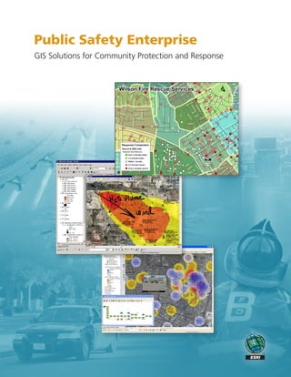
GIS analyzes emergency medical services density of incidents.
• Crime hazards
Whether you are an incident commander or first • Zoning information
responder, you have a few short moments to make
• School district boundaries
decisions that can impact the lives of victims and fellow
responders in an emergency. • Critical infrastructure
Geographic information system (GIS) technology provides The aggregation of this data in an enterprise architecture
you with the geographic advantage to leverage informa- enables public safety personnel at all levels to plan and
tion and make informed decisions. respond more effectively. Enterprise GIS facilitates enhanced
safety for first
More than a map display, GIS is the foundation for pre-
responders as well
senting and analyzing data for a more effective emergency Incident Analysis
as the community. It
response.
enables an agency
to leverage GIS data Risks and Hazards
to provide improved
analysis; better- Resource Allocation
informed decision
making; and safer,
Critical Infrastructure
more effective emer-
gency response.
Routing and Tracking
Station Locations
Real World
3. GIS Integrated Enterprise
Enterprise GIS supports the consolidation of information systems Emergency Management Systems Integration
and business processes across a public safety organization, GIS data and imagery can be enhanced with dynamic data feeds
among multiple agency jurisdictions, and with the private sector. including real-time weather, traffic cameras, resource tracking,
Integrating GIS with other public safety systems dramatically hospital status, and active incidents. This capability provides a
improves the effectiveness and efficiency of daily operations. common operating picture with accurate situational awareness
It also enhances response to major incidents such as natural for emergency management personnel.
disasters and man-made catastrophes.
Data Fusion Center Systems Integration
CAD and E-911 Systems Integration GIS provides a fusion platform for connecting disparate data to a
GIS provides improved capability to identify the location of common geographic view. Powerful analysis capabilities are then
an emergency call to deploy the closest available units and to available to transform data into more actionable information.
enhance situational awareness.
GIS in the Mobile Environment
Records Management Systems Integration ArcGIS® Mobile provides situational awareness through a variety
GIS technology enables records management system (RMS) data of mobile devices. As new events or emergencies occur, it can
to be geocoded and mapped for more effective incident analysis also be used in the field to add information that can update the
and trend evaluation. shared view of situational awareness.
Network Analysis
Resource and Routing
Situational Tracking
Awareness
E-911 Law Enforcement
Fire/EMS
Data Fusion Centers
Flood
Analysis
Threat Detection
Counterterrorism
Transportation
Emergency Modeling
Demographic Analysis
Management
Critical
Infrastructure Measuring
Hospitals
Protection Performance
Incident
Trend
Analysis
Vulnerability
Geoprocessing
Assessments
and Modeling
4. Providing You with the Geographic
Advantage
Geographic information provides an intuitive and com-
prehensive view of data for all public safety organizations
including law enforcement, emergency medical services,
computer-aided dispatch, homeland security, emergency
management, and structure and wildland fire. GIS helps
public safety personnel make informed decisions that
support all aspects of their missions.
Enterprise GIS eliminates data silos that have long
plagued emergency response, particularly in large-scale
operations. It also improves both the effectiveness and
efficiency of daily responsibilities as well as response to
large-scale disasters.
Station Location and Response Planning
GIS benefits the public safety enterprise by providing
• Easy integration with existing systems and technology
• Instant access to spatial and tabular data when needed most
• Improved collaboration and communication across com-
mand, control, and response teams
• Increased ability to analyze and respond to events as they
unfold by using a single, common view of operations
• Improved situational awareness for incident commanders and
first responders in the field
• Greater preparedness for faster, safer, more informed response
Crime Analysis
and Hot Spots
Counterterrorism Analysis
5. GIS Scalability for Public Safety Personnel
Emergency response requires powerful technology
to support the agency mission. Including GIS in
a public safety enterprise architecture provides a
geographic advantage to local, state, and federal
government agency information needs.
GIS technology supplies powerful analytic capabili-
ties, data replication, and distributed functionality
for all public safety personnel levels:
First Responders
GIS aids the first responder by improving situational
awareness, performance, and safety. It allows
rapid access to critical data while deploying to and
during an incident.
An in-vehicle application gives first responders access to critical
information prior to arriving on the scene.
Chief Officers
GIS enables chief officers to track resources, assess
exposures, establish hot zone boundaries, and per-
form other command and control responsibilities.
GIS provides the chief officer with overall situational
awareness for effective management of an incident.
Executive Staff
GIS provides the executive staff with the ability
to measure departmental performance, visualize
developing challenges, and identify business trends
and issues.
Technology Specialists
GIS is an open, standards-based technology plat-
form that is interoperable with existing information
systems, providing the capability to integrate, visual-
ize, and disseminate information quickly and easily.
Executive staff utilizes GIS to analyze trends,
performance, and historical comparisons.