1 geotop-summer-school2011
•
0 j'aime•563 vues

An introduction to the motivations that brought to build GEOtop

Recommandé
Recommandé
Contenu connexe
En vedette
En vedette (20)
Plus de Riccardo Rigon
Plus de Riccardo Rigon (20)
Dernier
Dernier (20)
1 geotop-summer-school2011
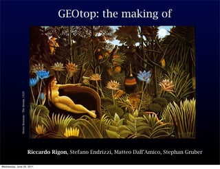
- 1. GEOtop: the making of Henry Rosseau - The dream, 1920 Riccardo Rigon, Stefano Endrizzi, Matteo Dall’Amico, Stephan Gruber Wednesday, June 29, 2011
- 2. “Prediction is very difficult, especially about the future” Niels Bohr Wednesday, June 29, 2011
- 3. The GEOtop Objectives •To explain what GEOtop is; •To explain why GEOtop is like it is; •To enumerate the basic scheme and the basic equations 3 Riccardo Rigon Wednesday, June 29, 2011
- 4. The GEOtop Rainfall–Runoff spatial patterns Problem: We cannot currently predict the spatial pattern of watershed response to precipitation and cannot quantitatively describe the surface and subsurface contributions to streamflow with enough accuracy and consistency to be operationally useful. Critical issues: Watershed runoff and streamflow are affected by heterogeneity in soil hydraulic properties, landscape structural properties, soil moisture profile, surface–subsurface interaction, interception by plants, snowpack, and storm properties. Traditional lumped models cannot do it! 4 Riccardo Rigon Wednesday, June 29, 2011
- 5. The GEOtop Snowpack evolution and ablation Problem: We would like to predict the spatial pattern of snow cover, its volumes and its effects on runoff with enough accuracy and consistency to be operationally useful. Critical Issue: Also in this case we know enough of the snow physics “in a point” but we do not have many tools to understand the snow cover effects on larger, catchment scales. Soil freezing substantially alter the hydraulic properties of the soils. Related problem: snow avalanches triggering 5 Riccardo Rigon Wednesday, June 29, 2011
- 6. The GEOtop Landslide and debris flow initiation Problem: We cannot currently predict the triggering of shallow landslides which eventually turns into a debris or a mudflow. Critical Issue: Initial and boundary conditions. Landslide initiation is affected by heterogeneity in soil hydraulic and geotechnical properties, landscape structural and geological properties, soil moisture profile, surface–subsurface interactions. 6 Riccardo Rigon Wednesday, June 29, 2011
- 7. The GEOtop Ecohydrology Problem: Well, I do not want to steal the work to John and Kelly ;-) Critical Issue: See their lectures 7 Riccardo Rigon Wednesday, June 29, 2011
- 8. The GEOtop However, hydrology in winter is usually different January 8 Riccardo Rigon Wednesday, June 29, 2011
- 9. The GEOtop In spring time plants have vegetative growth 9 Riccardo Rigon Wednesday, June 29, 2011
- 10. The GEOtop In summer: land use matter 10 Riccardo Rigon Wednesday, June 29, 2011
- 11. The GEOtop And eventually autumn comes 11 Riccardo Rigon Wednesday, June 29, 2011
- 12. The GEOtop Committee of hydrological Sciences NRC, 2003: “Although our understanding of individual processes is improving, the integration of that body of knowledge in spatially distributed predictive models has not been approached systematically”. 12 Riccardo Rigon Wednesday, June 29, 2011
- 13. Introduction Every Hydrologist would like to have THE MODEL of IT all But in reality everybody wants just to investigate a limited set of phenomena: for instance the discharge in a river. Or landsliding , or soil moisture distribution. Any problems requires its amount of prior information to be solved: some problems needs more detailed information of others 13 Riccardo Rigon Wednesday, June 29, 2011
- 14. Introduction So we use different models 14 Riccardo Rigon Wednesday, June 29, 2011
- 15. Introduction So we use different models GEOtop Fully distributed Grid based 14 Riccardo Rigon Wednesday, June 29, 2011
- 16. Introduction Wednesday, June 29, 2011 Riccardo Rigon Fully distributed Grid based GEOtop Large scale modelling Hillslope - Stream Anthropic Infrastructures NewAge So we use different models 14
- 17. Introduction Wednesday, June 29, 2011 Riccardo Rigon Fully distributed Grid based GEOtop Large scale modelling Hillslope - Stream Anthropic Infrastructures NewAge Fully Coupled Subsurface- Surface Grid Based Boussinesq So we use different models 14
- 18. Introduction Wednesday, June 29, 2011 Riccardo Rigon Fully distributed Grid based GEOtop Large scale modelling Hillslope - Stream Anthropic Infrastructures NewAge Fully Coupled Subsurface- Surface Grid Based Boussinesq GIUH So we use different models Peak floods PeakFlow 14
- 19. Introduction Every one of them: Perform the mass budget (and preserves mass) Make hypotheses on momentum variations Simplify the energy conservation (and its dissipation) to a certain degree (Implicitly delineates a way to entropy increase) 15 Riccardo Rigon Wednesday, June 29, 2011
- 20. GEOtop structure 1. Radiation - distributed model - sky view factor, self and cast shadowing, slope, aspect, drainage 2. Water balance 6. vegetation interaction - effective rainfall - surface flow (runoff and channel - multi-layer vegetation routing) scheme - evapotranspiration 3. Snow-glaciers - multilayer snow scheme 5. soil energy balance - soil 4. surface energy balance temperature - freezing soil - radiation - boundary-layer interaction 16 Riccardo Rigon Wednesday, June 29, 2011
- 21. GEOtop structure All of it starts from a DEM Horton Overland Flow Dunne Saturation Overland Flow Surface Layer Unsaturated Layer Saturated Layer: Modified from Abbot et al., 1986 17 Riccardo Rigon Wednesday, June 29, 2011
- 22. parameters → parameters → soil → 1 GEOtop structure name unit range of value default value #1 Thickness mm 50 All of it startsGeometry parameters DEM Table 3.1: Domain from a Figure 3.1: Soil thickness discretization 18 Riccardo Rigon Wednesday, June 29, 2011 17
- 23. GEOtop structure hapter 10 Layers, at the moment, form a structured grid. now With variable height. The larger the height, the more uncoupled the layers. 1 Introduction are dynamical snow layers On top there Figure 10.1: Snow stratigraphy 19 Riccardo Rigon Wednesday, June 29, 2011
- 24. GEOtop structure Chapter 3 Calculationthe overall So, domain grid is: 3.1 Domain Geometry Chapter 10 1. Thickness: is the thickness of the layer; for numeric reasons it is advisable to settle the top layer with a thickness of 0.05, Snow and the first following with a thickness of 0.15m. Further layer thickness can be defined as wanted, [mm]. parameters → parameters → soil → 1 10.1 Introduction name unit range of value default value #1 Thickness mm 50 Table 3.1: Domain Geometry parameters Figure 10.1: Snow stratigraphy 10.2 Input 10.2.1 Parameters Keyword Description M. U. range Default Sca / Str / Num Value Vec / Opt ThresSnowSoilRough Threshold on snow depth to change mm 0, 10 sca num roughness to snow roughness values 1000 with d0 set at 0, for bare soil fraction ThresSnowVegUp Threshold on snow depth above mm 0, 1000 sca num which the roughness is snow rough- 20000 ness, for vegetation fraction ThresSnowVegDown Threshold on snow depth below mm 0, 1000 sca num which the roughness is vegetation 20000 roughness, for vegetation fraction RoughElemXUnitArea Number of roughness elements Number 0, inf 0 sca num (=vegetation) per unit area - used m−2 only for blowing snow subroutines continued on next page 37 Figure 3.1: Soil thickness discretization 20 Riccardo Rigon 17 Wednesday, June 29, 2011
- 25. GEOtop structure Chapter 3 Is that the best Calculation domain we can do ? 3.1 Domain Geometry Chapter 10 1. Thickness: is the thickness of the layer; for numeric reasons it is advisable to settle the top layer with a thickness of 0.05, Snow and the first following with a thickness of 0.15m. Further layer thickness can be defined as wanted, [mm]. parameters → parameters → soil → 1 10.1 Introduction name unit range of value default value #1 Thickness mm 50 Table 3.1: Domain Geometry parameters Figure 10.1: Snow stratigraphy 10.2 Input 10.2.1 Parameters Keyword Description M. U. range Default Sca / Str / Num Value Vec / Opt ThresSnowSoilRough Threshold on snow depth to change mm 0, 10 sca num roughness to snow roughness values 1000 with d0 set at 0, for bare soil fraction ThresSnowVegUp Threshold on snow depth above mm 0, 1000 sca num which the roughness is snow rough- 20000 ness, for vegetation fraction ThresSnowVegDown Threshold on snow depth below mm 0, 1000 sca num which the roughness is vegetation 20000 roughness, for vegetation fraction RoughElemXUnitArea Number of roughness elements Number 0, inf 0 sca num (=vegetation) per unit area - used m−2 only for blowing snow subroutines continued on next page 37 Figure 3.1: Soil thickness discretization 21 Riccardo Rigon 17 Wednesday, June 29, 2011
- 26. Chapter 3 Put vegetation Calculation domain on top !!! 3.1 Domain Geometry Chapter 10 1. Thickness: is the thickness of the layer; for numeric reasons it is advisable to settle the top layer with a thickness of 0.05, Snow and the first following with a thickness of 0.15m. Further layer thickness can be defined as wanted, [mm]. parameters → parameters → soil → 1 10.1 Introduction name unit range of value default value #1 Thickness mm 50 Table 3.1: Domain Geometry parameters Figure 10.1: Snow stratigraphy 10.2 Input 10.2.1 Parameters Keyword Description M. U. range Default Sca / Str / Num Value Vec / Opt ThresSnowSoilRough Threshold on snow depth to change mm 0, 10 sca num roughness to snow roughness values 1000 with d0 set at 0, for bare soil fraction ThresSnowVegUp Threshold on snow depth above mm 0, 1000 sca num which the roughness is snow rough- 20000 ness, for vegetation fraction ThresSnowVegDown Threshold on snow depth below mm 0, 1000 sca num which the roughness is vegetation 20000 roughness, for vegetation fraction RoughElemXUnitArea Number of roughness elements Number 0, inf 0 sca num (=vegetation) per unit area - used m−2 only for blowing snow subroutines continued on next page 37 Figure 3.1: Soil thickness discretization 22 Riccardo Rigon 17 Wednesday, June 29, 2011
- 27. GEOtop structure Places where John goes skiing! Arabba Pordoi Ornella Saviner Pescul Caprile Malga Ciapela 23 Riccardo Rigon Wednesday, June 29, 2011
- 28. GEOtop structure Vegetation What do we put above the grid ? 11.1 Vegetation Figure 11.1: Precipitation 24 Riccardo Rigon 11.2 Input Wednesday, June 29, 2011
- 29. GEOtop structure What do we put above the grid ? Figure 12.1: Water fluxes 25 Riccardo Rigon Wednesday, June 29, 2011
- 30. GEOtop structure 26 Figure 12.2: Radiation Riccardo Rigon Wednesday, June 29, 2011
- 31. GEOtop structure 27 Riccardo Rigon Wednesday, June 29, 2011
- 32. GEOtop structure reflectivity reflectivity Figure 11.2: Vegetation parameters 28 Riccardo Rigon Wednesday, June 29, 2011
- 33. GEOtop structure 29 Figure 12.3: Energy Budget Riccardo Rigon Wednesday, June 29, 2011
- 34. Differentianl and other equations Chapter 3 does What the model do actually ? Blue are parametrizations Calculation domain Black are equations 3.1 Domain Geometry Chapter 10 1. Thickness: is the thickness of the layer; for numeric reasons it is advisable to settle the top layer with a thickness of 0.05, Snow and the first following with a thickness of 0.15m. Further layer thickness can be defined as wanted, [mm]. parameters → parameters → soil → 1 Parametrizations of 10.1 Introduction name unit range of value default value radiation and turbulence #1 Thickness mm 50 Table 3.1: Domain Geometry parameters Dynamic snow or Boundary conditions Dynamic runoff Figure 10.1: Snow stratigraphy 10.2 Input 10.2.1 Parameters Keyword Description M. U. range Default Sca / Str / Num Value Vec / Opt Dynamic energy and ThresSnowSoilRough Threshold on snow depth to change mm 0, 10 sca num roughness to snow roughness values 1000 with d0 set at 0, for bare soil fraction ThresSnowVegUp Threshold on snow depth above mm 0, 1000 sca num which the roughness is snow rough- 20000 ness, for vegetation fraction mass budget ThresSnowVegDown Threshold on snow depth below mm 0, 1000 sca num which the roughness is vegetation 20000 roughness, for vegetation fraction RoughElemXUnitArea Number of roughness elements Number 0, inf 0 sca num (=vegetation) per unit area - used m−2 only for blowing snow subroutines continued on next page 37 Boundary conditions Figure 3.1: Soil thickness discretization 30 Riccardo Rigon Wednesday, June 29, 2011 17
- 35. GEOtop structure Chapter 3 What doesdomain Calculation the model do actually ? 3.1 Domain Geometry Chapter 10 1. Thickness: is the thickness of the layer; for numeric reasons it is advisable to settle the top layer with a thickness of 0.05, Snow and the first following with a thickness of 0.15m. Further layer thickness can be defined as wanted, [mm]. parameters → parameters → soil → 1 Parametrizations of 10.1 Introduction name unit range of value default value radiation and turbulence #1 Thickness mm 50 Table 3.1: Domain Geometry parameters Dynamic snow or Dynamic runoff Figure 10.1: Snow stratigraphy Dynamic Boundary conditions 10.2 Input 10.2.1 Parameters Keyword Description M. U. range Default Sca / Str / Num Value Vec / Opt Dynamic energy and ThresSnowSoilRough Threshold on snow depth to change mm 0, 10 sca num roughness to snow roughness values 1000 with d0 set at 0, for bare soil fraction ThresSnowVegUp Threshold on snow depth above mm 0, 1000 sca num which the roughness is snow rough- 20000 ness, for vegetation fraction mass budget ThresSnowVegDown Threshold on snow depth below mm 0, 1000 sca num which the roughness is vegetation 20000 roughness, for vegetation fraction RoughElemXUnitArea Number of roughness elements Number 0, inf 0 sca num (=vegetation) per unit area - used m−2 only for blowing snow subroutines continued on next page 37 Boundary conditions Figure 3.1: Soil thickness discretization 31 Riccardo Rigon 17 Wednesday, June 29, 2011
- 36. GEOtop structure Chapter 3 What doesdomain Calculation the model do actually ? 3.1 Domain Geometry Chapter 10 1. Thickness: is the thickness of the layer; for numeric reasons it is advisable to settle the top layer with a thickness of 0.05, Snow and the first following with a thickness of 0.15m. Further layer thickness can be defined as wanted, [mm]. parameters → parameters → soil → 1 Parametrizations of 10.1 Introduction name unit range of value default value radiation and turbulence #1 Thickness mm 50 Table 3.1: Domain Geometry parameters Dynamic Boundary conditions Dynamic runoff Figure 10.1: Snow stratigraphy 10.2 Input 10.2.1 Parameters Keyword Description M. U. range Default Sca / Str / Num Value Vec / Opt ThresSnowSoilRough ThresSnowVegUp Threshold on snow depth to change mm roughness to snow roughness values with d0 set at 0, for bare soil fraction Threshold on snow depth above mm 0, 1000 0, 10 1000 sca sca num num Dynamic energy and which the roughness is snow rough- 20000 mass budget ness, for vegetation fraction ThresSnowVegDown Threshold on snow depth below mm 0, 1000 sca num which the roughness is vegetation 20000 roughness, for vegetation fraction RoughElemXUnitArea Number of roughness elements Number 0, inf 0 sca num (=vegetation) per unit area - used m−2 only for blowing snow subroutines continued on next page 37 Boundary conditions Figure 3.1: Soil thickness discretization 32 Riccardo Rigon 17 Wednesday, June 29, 2011
- 37. GEOtop structure Dynamic vegetation 33 Riccardo Rigon Wednesday, June 29, 2011
- 38. NOT YET BUT UPCOMING ! 34 Riccardo Rigon Wednesday, June 29, 2011
- 39. • Windows platform. GEOtop structure 1.1 Compile GEOtop through a makefile Downloading The GEOtop source code can be downloaded through a terminal (or command prompt if you are using W dows) by typing, as shown in Figure 1.1: ”svn co https://dev.fsc.bz.it/repos/geotop/trunk/0.9375KMacKenzie” Figure 1.1: Download GEOtop source code through a terminal The downloaded folder contains the folders: • Debug: which contains the object file created during the compilation and the makefile • geotop: which contains the code 35 • Libraries: Riccardo Rigon which contains the support libraries Wednesday, June 29, 2011
- 40. 1.2 GEOtop structure How to Run GEOtop 1.2.1 From Terminal Open a terminal, go into the folder Debug by typing: Running $ cd Debug Write: $ ./GEOtop1.2 Leave one space and type now the path to the folder where the simulation files are: $./GEOtop_1.2 /Users/matteo/Duron/ Remember to put a“/” (slash) at the end and the type Return. The simulation should start. Figure 1.2: SVN 36 Riccardo Rigon Wednesday, June 29, 2011
- 41. GEOtop structure 37 Riccardo Rigon Wednesday, June 29, 2011
- 42. GEOtop structure Figure 6.1 38 Riccardo Rigon Wednesday, June 29, 2011
- 43. GEOtop structure Table 10.1: Keywords of surface characteristics affecting surface energy fluxes Parameters: an excerpt from the dry manual Keyword Description M. U. range Default Sca / Str / Num Value Vec / Opt NumLandCoverTypes Number of Classes of land cover. - 1, inf 1 sca num Each land cover type corresponds to a particular land-cover state, described by a specific set of values of the pa- rameters listed below. Each set of land cover parameters will be dis- tributively assigned according to the land cover map, which relates each pixel with a land cover type num- ber. This number corresponds to the number of component in the numeri- cal vector that is assigned to any land cover parameters listed below. SoilAlbVisDry Ground surface albedo without snow - 0, 1 0.2 sca num in the visible - dry SoilAlbNIRDry Ground surface albedo without snow - 0, 1 0.2 sca num in the near infrared - dry SoilAlbVisWet Ground surface albedo without snow - 0, 1 0.2 sca num in the visible - saturated SoilAlbNIRWet Ground surface albedo without snow - 0, 1 0.2 sca num in the near infrared - saturated SoilEmissiv Ground surface emissivity - 0, 1 0.96 sca num Table 10.2: Keywords of land cover characteristics affecting surface energy fluxes 39 Riccardo Rigon 41 Wednesday, June 29, 2011
- 44. GEOtop- structure raster maps - time series (discharge, air temperature, evaporation, latent heat fluxes, etc.....) at specific points (Figure 14.10). Forcings where made spatial The output raster maps (Figure 14.9) have to be specified by the user through appropriate keywords in the parameter file (see Table 14.9), in addition, their output frequency has to be assigned through the OutputXXXMaps parameter. Figure 14.9: One of the many distributed output, the mean air temperature 40 Riccardo Rigon Wednesday, June 29, 2011
- 45. GEOtop structure 35 30 25 20 T [°C] 15 10 5 Surface Temperature Air Temperature 0 0.0 0.5 1.0 1.5 2.0 Days Figure 14.10: Two day-time series of mean air temperature output for a specified point 41 Riccardo Rigon Wednesday, June 29, 2011
- 46. Simulating Simulating is NOT the same as understanding 42 Riccardo Rigon Wednesday, June 29, 2011
- 47. Simulating But understanding without modeling is difficult 43 Riccardo Rigon Wednesday, June 29, 2011
- 48. Simulating In general before doing a simulation. Plan: •Space and Time Resolutions •Address subgrid variability •Computational Burden •Non calibrated parameters •Calibration Strategy •Model initialization •To carefully analyze the spatial characters of soil properties •To carefully analyze the spatial time series of meteorological data 44 Riccardo Rigon Wednesday, June 29, 2011
- 49. Simulating In general before doing a simulation. •Plan a validation strategy •Make some null hypothesis •Check the statistical structure of forcings and their correlation In general after simulation. •Always check mass and energy conservation •Assess physical realism with quantitative objective tools in selected points or transects. •Compare spatial distributions of quantities, correlations, and patterns (numbers of cluster of points above a threshold, size of above thresholds islands, etc. ) http://abouthydrology.blogspot.com/search/label/Initial%20Conditions 45 Riccardo Rigon Wednesday, June 29, 2011
- 50. The Dream An example of fantastic realism (Dietrich et al. 200). Components are realistic. The ecosystem is not. This is a methaphor of inaccurate modeling. Henry Rosseau - The dream, 1920 Wednesday, June 29, 2011
- 51. Thanks, Thanks, Thanks Thank you for your attention. G.Ulrici - 2000 ? 47 Riccardo Rigon Wednesday, June 29, 2011