Integrated risk assessment tools for decision-making. A case study from landslide affected mountain areas in Central Nepal
•
1 j'aime•658 vues

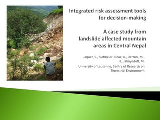
Stephanie JAQUET1, Karen I SUDMEIER-RIEUX2, Marc-Henri DERRON3, Michel JABOYEDOFF3 1Global Risk Forum, GRF, Davos; 2Independent, France; 3University of Lausanne, Institute of Geomatics and Analysis of Risk

Recommandé
Recommandé
Contenu connexe
Tendances
Tendances (20)
En vedette
En vedette (19)
Similaire à Integrated risk assessment tools for decision-making. A case study from landslide affected mountain areas in Central Nepal
Similaire à Integrated risk assessment tools for decision-making. A case study from landslide affected mountain areas in Central Nepal (20)
Plus de Global Risk Forum GRFDavos
Plus de Global Risk Forum GRFDavos (20)
Dernier
Dernier (20)
Integrated risk assessment tools for decision-making. A case study from landslide affected mountain areas in Central Nepal
- 1. Jaquet, S., Sudmeier-Rieux, K., Derron, M.- H., Jaboyedoff, M. University of Lausanne, Centre of Research on Terrestrial Environment
- 2. 2 Case studies: ◦ Khariswara and Thang Thang villages in Dolakha District, Central Nepal. ◦ Central-Eastern Nepal ◦ Average rainfall: ca. 2000mm, ca. 80% during the monsoon season (June – September) ◦ 194 persons/ km2
- 3. Landslides create most disaster losses in Nepal (ca. 100 per year) Underreported due to remoteness of landslides Impacting rural livelihoods to a greater extent than other hazards • Increase in the number of landslides and fatalities since the 1990s Why? • Development of road network • Undercutting of slopes • Roadside settlements • More intense rainfall (monsoon season) Petley, 2011
- 4. Combination of “bottom-up” vulnerability assessment and quantitative participatory approaches with a“top-down” geological risk assessment case study approach: ◦ semi-structured interviews ◦ transect walks ◦ participatory risk and resource mapping
- 5. Participatory mapping ◦ risk perception of the locals and local knowledge Physical risk = H x E x V x W ◦ Common method for assessing risk (Fell et al. 1997) Composite risk = H x E x V [N, E, S, H, Ph] x W ◦ Using a composite estimation of vulnerability using Natural, Economic, Social, Human and Physical components
- 7. Method High Middle Low Community 16 1 0 Physical vulnerability 11 3 6 Composite vulnerability 11 7 2 Community risk map
- 8. Composite risk map Physical risk map
- 9. April, 201 Sept, 0 2010 Jaquet/UNIL, 2010 March, Sept, 20 2011 11
- 10. Method High Middle Low Community 7 7 19 Physical risk 1 17 15 Composite risk 4 14 15
- 11. In both cases: ◦ The participatory method give the highest number of houses at risk ◦ The physical risk method produced the lowest risk assessment ◦ The composite risk produced an average risk assessment The perceived risk is higher due to different factors ◦ Recent landslide ◦ Willing for compensation ◦ The return period is not made explicit
- 12. Participatory risk map ◦ highest estimation of risk areas, reflecting local perceptions of risk ◦ quite accurate ◦ information on land use, cracks, landslide history The physical method ◦ quick to assess ◦ do not take into account local knowledge The composite method ◦ takes into account five different components of vulnerability ◦ time consuming ◦ costly to assess ◦ but as it takes a systems perspective to assessing risk, it is more likely to lead to sustainable outcomes for risk reduction measures in accordance with community priorities. landslide risk assessment should integrate community risk assessments to take into consideration local knowledge and perceptions.
- 13. Importance of taking into account community priorities for more sustainable risk reduction measures
- 14. Thank you: University of Lausanne, Centre of Research on Terrestrial Environment Funding from: Swiss National Science Foundation 2009- 2011 Jaquet S., 2010
- 15. Khariswara landslide April 2012. S.Devkota