Workshop on Flood management in a transboundary context, 13-14.12.2011,Erjon Kalaja
•
0 j'aime•1,145 vues

Hydropower vs Flood Control in Dam and Basin Management Levels Workshop on “Flood management in a transboundary context”, 13-14.12.2011, Zagreb, Croatia

Recommandé
Recommandé
Contenu connexe
En vedette
En vedette (20)
Similaire à Workshop on Flood management in a transboundary context, 13-14.12.2011,Erjon Kalaja
Similaire à Workshop on Flood management in a transboundary context, 13-14.12.2011,Erjon Kalaja (20)
Plus de GWP-Mediterranean (GWP-Med)
Plus de GWP-Mediterranean (GWP-Med) (12)
Dernier
Dernier (20)
Workshop on Flood management in a transboundary context, 13-14.12.2011,Erjon Kalaja
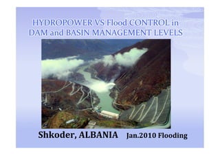
- 1. HYDROPOWER VS Flood CONTROL in DAM and BASIN MANAGEMENT LEVELS Shkoder, ALBANIA Jan.2010 Flooding
- 2. 20 DECEMBER 2009 the inundation of the Shkodra valley started because of the heavy rain. 29 DECEMBER 2009 HPP spillways started to operate with short intervals Hydropower versus Flood control in dam and basin management levels
- 3. The inundation in Shkoder In early December heavy rainfall in the catchments of the Drini River and Shkodra Lake led to flooding of an estimated 14,500 ha of farmland and settled areas including the city of Shkodra, within Shkodra Prefecture. It has been reported that 4,600 houses have been directly affected by the flooding, causing the evacuation of some 12,145 people. A further 14,646 livestock were also evacuated during the peak period of flooding. No deaths or casualties directly related to the flooding have been reported Hydropower versus Flood control in dam and basin management levels
- 5. The inundation in Shkoder Hydropower versus Flood control in dam and basin management levels
- 6. The inundation in Shkoder School was suspended Main Infrastructure damaged Water Supply National and Rural Roads Bridges Agriculture Infrastructure Agriculture Products
- 7. The inundation in Shkoder Hydropower versus Flood control in dam and basin management levels
- 8. Flooding in the Drini/Buna basin January 2010 - 3.600 m3/sec on Buna River • 3.000 m3/sec on Drin • 600 m3/sec on Buna • 1,500 m3/sec, transport capacity on the Buna river (after merging with Drin) of on the first 9.5 km which are not protected by dikes. • 32 km of Buna River is dikeed and has a capacity of 2,200 m3/sec Even with a fully operational flood management and drainage system, the rainfall would have resulted in flooding of parts of the area. Hydropower versus Flood control in dam and basin management levels
- 9. SOME HISTORY 3.100 m3/sec Maximum inflow registered in Fierza 5.550 m3/sec Maximum inflow registered in Vau i Dejes 1.800 m3/sec Maximum discharge from Vau I Dejes Maximum inflow with probability 1:10.000 years Fierza 9.600 m3/sec Vau i Dejes 12.600 m3/sec Hydropower versus Flood control in dam and basin management levels
- 10. The inundation in Shkoder Hydropower versus Flood control in dam and basin management levels
- 11. The inundation in Shkoder Area flooded in Montenegro from the increased level of Shkodra Lake Area flooded in Montenegro from increase of level on Buna River
- 12. The inundation in Shkoder Hydropower versus Flood control in dam and basin management levels
- 13. Drini & Buna River Basin The Drini/Buna River Basin is one single ecosystem It extends across national boundaries shared by: Albania FYROM Kosovo Montenegro Drini River Basin has a catchment area of 14,173 km2 Since 1851 Drini River joined with Buna River which flows out of the Shkodra Lake. Hydropower versus Flood control in dam and basin management levels
- 14. Drin River Hydropower versus Flood control in dam and basin management levels
- 15. Drini & Buna River Basin Buna 41 km long Mean annual flow 680 m3/sek From Shkodra lake 320 m3/sek From Drin 360 m3/sek Floods are natural phenomena in the Drini/Buna basin Excessive snow melt in the Drini River headwaters (which occurs in January-March months); High rainfall in lower reach of Drini Basin causing to Drini River to have high flows; and/or High rainfalls in Drini and over the Lake Shkodra Basin can cause combined flows of Drini and Buna Rivers to have high flows which over top the Buna River Banks
- 16. Drini & Buna River Basin • Drin is the biggest river in Albania with a total length of about 450 km • Drin 160 km ▫ White Drin 170km ▫ Black Drin 120 km • Black Drin sources from Ohrid Lake which soruces from Prespa Lake • Perennial average water flow of Drin River Fierza HPP is about 230 m3/sec and at Vau i Dejes 330 m3/sec Hydropower versus Flood control in dam and basin management levels
- 17. Drini & Buna River Basin Hydropower versus Flood control in dam and basin management levels
- 18. Drini & Buna River Basin 5 HPP constructed in Drin White Drin no HPP Black Drin Globocica / Spilje Skavica suggested in the feasibility study Drin Fierza / Koman / Vau I Dejes Ashta in process Hydropower versus Flood control in dam and basin management levels
- 19. Drini & Buna River Basin FIERZA HPP Dam/rockfilled/claycore/Height 167 m Total water volume of Fierza Lake 2.7 billion m3 Max water level 296 a.s.l. 297 a.s.l. agreement with ex Yugoslav government Combined max. discharge capacity from the Tunnels and Turbines 3.225 m3/sec Hydropower versus Flood control in dam and basin management levels
- 21. Drini & Buna River Basin KOMAN HPP • Dam/rockfilled/Concrete faced/Height 115 m • Total water volume of Koman Lake 500 millon m3 • Max. Water level 175 m a.s.l. • Combined discharge capacity from the Tunnels and Turbines 3.600 m3/sec at 171 m a.s.l. Hydropower versus Flood control in dam and basin management levels
- 23. Drini & Buna River Basin VAU I DEJES HPP • Distance from city of Shkodra 18 km • Dams ▫ Zadeje / rock filled / clay core 60 m ▫ Qyrsaq / gravity concrete & rock filled/clay core 46 &47 m ▫ Ragam/ rock filed 29 m • Total water volume of Vau i Dejes Lake 580 millon m3 • Max. Water level 76 m a.s.l. • Combined discharge capacity from the Spillway and Turbines 6.900 m3/sec Hydropower versus Flood control in dam and basin management levels
- 25. Drini & Buna River Basin SPILJE GLOBOCICA
- 26. DRIN DISCHAGRGE REGUALTIONS Safety Factor 1% 0.1% 0.01 % October – March 4.570 m3/sec 6.100 m3/sec 9.600 m3/sec April – May 1.600 m3/sec 2.050 m3/sec 2.500 m3/sec If the water level at Koman Dam downstream of Fierze is more than 170 m a.s.l. the water from Fierza dam can be discharged only by full operation of the turbines, about 550 m3/sec According to the discharge regulation for the three dams in Drin River, in winter discharge tunnels should be opened at 290m a.s.l. at Fierza dam and the water level must not be increased at 296 m a.s.l. Because of possible landslides. Fierza dam has a 15 m freeboard to resist the possible increase of the volume and height of wave to be created. Hydropower versus Flood control in dam and basin management levels
- 27. Drini & Buna River Basin • There were some ten or more major floods since 1851: 1854: 1905: 1962-63: 1970-71: 1979: 1992: 2003: 2010 January 2010 Nov-Dec Hydropower versus Flood control in dam and basin management levels
- 28. Flooding in the Drini/Buna basin 7 January 2010 - 3.600 m3/sec on Buna River • 3.000 m3/sec on Drin • 2.400 m3/sec max discharge from HPP (as reported from the media) • Gjader and Kir torrent, after the Vau i Dejes HPP, contributed to the increase of flow • 600 m3/sec on Buna (from Shkodra lake) • 1,500 m3/sec, transport capacity on the Buna river (after merging with Drin) of on the first 9.5 km which are not protected by dikes. • 32 km of Buna River is dikeed and has a capacity of 2,200 m3/sec Even with a fully operational flood management and drainage system, the rainfall would have resulted in flooding of parts of the area. Hydropower versus Flood control in dam and basin management levels
- 29. Flood Management Media tried to blame Albania Power Corporation about the Flood The graph below shows in brown the natural flow on Vau I Dejes and in Green the real discharge from Turbines and Spillways Fierze Shkarkimi nga porta(m3/s) Koman Shkarkimi nga porta(m3/s) V. Dejes Shkarkimi nga porta(m3/s) Prurja Natyrale ne Vaun e Dejes Hydropower versus Flood control in dam and basin management levels
- 30. Flood Management Council of Ministers declared "state of civil emergency" and founded an Inter-ministerial Committee with the Chairmanship of DeputyPrimeMinister Institutions Involved on Flood Management Emergency Directorate – Acting as coordinator Ministry of : Interior Affairs / Defense / Health / Economy / Public Works & Transport / Shkodra Prefecture/ several Communes, etc.
- 31. Flood Management Albania officially requested for international assistance on 7 January 2010 UN Office for the Coordination of Humanitarian Affairs (OCHA) UN Children’s Fund (UNICEF) UN Development Program (UNDP) CARITAS RED CROSS / RED CRESCENT Governments of : USA, Italy, UK, Norway, Netherland, Germany, Kosovo, Greece, Montenegro, FYROM, etc.
- 32. Flood Management AID CAME AS transportation boats for shallow water, transport helicopters, high capacity water pumps, mobile power generators, fuel, food, medicine
- 33. Flood Management In addition around 1,200 individuals from the army, police, fire fighters and other state departments were deployed to assist the evacuation of people and their animals and provide health support, land protection, and to protect dams to reduce further flooding Several engineers, hydrologists, geologists, and other technicians, assisted as international consultants
- 34. Flood Management GREAT EVERYTHING DONE ACCORDING TO THE BOOK than WHY DID IT HAPPENED AGAIN IN ?????!!!!!!!!!!! FEBRUARY MAY NOVEMBER DECEMBER
- 35. Flood Management Buna River and Shkodra Lake are considered as International waters. Nothing was done by the two countries, for the last 20 years, to increase the management of this vital water sources Since the January 2010 flood, Albanian and Montenegro Governments have intensified their collaboration in finding solutions in benefit of both countries and the population affected The two countries are seeing the possibility of deepening the Buna River bed and cleaning the sea outfall
- 36. Flood Management There was no advertising from measures on White Drin or Black Drin outside of Albanians border on increase on rainfall, following in few days an increase of flow. There was no advertising from Spile HPP on discharging schedules (to my knowledge) Problem to be solved on preparing an integrated management system on the hole Drin system
- 37. Flood Management Prespa Lake Ohrid Lake Black Drin Drin Buna ARE ONE SINGEL ECOSYSTEM AN INTEGRATED BASIN MANAGEMENT BETWEEN GREECE, FYROM, KOSOVA AND ALBANIA MUST BE PUT IN PLACE
- 38. Flood Management Construction of Ashta HPP, downstream of Vau I Dejes is very different from Bushati study with a dam and a small reservoir Nothing can be done at this stage
- 39. Flood Management Construction of Skavica HPP, up stream of Fierza with a big reservoir would not only increase by about 30% the production of Drin cascade (within Albanian border) but will also do perennial regulation of Drin flow This is one of the priorities of Albanian Government in the field of Safety and Power Production
- 40. Flood Management Albania Power Corporation (KESH) was producing at the maximum possible during the flood, but the system couldn’t supported all the energy produced by KESH Problem solved during this year a new interconnection line with Montenegro integrates better Albania with Regional Network.
- 41. Flood Management Buna River has 31 km of dikes which didn’t performed according to their purpose. Albanian Government has invested just during 2011, about 10 million USD on dikes and drainage system rehabilitation/improvement (reference from Ministry of Agriculture officials) Albanian Government in collaboration with World Bank is in process of a study to analyze the hydraulic characteristic of Shkodra Valley to determine the best long term solution on floods