Landscape Approaches to Future Forest and Tree Resources Management
•
1 j'aime•521 vues

Landscape Approaches to Future Forest and Tree Resources Management IUFRO-FORNESSA Meeting, Nairobi, June 2012

Recommandé
Recommandé
Contenu connexe
Tendances
Tendances (18)
Similaire à Landscape Approaches to Future Forest and Tree Resources Management
Similaire à Landscape Approaches to Future Forest and Tree Resources Management (20)
Plus de ASB Partnership for the Tropical Forest Margins
Plus de ASB Partnership for the Tropical Forest Margins (20)
Dernier
Dernier (20)
Landscape Approaches to Future Forest and Tree Resources Management
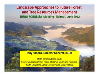
- 1. Landscape Approaches to Future Forest and Tree Resources Management IUFRO-FORNESSA Meeting, Nairobi, June 2012 Tony Simons, Director General, ICRAF With contributions from: Meine van Noordwijk, Peter Minang, Valentina Robiglio, Keith Shepherd, Anja Gassner and Ravi Prabhu Photo: INBAR China
- 2. Abdou Salam Ouedraogo 1957 - 2000
- 3. Landscape Approaches with Forest and Trees 1. What is a landscape? 2. A Portrait of Forests and Trees 3. What problems are we tackling? 4. Landscape Approaches
- 4. 1. What is a Landscape? Landscape comprises the visible features of an area of land, including: • physical elements of landforms such as mountains, water bodies, vegetation • human elements including different forms of land use, buildings and structures, and • transitory elements such as lighting and weather conditions. (from Wikipedia, 2012)
- 5. 1. What is a Landscape? (cont.) 5th Century - landscaef (England) & landscahft (Germany) - small administrative units of land (natural and human made) 16th Century - Dutch painter’s term (Bruegel) - bird’s eye viewpoint of Flemish countryside 1930s - domain of geography, subset of region (Hartshorne) 1970s - transition of natural to human landscapes - Meinig combined the physical and human perceptions "landscapes are not only what lies before our eyes but what lies within our heads."
- 6. 1. Recent political exposure 0 Rio - 20 (Stockholm , Earth Summit, 1972) (1) Rio (Rio de Janiero, UNCED, 1992) 0 MDGs (New York, UN General Assembly, 2000) 0 Rio +10 (Johannesburg, WSSD, 2002) 0 Rio +20 (Rio de Janiero, UNCSD, 2012)
- 7. Agriculture - 6 mentions Forest - 35 mentions Land Manag/Degrad - 12 mentions
- 8. Rio Dialogues 10,000 ideas from civil society Clustered to top 100 actions 1.3 million voted on-line Take concrete steps to eliminate fossil fuel subsidies 66.1% Restore 150 million ha of deforested and degraded lands by 2020 34.6% Secure water supply by protect biod, ecosystems and water sources 34.2%
- 16. Agroforests Fields,fallow, forest mosaic Integrate deforestation re- and afforestation Plantations Fields, Forests & Parks Segregate
- 17. 2. A Portrait of Forests and Trees
- 18. Choosing a forest definition for the CleanCLIMATE CHANGE WORKING PAPER 4 – 2006 FORESTS AND Development Mechanism http://www.fao.org/forestry/media/11280/1/0/ For the CDM, developing countries must choose the parameter values from the ranges: “Forest” is a minimum area of land of 0.05-1.0 hectares with tree crown cover (or equivalent stocking level) of more than 10-30 per cent with trees with the potential to reach a minimum height of 2-5 meters at maturity in situ.
- 19. 50 The relationship between tree crown cover and ability 40 to add extra carbon looks something like this. Opportunity for 30 incremental carbon (t/ha) 20 10 10 20 30 40 50 60 70 80 90 100 % tree crown cover
- 20. Lower and upper limits for CDM A/R 50 40 National governments can set their Opportunity forest definition as tree cover for 30 minimum threshold between incremental 10% and 30% carbon (t/ha) 20 10 10 20 30 40 50 60 70 80 90 100 % crown cover
- 21. AR at 10% 50 Avoided deforestation at 10% 40 Opportunity for 30 incremental REDD carbon (t/ha) 20 Avoided deforestation at 30% CDM A/R 10 Aff/Reforestation at 30% 10 20 30 40 50 60 70 80 90 100 % crown cover
- 22. 10% 20% 6700 km2 = 2.8% of land area 36,000 km2 = 14.9% of land area 30% Implications of forest definition 1- A/R Uganda Zomer et al. 2008 69,300 km2 = 28.6% of land area
- 23. Land suitable for CDM Afforestation according to tree canopy cover as forest definition % increase Difference from 10-30% (hectares) Cote d’Ivoire 1583% 7.7 million Ghana 1063% 6.8 million Nigeria 446% 19.5 million
- 24. Any signs of deforestation? ….are included under forest, as are areas normally forming part of the forest area which are temporarily unstocked as a result of human intervention such as harvesting or natural causes but which are expected to revert to forest; [FCCC/CP/2001/13/Add.1]
- 25. Adams J.M. & Faure H. (1997) (ed.s), QEN members. Review and Atlas of Palaeovegetation: Preliminary land ecosystem maps of the world since the Last Glacial Maximum. Oak Ridge National Laboratory, TN,
- 26. Adams J.M. & Faure H. (1997) (ed.s), QEN members. Review and Atlas of Palaeovegetation: Preliminary land ecosystem maps of the world since the Last Glacial Maximum. Oak Ridge National Laboratory, TN,
- 27. The foresters’ view of the world
- 28. The agroforestry view of the world
- 29. The integrated view of the world Global tree cover inside and outside forest, according to the Global Land Cover 2000 dataset, the FAO spatial data on farms versus forest, and the analysis by Zomer et al. (2009)
- 31. Spatial analysis: classification of 450 districts in Indonesia according to 7 tree cover transition stages (Dewi et al., in prep.) 31
- 32. Indonesia’s forest loss by land-use category Forest Use Class % area Loss during 2000-2005 t C ha-1 yr-1 % yr-1 % total emissions Protected Forest 26.7% 2.01 0.90% 20% Production Forest 31.8% 3.28 1.80% 39% Convertible 9.6% 3.07 1.87% 11% “Non-forest” 31.9% 2.57 3.33% 30% TOTAL 2.69 1.70 (Source http://www.worldagroforestrycentre.org/sea/ALLREDDI)
- 33. Number of described species for major groups of organisms as proportions of global total Nematodes - 0.9% Fungi - 4.2% Algae - 2.4% Arthropods 64.5% Protozoans - 2.4% Vertebrates - 2.7% Molluscs - 4.2% Plants - 14.3% 25% are woody species Bacteria - 0.2% Viruses - 0.3% Other invert - 3.9% Source: I. Koziell (2001) Diversity not Adversity, IIED, 58pp
- 34. Tree Products and Tree Services A. Trees for Products fruit firewood medicine income sawnwood fodder B. Trees for Services soil carbon soil watershed shade biodiversity fertility sequestration erosion protection
- 39. • Increased production of timber and fuelwood on- farm and in rotational wood- lots can potentially reduce emissions from forest degradation especially in instances of restricted access to forests or limited supply in “open access” forests.
- 41. Traditional Medicine in Sub-Saharan Africa 80% of people use traditional medicine
- 42. 3. What problems are we tackling? Los Angeles Cairo City Developing countries city commuters populace rural poor/hungry Differentiated problems? or interlinked global challenges?
- 43. Temporal Scale Ecosystem processes Lifespan timber tree Lifespan atmosph CO2 Human lifespan Time to project impact Political Term Project duration Cropping season 0 1 10 100 1000 Log Scale Time (years)
- 44. Adjudicated Land Adjudicated under the Land Adjudication Act CAP 284 1968, intensive smallholder cultivation with clear freehold title
- 45. Unadjudicated Land Unadjudicated land, no firm legal title
- 47. Economic, Environmental and Social Tenure Unadjud Freehold Impacts Effect Net returns to land ($ ha-1 y-1) $126 $288 2.28 Woody crops, woodlots etc (ha km-2) 5.4 25.6 4.7 Hedgerows (km km-2) 5.2 23.6 4.5 Social cost from embedding -$40 $30 $70 Social "tax" -32% +10% (Norton-Griffiths et al., 2012)
- 48. Redirecting development pathways towards environmental integrity Positive incentives are needed to reward rural poor for the environmental services they can/do provide
- 50. The amount of support that govts will need to provide by the year 2030 to enable farmers to implement SLM practices are projected at: US $20 billion in Africa, US $41 billion in Latin America, US $131 billion in Asia. World Bank (2012) World Bank, Washington, 118p.
- 52. Basic problem There is a lack of coherent and rigorous sampling and assessment frameworks that enable comparison of data (i.e. meta-studies) across a wide range of environmental conditions ... and scales Quantification and systematic monitoring are essential to understand and manage trade-offs among ecosystem services and know where are the tipping points
- 53. Land Health Surveillance Towards evidence-based decision making for sustainable agricultural intensification Vagen Land Health - the capacity of land to sustain delivery of essential ecosystem services (the benefits people obtain from ecosystems) Concepts, methods, technology, protocols, & tools to help apply the type of scientific rigour that exists in public health surveillance to measurement and management of agro-ecosystem health at multiple scales
- 54. Surveillance science Land health metrics Sentinel sites Randomized sampling schemes Consistent field protocol Coupling with remote Prevalence, Risk factors, Digital mapping sensing Soil spectroscopy
- 55. Ethiopia Soil Information System EthioSIS is adopting a new, innovative technological approach that allows for quick, high-resolution coverage of the country, combining remote sensing data and ground tests
- 56. Mapping soil carbon stocks in landscapes UNEP Carbon Benefits Project: Measurement tools Soil organic carbon stocks within a 10 x 10 km sentinel site in western Kenya mapped by statistical modelling of ground data to satellite spectral bands The effect of cloud is masked as no data 5 6
- 58. Biomolecules in Green Development C55H72O5N4Mg Chlorophyll
- 59. LANDSCAPE CONCEPT AND LANDSCAPE APPROACH Production Ecosystem services Biodiversity Institutions Carbon sink and sequestration Livelihoods strategies policy System resilience landscapes as spatially heterogeneous geographic areas characterized by diverse interacting patches or ecosystems Landscape approach is necessary to deal at the same time with production, biodiversity, ecosystem services and functions, livelihoods strategies, policy and institutions across scales. The landscape approach is particularly valuable to create an understanding in the complex (competing) interrelationships between resource use and users across scales.
- 60. HUMAN LANDSCAPES Land units as non-interacting aggregates Economic or social synergies not accommodated Social processes across land uses ignored or aggregated Ghazoul, ISPC Meeting, 2011)
- 62. The Challenges of REDD 1. Market alone won’t solve deforestation problem 2. Carbon only part of picture (water, habitat, biodiversity, services) 3. MRV needs to be independent of government 4. Handling cross-sectoral/ministerial issues 5. Controversy over rights to pollute, displacement of emissions 6. Opportunism of carbon cowboys 7. Definition and inclusion problems of tree, forest 8. Asynchronous forest laws, agrarian reform, land tenure 9. Land-use/land-cover conundrum 10. Bundling protection forest, production forest, conversion forest, (non-forest) 11. REDD is only partial accounting 12. Low capacity/compliance of fpic, indigenous rights, social safeguards 13. Baselines versus reference levels 14. Emissions embedded in trade 15. Stock:emission rate ratios are lowering (time pressure to act) 16. All actors believe most finance should go to them
- 63. ACTORS and FINANCING MAIN ACTORS % Finance National Governments 90% Brokers/Investors 90% MRV, compliance 90% Implementers, Managers, NGOs 90% Stewards, communities 90% TOTAL 450%
- 64. ACTORS and FINANCING (cont.) MAIN ACTORS % Finance National Governments 25% Brokers/Investors 15% MRV, compliance 15% Implementers, Managers, NGOs 20% Stewards, communities 25% TOTAL 100%
- 65. ACTORS and FINANCING (cont.) MAIN ACTORS % Finance Source of Finance National Governments 25% ODA Brokers/Investors 15% Market MRV, compliance 15% Market Implementers, Managers, NGOs 20% Market Stewards, communities 25% ODA TOTAL 100% - 50:50 financed by market and ODA - MRV independent of Govt - Govt and communities less vulnerable - Govts need to function for market to trust them
- 66. • Agroforestry, Afforestation and Reforestation can be part of REDD+ depending on the definition of forest in a given country
- 68. Ellison D, Futter MN, % of rainfall derived from ‘short cycle’ Bishop K, 2011.On the forest cover–water terrestrial origins(recalculated from Basilovich et al.) yield debate: from demand- to supply- 37% 58% 30% 68% side thinking. Global Change Biology, doi: 10.1111/j.1365- 2486.2011.02589.x Approximately a third comes from ‘local’ 42% sources 40% 22% 41% 46% 1) Mackenzie river basin, 2) Mississippi river basin, 3) Amazon river basin, 4) West Afri-ca, 5) Baltics, 6) Tibet, 7) Siberia, 8) GAME (GEWEX Asian Monsoon Experiment) and 9) Huaihe river basin.
- 69. Global circulation patterns of humidity in the atmosphere suggsts a strong link between West Africfan rainfall and the recycling of rain-fall back to the atmosphere in East Africa & Nile basin; this suggests very different geopolitics to carbon-based global climate negotiations van der Ent RJ, Savenije HHG, Schaefli B, Steele‐ Dunne SC, 2010. Origin and fate of atmospheric moisture over continents. Water Resources Research 46, W09525,
- 70. Dryland agricultural areas where more than 50% of rainfall is derived from terrestrial recycling Sahel Keys PW, van der Ent RJ, Gordon LJ, Hoff H, Nikoli R and Savenije HHG, 2012. Analyzing precipitationsheds to understand the vulnerability of rainfall dependent regions, Biogeosciences, 9, 733–746
- 71. Enhanced EL means increased precipitation 250 Ring w idth Rain season prec. 150 ainy season prec. (m ) m 200 130 ing idth index 150 110 R w 100 90 R 50 70 0 50 1937 1942 1947 1952 1957 1962 1967 1972 1977 1982 1987 1992 1997 2002 Empirical data: research by Aster Year Gebrekirstos c.s. showed intra- Three ‘drought’ indicators: annual variation in O16/O18 ratio in Ringwidth growth C12/C13 carbon isotope ratiops rings in the Sa- indicative of stomatal closure hel, indicative O16/O18 oxygen isotope ratios of ‘short cycle’ indicative of stomatal closure + rain in 2nd part ocean/terrestrial origin of rainfall of growing sea- son
- 73. 100 No. of households facing shortage Zambia 80 Hungry/cropping Malawi 60 season 40 20 Harvest/off- season 0 Tree Species Oct Nov Dec Jan Feb Mar Apr May Jun Jul Aug Sep Avocado Citrus Parinari curatellifolia Mangoes Uapaca kirkiana Strychnos cocculoides Syzygium cordatum Annona seneghalesis Azanza garckeana Flacourtia indica Vangueria infausta Vitex doniana Adansonia digitata Ziziphus mauritiana
- 74. New Cultivar Development (Uapaca kirkiana) A superior cultivar (fruited after 4 yrs.) Variations Earlier fruiting, bigger fruits, heavy fruit loads, smaller trees and uniform quality
- 75. Case Study: Cocoa Rehabilitation Palopo Cocoa Centre, Sulawesi
- 76. ~40 identified QTLs 1 2 3 cir120 4 5 0.0 cir184 0.0 cir252 0.0 2.1 cir150 cir153 0.0 1.5 cir242 cir234 0.0 0.3 WRKY-10 cir111 in cacao 5.1 cir19 3.8 cir198 3.8 cir241 1.3 cir232 5.4 TIR2 5.1 cir233 2.1 cir119 9.2 cir240 9.6 cir146 5.2 shrs37 11.6 cir161 9.4 Tce195 cir118 16.0 cir3 10.7 cir21 11.2 cir117 7.4 shrs12 15.7 cf974239 20.9 Tce089 10.9 cir192 14.5 cir33 7.6 shrs11 23.4 cir129 11.6 cir62 14.8 cir237 13.5 cir148 shrs21 12.3 cir40 20.6 cir95 18.2 shrs22 23.8 shrs6 13.9 cir247 21.5 cir10 23.3 shrs33 Witches’ Broom cir143 32.3 ca797995 17.0 cir204 26.2 cir32 26.1 Tce030 28.9 cir159 cir196 37.4 cir268 19.5 21.6 Tce380A cir180 32.0 cir43 26.8 cir123 Resistance cir152 34.2 cir12 38.5 shrs13 31.4 cir175 27.7 cir42 39.4 cir102 31.5 cir169 45.0 WRKY-14 39.6 cir280 cir149 Frosty Pod 46.5 cir29 48.5 cir60 40.6 cir289 39.8 51.0 cf972885 50.1 cir139 42.0 cir78 cir213 cir256 Resistance cir165 45.4 cir263 48.6 40.7 cir170 53.3 cir249 51.3 shrs2 cir206 47.7 shrs19 54.7 shrs3 48.0 cir219 57.7 cir162 63.6 cir254 48.8 cir245 Pod Weight 60.4 cir244 cir69 61.1 shrs23 63.9 cir135 59.4 Tce380 49.1 64.1 cir128 WRKY-11 62.7 cir246 52.3 TIR4 65.8 cir273 66.4 cir140 70.5 cir48 70.1 shrs7 52.6 TIR3 Pod Number 68.4 cir286 63.7 shrs4 69.0 shrs34 70.4 shrs5 67.6 cir87 cir226 73.0 cir80 70.8 cir131 75.3 cir115 80.1 Tce574 85.4 cir230 71.4 cir202 cir109 Trunk Circumference 86.1 cir228 72.1 cir144 84.9 cir101 88.0 WRKY-03 73.0 ca798018 85.3 cir274 87.7 cir275 cir68 89.9 cir264 93.5 cir261 79.5 cir81 9 93.5 cir22 cir73 91.6 ca795469 Jorquette Height 100.5 0.0 cir79 97.0 RGH11 cir269 3.4 cir85 10 cir194 0.0 cir37 Bean Length 4.7 cir223 11.2 RGH7 Pod Number & Wet 6 7 8 24.0 cir64 13.4 RGH8 cir98 Bean Weight 0.0 cir6 0.0 ca972846 24.8 cir283 0.0 cir103 1.5 cir136 1.7 cir186 3.0 cir134 23.3 cir61 5.4 cir277 32.8 cir212 3.2 5.4 cir189 RGH2 Frosty Pod Resistance 10.5 cir53 cir116 36.4 cir58 4.4 cir179 13.5 Tce487 40.6 cir104 & Wet Bean Weight 5.7 cir177 16.8 cir26 45.0 cir8 41.3 cir155 8.0 cir147 47.5 cir178 10.2 cir55 23.0 cir200 32.2 cir71 12.4 cir56 55.2 cir160 34.3 cir276 cir46 58.0 cir157 57.8 cir229 Black Pod 34.7 16.6 cir211 60.5 cir35 37.4 cir25 cir181 33.3 shrs20 22.8 RGH4 35.2 cir225 67.0 cf972909 26.1 RGH5 68.5 cir24 54.3 cir209 33.1 cir13 73.3 74.1 cir251 cir30 Bean Weight, Bean Thickness, 37.4 RGH1 45.1 cir282 57.9 cir9 43.7 cir190 79.5 cir166 Pod Weight & Pod Length 59.9 cir291 51.1 cir1 83.2 cir250 44.1 cir141 86.0 cir126 88.1 cir108 Bean Length, Seed Weight,Ovule 88.6 cir266 94.6 cir72 Number, & Trunk Circumference cir287 95.4 cir243
- 78. - Resolution 30m x 30m - Based on 280 (56 x 5) ground truthed cocoa locations - Maximum likelihood classifier spectral landcover reflectance probability using ENVI
- 79. Project Vision for Change (V4C) First flowers after 5 months First pod at 9 months
- 80. Capacity building and mobilisation: State of our national partners HQ in Abidjan, August 2011
- 81. A growing on-farm domestic timber sector in Cameroon (Ghana, Sri Lanka, Kenya????)… 3.0 Millions m3 2.0 1.0 0.0 2000 2005 2010 Official production SSL informal production Robiglio, V. et al. 2011. Submitted to Once SSL production is included the overall Small Scale Forestry . value of national timber production doubles! 81
- 83. eastern western Fort Tenan
- 84. Components: 1. Global Review 2. International Forum (March 12-16, 2012) FFAOFAO 3. Action and Advocacy
- 85. Sentinel landscapes –CGIAR long-term research network under CRP6 To strengthen CGIAR’s impact; in the past our research activities were not usually based on a common set of research instruments, and long term horizon Initial selection of 6 landscapes in Africa, Latin America, South East Asia Selection driven by CRP6 research hypothesis Cross regional comparison Standard network protocols & data sharing policies Long term presence Platform for co-locating research