![Acknowledgements ,[object Object]](data:image/gif;base64,R0lGODlhAQABAIAAAAAAAP///yH5BAEAAAAALAAAAAABAAEAAAIBRAA7)
Recommandé
Recommandé
Contenu connexe
Tendances
Tendances (20)
En vedette
En vedette (10)
Similaire à Comparative Review Integrated Models
Similaire à Comparative Review Integrated Models (20)
Comparative Review Integrated Models
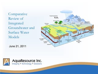
- 1. Comparative Review of Integrated Groundwater and Surface Water Models June 21, 2011
- 5. DHI Water and Environment
- 7. Ying Qiao
- 8. Doug Graham
- 10. Dr. Jon Paul Jones
- 11. S.S. Papadopulos and Associates
- 12. Chris Neville
- 14. David Van Vliet
- 15. Steven Murray
- 17. GSFLOW*
- 18. HydroGeoSphere*
- 19. MikeSHE**
- 20. ModHMS
- 21. Parflow
- 25. Model Evaluation GSFLOW (USGS) Based on well established and accepted modelling codes (PRMS + MODFLOW) Supported by USGS Open source, free No dynamic stream routing, no overland flow routing Soil water balance and runoff calculations highly empirical Daily timesteps
- 26. Model Evaluation – HydroGeoSphere (HGS) (University of Waterloo) Variable finite element mesh resolution, excellent mass balance Sophisticated subsurface model: 3D Richards representation of unsaturated zone. Variable saturated groundwater flow as well as Limited hydrologic processes (snowmelt, soil water balance, interflow) long run times
- 27. Model Evaluation – MIKE SHE (DHI Water and Environment) Highly flexible, full GUI interface Empirical and physical representations of hydrologic processes Sophisticated post processing Reasonable run times DHI support Uniform finite difference mesh
- 28. Examples of Model Comparison Criteria
- 29. Subwatershed 19 Credit River Watershed Mill Creek Grand River Watershed Case Studies Objectives Compare models Explore and demonstrate benefits of integrated models over traditional approaches Develop recommended practices and methods
- 30. Case Study: Credit Valley Subcatchment 19
- 31. Case Study: Credit Valley Subcatchment 19 Headwaters of the Credit River - Approximately 60 km2 Land use: urban, agriculture, wetlands, aggregate. Issues: Municipal drinking water supply (groundwater) Wastewater assimilation Streamflow quality and quantity Existing studies: Subwatershed Study (CVC) Tier Three Water Quantity Risk Assessment (MNR, municipalities) Island Lake Water Budget Study Existing Models HSPF, GAWSER (Surface Water) MODFLOW, FEFLOW (Groundwater)
- 32. Integrated Models Provide Realistic ET Predictions
- 33. Groundwater Recharge Predictions Influenced by Soils, Vegetation, Topography, Discharge
- 34. Groundwater Discharge Into Wetlands Simulated Without Boundary Conditions
- 37. Description of the Subwatershed Covers an area of roughly 100 km2 and is situated between the Galt-Paris moraines. The headwaters of Mill Creek are located southeast of Guelph, where Mill Creek flows southwest, joining the Grand River in downtown Cambridge (Galt). Land cover within Mill Creek is predominantly agriculture, with forests and wetlands comprising the majority of the remaining land area. Mill Creek supports cold-water fisheries, rich wetlands, and also has extensive aggregate production facilities within the watershed.
- 38. Mill Creek Subwatershed Land Cover
- 39. Calibration – Mike SHE Represents Low Flows Very Well. GW/SW Interactions Critical
- 40. Variable ET Across Watershed, Influenced by Landuse, Wetlands, Aggregate Extraction
- 41. Groundwater Discharge Critical Along Streams, Wetlands and Hillslopes
- 42. Simulated Soil Moisture Reflects Delineated Wetlands
- 43. Seasonal Soil Moisture Variability in Wetlands
- 44. Conclusions Benefits of Integrated Models over Traditional Models Integrating groundwater and surface water models removes traditional assumptions (recharge, boundary conditions) Realistic water budgets (ET, Influence of Topography) Groundwater / surface water interactions (Wetlands, Hillslopes, Hummocky Areas) better handled Physically-based continuous low flow predictions – needed for ecological flow assessments Data requirements are similar to traditional approaches Limitations Computational Time – It can be manageable Calibration Time – Reduced with experience Urban Systems – Manage technical expectations Learning Curve – Training requirements are significant Success requires both surface water and groundwater modelling expertise Costs are marginally extra than traditional methods but the results are much more meaningful