D8 Open Data for Agriculture Presentation by Melanie Bacou, IFPRI, HarvestChoice
•Télécharger en tant que PPTX, PDF•
0 j'aime•866 vues

Presentation by Melanie Bacou at the D8 Open Data for Agriculture Side event at IFPRI on May 1, 2013.

Recommandé
Recommandé
Contenu connexe
Tendances
Tendances (20)
En vedette
En vedette (7)
Similaire à D8 Open Data for Agriculture Presentation by Melanie Bacou, IFPRI, HarvestChoice
Similaire à D8 Open Data for Agriculture Presentation by Melanie Bacou, IFPRI, HarvestChoice (20)
Plus de International Food Policy Research Institute (IFPRI)
Plus de International Food Policy Research Institute (IFPRI) (20)
Dernier
Dernier (20)
D8 Open Data for Agriculture Presentation by Melanie Bacou, IFPRI, HarvestChoice
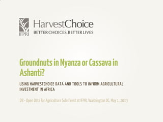
- 1. GroundnutsinNyanzaorCassavain Ashanti? USING HARVESTCHOICE DATA AND TOOLS TO INFORM AGRICULTURAL INVESTMENT IN AFRICA D8- Open Data for AgricultureSide Event at IFPRI, Washington DC,May 1, 2013
- 2. WhoWeAre,WhatWeDo… Researchprogramco-ledby the International Food PolicyResearchInstitute (IFPRI, CGIAR) and Universityof Minnesota. Wegeneratedata productsto help guide strategicinvestments for moreproductive and profitablefarming in sub-SaharanAfrica. Wedo this through: • Harmonizedand geo-referenced datasets at administrative unitsdown to 10-km grid • Analytics,modeling and data visualization tools • Flagshipstudies,atlases
- 3. Questionswearepassionateabout… Whereare the poor and what is theirwelfarestatus? Which farming systemsdo the poormost depend? How best to tune productivity targetsto different sub-national conditions? What arethe constraints affecting on-farmproductivity, technology adoption, and marketintegration? What investments in technologies andpractices might best address thoseconstraints? What is the aggregatelandscape of investments acrossthe region? What arethe benefits of investmentson productivity, farm incomeand ultimately,the reduction of povertyand hunger, andincome distribution?
- 4. HowWeDoIt… CropModelingatglobalandregional-scaleongrids Seasonality Soil Fertility Harvested Area Average Rainfall Yield Potential
- 5. IMPACT… Where is HarvestChoice open data making a difference? Bill & Melinda Gates Foundationstrategy refresh, country and value-chain targeting G-8New Alliance priority-setting tools USAID Feed the Future selection of target and control trial sites (M&E) Spatial analysis of aid effectiveness, etc.
- 6. B&MGates Foundation Combining active investmentswith spatialanalysis Showing BMGF investment portfolio within Uganda’s agro- ecological zones using Project MappingTool. http://caadp- cgiar.org/ftf
- 7. G8New Alliance Value-chain priority-setting tool Ghana:value-chain prioritization. Which CAADP value chains to focus on? What 10-year yield targets are achievable? Prototype for each country to be populated by IFPRI/HarvestChoice based on available secondary data sources National teams will adapt as needed and validate or replace data sources Prioritization criteria andweighting Baseline production/adoption Yield targets Outcome indicators
- 8. Wheat Profitability Assessment inSSA Ethiopia:Sensitivity analysis tool to estimate potential wheat profitability under varying fertilizer use scenarios. http://harvestchoic e.org/tools/profita bility-calculator
- 9. The Brookings Institution Sub-national povertyandaid targeting Combining World Bank Mapping for Results investment maps with HarvestChoice spatial layers http://www.brooki ngs.edu/research/o pinions/2013/02/0 4-world-bank- poverty-africa- chandy
- 10. HarvestChoice data may be found under 6 major research topics http://harvestchoice.org/topics ExploreHarvestChoiceTopics
- 11. Download data layers in ASCII raster and CSV formats http://harvestchoice.org/map Download,Map,andTabulate…
- 12. Use Mappr to browse and download indicator maps http://harvestchoice.org/mappr/ HarvestChoiceMappr #1 Select indicators #2 Toggle and re- arrange layers #3 Generate zonal statistics #4 Save reports
- 13. Use Mappr to generate point-based and zonal statistics http://harvestchoice.org/mappr/ HarvestChoiceMappr
- 14. Create and download your own custom tables using Tabler at http://harvestchoice.org/data/ Public release planned for mid-May 2013. HarvestChoiceTabler #2 Pivot and summarize #1 Select indicators
- 15. HarvestChoice launching new data API at http://dev.harvestchoice.org/harvestchoiceapi/0.1/ Public release planned for mid-May 2013. HarvestChoiceDataAPI
- 16. COMINGNEXT… We need to better our understanding of: Footprintof agricultural technologiesin sub-Saharan Africa Not only bio-physical, but also socio-economicand institutionalconstraints to technology adoption Current and future landscape of public and private agricultural investment in the region
- 17. Augmenting –and validating- HarvestChoice data layers and models with sub-national farm household characteristics, farm management practices, production, consumption and nutrition estimates. PartneringUp MappingAgriculturalCensus,DHSandLSMS- ISASurveys DHS Child Stunting Prevalence TZA AC 2007 – Tomato Yield
- 18. Showing target zones for planned agricultural investments http://csi.maps.arcgis.com/home/ PartneringUp MappingCGIARResearchProgramsand CAADPCountryInvestmentPlans
- 19. About IFPRI ifpri.org TheInternational Food Policy Research Institute(IFPRI) seekssustainablesolutions for endinghunger and poverty.IFPRI isone of 15 centers supportedby the ConsultativeGroup on International Agricultural Research (CGIAR),an alliance of 64 governments,private foundations,and internationaland regional organizations. HarvestChoice harvestchoice.org HarvestChoicegenerates knowledge products to help guidestrategicinvestments to improve thewell-being of poor people in sub-Saharan Africa through more productiveand profitable farming. To do this,a noveland spatiallyexplicitevaluationframework is being developedand deployed. By design,primary knowledge productsare currently targetedto theneeds of investors,policymakers and program managers, aswell as theanalysts andtechnical specialistswho support them.Most decisions that HarvestChoicetargetsare thosehaving implicationsthat cut across country boundaries. HarvestChoiceTeam at IFPRI MarkRosegrant / Co-PI (Interim) JawooKoo / Crop Modeling, SpatialAnalysis CarloAzzarri / Micro-economics ZheGuo / GIS Coordinator, SpatialAnalysis UlrikeWood-Sichra / Database,StatisticsManagement IvyRomero / Program Coordinator CecileMartignac / Participatory GIS, SpatialAnalysis MelanieBacou/ Economist MariaComanescu / Developer CindyCox / Technical Writer NaomieSakana / Farming Systems modeling SteveKibet / DataManagement in East Africa
Notes de l'éditeur
- Data and tools available on our website and what we have in the pipeline for 2013.
- Questions are reflected on our website. Change that one, only photos, bullets
- What that means in practice.Sources of data, harvested area (SPAM), rainfall (University of East Anglia Climatic Research Unit (CRU).), soil (Geoderma ), seasonality () => yield potential gaps
- Very concrete and pragmatic questions and applications
- How HC data is being used, Why geography matters: HarvestChoice spatial layers in BMGF Project Mapping Tool. Combining investment mapping with geographic analysis (spatial queries) – juxtaposing planned with on-the-ground activities (e.g. BMGF)
- Agricultural Investment Planning & Targeting: value-chain prioritization. Help support country-level strategies.
- Agricultural Investment Planning & Targeting: value-chain prioritization. Help support country-level strategies.
- Questions we are passionate about: categorized into research topics – also directly accessible through Data, Maps and Publications sections (brief overview of the website content organization and search options). Where are the poor and what is their welfare status? On what farming systems do the poor most depend? What are the constraints affecting the productivity and market integration of those farming systems? What present or prospective investments in technologies and practices might best address those constraints? How best to tune targets and technologies to different sub-national conditions?What are the benefits of investments on productivity, farmers income and ultimately, the reduction of poverty and hunger, and income distribution?What is the aggregate landscape of planned national investments across the region?
- Data and other resources: categorized into research topics – also directly accessible through Data, Maps and Publications sections. Publishing data through more channels, e.g. FAO, directly into donor information systems, Microsoft research for visualization.
- Data and other resources: categorized into research topics – also directly accessible through Data, Maps and Publications sections (brief overview of the website content organization and search options)
- Data and other resources: categorized into research topics – also directly accessible through Data, Maps and Publications sections (brief overview of the website content organization and search options)
- Data and other resources: categorized into research topics – also directly accessible through Data, Maps and Publications sections (brief overview of the website content organization and search options)
- Categorized into research topics – also directly accessible through Data, Maps and Publications sections (brief overview of the website content organization and search options)
- Address more complex questions, not enough to provide baseline situation analysis.
- Recognize that tech adoption and farm management practices, attitude to risks are largely influenced by household characteristics and institutional environment. Useful to augment existing models (e.g. market access, crop modeling).
- Why geography matters: planned investments within their geographic contexts. Different footprints. To be folded into HC framework. Develop methods and workflows and research groups to increase transparency.
- To find out more… and credits