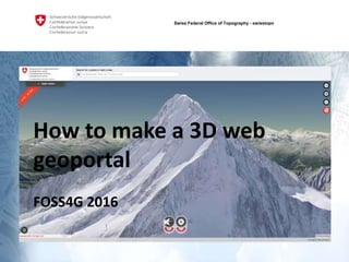
Foss4g 2016 How to make a 3D web geoportal
•Télécharger en tant que PPTX, PDF•
1 j'aime•990 vues

Did you ever fly around a country in 3D? In your standard web browser? Without plugins? 3D for the web is an emerging technology. WebGL enables web browsers to exploit the GPU of a computer to create beautiful and fast 3D worlds. It is time for web geoportals to go 3D. swisstopo was able to create a 3D viewer for the geoportal of the swiss confederation map.geo.admin.ch. We'll show you how it was done - and how Open Source enabled it. Links to project: https://github.com/geoadmin/mf-geoadmin3

Recommandé
Contenu connexe
Tendances
Tendances (19)
En vedette
En vedette (20)
Similaire à Foss4g 2016 How to make a 3D web geoportal
Similaire à Foss4g 2016 How to make a 3D web geoportal (20)
Plus de geoportal of the federal authorities of the Swiss Confederation
Plus de geoportal of the federal authorities of the Swiss Confederation (20)
Dernier
Dernier (20)
Foss4g 2016 How to make a 3D web geoportal
- 1. 3D bei swisstopo Darstellung «Standardsetting» Überlagern übriger 2D Daten GL-Sitzung 10. Februar 2015 A. Buogo, A. Streilein, D. Oesch, Swiss Federal Office of Topography - swisstopo How to make a 3D web geoportal FOSS4G 2016
- 2. FOSS4G 2016Swiss Federal Office of Topography - swisstopo Gilbert Jeiziner | @gilbertjeiziner | github.com/gjn Swiss Federal Office of Topography swisstopo geo.admin.ch | geoportal for all swiss federal offices 500+ datasets | 30k visits per day @swiss_geoportal 2
- 3. FOSS4G 2016Swiss Federal Office of Topography - swisstopo PL: David Oesch, Cédric Moullet Data/Terrain: Cédric Métraux, Loïc Gasser, Marcel Clausen Cloud: Marc Monnerat, Andrea Borghi Front-End: Eric Lemoine, Fréd Junod, Guillaume Beraudo, Olivier Terral Countless contributors to open source projects 3
- 4. FOSS4G 2016Swiss Federal Office of Topography - swisstopo 3D Data is available (DTM, TLM, etc) …not as a service …not directly usable for visualisation High precision DTM: up to ±0.25m Let’s put it on the web! 4
- 5. FOSS4G 2016Swiss Federal Office of Topography - swisstopo CesiumJS was only real 3D library WGS84 only Iván Sánchez: other WebGL libraries 5
- 6. FOSS4G 2016Swiss Federal Office of Topography - swisstopo Challenge 1: triangulation Original data is grid based Triangulate in X/Y/Z coordinate system Reproject to WGS84
- 7. FOSS4G 2016Swiss Federal Office of Topography - swisstopo Challenge 2: size ~ 1.5 TB Meshed triangles ?
- 8. FOSS4G 2016Swiss Federal Office of Topography - swisstopo CesiumJs uses ‘quantized mesh’ format for terrain https://cesiumjs.org/data-and-assets/terrain/formats/quantized-mesh-1.0.html Optimized for web and webGL 6 bytes per coordinate triple 8
- 9. FOSS4G 2016Swiss Federal Office of Topography - swisstopo No tools to write quantized mesh We wrote our own: 3d-forge https://github.com/geoadmin/3d-forge Consumes triangles – writes quantized mesh 9
- 10. FOSS4G 2016Swiss Federal Office of Topography - swisstopo ~ 1.5 TB ~ 15 GB Reduction 100X Raw Shapes Terrain format Good, but not good enough
- 11. FOSS4G 2016Swiss Federal Office of Topography - swisstopo «Eventually, everything gets tiled» Quadtree pyramid according to TMS 11 ~ 1.5 TB ~ 15 GB Reduction 100X ~ 1 - 5 MB For a single 3D view Reduction 3000X
- 12. FOSS4G 2016Swiss Federal Office of Topography - swisstopo The mesh [DEMO] 12
- 13. FOSS4G 2016Swiss Federal Office of Topography - swisstopo What to put on the mesh? Easy: just drape your 2D Maps over the terrain Reprojection again! (Hi Calvin Metcalf) 13
- 14. FOSS4G 2016Swiss Federal Office of Topography - swisstopo Challenge 3: reprojection 500+ 2D maps WMS/Mapserver -> too slow, doesn’t scale well We have 3.5 billion native WMTS tiles Pre-Generate all in WGS84 is costly (and insane)
- 15. FOSS4G 2016Swiss Federal Office of Topography - swisstopo Tiles CH03 Tiles WGS84 2D Map 3D World Reprojection using Mapproxy Terrain 3D
- 16. FOSS4G 2016Swiss Federal Office of Topography - swisstopo Created plugin for mapproxy (S3 caching) https://github.com/procrastinatio/mapproxy/tree/s3 16
- 17. FOSS4G 2016Swiss Federal Office of Topography - swisstopo Challenge 4: seamless integration Passing from 2D to 3D and back What you see in 2D, you will see in 3D ol3-cesium Library http://openlayers.org/ol3-cesium/ Visit Guillaume’s talk!
- 18. FOSS4G 2016Swiss Federal Office of Topography - swisstopo [DEMO] 18
- 19. FOSS4G 2016Swiss Federal Office of Topography - swisstopo That’s all? 19
- 20. FOSS4G 2016Swiss Federal Office of Topography - swisstopo It was slow (900+ requests, 20MB transferred) Many questions about operations (users, traffic, costs, etc.) 20
- 21. FOSS4G 2016Swiss Federal Office of Topography - swisstopo We let 10 people navigate Switzerland in 3D 21
- 22. FOSS4G 2016Swiss Federal Office of Topography - swisstopo 1 3D user created same traffic as 50 2D users Scare mail Impact on cost not tax payer friendly 22
- 23. FOSS4G 2016Swiss Federal Office of Topography - swisstopo Challenge 5: reduce operational costs and increase performance Skip LODs Add fog Reduce quality of draped layers
- 24. FOSS4G 2016Swiss Federal Office of Topography - swisstopo December 2015 - Alpha Release as 2.5D Usage is very low
- 25. FOSS4G 2016Swiss Federal Office of Topography - swisstopo From 2.5D to real 3D - Peak Preview [DEMO]
- 26. FOSS4G 2016Swiss Federal Office of Topography - swisstopo A couple of thougths about the future of 3D web mapping
- 27. FOSS4G 2016Swiss Federal Office of Topography - swisstopo Don’t throw away 2D We need real 3D data with real 3D models and symbology Find the right use cases VR/AR support for browsers very poor (webVR)
- 28. FOSS4G 2016Swiss Federal Office of Topography - swisstopo I think the most important aspect of 3D web mapping is usability/navigation Learn from games (DOOM VR) Is immersion better? [THE FINAL DEMO]