SNEAPA 2013 Thursday b3 10_30_visualizing_brt
•Télécharger en tant que PPTX, PDF•
1 j'aime•937 vues

Visualizing BRT-OD

Recommandé
Recommandé
Contenu connexe
Similaire à SNEAPA 2013 Thursday b3 10_30_visualizing_brt
Similaire à SNEAPA 2013 Thursday b3 10_30_visualizing_brt (20)
Plus de American Planning Association - Massachusetts Chapter
Plus de American Planning Association - Massachusetts Chapter (20)
Dernier
Dernier (20)
SNEAPA 2013 Thursday b3 10_30_visualizing_brt
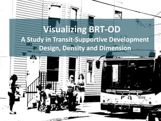
- 1. Visualizing BRT-OD A Study in Transit-Supportive Development Design, Density and Dimension
- 2. Agenda Project Overview MARTINA HAGGERTY, PRINCIPAL PLANNER, CITY OF PROVIDENCE Design & Dimension: Urban Design Principles & Best Practices DAVID GAMBLE, PRINCIPAL, GAMBLE ASSOCIATES 3D Modeling Methodology PAUL COTE, GIS SPECIALIST, HARVARD SCHOOL OF DESIGN Interactive 3D Modeling Demonstration PAUL COTE, GIS SPECIALIST, HARVARD SCHOOL OF DESIGN Take Home Points EMILY KISH, PRINCIPAL PLANNER, CITY OF PROVIDENCE Q+A
- 3. Project Overview MARTINA HAGGERTY, PRINCIPAL PLANNER, CITY OF PROVIDENCE
- 4. “the project” • Two phase project initiated by City of Providence in cooperation with RIPTA • Funded by OSHC Community Challenge Planning Grant • Phase I: TOD planning, creative placemaking strategies, transit improvements for five highest use transit corridors in Providence • Phase II: Complete rewrite of the Providence Zoning Ordinance
- 5. TransitOriented Development Encourage development that supports transit TOD: Mixed-use area designed to maximize access to, encourage use of public transit (~¼ mile radius around transit stop) DevelopmentOriented Transit Make transit attractive, convenient Make transit investments that encourage development Ensure that transit investments are made in right places
- 6. Downtown Pawtucket Improve transit Rapid Bus Route (R-Line) Downtown Providence • Frequent service • Fast service (spacing, TSP, jump lanes, curb extensions, TVMs) • Improved shelters & amenities Key Bus Routes (“rapid ready”) • Plans completed, budgeted • Encourage development to increase ridership • Awaiting implementation $$
- 7. Identify vacant and underutilized land Where is redevelopment potential? Look at land vacant by tax code In depth analysis of potentially “underutilized land” What is highest and best use? Does current development further or hinder community vision?
- 8. Identify “community hubs” • Redevelopment opportunities • Areas that can foster catalytic change for entire corridor, centers of activity • Previous plans - Where were community hubs and gateways previously identified? Are these still the best locations?
- 9. Develop short-term approach Credit: Wall Street Journal (Oakland Cemetery, Atlanta) Credit: Lisa Murch, Mural Arts Program (Philadellphia) Credit: Sean Capone Art + Video (Shoji Museum, Japan) • Creative development strategies • Identify temporary uses, other ways to activate, mitigate, create place (Public art, community gardens, pop up concerts)
- 10. Develop long-term approach • Where are “opportunity sites” within each hub? • Create long-term build out scenarios for potentially redevelopable land at each community hub location
- 11. Work with community to refine, affirm their vision Existing Conditions Analysis (in house) What is current housing density? Employment density? Is it transit-supportive? What is max. build out under current zoning regulations?
- 12. Design and Dimension: Urban Design Principles and Best Practices DAVID GAMBLE, PRINCIPAL, GAMBLE ASSOCIATES
- 13. 1. Connectivity Trinity Square Enhance connections to existing open spaces or parks that can link isolated places together.
- 14. Columbus Square 2. Blocks Aggregate adjoining parcels into larger development parcels and Subdivide exceptionally large parcels with new streets, public plazas
- 15. 3. Natural Systems Leverage existing rivers or waterways to reinforce sense of place Upper Manton
- 16. 4. Placemaking Chalkstone Avenue Foster a stronger a sense of place with open space, plazas, easements in relationship to existing assets.
- 17. 5. Placemaking Foster a stronger sense of place at the confluence of street grids Public Street
- 18. 6. Density Encourage greater density and height adjacent to landscape setbacks, open spaces Upper North Main
- 19. 7. Gateways Identify existing architectural and historical community assets Integrate assets into transit hubs Lower Manton
- 21. 8. Parking Chalkstone Avenue Reduce surface parking (limits dev. potential, thwarts ability to link places together) Use shared parking as tool to reduce parking on individual sites, promote active pedestrian environment Balance residential and commercial uses for efficient sharing between daytime, nighttime uses Buffer existing parking lots , break up with planting islands, bio-swales
- 22. 9. Streetscape Extend streetscape and public realm enhancements into the neighborhoods with street trees, improved sidewalks Lower North Main
- 23. 3D Modeling Methodology PAUL COTE, GIS SPECIALIST, HARVARD SCHOOL OF DESIGN
- 24. Connecting Planners and Designers Designers Planners 3D GIS
- 25. Existing Condition Model Tax Assessor data per parcel. Tabulated for opportunity Sites. Translated to 3D Sketchup Model.
- 27. Transit Oriented Build-Out Identify opportunity sites. Specify development targets. Design Numerical Summary / Comparison
- 28. Introducing the Buildout Calculator • 3D GIS Plugin for Sketchup • Allows Designer to experiment with schemes in 3D. • Calculates build consequences in terms of Gross Floor Area and Parking Capacity • Freely Downloadable from www.pbcgis.com/buildout_calculator
- 29. Model a Site Create Polygon for Site Apply Materials for Parking and Default Site Background Select All, Right-Click And choose “Create Site Group”
- 30. Model a Site Expose Dynamic Components toolbar. View>Toolbars… Build-Out Calculator Site Object
- 31. Model a Building Model building parts as simple extrusions. Apply materials to indicate use. Gridded materials Indicate stories. Select All, Right-Click And choose “Create Building Group”
- 32. Update Building Attributes Expose Dynamic Components toolbar. Expose attributes for building. Choose roof material. Gross Stories and GFA updated automatically. Fill in attributes for usage by stories.
- 33. Create Scheme Add more buildings. Select buildings and site Right-click and choose: Create Scheme Group.
- 34. Create Scheme Name Scheme and edit Default parking requirements if necessary.
- 35. Tabulate Schemes Create another scheme Use the sketchup Outliner window to Select and manage scheme groups Right-click and choose: “Tabulate Schemes” A table will appear.
- 36. Examine & Export Schemes Table Save report as an HTML file. Open table in excel.
- 37. Integration with Google Earth
- 38. Integration of Data from ArcGIS
- 39. Download the Build-Out Calculator Plugin! www.pbcgis.com/buildout_calculator
- 40. Take Home Points EMILY KISH, PRINCIPAL PLANNER, CITY OF PROVIDENCE
- 41. Begin with Placemaking • Understand existing character • Identify, uncover, connect to unique assets – – • Ex: Atlantic Mills dominates Lower Manton hub, rehabilitation should be priority Ex: Woonasquatucket River at Upper Manton provides potential for restoration and connection to industrial past Reveal intrinsic identity of each area, build cohesive urban design framework
- 42. Forge Public/Private Partnerships • Coordinate with anchor institutions that have longterm stake to align goals, get buy in • Provide grant opportunities to encourage involvement, help achieve goals
- 43. Implement the Vision • Phase II: New zoning ordinance will implement City’s goals for smart growth, sustainable, cultural, equitable, and transit‐oriented development • New TOD Districts for community hubs – Increased density, use mix, affordability mix – Eliminate parking minimum – Introduce design standards – Create parking maximums? – Introduce minimum density requirements?
- 44. Q+A