
Recommandé
Recommandé
Contenu connexe
Tendances
Tendances (20)
En vedette
En vedette (12)
Similaire à EIS_Presentation_new (3)
Similaire à EIS_Presentation_new (3) (20)
EIS_Presentation_new (3)
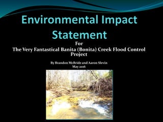
- 1. For The Very Fantastical Banita (Bonita) Creek Flood Control Project By Brandon McBride and Aaron Slevin May 2016
- 2. Outline Purpose and Need Laws and Regulations Public Involvement Project Description Alternatives Description Impact Analysis Mitigation and Monitoring Brandon McBride & Aaron Slevin Environmental Science Division of Stephen F. Austin State University Source: Google Images
- 3. What is an EIS? Environmental impact statement Comprehensive concise document for public review Complies with laws and regulations (state, local, federal) Examines current environmental, social, and economic parameters Analysis of impacts based on predetermined alternatives Provides plans for mitigation and monitoring Brandon McBride & Aaron Slevin Environmental Science Division of Stephen F. Austin State University
- 4. Purpose and Need Limit the intensity, frequency, and duration of flooding within the City of Nacogdoches, Texas. Demonstrate compliance with the National Environmental Policy Act (NEPA) Brandon McBride & Aaron Slevin Environmental Science Division of Stephen F. Austin State University Source: Google Images
- 5. Laws and Regulations National Environmental Policy Act Requires any federal action, project, or policy to be held accountable Public Involvement Sequencing Concise, Comprehensive, Complete Clean Air Act Clean Water Act Executive Order 11988 Endangered Species Act Noise Control Act National Historic Preservation Act Brandon McBride & Aaron Slevin Environmental Science Division of Stephen F. Austin State University
- 6. Public Involvement Public is informed through: Social media E-mail Television Newspaper Public hearings Brandon McBride & Aaron Slevin Environmental Science Division of Stephen F. Austin State University
- 7. Project Description Site consists of a 4,900 meter stretch of Banita Creek bounded to the north by West Austin Street and to the south by Martin Luther King Blvd. Further, the project area is constrained to the east and west by a 75 meter width. Brandon McBride & Aaron Slevin Environmental Science Division of Stephen F. Austin State University
- 8. Project Description Soils* Habitat* Water Quality* Vegetation* Historical* Cultural* Air Quality* Endangered Species Sensitive Areas Demographics Economics Reaches Topography Brandon McBride & Aaron Slevin Environmental Science Division of Stephen F. Austin State University
- 9. Alternatives Description No Action Alternative – Not Feasible Alternative 1 – 100-year flood; channelization, enlargement and levee installation Alternative 2 – 50-year flood; channelization and enlargement Alternative 3 – Clean out Alternative 4 – Clearing and snagging Brandon McBride & Aaron Slevin Environmental Science Division of Stephen F. Austin State University
- 10. Impact Analysis Focus areas were Environmental, Infrastructure, and Socioeconomics Each area of impact was examined for each alternative Brandon McBride & Aaron Slevin Environmental Science Division of Stephen F. Austin State University
- 11. Environmental Impacts Air and Climatology* Vegetation* Soil and Geology* Stream and Wildlife habitat* Wetlands* Solid and Hazardous waste Noise, light, and odor Endangered and Threatened species Brandon McBride & Aaron Slevin Environmental Science Division of Stephen F. Austin State University
- 12. Air and Climatology Diagnosis of emissions from PM10 From removal of soil, vegetation, and infrastructure Examination of effects on global warming Albedo effect Percent humidity Assumptions made to calculate final emission rates Vehicle miles traveled, number of vehicles, etc.… Brandon McBride & Aaron Slevin Environmental Science Division of Stephen F. Austin State University
- 13. Air and Climatology Alternative 1 Directly impacted from construction and operations Increase in temperature and humidity expected due largely to removal of vegetation (50%) Alternative 2 Impacts significantly less than alternative 1 Increase in temperature and humidity expected Alternative 3-4 Calculated emissions low; minimal construction/operation; inconsequential Brandon McBride & Aaron Slevin Environmental Science Division of Stephen F. Austin State University
- 14. Impact Summary for PM10 Emissions Alternative Total PM10 Emission, TPY Appendix Table 1 43.40 6.01-1 2 25.32 6.01-3 3 4.53 6.01-5 4 2.12 6.01-7 Factor Variable Assumption Wind Speed U 3.31 m/s Silt Content s 24.20% Soil Moisture Content M 26.30% Vegetation Moisture Content M 50.00% Concrete Moisture Content M 5.00% Soil Bulk Density - 1.46 g/cm3 Vegetation Density - 0.6 g/cm3 Concrete Density - 1640 kg/cm3 Mean Vehicle Speed S 10 mph Mean Vehicle Weight W 3 tons Total Emissions Assumptions for Calculations Brandon McBride & Aaron Slevin Environmental Science Division of Stephen F. Austin State University
- 15. Vegetation Alternative-1 Levee system has a large impact (82 meters) Large implications for communities that account for half of the project area Short and long term impact Alternative-2 No levee so less impact (14 meters) Short term and long term impacts much less Brandon McBride & Aaron Slevin Environmental Science Division of Stephen F. Austin State University
- 16. Vegetation Alternative-3 One top bank for operation – few impacts Debris removal from equipment – largest impact Alternative-4 Least impactful to communities Debris removal – largest impact Brandon McBride & Aaron Slevin Environmental Science Division of Stephen F. Austin State University
- 17. Soil and Geology Alternatives 1-2 Removal of approximately 28.89 Mg/yr of soil Exposes parent material and undisturbed soil matrices Inhibits natural soil properites Compaction from equipment limits root formation Alternatives 3-4 Impacts are minimal Large scale soil removal is not a factor Machinery may promote soil compaction Brandon McBride & Aaron Slevin Environmental Science Division of Stephen F. Austin State University
- 18. Stream Habitat Alternatives 1-2 Loss of stream variability and dynamics Loss of shade and cover (pH) Higher turbidity profile from increased erosion Water quality characteristics necessary for aquatic life may sustain impacts (DO) Alternatives 3-4 Snagging and clearing may impact water quality parameters (DO) Brandon McBride & Aaron Slevin Environmental Science Division of Stephen F. Austin State University
- 19. Wildlife Habitat Alternative-1 Loss of vegetation = loss of wildlife habitat is high Habitat removed will never return (forested areas) Alternative-2 Short term – net loss of habitat function Long term – normal capacity Alternatives 3-4 Minimal disturbance Increased flood risk may still have long term effects Brandon McBride & Aaron Slevin Environmental Science Division of Stephen F. Austin State University
- 20. Infrastructure Predictions Roads* Buildings* Utilities* Railroads Trails Brandon McBride & Aaron Slevin Environmental Science Division of Stephen F. Austin State University
- 21. Linear Features Impact Summary Feature Alternative1 Alternative2 Alternative3 Alternative4 Streets(meters) 1001 366 - - Railroads(meters) 521 20 - - Trails(meters) 1495 72 - - WaterMains(meters) 3278 3278 - - SewerMains(meters) 7277 7277 - - Buildings(sq.ft.) 76989 473 - - LinearFeaturesImpactSummary Brandon McBride & Aaron Slevin Environmental Science Division of Stephen F. Austin State University
- 22. Infrastructure Impacts Brandon McBride & Aaron Slevin Environmental Science Division of Stephen F. Austin State University Alternative 1 • Roads: 1001 meters • Buildings: 76,989 sq. ft. Alternative 2 • Roads: 366 meters • Buildings: 473 sq. ft.
- 23. Utilities Brandon McBride & Aaron Slevin Environmental Science Division of Stephen F. Austin State University Alternatives 1 – 2 • Water Mains: 3278 meters • Sewer Mains: 7277 meters Feature Total Length (Meters) Water Mains 3278 Sewer Mains 7277 Utilities Located Within the Project Site Boundary
- 24. Socioeconomic Impacts Archeological* Recreation* Economics Brandon McBride & Aaron Slevin Environmental Science Division of Stephen F. Austin State University
- 25. Archeological Alternatives 1 – 2 May impact historical areas Project area is typically categorized with a low historical significance Banita Creek Nature Preserve Banita Creek Hall Brandon McBride & Aaron Slevin Environmental Science Division of Stephen F. Austin State University
- 26. Recreation Alternatives 1 – 2 Banita Creek Park Banita Creek Nature Preserve Banita Creek Hall Coy Simms Softball Complex Brandon McBride & Aaron Slevin Environmental Science Division of Stephen F. Austin State University
- 27. Flood Control Alternative-1 Greatest success, most impact, most expensive Alternative-2 Successful, high impact, best cost Alternative-3 Marginal success, minimal impact, low cost Alternative-4 Least successful, lowest impact, lowest cost
- 28. Mitigation and Monitoring Vegetation Air Quality Stream and Wildlife Habitat Recreation Archeology Roads and Buildings Brandon McBride & Aaron Slevin Environmental Science Division of Stephen F. Austin State University
- 29. Air Quality Control Measures New machinery = lower emission rates Regular maintenance and check-ups Maximum cap on vehicle miles traveled per day Storage of equipment close to the project site Use of a water truck to stabilize soil Wind fence to limit fugitive dust emissions Brandon McBride & Aaron Slevin Environmental Science Division of Stephen F. Austin State University
- 30. Habitat Control Measures: Limit operations away from undisturbed areas Limit the number of entry points on to the site Re-establishment (where applicable) of communities on site Enhance downstream habitat concurrent with project implementation Brandon McBride & Aaron Slevin Environmental Science Division of Stephen F. Austin State University
- 31. Archeology Control Measures: Conduct an archeological survey before operations Significant items will be removed, indexed, and stored for protection Avoidance of areas such as Banita Creek Hall and Nature Preserve Brandon McBride & Aaron Slevin Environmental Science Division of Stephen F. Austin State University
- 32. Roads and Buildings Only one bridge/road will be demolished at a time Reconstruction of roads will be established before moving to another section Detour routes will be established for commuters Brandon McBride & Aaron Slevin Environmental Science Division of Stephen F. Austin State University
- 33. Wetlands No direct impacts Indirect impacts – alter hydrologic parameters Will be monitored annually for a period of ten years to re-evaluate conditions Brandon McBride & Aaron Slevin Environmental Science Division of Stephen F. Austin State University
- 34. Conclusion Compliance with NEPA Determined baseline environmental conditions Diagnosed impacts from introduced alternatives Determined mitigation strategies from alternatives analysis Introduced plans for monitoring and maintenance Brandon McBride & Aaron Slevin Environmental Science Division of Stephen F. Austin State University
- 35. Literature Cited Banita Creek Preserve, Nacogdoches County, Open to the Public. (n.d.). Retrieved March 09, 2016, from http://www.texaslandconservancy.org/lands/properties- list/east-texas/87-banita-creek-preserve-nacogdoches-county-open-to-the-public Barbour, M.T., J. Gerritsen, B.D. S:nyder, and J.B. Stribling. (1999). Rapid Bioassessment Protocols for Use in Streams and Wadeable Rivers: Periphyton, Benthic Macroinvertebrates and Fish, Second Edition. EPA 841-B-99-002. U.S. Environmental Protection Agency; Office of Water; Washington, D.C. City of Nacogdoches Emergency Management Staff, Nacogdoches Hazard Mitigation Planning Committee (2004). City of Nacogdoches Hazard Mitigation Action Plan. Ordinance No. 1338-10-03. Retrieved from http://www.ci.nacogdoches.tx.us/documentcenter/view/145 City of Nacogdoches. (n.d.). History of Nacogdoches. Retrieved January 31, 2016, from http://www.ci.nacogdoches.tx.us/index.aspx?NID=601 EPA (2015). Summary of the Clean Air Act. Retrieved April 15, 2016, from https://www.epa.gov/laws-regulations/summary-clean-air-act EPA (2015). Summary of the Clean Water Act. Retrieved April 15, 2016, from https://www.epa.gov/laws-regulations/summary-clean-water-act EPA (2015). Summary of the Endangered Species Act. Retrieved April 15, 2016, from https://www.epa.gov/laws-regulations/summary-endangered-species-act EPA (2015). Summary of the Noise Control Act. Retrieved April 15, 2016, from https://www.epa.gov/laws-regulations/summary-noise-control-act EPA, (2015). What is the National Environmental Policy Act?. Retrieved April 15, 2016, from https://www.epa.gov/nepa/what-national-environmental-policy-act EPA. (1992). NIBCO, INC., NACOGDOCHES DIV.: Environmental Protection Agency ORDER GRANTING IN PART MOTION FOR PARTIAL ACCELERATED DECISION AND MOTION TO STRIKE AFFIRMATIVE DEFENSES. Retrieved March 31, 2016, from https://books.google.com/books?id=quz-xe7X1psC EPA. (1996). Memorandum of Agreement Between the Texas Natural Resource Conservation Commission and the United States Environmental Protection Agency, Region 6. Retrieved March 31, 2016, from https://www.epa.gov/sites/production/files/2015-09/documents/tx_moa1.pdf EPA. (2015). The 2011 National Emissions Inventory. Retrieved March 16, 2016, from https://www3.epa.gov/ttn/chief/net/2011inventory.html FEMA (2015). Executive Order 11988: Floodplain Management. Retrieved April 15, 2016, from https://www.fema.gov/executive-order-11988-floodplain-management FEMA (2015). National Historic Preservation Act. Retrieved April 15, 2016, from https://www.fema.gov/national-historic-preservation-act-1966-amended-2000 Gallant, Brian, J. (2008). The Facility Manager’s Guide to Environmental Health and Safety. Lanham, Maryland: The Scarecrow Press, Inc.
- 36. Kägi, W. (2000). Economics of climate change: The contribution of forestry projects. Dordrecht: Kluwer Academic Publishers. Nacogdoches Economic Development Corporation. (n.d.). Labor Force. Retrieved March 06, 2016, from http://www.nedco.org/community-profile/labor-force National Oceanic and Atmospheric Administration (NOAA). (2010). Climate Data Online: Normals Hourly Location Details. Retrieved from http://www.ncdc.noaa.gov/cdo-web/datatools/findstation National Ready Mixed Concrete Association (NRMCA). (2003). Concrete in Practice: What, Why & How?. Retrieved from http://www.nrmca.org/aboutconcrete/cips/36p.pdf Natural Resources Conservation Service. (n. d.). Web Soil Survey. Retrieved from http://websoilsurvey.nrcs.usda.gov/ SFA/NWS Weather Station. (n.d.). Retrieved March 28, 2016, from http://forestry.sfasu.edu/weather/ Southern Regional Climate Center. (2010). Retrieved March 28, 2016, from http://www.srcc.lsu.edu/station_search.html?sid=168440 TCEQ. (2013). Three-year ambient air quality summary. Retrieved from http://www.tceq.state.tx.us/cgi-bin/compliance/monops/yearly_summary.pl Texas Commission on Environmental Quality. (2010). Chapter 307 - Texas Surface Water Quality Standards. Retrieved from https://d2l.sfasu.edu/d2l/le/content/113851/viewContent/1435529/View Texas Commission on Environmental Quality. (2015). Surface Water Quality Data: Forms for Collecting and Managing Surface Water Quality Data Discharge. Retrieved from https://www.tceq.texas.gov/waterquality/monitoring/swqm_forms-n-quality.html/#field Texas Natural Resources Information System. (n.d.). Retrieved March 08, 2016, from https://tnris.org/ Texas Parks & Wildlife. (1995). Wildlife Habitat Appraisal Procedure (WHAP).PWD RP-W7000-0145. Retrieved from https://tpwd.texas.gov/publications/pwdpubs/media/pwd_rp_w7000_0145.pdf Texas Parks & Wildlife. (2016). Annotated County List of Rare Species: Nacogdoches County. Retrieved from http://tpwd.texas.gov/gis/rtest/ United States Census Bureau. (2014). Population Estimates, July 1, 2014, (V2014). Retrieved from http://quickfacts.census.gov/qfd/states/48/48347.html United States Fish & Wildlife Service: National Wetlands Inventory. Wetlands Mapper. (2016). Retrieved March 08, 2016, from http://www.fws.gov/wetlands/Data/Mapper.html Williams, H. M., Miller, A. J., McNamee, R.S., and Klimas, C.V. (2010). A Regional Guidebook for Applying the Hydrogeomorphic Approach to the Functional Assessment of Forested Wetlands in Alluvial Valleys of East Texas. ERDC/EL TR-10-17, U.S. Army Engineer Research and Development Center, Vicksburg, MS.
- 37. Questions? Brandon McBride & Aaron Slevin Environmental Science Division of Stephen F. Austin State University