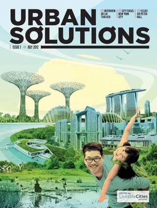
1. ESSAY:INTERVIEW:
DR LIU
THAI KER
NEWYORK
CITY
SIR PETER
HALL
CITYFOCUS:
JULY 2012ISSUE 1
A vision today can build a city of tomorrow.
Sino-Singapore Guangzhou Knowledge City (GKC Project) is the model and catalyst for the economic
transformation and environmental enhancement of Guangdong and the rest of China. Leveraging on a
knowledge-based economy, it will be the leader in creating innovations, new ventures and high value-added
products and services; all within an eco-friendly, cosmopolitan city.
Four elements of Smart, Eco, Learning and Design permeate every aspect of the GKC Project, making it
a unique, vibrant and sustainable city for all.
To discover what opportunities Sino-Singapore Guangzhou Knowledge City holds for the world,
visit www.ssgkc.com today.
A magnet
for talent,
enterprise
and industry.
SSGKC BrandAd_200x265.indd 1 12-6-12 ��6:38
Issue1/July2012
Cover+Spine.indd 1 20/6/12 4:01 PM
2. siemens.com/answers
Our commuter trains are getting people home faster in
cities like San Diego. Our water treatment technologies
are making safe water more plentiful in Singapore. In
Berlin, our building solutions are lowering energy costs.
And in Durban, our medical equipment is helping
citizens lead longer, healthier lives. All around the globe,
Siemens is helping cities become the kinds of places
where people, businesses and the environment can
thrive. Every day we’re working with the world to create
answers that will last for years to come.
Siemens answers help create sustainable cities – places that are more lasting,
livable and prosperous.
Building cities worth
building a future in.
P01 Contents_Final.indd 1 20/6/12 4:09 PM
3. 08 Integrating Emergency Response Management for
a Resilient Rio
By Eduardo Paes
Revitalising Singapore’s Urban Waterscapes: Active,
Beautiful, Clean Waters Programme
By Tan Nguan Sen
Stepping Stones to Better Cities: Urban Governance
Reform and Capacity Building in Ethiopia
By Abebaw Alemayehu and Wendy S. Ayres
Tianjin Eco-city: Setting New Benchmarks
By Ong Beng Lee
12
16
20
features
02
04
From the Editor
Interview: Dr Liu Thai Ker
24 New York City
CITY FOCUS
32 New Perspectives on Transportation and Urban Density
By Sir Peter Hall
Singapore: Housing a Nation
By Dr Cheong-Chua Koon Hean
Intelligent Cities in the European Diagonal
By Dr Alfonso Vegara and Mark Dwyer
Planning Strategies for Liveable High-Density Cities
By Yang Baojun
38
44
50
ESSAYS
Contents
58 The CLC Framework for Liveable and Sustainable Cities
By Khoo Teng Chye
Future Cities in a Resource Constrained World
By Jeremy B. Bentham
Sustainia: the Sustainable Society of Tomorrow
By Flemming Borreskov
64
70
RESEARCH & REPORTS
76 高密度的宜居城市规划探讨
杨保军
ESSAY (ORIGINAL LANGUAGE)
A translated extract of this essay is on pg 50–55.
24
12
Issue 1 / July 2012
58
32
P01 Contents_Final.indd 2 20/6/12 4:17 PM
6. Issue 1 / July 201204
Dr Liu Thai Ker has been the Director
of RSP Architects Planners & Engineers
since 1992. He is also the Chairman
of the Advisory Board of the Centre
for Liveable Cities in Singapore since
2008. As an architect-planner and later
CEO of the Housing and Development
Board (1969–1989) and Chief Planner-
cum-CEO of the Urban Redevelopment
Authority (1989–1992), Dr Liu was
instrumental in the successful
implementation of public housing and
the formulation of a vision for urban
development in Singapore. Dr Liu
obtained his Bachelor of Architecture
from the University of New South
Wales in 1962, and a Master in City
Planning from Yale University in 1965.
In 1995, he was conferred Doctor of
Science honoris cause by the University
of New South Wales. His personal
interests are in painting and calligraphy.
He is married to Gretchen Gustafson,
a writer, and has five children.
Through your remarkable career in Singapore’s public
housing and planning agencies, you have shaped this city’s
landscapes and lifestyles. In your current role as a consultant,
you design cities and advise mayors from around the world.
What are other cities most keen to learn from you, and why?
Dr Liu: Visitors to Singapore never fail to notice that our city
is green, clean, pollution-free and visually neat. They soon enjoy
the fact that our traffic flows and infrastructure works well.
Our prosperous economy and the very good public housing
developments further win them over. In our HDB estates,
amenities for daily needs of the residents are well provided at
convenient locations. This helps reduce the need for residents to
travel outside their new town and save a great deal of time on the
road. Indeed we have managed to create a quality environment,
in the last five decades, despite the high density and fast pace
of development. This is particularly meaningful to our visitors
because most Asian cities experience very high density as well as
immense pressure to develop quickly. Given more time, they also
like the fact that our citizens are generally civilised and respect
traffic rules. And there appear to be no policemen in the streets.
I explain to them that we do indeed have policemen but their
presence is very low key and quite friendly.
In terms of liveability and sustainability, the first few favourable
impressions that our visitors gather, as mentioned earlier, are key
contributors to the making of a quality urban environment. To
achieve this, there are many other considerations that operate
below the surface, unseen and often unknown to most people. For
example, comprehensive infrastructure planning, protection of
nature and ecologically sensitive areas, and energy conservation
strategies and policies. Beyond meeting basic requirements,
Singapore has given close attention to biodiversity. In the
process of trying to be self-sufficient in drinking water supply, the
Active, Beautiful and Clean Waters (ABC Waters) Programme was
introduced, to combine function with liveability. Furthermore,
our legal system has been highly rated. Our cultural programs
are credible. In fact, the city is home to many creative designers,
performers and writers.
The lesson, and therefore the message, which I often share is
that the liveability, sustainable and unique beauty of a city do
not depend on architecture alone. There are many other qualities
that can powerfully shape the quality of a city.
Like all cities, Singapore is a work in progress, and it
constantly seeks to renew and improve itself. What are the
areas where Singapore can learn most from other cities? Can
you give some examples that you would like Singapore to
learn from?
Dr Liu Thai Ker
INTERVIEW:
P4-7 Dr Liu.indd 4 21/6/12 3:13 PM
7. INTERVIEW 05
1
Dr Liu: I believe we have done very well in laying a
solid foundation to create an urban system and provide
the fundamental needs of the society. But, for further
refinement in the areas of regional character, elegance,
dignity and subtlety, there is room for improvement.
What can Singapore learn from other cities? This issue
may be dealt with in two parts: the hardware and the
software aspects.
On the hardware side, we may learn from other cities on
how they make better use of the local vegetation, trees,
shrubs, and so on in their landscape. In the urban milieu,
we can also learn from some of the cities on how to take
advantage of the special climatic conditions to create
urban spaces and architecture. For example, being in
the sub-tropical climate zone, designers in Brisbane
have developed an architecture typology that is uniquely
Brisbane. In Singapore we would do well to continue our
quest for the kind of architecture that is more tropical
and Asian, while at the same time durable and classical
in its aesthetic appeal. The quality will elevate our city
to stand more firmly among the great cities of the world.
While we have done an excellent job in preserving and
conserving the historical buildings and historical districts,
I still hope that our government will conserve the last
remaining Malay and Chinese kampong (village) in Pulau
Ubin for the sake of posterity.
On the software side, we need to improve our spoken
languages. We have a journey ahead to nurture artists,
performers and writers telling our Singapore stories
but with universal appeal. We need to help more
Singaporeans, especially the next generation citizens,
to look at problems and issues with greater intellectual
depth and curiosity. A city is not made of bricks and mortar
alone. The quality of its people and their achievements
are just as important.
You’ve recently spoken about how you see Value,
Science and Art as being at the heart of sustainable
urbanisation. Can you explain this to us?
Dr Liu: The 21st century is the century of urbanisation
in Asia. If Asian countries are to become urbanised like
America, with a similar quality of urban environment,
China will have to build the equivalent of three Americas,
India five Americas, and Indonesia two Americas. That
is assuming that they do their jobs well. If they don’t,
they may have to build and demolish and therefore
build even more than 10 Americas. That will be a serious
drain on world resources and may even cause further
environmental deterioration of planet earth. For these
reasons, I ask myself what are the few most critical
factors, which might help Asian countries plan and
develop their cities well, with minimum waste and little
averse effect on our globe. I can think of three main
starting points, i.e. Value, Science and Art.
If good, sound values of urban development can be
embraced by top political leaders that will make a great
start for urban planning and development. This is easier
said than done. The political leaders in Asian cities tend
to have a very strong say about how they want the city
to be developed. Therefore, it is very important for these
leaders to have a good understanding of what is good
quality living in cities. In the old days, before the mid-
20th century, when cities grew slowly and population
sizes were generally quite small, the city elders tended
to be people who had lived in cities for decades and even
generations. Without being trained as city planners, they
instinctively understood the culture of good urban life and
therefore were generally able to make sound decisions
for the growth of their cities. But in today’s Asian cities,
becauseofrapidandmassiverural-urbanmigration,many
urban dwellers are first generation rural people. Some
of them only live in cities for only a few years, including
some political leaders. With the best intentions in the
world, they might not be able to grasp in such a short
time what makes a good city and therefore may often
make unfortunate choices. For example, many of them
In fact, I like to think that a city is
the largest man-made industrial
design, like a giant car, a huge
washing machine or a mammoth
refrigerator. This urban machine
must first function extremely
effectively and efficiently. It must
also be user-friendly, like all
industrial design products.
P4-7 Dr Liu.indd 5 21/6/12 3:13 PM
8. Issue 1 / July 2012
tend to believe that sensational
architecture is progress. But we
know that a mere collection of
sensational architecture does not
make a good city, especially if
the buildings are more grotesque
than beautiful. To make a good
city, we need to protect as well as
develop. We need to build urban
systems for infrastructure, roads,
parks, commercial centres, etc.
We need to consider functionality,
liveability, and sustainability as
well as beauty.
Butourattentionshouldalsoturnto
urban planners themselves. Many
experts believe that urban planning
is mostly about urban culture. This
is only partially true. There is a very
serious and challenging aspect of
urban planning, which requires
a city to function perfectly like a
Giant Urban Machine for Living.
In fact, I like to think that a city is
the largest man-made industrial
design, like a giant car, a huge
washing machine or a mammoth
refrigerator. This urban machine
must first function extremely
effectively and efficiently. It
must also be user-friendly, like all
industrial design products. It must
be easy for residents to use and
06
1 pg 4: Dr Liu Thai Ker.
Photo courtesy of the National
University of Singapore (NUS).
2 pg 5: Dr Liu in a project
meeting in Kazan, Russia
in April 2012.
Photo courtesy of Dr Liu.
3 pg 6: Dr Liu in a project
discussion with his staff
at RSP and the traffic
consultants.
Photo courtesy of Dr Liu.
4 pg 7 above: Presentation of a
project in Ningbo to the then
Prime Minister of Singapore
Lee Kuan Yew.
Photo courtesy of Dr Liu.
5 pg 7 below: Dr Liu and
Michael Fam, then Chairman
of HDB, welcoming the late
Deng Xiaoping at HDB’s
headquarters in 1978. Mr
Deng, who was then the
Chinese Senior Vice-Premier,
was a on a three-day visit to
Singapore.
Photo from MINISTRY
OF INFORMATIONS,
COMMUNICATIONS AND THE
ARTS. Courtesy of National
Archives of Singapore.
Acc/Neg/PCD No.
19980002489/7
enjoy the facilities. But it is not a
simple task to assemble this giant
urban machine. To begin with, a
planner must know what parts
are required for the machine to
function perfectly. How big is each
of the parts? How many of each
type? How should the parts be
fitted in relation to one another?
To answer these questions, and
assemble the parts, requires a great
deal of research and experience, as
well as a tremendous amount of
stamina. No matter how arduous,
as planners, we cannot afford to
ignore any of these issues if we
are committed to producing good
master plans that work.
However a city is not just a
functional machine or a heap
of individual parts. There are
aesthetic and cultural components
as well. Many city leaders want
their city to be unique and
impressive. They wrongly believe
that these can be achieved
through sensational architecture
design. I would like to suggest
that rather than architecture, the
two most powerful ingredients for
uniqueness of a city are its:
• Natural environment (such as
rivers, hills and wetlands)
• Historical buildings and historical
districts
These two ingredients, if well
protected, set one city apart from
another. With regards to nature,
no two rivers, lakes or hills look
alike. In the old days, before the
onset of globalisation, architecture
design depended heavily on
using local materials, assembled
by local craftsmen to meet the
challenges of the local climatic
conditions (without access to
modern technology) and dictation
of local customs. The result – these
buildings were very different from
one village to another. In short,
a city plan should first consider
what to conserve in the natural
environment and the historical
districts. To do so, a city planner
needs to have a good aesthetic
sense and feeling for the land. In
P4-7 Dr Liu.indd 6 21/6/12 3:13 PM
9. high-density cities liveable. In the case of Singapore, if our population needs to
continue to grow, albeit at a slow pace, we have to face the reality and deal with it
skilfully and confidently.
is aimed at mayors from around the world, as well as
other urban experts and practitioners. If there is one message you can
give to the leaders of the world’s cities, what would it be?
Dr Liu: One message is that no matter how backward a city is, as long as
its top leaders are committed to improving the city to world standards and
learning the sound values of urban development, it is a good start. This needs
to be complemented by an enlightened administrative system in which the
leaders will focus mainly on important policy decisions, and the planners –
assuming they are competent – must be given ample freedom and creative
space to carry out their work.
Considering that the amount of urbanisation in the next few decades is going to
be immense, it is the sacred duty of these leaders and their planners to plan the
city properly, for the sake of collectively building a better world instead of a more
urban world that brings diseases and problems to our planet.
07
the process of creating the plan,
he/she also needs to have high
respect for the terrain of the
city. In assembling the different
components of the plans, he/she is
expected to make every effort to fit
them seamlessly into one another. I
often urge that a city planner must
learn to romance with the land.
Value, Science, Art – these are
the three starting points which
a planner will need to ponder
seriously and work diligently in
order to create a good city plan.
There seems an expert
consensus that high-density
cities are more sustainable
than urban sprawl. Yet, many
citizens around the world equate
high-density living with a lower
quality of life. You’ve stated
your belief that high-density
cities can be highly liveable.
Why do you think this, and what
do you think are some of the
best examples of highly liveable,
high-density environments in
the world?
Dr Liu: Although not among
the densest cities in the world,
Singapore’s density is clearly
high. Despite that, in terms of the
liveability quality, Singapore is
ranked among the highest in the
world. We have thus demonstrated
that a city can have both high
density and high liveability. New
York City, being the second
recipient of the Lee Kuan Yew
World City Prize, is another good
example. Careful planning coupled
with provision of public places
and amenities are some of the key
considerations for high liveability.
There are also techniques required
to help a city achieve high
liveability. Cities like New York,
Chicago and Singapore, whilst
having very tall buildings they are
moderated by parks and plazas,
as well as an interspersal of low or
mid-rise buildings. Among them are
historical buildings for conservation.
I am personally hopeful that given
proper skills, we can still make
INTERVIEW
P4-7 Dr Liu.indd 7 21/6/12 3:13 PM
10. 08 Issue 1 / July 2012
Integrating
Emergency
Response
Management
for a Resilient Rio
By Eduardo Paes
The Challenge
In 2010, an overnight flash flood
hit Rio de Janeiro, resulting in 28
centimetres of rain and 68 deaths.
Approximately 15,000 people lost
their homes to landslides, and a
further 10,000 people were at risk
of losing their homes, as the rain
continued long after the initial
flash flood.
The city’s transport system was
paralysed, with highways and
bridges forced to close and, in
certain areas, residents urgently
needed to be evacuated. In other
cases, people were asked to stay
indoors until the storm passed.
It was one of the worst natural
disasters to hit Rio in recent
history.
In part, the catastrophe was
unavoidable, but the consequences
of the storm might have been less
severe had various city agencies
had the necessary communication
systems in place, in order to
respond to the crisis faster and
more effectively. At the time,
Rio’s emergency preparation was
lacking. It was a painful lesson but,
as a result, the city is now prepared
for almost any eventuality —
planned or unplanned.
The Solution
Following the floods, the city’s
immediate concern was emergency
response management. As mayor,
I vowed that Rio would never
suffer such a tragic disaster again.
With less than a year before the
next rainy season, the city had
to act quickly. Six weeks after
the April 2010 storms, the city’s
planners had the technological
and physical blueprint for the Rio
Operations Center – an emergency
management operations centre
that was created in collaboration
with IBM.
This was not simply a call centre and
dispatchsystem.Thegroundbreaking
proposal broke down traditional
communication barriers between
city agencies and built an operations
centre where information could be
centrally sourced, shared, stored
and analysed.
The Rio Operations Center was
integrated with IBM’s weather
modelling and forecasting tool
(called Deep Thunder) that
employs fine-grain calculations to
predict floods and landslides – and
their precise locations – up to 48
hours in advance. These models,
integrated with data streams and
communications systems from
multiple municipal agencies, would
allow authorities to prepare a
response before a disaster strikes,
and emergency teams could be
positioned ahead of time in optimal
locations.
Before the centre was built,
each department operated
independently and was hindered by
the quantity, quality and relevance
of its data. Under the new system,
we slashed emergency response
times by 30%, which is no small
feat in a city as large as Rio.
It took six months to install the
core system and, once completed,
it proved so effective that the city
decided to take it a step further.
There was no reason the Rio
OperationsCentershouldbelimited
to emergency management. Using
innovative technologies, such as
P08-10 Rio_Final_.indd 8 20/6/12 4:45 PM
12. 10 Issue 1 / July 2012
IBM’s analytics software, the city’s
various authorities realised that
they could monitor city systems
and predict potential issues before
they occurred.
For example, a report of a fire
on a major freeway is relevant to
firefighters as well as transport
departments. While firefighters
travel to the scene, transportation
authorities can redirect traffic to
help minimise congestion. With
the operations centre, the city
was able to integrate data from all
of its departments under a single
system. Some people labelled the
initiative as being “experimental”
due to radical information
sharing and the breaking down
of departmental boundaries,
something that traditional
government organisations were –
at that time – not used to.
Physically, the Rio Operations
Center resembles a “nerve centre”
– a giant screen shows maps with
weather patterns and specific spots
that are vulnerable to floods or
landslides. A second section streams
video feeds from 850 video cameras
that are mostly positioned along
major transportation routes around
the city. Finally, the most important
data available at any given time – the
city’s ‘vital signs’ – are highlighted in
a third sector, which looks similar to
a dashboard.
In order to get all agencies on board,
the city’s planners asked all 31
municipal departments to appoint
one leader and staff members
to work on location. They also
appointed a Chief Operations Officer
to oversee the entire facility.
The Outcome
An interesting thing happened
when employees from every
municipal department were forced
to work together under one roof.
Those who might have otherwise
been reluctant to cooperate with
people outside of their organisation
began collaborating with others
naturally.
While the system does indeed
work, the city has not become
complacent. In fact, the city is
constantly working to improve it.
Recently, various algorithms were
tested on historical storms and
flooding to see whether the new
software accurately predicted
problematic areas. In cases
where the algorithms were off,
adjustments and modifications
were made to improve their
accuracy.
In November 2011, the city
also conducted simulations of
landslides and flood emergencies,
which involved more than 100 city
managers, to test technologies and
coordination procedures that the
city had put in place for emergency
response.
In the event that the same flash
flood that occurred two years
ago were to hit Rio today, the
city could not guarantee it would
avoid damage. It could, however,
guarantee its response to be
quicker, more effective and more
efficient than it ever was before.
1 pg 9: Inside the Rio
Operations Center, the
incident commander and
responders have a unified
view of all the information
to help them predict
and prepare emergency
response plans.
Photo courtesy of IBM.
2 pg 10: Close up of the
giant screen. It provides
a summary of everything
happening around the city
– surveillance cameras,
maps, simulations, news
updates, resources
and information about
incidents.
Photo courtesy of IBM.
Eduardo Paes started his political
career as the head of the Barra da
Tijuca and Jacarepagua districts in
Rio de Janeiro. He then became a
city councilman, President of the
City Council, a congressman, the
MunicipalSecretaryforEnvironment
and the State Government’s
Secretary for Sports and Tourism in
2007. In 2008, Eduardo Paes was
elected Mayor of Rio de Janeiro.
He has since created numerous
urban initiatives that include Porto
Maravilha (revitalisation of the port
area), Morar Carioca (urbanisation
of all the favelas), UPP Social
(development of social programmes
in pacified favelas), and the
Rio Operations Center (a nerve
centre that monitors all municipal
logistics).
P08-10 Rio_Final_.indd 10 20/6/12 4:46 PM
14. Issue 1 / July 201212
Revitalising
Singapore
,
s Urban
Waterscapes:
Active, Beautiful, Clean
Waters Programme
By Tan Nguan Sen
P12-14 ABC Water.indd 12 20/6/12 3:00 PM
15. FEATURES 13
The Challenge
Singapore is a densely populated,
island city-state with over five
million people living in an area
of only 710 square kilometres.
Although it receives ample rain,
its small catchment area means
there is insufficient ground space
to collect and store enough water
for its needs. In addition, the island
does not have extensive aquifers
or groundwater. Ensuring water
sustainability is, hence, a strategic
national challenge.
During the 1960s and 1970s,
Singapore faced multiple problems
associated with rapid urbanisation.
These included polluted rivers,
water shortages and widespread
flooding. Yet today, it is capable of
producing enough water to satisfy
the requirements of its population
and industries. In just four decades,
Singapore has overcome its
water challenges and turned its
vulnerability into a strategic asset.
Singapore has 32 major rivers, 17
reservoirs, and more than 7,000
kilometres of drains and canals.
The Blue Map of Singapore on page
15 shows this pervasive network
of waterways and water bodies.
Moving beyond a source of water
supply, the PUB, Singapore’s
national water agency – saw the
potential of using these ‘blue
spaces’ to encourage people to
create more interaction between
people and water.
The Solution
In 2006, PUB launched the Active,
Beautiful, Clean Waters (ABC
Waters) Programme with the
aim of transforming Singapore’s
network of functional but utilitarian
drains, canals and reservoirs into
vibrant and aesthetically pleasing
streams, lakes and rivers with
lush landscaped banks. They are
also integrated into surrounding
residential developments, where
residents can enjoy activities close
to the water.
The ABC Waters Programme is
not only an asset in improving
water quality, but also an urban
revitalisation tool that improves
accessibility, aesthetics and
recreational potential. It has
created new community spaces
and opportunities for people to
enjoy and appreciate water bodies
and, in so doing, bond with water.
The integration of the ABC Waters
sites with park connectors also
P12-14 ABC Water.indd 13 20/6/12 3:00 PM
16. Issue 1 / July 201214
PUB also carried out extensive
briefings, consultations and
road shows involving grassroots
leaders, educational institutions,
and non-governmental
organisations. Such sessions
helped refine the projects based
on users’ feedback. Site visits held
during the project’s construction
stage kept the stakeholders
regularly updated and helped get
their buy-in.
Through PUB’s Our Waters
Programme, members from
the public, people and private
sectors can ‘adopt’ waterways
or reservoirs and organise
community events or develop
sustainable projects at these
sites. As of March 2012, there are
158 corporations, schools and
organisations that have adopted
various waterways and reservoirs.
Strategy Three: Encouraging
Adoption Of ABC Waters
Concept by the Public And
Private Sectors
The public and private sectors
are encouraged to embrace
the ABC Waters concept and
incorporate its design features
– such as bioretention swales,
rain gardens and wetlands –
in their developments. Such
environmentally sustainable
features minimise the hydrological
and pollution impact of urbanised
catchments and safeguard
water quality. PUB has compiled
information on these features into
the ABC Waters Design Guidelines
handbook (launched in 2009) as
reference material for industry
professionals to incorporate into
their development projects.
The ABC Waters Certification
scheme, launched in 2010,
recognises organisations that
embrace the ABC Waters concept
and holistically incorporate
its design features in their
developments. Additionally, the
BCA (Singapore’s Building and
Construction Authority) Green
Mark Scheme – a benchmarking
scheme that incorporates
helps create a sustainable urban
environment.
PUB adopted a three-pronged
approach for the project’s
implementation. This entailed
the development of a master
plan, sustained engagement
of the community, and efforts
in encouraging the public and
private sector to adopt the
ABC Waters concept.
Strategy One: Developing the
ABC Waters Master Plan
PUB initiated three demonstration
projects at Bedok Reservoir,
MacRitchie Reservoir and a stretch
of the Kallang River at Kolam
Ayer. With the experience gained,
a master plan was developed
to identify over 100 potential
projects across the island to be
implemented over the next 10 to
15 years.
The map of Singapore was divided
into three watersheds – Central,
Eastern, and Western – each with
its own themes and projects.
A team of multi-disciplinary
consultants was then engaged
for each watershed, working
together with other government
agencies, including the Urban
Redevelopment Authority (URA),
the Housing and Development
Board (HDB), JTC Corporation and
the National Parks Board (NParks).
With this integrated approach,
ideas and resources could be
pooled in order to synergise the
infrastructure planning.
Strategy Two: Engaging
the Community
From the outset, PUB recognised
the importance of actively
engaging the community. Thus, a
publicitycampaignwaslaunchedin
2007. It started with an exhibition
officiated by Singapore’s Prime
Minister, where the public were
invited to learn more about
the programme and what it set
out to achieve. The campaign
got residents excited about the
projects near their homes and was
well received.
1 pg 12-13: People
enjoying activities by
the rejuvenated river
at the Bishan-Ang Mo
Kio Park.
Photo courtesy of Atelier
Dreiseitl.
2 pg 14, top: Kallang
River at the Bishan-
Ang Mo Kio Park before
its transformation
under the ABC Waters
Programme.
Photo courtesy of Atelier
Dreiseitl.
3 pg 14, middle: The
river after the
transformation.
Photo courtesy of Atelier
Dreiseitl.
4 pg 14, bottom: Canoeing
activities along the
revitalised Kolam Ayer
waterfront.
Photo courtesy of PUB.
5 pg 15: The Blue Map
of Singapore shows
Singapore’s network of
waterways and water
bodies.
Image courtesy of PUB.
P12-14 ABC Water.indd 14 20/6/12 3:00 PM
17. FEATURES
Tan Nguan Sen is the Director
of Catchment and Waterways
Department at PUB, Singapore’s
national water agency. He has
extensive experience in planning
and designing drainage and used
water infrastructure, as well as in
the construction, operation and
management of drainage and water
reclamation facilities. Prior to
his current appointment, he was
involved in formulating key policies
and charting the master plans for
used water and NEWater in the
Planning and Policy Department.
Mr Tan graduated with an
engineering degree from Munich
Fachhochschule, Germany. He
went on to pursue a post-graduate
diploma in Hydrological Engineering
from the International Institute
for Hydraulic and Environmental
Engineering in Delft, the
Netherlands. Subsequently, he
obtained a Master of Science in
Management of Technology from the
National University of Singapore.
internationally recognised best
practices in environmental design
and performance – acknowledges
the inclusion of such design
features.
PUB also taps into the experience
of top local architects, engineers
and developers, which comprise
the ABC Waters Review Panel.
They review the master plan, and
the design of strategic projects.
The Outcome
The ABC Waters programme has
provided a framework for an
integrated planning process, where
multi-disciplinary teams from
various government agencies and
stakeholder groups collaborate
creatively. The results are seen in
key projects such as the Sengkang
Floating Wetland and the Kallang
River at Bishan-Ang Mo Kio Park.
The latter is a flagship ABC Waters
project, and a collaboration with
NParks. Designed based on a
flood plain concept, it entailed the
transformation of a 2.7 kilometre
stretch of Kallang River that ran
in a canal along the edge of the
park into a lush river meandering
through the park. Bishan-Ang Mo
Kio Park was initially identified as
a ‘people’s park’, and the design
facilitates that. When the water
level in the river is low, users can
15
get closer to the water and enjoy
recreational activities along the
banks. Yet, upon heavy rain,
the parkland next to the river
doubles-up as a conveyance
channel, carrying excess water
downstream. The concrete canal
walls were naturalised using bio-
engineering techniques. Plants
and bedding materials were also
used to stabilise the banks, and to
create a natural habitat for native
plants and animals.
Opened in March 2012, this project
has demonstrated that careful
planning and innovative design can
transform concrete waterways
into socially rejuvenating urban
waterscapes, characterised by
a thriving ecosystem that is
enriched with biodiversity.
The success of the first phase of
the ABC Waters Programme was
made possible with strong support
from PUB’s 3P (People, Public,
Private) partners. Since its launch
in 2006, 18 projects have been
completed by PUB with four more
currently being implemented; 14
projects have been completed
by other public agencies and
private developers with another
17 are in the pipeline. For two
consecutive years, World Water
Day celebrations have been held
concurrently across the island,
with more than 25,000 people
gathering at 15 ABC Waters sites.
Realising the programme’s full
potential may take decades, but
the success thus far has allowed
PUB to embark on a second phase.
This will see the creation of yet
more recreational hotspots in
order to educate people on the
importance of keeping Singapore’s
waters clean; the notion behind
which stems from the belief that
long-term sustainability can only
be achieved when people become
stewards of the environment.
P12-14 ABC Water.indd 15 20/6/12 3:00 PM
18. Issue 1 / July 2012
Stepping Stones
to Better Cities :
Urban Governance Reform and
Capacity Building in Ethiopia
By Abebaw Alemayehu and Wendy S. Ayres
16
The Challenge
Ethiopia’s urban areas are among
the fastest growing in Africa, with
populations rising at about 4% each
year. By 2020, cities are projected
to be home to 20% of Ethiopia’s
population. Moreover, the urban
economy is a major driver of growth,
with urban areas now accounting for
over 55% of Gross Domestic Product
(GDP). Approximately 60% of this
growth has been linked in recent
years to the urban economy, and
urban areas will continue to drive
Ethiopia’s economic prosperity for the
foreseeable future.
However, urban areas in Ethiopia have
only had functioning governments
since the year 2000, when
proclamations to establish urban
local governments were first issued.
Combined with a commitment to fiscal
decentralisation, the proclamations
were intended to give the authorities
more direct and transparent control
over public spending. The objective
wastocreateurbanlocalgovernments
that ensure public participation in
making choices, and enhance urban
service delivery.
The principal challenge associated
with this was how best to help urban
local governments develop the skills
and financial resources they need to
deliver infrastructure and services to
residents, effectively and efficiently.
An additional challenge was how
to create jobs for the significant
proportion of urban residents who
were unemployed.
The Solution
The solution involved a sequence
of initiatives. The first step in the
strategy was to build capacity as
part of the Ethiopian government’s
comprehensive National Capacity
Building Program, which was
launched in 2001. This led to the
Capacity Building for Decentralized
Service Delivery Project, which
became effective in 2003, and then
to the Public Sector Capacity Building
Program that started in 2004.
Both of these programmes were
supported by the World Bank, and
they provided conditional grants
to finance capacity building and
systematic reforms. Among other
things, these projects supported
the establishment of an accredited
master’s degree program in urban
management at the Ethiopian Civil
Service College.
By the end of 2011, more than
1,700 students had been awarded
degrees. Upon graduation, students
are required to serve for a minimum
of five years in a local government
administration. Even after this
probationary period, the majority
of graduates still serve as planning
specialists in a city, regional or
federal government department.
The second step was to provide grants
to selected urban local governments.
The size of these grants varied. They
were subject to the administration’s
performance in the areas of
financial management, participatory
planning, investment, maintenance
of infrastructure, and transparency
and accountability of operations.
The grants provided urban local
governments with resources to enable
them to apply their learning, and
provided access to other resources,
subject to the achievement of key
performance indicators.
For approximately five years, city
governments also have access
to capacity building support and
expertise on a grant basis, which was
designed to help them strengthen
their skills. Following this, each local
administration is expected to have
sufficient capacity to manage their
finances and operations.
Currently,theWorldBankisfinancing
this Urban Local Government
Development Program (ULGDP) with
a US$300 million credit facility.
The Outcome
The results of this project are
impressive. Each performance-
basedgranthashadatransformative
effect on the 19 Ethiopian cities
participating in the programme.
All the cities involved, have made
significant improvements in their
planning, revenue mobilisation, asset
management, budgeting, financial
management, investment planning,
procurement, and project execution,
as shown in the results of their
annual performance assessments.
Public participation in all cities has
grown considerably, starting with
P16-18 Ethiopia.indd 16 20/6/12 3:04 PM
19. 17FEATURES
1 top: Cobblestone streets in the city of
Adama, Ethiopia.
Photo courtesy of Yohannes Fisseha,
Infrastructure Engineer, World Bank, Ethiopia
Country Office.
2 middle left: Skilled women pavers
constructing cobblestone streets in
the city of Hawassa, Ethiopia.
Photo courtesy of Wendy S. Ayres.
3 middle right: Local residents employed
in the construction of cobblestone
streets under the ULGDP.
Photo courtesy of GIZ Urban Governance and
Decentralization program, Ethiopia.
4 bottom: Cobblestone streets in the
city of Adama, Ethiopia.
Photo courtesy of Yohannes Fisseha,
Infrastructure Engineer, World Bank, Ethiopia
Country Office.
P16-18 Ethiopia.indd 17 20/6/12 3:08 PM
20. Issue 1 / July 2012
Abebaw Alemayehu has more than
12 years of World Bank operational
experience, including task management in
urban and local government, and human
development sectors within Africa.
Currently, he is task managing the flagship
urban programme of the region: Ethiopia’s
Urban Local Government Development
Project. Recently, he prepared additional
financing for the programme, doubling
its size from US$208 million to US$416
million, in record time and within budget.
The lessons of the Ethiopia Local
Government Development Project have
informed the design of the urban projects
in Kenya and in Ghana. He is an economist
by training with a postgraduate degree
from the UK with further training in the
United States and Poland.
Wendy S. Ayres is an economist and has
been with the World Bank since 1990.
She has been based in Nairobi since
2003. Wendy has worked on a wide range
of projects for the World Bank around
the world, including Eastern and Central
Europe, Asia, South America, and Africa.
She is a member of the World Bank’s
urban team. In addition to the Ethiopia
Local Government Development Project,
Wendy is currently working on the Nairobi
Metropolitan Services Improvement
Project, the Kenya Informal Settlements
Improvement Program, and the Kenya
Municipal Program. She holds graduate
degrees in economics and anthropology
from Columbia University, New York.
18
Notably, the funding has been
used for cobblestone streets
and drainage systems, which are
becoming a ULGDP trademark.
As a result of the cobblestone
works, mobility for residents has
increased, flooding has diminished,
property values are rising, small
The ULGDP has helped 19 cities
across Ethiopia provide better
urban governance, infrastructure
and public services to over 2.8
million people. With over 42% of
the nation’s urban population now
enjoying the many benefits brought
about by the programme, this
success has prompted the World
Bank to award additional ULGDP
grants to a further 18 Ethiopian
cities by 2013. Given the economic,
social and environmental
successes of this programme,
it may be an interesting model
to other developing nations, in
order to boost urban and national
3
planning. In nearly all cities, the
number of citizens participating
in planning forums has more than
doubled since the start of the
project. Previously, cities did not
systematically consult citizens to
determine planning priorities.
Financial management and
mobilisation have improved, due to
the introduction of computerised
systems that generate financial
reports and examine the use of
government funds. Cities have
significantly increased their
revenues by delegating the task
of revenue collection to sub-cities.
Informal businesses have also been
brought on to the nation’s tax rolls.
In addition, each city has increased
tariffs and fees for city services,
and raised resident awareness of
the importance of paying taxes.
All the cities involved in this project
are steadily enhancing their
dissemination of key information
regarding city functioning to
the public. All of them are using
multiple channels, including notice
boards, newspapers, radio, public
events, and – in some cities– the
Internet. Many cities now provide
comprehensive data on approved
capital investment plans, budgets,
budget execution, project physical
progress, bid evaluations, and
contract awards. Councils are also
discussing internal and external
audit reports and the ULGDP
quarterly progress reports.
Arguably of most significance,
cities are effectively implementing
capital-investment plans,
enhancing infrastructure and
creating much-needed jobs.
They are effectively utilising
their budgets for infrastructure
investments.
enterprises are opening, and
investment in private homes
is rising. These changes are
transforming city centres into
lively and welcoming places to live
and work in.
The construction of cobblestone
streets has had several other
benefits. It has created many
new jobs for city residents, with
a substantial proportion of these
having been undertaken by women,
young people, disabled individuals
and the previously unemployed.
The results have greatly improved
their lives.
Many cobblestone workers have
now formed micro and small
enterprises (MSEs). This enables
them to bid for and win contracts
for other infrastructure projects,
which are essential for these MSEs
to become sustainable enterprises.
Cobblestone construction also
utilises local materials, further
contributing to the local economy
and reducing costs.
By the end of June 2011,
approximately 95,000 people
were employed in cobblestone and
other infrastructure work that is
financed by the ULGDP. Of these
workers, 65% are male and 35%
female. In fact, citizens appreciate
the cobblestone roads, bridges,
and drainage systems so much,
that they are now contributing
their own funds to construct more.
development. This programme
has been an effective platform
upon which Ethiopia’s cities can
be transformed from third world
urban settlements to vibrant cities
of the future.
P16-18 Ethiopia.indd 18 20/6/12 4:47 PM
22. Issue 1 / July 2012
The Challenge
Rapid urbanisation has placed
immense pressure on the
environment, amenities, and
resources of cities around the
world. It also generates pollution,
including greenhouse gas emissions
that contribute to climate change.
The United Nations Framework
Convention for Climate Change
(UNFCCC) has declared the
collective global effort to keep
greenhouse gases at a safe level
“grossly insufficient” so far.
China, the world’s most populated
country, second largest economy,
and largest carbon emitter, is at
the forefront of rapid urbanisation.
Fortunately, the Chinese government
understands that, if not properly
managed, the rapid expansion of
China’s megacities will strain its
energy, water and land resources and
pollute its air, soil and water. It will
also increase competition for housing
and jobs and lower the quality of life
of the people.
China is seeking to develop its
urban space sustainably. However,
there is no international standard
The Solution
The idea for the Sino-Singapore
Tianjin Eco-city was conceived by
the leaders of China and Singapore
in 2007. Tianjin Eco-city aims to
provide a model for sustainable
development for other cities in
China and elsewhere, amidst global
concerns about the effects of
urbanisation on climate change.
It is the second joint project between
the Chinese and Singaporean
governments. The first was the
acclaimed Suzhou Industrial Park.
Built in 1992, it is characterised by
state-of-the-art business facilities,
modern housing, new universities,
schools, and other public amenities.
20
TIANJIN ECo-city
SETTING NEW BENCHMARKS
By Ong Beng Lee
or industry benchmark for
sustainable development that China
should rely on. To demonstrate
their commitment to do their
part to strengthen environmental
protectionandenergyconservation,
the governments of Singapore and
China decided to jointly embark
on a project to create a model for
sustainable development.
In Tianjin Eco-city, the two
governments have moved beyond
industrial park planning to develop
30 square kilometres of wasteland
into an economically and socially
vibrant, environmentally friendly,
and resource-efficient city.
Through the project, the Singapore
government undertakes to share
with the Chinese government its
expertise and experience in areas
like urban planning, environmental
protection, resource conservation,
water and waste management and
sustainable development, as well
as policies and programmes that
engender social harmony. Through
these engagements with the
Chinese government, the Singapore
government hopes to learn from
them in areas where China is
more advanced than Singapore as
well. Construction of the Eco-city
commenced in September 2008
and, when finished in 2020, it
will house an estimated 350,000
residents.
In choosing the city’s location,
the Chinese government set two
criteria. Firstly, the Eco-city should
P20-23 Tianjin Eco-City.indd 20 20/6/12 3:10 PM
24. Issue 1 / July 201222
be developed on non-arable land.
Secondly, it should be located in
an area with limited water supply.
The site was selected after a
thorough study by both Chinese and
Singaporean experts, and is located
40 kilometres from the Tianjin city
centre.
Water has been the Achilles’ heel
of Chinese urban development as,
without adequate water supply,
land becomes unliveable and
unworkable. Of note, North China
is particularly vulnerable to water
resource constraints. This prompted
the several decade-long South-
North Water Transfer Project,
which transfers excess water from
China’s southern heartlands to
the urbanised Northeast, including
Tianjin. However, even supplies from
this source will be put under intense
strain if urbanisation in Northeast China
continues unabated.
Tianjin Eco-city sits on non-arable, salt-
alkaline land in an area characterised
by heavily polluted water bodies. This
was due to surrounding factories
discharging wastewater and other
toxins into the water table. Following
an extensive cleaning operation, a
pond that was once heavily polluted will
soon become suitable for recreation.
The Eco-city is also using water more
efficiently by means of novel initiatives,
which include rainwater harvesting,
wastewater recycling and, when
residents have moved in, encouraging
water conservation.
The Eco-city is transforming the area
from wasteland into a thriving and
片区 District
- Integrated Site Planning
细胞 Cell
-Basic Community
阾邻里 Neighbourhood
- Residential Community
liveable city, where ecological
rehabilitation will be delicately
balanced with urban development.
The project pays close attention to
social and economic development,
and environmental protection. Once
complete, one-fifth of the city’s
housing units will be in the form of
subsidised public housing, in order
to meet the needs of lower income
households. Public green spaces, as
well as free recreational and sports
facilities, will be within 500 metres
of all public housing. This will help to
forge a more inclusive community.
Buildings will be built high-rise and
of high density to optimise land
use. The city’s plans have a unique
cellular layout, where several cells
constitute a neighbourhood, and a
few neighbourhoods constitute a
district. Amenities are planned at
the cell and neighbourhood levels
so that residents’ needs can be
met, while minimising the need to
commute. Furthermore, jobs in
business parks will be within easy
reach of residential areas. A light rail
transit system, complemented by a
modern tram system, will be built
in order to meet the transportation
needs of residents.
Thecity’seconomichubwillgenerate
jobsforitsresidents,drawtalent,and
inject vibrancy into the city. To date,
it has attracted over RMB50 billion
(US$8 billion) in investment. Despite
the city enjoying the full support
of the Chinese and Singaporean
governments, it is intended to be
a replicable, scalable and practical
model for other cities to emulate,
characterised by financial self-
sufficiency and commercial viability
from the standpoint of investors.
As such, the technologies used in
the development and operations of
the city will be both affordable and
suitable for replication elsewhere.
The Outcome
The Eco-city has made progress
since construction began four years
ago. The project is being tackled in
stages, with the first of these near
completion. Social amenities, such
as schools, healthcare facilities
Huifeng Brook Park National Animation Centre Park
Yongdingzhou ParkWetlands Park at Huifeng Brook
P20-23 Tianjin Eco-City.indd 22 20/6/12 3:10 PM
25. 1 pg 21: Master plan of Tianjin Eco-city.
Image courtesy of URA, Singapore.
2 pg 22, above: Tianjin Eco-city has a
cellular layout, where several cells
constitute a neighbourhood, and a few
neighbourhoods constitute a district.
Image courtesy of URA, Singapore.
3 pg 22, below: Completion of the first
parks in the Eco-city.
Photo courtesy of the Eco-city Project Office/
MND, Singapore.
4 pg 23, above: The recently completed
National Animation Centre in the
Eco-city.
Photo courtesy of the Eco-city Project Office/
MND, Singapore.
5 pg 23, below: The Tianjin Eco-city
utilises renewable energy through solar
photovoltaics, solar water heating,
ground source heat pumps and wind
turbines, thus allowing the city to
reduce reliance on fossil fuels. The
target is to achieve 20% renewable
energy utilisation in the
Eco-city by 2020.
Photos courtesy of SSTEC.
23
and neighbourhood centres will
commence operations soon. Several
companies located in the Eco-city
have already begun operations, and
residents have started moving into
their homes.
Ong Beng Lee is the Senior Director of
the Eco-city Project Office (ECPO) in
the Ministry of National Development,
which is the lead agency for the Tianjin
Eco-city project on the Singapore side.
ECPO works closely with the Chinese
authorities, other Singapore agencies
involved in the project and the joint
venture company to conceptualise
strategies and plans for the Eco-city
and to oversee its implementation.
Mr Ong has been with ECPO since
September 2007. A member of the
Singapore Administrative Service,
he has previously served in other
ministries such as the Ministries of
Trade & Industry, Home Affairs and
Defence.
However,itistheproject’sambitious
environmental, social and economic
goals that really set this city apart.
The city’s urban planners have
introduced a set of 22 quantitative
key performance indicators (KPIs).
These include developing 100%
green buildings that will better
conserve energy; 20% renewable
energy utilisation to reduce reliance
on fossil fuels and tap clean energy
like solar, wind and geothermal
energy; 90% of all internal travel
to be via public transport or non-
motorised transport; and at least
50% of employable residents are to
be employed within the Eco-city to
minimise the need to commute.
Other KPIs include maintaining low
carbon emissions per capita GDP,
ensuring high recycling rates, and
potable water from the tap – a rarity
in China.
TheTianjinEco-cityisapproximately
eight years from completion yet
people have started citing it as a role
model for sustainable development
that other cities in China – and the
rest of the world – could emulate.
The Eco-city was not planned as an
experimental showpiece. Instead,
it is a carefully planned and well-
executed project, which hopes to
change the way urban planners,
from around the globe, design and
realise the cities of tomorrow.
FEATURES
P20-23 Tianjin Eco-City.indd 23 20/6/12 3:11 PM
26. Issue 1 / July 201224
NEW
YORK
CITY
P24-28 NYC.indd 24 20/6/12 3:12 PM
28. Issue 1 / July 201226
3
Long-term planning is vital in
New York City, and in other cities,
too. Because with more than half
the world’s people now living in
cities and with three-fourths of
the people on Earth expected to
be city dwellers by mid-century,
cities around the globe, including
New York, must confront all the
effects of this urban growth: in
transportation, housing, public
health, public safety, education,
and in so many other areas.
We also must work to enhance what
gives city life its zest. Attractive
public parks. Innovative public
plazas. Exciting public art. By doing
so, we can, as we’ve demonstrated
in New York, reclaim outdated and
derelict infrastructure elements
for recreational use. Such projects
can also be catalysts for private
sector investment, creating jobs
and producing greater prosperity
for all our people.
So let me turn briefly to each of
the three ‘demonstration projects’
that I think very rightly caught
the attention of the judges in this
year’s Lee Kuan Yew World City
Prize competition because of the
way that they are accomplishing
these goals.
Brooklyn Bridge Park
The first is Brooklyn Bridge Park.
New York, as you may know, is a
city of five major sub-districts,
or boroughs – and with some
2.5 million people, Brooklyn is
the most heavily populated of
our boroughs. In fact, if it were a
separate city – which it was until
1898 – it would be the fourth-
biggest city in the United States.
Brooklyn Bridge Park, the first
portions of which opened two
years ago, is one of the most
significant new parks to be
developed in Brooklyn in some
140 years. Just as importantly,
it’s one of the most innovative
parks created in any city in
recent years. Here’s what I mean
by saying that: traditionally,
city parks have attempted to
remove park-goers from the
hustle and bustle of urban life.
Brooklyn Bridge Park does
something radically different.
It brings park users right to the
edge of one of the greatest,
busiest harbours in the world
– framed by Manhattan’s
dramatic skyline and by the
classic elegance of the world-
famous Brooklyn Bridge itself. It
The Lee Kuan Yew World City
Prize 2012 was awarded to
the Mayor of the City of New
York, Michael R. Bloomberg,
and the Departments of
Transportation, City Planning,
and Parks and Recreation, for
New York City’s remarkable
transformation over the
last decade. Co-organised
by Singapore’s Urban
Redevelopment Authority and
the Centre for Liveable Cities,
the biennial award honours
outstanding contributions
towards the creation
of vibrant, liveable and
sustainable urban communities
around the world.
On 21 March 2012, Mayor
Bloomberg delivered the
Lee Kuan Yew World City
Prize 2012 Laureate Lecture
at Singapore’s historic
Raffles Hotel. In his opening
comments, he noted the
similarities between New York
and Singapore as “crossroads
of commerce and homes to
many cultures.” He added that
both cities were “energetic,
restless, and forward-
looking, constantly in motion,
and constantly rebuilding
themselves.” Mayor Bloomberg
commended Singapore’s strong
commitment to sustainability,
which he credited to the
leadership of former Prime
Minister Lee Kuan Yew, after
whom the Prize is named. The
following is extracted from a
transcript of his lecture.
P24-28 NYC.indd 26 20/6/12 3:12 PM
29. CITY FOCUS
gives them a front row seat to take
it all in – as well as a wide variety
of ways to enjoy themselves at
the harbour’s edge. And it’s doing
that by creatively reusing what
had become relics of Brooklyn’s
maritime past: Six abandoned piers
along nearly a mile and a half of
the borough’s East River shore.
Once they were part of a thriving
working waterfront. But a cargo
ship hasn’t docked at them in more
than a quarter-century.
I could easily spend the rest of
my time today describing all the
striking and subtle ways that the
design of the park accentuates this
theme of adaptive reuse: The way
it captures storm water to irrigate
its landscape, for example, or the
way materials found on-site were
recycled for use in the park. Let
me just summarise by saying that
Brooklyn Bridge Park – the rest of
which will be built out over the next
few years – succeeds spectacularly
in realising a new vision of what a
park in an intensely urban setting
can be.
The High Line
The same can be said,
enthusiastically, about the second
project for which we have been
awarded the Lee Kuan Yew World
City Prize: The High Line. It was an
elevated railway running for about
a mile and a half along Manhattan’s
West Side. Once, it served
warehouses and industries in this
area, which is still referred to as
the ‘meatpacking district’ – even
though today, far more painters
and software engineers work there
than butchers do. Like the piers
we just described on the Brooklyn
waterfront, however, the High Line
hasn’t been a working rail line since
1980.
After decades of disuse, the opinion
of many was that the High Line was
an eyesore that was impeding the
area’s redevelopment, and had to
27
be torn down – the sooner the better.
Incredibly, when our Administration
took office in 2002, it was just a
single court decision away from
demolition.
Thankfully, a different vision for the
future of the High Line prevailed:
And through a combination of
private activism and funding, and
public investment and zoning action,
the High Line has now been re-born
as New York’s first aerial park.
To quote the architecture critic Paul
Goldberger: ”Walking on the High
Line is unlike any other experience
in New York. You float about 25
feet above the ground, at once
connected to street life and far away
from it.” Like the Brooklyn Bridge
Park, the High Line plunges visitors
into the very heart of a dense urban
environment. Like Brooklyn Bridge
Park, it also reclaims an artefact of
the city’s recent industrial past, and
reinvents it for the 21st century.
None of this would have been
possible without the ingenuity of a
rezoning that gave property owners
under the High Line value for their
land. It convinced them that, far from
being a blight, a re-designed High
Line could become the organizing
principle of a new neighbourhood.
And that has, in turn catalysed,
some US$2 billion in private sector
investment, transforming this
neighbourhood into one of the
hottest stretches of real estate in
the entire city.
Re-purposing the
Public Right of Way
The third of the three projects that
has earned New York the World City
Prize involves ‘re-purposing the
public right of way’: In other words,
our new approach to using much
of our 10,000 kilometres of streets
and roadways. It’s based on our
Administration’sstrongcommitment
to dramatically shrinking the city’s
carbon footprint, to clearing our
air of the harmful pollutants
produced by auto exhaust and also
to encouraging a safer and more
vibrant street life.
For those reasons, we’ve begun
re-designing roadways to provide
greater space and safety to
travellers who aren’t in cars:
specifically, to cyclists and to
pedestrians. Bicycling has become
increasingly popular in New York.
In fact, the number of New Yorkers
who bicycle to work and school
has doubled since 2007, and
quadrupled in the past 10 years.
We expect the number of cyclists
on our streets to continue growing
– in part because later this year,
we’ll inaugurate the largest ‘bike-
sharing’ program in the Americas.
To increase safety for cyclists,
since 2007 we’ve installed more
than 430 kilometres of bike lanes
in our city. We have, for example,
established the first “protected”
bikelanesintheUnitedStates.They
move cyclists out of harm’s way,
putting them between street curbs
and a new parking lane for cars.
And because some auto lanes were
narrowed in the process, drivers
are more cautious, increasing
traffic safety for everyone.
We’re also reclaiming more public
right of way for pedestrians. The
most celebrated example is our
famous Times Square, which,
on average, more than 365,000
people use every day. Traditionally,
pedestrians only had about 11% of
the available public space even
though they comprised 86% of the
traffic. This created an unbearable
crush on the sidewalks – and also
a big spill-over of pedestrians into
some of the city’s busiest streets.
And that contributed to a level of
traffic injuries and fatalities more
than 50% greater than on nearby
streets and avenues.
So three years ago, we took the
somewhat controversial step of
P24-28 NYC.indd 27 20/6/12 3:12 PM
30. to live in the cities that not only
give them the greatest opportunity,
but that also offer the best quality
of life.
Earlier this month, the Economist
Intelligence Unit published an
exhaustive study on ‘global city
competitiveness.’ It named New
York City Number One in the
world – just narrowly ahead of
London and then Singapore, let
me add. The talent of our people,
the study said, is what gives us our
competitive edge. The projects like
the ones you’ve honoured us for
today as well as the ones like it that
I’ve given you a brief glimpse of just
now bring talented people to New
York, and convince them to stay.
closing the major roadway through
Times Square – our Broadway – to
auto traffic. The results: traffic in
the entire area now moves more
smoothly. Pedestrians, who now
have more than 41% of available
public space in Times Square, are
far safer. And there’s also now an
exciting new public space where
only congestion and chaos existed
before – a big plus for everyone.
That includes economic benefits
– because the new Times Square
plaza, like the High Line, has greatly
increased property values. In fact,
since 2009, rents for street-level
stores along the plaza have actually
doubled – despite the effects of the
national recession — and Times
Square was recently named one of
the top ten retail locations in the
world. And Times Square is only
the tip of the iceberg. We have
50 new neighbourhood plazas
in development throughout the
five boroughs that will transform
underused local streets into vibrant
public spaces.
PlaNYC
All three of these projects
are elements in our far–
reaching PlaNYC agenda for
a greener, greater New York
City. Implementing that agenda
also includes everything from
developing thousands of new
apartments, as well as new parks,
on formerly industrial sites on the
city’s 520 miles of waterfront,
some of it complete and some of it
still to come.
It includes continuing to improve
the quality of our waterways –
already cleaner than they’ve been
in a century so that they become
a more inviting resource for
recreation, and also a home for
the wildlife that reminds us that as
humans, we share this environment
with other living things.
We’re making New York an even
more public transit-oriented city
than we already are, by making
our city bus system faster and
more efficient and along several
corridors, showing how streets
can safely and harmoniously
accommodate buses, bikes, cars,
and pedestrians.
We’ve also funded from the City’s
own treasury the first major
extension in decades to New York’s
famous subway system: a project
that will transform the last major
undeveloped stretch of Manhattan
into the largest new transit-
oriented business and residential
development in the United States.
It will accomplish for this district
what the extension of London’s
underground did for the now
bustling Canary Wharf area.
We’ve also initiated more new
public spaces like those I’ve
described today, projects that not
only create a more environmentally
sustainable New York, but that also
make our city more liveable, more
attractive, more exciting, and more
economically competitive.
All these cutting-edge projects
add to New York City’s reputation
for creativity and innovation. They
make us a place where people
want to come; especially people
who are creative and innovative
themselves. Talented people want
1 pg 24-25: People enjoying the
vibrant public plaza space at
Times Square.
Photo courtesy of the Department of
Transportation, the City of New York.
2 pg 26: Located at the harbour’s
edge, Brooklyn Bridge Park
overlooks the Manhattan
skyline and the famous
Brooklyn Bridge itself.
Photo courtesy of URA, Singapore.
3 pg 28: Originally a disused
railway, the High Line has been
transformed into an aerial park
that runs through the heart of
a dense urban environment in
Manhattan’s West Side.
Photo by Centre for Liveable Cities.
28 Issue 1 / July 2012
P24-28 NYC.indd 28 20/6/12 3:12 PM
31. 29
Until the 1930s, Saudi Arabia was best known for two things
– its desert landscape and housing two of Islam’s holiest sites –
Makkah and Medinah.
Fast-forward to today and the transformation has been
spectacular. In 1938 oil was discovered and, as the industry
matured, state revenues quickly began to rise. The economy
modernised and the country grew into what we see today – the
world’s leading producer of oil with a GDP of $24,000 per capita
and a burgeoning population.
However, rapid population growth, depletion of water
resources, and an economy dependent on petroleum are all
ongoing governmental concerns, which have been the catalyst for
mass urban development programmes.
Around 86 per cent of today’s estimated 26 million population
reside in Saudi Arabia’s cities. Therefore, sustainability, creating
jobs, housing and improved infrastructure are all high on the
agenda for the future of Saudi Arabia.
The Crown Prince’s Commitment To
Urban Development
The work of HRH Prince Mansour Bin Mitib
Bin Abdulaziz, Minister of Municipal &
Rural Affairs (MOMRA), has been key to
driving successful infrastructure development
to aid the Kingdom on its path of expansion.
Development plans in each of Saudi Arabia’s
13 administrative regions fall under his
guidance and he has been instrumental in
URBAN
DEVELOPMENT
IN SAUDI ARABIAN
CITIES
implementing the ninth Saudi development plan, which has
allocated US$385 billion to develop the infrastructure in major
cities between the year 2010 and 2014.
Plans at city level also adhere to King Abdullah’s overall
strategy of economic diversification. This involves, creating
more jobs for Saudi’s ever-growing young workforce (the
average age is 26), encouraging growth in the private sector and
attracting foreign investment.
New Economic Cities
One of the leading examples of the Saudi Arabian government’s
determination to revitalising the economy and developing the
country is the construction of six new economic cities.
King Abdullah and the Saudi Arabian General Investment
Authority (SAIGA) announced the project in 2005. Four of the
six developments are now fully planned and under construction.
More than $60 billion is being ploughed into four of the cities,
which seek to propel Saudi Arabia’s economy to a new level by
creating over a million job opportunities, homes for up to five
million residents and contribute US$150billion to Saudi Arabia’s
Gross Domestic Product (GDP).
However, while this work is underway much has been done
by HRH Crown Prince to improve, expand and diversify Saudi
Arabia’s existing major cities. Here, we will examine these cities
to establish how the Minister for Municipal and Rural Affairs,
King Abdullah and the Saudi government are transforming
the country to maximise its potential as a global economic
powerhouse.
ADVERTORIAL
P29-31 Saudi Arabia Advertorial_Final.indd 29 20/6/12 4:26 PM
32. 30 ADVERTORIAL
Riyadh
As the capital city of Saudi Arabia and the
country’s largest city, with a population of
more than 5.8 million, Riyadh is now one
of the richest cities in the Middle East.
It houses government ministries and the
civil service. This created the need for a
whole range of services, such as housing,
and the development of a sophisticated
urban infrastructure.
As the city’s economy prospered it
attracted increasing numbers of highly
qualified new residents, and with the skills
brought in by these newcomers the scope
of business expanded beyond agriculture
to include local and international trade and
modern industries.
In addition to being the center of
power, the city is also a commercial
hub. Educational, financial, agricultural,
cultural, technical, and social organisations
have bases here.
The government has ploughed money
into infrastructure with King Fahd road
providing a main thoroughfare and a focal
point for business and social activity.
To bolster the public transport system a
25 kilometre electric sky train has been
approved and the first phase will be
installed in King Abdullah Road, King
Fahd Road and Al Olaya Road.
The Holy City of Makkah (Mecca)
Makkah is the holiest city on earth for
Muslims and five times each day, the
world’s one billion Muslims turn to the
Makkah to pray.
Millions of Muslims each year also
perform the Hajj – the pilgrimage to
Makkah – which means the city’s economy
is widely focused on tourism to host the
pilgrims.
In 2011, HRH Prince Khalid Al-Faisal
Bin Abdulaziz, governor of Makkah,
announced the Makkah Redevelopment
Plan. It encompasses infrastructure,
utilities, investment, financing, real estate
and tourism projects to modernise the
region. The US$27 billion development
project is expected to change the face of
the holy city by 2030.
In addition to this, the Makkah Gate
Project, a new city will sit at the western
edge of Makkah along the Jeddah-Makkah
Highway. The site covers approximately
84 square kilometres and will house an
estimated population of 690,000 people.
It also incudes a new government district,
financial district, university and research
centre, exhibition centre, Prince Sultan
P29-31 Saudi Arabia Advertorial_Final.indd 30 20/6/12 4:26 PM
33. Cultural Oasis, King Abdullah Dialogue
Centre, craft and heritage village.
Jeddah
The Red Sea port of Jeddah, is a bustling,
thriving city and seaport.
The population of the city is
approximately 3.2 million and it is an
important commercial hub in Saudi Arabia.
It also serves as a gateway to the Holy
city of Mecca and is a popular base for
expatriates in Saudi Arabia.
The Jeddah Development & Urban
Regeneration Company was formed in
2006, by Royal decree, to transform the
city into a modern dynamic city.
To date, 14 projects have been
identified, of which eight are in
development, and range from housing
projects to recreation and leisure facilities,
a university campus and a technology park.
The Holy City of Medinah
Medinah is the second holiest city in Islam.
Like Makkah, much of the economy in
Medinah is reliant on tourism from Muslim
pilgrims.
However, SAIGA is building one of
the country’s new cities in Medinah – the
Knowledge Economic City, which aims
to boost development and increase the
number of jobs in the region.
With an investment of US$7 billion,
the new Knowledge Economic City will
play a crucial role in transforming Saudi
Arabia into a global force in knowledge-
based industries. Its development will
complement the work of the King Abdullah
Foundation, creating an alternative
central business district for Medinah with
improved facilities and infrastructure,
and a superior urban environment. It will
include a complex for medical studies,
biological sciences and health services, a
business centre and an Islamic Civilisation
Studies Centre.
Dammam
To the east of Saudi Arabia is Dammam,
the most oil-rich region in the world.
The growth of the Saudi Arabian oil
industry into the largest in the world
brought about the rapid development of the
region, which now boasts a population of
well over 1.5 million, growing at five per
cent a year.
Dammam was designed based on
modern urban planning principles with
residential areas separate from commercial
areas. Land reclamation has also boosted
the area with hotels and office buildings
occupying what were once marshes.
In 2010 the Dammam seafront project
was announced to expand the area’s real
estate and tourism market. The 3.3 million
square metre development will include a
300,000 square metre lagoon, a waterfront
shopping mall, open-air recreational areas
and high rise residential areas. It will also
encompass facilities such as educational,
health, fire and police, a community centre
and mosques.
Qassim
Located at the heart of the country, Qassim
is one of Saudi Arabia’s fastest growing
cities.
Agriculture forms the basis for the
region’s economy, aided by an abundance
of underground water, which means large
quantities of grain, vegetables, and fruit
can grow. Qassim is also rich in non-metal
substances such as salt, kaolin, plaster,
and marble and has become known for its
industrial activity with factories producing
cement, building materials, foodstuffs,
chemicals, plastic and metal.
Future development in Qassim is
centred on tourism, the regions’ second
biggest industry. The Saudi Commission
for Tourism and Antiquities (SCTA) is
working with a number of government
agencies, particularly the Ministry of
Municipal and Rural Affairs, to redevelop
heritage sites and turn them into a
productive economic sector.
Al-Hasa
Home to the largest oasis in Saudi Arabia,
Al-Hasa has a dry, tropical climate. The
reserves of underground water have
allowed the area to develop its agricultural
potential.
The oasis boasts two million palm trees.
The agricultural production in the area is
varied and it includes rice, corn, and citrus
fruit. The Ministry of Agriculture has also
set up a factory in the region to process its
rich output of dates. There is also heavy
livestock activity, with 200,000 sheep,
50,000 goats, 12,000 cattle and 15,000
camels. There are more than 15 extensive
poultry farms that produce more than 100
million eggs and 30 million table chickens
annually.
However, its location means Al-Hasa
has to deal with tones of sand, which the
wind carries. To counter this problem,
large barriers of trees have been planted to
prevent the sand from damaging inhabited
and agricultural areas.
31ADVERTORIAL
P29-31 Saudi Arabia Advertorial_Final.indd 31 20/6/12 4:27 PM
35. Urban planners around the world agree that the key
to urban reform and creating sustainable cities is
improved public transport infrastructure. However,
an unresolved dilemma remains. Although experts
seem to agree that we should aim to achieve more
compact, higher-density cities, it seems that market
forces are causing cities to develop in the opposite
manner, spreading outwards and forming lower-
density suburbs.
H
ow do urban planners strike a balance and build
suitable transit-networks that connect urban
centres to ever-growing suburbs? Some experts
argue that there is a solution. However, many believe
there is not.
The case for public transport is twofold. Firstly, the
underlying rationale is that diminishing fossil fuel
resources and the imperative need to counter climate
change will make it necessary to reduce dependence on
fossil fuel travel. This is accepted by the majority of the
world’s scientific community.
Secondly, there is equal acceptance of the argument
that urban sprawl will encourage more car travel. As
homes disperse faster and more widely than jobs or
consumer services, the said sprawl will increase journey
lengths between homes and places of employment, and
between homes and city-based services.
Encouraging People out of Their Cars
Australian urbanist Dr Paul Mees recently expressed
a somewhat iconoclastic view on this matter. Dr Mees
argues that the degree of automobile dependence
in any city may be less of a reflection of urban form
and density, and more an indication of the standard of
public transport service.
33ESSAYS
P32-37 Urban Transport_Final.indd 33 20/6/12 4:28 PM
36. To demonstrate this, Dr Mees
showed that despite Toronto and
Melbourne having similar urban
structures with extensive low-
density suburbs, Toronto achieved
much higher transit use due to
its high frequency of service that
operated throughout the entire
working day.
More recently, he extended his
analysis to cover a wider range
of differently structured cities,
including Zurich, Vancouver,
Ottawa, Curitiba and London. All
of these cities achieve high levels
of public transit use, whilst other
similar places do not.
The key, Dr Mees argues, is to
develop coherent networks. In
a dispersed city, it is simply not
possible to deliver a service that
will do what the car typically does,
which is to take the commuter,
on command, from A to B. Yet,
a transport system should offer
seamless, convenient, easy and
comfortable transfers at key
interchanges. To achieve this,
a city must develop a strong
central infrastructure capable of
achieving a high level of logistical
coherence.
High-density versus Low-
density Cities
Dr Mees argues that different
cities, with varying geographies,
have succeeded in developing a
highly efficient transportation
infrastructure, irrespective of
their degree of urbanisation and
dispersion. His research devotes
an entire chapter to this issue,
comparing densities and public
transport use for cities around the
world – a task that proved far from
easy, because of the usual data
problems.
Some odd results emerged from
this research. Los Angeles, a
metropolis with its notorious
disregard for public transport,
has the highest density of all of
America’s major urban areas,
including that of New York City.
However, the city’s car dependence arises not from this,
but because its city planners made a conscious decision in
the 1920s to become a different type of city. At that time,
it housed the most extensive light railway network in the
world, but decided to favour automobile dependence.
Likewise, Zurich – one of Dr Mees’ key case studies – is not
an archetypal high-density European city, as it occupies
mountainous terrain with many of its suburbs being
dispersed hilltop villages. However, all areas enjoy the
same, uniformly excellent, level of public transport service.
Dr Mees shows in detail how this uniformity is achieved,
with buses connecting to suburban railways at guaranteed
times and with extraordinarily slick connections. He does
not mention that, by the standards of other transport
systems, this means a very high level of investment in
interchanges that remain almost unused for long periods
each hour. This highlights the fact that Swiss rail managers
view their service in the light of passenger convenience,
not for the exploitation of their infrastructure. This is a
critical difference in culture, compared to other cities and
countries.
The outcome, from Dr Mees’ analysis, is that a city’s density
is not critically important. Relatively low-density cities can
develop effective transport systems, if they are organised
properly.
Does Density Matter when it Comes to Good
Infrastructure?
Zurich is viewed by almost all comparative infrastructure
studies as one of the best served public transport cities in
the world. Dr Mees shows that the overall urban density of
Zurich is quite low, which is also true of parts of the city
with effective transit service.
One reason for this becomes obvious from even a superficial
look at a map. Located in the Swiss Alps, Zurich concentrates
urban development into relatively narrow valley corridors,
which provide almost the sole practicable routes for fixed-
route transit services, leaving wide mountain areas that are
both thinly populated and bereft of transport.
For a different reason, a similar distribution is observed
in the Swedish capital of Stockholm, another celebrated
European model of a transit metropolis. Here, much of
the metropolitan area consists of lakes, concentrating all
development and transport on to the relatively narrow
intervening land areas.
In both these and in other European cities, the residual
areas can be intensively used for land or water-based
recreation. In Vienna, a vast upland area northwest of the
city, the Vienna Woods, is permanently reserved for open-
air recreation, with urban development surrounding it in
narrow river valleys. Interestingly, the few North American
urban areas that are shown as performing relatively well
34 Issue 1 / July 2012
P32-37 Urban Transport_Final.indd 34 20/6/12 4:28 PM
37. in transit service – including
Vancouver in Canada and the US
cities of Portland in Oregon and
San Francisco in California – share
these physical characteristics.
Dr Mees’ argument fortifies
another contentious research
conclusion, from Marcial
Echenique, director of the
UK’s Engineering and Physical
Sciences Research Council-funded
Solutions study, in that urban
form has virtually no influence on
sustainable transport patterns.
However, other members of
Echenique’s team argue that
density does indeed matter, in
terms of adequate services at the
neighbourhood level – a point with
which Dr Mees might not disagree.
Still, whatever the precise
parameters, it is true that a highly
dispersed, low-density pattern
of living and working makes it
increasingly difficult to maintain
adequate transit service.
The successful transit cities Dr Mees
discusses are generally medium-density
with a degree of higher-density clustering
– often due to physical features, such as
mountains or water bodies, which sharply
reduce the amount of land available for
urban development. Dr Mees’ argument,
and the case studies he uses to support
it, raises intriguing debates on seeking
alternative ways to promote sustainable
urban form.
There are several basic variables. These
include the distributions of employment,
residence and other traffic-generating
urban functions; the densities necessary
to support adequate levels of service
(however these are defined) by different
public transport modes (bus, light rail,
heavy rail); and, more subtly, the precise
ways in which transport networks connect
urban land uses and activities.
To achieve urban
sustainability
through transport
planning, there
is no substitute
for a good public
transport system
that delivers
a smooth,
interconnected
service throughout
most – if not all –
of the 24-hour day.
35ESSAYS
P32-37 Urban Transport_Final.indd 35 20/6/12 4:28 PM
39. new RandstadRail connects the
cities of The Hague, Zoetermeer
and Rotterdam by a combined
tram-metro network, serving as
the basis for extensive newly
planned suburbs along the
network and the tramlines that
feed into the rail network.
Essentially, tram-train is a new
technological and administrative
innovation that is already
demonstrating huge capacity
to generate dynamic growth in
expansive city regions around and
between cities. This demonstrates
the potential for new forms of
urban growth.
The Challenges Facing Future
Public Transport
To achieve urban sustainability
through transport planning,
there is no substitute for a good
public transport system that
delivers a smooth, interconnected
service throughout most – if not
all – of the 24-hour day. With
this as its base, many different
urban forms are then possible.
However, it must minimise the
Sir Peter Hall is Bartlett Professor
of Planning and Regeneration at the
Bartlett School of Architecture and
Planning, University College London,
and President of the UK’s Town and
Country Planning Association. He has a
Ph.D. from the University of Cambridge
and has taught at the London School of
Economics, the University of Reading
and the University of California at
Berkeley. He has worked as a special
adviser to numerous British and EU
urban initiatives and is the author,
co-author or editor of over 40 books
on urban and regional planning and
related topics. These include The World
Cities, Urban and Regional Planning,
Cities of Tomorrow and The Polycentric
Metropolis.
37ESSAYS
need for car travel, and maximise
the opportunities for short trips
on foot and by bicycle, and on
short-distance public transport,
by planning different key land
uses – residential, service, local
employment – in close proximity.
This will mean higher densities
close to stations and transport
stops. Just how dense will be a
matter of local circumstance and
local choice. For longer journeys,
the basic urban transport
infrastructure – whether metro,
light rail, or BRT – will cater for
the greater bulk of travel needs,
comfortably and conveniently.
This is a pattern already achieved
in many of the world’s cities that
are cited, again and again, as
examples of global best practice,
from Singapore to Stockholm,
Karlsruhe to Kassel, Bogota
to Brisbane, Copenhagen to
Curitiba, Strasbourg to Zurich.
The challenge now is for other
places to improve and build on
the lessons that these model cities
have experienced.
P32-37 Urban Transport_Final.indd 37 20/6/12 4:28 PM
40. Issue 1 / July 201238
Singapore’s Housing and Development Board (HDB) houses more than 80% of the island’s
population. Over three million residents live in just under one million public housing flats across
our small city-state of 710 square kilometres. Similar to cities with diverse competing demands for
limited land, a high-density, high-rise housing model was thus a natural choice.
Y
et, public housing in
Singapore stands out
internationally, as the HDB
went beyond the provision of basic
shelter to provide quality housing
that residents can proudly call
homes and a living environment
that nurtures the development of
vibrant and cohesive communities.
This was achieved through long-
By Dr Cheong-Chua Koon Hean
term, integrated urban planning
that optimised limited land
resources, which provided highly
liveable environments for its
residents to live, work and play.
Today, through generous
incentives and subsidies,
approximately 90% of HDB
residents own their homes, unlike
many global cities where public
housing is predominantly rental
housing. Furthermore, to maintain
high standards of living, the HDB
has launched a variety of initiatives
aimed at rejuvenating older towns
and estates. HDB also encourages
community bonding and
promotes good neighbourliness
amongst its residents. In spite
Housing a Nation
singapore:
P38-43 Singapore HDB.indd 38 20/6/12 3:14 PM
41. ESSAYS 39
1
of its high population density and limited natural
resources, according to Mercer’s 2011 Quality of
Living rankings, the city-state still ranks among
the top 25 cities worldwide in terms of quality
of living.
Creating Liveable Towns
and Homes
Long-term integrated urban planning
Long-term integrated planning is crucial for Singapore
to ensure it is developed sustainably and that there is
sufficient land to meet its development needs. At the
national level, the Concept Plan – an integrated land use
and transportation plan – takes into consideration the
city-state’s various competing land use demands. It also
ensures land and infrastructure planning is strategic,
integrated across various government agencies and
oriented towards the long term.
To date, three such plans have been launched – in 1971,
1991 and 2001. As a result of these, the HDB safeguards
land for public housing development in the form of
satellite towns that are interlinked by expressways to one
another, and ultimately with Singapore’s central business
district. Each town is complemented by regional and sub-
regional centres and is serviced by the city-state’s mass
rapid transit (MRT) system.
All three concept plans have significantly shaped
Singapore’s physical landscape, with the HDB playing a
major role in its overall development. Care is also taken to
maintain greenery and water bodies in order to preserve
the living environment. Since the establishment of the
HDB in 1960, it has built 23 towns and three smaller public
housing estates across the island.
Comprehensive Town Planning
and Urban Design
Comprehensive and Self-sufficient
At the town level, the HDB adopts a comprehensive
approach, exemplified by the holistic planning of towns
as self-sufficient environments. Each town is equipped
with a full range of facilities – such as schools, shops
and recreational amenities – in order to serve the daily
requirements of its residents and reduce the need to
travel to the downtown city centre.
Town and Neighbourhoods
Each town is designed with a central hub serving several
neighbourhoods. In turn, each of these neighbourhoods
is served by precincts with supporting socio-communal
facilities, such as kindergartens, shops and eateries,
to meet the needs of residents. Typically, a town has
around 25,000 to 50,000 dwelling units, while each
neighbourhood has around 4,000 to 6,000 dwelling
units. Within each neighbourhood are precincts of about
600 to 1,000 dwelling units each.
Hierarchy Design
To create a sense of structure, a hierarchical
concept is adopted to help residents navigate
their living environment. Facilities that serve
more people — such as shopping complexes
and hawker centres — are placed at the top of
the hierarchy (the centre of the town), while
facilities that are more localised — such as
smaller supermarkets and mini-marts and
eating houses — are placed further down in
the hierarchy (within neighbourhoods and
precincts). Similarly, parks, commercial facilities
and educational amenities are allocated on a
town, neighbourhood and precinct basis.
Seamless Connectivity
Connectivity was planned from the onset to
allow residents to move efficiently within their
town and to other parts of Singapore. The city-
state’s transportation network derives from
a planned island-wide transportation plan.
This incorporates bus interchanges and MRT
stations, which are strategically situated in the
centre of towns, as well as local roads within
towns that connect to the major arterial roads
and expressways.
To meet the rising need for greater connectivity
and accessibility – particularly with an ageing
population – barrier-free design features, such
as ramps, ensure that residents of all ages have
convenient access to public transport.
Checkerboard Pattern
Due attention is also given to ensure visual
and spatial relief of high-rise, high-density
HDB developments between each town. This is
achieved by juxtaposing low-rise developments
in a checkerboard pattern to create a more
interesting and varied skyline for HDB towns.
P38-43 Singapore HDB.indd 39 20/6/12 3:14 PM