Soumettre la recherche
Mettre en ligne
Hydrographic Surveying - Depth Sounding Equipment
•
Télécharger en tant que PPTX, PDF
•
0 j'aime
•
23 vues
A
Ahmed Nassar
Suivre
Hydrographic Surveying - LECTURE 4: DEPTH SOUNDING EQUIPMENT
Lire moins
Lire la suite
Ingénierie
Affichage du diaporama
Signaler
Partager
Affichage du diaporama
Signaler
Partager
1 sur 9
Télécharger maintenant
Recommandé
Basic things are included about radar and sonar
Radar and sonar subbu
subrahmanyam Subbu
aa
Intro to Hydro survey part 2.pptx
AVAbraham1
Sonar, (from “sound navigation ranging”), technique for detecting and determining the distance and direction of underwater objects by acoustic means. Sound waves emitted by or reflected from the object are detected by sonar apparatus and analyzed for the information they contain.
Sonar
Sonar
KhushiSingh110
Therapeutic Ultrasound in Physiotherapy
Therapeutic Ultrasound SRS
Sreeraj S R
ULTRASONIC SENSOR GENERATION
Ultrasonic generation-and-its-application
SYED AHMED SHAH
OPERATION AND MAINTENANCE
ELECTRONIC FISH FINDING EQUIPMENTS
Mr. Jayanta Tiple
Bionics and its application
Applications of Bionics in engineering such as Sonar and radar
Smitha Vijayan
sonar applications
P. sai srikar ppt on sonar applications
9948879993
its a pretty much basic but its good for learning.
STUDY OF RADAR
STUDY OF RADAR
prashant gupta
Sonar (sound navigation and ranging or sonic navigation and ranging) is a technique that uses sound propagation (usually underwater, as in submarine navigation) to navigate, measure distances (ranging), communicate with or detect objects on or under the surface of the water, such as other vessels.
Sonar.pptx
Sonar.pptx
Urvi Patel
radar
radar
radar
jhcid
phased array ultrasonic testing
PAUT.pptx
PAUT.pptx
SrinivasanMuthuvel1
New introduction to seismic method
SEISMIC METHOD
SEISMIC METHOD
Shah Naseer
SONAR
SONAR
shri. ram murti smarak college of engg. & technology
How does laser scanning work? Explore the ins and outs of laser scanning or LiDAR as it is commonly known. If you would like to find out more - please drop us a line at info@3dlasermapping.com or have a look at our website www.3dlasermapping.com
An Introduction to Laser Scanning - Part 1: How does it all work?
3D Laser Mapping
ultrasound physics by engr ahmed hassan
U ltrasound physiscs
ahmedhassan1970
An introduction to the physics underlying echocardiography
Echo Physics and Doppler
George Abraham
https://www.youtube.com/channel/UC6lLcxFNKgdBAJONnHuLuqA subscribe this channel guys.
ultrasonic
ultrasonic
stanley christy
Basic information about sonar system-History of Sonar-types of Sonar -application and limitation of sonar systems-component of sonar - Microwave systems- (with transition and animation & include one video)
Sonar system
Sonar system
Arvin Moeini
Acoustics
Acoustics 4.ppt
Acoustics 4.ppt
Merwyn Jasper D Reuben
sound navigation and ranging. how sonar works? first type of sonar? types of sonar? advantages disadvantages and its application all are in this ppt.
SONAR
SONAR
kamal6902
Science 7
G7 Science Q3- Week 5- Sound Energy..ppt
fitzzamora
Topic on Underwater Communication which includes both underwater wireless and wired communication . A full detailed overview about the topic has been given. Pictures are given to visualize the topic in better way. Covers a major potion like Hydrophones and SONAR. Can be presented as a seminar topic as well .
Underwater communication
chiranjitgiri
NSA-2015_BIO-3_JOIS
NSA-2015_BIO-3_JOIS
Kashyap Jois
THE PRESENTATION
radar technology
radar technology
vipin mishra
TOPICS COVERED:- How SONAR works Factors that affect the performance of a sonar unit Factors that affect underwater acoustic propagation in the ocean Principles of sonar Application of sonar. Significance of frequency Conclusion…
Report on sonar
Report on sonar
Komal Verma
MATLAB NOTES To create a matrix that has multiple rows, separate the rows with semicolons. >> a = [1 2 3; 4 5 6; 7 8 10] a = 1 2 4 5 3 6 7 8 10 Another way to create a matrix is to use a function, such as ones, zeros, or rand. For example, create a 5-by-1 column vector of zeros. >> z = zeros(5,1) z = 0 0 0 0 0 >> z = ones(5,2) z = 1 1 1 1 1 1 1 1 1 1 >> z = rand(5,3) z = 0.8147 0.0975 0.1576 0.9058 0.2785 0.9706 0.1270 0.5469 0.9572 0.9134 0.9575 0.4854 0.6324 0.9649 0.8003 To transpose a matrix, use a single quote ('): >> a' ans = 1 4 7 2 5 8 3 6 10 >> a + 10 4 ans = 11 12 13 14 15 16 17 18 20 To perform element-wise multiplication rather than matrix multiplication, use the .* operator: >> p = a.*a p = 1 4 9 16 25 36 49 64 100 To perform Natural Matrix multiplication, use the * operator: >> a * a ans = 30 36 45 66 81 102 109 134 169 MATLAB NOTES Concatenation >> A = [a,a] A = 1 2 3 1 2 3 4 5 6 4 5 6 7 8 10 7 8 10 >> A = [a; a] A = 1 2 3 4 5 6 7 8 10 1 2 3 4 5 6 7 8 10 When you want to access selected elements of an array, use indexing. >> a(2,2) ans = 5 5 MATLAB NOTES use a single subscript that traverses down each column in order: >> a(6) ans = 8 The colon operator also allows you to create an equally spaced vector of values using the form start:step:end. >> b = 0:20:200 b = 0 20 40 60 80 100 120 140 160 180 200 sqrt(X) is the square root of the elements of X. Complex results are produced if X is not positive. >> sqrt((-2:2)')
Notes on MATLAB - Basic Cheatsheet
Ahmed Nassar
SAFE NAVIGATION ON THE NILE RIVER TEAM (6) MEMBERS AHMED YASSER AHMED MOHAMED NASSAR HOSSAM HASSAN RAMADAN HASSAN AHMED FAYEZ MOHAMED AHMED AHMED MOHAMED MESBAH ELSAYED AHMED ABDEL-RAHMAN GALAL ABSTRACT Millions of tons of cargo is transported over the Nile River yearly. Hundreds of Nile Cruises (Floating Hotels)operating between Luxor and Aswan. the Egyptian government gives a high priority to the improvement of safety of navigation on the Nile River. Cargo Ship Nile Cruise INTRODUCTION Transport on Nile River is for: Goods and Materials Tourists and Passengers INTRODUCTION SAFE VISUAL NAVIGATION implementation of hydrographic survey. cost effective solar-powered visual aids to navigation. Together with further development of infrastructure works along the Nile River. vessel tracking system for Nile cruise ships for lock passage planning and emergency cases. PROBLEMS OF Long duration of transport due to daylight navigation only NAVIGATION LOW FLOW OF CARGO REASONS: Unreliability of the river; no technical means for safe navigation in the navigable channel. Poor quality of services Unreliable delivery times due to grounding or technical failures of the barges. Poor quality of barges. AIM Is to define and design the main steps that should be followed now and, in the future, to achieve safe visual navigation on the Nile River. Considering (IHO) standards for hydrographic survey. HYDROGRAPHIC DATA ACQUISITION Data ACQUISITION Water level records Data Collection Vertical Position Horizontal Position Data Logging Data Processing Shoreline Survey Ortho-photos-Coordinates of First Order Points DATA ACQUISITION WATER LEVEL RECORDS Ministry of Public Works and Water Resources maintains a series of Staff Gauges along the Nile River from Aswan to the Mediterranean Sea. . The MPWWR can provide the water level reading daily. Overall, station readings are sufficient for the need of hydrographic survey. DATA ACQUISITION WATER LEVEL RECORDS Tide Guage DATA ACQUISITION VERTICAL (DEPTH) POSITION The flow depth is recorded referring to the bed level. The output data in form of chart . The output depth in the form of digital data is logged into data logger. DATA ACQUISITION HORIZONTAL POSITION boats are equipped with GPS antenna and controller. A reference installed GPS station is over a defined controlling point. Momentarily, The corrected horizontal position is logged into data logger to be integrated with vertical position. DATA ACQUISITION DATA LOGGING Data from DGPS system and digital depths from Echo sounder are logged in an ISAH data logging system (Integrated System for Hydrography). Automated DATA PROCESSING Sounding and position data are saved then processed workstation. then depths and positions are plotted on the screen and erroneous data are rejected. To produce navigation charts, depths were set to the chart datum .
Hydrographic Surveying : Safe Navigation
Ahmed Nassar
DETERMINATION OF THE EARTH’S RADIUS In 200 B.C., the size of the Earth was calculated to within 1% accuracy! Eratosthenes used Aristotle's idea that, if the Earth was round, distant stars in the night sky would appear at different positions to observers at different latitudes. Eratosthenes knew that on the first day of summer, the Sun passed directly overhead at Syene, Egypt. At midday of the same day, he measured the angular displacement of the Sun from overhead at the city of Alexandria - 5000 stadia away from Syene. He found that the angular displacement was 7.2 degrees - there are 360 degrees in a circle, making 7.2 degrees equivalent to 1/50 of a circle. Geometry tells us that the ratio of 1/50 is the same as the ratio of the distance between Syene and Alexandria to the total circumference of the Earth. Thus, the circumference can be estimated by multiplying the distance between the two cities, 5000 stadia, by 50, equaling 250,000 stadia. C equals circumference (5000 times 50 or 250,000) the unit of the "stadium" was about 0.15 km. This means that Eratosthenes estimated the circumference of the Earth to about 40,000 km. He also knew that the circumference of a circle was equal to 2 times π (3.1415...) times the radius of the circle. (C = 2πr) With this information, Eratosthenes inferred that the Earth's radius was 6366 km. Both values are very close to the accepted modern values for the Earth's circumference and radius, 40,070 km, and 6378 km respectively, which have since been measured by orbiting spacecraft. The diameter of a circle is twice the radius, giving us a diameter for Earth of 12,756 km. Note: Eratosthenes was measuring the polar radius, and his value (using the 0.15 km/stadium conversion) lies between the polar and equatorial values. DETERMINATION OF THE GRAVITIONAL CONSTANT Isaac Newton expressed the Universal Gravitation Equation in 1687: where F is the force of attraction between objects G is the Universal Gravitational Constant M is the mass of the larger object m is the mass of the smaller object R is the separation between the centers of mass of the object After that, there really wasn't much interest in G. Most scientists simply considered it a proportionality constant. they were more interested in gravity than gravitation. In 1798, Henry Cavendish made an experiment to determine the Earth’s density. He used a torsion balance to measure the force of attraction between the two masses. The Cavendish experiment uses a torsion equilibrium to measure the weak gravitational force between lead balls. A torsion equilibrium consists of a bar suspended at its middle by a thin wire. Twisting the wire requires a torque. The way it works is that the gravitational force attracting the balls together turns the bar, overcoming torque resistance from the wire. That resistance is a function of angle turned and the torsion coefficient of the wire.
DETERMINATION OF THE EARTH’S RADIUS, MASS, AND GRAVITIONAL CONSTANT - PHYSIC...
Ahmed Nassar
REMOTE SENSING OPERATING SATELLITES Landsat 7 Landsat 8 Spot 6 Spot 7 Worldview-2 Worldview-3 GEOEYE-1 ASTER Sentinel-2A Pleiades Neo 4 ZY-3 GF-5 GF-6 EgyptSat A Lifetime span (Lunch time) Orbit Altitude Spatial resolution Swath width Spectral Bands Sensors Band Revisit Frequency Applications
Remote Sensing - Operating Satellites
Ahmed Nassar
Contenu connexe
Similaire à Hydrographic Surveying - Depth Sounding Equipment
its a pretty much basic but its good for learning.
STUDY OF RADAR
STUDY OF RADAR
prashant gupta
Sonar (sound navigation and ranging or sonic navigation and ranging) is a technique that uses sound propagation (usually underwater, as in submarine navigation) to navigate, measure distances (ranging), communicate with or detect objects on or under the surface of the water, such as other vessels.
Sonar.pptx
Sonar.pptx
Urvi Patel
radar
radar
radar
jhcid
phased array ultrasonic testing
PAUT.pptx
PAUT.pptx
SrinivasanMuthuvel1
New introduction to seismic method
SEISMIC METHOD
SEISMIC METHOD
Shah Naseer
SONAR
SONAR
shri. ram murti smarak college of engg. & technology
How does laser scanning work? Explore the ins and outs of laser scanning or LiDAR as it is commonly known. If you would like to find out more - please drop us a line at info@3dlasermapping.com or have a look at our website www.3dlasermapping.com
An Introduction to Laser Scanning - Part 1: How does it all work?
3D Laser Mapping
ultrasound physics by engr ahmed hassan
U ltrasound physiscs
ahmedhassan1970
An introduction to the physics underlying echocardiography
Echo Physics and Doppler
George Abraham
https://www.youtube.com/channel/UC6lLcxFNKgdBAJONnHuLuqA subscribe this channel guys.
ultrasonic
ultrasonic
stanley christy
Basic information about sonar system-History of Sonar-types of Sonar -application and limitation of sonar systems-component of sonar - Microwave systems- (with transition and animation & include one video)
Sonar system
Sonar system
Arvin Moeini
Acoustics
Acoustics 4.ppt
Acoustics 4.ppt
Merwyn Jasper D Reuben
sound navigation and ranging. how sonar works? first type of sonar? types of sonar? advantages disadvantages and its application all are in this ppt.
SONAR
SONAR
kamal6902
Science 7
G7 Science Q3- Week 5- Sound Energy..ppt
fitzzamora
Topic on Underwater Communication which includes both underwater wireless and wired communication . A full detailed overview about the topic has been given. Pictures are given to visualize the topic in better way. Covers a major potion like Hydrophones and SONAR. Can be presented as a seminar topic as well .
Underwater communication
chiranjitgiri
NSA-2015_BIO-3_JOIS
NSA-2015_BIO-3_JOIS
Kashyap Jois
THE PRESENTATION
radar technology
radar technology
vipin mishra
TOPICS COVERED:- How SONAR works Factors that affect the performance of a sonar unit Factors that affect underwater acoustic propagation in the ocean Principles of sonar Application of sonar. Significance of frequency Conclusion…
Report on sonar
Report on sonar
Komal Verma
Similaire à Hydrographic Surveying - Depth Sounding Equipment
(18)
STUDY OF RADAR
STUDY OF RADAR
Sonar.pptx
Sonar.pptx
radar
radar
PAUT.pptx
PAUT.pptx
SEISMIC METHOD
SEISMIC METHOD
SONAR
SONAR
An Introduction to Laser Scanning - Part 1: How does it all work?
U ltrasound physiscs
Echo Physics and Doppler
ultrasonic
ultrasonic
Sonar system
Sonar system
Acoustics 4.ppt
Acoustics 4.ppt
SONAR
SONAR
G7 Science Q3- Week 5- Sound Energy..ppt
Underwater communication
NSA-2015_BIO-3_JOIS
NSA-2015_BIO-3_JOIS
radar technology
radar technology
Report on sonar
Report on sonar
Plus de Ahmed Nassar
MATLAB NOTES To create a matrix that has multiple rows, separate the rows with semicolons. >> a = [1 2 3; 4 5 6; 7 8 10] a = 1 2 4 5 3 6 7 8 10 Another way to create a matrix is to use a function, such as ones, zeros, or rand. For example, create a 5-by-1 column vector of zeros. >> z = zeros(5,1) z = 0 0 0 0 0 >> z = ones(5,2) z = 1 1 1 1 1 1 1 1 1 1 >> z = rand(5,3) z = 0.8147 0.0975 0.1576 0.9058 0.2785 0.9706 0.1270 0.5469 0.9572 0.9134 0.9575 0.4854 0.6324 0.9649 0.8003 To transpose a matrix, use a single quote ('): >> a' ans = 1 4 7 2 5 8 3 6 10 >> a + 10 4 ans = 11 12 13 14 15 16 17 18 20 To perform element-wise multiplication rather than matrix multiplication, use the .* operator: >> p = a.*a p = 1 4 9 16 25 36 49 64 100 To perform Natural Matrix multiplication, use the * operator: >> a * a ans = 30 36 45 66 81 102 109 134 169 MATLAB NOTES Concatenation >> A = [a,a] A = 1 2 3 1 2 3 4 5 6 4 5 6 7 8 10 7 8 10 >> A = [a; a] A = 1 2 3 4 5 6 7 8 10 1 2 3 4 5 6 7 8 10 When you want to access selected elements of an array, use indexing. >> a(2,2) ans = 5 5 MATLAB NOTES use a single subscript that traverses down each column in order: >> a(6) ans = 8 The colon operator also allows you to create an equally spaced vector of values using the form start:step:end. >> b = 0:20:200 b = 0 20 40 60 80 100 120 140 160 180 200 sqrt(X) is the square root of the elements of X. Complex results are produced if X is not positive. >> sqrt((-2:2)')
Notes on MATLAB - Basic Cheatsheet
Ahmed Nassar
SAFE NAVIGATION ON THE NILE RIVER TEAM (6) MEMBERS AHMED YASSER AHMED MOHAMED NASSAR HOSSAM HASSAN RAMADAN HASSAN AHMED FAYEZ MOHAMED AHMED AHMED MOHAMED MESBAH ELSAYED AHMED ABDEL-RAHMAN GALAL ABSTRACT Millions of tons of cargo is transported over the Nile River yearly. Hundreds of Nile Cruises (Floating Hotels)operating between Luxor and Aswan. the Egyptian government gives a high priority to the improvement of safety of navigation on the Nile River. Cargo Ship Nile Cruise INTRODUCTION Transport on Nile River is for: Goods and Materials Tourists and Passengers INTRODUCTION SAFE VISUAL NAVIGATION implementation of hydrographic survey. cost effective solar-powered visual aids to navigation. Together with further development of infrastructure works along the Nile River. vessel tracking system for Nile cruise ships for lock passage planning and emergency cases. PROBLEMS OF Long duration of transport due to daylight navigation only NAVIGATION LOW FLOW OF CARGO REASONS: Unreliability of the river; no technical means for safe navigation in the navigable channel. Poor quality of services Unreliable delivery times due to grounding or technical failures of the barges. Poor quality of barges. AIM Is to define and design the main steps that should be followed now and, in the future, to achieve safe visual navigation on the Nile River. Considering (IHO) standards for hydrographic survey. HYDROGRAPHIC DATA ACQUISITION Data ACQUISITION Water level records Data Collection Vertical Position Horizontal Position Data Logging Data Processing Shoreline Survey Ortho-photos-Coordinates of First Order Points DATA ACQUISITION WATER LEVEL RECORDS Ministry of Public Works and Water Resources maintains a series of Staff Gauges along the Nile River from Aswan to the Mediterranean Sea. . The MPWWR can provide the water level reading daily. Overall, station readings are sufficient for the need of hydrographic survey. DATA ACQUISITION WATER LEVEL RECORDS Tide Guage DATA ACQUISITION VERTICAL (DEPTH) POSITION The flow depth is recorded referring to the bed level. The output data in form of chart . The output depth in the form of digital data is logged into data logger. DATA ACQUISITION HORIZONTAL POSITION boats are equipped with GPS antenna and controller. A reference installed GPS station is over a defined controlling point. Momentarily, The corrected horizontal position is logged into data logger to be integrated with vertical position. DATA ACQUISITION DATA LOGGING Data from DGPS system and digital depths from Echo sounder are logged in an ISAH data logging system (Integrated System for Hydrography). Automated DATA PROCESSING Sounding and position data are saved then processed workstation. then depths and positions are plotted on the screen and erroneous data are rejected. To produce navigation charts, depths were set to the chart datum .
Hydrographic Surveying : Safe Navigation
Ahmed Nassar
DETERMINATION OF THE EARTH’S RADIUS In 200 B.C., the size of the Earth was calculated to within 1% accuracy! Eratosthenes used Aristotle's idea that, if the Earth was round, distant stars in the night sky would appear at different positions to observers at different latitudes. Eratosthenes knew that on the first day of summer, the Sun passed directly overhead at Syene, Egypt. At midday of the same day, he measured the angular displacement of the Sun from overhead at the city of Alexandria - 5000 stadia away from Syene. He found that the angular displacement was 7.2 degrees - there are 360 degrees in a circle, making 7.2 degrees equivalent to 1/50 of a circle. Geometry tells us that the ratio of 1/50 is the same as the ratio of the distance between Syene and Alexandria to the total circumference of the Earth. Thus, the circumference can be estimated by multiplying the distance between the two cities, 5000 stadia, by 50, equaling 250,000 stadia. C equals circumference (5000 times 50 or 250,000) the unit of the "stadium" was about 0.15 km. This means that Eratosthenes estimated the circumference of the Earth to about 40,000 km. He also knew that the circumference of a circle was equal to 2 times π (3.1415...) times the radius of the circle. (C = 2πr) With this information, Eratosthenes inferred that the Earth's radius was 6366 km. Both values are very close to the accepted modern values for the Earth's circumference and radius, 40,070 km, and 6378 km respectively, which have since been measured by orbiting spacecraft. The diameter of a circle is twice the radius, giving us a diameter for Earth of 12,756 km. Note: Eratosthenes was measuring the polar radius, and his value (using the 0.15 km/stadium conversion) lies between the polar and equatorial values. DETERMINATION OF THE GRAVITIONAL CONSTANT Isaac Newton expressed the Universal Gravitation Equation in 1687: where F is the force of attraction between objects G is the Universal Gravitational Constant M is the mass of the larger object m is the mass of the smaller object R is the separation between the centers of mass of the object After that, there really wasn't much interest in G. Most scientists simply considered it a proportionality constant. they were more interested in gravity than gravitation. In 1798, Henry Cavendish made an experiment to determine the Earth’s density. He used a torsion balance to measure the force of attraction between the two masses. The Cavendish experiment uses a torsion equilibrium to measure the weak gravitational force between lead balls. A torsion equilibrium consists of a bar suspended at its middle by a thin wire. Twisting the wire requires a torque. The way it works is that the gravitational force attracting the balls together turns the bar, overcoming torque resistance from the wire. That resistance is a function of angle turned and the torsion coefficient of the wire.
DETERMINATION OF THE EARTH’S RADIUS, MASS, AND GRAVITIONAL CONSTANT - PHYSIC...
Ahmed Nassar
REMOTE SENSING OPERATING SATELLITES Landsat 7 Landsat 8 Spot 6 Spot 7 Worldview-2 Worldview-3 GEOEYE-1 ASTER Sentinel-2A Pleiades Neo 4 ZY-3 GF-5 GF-6 EgyptSat A Lifetime span (Lunch time) Orbit Altitude Spatial resolution Swath width Spectral Bands Sensors Band Revisit Frequency Applications
Remote Sensing - Operating Satellites
Ahmed Nassar
Parallax Apparent shift in the position of an object, with respect to a frame of reference, caused by a shift in the position of observation. Change in position of an image from one photo to the next is caused by aircraft’s motion. – Called stereoscopic parallax, x parallax, or simply parallax Parallax of any point is directly related to the elevation of the point. Parallax is greater for high points than for low points. Stereoscopic Parallax Stereoscopic parallax is caused by taking photographs of the same object but from different points of observation. Note the displacement between the top and base of the storage towers in this photo stereo-pair. Parallax of Principal Point Parallax of left ground principal point is photo base b’ measured on right photo, and the parallax of right ground principal point is photo base b measured on left photo. For moderate relief, b ≈ b’ Photo base is average of two values Photographic Flight-Line Axes for Parallax Measurement Parallax is occurred along the flight-line. Photographic x and x′ axes for parallax measurement must be parallel with the flight line. Flight line is the line connecting the two principal points. The y and y′ axes for parallax measurement pass through their respective principal points and are perpendicular to the flight line. Monoscopic Methods of Parallax Measurement Direct measurement of x and x' on the left and right photos, respectively. By fastening the photographs down on a table: flight lines O_1 O_2 and O_1'O_2' are marked as usual. Now parallax is P_b=D-d_(b ) Stereoscopic Methods of Parallax Measurement Stereoscope is used with a parallax bar, or a stereometer for calculation. D = spacing between principal points C= the parallax bar constant. K = the distance from the fixed mark to the index mark of the parallax. Parallax pf Point A =P_a=X_a'-X_a=D-(K-r_a)=(D-K)+r_a
Photogrammetry - Stereoscopic Parallax
Ahmed Nassar
Hydrographic Surveying LECTURE 5: GEODETIC CONTROL AND TIDAL EFFECTS
Hydrographic Surveying - Geodetic Control And Tidal Effects
Ahmed Nassar
HYDROGRAPHIC SURVEYING - LECTURE 3: POSITIONING
Hydrographic Surveying - Positioning
Ahmed Nassar
HYDROGRAPHIC SURVEYING LECTURE 2: BASIC MEASUREMENTS AND EQUIPMENTS
Hydrographic Surveying - Basic Measurements And Equipments
Ahmed Nassar
حقوق الانسان هي المعايير التي تنسق تعامل الناس كجزء من المجتمع وتحكم أساليب معيشتهم وتحفظ لهم كرامتهم وتعمل على تطوير حياتهم ونموها وهي أساس السلام والعدل والحرية. أيضا هي ملك للكل وليست حكر على أحد. فهي حق متساوي وغير قابل للتجزئة. فبدونها لا نستطيع العيش كبشر. من الصعب تحديد فكرة الحقيقة والعدالة لدي قدماء المصريين، فلم تكن قوانينهم مكتوبة بل كانت قائمة على الممارسة اليومية، بالإضافة لاختلاف مفهوم العدالة عما تعنيه في عالمنا اليوم. كانت الحضارة المصرية القديمة أولي الحضارات التي جسدت فكر حماية حقوق الانسان، فكان المصريون القدماء اول من اعترفوا بحق الانسان في الحياة. ولكي ندرك ونتعمق في مفهوم حقوق الانسان في مصر القديمة، فمفهوم الماعت هو البداية التي سنحاول التعمق منها.
حقوق الانسان في مصر الفرعونية
Ahmed Nassar
This research article mainly talks about railways. An account of the long history of centuries-old railways will be mentioned. Hence the vital importance of the railways and its role in all fields. Then the types of railway elements (rail, sleepers, and ballast). Then we will look at the advantages and disadvantages of each. Finally, the design of rail with all needed geometric equations. In the Middle Ages, people traveled on foot or horseback, and other forms of transport were intended for goods. It is impossible to imagine the revolution that took place in industry and population expansion without the modern means of transportation for passengers and goods. So, the development of railways to coincide with industrial progress was a major challenge. In ancient civilizations in Egypt, Greece…etc, transportation of transporting goods and people by carts (drawn by bulls or horses), and they built predetermined methods to reduce animal energy consumption during transport, paved flat roads and prevented animals from walking on unpaved terrain Because this consumes much energy, this was the first transportation lines in the world.
The Importance of Railway in Transportation
Ahmed Nassar
The Geometrical design of the highways deals with the nature of the visible dimensions and the setting of the visible features of the highway. The focus of geometric design is to meet the requirements of the driver and the vehicle such as safety, comfort, efficiency, smooth-flowing, and crash-free facility…etc. The features generally considered are elements of cross-section, sight distance, horizontal and vertical alignments, gradients, intersections, bicycle, and pedestrian lanes. The design of these features depends greatly on driver behavior, the characteristics of the vehicle, and traffic characteristics such as speed and size. The right geometric design will help reduce the severity of accidents. Hence, the goal of the geometric design is to ensure and provide optimum efficiency in the operation of traffic and maximum safety at an economic cost. We mean here to reduce costs and improve the quality and function of the highway.
Geometric Design of Roads and Highways
Ahmed Nassar
circuit breaker, conductors, distribution, electric power system, electrical, electromechanical, engineering, feeders, generators, insulators, lightning arresters, non-renewable energy, renewable energy, substation, substations, transformers 1. ABSTRACT This Research Article speaks about electrical power systems which consist of three main phases: generation, transmission, and distribution. generators produce electricity from power sources at power plants. then power is delivered to customers through transmissions which stepping power up or down According to the distance that the energy travels. then power moves through distribution lines that carry electricity to homes and businesses. 2. INTRODUCTION Typically, electricity is provided to homes and industries as AC. The electrons do not travel overhead along the power lines but vibrate in these lines 60 times per second. The electricity outlet plugs in your home does not produce electrons, but energy. If an appliance is attached, the outlet plugs provide the power for electrons to be moved around a closed circuit which is already in the wire. The energy is supplied as voltage to your home via a large, very complex distribution network. The energy is generated in a power plant and transmitted to the consumer via a network of power lines. In several steps, this is done. With a power voltage of several thousand volts, electricity leaves the power station at very high levels. The voltage is increased to several hundreds of thousand volts due to the loss of energy on high voltages at the overhead power lines. The voltage is decreased again to several thousand volts before power is distributed to industrial users. The voltage is decreased to 110 volts for home use. A transformer is used every time the voltage is down. Transformers are devices that only work with alternating current flows to either increase or decrease voltages. Electric power systems (Figure 1) are real-time energy supply systems. Real-time means that power is generated, transported, transmitted, and distributed now of consumption. Electric power systems do not store electricity for the time of need as water and gas systems. Instead, generators produce the energy needed by demand It transforms other sources of energy (Such as wind, mechanical, solar, chemical, hydraulic, heat, geothermal, nuclear …etc.) into electrical power. Six main components of the power system are the power stations, transformer, transmission line, substations, distribution lines, distribution transformers. Also, there are many other devices connected to the network such as circuit breakers, conductors, etc. The system starts with a power plant generator where electrical energy is produced. Then power station transformers transformed to high-voltage electrical energy that is more suitable for efficient far distances transportation. High-voltage power lines in the electric power transmission system efficiently transport electricity over long distances to the
The Function of Electric Power Systems
Ahmed Nassar
Gearsare a type of mechanical element, the surface with the same space. It is toothed members used for the turning and transmitting of power and/or motion by meshing a pair of elements with no-slip from the driving shaft to the driven shaft. Therefore, gear drives are called positive drives. The smaller one is called pinion in any pair of gears and the larger one is called the immaterial gear that drives the other. The smaller gear is called pinion in any pair of gears and the larger one is called the immaterial gear that drives the other. If the pinion is the driver, the speed is decreased and the torque increases. If the pinion (the smaller one) is the driver, the speed is decreased and the torque increases, vice versa. The gears may be classified according to their shape into spiral, cycloid, and trochoid gears. Depending on the direction of the shaft, it can be categorized as Parallel, non-parallel, transverse, and non-transverse shaft gear.
Types of Gears
Types of Gears
Ahmed Nassar
This literature review talks about the principles of stereoscopy and the stereoscopic instruments used, in addition to the steps for correcting the rotation of photos under the stereoscope, then talks about the Y-Parallax which result of Principal points line not parallel with Flight line. also, the stereoscopic parallax principles and it's measurement.
Photogrammetry: Stereoscopy and Parallax
Ahmed Nassar
literature review speaks about the geodesy and its relation to the figure of the earth. The definition of geodesy and the imagining of the earth's shape evolution throughout history, it passed at many important developments. We will discuss that geodesy almost interferes with all Geo- and Space sciences, by clarifying some of its uses and applications.
Geodesy - Definition, Types, Uses and Applications
Ahmed Nassar
تُعرف الصخور بأنّها تشكيلات طبيعيّة صلبة تتكوّن من معدن واحد أو أكثر، وهي جزء أساسيّ في تركيب القشرة الأرضيّة. تُقسَم الصّخور تبعاَ لطريقة تكونّها إلى ثلاثة أنواع رئيسيّة، وهي: الصّخور النّاريّة، والصّخور المُتحوّلة، والصّخور الرّسوبيّة، ولكل نوع من الصّخور خصائص فريدة يمكن من خلالها تمييزه عن النَّوعَين الآخَرين.
Geology - rocks | جيولوجيا - الصخور
Ahmed Nassar
تعرّف الزلازل على أنّها اهتزاز مفاجئ للأرض، ينتج عن مرور الموجات الزلزاليّة خلال صخور الأرض، بسبب الطاقة المخزّنة في القشرة، فتضغط كتل الصخور على بعضها البعض بشكل كبير ممّا يتسبّب في انزلاقها، لذلك تحدث الزلازل في أغلب الأحيان بسبب عوامل جيولوجية، أو بسبب مناطق ضيقة تتحرّك فيها كتل الصخور.
Geology - earthquakes | جيولوجيا - الزلازل
Ahmed Nassar
Space resection is commonly used to determine the exterior orientation parameters (which refers to position and orientation related to an exterior coordinate system) associated with one or more photos based on measurements of ground control points (GCPs). space resection is a nonlinear problem, existing methods involve linearization of the collinearity condition and the use of an iterative process to determine the final solution using the least-squares method. The process also requires initial approximate values of the unknown parameters, some of which must be estimated by another least-squares solution.
Photogrammetry - Space Resection by Collinearity Equations
Ahmed Nassar
Geodetic Astronomy MOTION IN THE HEAVENS EARTH, SUN AND STARS Motion of Earth Earth’s Rotation Earth’s Revolution Motion of Sun Equinoxes Solstices Motion of Stars Proper Motion Transverse Velocity Radial Velocity
Geodetic Astronomy - MOTION IN THE HEAVENS - EARTH, SUN AND STARS
Ahmed Nassar
GROUND CONTROL FOR AERIAL PHOTOGRAMMETRY نقاط الضبط الأرضي في أعمال التصوير الجوي الضبط الأرضي يتكون من أي نقاط موقعها معروف في نظام احداثي مرجعي (object space) حيث من الممكن ان تتعرف الصورة إيجابيا في الصور الفوتوغرافية. او هي نقاط يتم اختيارها كمرجع من سطح الأرض بمعلومية موقعها الأفقي والرأسي معاً او فرادي، ويتم تحديدها عن طريق أدوات المساحة التقليدية او المتقدمة.
PHOTOGRAMMETRY: GROUND CONTROL FOR AERIAL PHOTOGRAMMETRY نقاط الضبط الأرضي في...
Ahmed Nassar
Plus de Ahmed Nassar
(20)
Notes on MATLAB - Basic Cheatsheet
Hydrographic Surveying : Safe Navigation
DETERMINATION OF THE EARTH’S RADIUS, MASS, AND GRAVITIONAL CONSTANT - PHYSIC...
Remote Sensing - Operating Satellites
Photogrammetry - Stereoscopic Parallax
Hydrographic Surveying - Geodetic Control And Tidal Effects
Hydrographic Surveying - Positioning
Hydrographic Surveying - Basic Measurements And Equipments
حقوق الانسان في مصر الفرعونية
The Importance of Railway in Transportation
Geometric Design of Roads and Highways
The Function of Electric Power Systems
Types of Gears
Types of Gears
Photogrammetry: Stereoscopy and Parallax
Geodesy - Definition, Types, Uses and Applications
Geology - rocks | جيولوجيا - الصخور
Geology - earthquakes | جيولوجيا - الزلازل
Photogrammetry - Space Resection by Collinearity Equations
Geodetic Astronomy - MOTION IN THE HEAVENS - EARTH, SUN AND STARS
PHOTOGRAMMETRY: GROUND CONTROL FOR AERIAL PHOTOGRAMMETRY نقاط الضبط الأرضي في...
Dernier
Geophysics
XXXXXXXXXXXXXXXXXXXXXXXXXXXXXXXXXXXXXXXXXXXXXXXXXXXX
ssuser89054b
MG University, B.Arch Semester 1&2, History of Architecture, Module III, Topic: Religious Architecture of Kerala - Temple Architecture of Kerala
S1S2 B.Arch MGU - HOA1&2 Module 3 -Temple Architecture of Kerala.pptx
SCMS School of Architecture
Kiln thermal koad
kiln thermal load.pptx kiln tgermal load
hamedmustafa094
This presentation takes a deep dive into the methodologies of HAZID and HAZOP, two cornerstone risk assessment techniques in the oil and gas industry. Over 12 slides, we compare the structured approaches of both HAZID and HAZOP, detail their individual steps, and discuss their benefits and drawbacks. The aim is to provide professionals with concise insight to make informed decisions about which method suits their project's needs. By the end, viewers will have understood each method's strategic value in the pursuit of workplace safety and efficiency.
Hazard Identification (HAZID) vs. Hazard and Operability (HAZOP): A Comparati...
soginsider
Tamil Call Girls Bhayandar WhatsApp +91-9930687706, Best Service
meghakumariji156
Bhubaneswar🌹Call Girls Bhubaneswar ❤Komal 9777949614 💟 Full Trusted CALL GIRLS IN bhubaneswar ESCORT SERVICE❤CALL GIRL No Advance Pay 💋💋 Book Now +91-9777949614 Discover Bhubaneswar Finest Call GirlsY ou're heading to Bhubaneswar for business or pleasure and want to experience the city to the fullest. What better way than in the company of a beautiful, intelligent companion to show you around town? Look no further than Bhubaneswar's finest Call Girls. These lovely ladies know all the hot spots and hidden gems that only locals are privy to. From the top restaurants and bars to the most stunning sights, they'll ensure you make unforgettable memories.
Bhubaneswar🌹Call Girls Bhubaneswar ❤Komal 9777949614 💟 Full Trusted CALL GIRL...
Call Girls Mumbai
Use of proper tools save both time & energy. It makes work energy, smooth, neat. A good knowledge about tools helps us to select the proper tools for using a particular job.
HAND TOOLS USED AT ELECTRONICS WORK PRESENTED BY KOUSTAV SARKAR
KOUSTAV SARKAR
Briefing the sora ai
Unleashing the Power of the SORA AI lastest leap
RishantSharmaFr
hgjgfyffty
notes on Evolution Of Analytic Scalability.ppt
MsecMca
This report will provide a great deal of data for planning Pabna Municipality. The source are old but might give a better result in analysis for urban planning. We can have a proper idea of how to plan a municipal area in the future, control urban growth, and increase utility services for betterment of the people living in an urban area
A Study of Urban Area Plan for Pabna Municipality
Morshed Ahmed Rahath
PEMESANAN OBAT ASLI : +6287776558899 Cara Menggugurkan Kandungan usia 1 , 2 , bulan - obat penggugur janin - cara aborsi kandungan - obat penggugur kandungan 1 | 2 | 3 | 4 | 5 | 6 | 7 | 8 bulan - bagaimana cara menggugurkan kandungan - tips Cara aborsi kandungan - trik Cara menggugurkan janin - Cara aman bagi ibu menyusui menggugurkan kandungan - klinik apotek jual obat penggugur kandungan - jamu PENGGUGUR KANDUNGAN - WAJIB TAU CARA ABORSI JANIN - GUGURKAN KANDUNGAN AMAN TANPA KURET - CARA Menggugurkan Kandungan tanpa efek samping - rekomendasi dokter obat herbal penggugur kandungan - ABORSI JANIN - aborsi kandungan - jamu herbal Penggugur kandungan - cara Menggugurkan Kandungan yang cacat - tata cara Menggugurkan Kandungan - obat penggugur kandungan di apotik kimia Farma - obat telat datang bulan - obat penggugur kandungan tuntas - obat penggugur kandungan alami - klinik aborsi janin gugurkan kandungan - ©Cytotec ™misoprostol BPOM - OBAT PENGGUGUR KANDUNGAN ®CYTOTEC - aborsi janin dengan pil ©Cytotec - ®Cytotec misoprostol® BPOM 100% - penjual obat penggugur kandungan asli - klinik jual obat aborsi janin - obat penggugur kandungan di klinik k-24 || obat penggugur ™Cytotec di apotek umum || ®CYTOTEC ASLI || obat ©Cytotec yang asli 200mcg || obat penggugur ASLI || pil Cytotec© tablet || cara gugurin kandungan || jual ®Cytotec 200mcg || dokter gugurkan kandungan || cara menggugurkan kandungan dengan cepat selesai dalam 24 jam secara alami buah buahan || usia kandungan 1_2 3_4 5_6 7_8 bulan masih bisa di gugurkan || obat penggugur kandungan ®cytotec dan gastrul || cara gugurkan pembuahan janin secara alami dan cepat || gugurkan kandungan || gugurin janin || cara Menggugurkan janin di luar nikah || contoh aborsi janin yang benar || contoh obat penggugur kandungan asli || contoh cara Menggugurkan Kandungan yang benar || telat haid || obat telat haid || Cara Alami gugurkan kehamilan || obat telat menstruasi || cara Menggugurkan janin anak haram || cara aborsi menggugurkan janin yang tidak berkembang || gugurkan kandungan dengan obat ©Cytotec || obat penggugur kandungan ™Cytotec 100% original || HARGA obat penggugur kandungan || obat telat haid 1 bulan || obat telat menstruasi 1-2 3-4 5-6 7-8 BULAN || obat telat datang bulan || cara Menggugurkan janin 1 bulan || cara Menggugurkan Kandungan yang masih 2 bulan || cara Menggugurkan Kandungan yang masih hitungan Minggu || cara Menggugurkan Kandungan yang masih usia 3 bulan || cara Menggugurkan usia kandungan 4 bulan || cara Menggugurkan janin usia 5 bulan || cara Menggugurkan kehamilan 6 Bulan ________&&&_________&&&_____________&&&_________&&&&____________ Cara Menggugurkan Kandungan Usia Janin 1 | 7 | 8 Bulan Dengan Cepat Dalam Hitungan Jam Secara Alami, Kami Siap Meneriman Pesanan Ke Seluruh Indonesia, Melputi: Ambon, Banda Aceh, Bandung, Banjarbaru, Batam, Bau-Bau, Bengkulu, Binjai, Blitar, Bontang, Cilegon, Cirebon, Depok, Gorontalo, Jakarta, Jayapura, Kendari, Kota Mobagu, Kupang, Lhokseumawe
Cara Menggugurkan Sperma Yang Masuk Rahim Biyar Tidak Hamil
Cara Menggugurkan Kandungan 087776558899
Prehistoric built structures of Kerala, Topics from M.G University B.Arch syllabus 2019, Module III
HOA1&2 - Module 3 - PREHISTORCI ARCHITECTURE OF KERALA.pptx
SCMS School of Architecture
Bridge Jacking Sample Calculation.
Bridge Jacking Design Sample Calculation.pptx
nuruddin69
STEAM NOZZLES AND TURBINES Flow of steam through nozzles, shapes of nozzles, effect of friction, critical pressure ratio, supersaturated flow - impulse and reaction principles, velocity diagram, work done and efficiency – types of compounding - governors. AIR COMPRESSORS Classification - working principle - type of compressors, work of compression with and without clearance - volumetric efficiency - isothermal and isentropic efficiency of reciprocating compressors - multistage air compressor with inter cooling.
Thermal Engineering -unit - III & IV.ppt
DineshKumar4165
Education system forms the backbone of every nation. And hence it is important to provide a strong educational foundation to the young generation to ensure the development of open-minded global citizens securing the future for everyone. Advanced technology available today can play a crucial role in streamlining education-related processes to promote solidarity among students, teachers and the school staff. School Management System(SMS) consists of tasks such as registering students, attendance record keeping to control absentees, producing report cards, producing official transcript, preparing timetable and producing different reports for teachers, officials from Dr.Mohiuddin Education foundation and other stakeholders. Automation is the utilization of technology to replace human with a machine that can perform more quickly and more continuously. By automating SMS documents that took up many large storage rooms can be stored on few disks. Transcript images can be annotate. It reduces the time to retrieve old transcripts from hours to seconds.
School management system project Report.pdf
Kamal Acharya
Online Food Ordering System is proposed for simplifies the food ordering process. ThisSystem shows an user interface and update the menu with all available options so that it eases thecustomer work. Customer can choose more than one item to make an order and can view Orderdetails before logging off. The order confirmation is sent to the customer. The order is placed inthe queue and updated in the Database and returned in real time. This system assists the staff togo through the orders in real time and process it efficiently. Online food order system is mainlydesigned primarily function for use in the food delivery industry. This system will allowhotels and restaurants to increase online food ordering such type of business. The customerscan be selected food menu items just few minutes. In the modern food industries allows toquickly and easily delivery on customer place. Restaurant employees then use these ordersthrough an easy to delivery on customer place easy find out navigate graphical interface forefficient processing .
Online food ordering system project report.pdf
Kamal Acharya
Mini project for btech
AIRCANVAS[1].pdf mini project for btech students
vanyagupta248
Motoring and generation Armature circuit equation for motoring and generation, Types of field excitations - separately excited, shunt and series. Open circuit characteristic of separately excited DC generator, back EMF with armature reaction, voltage build-up in a shunt generator, critical field resistance and critical speed. V-I characteristics and torque-speed characteristics of separately excited shunt and series motors. Speed control through armature voltage. Losses, load testing and back-to-back testing of DC machines
DC MACHINE-Motoring and generation, Armature circuit equation
BhangaleSonal
The purpose of Integrated Test Rig is to assess performance of Fuel Cooled Oil Cooler (FCOC), HP Pump & Oil Pump prior to fitment on Aero Engine. The design of rig is such that it can cater to individual testing of individual LRU or integrated testing of all the LRU’s installed together (in combination). The pumps under test shall be mounted directly on the high-speed electric motor flange through adapter quill shaft assembly. Variable speed drives shall be provided for all the pumps under testing. The rig shall cater for real time monitoring and recording of performance parameters. KEY FEATURES Key features of this Rig are as follows: - 1. It has separate power packs for both the fluids i.e. ATF Power pack for ATF Fluid, OX Power Pack for OX-27 Oil. 2. This Rig is designed for high temperature Application. It works on 200 deg. Celsius. 3. Two Dedicated heating systems have been integrated with this Rig to raise the temperature of OX-27 Oil. 4. In both Power Packs insulated tanks are being used, which is good for safe operation and safety of operator. 5. This rig is designed in such a way, that it’s OX power pack is in its left side, ATF Power pack is in right Side and test bed is in Centre. 6. A big Test bed have been provided for smooth testing of UUT’s. 7. All piping is being insulated for safe operation and maintenance. 8. It comprises with DAQ System. 9. This rig can test several components at a time, together or separately. Application All the UUT’s are mounted on HTFE-25 Engine after successful performance testing of those. Application of this Rig are as follows: - 1. One of its application is to test LP Pump of HTFE-25. It is designed for functional testing of LP Pump. a. Free Flow Test b. Load Test 2. It is used to test HP Pump of HTFE-25. It is designed for functional testing of HP Pump. a. Free Flow Test b. Load Test 3. It is used to test Oil Pump of HTFE-25. It is designed for functional testing of Oil Pump. 4. It is used to test FCOC of HTFE-25.
Integrated Test Rig For HTFE-25 - Neometrix
Neometrix_Engineering_Pvt_Ltd
Learn Thermodynamics on Magic Marks, an online learning platform that offers several high-quality video tutorials and study materials for engineering students- https://www.magicmarks.in/product/applied-thermodynamics-i/
Learn the concepts of Thermodynamics on Magic Marks
Magic Marks
Dernier
(20)
XXXXXXXXXXXXXXXXXXXXXXXXXXXXXXXXXXXXXXXXXXXXXXXXXXXX
S1S2 B.Arch MGU - HOA1&2 Module 3 -Temple Architecture of Kerala.pptx
kiln thermal load.pptx kiln tgermal load
Hazard Identification (HAZID) vs. Hazard and Operability (HAZOP): A Comparati...
Tamil Call Girls Bhayandar WhatsApp +91-9930687706, Best Service
Bhubaneswar🌹Call Girls Bhubaneswar ❤Komal 9777949614 💟 Full Trusted CALL GIRL...
HAND TOOLS USED AT ELECTRONICS WORK PRESENTED BY KOUSTAV SARKAR
Unleashing the Power of the SORA AI lastest leap
notes on Evolution Of Analytic Scalability.ppt
A Study of Urban Area Plan for Pabna Municipality
Cara Menggugurkan Sperma Yang Masuk Rahim Biyar Tidak Hamil
HOA1&2 - Module 3 - PREHISTORCI ARCHITECTURE OF KERALA.pptx
Bridge Jacking Design Sample Calculation.pptx
Thermal Engineering -unit - III & IV.ppt
School management system project Report.pdf
Online food ordering system project report.pdf
AIRCANVAS[1].pdf mini project for btech students
DC MACHINE-Motoring and generation, Armature circuit equation
Integrated Test Rig For HTFE-25 - Neometrix
Learn the concepts of Thermodynamics on Magic Marks
Hydrographic Surveying - Depth Sounding Equipment
1.
HYDROGRAPHIC SURVEYING LECTURE 4: DEPTH SOUNDING
EQUIPMENT BY: AHMED YASSER AHMED MOHAMED NASSAR SECTION: 1 ID:20
2.
HOW DEPTH SOUNDING WORKS •
Transducer ayassern@hotmail.com 2
3.
HOW DEPTH SOUNDING WORKS •
Transducer transmits (sonic pulses) Sounds ayassern@hotmail 3
4.
HOW DEPTH SOUNDING WORKS •
When sonic pulses detect a ground, it reflects to the vessel receiver , them with known pulse speed and time needed to reflect, we calculate the distance. ayassern@hotmail 4
5.
COMPONENTS OF DEPTH SOUNDING EQUIPMENT ayassern@hotmail 5 FREQUENCY BEAM DIVERGENCE (CONE ANGLE) DEPTH
6.
FREQUENCY , DEPTH AND DIVERGENCE ayassern@hotmail
6
7.
FREQUENCY , DEPTH AND DIVERGENCE ayassern@hotmail
7
8.
ELEMENTS EFFECT DEPTH
CAPABILITY 1. Transmitter power. 2. Receiver, sensitivity. 3. Frequency. 4. Transducer. 5. Transducer installation. 6. Water conditions and types. 7. Bottom conditions . 8. Factors affecting wave propagation include: temperature, salinity , pressure and density. ayassern@hotmail 8
9.
THANKS ayassern@hotmail 9
Notes de l'éditeur
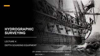
Measuring the depth of water aboard a frigate, illustration of 1844 صورة توضح قياس الأعماق , 1844
Télécharger maintenant