1. The aim of the Landscape Strategy is to retain, conserve and enhance the existing habitat using the land-
scape planting strategy to strengthen and enhance existing biodiversity. This will minimise the fragmenta-
tion of existing habitats and help to maintain the successful continuity of existing wildlife populations.
Opportunities to create functional habitats within the site have been identified, and the landscape strategy
aims to create valuable new habitat within a robust framework of open spaces and natural environment.
The integration of new habitat to existing biodiversity will allow species and populations within the existing
community to flourish in response to the distribution of resources and competitors. In turn, these popula-
tions also alter.
Our site lies in close proximity to a number of potentially important ecological sites including Statutory and
The development will be designed to take account of the landform and any of the steep slopes will be de-
signed to create positive landscape features that focus on the important views.
The landform provides the opportunity for a woodland walk to take advantage of the prominent vista, and to
provide a public footpath to improve public benefit-a network of well landscaped pedestrian / cycle routes
will be provided to improve the permeability of the site and link the development with the other routes and
facilities and the open spaces.
Our development strategy will conserve, retain and enhance the existing features of the site and reinforce
the biodiversity of the site.
New tree and shrub planting will be used to provide shelter and screening, create focal points, landscape
features and improve biodiversity.
A palette of plants will be used that relate to the site to further enhance the site character and provide a
clear sense of place.
BridgeheadDevelopment
N
Aspirations
Office Research and Development
Indicative Building Proposals
First Floor Plan
Typical Floor Plan
Ground Floor Plan (Undercroft)
Material Palette
The use of local materials in the design of any future proposals is encouraged in order to strengthen the local
identity and distinctiveness of the place as well as sustainability.
The specification of the materials and maintenance regimes must demonstrate high standards of sustaina-
bilty, visual attractiveness, durability and environmental performance.
The palette of materials suggest that the materials must be appropriate to the scale, density and use of the
development. These core materials are as follows:
• Brickwork
• Stonework
• Timber
• Render
• Metal
• Glass
A11
05 BOOTHFERRY ROAD
A614TO
BEVERLEY
BORROWPIT SITE
BOOTHFERRY
ROAD
HESSLE VILLAGE
HUMBER RIVER
HUMBER BRIDGE
A63
CLIVE SULLIVAN WAY
HUMBERBRIDGE
COUNTRY PARK
HESSLEWOOD
HALL
FORMER REFUSE
TIP
HESSLE TRAIN STATION
HESSLE BUS INTERCHANGE
BRIDGEBOARD SITE
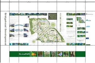
Site Aerial
Indicative Masterplan
• The design aspiration is to create ‘quality focal buildings’ of high quality design which make a positive
contribution to the local area.
• The development will convey the image of an excellent quality, contemporary, hi tech business park
located within a parkland setting.
• It is intended to create a green corridor/vista to the Humber Bridge running from Borrowpit site to Bridg
board site.
• This corridor/vista is envisaged to be a space of high quality hard and soft landscaping at building e
trances.
• Increased public spaces are proposed at each end of the vista. The public space in the Bridgeboard site
is positioned as such to create a natural link with Humber Bridge Country Park.
• Car parking is strategically positioned out of view from the access roads which will guarantee the green
corridor/vista through the development.
• The use of a coherent palette of materials throughout the design will ensure that there is continuity in the
quality of this primary route. The vista addresses the nature of the setting of the buildings within a green
area immediately off the dual carriageway.
• The massing and form of each individual plot will give the overall development diversity in design whilst
maintaining common threads through material selection, plot density, storey height and building footprint.
Landscaping
Examples of high quality public space
Key
Site Boundary
B1(A, B, C)
Cafe
Building Entrance
Service Access
Trees
Existing Trees to be retained
(T.P.O.)
Hard Landscaping
Cycle Parking
Public Space
Amenity Grassland
Species Rich Grassland
Wildflower Grassland
Shrub Planting
Structure Planting
Hedge with Hedgerow Trees
Wetland Grassland Zone
Sustainable Urban Drainage
Broadway over Water Feature
Public Footpath for Recreational
Use e.g.Dog walking and Jogging
Access to Humberbridge
Country Park
Water Treatment Plant
The landscape design proposals will seek to:
• Enhance the existing landscape character of the site and improve biodiversity
• Provide a robust and sustainable landscape setting to the proposed new development
• Provide a framework of passive and active open spaces linked by a network of footpaths and cycleways
throughout the development to provide public benefit
• Create a sense of place
• Provide a pleasant safe environment for the new development
A hierarchy of open spaces will be developed throughout the site ranging from formal open space areas, to
more informal incidental spaces between buildings.
Development Plots
Proposed Landscaping
Key
Structural Landscaping
Proposed Highway
Infrastructure
Biodiversity and Sustainable Urban Drainage
The open space areas throughout the development will be multifunctional and will link into the existing
network of green spaces surrounding the site such as Humber Bridge Country Park.
Well designed shared surface routes will be incorporated into the layout providing opportunities for the crea-
tion of outdoor spaces, with tree and shrub planting, where dog walkers and local residents can exercise and
socialise, to exploit the views and footpaths created by the green infrastructure.
Non-statutory Nature conservation Designations. These include Hessle Foreshore SINC, Hessle Quarry
SINC, Stockdove Wood SINC, Humber Flatts and Marshes SSSI/SPA/Ramsar site and possible Humber
Estuary Special Area of conservation. Boundary features (as described in the UK BAP ), are an important
biological characteristic of this landscape, and many can be described as Wildlife Corridors; for example
lines of trees and shrubs, grassland, other semi-natural habitats.
The site layout will concentrate development in the centre of the site to allow the retention and strengthen-
ing of the existing woodland habitat which reinforces much of the character of the site. This will be man-
aged to maintain and enhance its ecological value.
Innovative opportunities for providing a diverse mosaic of ecological habitat within the site will be explored
such as incorporating habitat as part of the built form to include native tree and shrub planting, structural
and ornamental shrub planting, native and specimen tree planting as well as areas of wildflower meadow
and species rich grassland.
We have been working closely with other professional consultants to provide Sustainable Urban Drainage
Systems and this includes proposals to provide a mosaic of wetland habitat including structural, marginal,
emergent and submerged native planting of open drainage channels and wetland scrapes and an
ornamental pond as well as enhancing existing drainage channels to improve the quality and quantity of
habitat, visual amenity and intrinsic aesthetic value of the site.
Development/Landscaping Breakdown
2250
675
CURVED PANEL
675
CURVED PANEL
675
CURVED PANEL
675
CURVED PANEL
675
CURVED PANEL
675
CURVED PANEL
STARTOFCURVE
STARTOFCURVE