Imaging Technologies & Methodologies for Archaeological Visualization
•Télécharger en tant que PPTX, PDF•
1 j'aime•581 vues

Presented during a guest lecture workshop on archaeological imaging at the University of California, Los Angeles, Cotsen Institute of Archaeology

Recommandé
Recommandé
Contenu connexe
Similaire à Imaging Technologies & Methodologies for Archaeological Visualization
Similaire à Imaging Technologies & Methodologies for Archaeological Visualization (20)
Plus de Ashley M. Richter
Plus de Ashley M. Richter (14)
Dernier
Dernier (20)
Imaging Technologies & Methodologies for Archaeological Visualization
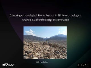
- 1. Capturing Archaeological Sites & Artifacts in 3D for Archaeological Analysis& Cultural Heritage Dissemination Ashley M. Richter
- 2. TABLE OF CONTENTS BRIEF INTRO •CISA3 •Point Clouds as a Digital Scaffold PART ONE: Laser Scanning for Archaeological Landscapes •Intro to the Mechanism •Evolution of the Scanner •Field Problems & Solutions •Jordanian Field Examples •Scan Planning •Scanning Basics PART TWO: Laser Scanning for Cultural Heritage Artifacts •Intro to the Mechanism •Field Problems & Solutions •Scanning Basics
- 3. Center of Interdisciplinary Science for Art, Architecture, and Archaeology =
- 5. But what does it mean?
- 6. Layered Realities!! 3D Immersive Cave Systems Collaborative Visualization Walls Augmented Reality: ARtifact Capable Point Rendering Software
- 8. LAYERED REALITIES Satellite Imagery Aerial Photography (Visible, Multispectral) Point Clouds- Raw & Modeled Layers High Resolution Photography Artifact Layers Multispectral Imaging Community Input Textual Annotation Layers Cartography GIS
- 10. LIGHT DETECTION & RANGING (LIDAR) BRIEF FARO VIDEO
- 11. The Evolution of the Laser Scanner Cyrax Models Leica Scanstation 2 Leica C10 Faro Focus 3D
- 13. KHIRBAT FAYNAN
- 14. Terrestrial LiDAR = The best way to get a dense data scaffold in the field- if it could be adapted for rapid deployment in uncertain environments…
- 15. •Weight •Electricity •Time •TheUnexpected Using LiDAR in the Field…
- 16. TEST CASE 2011 Khirbat Faynan, Jordan *testing the engineering *creating metadata standards & workflow *building a digital scaffold
- 17. UMMAL-AMAD
- 18. Rescue LiDAR at Umm al-Amad
- 19. Byzantine Petra Mosaic Church
- 21. Scan Planning •Pre-Plan: Size, Schedule, Power, Transport.. •Trouble Shoot the Landscape •Re-Assess the Plan & Prioritize •Scan, Scan, Scan •Scan •Keep up your Labeling Systems •Keep visual & textual Metadata throughout
- 22. The Faro Focus
- 23. The Leica C10
- 24. The Leica ScanStation 2
- 25. Structured Light
Notes de l'éditeur
- But we’d assume that in today’s modern world, we’d assume that all of that wonderful tech gets applied to archaeology and pop culture sources speak to this having happened and to science fiction potential for high speed data capture and visualization Bones CSI Prometheus LiDAR balls BUT ITS NOT YET SO- visual data manipulation limited, 3D modelling mostly- one offs- not a systems for entering, storing, and accessing information
- As an archaeologist- approached the initial data collection problems- how can we use laser scanning tech (LiDAR) for quick data collection in excavation and surveying environments Solved certain archaeology specific field issues- Resulted in Enhanced speed
- My trial system at Khirbat Faynan in southern Jordan worked so well that we applied it to a nearby endangered site
- The Birth of Rescue LiDAR: Umm al-Amad