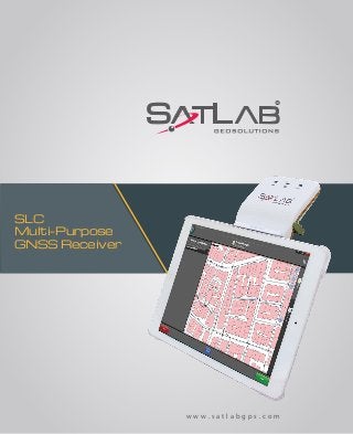
SLC Multi- Purpose GNSS Receiver minat Call/ Wa : 082119953499

PT. MINDS INDO SURVEY DISTRIBUTOR ALAT UKUR SURVEY DAN PEMETAAN Komp/Ruko. Mega Kalimalang Kav. 8 Jln KH Noer Ali No. 11 Pekayon Jaya Bekasi Mobile : 082119953499/ 087886144398 Pin BB : 5943AB9C/ 237FC845 . Email : budi1080@yahoo.com/ @gmail.com PENGIRIMAN GRATIS UNTUK WILAYAH DKI Menjual Alat-Alat Untuk Survey Pemetaan, Infrastruktur, Kontraktor, Telekomunikasi, Pertambangan, Geologist, Exploration, Mining, Driling, Kelautan, Militer, Migas, Pembangunan, Pengelolaan Lahan Lahan Perhutanan Dan Perkebunan Kelapa Sawit. Hal : Perkenalan RUANG LINGKUP KEGIATAN PENJUALAN, SERVICE / PERBAIKAN DAN PENYEWAAN ALAT-ALAT UKUR PENJUALAN : • Alat Ukur : - Total Station (baru dan second hand) - Altimeter - Theodolite (baru dan second hand) - Digital Planimeter - Levels (baru dan second hand) - Walking Measure - GPS - Digital Level / Smart Tool - Compass - Phantograph - Clinometer - Tandem / Clino - Compass • Accessories : - Tripod - Prisma - Rambu Ukur - Meteran - Jalon - Binocular PENYEWAAN : - Total Station - Automatic Level - Theodolite MEREK ALAT UKUR YANG TERSEDIA : - MINDS - SPECTRA PRECISION - NIKON - SUUNTO - GARMIN SERVICE / PERBAIKAN DAN KALIBRASI MACAM-MACAM ALAT UKUR HARGA MENARIK / COMPETITIVE Catatan : Price List akan dikirim sesuai permintaan

Recommandé
Recommandé
Contenu connexe
Plus de Budi anto
Plus de Budi anto (20)
Dernier
Dernier (20)
SLC Multi- Purpose GNSS Receiver minat Call/ Wa : 082119953499
- 1. SLC Multi-Purpose GNSS Receiver w w w . s a t l a b g p s . c o m
- 2. SLC Multi-Purpose GNSS Receiver The Ultimate Expandable Handheld Smart GNSS Sensor with Multi Constellation Tracking Fully Automated GNSS Receiver SLC is a multi-purpose, surveying grade GNSS receiver with industrial modem for internet and one button operation. BluetoothLightweight Multi Constellation Tracking Long Life Battery Windows Compatibility Swedish Design Android Compatibility iOS Compatibility Internet RTK Technology Internal 3.5G GSM Modem Multiple Expansion Possibilities SLC GNSS sensor includes 2 mounting plates to attach your tablet computer as its display, running your Apps. Its industrial grade 3.5G modem applies available RTK corrections for cm accuracy. The USB/RS232 serial connection allows for external power, UHF radio connection or wired connection to a display. Press Run Android, Windows and iOS Compatibility
- 3. *NovAtel is a registered trademark of NovAtel Inc. Unlimited Application Areas Any software running on Windows, Android or iOS accepting GNSS position over a serial port (Direct or over Bluetooth) can be used. This makes SLC the high precision positioning solution to virtually unlimited number of applications. Latest GNSS Technology SLC utilizes a Novatel* GNSS OEM receiver with all options enabled. The GNSS board can be controlled through the RS232 Serial Port or Bluetooth for custom applications. The SLC tracks multi constellation satellite as well as SBAS satellites. The SLC is ready to use RTK corrections from NTRIP casters and Satlab InternetRTK servers. Antenna Options SLC contains a convenient internal full constellation dual frequency tracking antenna for centimeter accuracies in your hand. For even greater precision, an external geodetic antenna kit and pole mount option is available. Industrial Approach The sleek and rugged Swedish designed SLC, is easy to hold and designed for long and reliable field work, backed by Satlab’s standard 2 year warranty. Fast and Reliable Technical Support One of the greatest benefits with Satlab is support. We ensure spare parts are always available and easy to access from any place in the world. We keep our distribution network apprised on all software updates and support them with everything needed to guarantee a great user experience. Antenna Options Multi Constellation Tracking GNSS Technology Technical Support Swedish Design
- 4. System - Multi Purpose GNSS Receiver - Internal Memory: 32GB Channel Configuration - 120 Channels GNSS Tracking - GPS : L1, L2, L2C - GLONASS : L1, L2 - BEIDOU : B1, B2 - GALILEO** : E1, E5b - QZSS : L1, L2C - SBAS : L1 C/A Horizontal Position Accuracy (RMS) - Single Point L1 1.5 m - Single Point L1/L2 1.2 m - SBAS 0.6 m - DGPS 0.4 m - RTK 1 cm + 1 ppm - Initialization Time < 10 s - Initialization Reliability > 99.9% Measurement Precision (RMS) - L1 Carrier Phase 0.5 mm 1 mm - L2 Carrier Phase 1 mm 1 mm - L2C Carrier Phase 1 mm 1 mm Formats - NTRIP, intRTK - Navigation Output Support for NMEA 0183, NovAtel* ACSII and Binary Logs - Differential Correction Support for RTCM 2.1, 2.3, 3.0, 3.1, 3.2, CMR, CMR+ and RTCA - Raw data recording for Post Processing - Field Upgradable Software - Differential GPS Positioning Interface and Hardware - USB (Disk and Charging) - RF for External GNSS Antenna - RS232 Serial - Integrated 3.5G Environmental - IP67 water/dustproof - Temp: -20°C to +65°C Physical - Size: 25 x 9.5 x 3 cm - Weight: 620 grams Power - Mini USB Charging (Power Bank compatible) @1 A - Battery life 8-12 hours depending on the working mode and environmental conditions GPS GLONASS *NovAtel is a registered trademark of NovAtel Inc. **Optional Specifications subject to change without notice.
- 5. Fully Automated GNSS Receiver Windows, Android, iOS (BLE) Bluetooth Compatibility USB/Serial Port for Charging and Wired Data Connection Internal 3.5G GSM Modem Internal Memory: 32GB Internal GNSS Antenna Dual Frequency RTK Multi Constellations Tracking Geodetic Position Accuracy
- 6. Headquarters: Datavägen 21B SE-436 32 Askim,SWEDEN info@satlabgps.com | www.satlabgps.com Regional Offices: Jičín, CZECH REPUBLIC Ankara, TURKEY Scottsdale, USA Singapore, SINGAPORE Warsaw, POLAND www.artarda.com