Cnu 2009 Highway Removal
•Télécharger en tant que PPTX, PDF•
0 j'aime•843 vues


Recommandé
Recommandé
Contenu connexe
Plus de Congress for the New Urbanism
Plus de Congress for the New Urbanism (20)
Dernier
Dernier (20)
Cnu 2009 Highway Removal
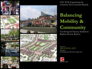
- 1. CNU XVII: Experiencing the Urbanism: The Convenient Remedy Balancing Mobility & Community Cost Saving for Freeway Teardowns: Replace, Prevent, Remove Prepared by: TROY RUSS, AICP Principal Glatting Jackson Kercher Anglin, Inc. June 13, 2009
- 2. Baton Rouge Past & Future
- 3. Early Settlement Pattern: 1700s-1900 Zachary • Population: 11,000 • River & Rail Economy Baker Denham Walker Springs Baton Rouge Port Allen Brusly Addis Plaquemine
- 4. Initial Suburban Growth: 1900 – 1960 Zachary • Population: 125,000 • Industrial Expansion (Oil) • Growing road infrastructure Baker Denham Walker Springs Baton Rouge Port Allen Brusly Addis Plaquemine
- 5. Highway Expansion: 1960 – Present Zachary • Population: 230,000 (Baton Rouge) • 412,000 (East Baton Rouge Parish) • Interstate access and urban Baker Central expansion Denham Walker Springs Baton Rouge Port Allen Brusly Addis Plaquemine I-10
- 6. What’s Next? 21st Century • Horizon Plan: Focused Growth Zachary Centers (Major Regional, Regional, Community) Baker • Intensified Corridors? Central • Town intensification? (Baker, Zachary, etc.) Denham Walker Springs Baton Rouge Port Allen Brusly Addis Plaquemine
- 7. What’s Next? 21st Century Zachary • Baton Rouge Loop?? • Intercity Passenger Rail?? Baker Central Denham Walker Springs US 190 Baton Rouge Port Allen Brusly Addis Plaquemine
- 8. What’s Next? 21st Century Zachary • Baton Rouge Loop?? • Intercity Passenger Rail?? Baker Central Denham Walker Springs US 190 Baton Rouge Port Allen Brusly Addis Plaquemine
- 9. Transportation / Land Use Relationship
- 10. More More Lanes Pavement Conventional Approach More Roads More Cars System Management ITS More Efficiency Conventional Approach
- 11. Land Use/Transportation “The Concept” Land Use Travel Road Capacity generates demands Anticipate Forecast Accommodate
- 12. Typical Regional Program Traffic Needs Engineer Plan Widen Program Project Build Other 1 2 3 4 5 Words Local Input Local Plans Public Information Technicians Public Input Input
- 13. Land Use & Transportation – Ideal Traffic Planning Widen 20-Year Forecast Capacity Years
- 14. Land Use & Transportation – The Reality Actual Widen Induced Traffic Forecast Capacity Years
- 15. Chain of Impacts Widen Road FIRST Reduce Reduce ORDER Delay Cost SECOND Move Range Drive Own More ORDER Home Farther More Cars THIRD Lose Community Big Inactivity More Increased Higher Increased ORDER Business & Jobs Disinvestment Box Epidemic VMT Energy Carbon Household Demand Footprint Transportation Costs
- 16. Road Size, Not Congestion, is the Choice No Option Congestion Widen Reduced Options Congestion Widen Choice Congestion Traffic Capacity Years
- 18. Transportation Statistics Results Over the Last 50-Years 1) Vehicle Miles of Travel (VMT) Growing Faster Than Population Growth 2) Longer Commute Times 3) Decreased Transit Ridership
- 19. Land Use Statistics Decreased Density . . Increased Sprawl 6.98 4.85 4.96 Persons Per Acre 3.52 3.56 3.48 3.6 1950 1960 1970 1980 1990 2000 2005 Charlotte’s Population Per Acre 1950-2005
- 20. Social Statistics The physical impacts of all this inactivity • Increased risk of obesity • Increased risk of major diseases • Diabetes • Cardiovascular disease • Colon cancer • Increased symptoms of depression and anxiety • Poorer development and maintenance of bones and muscles
- 21. Household Statistics Education 2.1% Misc. 8.2% Apparel & Services 4.8% Entertainment 5.0% Shelter 19% Shelter 19 Transportation 17.9 Food 13.7 Insurance & Pensions 9.6 Other Household 7.5 Health Care 5.4% Utilities 6.8 Health Care 5.4 Entertainment 5 Apparel & Services Education Miscellaneous 4.8 2.1 8.2 Transportation 17.9% Utilities Total 6.8% 100 Other Household 7.5% Food 13.7% Insurance & Pensions 9.6% Source: Surface Transportation Policy Project: Driven to Spend – The Impact of Sprawl on Transportation Expenditure
- 22. Environmental Statistics Photographer: rosevita. Used through license agreement with morguefile.com
- 24. Budgetary Statistics (PENNDOT 2006-2015) 4,000 3,000 Cost to ―Improve‖ = $3.4 trillion Gap to ―Improve" = $1.0 trillion 2,000 Gap to ―Maintain" = $415 billion Cost to ―Maintain‖ 1,000 = $2.8 trillion $2.4 trillion 0 Cumulative Needs Existing Sources of Revenue Current Dollars (in Billions) Source: Cambridge Systematics, April 2006
- 25. “The problems we have created cannot be solved with the same thinking that created them….” Image Source: Library of Congress, Prints & Photographs Division. Original copyright expired.
- 26. Chain of Impacts Accept Congest FIRST Increase Increase ORDER Delay Cost SECOND Improve Change Drive Own Fewer ORDER Home Modes Less Cars THIRD Keep Community Main Healthy Less Decreased Lower Decreased ORDER Business & Jobs Reinvestment Communities VMT Energy Carbon Household Street Demand Footprint Transportation Costs
- 27. Supply and Demand New ―Market‖ Price Points Price Old Policy Demand
- 28. USA Today, May 24, 2008
- 29. When you have eliminated the impossible whatever remains, however improbable, must be the truth.
- 31. People will get sick and tired of traffic congestion and... Karl Rasmussen State Traffic Engineer, Minnesota
- 32. …and move into the city. Karl Rasmussen State Traffic Engineer, Minnesota
- 33. Case Study: Chattanooga, TN Riverfront Parkway
- 35. Chattanooga: A Transformative Vision
- 36. Riverfront Parkway –Traffic Flow – Year 2000 Tennessee River 19,998 ADT (2,050) AM Peak 13,339 ADT (1,262) AM Peak 19,482 ADT (1,728) AM Peak
- 37. Riverfront Parkway –Traffic Flow – Year 2005 Tennessee River
- 38. Riverfront Parkway Looking From Walnut Street Bridge to Market Street Bridge: 2000
- 39. Riverfront Parkway Looking From Walnut Street Bridge to Market Street Bridge: Vision
- 40. Riverfront Parkway Looking From Walnut Street Bridge to Market Street Bridge: 2005
- 42. 21st Century Waterfront – 2005
- 44. Chattanooga: A Transformative Vision
- 45. Case Study: Trenton, N J Use Network to Balance Traffic Impacts
- 47. The Change for Mobility
- 48. Time to Reclaim the River
- 49. Project Goals • Reclaim the Delaware River Waterfront • Improve Access to Waterfront • Improve Safety and Provide Traffic Calming • Promote Urban and Economic Redevelopment • Provide Environmental Enhancements along Assunpink Creek and Delaware River
- 52. Riverfront & Park Space
- 53. Travel Time Runs Sullivan Way Lee Street Parkside Calhoun Street Avenue 1m15s Market Street 42s 2m10s 1m59s South Warren Cass Street Street From I-195 1m40s 45s 13m26s Difference AM Peak Hour = 2m 01s Difference PM Peak Hour = 5 4s
- 54. Case Study: Flemington, NJ Regulating Redevelopment to Build Transportation Infrastructure ITE Best Project Award 2009
- 55. Existing Land Use • Commercial strip development along Commercial Route 31 and US 202 Industrial • Undeveloped agricultural lands converting to commercial and industrial uses • Still lots of undeveloped land (opportunity to shape future development pattern) Undeveloped Land
- 57. Flemington Today • Sparse Network • Three routes all meet at “Flemington Circle” Flemington Circle
- 58. Flemington – On the Books • 4-lane Bypass • Widen existing Rt. 31 from 2 to 4 lanes • Grade Separate “Flemington Circle” • 100% Designed, $100 million (not funded) Flemington Circle
- 59. Flemington Circle • Bypass – Grade Separated Circle traffic volumes & Levels of Service LOS C
- 60. Development Pressure Undeveloped (Green) Considering Development • Lots of moving pieces that can (Red outline) sill be influenced Currently planned or approved (Red)
- 61. An Alternative Concept: “South Branch Parkway” • An at grade “parkway” • Integrated Land Use and • New network Transportation Strategy connections to provide parallel • $20 million routes to 202 and 31 • Work with property owners to manage access and support approved development plans
- 62. Phasing: Secondary Connections • Private Development required to build secondary network.
- 63. • Separate the Rt. 202, 31, &12 movements • Transform circle to square • Continue development of parallel street south of 202 • New site development standards that focus on the street & pedestrian environment
- 64. • Separate the Rt. 202, 31, &12 movements • Transform circle to square • Continue development of parallel street south of 202 • New site development standards that focus on the street & pedestrian environment
- 65. “ Circle to Square ”
- 66. “ Circle to Square”
- 67. Conventional Planning Connectivity Planning LOS C LOS B
- 68. Case Study: Montgomery County, PA Context & Fiscal Responsibility
- 69. The Concept for US 202 Has Changed Significantly Over the Years
- 70. No Build Option
- 71. NBCP Option $111M Project Cost
- 72. Parkway Option $206M Total Project Cost $161M Cost to Complete Project Cost
- 73. Expressway Option $465M Total Project Cost $383M Cost to Complete Project Cost
- 74. No Significant Relief to Section 700 or Other Local Roads
- 75. 93% of the Trips are Local Trips Rather than Regional Through Trips Only 7% of trips on US 202 are regional through trips. Most trips are best served by a complete network of local roads 37% of all trips begin or end in the study area. 56% of all trips are completely local, beginning and ending in the study area.
- 76. Travel Times and Total Travel The Expressway significantly reduces Which brings more travel into the travel time for regional through corridor trips… Expressway Expressway Parkway Parkway NBCP NBCP NB NB 0 10 20 30 40 50 60 0 500,000 1,000,000 1,500,000 2,000,000 Travel Time from Doylestown to Plymouth Total Travel (VMT) Meeting (Minutes)
- 77. Evaluation
- 78. The Goal is to Maximize Benefits to Local Trips
- 79. The Goal is to Maximize Benefits to Local Trips NEW SOLUTION A complete network of local roads rather than one new regional route.
- 80. Case Study: Charlotte, NC Cost to Value
- 81. 29 / 29 Weave The Need The 85 Connector Rocky River
- 82. 29 / 29 Weave The “Fix” – 1998 Version The 85 Connector Rocky River
- 83. 29 / 29 Weave The New “Fix”– 2007 Version City Boulevard Station Rocky River Station The 85 Connector Rocky River
- 84. 29 / 29 Weave The Problem City Boulevard Station Rocky River Station The 85 Connector Rocky River
- 85. Process 1) Conducted one-on-one stakeholder interviews October 4th and 5th: • Crescent Resources • Stewart Family (During UCP City Boulevard Station Study) • I-85 partnership – Shawn McClaren & John Smith • Diane Carter, George Shield, & Bob Henderson • Steve Mogowan & Mary Hopper (Volvo Dealership & UCP) • CDOT & E&PM • Office of Economic Rocky River Station Development • CMPC • CATS The 85 Connector Rocky River
- 86. Existing Conditions Issues & Concerns: 1) Limited Street Network • Requires 29 / 49 to accommodate all existing and future traffic. City Boulevard Station • Limits the potential for an Urban Boulevard. • Limits the Transit Oriented Development Potential of the Study Area. 2) Roadway Design Speed and Access • Limits Pedestrian Oriented Development • Limits Land Development Potential. • Prohibits Rocky River Station. Rocky River Station The 85 Connector Rocky River
- 87. Primary Street Network These streets are critical to the success of the 29 / 49 Intersection and can be developed as property is developed without City money: 1) Extension of the 85 Connector to City Boulevard. City Boulevard Station 2) Creation of North / South Parallel Road from connector to McCullough Drive (Harris) 3) Extension of Shopping Center Drive Over I- 85 Rocky River Station The 85 Connector Rocky River
- 88. Recommended Street Classification Design of the streets should follow those identified in the City’s Urban Street Design Guidelines: City Boulevard Station 1) Boulevards (Red) • North Tryon • City Boulevard 2) Avenues (Blue) • Commercial • Residential 3) Main Streets (Yellow) • Rocky River Station 4) Local (Black) • Commercial • Residential Rocky River Station The 85 Connector Rocky River
- 89. What If?
- 90. Public Input Connections Throughout More Small Roads Less Travel Bike Routes Business Sidewalks, Trees Neighborhoods Great Streets Traffic Needs Visitor Needs Great Neighborhoods Traffic Calming Partners Plan Communit Program y Design Widen / or Vision Network Plan Other Project Dialogue 1 2 3 4 5 Local Plans
- 91. Land Use/Transportation Road Design Travel Land Use manages influences • Lead Land Use • Condition Protects • Manage Supply
- 92. “Courage is being scared… but saddling up anyway.” — John Wayne
Notes de l'éditeur
- As a society, we have created a number of financial, environmental, and social problems. If we are to solve this new generation of challenges, we must adhere to Einstein’s theory that the solutions will lie in thinking differently. In the past we built transportation systems that solved the challenges of the time; now we have a new set of challenges, and need a new set of solutions.