Planning For Form Based Codes - Carlat CNU 17
•
1 j'aime•493 vues

Planning for Form-Based Codes The document discusses Nashville's transition from traditional land use and zoning policies to form-based community character policies. It outlines how the community character manual uses the transect planning tool to categorize areas from rural to urban based on density and design. The policies provide guidance on appropriate land uses, building types, and design principles for different transect zones. The document also provides an example of how the community character policies would be applied in updating a specific community plan.

Recommandé
Recommandé
Contenu connexe
Similaire à Planning For Form Based Codes - Carlat CNU 17
Similaire à Planning For Form Based Codes - Carlat CNU 17 (20)
Plus de Congress for the New Urbanism
Plus de Congress for the New Urbanism (20)
Dernier
Dernier (20)
Planning For Form Based Codes - Carlat CNU 17
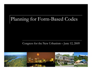
- 1. Planning for Form-Based Codes Congress for the New Urbanism – June 12, 2009
- 2. Attempts to develop with emphasis on character and form will always be compromised if the community does not plan for character and form.
- 3. Evolution of Planning Efforts Community Plans (1988) Detailed Neighborhood Design Plans (2002)
- 4. Basics of Community Planning What makes a “complete community”? Employment and services in proximity to housing Housing choice Transportation choice Recreational opportunities
- 5. Form & Character Matters
- 6. Form & Character Varies
- 7. Transect Methodology The Transect A tool for understanding, categorizing, and designing the natural and build environment from rural to urban. Encourages diversity of development rather than homogeneity. First introduced in 2004 revision of the Land Use Policy Application. Later used as guiding principle in the Community Character Manual.
- 8. Community Character Manual Dictionary of all Community Character Policies Community Character Policies Intended to preserve, enhance or create community character Changes emphasis from land use and density to the form and character Provides clear urban design guidance Will replace land use policies as Community Plans updated
- 9. What is Community Character? The quality of a community as defined by its: built environment; natural features and open space; infrastructure, public facilities and services; and public realm – the character of its roadways and streetscape.
- 10. Structure of the CCM 1. Based on the Transect planning tool; Different transect categories can sit side by side, but within any transect category, all elements of development should be consistent.
- 12. Structure of the CCM 2. Community Elements – Open Space, Neighborhoods, Centers, Corridors; T4 Open Space T4 Neighborhood T4 Center T4 Corridor
- 13. Community Elements T4 Neighborhood T4 Corridor T3 Neighborhood T3 Corridor
- 14. Structure of the CCM 3. Policy Intent Preserve Enhance Create
- 15. Structure of the CCM 3. Community Character Policies General Characteristics Application Appropriate Land Uses Appropriate Zoning Districts Building Types
- 16. Structure of the CCM 3. Community Character Policies Design Principles Per Policy Block Length Lighting Access Parking Building Form (Mass, Service Area Orientation, Placement) Signage Connectivity Density/Intensity Landscaping
- 17. T3 Suburban Neighborhood Maintenance • Moderate to deep setbacks • Informal landscaping • Shoulder and swale, likely no sidewalk • Larger lots and smaller building footprint • Moderate connectivity, often with curvilinear streets
- 18. T4 Urban Neighborhood Maintenance • Shallow setbacks • Formal landscaping • Curb and gutter with sidewalk • Smaller lots and larger building footprint • High connectivity with linear streets, shorter block lengths and complete grid
- 20. General Principles Overarching commitment to Sustainable Communities & Sustainable Development Complete Communities Housing & Neighborhoods Gentrification, Revitalization & Deterioration Historic Preservation Natural Resources Preservation Infill Development
- 21. General Principles Mixed Use Centers & Economic Development Transportation Street Cross Sections & the Transect Stormwater & the Transect Transitions between Policies/Determining the Boundaries of Policies
- 22. Conservation Policy Found in all Transect areas except T6 Downtown Preservation and remediation of environmentally sensitive land features
- 23. Conservation Policy Floodplain Floodway Steep Slopes View sheds Ridgelines Unstable Soils Cedar Glades
- 24. T2 Rural Low density residential; mix of housing where appropriate. Low connectivity Large setbacks are present Natural landscaping
- 26. T3 Suburban Low to medium density residential, some mix of housing but are predominantly single-family Street pattern is usually curvilinear and has moderate connectivity Sidewalks are provided in centers, along corridors, and in newer subdivisions
- 28. T4 Urban Medium density residential neighborhoods that contain a mix of housing Street pattern is usually a grid and has high connectivity Sidewalks widespread More formal landscaping, street trees
- 30. T6 Downtown Commercial, civic and entertainment center. Most intense, mixed use Highly multi-modal with walkable, pedestrian friendly streetscapes
- 32. Applying the CCM – Madison Community Plan Update
- 33. Transect Feedback from Visioning Workshop hints at Transect Categories
- 34. Community Elements & Intent Concept Plan designates Community Elements & Intent
- 35. Community Character Policies Staff propose policies
- 36. Determine the appropriate policy In “Application” of each policy, guidance on how to determine if the policy is appropriate for an area Ex. T4 Urban Neighborhood Evolving applied to areas that are Zoned residential Where the primary land use is residential Or that are envisioned to become primarily residential
- 37. Determine the appropriate policy Ex. T4 Urban Neighborhood Evolving applied to areas where The community has expressed an interest in “evolving” OR The following characteristics are present: High vacancy rates, High proportion of vacant land High potential for consolidation or subdivision of incongruous lots (little lot pattern) Incongruity between existing land use and zoning Proximity to centers or corridors and/or Age/condition of existing development
- 38. Set boundaries for each policy In “Application” of each policy, “Commonly used boundaries include…”
- 39. Determine “Special Policies” for each Policy Area Any unique features are outlined in the plan. Otherwise, the basic policy applies.
- 40. Newest Emphasis – Regionalism and Sustainability
- 41. Regional Context – Transportation and Land Use
- 43. Regional Context – Open Space Preservation
- 44. Jennifer Carlat Metro Nashville/Davidson County Planning jennifer.carlat@nashville.gov www.nashville.gov/mpc