SlideShare une entreprise Scribd logo
1  sur  57
Télécharger pour lire hors ligne
GEO Laboratory
Como Campus
FOSS4G in Europe, Italy and
the Politecnico di Milano
Politecnico di Milano, DICA – GEO Laboratory at Como Campus
http://geomatica.como.polimi.it/
Maria Antonia Brovelli, Carolina Arias Munoz,
Marco Minghini, Monia Molinari and Giorgio Zamboni
University of Colorado Denver FOSS4G Lab
Spring 2015 Speaker Series
Wed March 4, 12:00-1:00 PM US Mountain Time (7:00 PM GMT)
2
✔ 1994: my first course in “Digital Cartography” (the first
in Italy with GIS practice) at the Como Campus of
Politecnico di Milano
✔ 1998: Birth of the Geomatics Lab at the Como Campus
of Politecnico di Milano
✔ 1998: First thesis with GRASS
✔ 2000: at the Como Campus was organized the “First
Meeting of Italian Users of GRASS”
✔ 2000: the First Number of Geomatics Workbooks with an
Introduction to GRASS GIS by Markus Neteler was
issued
✔ 2002: in Trento the first international “Open Source
Free Software GIS - GRASS users conference” was
organized: 140 attendees !!!
http://www.ing.unitn.it/~grass/conferences/GRASS2002/home.html
A bit of history …
3
✔ 2004: FOSS4G 2004 - Free/Libre and Open Source
Software for Geoinformatics in Bangkok
A bit of history …
4
✔ 2007: Birth of the Italian Association “GFOSS.it”. The
Headquarter of the Association were at Como Campus of
Politecnico di Milano.
✔ 2008: GFOSS became OSGeo Italian Chapter
✔ 2012: NASA World Wind Summer School
A bit of history …
5
✔ 2012: ZOO Open WPS platform Knowledge
Partner
✔ 2013: GeoForAll initiative (Maria Member of
the Advisory Board)
✔ 2013: 1°NASA World Wind Europa Challenge,
Florence
✔ 2014: First FOSS4G Europe and 2° NASA
World Wind Europa Challenge
A bit of history …
6
✔ Politecnico di Milano, Como Campus (Italy) – July 14-17, 2015
http://europe.foss4g.org/2015
Coming soon … @foss4ge
7
✔ 6 scientific sessions (submission deadline: March 9, 2015)
FOSS4G Europe 2015 conference
➔ General Track
➔ Academic Track
➔ Water Track
➔ Open Data Track
➔ Library Track
➔ Indoor/outdoor Positioning Track
✔ Complimentary events:
➔ Practical workshops
➔ Hacker Code Sprint
➔ NASA World Wind Europa Challenge
➔ 4 Mapping Parties
➔ GeoForAll Labs meeting
http://europe.foss4g.org/2015
8
Desktop GIS
GRASS commands for
filtering
LiDAR Data and for
interpolating
them to obtain DTM
2002
http://grasswiki.osgeo.org
/wiki/LIDAR
9
WebGIS
http://webgis2.como.polimi.it/agew/ 2002-2004
A GIS-BASED ACCURACY ASSESSMENT OF
GLOBELAND30 ON ITALIAN AREA
Maria Brovelli, Monia Molinari
Politecnico di Milano, DICA - Hydroinformatics Lab at Como Campus
2
GlobeLand30
SOURCES:
- Landsat TM and ETM+
- HJ-1
RESOLUTION:
- 30 m
FORMAT:
- Raster
REFERENCE SYSTEM:
- WGS84 / UTM
BASELINE YEARS:
- 2000, 2010
OVERALL ACCURACY:
- 80% (preliminary tests)
GlobeLand30 (from www.globallandcover.com)
New global land cover dataset produced by the National Geomatic
Center of China and released in September 2014 as open data.
3
Reference Data
SOURCES:
- HR satellite images
- Aerial orthophotos
RESOLUTION:
- 5 m
FORMAT:
- Vector (Shape File)
REFERENCE SYSTEMS:
- Roma40/Gauss Boaga
- WGS 84/ UTM 32-33 N
- ETRS89 /UTM 32-33 N
LEGEND:
- Corine Land Cover
Friuli Venezia Giulia
Land Cover 2000 - 1:25’000
Veneto
Land Cover 2007/2009 - 1:10’000
Emilia Romagna
Land Cover 2003 - 1:10’000
Land Cover 2008 - 1:10’000
Sardegna
Land Cover 1997/2000 - 1:25’000
Land Cover 2003/2006 - 1:25’000
Liguria
Land Cover 2000 - 1:10’000
Land Cover 2012 - 1:10’000
Lombardia
Land Cover 1999/2000 - 1:10’000
Land Cover 2012 - 1:10’000
Autonomous Province of Bolzano
Land Cover 2000 - 1:10’000
Autonomous Province of Trento
Land Cover 2000 - 1:10’000
Abruzzo
Land Cover 1997- 1:25’000
4
Accuracy Analysis
A B C D
A fAA fAB fAC fAD fA+
B fBA fBB fBC fBD fB+
C fCA fCB fCC fCD fC+
D fDA fDB fDC fDD fD+
f+A f+B f+C f+D n
CLASSIFICATION
f+i = marginal sum of column i (i = A, B, C, D)
fi+ = marginal sum of row i (i = A, B, C, D)
n = total number of cells
CONFUSION MATRIX
GROUND TRUTH (REFERENCE)
The comparison can be performed through a pixel-by-pixel procedure that
allows to obtain the confusion or error matrix.
𝑶𝑨 =
𝑓𝑖𝑖
𝑛
5
Accuracy Analysis
A B C D
A fAA fAB fAC fAD fA+
B fBA fBB fBC fBD fB+
C fCA fCB fCC fCD fC+
D fDA fDB fDC fDD fD+
f+A f+B f+C f+D n
CLASSIFICATION
CONFUSION MATRIX DERIVED STATISTICS
(i = A, B, C, D)
Overall accuracy: percentage of correctly
classified pixels
GROUND TRUTH (REFERENCE)
The comparison can be performed through a pixel-by-pixel procedure that
allows to obtain the confusion or error matrix.
6
GRASS GIS-Based procedure
7
GRASS GIS-Based procedure
RASTERIZATION
REGION
v.to.rast
• 5 m
• 30 m
Vector Raster 30 m Raster 5 m
8
GRASS GIS-Based procedure
CODE CORINE LEGEND GLOBELAND30 LEGEND
1 Artificial surfaces Artificial cover
2 Agricultural areas Croplands
3 Forests and semi natural areas
Forest, Grass, Shrub, Bare land, Permanent ice or
snow
4 Wetlands Wetlands
5 Water bodies Water
RASTERIZATION
REGION
RE-CLASSIFICATION
r.reclass
v.to.rast
GL30
GL30
RE-CLASSIFICATION
r.reclass
• I scheme
• II scheme
• I scheme
• II scheme
• 5 m
• 30 m
9
RASTERIZATION
REGION
RE-CLASSIFICATION
GL30
GL30
RE-CLASSIFICATION
CODE CORINE LEGEND GLOBELAND30 LEGEND
1 Artificial surfaces Artificial cover
2 Agricultural areas Croplands
31 Forests Forests
32
Scrub and/or herbaceous vegetation
associations
Grass, shrub
330 Open spaces with little or no vegetation Bare land
335 Glaciers and perpetual snow Permanent ice or snow
4 Wetlands Wetlands
5 Water bodies Water
r.reclass
r.reclassv.to.rast
GRASS GIS-Based procedure
• I scheme
• II scheme
• I scheme
• II scheme
• 5 m
• 30 m
10
GL30
r.kappa
COMPARISON
RASTERIZATION
REGION
RE-CLASSIFICATION
r.reclass
v.to.rast
GL30
GL30
RE-CLASSIFICATION
r.reclass
GRASS GIS-Based procedure
• I scheme
• II scheme
• I scheme
• II scheme
• 5 m
• 30 m
LOMBARDIA LAND COVERGLOBELAND30
11
GL30
r.kappa
COMPARISON
RASTERIZATION
REGION
RE-CLASSIFICATION
r.reclass
v.to.rast
GL30
GL30
RE-CLASSIFICATION
r.reclass
COMPARISON
r.kappa
BUFFER
r.buffer
GRASS GIS-Based procedure
• I scheme
• II scheme
• I scheme
• II scheme
• 5 m
• 30 m
LOMBARDIA LAND COVERGLOBELAND30
12
r.patch
TILES MERGING
REPROJECTION
REGION
RASTERIZATION
v.to.rast
v.proj
GL30
GL30
REPROJECTION
r.proj
COMPARISON
RASTER EDITING
r.mapcalc r.mapcalc
RASTER EDITING
RE-CLASSIFICATION
r.reclass
RE-CLASSIFICATION
r.reclassr.kappa
COMPARISON RE-CLASSIFICATION
r.reclassr.kappa
GRASS GIS-Based procedure
• 5 m
• 30 m
• I scheme
• II scheme
• I scheme
• II scheme
13
Results & further research
OVERALL ACCURACY VALUES RANGE (30 m DATASETS)
• Develop a geo-platform to involve citizens in the improvement of the land cover
classification quality
• Complete the analysis on the remaining Italian regions
I schema, buffer
I schema, no buffer
II schema, no buffer
II schema, buffer
OA[%]
100
90
80
70
60
Web-based spatial information
systems in the water domain
Maria Antonia Brovelli, Carolina Arias Muñoz, Simone Corti
Politecnico di Milano, DICA – Hydroinformatics Lab at Como Campus
Geomatics and Water
Publish
Discover
UseStorage AccessData
Interoperability!!
Water Spatial Data Infrastructure SDI
Hydrology
(RFC Basins,
NHDPlus Catchments)
Hydraulics
(National Flood Hazard Layer,
Flood Inundation Map Libraries)
Geospatial
Temporal
Time Series
(WaterML2 and .csv)
Multidimensional Arrays
(WCS and netCDF)
Slide source: David Maidment
Water Spatial Data : water data framework
WPS
Data
Time Series
Geospatial
Multidimensional arrays
Observations
Processed
Data
WMSWCS SOSWFS
Web service = Any software which makes itself
available over the internet and uses a standard XML
(eXtensible Markup Language)
messaging system
*Hydrological Models
Geospatial Web Services for Water
Hydraulics
FOSS Software for a Water SDI
Server Side Client Side
….. …..
FOSS Software for a Water SDI
Ongoing Projects
POLIRISPOSTA
Objective
To build a model, tools and advanced technology solutions for the collection, mapping and
evaluation of post-flood damage data, that will be useful for all organizations involved in
risk management, specially the Civil Protection.
Workgroup
Departments involved: DASTU, DICA, DEIB
Coordinator: Francesco Ballio
Risk Assessment: Francesco Ballio, Scira Menoni, Daniela Molinari, Funda Atun, Guido
Minucci
GIS: Maria Brovelli, Carolina Arias
ICT: Mirjana Mazuran, Danilo Ardagna
Begin – End
Date
September 2013 – October 2015
Main expected
results
 Methodology and operative steps for the reconstruction of the flood event aftermath ( ex-
post)
 Standard procedure to collect flood damage data on the field
 Web GIS for the visualization and analysis of geospatial data ( for experts and non experts)
stRumentI per la protezione civile a Supporto delle POpolazioni nel poST Alluvione.
(Tools for Civil Protection to support the community affected by floods on the post event)
Ongoing Projects
Ongoing Projects
IMMR Geoportal
Objective
The IMRR project aims at developing and promoting strategies for the sustainable
management of the Red-Thai Binh Rivers System in Vietnam through coordinated
decision-making and negotiation, supported by modelling and optimization tools and
through capacity building of local authorities in the water sector.
The geoportal allows to visualize, analyse and compare different planning alternatives
for the management of the Red River water system in Vietnam, as a result of the Multi
Criteria Decision Analysis methodology applied in the IMRR project
Workgroup
Departments involved: DICA, DEIB
WebGIS Component: Carolina Arias, Maria Brovelli, Simone Corti
Domain experts: Marco Micotti, Rodolfo Soncini-Sessa, and Enrico Weber
Begin – End Date December 2013 – January 2015
Main expected
results
 Methodology and operative steps for the reconstruction of the flood event aftermath (
ex- post)
 Standard procedure to collect flood damage data on the field
 Web GIS for the visualization and analysis of geospatial data ( for experts and non
experts)
A FOSS based webGIS for supporting Integrated and sustainable water Management of Red-Thai
Binh Rivers System in changing climate - IMRR -
Ongoing Projects
Ongoing Projects
Ongoing Projects
Geomatics Laboratory
Como Campus
Experiences in VGI and citizen
science projects
Politecnico di Milano, DICA – Geomatics Laboratory at Como Campus
Maria Antonia Brovelli, Marco Minghini, Giorgio Zamboni
2
✔ Set of practices in which citizens participate in data collection, analysis
and dissemination of a scientific project
✔ Active or passive
✔ Explicit or implicit
✔ Classification (Haklay 2013)
Citizen science
✗ volunteered computing: citizens download data, run analyses on their own
computers and send back data to the server
✗ volunteered thinking: citizens perform classification works
✗ participatory sensing: applications centered on mobile phones capabilities
➔ 'classic' citizen science: amateurs engaged in traditional scientific activities
➔ community science: measurements and analysis carried out by amateurs in
order to set action plans to deal with environmental problems
➔ citizen cyberscience: use of computers, GPS receivers and mobile phones
GEO Laboratory, Politecnico di Milano – Como Campus
3
✔ Set of practices in which citizens participate in data collection, analysis
and dissemination of a scientific project
✔ Active or passive
✔ Explicit or implicit
✔ Classification (Haklay 2013)
Citizen science – Our experience
➔ 'classic' citizen science: amateurs engaged in traditional scientific activities
➔ community science: measurements and analysis carried out by amateurs in
order to set action plans to deal with environmental problems
➔ citizen cyberscience: use of computers, GPS receivers and mobile phones
✗ volunteered computing: citizens download data, run analyses on their own
computers and send back data to the server
✗ volunteered thinking: citizens perform classification works
✗ participatory sensing: applications centered on mobile phones capabilities
GEO Laboratory, Politecnico di Milano – Como Campus
4
➔ field-data collection from mobile devices
➔ data access and interaction based on user privileges
➔ data Web publication and sharing
➔ data access through multi-dimensional (2D and 3D) Web interfaces
➔ data participative enrichment
✔ To build an architecture for participatory sensing applications enabling:
Our purpose
✔ To use FOSS4G (Free and Open Source Software for Geospatial)
GEO Laboratory, Politecnico di Milano – Como Campus
5
Participatory sensing FOSS architecture
GEO Laboratory, Politecnico di Milano – Como Campus
6
Report of road pavement damages
➔ classification of the type of damage and its severity degree
➔ open to everyone, advertised through the media (TV and newspapers)
✔ Report of road pavement damages, winter 2012-13
GEO Laboratory, Politecnico di Milano – Como Campus
7
Report of road pavement damages
GEO Laboratory, Politecnico di Milano – Como Campus
8
Report of road pavement damages
GEO Laboratory, Politecnico di Milano – Como Campus
9
Report of road pavement damages
GEO Laboratory, Politecnico di Milano – Como Campus
10
Report of architectural barriers
➔ physical obstacles for the mobility of people (stairs, ramps, pathways)
➔ verification of the compliance with the current Italian legislation
➔ performed by students within a collaboration action with a local high school
✔ Report of architectural barriers, fall 2013
GEO Laboratory, Politecnico di Milano – Como Campus
11
Report of architectural barriers
GEO Laboratory, Politecnico di Milano – Como Campus
12
Mapping street furniture elements
➔ benches, litter bins, waste bells, fountains
➔ performed by students within a collaboration action with a local high school
✔ Report of street furniture elements, spring 2014
GEO Laboratory, Politecnico di Milano – Como Campus
13
Mapping elements along cultural paths
✔ Map parties within INTERREG project “The paths of Via Regina”, ongoing
SVIZZERA
GEO Laboratory, Politecnico di Milano – Como Campus
14
Mapping elements along cultural paths
➔ user report of points of interest related to history, culture, tourism and other
services along the paths connected to the ancient Via Regina
➔ one-day events (jointly organized with a cultural association of hikers) which
target local communities and are advertised ad hoc
✔ Map parties within INTERREG project “The paths of Via Regina”, ongoing
GEO Laboratory, Politecnico di Milano – Como Campus
15
Mapping elements along cultural paths
GEO Laboratory, Politecnico di Milano – Como Campus
16
Mapping elements along cultural paths
GEO Laboratory, Politecnico di Milano – Como Campus
17
Comparison OSM/authoritative road datasets
GEO Laboratory, Politecnico di Milano – Como Campus
➔ evaluation of spatial accuracy and completeness
➔ user-driven procedure (e.g. by entering parameters value)
✔ GRASS-based automated procedure to compare road network datasets
from OpenStreetMap (OSM) and authoritative data sources:
GEO Laboratory
Como Campus
Multidimensional web mapping
NASA World Wind examples
Politecnico di Milano, DICA – GEO Laboratory at Como Campus
Maria Antonia Brovelli and Giorgio Zamboni
2
Multi-Dimensional Map Clients
✔ Currently the most of the Internet viewers are bi-
dimensional (horizontal).
✔ Virtual globe: a 3D representation of the Earth
Advantages:
– more immersive effects
– intuitive interactions
– ability to freely move around in the virtual
environment by changing the viewing angle and
location
– capability of representing many different views on
the surface of the Earth
3
NASA World Wind SDK
✔ SDK (Software Development Kit)
✔ Virtual Globe
✔ NASA Open Source Agreement License
✔ Multi-Platform (Java: “Write Once, Run AnyWhere”)
✔ JOGL (Java OpenGL 3D - Engine)
✔ V1.5 (JOGL 1), v2.0.0 (JOGL2), and nightly builds
✔ Web: http://goworldwind.org

Contenu connexe

Tendances

Landslide_Mapping_Sri lanka
Landslide_Mapping_Sri lankaLandslide_Mapping_Sri lanka
Landslide_Mapping_Sri lanka
RASHID JAVED
 
TU3.L09 - SPACEBORNE FULLY POLARIMETRIC TIME-SERIES DATASETS FOR LAND COVER A...
TU3.L09 - SPACEBORNE FULLY POLARIMETRIC TIME-SERIES DATASETS FOR LAND COVER A...TU3.L09 - SPACEBORNE FULLY POLARIMETRIC TIME-SERIES DATASETS FOR LAND COVER A...
TU3.L09 - SPACEBORNE FULLY POLARIMETRIC TIME-SERIES DATASETS FOR LAND COVER A...
grssieee
 
09155183 d essay
09155183 d essay09155183 d essay
09155183 d essay
lsgi4321
 

Tendances (20)

GPS cycle slips detection and repair through various signal combinations
GPS cycle slips detection and repair through various signal combinationsGPS cycle slips detection and repair through various signal combinations
GPS cycle slips detection and repair through various signal combinations
 
Geopsy: Seismic Vibration Processing
Geopsy: Seismic Vibration ProcessingGeopsy: Seismic Vibration Processing
Geopsy: Seismic Vibration Processing
 
Traffic Forecasting Irregularities
Traffic Forecasting IrregularitiesTraffic Forecasting Irregularities
Traffic Forecasting Irregularities
 
MapStyle: Automatic Rendering of a Cassini Style
MapStyle: Automatic Rendering of a Cassini StyleMapStyle: Automatic Rendering of a Cassini Style
MapStyle: Automatic Rendering of a Cassini Style
 
ADVANTAGES OF DEPLOYMENT OF BESPOKE GNSS POSITION ESTIMATION METHODS IN NAVIG...
ADVANTAGES OF DEPLOYMENT OF BESPOKE GNSS POSITION ESTIMATION METHODS IN NAVIG...ADVANTAGES OF DEPLOYMENT OF BESPOKE GNSS POSITION ESTIMATION METHODS IN NAVIG...
ADVANTAGES OF DEPLOYMENT OF BESPOKE GNSS POSITION ESTIMATION METHODS IN NAVIG...
 
Landslide_Mapping_Sri lanka
Landslide_Mapping_Sri lankaLandslide_Mapping_Sri lanka
Landslide_Mapping_Sri lanka
 
A GRASS-based automated procedure to compare OpenStreetMap and authoritative ...
A GRASS-based automated procedure to compare OpenStreetMap and authoritative ...A GRASS-based automated procedure to compare OpenStreetMap and authoritative ...
A GRASS-based automated procedure to compare OpenStreetMap and authoritative ...
 
Reiner Jäger Karlsruhe University of Applied Sciences
Reiner Jäger Karlsruhe University of Applied SciencesReiner Jäger Karlsruhe University of Applied Sciences
Reiner Jäger Karlsruhe University of Applied Sciences
 
Mapping Landscape Change: Dornoch Point
Mapping Landscape Change: Dornoch PointMapping Landscape Change: Dornoch Point
Mapping Landscape Change: Dornoch Point
 
A new generation of data to monitor landscapes across the tropics
A new generation of data to monitor landscapes across the tropicsA new generation of data to monitor landscapes across the tropics
A new generation of data to monitor landscapes across the tropics
 
Geo++'s Experiments on Android GNSS Raw Data
Geo++'s Experiments on Android GNSS Raw DataGeo++'s Experiments on Android GNSS Raw Data
Geo++'s Experiments on Android GNSS Raw Data
 
TU3.L09 - SPACEBORNE FULLY POLARIMETRIC TIME-SERIES DATASETS FOR LAND COVER A...
TU3.L09 - SPACEBORNE FULLY POLARIMETRIC TIME-SERIES DATASETS FOR LAND COVER A...TU3.L09 - SPACEBORNE FULLY POLARIMETRIC TIME-SERIES DATASETS FOR LAND COVER A...
TU3.L09 - SPACEBORNE FULLY POLARIMETRIC TIME-SERIES DATASETS FOR LAND COVER A...
 
09155183 d essay
09155183 d essay09155183 d essay
09155183 d essay
 
Sha Mahesh, Kumar: Measurements of greenhouse gases from ground-based remote ...
Sha Mahesh, Kumar: Measurements of greenhouse gases from ground-based remote ...Sha Mahesh, Kumar: Measurements of greenhouse gases from ground-based remote ...
Sha Mahesh, Kumar: Measurements of greenhouse gases from ground-based remote ...
 
agINFRA work on Vocabularies for Soil Data as Linked Data by Valeria Pesce, C...
agINFRA work on Vocabularies for Soil Data as Linked Data by Valeria Pesce, C...agINFRA work on Vocabularies for Soil Data as Linked Data by Valeria Pesce, C...
agINFRA work on Vocabularies for Soil Data as Linked Data by Valeria Pesce, C...
 
Miklovicz thesis defence 2017
Miklovicz thesis defence 2017Miklovicz thesis defence 2017
Miklovicz thesis defence 2017
 
VEG-GAP LIFE+: Vegetation for urban green air quality plans
VEG-GAP LIFE+: Vegetation for urban green air quality plansVEG-GAP LIFE+: Vegetation for urban green air quality plans
VEG-GAP LIFE+: Vegetation for urban green air quality plans
 
Automated generalisation of intermediate levels in a multi-scale pyramid
Automated generalisation of intermediate levels in a multi-scale pyramidAutomated generalisation of intermediate levels in a multi-scale pyramid
Automated generalisation of intermediate levels in a multi-scale pyramid
 
Integration of terrain, parent material and soil information in e-SOTER at sc...
Integration of terrain, parent material and soil information in e-SOTER at sc...Integration of terrain, parent material and soil information in e-SOTER at sc...
Integration of terrain, parent material and soil information in e-SOTER at sc...
 
IMWA2011_Turner_311
IMWA2011_Turner_311IMWA2011_Turner_311
IMWA2011_Turner_311
 

En vedette

RSProject final pres
RSProject final pres RSProject final pres
RSProject final pres
Amir Javaid
 
Testovaci prezentace
Testovaci prezentaceTestovaci prezentace
Testovaci prezentace
harmecko
 
Introducereadespeciinoi necosisteme
Introducereadespeciinoi necosistemeIntroducereadespeciinoi necosisteme
Introducereadespeciinoi necosisteme
anamaria3570
 
Intro to internships final 2
Intro to internships final 2Intro to internships final 2
Intro to internships final 2
082193
 
Introducereadespeciinoi necosisteme
Introducereadespeciinoi necosistemeIntroducereadespeciinoi necosisteme
Introducereadespeciinoi necosisteme
anamaria3570
 
Testovaci prezentace
Testovaci prezentaceTestovaci prezentace
Testovaci prezentace
harmecko
 
Testovaci prezentace
Testovaci prezentaceTestovaci prezentace
Testovaci prezentace
harmecko
 
Jooist Presentation
Jooist PresentationJooist Presentation
Jooist Presentation
walikha
 
Introducereadespeciinoi necosisteme
Introducereadespeciinoi necosistemeIntroducereadespeciinoi necosisteme
Introducereadespeciinoi necosisteme
anamaria3570
 
Rimem contes sant jordi 2013
Rimem contes sant jordi 2013Rimem contes sant jordi 2013
Rimem contes sant jordi 2013
calella13
 
DISTRILAKE PROJECT D1 module 20_3_2013
DISTRILAKE PROJECT D1 module 20_3_2013DISTRILAKE PROJECT D1 module 20_3_2013
DISTRILAKE PROJECT D1 module 20_3_2013
Carolina Arias Muñoz
 
Treasury of Atreus
Treasury of AtreusTreasury of Atreus
Treasury of Atreus
Victor Reijs
 

En vedette (18)

RSProject final pres
RSProject final pres RSProject final pres
RSProject final pres
 
Netykieta
NetykietaNetykieta
Netykieta
 
Testovaci prezentace
Testovaci prezentaceTestovaci prezentace
Testovaci prezentace
 
Introducereadespeciinoi necosisteme
Introducereadespeciinoi necosistemeIntroducereadespeciinoi necosisteme
Introducereadespeciinoi necosisteme
 
Isa y esteban
Isa y estebanIsa y esteban
Isa y esteban
 
Intro to internships final 2
Intro to internships final 2Intro to internships final 2
Intro to internships final 2
 
Introducereadespeciinoi necosisteme
Introducereadespeciinoi necosistemeIntroducereadespeciinoi necosisteme
Introducereadespeciinoi necosisteme
 
Testovaci prezentace
Testovaci prezentaceTestovaci prezentace
Testovaci prezentace
 
Testovaci prezentace
Testovaci prezentaceTestovaci prezentace
Testovaci prezentace
 
Jooist Presentation
Jooist PresentationJooist Presentation
Jooist Presentation
 
Introducereadespeciinoi necosisteme
Introducereadespeciinoi necosistemeIntroducereadespeciinoi necosisteme
Introducereadespeciinoi necosisteme
 
A FOSS based web geo-service architecture for data management in complex wate...
A FOSS based web geo-service architecture for data management in complex wate...A FOSS based web geo-service architecture for data management in complex wate...
A FOSS based web geo-service architecture for data management in complex wate...
 
A FOSS approach to Integrated Water Resource Management. The case study of Re...
A FOSS approach to Integrated Water Resource Management. The case study of Re...A FOSS approach to Integrated Water Resource Management. The case study of Re...
A FOSS approach to Integrated Water Resource Management. The case study of Re...
 
Rimem contes sant jordi 2013
Rimem contes sant jordi 2013Rimem contes sant jordi 2013
Rimem contes sant jordi 2013
 
Archaeocosmology. Part two: Treasury of Atreus
Archaeocosmology. Part two: Treasury of AtreusArchaeocosmology. Part two: Treasury of Atreus
Archaeocosmology. Part two: Treasury of Atreus
 
DISTRILAKE PROJECT D1 module 20_3_2013
DISTRILAKE PROJECT D1 module 20_3_2013DISTRILAKE PROJECT D1 module 20_3_2013
DISTRILAKE PROJECT D1 module 20_3_2013
 
Visualisation of astronomical alignments
Visualisation of astronomical alignmentsVisualisation of astronomical alignments
Visualisation of astronomical alignments
 
Treasury of Atreus
Treasury of AtreusTreasury of Atreus
Treasury of Atreus
 

Similaire à FOSS4G in Europe; Italy and the Politecnico de Milano

SDSC Technology Forum: Increasing the Impact of High Resolution Topography Da...
SDSC Technology Forum: Increasing the Impact of High Resolution Topography Da...SDSC Technology Forum: Increasing the Impact of High Resolution Topography Da...
SDSC Technology Forum: Increasing the Impact of High Resolution Topography Da...
OpenTopography Facility
 
TrendsEarth_Session2_final.pdf
TrendsEarth_Session2_final.pdfTrendsEarth_Session2_final.pdf
TrendsEarth_Session2_final.pdf
eriStiyanto2
 

Similaire à FOSS4G in Europe; Italy and the Politecnico de Milano (20)

Lesson3 esa summer_school_brovelli
Lesson3 esa summer_school_brovelliLesson3 esa summer_school_brovelli
Lesson3 esa summer_school_brovelli
 
HIC_2014
HIC_2014HIC_2014
HIC_2014
 
HIC2014
HIC2014HIC2014
HIC2014
 
SmartGeo - G. Satta
SmartGeo - G. SattaSmartGeo - G. Satta
SmartGeo - G. Satta
 
[MIPRO2019] Map-Matching on Big Data: a Distributed and Efficient Algorithm w...
[MIPRO2019] Map-Matching on Big Data: a Distributed and Efficient Algorithm w...[MIPRO2019] Map-Matching on Big Data: a Distributed and Efficient Algorithm w...
[MIPRO2019] Map-Matching on Big Data: a Distributed and Efficient Algorithm w...
 
Citizen science, vgi, geo crowd sourcing, big geo data how they matter to th...
Citizen science, vgi, geo  crowd sourcing, big geo data how they matter to th...Citizen science, vgi, geo  crowd sourcing, big geo data how they matter to th...
Citizen science, vgi, geo crowd sourcing, big geo data how they matter to th...
 
Citizen Science, Geocrowdsourcing and Big Data in Urban Context
Citizen Science, Geocrowdsourcing and Big Data in Urban ContextCitizen Science, Geocrowdsourcing and Big Data in Urban Context
Citizen Science, Geocrowdsourcing and Big Data in Urban Context
 
Application packaging and systematic processing in earth observation exploita...
Application packaging and systematic processing in earth observation exploita...Application packaging and systematic processing in earth observation exploita...
Application packaging and systematic processing in earth observation exploita...
 
City Data 3.0 Early Steps - Best Poster AGILE 2017
City Data 3.0 Early Steps - Best Poster AGILE 2017City Data 3.0 Early Steps - Best Poster AGILE 2017
City Data 3.0 Early Steps - Best Poster AGILE 2017
 
From Digital Earth to the Internet of Places for Management of Risks and Emer...
From Digital Earth to the Internet of Places for Management of Risks and Emer...From Digital Earth to the Internet of Places for Management of Risks and Emer...
From Digital Earth to the Internet of Places for Management of Risks and Emer...
 
NextGEOSS: The Next Generation European Data Hub and Cloud Platform for Earth...
NextGEOSS: The Next Generation European Data Hub and Cloud Platform for Earth...NextGEOSS: The Next Generation European Data Hub and Cloud Platform for Earth...
NextGEOSS: The Next Generation European Data Hub and Cloud Platform for Earth...
 
SDSC Technology Forum: Increasing the Impact of High Resolution Topography Da...
SDSC Technology Forum: Increasing the Impact of High Resolution Topography Da...SDSC Technology Forum: Increasing the Impact of High Resolution Topography Da...
SDSC Technology Forum: Increasing the Impact of High Resolution Topography Da...
 
Ramage Keynote ISPRS Geospatial Week 2017
Ramage Keynote ISPRS Geospatial Week 2017Ramage Keynote ISPRS Geospatial Week 2017
Ramage Keynote ISPRS Geospatial Week 2017
 
GSOC Map
GSOC MapGSOC Map
GSOC Map
 
Global Soil Data Products: Global soil salinity and soil erosion
Global Soil Data Products: Global soil salinity and soil erosion Global Soil Data Products: Global soil salinity and soil erosion
Global Soil Data Products: Global soil salinity and soil erosion
 
A GRASS-based procedure to compare OSM and IGN Paris road network datasets
A GRASS-based procedure to compare OSM and IGN Paris road network datasetsA GRASS-based procedure to compare OSM and IGN Paris road network datasets
A GRASS-based procedure to compare OSM and IGN Paris road network datasets
 
DRONES FOR ENVIRONMENTAL MONITORING
DRONES FOR ENVIRONMENTAL MONITORINGDRONES FOR ENVIRONMENTAL MONITORING
DRONES FOR ENVIRONMENTAL MONITORING
 
TrendsEarth_Session2_final.pdf
TrendsEarth_Session2_final.pdfTrendsEarth_Session2_final.pdf
TrendsEarth_Session2_final.pdf
 
12 SuperAI on Supercomputers
12 SuperAI on Supercomputers12 SuperAI on Supercomputers
12 SuperAI on Supercomputers
 
DSD-SEA 2023 Global to local multi-hazard forecasting - Yan
DSD-SEA 2023 Global to local multi-hazard forecasting - YanDSD-SEA 2023 Global to local multi-hazard forecasting - Yan
DSD-SEA 2023 Global to local multi-hazard forecasting - Yan
 

Dernier

Why Teams call analytics are critical to your entire business
Why Teams call analytics are critical to your entire businessWhy Teams call analytics are critical to your entire business
Why Teams call analytics are critical to your entire business
panagenda
 
Cloud Frontiers: A Deep Dive into Serverless Spatial Data and FME
Cloud Frontiers:  A Deep Dive into Serverless Spatial Data and FMECloud Frontiers:  A Deep Dive into Serverless Spatial Data and FME
Cloud Frontiers: A Deep Dive into Serverless Spatial Data and FME
Safe Software
 

Dernier (20)

AXA XL - Insurer Innovation Award Americas 2024
AXA XL - Insurer Innovation Award Americas 2024AXA XL - Insurer Innovation Award Americas 2024
AXA XL - Insurer Innovation Award Americas 2024
 
Polkadot JAM Slides - Token2049 - By Dr. Gavin Wood
Polkadot JAM Slides - Token2049 - By Dr. Gavin WoodPolkadot JAM Slides - Token2049 - By Dr. Gavin Wood
Polkadot JAM Slides - Token2049 - By Dr. Gavin Wood
 
Strategies for Landing an Oracle DBA Job as a Fresher
Strategies for Landing an Oracle DBA Job as a FresherStrategies for Landing an Oracle DBA Job as a Fresher
Strategies for Landing an Oracle DBA Job as a Fresher
 
Why Teams call analytics are critical to your entire business
Why Teams call analytics are critical to your entire businessWhy Teams call analytics are critical to your entire business
Why Teams call analytics are critical to your entire business
 
Connector Corner: Accelerate revenue generation using UiPath API-centric busi...
Connector Corner: Accelerate revenue generation using UiPath API-centric busi...Connector Corner: Accelerate revenue generation using UiPath API-centric busi...
Connector Corner: Accelerate revenue generation using UiPath API-centric busi...
 
Apidays New York 2024 - The Good, the Bad and the Governed by David O'Neill, ...
Apidays New York 2024 - The Good, the Bad and the Governed by David O'Neill, ...Apidays New York 2024 - The Good, the Bad and the Governed by David O'Neill, ...
Apidays New York 2024 - The Good, the Bad and the Governed by David O'Neill, ...
 
How to Troubleshoot Apps for the Modern Connected Worker
How to Troubleshoot Apps for the Modern Connected WorkerHow to Troubleshoot Apps for the Modern Connected Worker
How to Troubleshoot Apps for the Modern Connected Worker
 
ICT role in 21st century education and its challenges
ICT role in 21st century education and its challengesICT role in 21st century education and its challenges
ICT role in 21st century education and its challenges
 
A Year of the Servo Reboot: Where Are We Now?
A Year of the Servo Reboot: Where Are We Now?A Year of the Servo Reboot: Where Are We Now?
A Year of the Servo Reboot: Where Are We Now?
 
GenAI Risks & Security Meetup 01052024.pdf
GenAI Risks & Security Meetup 01052024.pdfGenAI Risks & Security Meetup 01052024.pdf
GenAI Risks & Security Meetup 01052024.pdf
 
A Beginners Guide to Building a RAG App Using Open Source Milvus
A Beginners Guide to Building a RAG App Using Open Source MilvusA Beginners Guide to Building a RAG App Using Open Source Milvus
A Beginners Guide to Building a RAG App Using Open Source Milvus
 
Apidays New York 2024 - The value of a flexible API Management solution for O...
Apidays New York 2024 - The value of a flexible API Management solution for O...Apidays New York 2024 - The value of a flexible API Management solution for O...
Apidays New York 2024 - The value of a flexible API Management solution for O...
 
Strategize a Smooth Tenant-to-tenant Migration and Copilot Takeoff
Strategize a Smooth Tenant-to-tenant Migration and Copilot TakeoffStrategize a Smooth Tenant-to-tenant Migration and Copilot Takeoff
Strategize a Smooth Tenant-to-tenant Migration and Copilot Takeoff
 
Cloud Frontiers: A Deep Dive into Serverless Spatial Data and FME
Cloud Frontiers:  A Deep Dive into Serverless Spatial Data and FMECloud Frontiers:  A Deep Dive into Serverless Spatial Data and FME
Cloud Frontiers: A Deep Dive into Serverless Spatial Data and FME
 
Repurposing LNG terminals for Hydrogen Ammonia: Feasibility and Cost Saving
Repurposing LNG terminals for Hydrogen Ammonia: Feasibility and Cost SavingRepurposing LNG terminals for Hydrogen Ammonia: Feasibility and Cost Saving
Repurposing LNG terminals for Hydrogen Ammonia: Feasibility and Cost Saving
 
Axa Assurance Maroc - Insurer Innovation Award 2024
Axa Assurance Maroc - Insurer Innovation Award 2024Axa Assurance Maroc - Insurer Innovation Award 2024
Axa Assurance Maroc - Insurer Innovation Award 2024
 
Apidays Singapore 2024 - Building Digital Trust in a Digital Economy by Veron...
Apidays Singapore 2024 - Building Digital Trust in a Digital Economy by Veron...Apidays Singapore 2024 - Building Digital Trust in a Digital Economy by Veron...
Apidays Singapore 2024 - Building Digital Trust in a Digital Economy by Veron...
 
Emergent Methods: Multi-lingual narrative tracking in the news - real-time ex...
Emergent Methods: Multi-lingual narrative tracking in the news - real-time ex...Emergent Methods: Multi-lingual narrative tracking in the news - real-time ex...
Emergent Methods: Multi-lingual narrative tracking in the news - real-time ex...
 
TrustArc Webinar - Unlock the Power of AI-Driven Data Discovery
TrustArc Webinar - Unlock the Power of AI-Driven Data DiscoveryTrustArc Webinar - Unlock the Power of AI-Driven Data Discovery
TrustArc Webinar - Unlock the Power of AI-Driven Data Discovery
 
2024: Domino Containers - The Next Step. News from the Domino Container commu...
2024: Domino Containers - The Next Step. News from the Domino Container commu...2024: Domino Containers - The Next Step. News from the Domino Container commu...
2024: Domino Containers - The Next Step. News from the Domino Container commu...
 

FOSS4G in Europe; Italy and the Politecnico de Milano

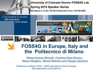
  • 1. GEO Laboratory Como Campus FOSS4G in Europe, Italy and the Politecnico di Milano Politecnico di Milano, DICA – GEO Laboratory at Como Campus http://geomatica.como.polimi.it/ Maria Antonia Brovelli, Carolina Arias Munoz, Marco Minghini, Monia Molinari and Giorgio Zamboni University of Colorado Denver FOSS4G Lab Spring 2015 Speaker Series Wed March 4, 12:00-1:00 PM US Mountain Time (7:00 PM GMT)
  • 2. 2 ✔ 1994: my first course in “Digital Cartography” (the first in Italy with GIS practice) at the Como Campus of Politecnico di Milano ✔ 1998: Birth of the Geomatics Lab at the Como Campus of Politecnico di Milano ✔ 1998: First thesis with GRASS ✔ 2000: at the Como Campus was organized the “First Meeting of Italian Users of GRASS” ✔ 2000: the First Number of Geomatics Workbooks with an Introduction to GRASS GIS by Markus Neteler was issued ✔ 2002: in Trento the first international “Open Source Free Software GIS - GRASS users conference” was organized: 140 attendees !!! http://www.ing.unitn.it/~grass/conferences/GRASS2002/home.html A bit of history …
  • 3. 3 ✔ 2004: FOSS4G 2004 - Free/Libre and Open Source Software for Geoinformatics in Bangkok A bit of history …
  • 4. 4 ✔ 2007: Birth of the Italian Association “GFOSS.it”. The Headquarter of the Association were at Como Campus of Politecnico di Milano. ✔ 2008: GFOSS became OSGeo Italian Chapter ✔ 2012: NASA World Wind Summer School A bit of history …
  • 5. 5 ✔ 2012: ZOO Open WPS platform Knowledge Partner ✔ 2013: GeoForAll initiative (Maria Member of the Advisory Board) ✔ 2013: 1°NASA World Wind Europa Challenge, Florence ✔ 2014: First FOSS4G Europe and 2° NASA World Wind Europa Challenge A bit of history …
  • 6. 6 ✔ Politecnico di Milano, Como Campus (Italy) – July 14-17, 2015 http://europe.foss4g.org/2015 Coming soon … @foss4ge
  • 7. 7 ✔ 6 scientific sessions (submission deadline: March 9, 2015) FOSS4G Europe 2015 conference ➔ General Track ➔ Academic Track ➔ Water Track ➔ Open Data Track ➔ Library Track ➔ Indoor/outdoor Positioning Track ✔ Complimentary events: ➔ Practical workshops ➔ Hacker Code Sprint ➔ NASA World Wind Europa Challenge ➔ 4 Mapping Parties ➔ GeoForAll Labs meeting http://europe.foss4g.org/2015
  • 8. 8 Desktop GIS GRASS commands for filtering LiDAR Data and for interpolating them to obtain DTM 2002 http://grasswiki.osgeo.org /wiki/LIDAR
  • 10. A GIS-BASED ACCURACY ASSESSMENT OF GLOBELAND30 ON ITALIAN AREA Maria Brovelli, Monia Molinari Politecnico di Milano, DICA - Hydroinformatics Lab at Como Campus
  • 11. 2 GlobeLand30 SOURCES: - Landsat TM and ETM+ - HJ-1 RESOLUTION: - 30 m FORMAT: - Raster REFERENCE SYSTEM: - WGS84 / UTM BASELINE YEARS: - 2000, 2010 OVERALL ACCURACY: - 80% (preliminary tests) GlobeLand30 (from www.globallandcover.com) New global land cover dataset produced by the National Geomatic Center of China and released in September 2014 as open data.
  • 12. 3 Reference Data SOURCES: - HR satellite images - Aerial orthophotos RESOLUTION: - 5 m FORMAT: - Vector (Shape File) REFERENCE SYSTEMS: - Roma40/Gauss Boaga - WGS 84/ UTM 32-33 N - ETRS89 /UTM 32-33 N LEGEND: - Corine Land Cover Friuli Venezia Giulia Land Cover 2000 - 1:25’000 Veneto Land Cover 2007/2009 - 1:10’000 Emilia Romagna Land Cover 2003 - 1:10’000 Land Cover 2008 - 1:10’000 Sardegna Land Cover 1997/2000 - 1:25’000 Land Cover 2003/2006 - 1:25’000 Liguria Land Cover 2000 - 1:10’000 Land Cover 2012 - 1:10’000 Lombardia Land Cover 1999/2000 - 1:10’000 Land Cover 2012 - 1:10’000 Autonomous Province of Bolzano Land Cover 2000 - 1:10’000 Autonomous Province of Trento Land Cover 2000 - 1:10’000 Abruzzo Land Cover 1997- 1:25’000
  • 13. 4 Accuracy Analysis A B C D A fAA fAB fAC fAD fA+ B fBA fBB fBC fBD fB+ C fCA fCB fCC fCD fC+ D fDA fDB fDC fDD fD+ f+A f+B f+C f+D n CLASSIFICATION f+i = marginal sum of column i (i = A, B, C, D) fi+ = marginal sum of row i (i = A, B, C, D) n = total number of cells CONFUSION MATRIX GROUND TRUTH (REFERENCE) The comparison can be performed through a pixel-by-pixel procedure that allows to obtain the confusion or error matrix.
  • 14. 𝑶𝑨 = 𝑓𝑖𝑖 𝑛 5 Accuracy Analysis A B C D A fAA fAB fAC fAD fA+ B fBA fBB fBC fBD fB+ C fCA fCB fCC fCD fC+ D fDA fDB fDC fDD fD+ f+A f+B f+C f+D n CLASSIFICATION CONFUSION MATRIX DERIVED STATISTICS (i = A, B, C, D) Overall accuracy: percentage of correctly classified pixels GROUND TRUTH (REFERENCE) The comparison can be performed through a pixel-by-pixel procedure that allows to obtain the confusion or error matrix.
  • 16. 7 GRASS GIS-Based procedure RASTERIZATION REGION v.to.rast • 5 m • 30 m Vector Raster 30 m Raster 5 m
  • 17. 8 GRASS GIS-Based procedure CODE CORINE LEGEND GLOBELAND30 LEGEND 1 Artificial surfaces Artificial cover 2 Agricultural areas Croplands 3 Forests and semi natural areas Forest, Grass, Shrub, Bare land, Permanent ice or snow 4 Wetlands Wetlands 5 Water bodies Water RASTERIZATION REGION RE-CLASSIFICATION r.reclass v.to.rast GL30 GL30 RE-CLASSIFICATION r.reclass • I scheme • II scheme • I scheme • II scheme • 5 m • 30 m
  • 18. 9 RASTERIZATION REGION RE-CLASSIFICATION GL30 GL30 RE-CLASSIFICATION CODE CORINE LEGEND GLOBELAND30 LEGEND 1 Artificial surfaces Artificial cover 2 Agricultural areas Croplands 31 Forests Forests 32 Scrub and/or herbaceous vegetation associations Grass, shrub 330 Open spaces with little or no vegetation Bare land 335 Glaciers and perpetual snow Permanent ice or snow 4 Wetlands Wetlands 5 Water bodies Water r.reclass r.reclassv.to.rast GRASS GIS-Based procedure • I scheme • II scheme • I scheme • II scheme • 5 m • 30 m
  • 19. 10 GL30 r.kappa COMPARISON RASTERIZATION REGION RE-CLASSIFICATION r.reclass v.to.rast GL30 GL30 RE-CLASSIFICATION r.reclass GRASS GIS-Based procedure • I scheme • II scheme • I scheme • II scheme • 5 m • 30 m LOMBARDIA LAND COVERGLOBELAND30
  • 21. 12 r.patch TILES MERGING REPROJECTION REGION RASTERIZATION v.to.rast v.proj GL30 GL30 REPROJECTION r.proj COMPARISON RASTER EDITING r.mapcalc r.mapcalc RASTER EDITING RE-CLASSIFICATION r.reclass RE-CLASSIFICATION r.reclassr.kappa COMPARISON RE-CLASSIFICATION r.reclassr.kappa GRASS GIS-Based procedure • 5 m • 30 m • I scheme • II scheme • I scheme • II scheme
  • 22. 13 Results & further research OVERALL ACCURACY VALUES RANGE (30 m DATASETS) • Develop a geo-platform to involve citizens in the improvement of the land cover classification quality • Complete the analysis on the remaining Italian regions I schema, buffer I schema, no buffer II schema, no buffer II schema, buffer OA[%] 100 90 80 70 60
  • 23. Web-based spatial information systems in the water domain Maria Antonia Brovelli, Carolina Arias Muñoz, Simone Corti Politecnico di Milano, DICA – Hydroinformatics Lab at Como Campus
  • 26. Hydrology (RFC Basins, NHDPlus Catchments) Hydraulics (National Flood Hazard Layer, Flood Inundation Map Libraries) Geospatial Temporal Time Series (WaterML2 and .csv) Multidimensional Arrays (WCS and netCDF) Slide source: David Maidment Water Spatial Data : water data framework
  • 27. WPS Data Time Series Geospatial Multidimensional arrays Observations Processed Data WMSWCS SOSWFS Web service = Any software which makes itself available over the internet and uses a standard XML (eXtensible Markup Language) messaging system *Hydrological Models Geospatial Web Services for Water Hydraulics
  • 28. FOSS Software for a Water SDI
  • 29. Server Side Client Side ….. ….. FOSS Software for a Water SDI
  • 30. Ongoing Projects POLIRISPOSTA Objective To build a model, tools and advanced technology solutions for the collection, mapping and evaluation of post-flood damage data, that will be useful for all organizations involved in risk management, specially the Civil Protection. Workgroup Departments involved: DASTU, DICA, DEIB Coordinator: Francesco Ballio Risk Assessment: Francesco Ballio, Scira Menoni, Daniela Molinari, Funda Atun, Guido Minucci GIS: Maria Brovelli, Carolina Arias ICT: Mirjana Mazuran, Danilo Ardagna Begin – End Date September 2013 – October 2015 Main expected results  Methodology and operative steps for the reconstruction of the flood event aftermath ( ex- post)  Standard procedure to collect flood damage data on the field  Web GIS for the visualization and analysis of geospatial data ( for experts and non experts) stRumentI per la protezione civile a Supporto delle POpolazioni nel poST Alluvione. (Tools for Civil Protection to support the community affected by floods on the post event)
  • 32.
  • 33.
  • 34. Ongoing Projects IMMR Geoportal Objective The IMRR project aims at developing and promoting strategies for the sustainable management of the Red-Thai Binh Rivers System in Vietnam through coordinated decision-making and negotiation, supported by modelling and optimization tools and through capacity building of local authorities in the water sector. The geoportal allows to visualize, analyse and compare different planning alternatives for the management of the Red River water system in Vietnam, as a result of the Multi Criteria Decision Analysis methodology applied in the IMRR project Workgroup Departments involved: DICA, DEIB WebGIS Component: Carolina Arias, Maria Brovelli, Simone Corti Domain experts: Marco Micotti, Rodolfo Soncini-Sessa, and Enrico Weber Begin – End Date December 2013 – January 2015 Main expected results  Methodology and operative steps for the reconstruction of the flood event aftermath ( ex- post)  Standard procedure to collect flood damage data on the field  Web GIS for the visualization and analysis of geospatial data ( for experts and non experts) A FOSS based webGIS for supporting Integrated and sustainable water Management of Red-Thai Binh Rivers System in changing climate - IMRR -
  • 38. Geomatics Laboratory Como Campus Experiences in VGI and citizen science projects Politecnico di Milano, DICA – Geomatics Laboratory at Como Campus Maria Antonia Brovelli, Marco Minghini, Giorgio Zamboni
  • 39. 2 ✔ Set of practices in which citizens participate in data collection, analysis and dissemination of a scientific project ✔ Active or passive ✔ Explicit or implicit ✔ Classification (Haklay 2013) Citizen science ✗ volunteered computing: citizens download data, run analyses on their own computers and send back data to the server ✗ volunteered thinking: citizens perform classification works ✗ participatory sensing: applications centered on mobile phones capabilities ➔ 'classic' citizen science: amateurs engaged in traditional scientific activities ➔ community science: measurements and analysis carried out by amateurs in order to set action plans to deal with environmental problems ➔ citizen cyberscience: use of computers, GPS receivers and mobile phones GEO Laboratory, Politecnico di Milano – Como Campus
  • 40. 3 ✔ Set of practices in which citizens participate in data collection, analysis and dissemination of a scientific project ✔ Active or passive ✔ Explicit or implicit ✔ Classification (Haklay 2013) Citizen science – Our experience ➔ 'classic' citizen science: amateurs engaged in traditional scientific activities ➔ community science: measurements and analysis carried out by amateurs in order to set action plans to deal with environmental problems ➔ citizen cyberscience: use of computers, GPS receivers and mobile phones ✗ volunteered computing: citizens download data, run analyses on their own computers and send back data to the server ✗ volunteered thinking: citizens perform classification works ✗ participatory sensing: applications centered on mobile phones capabilities GEO Laboratory, Politecnico di Milano – Como Campus
  • 41. 4 ➔ field-data collection from mobile devices ➔ data access and interaction based on user privileges ➔ data Web publication and sharing ➔ data access through multi-dimensional (2D and 3D) Web interfaces ➔ data participative enrichment ✔ To build an architecture for participatory sensing applications enabling: Our purpose ✔ To use FOSS4G (Free and Open Source Software for Geospatial) GEO Laboratory, Politecnico di Milano – Como Campus
  • 42. 5 Participatory sensing FOSS architecture GEO Laboratory, Politecnico di Milano – Como Campus
  • 43. 6 Report of road pavement damages ➔ classification of the type of damage and its severity degree ➔ open to everyone, advertised through the media (TV and newspapers) ✔ Report of road pavement damages, winter 2012-13 GEO Laboratory, Politecnico di Milano – Como Campus
  • 44. 7 Report of road pavement damages GEO Laboratory, Politecnico di Milano – Como Campus
  • 45. 8 Report of road pavement damages GEO Laboratory, Politecnico di Milano – Como Campus
  • 46. 9 Report of road pavement damages GEO Laboratory, Politecnico di Milano – Como Campus
  • 47. 10 Report of architectural barriers ➔ physical obstacles for the mobility of people (stairs, ramps, pathways) ➔ verification of the compliance with the current Italian legislation ➔ performed by students within a collaboration action with a local high school ✔ Report of architectural barriers, fall 2013 GEO Laboratory, Politecnico di Milano – Como Campus
  • 48. 11 Report of architectural barriers GEO Laboratory, Politecnico di Milano – Como Campus
  • 49. 12 Mapping street furniture elements ➔ benches, litter bins, waste bells, fountains ➔ performed by students within a collaboration action with a local high school ✔ Report of street furniture elements, spring 2014 GEO Laboratory, Politecnico di Milano – Como Campus
  • 50. 13 Mapping elements along cultural paths ✔ Map parties within INTERREG project “The paths of Via Regina”, ongoing SVIZZERA GEO Laboratory, Politecnico di Milano – Como Campus
  • 51. 14 Mapping elements along cultural paths ➔ user report of points of interest related to history, culture, tourism and other services along the paths connected to the ancient Via Regina ➔ one-day events (jointly organized with a cultural association of hikers) which target local communities and are advertised ad hoc ✔ Map parties within INTERREG project “The paths of Via Regina”, ongoing GEO Laboratory, Politecnico di Milano – Como Campus
  • 52. 15 Mapping elements along cultural paths GEO Laboratory, Politecnico di Milano – Como Campus
  • 53. 16 Mapping elements along cultural paths GEO Laboratory, Politecnico di Milano – Como Campus
  • 54. 17 Comparison OSM/authoritative road datasets GEO Laboratory, Politecnico di Milano – Como Campus ➔ evaluation of spatial accuracy and completeness ➔ user-driven procedure (e.g. by entering parameters value) ✔ GRASS-based automated procedure to compare road network datasets from OpenStreetMap (OSM) and authoritative data sources:
  • 55. GEO Laboratory Como Campus Multidimensional web mapping NASA World Wind examples Politecnico di Milano, DICA – GEO Laboratory at Como Campus Maria Antonia Brovelli and Giorgio Zamboni
  • 56. 2 Multi-Dimensional Map Clients ✔ Currently the most of the Internet viewers are bi- dimensional (horizontal). ✔ Virtual globe: a 3D representation of the Earth Advantages: – more immersive effects – intuitive interactions – ability to freely move around in the virtual environment by changing the viewing angle and location – capability of representing many different views on the surface of the Earth
  • 57. 3 NASA World Wind SDK ✔ SDK (Software Development Kit) ✔ Virtual Globe ✔ NASA Open Source Agreement License ✔ Multi-Platform (Java: “Write Once, Run AnyWhere”) ✔ JOGL (Java OpenGL 3D - Engine) ✔ V1.5 (JOGL 1), v2.0.0 (JOGL2), and nightly builds ✔ Web: http://goworldwind.org