I.S.I.S.S. della Piana di Lucca - La risorsa acqua tra passato, presente e futuro 1
•Télécharger en tant que PPTX, PDF•
1 j'aime•819 vues

Lavoro delle 8 classi del Liceo Scientifico E. Majorana partecipanti al progetto.

Recommandé
Recommandé
Contenu connexe
En vedette
Similaire à I.S.I.S.S. della Piana di Lucca - La risorsa acqua tra passato, presente e futuro 1
Similaire à I.S.I.S.S. della Piana di Lucca - La risorsa acqua tra passato, presente e futuro 1 (20)
Plus de Consorzio LaMMA - Corso UdC
Plus de Consorzio LaMMA - Corso UdC (20)
Dernier
Dernier (20)
I.S.I.S.S. della Piana di Lucca - La risorsa acqua tra passato, presente e futuro 1
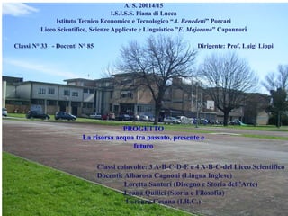
- 1. A. S. 20014/15 I.S.I.S.S. Piana di Lucca Istituto Tecnico Economico e Tecnologico “A. Benedetti” Porcari Liceo Scientifico, Scienze Applicate e Linguistico ”E. Majorana” Capannori Classi N° 33 - Docenti N° 85 Dirigente: Prof. Luigi Lippi Classi coinvolte: 3 A-B-C-D-E e 4 A-B-C-del Liceo Scientifico Docenti: Albarosa Cagnoni (Lingua Inglese) Loretta Santori (Disegno e Storia dell’Arte) Leana Quilici (Storia e Filosofia) Lorenzo Cesana (I.R.C.) PROGETTO La risorsa acqua tra passato, presente e futuro
- 2. WATER ON THE EARTH SALTY WATER ICE WATER "GOOD WATER" Our planet is called Earth, but in fact it is a planet made of water, covering as much as 71% of the globe. 97% of this water is salty, and the remaining 3% is divided between a 2% of ice water and only a small part is available to man, to drink, to produce energy, to survive and for agriculture.
- 3. Nowaday a responsible use that avoids waste is increasingly important, whereas the lifestyle of most developed countries requires more and more water at a rate that seems to be increasingly unattainable. Fresh water is a precious resource, and we all need to do as much as possible to preserve it. Here we have learned about why water should be saved, how you can do so at home and at work, and the potential that reclaimed water has to improve the condition of our environment.
- 4. Why save water? Learning how to save water is not difficult, and it can begin with teaching good habits to children. All you have to do is think about how easy it is to waste water in everyday activities; Remember, children learn fast and change quickly as they grow and develop. The risks faced by infants and toddlers are often very different from those of school-age children and teens. But no matter how old your children are: here are some tips to prevent wasting water.
- 7. 2. The damp areas and the hydrological resources of our territory 1. Hydrogeological history of the municipality of Capannori and of the Plain of Lucca 4. The use of drinking water, yesterday and today.5. The use of underground and superficial waters by the paper industry. 6 . Identification of “good habits” that citizens and public administrations can apply to improve the use of water. 3. The hydrological risk and the activities of the “Consorzio 1 Toscana Nord” water
- 8. With the collaboration of - Dott.ssaa Mara Dell’Aringa, Geologo - Il Consorzio di Bonifica del Bientina - l’Associazione di guide ambientaliste“Tuffetto” - Le classi 3A-B-C-D-E del Liceo Scientifico “E. Majorana” - La prof.ssa Albarosa Cagnoni, - La prof.ssa Loretta Santori Bibliografia - Autorità di Bacino, QUADRO GENERALE DELLA SUBSIDENZA NELLA PIANA DI LUCCA - Autorità di Bacino, Distretto del Fiume Serchio, DESCRIZIONE DEL DISTRETTO IDROGRAFICO DEL FIUME SERCHIO, 25 settembre 2009 D - Bottari P. All’ombra della grande ciminiera – La Cucirini Cantoni Coats e la crescita economico sociale lucchese, Maria Pacini Fazzi editore - Brugioni M., Menduni G., Montini G. Autorità di Bacino del fiume Arno, Analisi dei fenomeni di subsidenza nel bacino del fiume Arno tramite l’utilizzo della tecnica di interferometria satellitare PSI in SARTM - Caciagli G. Il lagodi Bientina. Vicende storiche e idrogeologiche, Bandecchi e Vivaldi 1984. - Cardella R. Un’azienda, il suo territorio, il suo sviluppo – 1946-1996 – Cinquant’anni della “Cartiera Modesto Cardella, Maria Pacini Fazzi editore. - DichiarazioneAmbientale EMAS-Distretto Cartario di Capannori, Emissione 2014 (Dati 2012) - Morosi A. Sereni U. La città industriosa – Lucca alla fine dell’Ottocento - Ordine degli Ingegneri, Prov. Di Foggia, L’uso della modellistica idraulica nella difesa del suolo. Ing. Tricoli D. 21/11/2006 - Provincia di Lucca Convegno Ambiente , 29 marzo 2001, Riduzione del consumo idrico, attraverso l’applicazione del documento BREF per l’industria della carta e della asta carta, in cartiere campione– Fattibilità, misure ed implicazioni locali. - University of Pisa, Earth Sciences Department, M. Dell’Aringa M.-Giannecchini R. Puccinelli A. Geologist, external collaborator, Small sinkhole-like features in alluvial plains: the example of Paganico
- 9. Siti consultati: www.isprambiente.gov.it//Cartario/CartaeAmbiente.pdf www.isprambiente.gov.it//sinkhole.pdf. www.isprambiente.gov.it/files/pubblicazioni/atti/sessione4-sinkhole.www.museodellacarta.org www.comune.porcari.it www.comune.capannori.lu.it www.capannorieventi.it www.iltuffetto.it www.lifepioneer.info/riservato/doc_pubblico/Dichiarazione%20Ambientale%20di%20Distretto%202014. Autorità di Bacino del fiume Serchiowww.autorita.bacinoserchio.it – Pianodigestione Cartografie Bacino pilota fiume Serchio Carte e strati informativi relativi al rischio idraulico Piano di Assetto Idrogeologico 1° Aggiornamento approvato L'impatto ambientale dalle attività cartarie in Provincia di Lucca — ARPAT - Agenzia regionale per la protezioneambientale della Toscana www.arpat.toscana.it www.nat-hazards-earth-syst-sci.net/14/41/2014/ www.lucartgroup.com www.dssmith.com www.cartierapieretti.it www.molinomenicone.it Trattamento Acque Reflue – Lenntech www.lenntech.it www.zoneumidetoscane.it www.scapackaging.it www.luccavirtuale.it www.edison.it Provincia di Lucca - Ambientewww.provincia.lucca.it www.arpat.toscana.it › Notizie › ARPATnews › www.clubdistretti.it
- 10. Lower Pleistocene from 1.700.000 To 700.000 Years ago The hydrogeological history of the Territory
- 11. Late 120.000/10.000 years ago An uplifting movement progressively gave origin to the ridges of the Cerbaie, a series of hills which divide the original big lake in two smaller ones: Lucca- Montecarlo-Vinci and Firenze-Prato- Pistoia.
- 12. Water withdraws and two lakes form: Lake Bientina and Lake Fucecchio
- 13. N S W E Bientina Montuolo In the Middle age due to the formation of the flatlands the river Auser (Serchio) divides in two branches in San Pietro a Vico. Lunata Cartina della piana di Lucca (Natali, 1997) The Auser ( the bigger ): Marlia, Lunata, Antraccoli, Pieve San Paolo where it went through a new ramification. The Auserculus (small Auser) touched Lucca from the North and from Borgo Giannotti it reached Montuolo, than it flowed into the Arno near Pisa. A branch, went to the sout- west of Lucca to reach and flow into the Auserculus near Montuolo. Another branch continued its course to the east towards Bientina and flowed (when it could) into the river Arno near Calcinaia. Lucca Pisa
- 14. In 1905 some expansion cases of the Bottaccio di Massa Pisana were made, into which even today the southern streams of the city flow. Can.Ozzeri An important figure for the regimentation of waters was the Bishop of Lucca Frediano (561- 589) who, because of the continuous floods, had the waters of the main river deviated into the main Northern branch (Auserculus). The river was also redirected to Ripafratta, to the west of the «Monti Pisani», and made to flow directly into the sea close to Pisa instead of flowing into the river Arno. Floods: an ancient problem In 1800 the Ozzeri canal was built as an irrigating and reclaiming canal of the lower Plain of Lucca (Nottolini) merging into the River Serchio at Cerasomma. Carta da acque e strade, 1563 n. 10
- 15. R e c l a i m i n g in the river-bed of the ancient lake Bientina The lake was drained in 1859 «using the barrel»: this important work by Alessandro Manetti consisted in digging an outflowing stream with a very clever underground gallery system, which is still under the river Arno today.
- 16. In 1852 “The barrel” is built: it is a canal which gathers the waters of the Basin which flow under the river Arno and continue to Livorno
- 17. The water ducts The water shed “The Barrel” The Barrel
- 18. The terrace marks the bottom of the river Arno; the roof of the water ducts is protected by a waterproof layer of clay which stops water from the river Arno to penetrate. The two water ducts
- 19. Doors that close at 120 degrees because of the hydraulic pressure of the main water stream. Automatism invented by Leonardo da Vinci. Vincian doors and cataracts Vincian Doors: Invented by Leonardo Da Vinci to prevent water from flowing back in case of flooding. In this case they close with opposing pressure. Fosso Zero, Padule Bientina
- 20. The damp areas and the hydrological resources of the territory
- 21. Da “Manon Lescaut” Intermezzo del III atto Water has fascinated many artists. The composer Giacomo Puccini inspired by the waters of Lake Massaciuccoli, composed some of his best and most famous operas
- 22. Environmental resources of the Plain of Lucca Forest areas in the North and South of the Plain, on the Mountains of Pisa and on the Pizzorne The river Serchio Hills cultivated with grape vines and olive trees. Abundant underground layer water and surface water The network of tributaries coming from the hills and flow down from the Pizzorne mountain into the Bientina marshlands. Natural Oasis of Bottaccio
- 23. The Plain The marshlands The river The Bottaccio
- 24. What we have studied Fountains of the aqueduct The Nottolini aqueduct The Bottaccio Oasis The river Serchio and the public channel The river bed of Lake Bientina Public fountains in Capannori Ozzeri
- 25. IN RED THE PUBLIC CHANNEL The Public conduct built in 1380 has always been important. Today it still takes its water from the River San Gemignano di Moriano and after a course of 13 Km. it crosses Lucca from the Norh West to the South-East. It generates the irrigation network of the Plain whose main canals, nearly all, . merge into the Rogio Canal which also collects waters from the area of Bientina. The public conduct and some of its canals flow into the Ozzeri
- 26. The river Serchio It has an annual flow rate of (46 m³/s); the rate is maintained high due to the rainfalls of the mountain areas it goes through and also because of the permeability of the basin. The hydroelectric plant covers about 12% of the local annual needs. It is responsible of hydrological disasters such as the 1812 and 2012 floods. The richest annual period is Autumn, in particular the month of November.
- 27. Lake Bientina 27 Lake Bientana was the vastest of the Tuscan lakes and was also known to the inhabitants of Lucca with the name Sesto. It had as main tributary the Auser and as outflowing streams the Cirecchio canal and the Serezza The area is believed to have always been swampy as it is lower than the the river The lake had an area of permanent water called «clear waters» and a swamp area which dried in the Summer and even today continues to be swampy.
- 28. Aerial view of former Lake Bientina after abundant rainfalls
- 29. Lakes at “Isola Bassa” of Lammari The area offers to the citizens new forms of aggregation thanks to sports and entertaining facilities which are didactically useful and help people become environmentally aware by coming in contact with recycled material while relaxing. Today the area is threatened by the construction of an intense traffic road system from the North to the South which runs close to these lakes.
- 30. In Lucca Expansion frames are often called “Barrel” and the Bottaccio Wood is in fact situated inside the expansion frame of the Stream Visona of Castelvecchio di Compito.
- 31. 31 Natural Oasis of Bottaccio The municipality of Capannori, with city council By-laws ·N° 82 18.07.96 has instituted The protected Natural Area of local interest (ANPIL) “The Bottaccio” which extends for 16.6 hectares.
- 32. The Italian WWF with the acquisition of government concessions, has been taking care of the Bottaccio since 1991 and since then has inserted it in the National system of the Italian WWF Oasis. The Municipality of Bientina (Prov. Pisa) With by-law n.50/14.05.98 added to ANPLIN «The Tanali Wood» on the Northern side so as to unite it with Bottaccio. In this way the two adjacent Protected areas are inside the Marshlands of Bientina.
- 33. 33 The waters which flow from the Mountains of Pisa, without polluted elements, closed in by banks, remain in the Bottaccio and so create watery and semi-watery environments in the wood . The Bottaccio completely relies on the expansion of the Stream, Visona of Castelvecchio, which ends here. The Environment
- 34. The hydrological risk and the problems and activities of the “Consorzio 1 Toscana Nord”
- 35. Limited availability for water: Meteorological phenomena Irregular distribution Pollution increase Meteorological changes Demographic growth Changes in habits, customs and uses Advent of different needs Economical expansion Excessive pumping and use Subsidence shrinkingl-swelling sinkholes Floods Environmental problems of the Territory , particularly of the Eastern part of the Plain
- 36. Subsidence This phenomenon is generally caused by geological features, but in the last decade it has been locally increased by the work of man. Subsidence consists in a slow sinking process of a layer of soil, this can involve areas of different sizes. The phenomenon affects the locality of Pollino (Porcari and of the Cerbaie (Bientina. The sinking of the water layer is progressive and gradual in time but irreversible because the annual rain water is not enough to compensate the water loss. In this way the alluvial areas which before were reached by the water layer during the year, always remain dry. They become compacted and make the ground drop irreversibly, with damages to buildings that are no longer adequate to the new context.
- 37. Evolution of the sinking of the land in the Padule of Bientina (Lucca) in the years 1992-2007. Taken from the PS data and elaborated according to the APSA technique Autorità di Bacino del fiume Arno Pollino (Porcari) e Cerbaie (Bientina
- 38. The shrinkingl-swelling which takes place between summer and autumn has natural causes, but sometimes it can be increased if water is pumped out. This phenomenon is typical of clays (vertiche) comes out when the water layer seasonally sways internally, the layers of clay get wet and increase in volume like “sponges”. In summer the opposite takes place, so the clays shrink. This shrinking-swelling of the clays follows a seasonal swaying of the water layer. The ground goes through reversible seasonal sinkings which can damage inadequate building. These damages expand and retreat in a cyclic way in the course of the seasons. shrinking-swelling Variations in the percentage of water can provoke swelling or shrinking of the ground. The houses affected by this instability often present flaws in the foundations or design.
- 39. The shrinking-swelling has been taking place in the fractions of Paganico, Pieve San Paolo, Santa Margherita (Capannori ) and Rughi (Porcari) since the ‘80s. The existence of a water table and/or of underground circulation of water. The shrinking-swelling is different form subsidence because the permanent layer does not undergo water loss, so even if it undergoes pumping, it is able to increase seasonally , sometimes even to ground level.
- 40. Sinkholes The sinkholes originate in complex hydrogeological contexts of the territory and come about for various reasons: earthquake, draught-rain, the pumping of great quantities of water and the flooding of canals. The causes can be a lot and complementary. They are holes in the ground which form because of drainage phenomena between layers that are one on top of the other and superficial layers and irrigating canals. It is a matter of water streams mixed between elements with different water levels, The waters, by moving, erode the ground following an evolutionary sequence which ends up in a hole. The holes concern the fraction of Paganico (Capannori). M. Dell’Aringa et al.: Small sinkhole-like features in alluvial plains
- 41. The digging of wells for the municipal acqueduct MORE MAIN CAUSES An absolute decrease in rainfall A particular structure of the ground Birth of one of the vastest national industrial groups for the Production of Paper A lot of private wells Drought and rainfalls determine a lack of balance between the water table and the restrained one. Demographic expansion From recent studies it has emerged that the paper industries should take care of the sinkholes in Paganico so that: • The depression cones don’t reach the residential area. • The cones, deformed by the deep flow of the water layer are deviated to the south. • The paper factories should be set in geological areas different from that of Paganico. (areas without loam sands where these holes originate) . Because of this around the paper factories there can be local sinking or shrinking-swelling but not holes.
- 42. Ground cavities EFFECTS Strong lowering of the piezometric surface Damages to buildings Disapperance of numerous springs Devaluation of estates and of building areas An increase in the building costs in ugrading and re-utilisation of old buildings Migration to other parts of the territory Fear among the residents
- 43. 1. The firm Acque Spa will have to decrease by 15% the drainage from the aqueduct of Paganico 2. It is forbidden to take local water either from the aqueduct or from superficial water or pumped from the underground water tables and transport it outside the municipal territory. 3. The inhabitants are invited to adopt useful measures to rationalise water, by applying specific reductions on taps so as to use less water in everyday household activities. - 15%
- 44. 5. Within 120 days the productive activity will have to be decreased by 30%. 4. The filling of private swimming pools, fountains and pools with water from the aqueduct or with water pumped directly from the water table are prohibited. 6. The Provincial administration is asked to suspend permits to pump water from underground on the whole territory, with the exception of those for domestic use and to check on the permits already issued The Provincial administration and the firm Consorzio di Bonifica Auser-Bientina are asked to restore superficial water circulation in canals and water ways so as to restore the underground water table. - 30%
- 45. Interventions on the waterways with the function of: Prevention activites Safekeeping and maintenance of the public works of reclaiming Supervision of private activities in the area. Hydraulic security (water pumps, reclaiming canals), the management of irrigation waters. Participation in town planning Safeguard of the agricultural and environmental assets The Consorzio di Bonifica Auser–Bientina now Consorzio 1 Tuscany North
- 46. Water ways of the hydrogrphic Basin under the jurisdiction of the ex Consorzio di Bonifica
- 47. And extra-ordinary Some of the ordinary maintenance activities
- 48. Wooden or cement harnesses are positioned across the water bed to retain the coarse material transported by water (trunks, wood and rocks) Torrente Picigiana, Massa Carrara Monitoring the water ways. Maintenance of ditches and waterways Rio Sanetta
- 49. Deviation of the river: Fossa Nuova in the Padule (marshlands) of Porcari Expansion frame in case of floods
- 50. Very expensive for the flow of the Rio The bridge on Rio Casale Strongly opposed and contested by residents Dangerous for the lack of visibility An impossible architectural barrier for those with special walkig needs, because of the steep slope and the stairs which are the only walking access why
- 51. Some of the activities of the Consorsio not approved by the residents and by the environmental associations: Cementing the stream beds which increases the water flow in case of floods-. The indiscriminate cutting of all the trees on the river banks which increases the risk of landslide The indiscriminate cutting of the vegetation on the banks, in particular of swamp grasses , which help to maintain an environmental balance. Omitting to gather the mowed grass on the road sides thus the blockage of the irrigation ditches which during the rainy seasons overflow. Omitting to reactivate and take care of water and the environmental and the insufficient maintenance of the minor water network so as to guarantee the original output. The lack of control on the maintenance of the minor ditches which makes irrigation of the land impossible with superficial water. The lack of sensibility for all that is tradition and culture of the territory (people, cultivations, actions) which would contribute to a better environmental balance.
- 52. In the Northern part of Tuscany the Reclaiming Consorzi along with those of Versilia Massaciuccoli and Auser Bientina were fused with the new authority called «Toscana Nord 1». New reclaiming projects With the Consorzio Toscana Nord, the agricultural firms became the protagonists of the prevention activities due to hydraulic risks. The guardian farmers can make their experience, competence and means available for everyone, in particular they can be a daily and constant presence in many areas of the district. With the l.r. 79/2012 the Regional Government of Tuscany has started a reform for the field of reclamation and defence of ground, it authorised the creation of 6 ReclamationConsorzi unite structures and competences of the existing 13 Consorzi and of the 13 Municipal unions.
- 53. Acque SpA Is the organ that controls the integrated public water service for the citizens and the economic activities The duties of this organ are to guarantee a qualitative standard of the aqueduct service and to extend in all the serviced area the drainage and purification system which safeguards the environment and the citizens. It controls the quality of the waters along the whole hydric cycle: aqueduct, drainage and purification.
- 54. The use of drinking water yesterday and today. The Nottolini aqueduct and «The via dell’acqua»
- 55. In 1822, Maria Luisa di Borbone, Duchess of Lucca, for hygienical motivations, approved the construction of an aqueduct and appointed a local engeneer, Lorenzo Nottolini, to build it.
- 56. Between 1822 and 1832 the engineer Lorenzo Nottolini constructed the aqueduct to bring drinking and luxury water from the springs in Guamo to the city of Lucca. Luxury water was so called because it had different uses from drinking water.
- 57. Route of the aqueduct from Guamo to Lucca
- 58. The ducts developed for 3.2 km in a structure 12 meters high sustained by buttresses and by 460 brick arches which hold, on the top, two water canals
- 59. According to Nottolini’s project the waters collected from about 18 springs of the «Serra Vespaiata» of Rio San Quirico and Rio della Valle were routed to the Tempietto di Guamo, a circular building in neoclassical Doric style. From there the water was cleaned and made clear by having it flow through rocks and gravel and by having it go through further holes and obstacles so that all the residual impurities would deposit.
- 60. Water system from the filters to the arches Buildings where the waters were checked Vespaiata Dike: filter made of gravel and coal to make the water drinkable Spring
- 61. The two water ducts Beginning of the arches: The Temple of Guamo End of the arches: the Temple of San Concordio on the outskirts of Lucca.
- 62. The interred duct by the walls of Lucca The inside of the tunnel The water from Guamo reaches Piazza Antelminelli by the Cathedral of Lucca
- 63. Nottolini built two ducts: one, for spring waters that went to the public and private fountains of Lucca. The second that went to fountains destined to other uses. Piazza Antelminelli Nottolini’s will was not to waste any drinking water P.za della Misericordia Via dei Fossi The water from Guamo reaches Piazza Antelminelli In front of the Cathedral of Lucca
- 64. Today many Important aqueducts for drinking water draw from the Plain: that of Paganini and that of Lucca, the subsidiary ones of Pisa and Livorno, that of Capannori and the so called “Pollino” which serves Pescia and Montecatini but also numerous other municipalities of the Valdinievole and that of the Cerbaie for the area of Bientina-Pontedera.
- 65. Water isa humanright The link between water and legality is very strong and very little is known among the public and especially young people. The care of the environment depends directly on the behavior and actions of the individual and the political choices of the community. Citizens are first called to the legality of water use by observing the rules that determine the proper use, protection from pollution and misuses. Water and Legality The consequences due to the abandoning of the rules and regulation of superficial water
- 66. Referendum 2011 In June 2011, around 27 millions of Italians voted in a referendum with 95% of the voters agreeing to the proposal they voted to have water as a common good denying the possibility of privatization.
- 67. Chiattino-Guamo La Pollina - Ruota Thanks to the project “The flow of good water”, financed by the Municipality of Capannori and the Regional Government Safeguarded “a common wealth” water Improved the best spring waters of our territory by making them accessible to residents and tourists. Used new technologies to disinfect which do not alter the aspects of taste and quality of water we have:
- 68. thanks to water, we have established, new social relationships among citizens and communities on the territory, thus continuing with the best cultural traditions of our people. Ravano - Castelvecchio di Compito S. Pierino o S. Pietro – Sant’Andrea di Compito Architectural solutions environmentally friendly and able to improve our territory have been used on the fountains and the water locations,
- 69. Capo di Vico - Sant'Andrea di Compito Polla del cane- Camigliano Al Marzocco - Matraia Perfido - San Colombano The project “The flow of good water” involves 15 fountains on the territory of Capannori. The fountains have been upgraded and furnished with an ultraviolet disinfection system and the quality of water is also guaranteed by periodical controls.
- 70. To save on waste, leaving less plastic water bottles around The “flow” winds through 14 fractions and represents an opportunity: To reflect on water as a precious good and inalienable right,, To admire the vast richness of history and architecture of our municipality Finetti - Gragnano
- 71. 5. How the paper industries use layer and superficial water and the problems that derive from this.
- 72. Water promotes and determines the economy of our territory. • You could count at least 40, and they were mills, textile and woollen industries. • The most important were: the Textile industry “Oliva” at Piaggione the hessian jute factory “Balestrieri” in Ponte a Moriano, the thread factory Niemack (later Cucirini Cantoni &Coats) at Acquacalda. • In the 1910s the first paper mills and factories were set up. • Jutificio «Balestrieri» Cucirini Cantoni Coats The bond between water and the industries of Lucca has always been decisive. In the 1920s, along this course, there were a lot of factories quite important for the economy of the city.
- 73. Today a lot of the ancient mills have become museums ( The Menicone Mill), some big industries have closed (the hessian jute factory “Balestriere and the thread factory Cucirini Cantoni &Coats) others have been bought by international firms (Italcarta), very few are still owned by the original families of Lucca (Pasquini of the Paper factory Lucart and Stefani-Lazzereschi for Sofidel) Molino Menconi Lucart Cardella
- 74. Water can be considered one of the main resources used in the paper process
- 76. Environmental impact of the paper factories Use of water Water sewers Use of Energy (electrical, fuels) Visual impact Emergencies (fires, loss of liquids) Use of chemical products Smells Waste Contamination and use of soil Emissions in the atmosphere Noise
- 77. How the water layer of the Plain of Lucca has dropped in time
- 78. Measures adopted by the paper industry in relation to pumping water from the underground water tables
- 79. The firms have now started to study and test how to manage in an efficient way this resource, through the recycling of water in the phases of the working process so as to limit the pumping of water from the wells. Water use in the paper industry Today the province of Lucca remains the seat of one of the most important Italian paper groups for the production of packaging and tissue paper. In addition to the paper factories there are also numerous factories for the transformation of paper into finished products. This aspect, as we have already seen in the previous section, is particularly important for the Plain of Lucca, which presents a drop in the layer level. The use of water in great quantities has caused serious environmental damages which are now unsustainable.
- 80. To reduce further the pumping from the water layer an industrial aqueduct called “tubone” was built, it takes water from the river Serchio through a pre-existing canal (fossa Nuova) that originates in Ponte a Moriano and reaches Camigliano. Afterwards, with an interred pipe, from Camigliano it should take the water of the industrial area of Capannori Porcari to the purifying plant Casa del Lupo. Acquedotto delle Cerbaie Pozzi di Paganico Fossa Nuova TUBONE The present system of the new canal “tubone” which is used to deviate the water of the river Serchio.
- 81. The recycling of water in the paper industry Purification plant Water which flows back from the productive process Rain water Water which flows back from sewers Chemical-physical treatment Anaerobic treatment Biological treatment To the Purification plant ACQUAPUR Re-used for the productive process The biological/ anaerobic phase produces biogas which is sent to the section of energetic re cycling for the production of electrical Energy.
- 83. 5,9 5,6 5,3 4,2 4,4 Tissue Packaging Results reached in “the environmental declaration EMAS – the Paper district of Capannori” is praised as excellent , it reports that : “the performances reached in the use of water make the paper factories of the Plain of Lucca an international excellence. Results like those indicated by the graph are hardly ever reached elsewhere.” This has also been confirmed by the average values reported in Bref (Best Reference Document of the European Commission) which reports the best techniques available in the field of application according to the IPPC indications – which can be seen in this graph.
- 84. … some problems. Using less water means: A biological increase A higher concentration of pollutants In addition the unsuccessful cleansing system, and the irregular water supply have not permitted a definite stop in the use of layer water. The output of strong smells Purifying plant - Casa del Lupo The good procedures that citizens and public administrations can adopt for a better use of water
- 85. Laws about water in time Code of health laws (RD 27/07/1934) DPR 03/07/1982 n.515 DPR 3/07/1982 n.515 DPR 24/05/1988 n.236 Innovations during 60 years Chlorination
- 86. o It gave us a first definition of “drinking water”; o But this definition was very questionable because it evaluated characteristics in a very coarse way
- 87. Dirty water in the aqueducts We have to find a way to reduce the pollution in the water
- 88. Surface waters were divided into three categories A1 simple physics treatment and disinfection A2 normal physics and chemical treatment, disinfection and refining A3 pushed physics and chemical treatment, disinfection and refining
- 90. Saving water at home means huge improvements The most obvious place to start saving water is at home, here we have some tips that will allow you to conserve fresh water by only changing your habits slightly
- 91. In the kitchen… 1. Don't rinse your hands, clothes or vegetables under a running tap, do so in a bowl or sink. 2. Only run washing machines or dishwashers with a full load, and cut down the rinse cycle if possible. 3. Water plants with the same water used for washing food.
- 92. In the bathroom… 1. Turn off the tap while brushing teeth, soaping hands or shaving; 2. Take short showers instead of baths; 3. If you do have a bath, use the water left over to wash the floor; 4. Use water saving devices, e.g. water efficient showerhead, water tap, dual flush cistern for the toilet, and pay attention to water efficiency labels; 5. Avoid flushing unnecessarily.
- 93. And, at least… 1. Fix dripping taps and water mains quickly; 2. Teach children that water is not for games; 3. Control the flow from the tap, do not always turn it to the full. 4. Wash cars with a bucket of water and the towel instead of a hose.
- 94. A well planned urban and industrial growth Measures to apply as prevention for a correct management of the water resources are: Use materials and architectural solutions environmentally friendly able to improve our territory, the fountains and the water locations Upgrade, respecting the environment, industrial areas and buildings.
- 95. Collecting rain water The use of new technologies to disinfect and not alter the aspects of taste and quality of water Thus avoiding to rely excessively on drainage from the water tables and a strict organisation of the pumping activities Draining water from lakes and rivers
- 96. Thanks to water, we have established, new social relationships among citizens and communities on the territory. The separation of gray and black waters and the decentralisation of the treatment techniques for local re-use Promote and incentivate the use of tap water in private and public structures
- 97. The lack of interest for some types of plants which favour the oxygen production of the territory and remove polluting elements. The lack of sensibility for all that is traditional and the territorial cultural heritage (people, farming, the elders) who and which would contribute to improve the territorial environmental balance. Water reeds Hemp
- 98. Further operations in the area of the Plain at high hydrogeological risk Make the new “wells field” in the river bed of the Serchio at San Pietro a Vico more efficient. Decrease the water drainage of the paper mills. Monitor the levels of the layer and the percentage of territory under the authority of the Bacino dell’Arno Increase the pressure in the restrained table during rainy periods. Eliminate the private wells Experiment techniques of artificial refilling of the water layer at Casa del Lupo
- 99. Joint Research Centre The European Commission’s in-house science service JRC Mission As the Commission’s in-house science service, the Joint Research Centre’s mission is to provide EU policies with independent, evidence-based scientific and technical support throughout the whole policy cycle. Working in close cooperation with policy Directorates-General, the JRC addresses key societal challenges while stimulating innovation through developing new methods, tools and standards, and sharing its know-how with the Member States, the scientific community and international partners. Serving society Stimulating innovation Supporting legislation Communication Unit Brussels Tel.: +32 2 299 02 66 Fax: +32 2 299 63 22 Ispra Tel.: +39 0332 78 98 89 Fax: +39 0332 78 54 09 Web: ec.europa.eu/jrc Programma Liceo Scientifico E. Mayorana Capannori (LU) Visita al JRC Seminario PROGETTO ACQUA JRCIspra 8 Maggio 2015
- 100. 14.00-16.30: seminario "Progetto Acqua" Unità Risorse idriche, Istituto per l'ambiente e la sostenibilità Liceo Scientifico 'E. Mayorana' 14:00 Benvenuto e introduzione al seminario Giovanni BIDOGLIO, Capo unità Risorse idriche 1°sessione: Water as resource and local development ⌘ L'acqua come risorsa e sviluppo territoriale Liceo E. Mayorana: - The importance of water ⌘ L'importanza dell'acqua Keywords: water – responsabilities – important save Name SURNAME, Name SURNAME, Name SURNAME, Name SURNAME - The use of drinking water,yesterday and today: the “Nottolini” aqueduct and the “Via dell’acqua” ⌘ L’utilizzo dell’acqua potabile ieri ed oggi: l’acquedotto “Nottolini” e “La via dell’acqua” Keywords: aqueduct – Nottolini – human rights - fountains Name SURNAME, Name SURNAME, Name SURNAME, Name SURNAME - The use of underground and superficial watersby the paper mills and industries and the problems deriving from it (subsidence) ⌘ L’utilizzo dell’acqua di falda e di superficie da parte dell’industria cartaria ed i problemi che ne derivano (subsidenza) Keywords: Industries- paper – environment – impact – water layer - subsidence Name SURNAME, Name SURNAME, Name SURNAME, Name SURNAME - Identification of “good habits” that citizens and public administrations can apply to improve the use of water ⌘ Le” buone pratiche” che cittadini e Amministrazioni pubbliche possono attuare per un miglior utilizzo dell’acqua Keywords: laws – saving – habits – measures Name SURNAME, Name SURNAME, Name SURNAME, Name SURNAME Unità Risorse idriche: - Presentation title ⌘ Titolo presentazione Bernd GAWLIK,unità Risorse idriche 2°sessione: Sites, activities and water resources of the territory ⌘ Siti e attività del territorio e le sue risorse idriche Liceo E. Mayorana: - Hydrogeological history of the municipality of Capannori and of the Plain of Lucca ⌘ Storia idrogeologica del territorio del comune di Capannori e della Piana di Lucca Keywords: rivers - lakes - the plain - reclaiming - water ducts Name SURNAME, Name SURNAME, Name SURNAME, Name SURNAME - The damp areas and the hydrological resources of our territory ⌘ Le aree umide e le risorse idriche del nostro territorio Keywords: the environment – the river Serchio and lake Bientina - il Bottaccio – expansion frames Name SURNAME, Name SURNAME, Name SURNAME, Name SURNAME - The hydrological risk and the activities of the “Consorzio 1 Toscana Nord” ⌘ Il rischio idrogeologico e le attività di bonifica del Consorzio 1 Toscana Nord Keywords : risks – problems – floods – subsidence – laws – maintenance – reclaiming Unità Risorse idriche: - Presentation title ⌘ Titolo presentazione Name SURNAME,unità Risorse idriche 16:30 Conclusioni Giovanni BIDOGLIO, Capo unità Risorse idriche JRC Ispra, 8 Maggio 2015Liceo scientifico E. Mayorana 9:30 Arrivo al JRCIspra,procedure di ingresso 10:00-12:15 Visita al JRC Benvenuto con frutta fresca,Visitors' Centre 1° bus: 10:00-11:00 Tour in autobus del Sito di Ispra 11:00-12:15 Visita del Visitors' Centre e del Sylvia's Lab 2° bus: 10:00-11:15 Visita del Visitors' Centre e del Sylvia's Lab 11:15-12:15 Tour in autobus del Sito di Ispra 12:15-13:50 Trasferimento a sala Anfiteatro e pranzo Ed. 36
- 101. Visita Liceo Scientifico E. Majorana 8 Maggio 2015 Risorse idriche: rafforzare le conoscenze alla base della presa di decisioni Giovanni Bidoglio
- 102. Cosa pensano della loro acqua i cittadini europei? FLASH EUROBAROMETER 344 (2012)
- 103. • Protecting all waters, surface and ground waters • Covering all impacts on waters • Water quality defined in terms of biology, chemistry and morphology • Good ecological status to be achieved with the first RBMPs by 2015 • Second RBMPs end by 2021 HHIIGGHH GGOOOODD MMOODDEERRAATTEE PPOOOORR BBAADD Ecological status No or minimal { Slight { Moderate { Major { Severe { No-deterioration Restoration Courtesy Peter Pollard Direttiva Quadro sulle Acque: dal controllo dell’inquinamento all’integrità degli ecosistemi La risposta dell’Unione Europea
- 104. Un problema condiviso • 11% della popolazione e 17% del territorio europeo hanno sperimentato condizioni di scarsità d’acqua • 2012: Condizioni di stress idrico in 26 bacini idrografici tutto l’anno (43 durante l’estate) • 2030: Condizioni di stress idrico in 47 bacini idrografici tutto l’anno (63 durante l’estate) • Non solo un problema per il sud Europa: le attuali valutazioni parlano di 31 su 63 bacini idrografici nel nord Europa • Aumento della competizione per l’acqua tra diversi settori economici e politiche Piani di bacino della Direttiva Quadro sulle Acque e progetto ClimWatAdapt
- 105. Riferimenti : Il Prodotto Interno Lordo dei 10 più popolosi bacini idrografici al mondo supererà quello delle economie combinate di USA, Giappone e Germania, ma solo se verrà affrontato il problema della scarsità d’acqua FrazionedelGDPglobale 2010 2050 June 2012 Acqua come opportunità di crescita 1013 miliardi € 4995 miliardi € 2313 miliardi € 232 miliardi €
- 106. Il Water Footprint della produzione agricola Vanham et al. (JRC), 2014 Bacini esportatori netti di acqua virtuale Bacini importatori netti di acqua virtuale Analisi dell’impronta idrica del consumo (WFcons) e della produzione (WFprod) di prodotti agricoli e risultante flusso virtuale d’acqua per 365 grandi bacini idrografici nell’Unione Europea
- 107. Scenari per il 2020 di carico di azoto ai mari europei (1000 ton/anno) Business As Usual Change in diet Manure management 18493 17906 (-3 %) 8170 (- 55 %) Agriculture as main contributor of nitrogen entering the European Seas Agricoltura come principale responsabile del carico di nutrienti ai mari europei
- 108. Cooperazione CNR –CCR nel Mar Mediterraneo: 2007, 2008, 2012, 2014 BiOMaP Ships AAOT Monitoraggio di acque marine e costiere tramite osservazioni satellitari Clorofilla-a Materia organica
- 109. 109 10 July 2015 1 2 3 4 5 1. Battery 12 V 2. Flow-meter/Counter 3. Pump (Flow rate: 0.1-0.2 L/min) 4. Holder-SPE: adsorbent 5. Water Sampling line 6. Waste 6 Cost prototype: 1500 Euro Expected cost in production: 600 Euro Patent: pending Target volume: max. 10-20 L 10 to 20 fold increase of LoQ 30 cm The Mariani Box
- 110. Unrestricted irrigation Farm applications Restricted irrigation Restricted irrigation Reuse of industrial effluent Unrestricted irrigation Industrial reuse Urban reuse Urban reuse Indirect potable reuse Saline intrusion barrier Indirect potable reuse Saline intrusion barrier Greenfield site Indirect potable reuse
- 111. Alcune conclusioni • Un approccio economico può aiutare il processo politico di policy: • Valori economici possono essere scambiati con altri valori • Le funzioni ambientali sono da considerare • Scelte di priorità • L’acqua non è un bene commerciale • Il suo valore economico non è il suo valore totale • Problemi e opportunità sono due facce della stessa medaglia • Qualsiasi soluzione deve mirare al consenso • Necessità di una continuità politica oltre schemi tradizionali • È fondamentale coinvolgere tutti i cittadini – anche bambini ed anziani
- 112. • Dimmi e dimenticherò • Fammi vedere e mi ricorderò • Coinvolgimi e apprenderò 112 10 July 2015
- 113. Progetto Lago della Gherardesca Intervista: è stato chiesto alla popolazione di Colle di compito e di Castelvecchio di Compito quale parere avessero riguardo all'idea di poter far diventare la zona del lago un'area turistica.
- 114. La domanda posta: <<Se venisse portato a termine il progetto di far diventare la zona del Lago della Gherardesca, quello che è il nostro ''padule'', lei sarebbe a favore o meno?>> INTERVISTATO n°1 << Secondo me sarebbe una bella cosa perché almeno si creerebbe del movimento in paese, dato che è un po' smorto. >> INTERVISTATO n°2 << Non sono a favore, quella è un'area da preservare e non da rendere luogo pubblico in modo '' eccessivo'' come potrebbe avvenire nel caso fosse messo in atto questo progetto. Questo luogo è perfetto per rilassarsi, trovare la bellezza della flora e della fauna e non è corretto distruggere l'equilibrio che vi si trova. >>
- 115. INTERVISTATO n°3 << Il Palude è un luogo da conservare e non ci deve essere costruito o altro perché verrebbe rovinato, è un luogo tranquillo, in cui si sta bene. >> INTERVISTATO n°4 << Non sono favorevole perché lì si trova un paesaggio naturale e deve essere protetto. >> INTERVISTATO n°5 << Ma siee, è bellissimo così com'è e un dev'esse toccato da nimmo. >> INTERVISTATO n°6 << Son d'accordo col facci la zona turistica, per guadagnà du sordi in questo paesin vi. >>
- 116. INTERVISTATO n°7 << Va ben osì com'è, ma se un ci fossero le zanzare a datti noia. D'inverno po si riempe d'acqua, ma in du voglian andà a fa il posto turistico. >> INTERVISTATO n°8 << Io son d'accordo co sta '' iniziativa'' almeno porterebbe un popò di turismo per in qua. >>
- 117. INTERVISTATO n°9 << Son a favore perché potrebbe dà der lavoro a sti giovani vi, osì il posto lo terrebbero un popò più pulito anche se un si deve sta a stravolgge l'ambiente naturale. >>
- 118. Dalla sintesi delle posizioni riportate in questo stralcio di intervista, possiamo ben capire che la comunità di Colle di Compito e di Castelvecchio di Compito è nettamente divisa intorno a due posizioni prevalenti: chi risulta a favore della realizzazione di un'area turistica nella zona del Lago della Gherardesca, chiamato dagli abitanti ''Il Padule'', per motivi puramente economici, e chi invece opta per una conservazione che garantisca la bellezza e l’unicità della zona. Ci siamo chiesti se e come sia possibile conciliare sviluppo economico e tutela del paesaggio, aprendo un confronto con la proprietà e gli stakeholders.