![2
Details of five antennas of the ILS at Pisa Airport, Italy
The pilot has to correct to the left and a little upwards.
An aircraft approaching a runway is guided by the ILS receivers in the aircraft by performing
modulation depth comparisons. Many aircraft can route signals into the autopilot to fly the approach
automatically. An ILS consists of two independent sub-systems. The localizer provides lateral
guidance; the glide slope provides vertical guidance.
Localizer
A localizer (LOC, or LLZ until ICAO standardisation[2]
) is an antenna array normally located beyond
the approach end of the runway and generally consists of several pairs of directional antennas.
The localizer will allow the aircraft to turn and match the aircraft with the runway. After that, the pilots
will activate approach phrase (APP).
Further information: Instrument landing system localizer
Glide slope of ILS (G/S)
The pilot controls the aircraft so that the glide slope indicator remains centered on the display to
ensure the aircraft is following the glide path of approximately 3° above horizontal (ground level) to
remain above obstructions and reach the runway at the proper touchdown point (i.e., it provides
vertical guidance).
Further information: Instrument landing system glide path](data:image/gif;base64,R0lGODlhAQABAIAAAAAAAP///yH5BAEAAAAALAAAAAABAAEAAAIBRAA7)
Recommandé
Contenu connexe
Similaire à Instrument landing system.docx
Similaire à Instrument landing system.docx (20)
Plus de CyprianObota
Plus de CyprianObota (20)
Dernier
Dernier (20)
Instrument landing system.docx
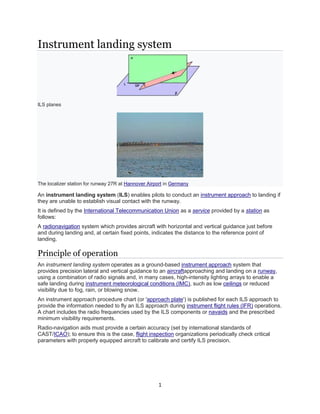
- 1. 1 Instrument landing system ILS planes The localizer station for runway 27R at Hannover Airport in Germany An instrument landing system (ILS) enables pilots to conduct an instrument approach to landing if they are unable to establish visual contact with the runway. It is defined by the International Telecommunication Union as a service provided by a station as follows: A radionavigation system which provides aircraft with horizontal and vertical guidance just before and during landing and, at certain fixed points, indicates the distance to the reference point of landing. Principle of operation An instrument landing system operates as a ground-based instrument approach system that provides precision lateral and vertical guidance to an aircraftapproaching and landing on a runway, using a combination of radio signals and, in many cases, high-intensity lighting arrays to enable a safe landing during instrument meteorological conditions (IMC), such as low ceilings or reduced visibility due to fog, rain, or blowing snow. An instrument approach procedure chart (or 'approach plate') is published for each ILS approach to provide the information needed to fly an ILS approach during instrument flight rules (IFR) operations. A chart includes the radio frequencies used by the ILS components or navaids and the prescribed minimum visibility requirements. Radio-navigation aids must provide a certain accuracy (set by international standards of CAST/ICAO); to ensure this is the case, flight inspection organizations periodically check critical parameters with properly equipped aircraft to calibrate and certify ILS precision.
- 2. 2 Details of five antennas of the ILS at Pisa Airport, Italy The pilot has to correct to the left and a little upwards. An aircraft approaching a runway is guided by the ILS receivers in the aircraft by performing modulation depth comparisons. Many aircraft can route signals into the autopilot to fly the approach automatically. An ILS consists of two independent sub-systems. The localizer provides lateral guidance; the glide slope provides vertical guidance. Localizer A localizer (LOC, or LLZ until ICAO standardisation[2] ) is an antenna array normally located beyond the approach end of the runway and generally consists of several pairs of directional antennas. The localizer will allow the aircraft to turn and match the aircraft with the runway. After that, the pilots will activate approach phrase (APP). Further information: Instrument landing system localizer Glide slope of ILS (G/S) The pilot controls the aircraft so that the glide slope indicator remains centered on the display to ensure the aircraft is following the glide path of approximately 3° above horizontal (ground level) to remain above obstructions and reach the runway at the proper touchdown point (i.e., it provides vertical guidance). Further information: Instrument landing system glide path
- 3. 3 Limitations Glide slope station for runway 09R at Hannover Airport in Germany Due to the complexity of ILS localizer and glide slope systems, there are some limitations. Localizer systems are sensitive to obstructions in the signal broadcast area, such as large buildings or hangars. Glide slope systems are also limited by the terrain in front of the glide slope antennas. If terrain is sloping or uneven, reflections can create an uneven glidepath, causing unwanted needle deflections. Additionally, since the ILS signals are pointed in one direction by the positioning of the arrays, glide slope supports only straight-line approaches with a constant angle of descent. Installation of an ILS can be costly because of siting criteria and the complexity of the antenna system. ILS critical areas and ILS sensitive areas are established to avoid hazardous reflections that would affect the radiated signal. The location of these critical areas can prevent aircraft from using certain taxiways[3] leading to delays in takeoffs, increased hold times, and increased separation between aircraft. Variant Instrument guidance system (IGS) (Localizer type directional aid (LDA) in the United States) - a modified ILS to accommodate a non-straight approach; the most famous example was for the approach to runway 13 at Kai Tak Airport, Hong Kong.[4][5] Identification A 14 element, Mark 20 localizer array and approach lighting at Whiteman Air Force Base, Knob Noster, Missouri In addition to the previously mentioned navigational signals, the localizer provides for ILS facility identification by periodically transmitting a 1,020 Hz Morse code identification signal. For example, the ILS for runway 4R at John F. Kennedy International Airport transmits IJFK to identify itself, while runway 4L is known as IHIQ. This lets users know the facility is operating normally and that they are tuned to the correct ILS. The glide slope station transmits no identification signal, so ILS equipment relies on the localizer for identification. Monitoring It is essential that any failure of the ILS to provide safe guidance be detected immediately by the pilot. To achieve this, monitors continually assess the vital characteristics of the transmissions. If any significant deviation beyond strict limits is detected, either the ILS is automatically switched off or the
- 4. 4 navigation and identification components are removed from the carrier.[6] Either of these actions will activate an indication ('failure flag') on the instruments of an aircraft using the ILS. Localizer back course Modern localizer antennas are highly directional. However, usage of older, less directional antennas allows a runway to have a non-precision approach called a localizer back course. This lets aircraft land using the signal transmitted from the back of the localizer array. Highly directional antennas do not provide a sufficient signal to support a back course. In the United States, back course approaches are typically associated with Category I systems at smaller airports that do not have an ILS on both ends of the primary runway. Pilots flying a back course should disregard any glide slope indication. Marker beacons Main article: Marker beacon On some installations, marker beacons operating at a carrier frequency of 75 MHz are provided. When the transmission from a marker beacon is received it activates an indicator on the pilot's instrument panel and the tone of the beacon is audible to the pilot. The distance from the runway at which this indication should be received is published in the documentation for that approach, together with the height at which the aircraft should be if correctly established on the ILS. This provides a check on the correct function of the glide slope. In modern ILS installations, a DME is installed, co-located with the ILS, to augment or replace marker beacons. A DME continuously displays the aircraft's distance to the runway. DME substitution Main article: Distance measuring equipment Distance measuring equipment (DME) provides pilots with a slant range measurement of distance to the runway in nautical miles. DMEs are augmenting or replacing markers in many installations. The DME provides more accurate and continuous monitoring of correct progress on the ILS glide slope to the pilot, and does not require an installation outside the airport boundary. When used in conjunction with an ILS, the DME is often sited midway between the reciprocal runway thresholds with the internal delay modified so that one unit can provide distance information to either runway threshold. For approaches where a DME is specified in lieu of marker beacons, DME Required is noted on the Instrument Approach Procedure and the aircraft must have at least one operating DME unit, or an IFR approved GPS system (an RNAV system meeting TSO-C129/ -C145/-C146),[7] to begin the approach. Approach lighting Main article: Approach lighting system Some installations include medium- or high-intensity approach light systems (abbreviated ALS). Most often, these are at larger airports but many small general aviation airports in the U.S. have approach lights to support their ILS installations and obtain low-visibility minimums. The ALS assists the pilot in transitioning from instrument to visual flight, and to align the aircraft visually with the runway centerline. Pilot observation of the approach lighting system at the Decision Altitude allows the pilot to continue descending towards the runway, even if the runway or runway lights cannot be seen, since the ALS counts as runway end environment. In the U.S., an ILS without approach lights may have CAT I ILS visibility minimums as low as 3/4 mile (runway visual range of 4,000 feet) if the required obstacle clearance surfaces are clear of obstructions. Visibility minimums of 1/2 mile (runway visual range of 2,400 feet) are possible with a CAT I ILS approach supported by a 1,400-to- 3,000-foot-long (430 to 910 m) ALS, and 3/8 mile visibility 1,800-foot (550 m) visual range is possible if the runway has high-intensity edge lights, touchdown zone and centerline lights, and an ALS that
- 5. 5 is at least 2,400 feet (730 m) long (see Table 3-3-1 "Minimum visibility values" in FAA Order 8260.3C).[8] In effect, ALS extends the runway environment out towards the landing aircraft and allows low-visibility operations. CAT II and III ILS approaches generally require complex high- intensity approach light systems, while medium-intensity systems are usually paired with CAT I ILS approaches. At many non-towered airports, the pilot controls the lighting system; for example, the pilot can key the microphone 7 times to turn on the lights on the high intensity, 5 times to medium intensity or 3 times for low intensity Decision altitude/height Once established on an approach, the pilot follows the ILS approach path indicated by the localizer and descend along the glide path to the decision height. This is the height at which the pilot must have adequate visual reference to the landing environment (i.e. approach or runway lighting) to decide whether to continue the descent to a landing; otherwise, the pilot must execute a missed approach procedure, then try the same approach again, try a different approach, or divert to another airport. ILS categories There are three categories of ILS equipment which support similarly named categories of approach/landing operation, known as CAT I, II, and III. Information below is based on ICAO, FAA, and EASA;.[9] ICAO classifies ILS approaches as being in one of the following categories: ILS categories for precision instrument approach and landing Approach category Decision height Runway visual range (RVR) Visibility minimum Notes I 200 ft (61 m) or more[10] 1,800 ft (550 m) ;[10] at some airports 1,210 ft (370 m) is approved.[11] For single crew operations, increased to 2,600 ft (790 m). 800 m (2,600 ft). Either visibility not less than 800 m (2,600 ft) or a runway visual range (RVR) not less than 550 meters (1,800 ft) on runway with touchdown zone and centerline lighting. FAA Order 8400.13D allows for special authorization of CAT I ILS approaches to a decision height of 150 feet (46 m) with RVR ≥ 1,400 feet (430 m).[12] The aircraft and crew must be approved for CAT II operations and a heads-up display in CAT II or III mode must be used to the decision height. CAT II/III missed approach criteria apply.[12] II less than 200 ft and more than 100 ft 1,000 feet (300 m)[10] N/A ICAO and FAA: 350 meters (1,150 ft) or EASA: 300 meters (980 ft).[9]
- 6. 6 (30 m)[10] IIIa less than 100 ft and more than 50 ft (15 m)[10] 600 feet (180 m)[10] N/A IIIb less than 50 ft (15 m) or none[10] 150 feet (46 m)[10] N/A IIIc No limitations[10] None[10] N/A As of 2012, this category is not yet in operation anywhere in the world, as it requires guidance to taxi in zero visibility as well.[citation needed] Category IIIc is not mentioned in EU-OPS.[citation needed] Smaller aircraft generally are equipped to fly only a CAT I ILS. On larger aircraft, these approaches typically are controlled by the flight control system with the flight crew providing supervision. CAT I relies only on altimeter indications for decision height, whereas CAT II and CAT III approaches use radio altimeter (RA) to determine decision height.[13] An ILS must shut down upon internal detection of a fault condition. Higher categories require shorter response times; therefore, ILS equipment is required to shut down more quickly. For example, a CAT I localizer must shut down within 10 seconds of detecting a fault, but a CAT III localizer must shut down in less than 2 seconds.[6] Special CAT II and CAT III operations Taxiway signs indicating the ILS category of a runway as CAT II/III In contrast to other operations, CAT III weather minima do not provide sufficient visual references to allow a manual landing to be made. CAT III minima depend on roll-out control and redundancy of the autopilot,[citation needed] because they give only enough time for the pilot to decide whether the aircraft will land in the touchdown zone (basically CAT IIIa) and to ensure safety during rollout (basically CAT IIIb). Therefore, an automatic landing system is mandatory to perform Category III operations. Its reliability must be sufficient to control the aircraft to touchdown in CAT IIIa operations and through rollout to a safe taxi speed in CAT IIIb (and CAT IIIc when authorized).[9] However, special approval has been granted to some operators for hand-flown CAT III approaches using a head-up display (HUD) guidance which provides the pilot with an image viewed through the windshield with eyes focused at infinity, of necessary electronic guidance to land the airplane with no true outside visual references. In the United States, airports with CAT III approaches have listings for CAT IIIa and IIIb or just CAT III on the instrument approach plate (U.S. Terminal Procedures). CAT IIIb RVR minimums are limited by the runway/taxiway lighting and support facilities, and are consistent with the airport Surface Movement Guidance Control System (SMGCS) plan. Operations below 600 ft RVR require taxiway centerline lights and taxiway red stop bar lights. If the CAT IIIb RVR minimums on a runway end are 600 feet (180 m), which is a common figure in the U.S., ILS approaches to that runway end with RVR below 600 feet (180 m) qualify as CAT IIIc and require special taxi procedures, lighting, and
- 7. 7 approval conditions to permit the landings. FAA Order 8400.13D limits CAT III to 300 ft RVR or better. Order 8400.13D (2009) allows special authorization CAT II approaches to runways without ALSF-2 approach lights and/or touchdown zone/centerline lights, which has expanded the number of potential CAT II runways. In each case, a suitably equipped aircraft and appropriately qualified crew are required. For example, CAT IIIb requires a fail-operational system, along with a crew who are qualified and current, while CAT I does not. A HUD which allows the pilot to perform aircraft maneuvers rather than an automatic system is considered as fail-operational. A HUD allows the flight crew to fly the aircraft using the guidance cues from the ILS sensors such that if a safe landing is in doubt, the crew can respond in an appropriate and timely manner. HUD is becoming increasingly popular with "feeder" airlines and most manufacturers of regional jets are now offering HUDs as either standard or optional equipment.[citation needed] A HUD can provide capability to take off in low visibility. Some commercial aircraft are equipped with automatic landing systems that allow the aircraft to land without transitioning from instruments to visual conditions for a normal landing. Such autoland operations require specialized equipment, procedures and training, and involve the aircraft, airport, and the crew. Autoland is the only way some major airports such as Paris–Charles de Gaulle Airport remain operational every day of the year. Some modern aircraft are equipped with Enhanced flight vision systems based on infrared sensors, that provide a day-like visual environment and allow operations in conditions and at airports that would otherwise not be suitable for a landing. Commercial aircraft also frequently use such equipment for takeoffs when takeoff minima are not met.[14] For both automatic and HUD landing systems, the equipment requires special approval for its design and also for each individual installation. The design takes into consideration additional safety requirements for operating an aircraft close to the ground and the ability of the flight crew to react to a system anomaly. The equipment also has additional maintenance requirements to ensure that it is capable of supporting reduced visibility operations. Use At a controlled airport, air traffic control will direct aircraft to the localizer course via assigned headings, making sure aircraft do not get too close to each other (maintain separation), but also avoiding delay as much as possible. Several aircraft can be on the ILS at the same time, several miles apart. An aircraft that has turned onto the inbound heading and is within two and a half degrees of the localizer course (half scale deflection or less shown by the course deviation indicator) is said to be established on the approach. Typically, an aircraft is established by at least 2 nautical miles (3.7 km) prior to the final approach fix(glideslope intercept at the specified altitude). Aircraft deviation from the optimal path is indicated to the flight crew by means of a display dial (a carryover from when an analog meter movement indicated deviation from the course line via voltages sent from the ILS receiver). The output from the ILS receiver goes to the display system (head-down display and head-up display if installed) and may go to a Flight Control Computer. An aircraft landing procedure can be either coupled where the autopilot or Flight Control Computer directly flies the aircraft and the flight crew monitor the operation, or uncoupled where the flight crew flies the aircraft manually to keep the localizer and glideslope indicators centered.
- 8. 8 History Luftwaffe AFN 2 indicator, built 1943 Tests of the ILS system began in 1929 in the United States.[15] A basic system, fully operative, was introduced in 1932 at Berlin-Tempelhof Central Airport (Germany) named LFF or "Lorenz beam" due its inventor, the C. Lorenz AG company. The Civil Aeronautics Administration (CAA) authorized installation of the system in 1941 at six locations. The first landing of a scheduled U.S. passenger airliner using ILS was on January 26, 1938, when a Pennsylvania Central Airlines Boeing 247D flew from Washington, D.C., to Pittsburgh, Pennsylvania, and landed in a snowstorm using only the Instrument Landing System.[16] The first fully automatic landing using ILS occurred in March 1964 at Bedford Airport in UK.[17] Alternatives Microwave Landing System (MLS) allows curved approaches. The Microwave Landing System (MLS) introduced in the 1970s[18] was intended to replace ILS but fell out of favour in the United States because of satellite based systems. In the 1980s, there was a major US and European effort to establish MLS. But a combination of airlinereluctance to invest and the rise of Global Navigation Satellite System (GNSS) resulted in its not being adopted in civil aviation. MLS is showing a resurgence in the United Kingdom for civil aviation.[19] ILS and MLS are the only standardized systems in Civil Aviation that meet requirements for Category III automated landings.[20] The first Category III MLS for civil aviation was commissioned at Heathrow airport in March 2009.[21] Transponder Landing System (TLS) can be used where a conventional ILS cannot work or is not cost-effective. Localizer Performance with Vertical guidance (LPV) is based on the Wide Area Augmentation System (WAAS), LPV has similar minima to ILS for appropriately equipped aircraft. As of November 2008, the FAA has published more LPV approaches than Category I ILS procedures. Ground-Based Augmentation System (GBAS) (Local Area Augmentation System in the United States) is a safety-critical system that augments the GNSS Standard Positioning Service (SPS) and provides enhanced levels of service. It supports all phases of approach, landing, departure, and surface operations within the VHF coverage volume. GBAS is expected to play a key role in modernization and in all-weather operations capability at CATI/II and III airports, terminal area navigation, missed approach guidance and surface operations. GBAS provides the capability to service the entire airport with a single frequency (VHF transmission) whereas ILS requires a separate frequency for each runway end. GBAS CAT-I is seen as a necessary step towards the more stringent operations of CAT-II/III precision approach and landing. The technical risk of
- 9. 9 implementing GBAS delayed widespread acceptance of the technology. The FAA, along with industry, have fielded Provably Safe Prototype GBAS stations which mitigate the impact of satellite signal deformation, ionosphere differential error, ephemeris error, and multipath. Future The advent of the Global Positioning System (GPS) provides an alternative source of approach guidance for aircraft. In the US, the Wide Area Augmentation System (WAAS) has been available in many regions to provide precision guidance to Category I standards since 2007. The equivalent European Geostationary Navigation Overlay Service (EGNOS) was certified for use in safety of life applications in March 2011.[22] Local Area Augmentation System (LAAS) is under development to provide for Category III minimums or lower. The FAA Ground-Based Augmentation System (GBAS) office is currently working with the industry in anticipation of the certification of the first GBAS ground stations in Memphis, TN; Sydney, Australia; Bremen, Germany; Spain; and Newark, NJ. All four countries have installed GBAS systems and are involved in technical and operational evaluation activities. The Honeywell and FAA team obtained System Design Approval of the world's first Non-Federal U.S. approval for LAAS Category I at Newark Liberty International Airport, operations on Sept. 2009 and Operational Approval on Sept. 28, 2012.[23] In Norway a D-GPS based landing system, called SCAT-I, is in operation on some short runway airports.