Geo data analytics
•Télécharger en tant que PPTX, PDF•
20 j'aime•5,935 vues

This document summarizes a presentation on geo data analytics. It discusses why geo data matters, common data formats and libraries for working with spatial data, challenges of working with spatial data at scale, and solutions including dimension reduction techniques and spatial databases. It also provides tips for working with spatial data in tools like Spark, R, and Javascript libraries.

Recommandé
Contenu connexe
Tendances
Tendances (20)
Similaire à Geo data analytics
Similaire à Geo data analytics (20)
Plus de Daniel Marcous
Plus de Daniel Marcous (10)
Dernier
Dernier (20)
Geo data analytics
- 2. @dmarcous ● DBA (@IDF) ● Big Data Professional (@IDF) ● Data Wizard - Magic with Data (@Google - Waze)
- 3. ● Pure professional ● Best practices ● Tools ● Tips & Tricks ● Free Advice!
- 4. Agenda ● Why? ● Common Language ● Problems at scale ● Solutions at scale ● Tips & Tricks for scientists (/Wizards) ● Art ● Keep an eye out for… ● Dog Pictures
- 5. Why Does Geo Data Matter?
- 8. ● C/C++, GEOS: http://trac.osgeo.org/geos ● C#, NTS: http://code.google.com/p/nettopologysuite/ ● Java, JTS: ○ http://tsusiatsoftware.net/jts/main.html ○ http://www.vividsolutions.com/jts/JTSHome.htm ● Python, shapely: https://github.com/Toblerity/Shapely ● Ruby, ffi-geos: https://github.com/dark-panda/ffi-geos ● Javascript, JSTS: http://github.com/bjornharrtell/jsts
- 11. ● WKT / WKB - Geospatial Markup Language ○ POLYGON((34.807841777801514 32.164333053441936,34.81168270111084 32.164859820966136,34.81337785720825 32.1613540349589,34.80865716934204 32.16046394346568,34.807841777801514 32.164333053441936)) ○ http://arthur-e.github.io/Wicket/sandbox-gmaps3.html ● GeoJSON ○ { "type": "FeatureCollection", "features": [{ "type": "Feature", "properties": { "Name": "Verint", "Guest": "dmarcous", "Accomodations": "Beer; Pizza" }, "geometry": { "type": "Polygon", "coordinates": [ [ [ 34.807841777801514, 32.164333053441936 ], [ 34.81168270111084, 32.164859820966136 ], [ 34.81337785720825, 32.1613540349589 ], [ 34.80865716934204, 32.16046394346568 ], [ 34.807841777801514, 32.164333053441936 ]]]}}]} ○ http://geojson.io/#map=17/32.16267/34.81061 ● Shape Files - ESRI vector format ● GML - The Geography Markup Language (GML) is an XML grammar for expressing geographical features. ● Raster - Display file built from coordinates Formats
- 12. Databases ● RDBMS ○ Postgres (PostGIS) ○ MS-SQL / DB2 / Oracle ● NoSQL ○ MongoDB ○ IBM Cloudant ○ Lucene spatial module (elastic/ solr) ● Pure Geospatial Database ○ CartoDB (OS / Hosted) ○ GeoMesa (Accumulo) ■ GeoTrellis - Scala framework for processing raster data
- 13. GIS Systems List of most popular ones - http://en.wikipedia.org/wiki/List_of_geographic_information_systems_software QGIS TileMillGRASS
- 15. Problem? ● Non scalar data types ○ Aggregating ○ Sharding ○ Unordered ● Speed & Accuracy ○ The Physical World is non-euclidian http://www.jandrewrogers.com/2015/03/02/geospatial- databases-are-hard/
- 16. Solution
- 17. Data Structures ● R-Tree (PostGIS, actually R+Tree) ● Quad Tree (DB2) ● Hyperdimensional Hashing ● Space Filling Curves ○ Z Order Curve (MS-SQL) ○ Hilbert Curve
- 18. The Curse of Dimensionality
- 19. Dimension Reduction ● GeoHash - The mainstream way ○ Linear (non tangant), up to x5 difference in cell area ○ Same Prefix - Close areas (sort of…) ○ http://geohash.org/ ○ https://github.com/google/open-location- code/blob/master/docs/comparison.adoc ● S2 - The google way ○ Quadratic, same level cell ~ similar area ○ Faces of a projected cube - divided by Quad-Trees to levels - Referenced to position on face by a Hilbert Curve ○ https://code.google.com/p/s2-geometry-library/
- 20. ● MongoDB Geospatial Indexing ● elastic / solr spatial indexing ● GeoMesa ● Build your own - Store the bytes in a fast key-value store with reduced keys (HBase / Cassandra) Near Real Time Answers
- 21. ● ESRI - Hive UDFs - https://github.com/Esri/spatial-framework-for- hadoop/wiki/UDF-Documentation ● Pigeon - Pig UDFs - https://github.com/aseldawy/pigeon ● Spark - ○ SpatialSpark ○ GeoTrellis Big Processing - It’s a UDF World
- 22. Graph Representation ● Use Cases ○ Routing ○ Supply Chains ○ Users Networks ● Tools ○ GraphX (Spark!) / Giraph (MR) ○ Dato SGraph (formerly known as GraphLab) ○ Gephi (On small parts for exploration) ● Algorithms ○ Shortest Path - Dijkstra / A-* ○ Communities - Triangle Counting ○ Importance - Centrality / Page Rank
- 23. Tips & Tricks
- 24. Approximation
- 26. Timezones ● tz_world ○ http://efele.net/maps/tz/world/ ○ What do we do with shapefiles? ● APIs ○ Geonames ○ http://www.earthtools.org/ ○ Google Timezone API ● UDFs? ○ Hive - from_utc_timestamp(timestamp, string timezone)
- 28. // Word Count val textFile = spark.textFile("hdfs://...") val counts = textFile.flatMap(line => line.split(" ")) .map(word => (word, 1)) .reduceByKey(_ + _) counts.saveAsTextFile("hdfs://...") // Modified Word Count val textFile = spark.textFile("hdfs://...") val counts = textFile.map(line => line.split(",")) .map(point => (coord2S2Cell(point(1),point(2)), 1)) .reduceByKey(_ + _) counts.saveAsTextFile("hdfs://...") // Take that from a library! def coord2S2Cell(longitude: Double, latitude: Double, lvl = 14) : Int = { return S2Cell(longitude,latitude, lvl).CellId() } Good Old Word Count
- 29. Advanced - Precision is of the Essence ● Density Based Clustering ○ DBSCAN ■ Minimum cluster size (> Noise) ■ Epsilon (Spatial Radius) ○ R - MASS - kde2d ■ RGoogleMaps for the map ■ http://www.everydayanalytics.ca /2014/04/heatmap-of-toronto- traffic-signals.html
- 30. rJava ● Wrap geospatial functions of your choice ● call them from R ● Use apply on an entire Dataframe! ● Use as features! ● Visualize??? (in 5 minutes)
- 31. R Packs for Geospatial Analysis ● geonames ○ Timezone ○ Weather ○ Nearby places ● RGoogleMaps ○ download+paint Maps ○ getGeoCode ● sp / maps / maptools ○ OGC object abstractions ○ Manipulate / display geo data ● rgdal - spTransform ○ Convert formats / coordinates systems ● geosphere - distances / circles / centroids ● fpc - DBSCAN ● Coverage - ○ http://cran.r-project.org/web/views/Spatial.html
- 33. Engineered Geo features ● LOCAL ○ time ○ is_early / is_late ○ day of week ○ is_workday / is_weekend ○ is_day_light (sunrise/ sunset tz_world) ● Weather ○ Temperature ○ is_ Rain/ Fog / Hail / Snow ● Squared (s2cell/ geohash) statistics ○ Probability of users in square to predict X ● Address - is_residence / is_business ● News - GDELT
- 34. WOW!
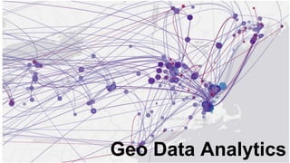
- 35. Data Art
- 36. Google Sheets
- 37. Frontend = Javascript? ● Google Maps API ○ https://developers.google.com/maps/documentation/javascript/examples/layer- heatmap ● Leaflet
- 38. R for Visualisation ● ggplot2 + geospatial packs ○ http://uce.uniovi.es/mundor/howtoplotashapemap.html ○ http://stackoverflow.com/questions/9558040/ggplot-map-with-l ○ http://spatial.ly/2012/02/great-maps-ggplot2/ ● RGoogleMaps ○ http://rforwork.info/tag/rgooglemaps/
- 43. R For Interactive ● Shiny ○ Leaflet ■ http://rstudio.github.io/leaflet/ ■ http://shiny.rstudio.com/gallery/superzip-example.html ■ http://shiny.rstudio.com/gallery/bus-dashboard.html ○ Globe ■ https://github.com/trestletech/shinyGlobe
- 46. @aaronkoblin
- 47. Keep an Eye Out! https://locationtech.org/list-of-projects
- 50. Contact ● Daniel Marcous ● dmarcous@gmail.com