1. “Life on the Edge”
October 5, 2011
DISTRICT OF
UCLUELET
OFFICIAL COMMUNITY PLAN
2011
2. [ this page left intentionally blank for double-sided printing]
3. DISTRICT OF UCLUELET OFFICIAL COMMUNITY PLAN
i
Bylaw No. 1140, 2011
A bylaw to adopt “District of Ucluelet Official Community Plan Bylaw No. 1140, 2011"
WHEREAS Section 876 of the Local Government Act provides that Council of a local
government may, by bylaw, adopt an Official Community Plan;
AND WHEREAS Council has caused an Official Community Plan to be prepared for all
areas of the District in accordance with the provisions of Sections 877 and 878 of the
Local Government Act and other relevant sections as referenced in the Plan;
AND WHEREAS Council has consulted with the board of education and considered and
consulted with other persons, organizations and authorities it considers will be affected,
including how many and whether appropriate opportunities for consultation should be
early and ongoing, all in accordance with Sections 879 and 881 of the Local
Government Act;
NOW THEREFORE the Council of the District of Ucluelet, in open meeting assembled,
enacts as follows:
1. The document entitled “District of Ucluelet Official Community Plan 2011” and its
associated appendices, maps, schedules, tables and figures, all attached as Schedule
1 to this bylaw and made a part of this bylaw, is hereby designated as the Official
Community Plan for the entirety of the area within the District of Ucluelet, as
depicted on Schedule A of the Official Community Plan.
2. The “District of Ucluelet Official Community Plan Bylaw No. 900, 2004” and its
amendments are repealed.
3. This bylaw may be cited as "District of Ucluelet Official Community Plan Bylaw No.
1140, 2011."
READ A FIRST TIME this 25th
day of October, 2011
READ A SECOND TIME this 25th
day of October, 2011
Considered in conjunction with the District of Ucluelet Financial Plan and the
Liquid Waste Management Plan under Section 882 of the Local Government
Act, this 25th
day of October, 2011.
PUBLIC HEARING held this 8th
day of November, 2011
READ A THIRD TIME this 8th
day of November, 2011
ADOPTED this 22nd
day of November, 2011
4. DISTRICT OF UCLUELET OFFICIAL COMMUNITY PLAN
ii
CERTIFIED A TRUE AND CORRECT COPY of "District of Ucluelet Official Community
Plan Bylaw No. 1140, 2011."
_____________________________ _____________________________
Mayor Corporate Officer
THE CORPORATE SEAL of the
District of Ucluelet was hereto
affixed in the presence of:
_____________________________
Corporate Office
5. DISTRICT OF UCLUELET OFFICIAL COMMUNITY PLAN
iii
SCHEDULE "1"
District of Ucluelet
Official Community Plan 2011
6. DISTRICT OF UCLUELET OFFICIAL COMMUNITY PLAN
iv
Contents
1. Overview ........................................................................................................................1
1.1 Purpose of Official Community Plan....................................................................... 1
1.2 Community Overview ............................................................................................. 1
1.3 Population, Demographics and Growth ................................................................. 2
1.4 Regional Context..................................................................................................... 4
1.5 Economic Development.......................................................................................... 5
2. Vision and Guiding Principles......................................................................................8
2.1 Vision....................................................................................................................... 8
2.2 Guiding Principles ................................................................................................... 8
3. Land Use Policies..........................................................................................................9
3.1 Overview of Land Use Designations ....................................................................... 9
3.2 Village Square ....................................................................................................... 13
3.3 Parks, Trails and Open Space................................................................................ 18
3.4 Small Craft Harbour/ Marine ................................................................................ 21
i. Small Craft Harbours................................................................................. 23
ii. Water Lots................................................................................................. 23
iii. Managed Water........................................................................................ 24
3.5 Residential............................................................................................................. 25
i. Affordable Housing ................................................................................... 26
ii. Residential – Multi Family......................................................................... 29
iii. Residential – Single Family........................................................................ 29
iv. Residential – General................................................................................ 30
3.6 Commercial Development .................................................................................... 31
i. Service Commercial................................................................................... 32
ii. Tourist Commercial................................................................................... 33
3.7 Industrial ............................................................................................................... 35
3.8 Institutional........................................................................................................... 39
3.9 Comprehensive Development .............................................................................. 41
i. Master Development Agreement Areas................................................... 41
ii. General Comprehensive Development Policies ....................................... 44
3.10 Heritage and Culture............................................................................................. 46
3.11 Natural Environment ............................................................................................ 49
i. Ecology...................................................................................................... 49
ii. Wildlife Management ............................................................................... 49
iii. Environmental Protection......................................................................... 50
iv. Hazardous Areas ....................................................................................... 50
4. Transportation.............................................................................................................52
5. Servicing......................................................................................................................54
5.1 Water Supply......................................................................................................... 54
5.2 Water Storage....................................................................................................... 55
5.3 Sanitary Sewer ...................................................................................................... 56
7. DISTRICT OF UCLUELET OFFICIAL COMMUNITY PLAN
v
5.4 Stormwater Management .................................................................................... 58
5.5 Solid Waste and Recycling .................................................................................... 59
5.6 Emergency Services Planning................................................................................ 60
5.7 Servicing Policies................................................................................................... 60
6. Greenhouse Gas Emission Targets, Policies and Actions.......................................63
6.1 Introduction .......................................................................................................... 63
6.2 Greenhouse Gas Targets....................................................................................... 64
6.3 Greenhouse Gas Policies....................................................................................... 64
i. Land Use and Development...................................................................... 64
ii. Transportation .......................................................................................... 65
iii. Buildings.................................................................................................... 65
iv. Public Infrastructure and Facilities ........................................................... 66
v. Community Energy Systems ..................................................................... 66
vi. Solid Waste and Waste Management ...................................................... 66
vii. Awareness, Education and Outreach........................................................ 66
6.4 Greenhouse Gas Actions....................................................................................... 67
i. Community Energy and Emission Plan ..................................................... 67
ii. Monitoring and Reporting ........................................................................ 67
7. Implementation............................................................................................................69
7.1 Development Permit Areas................................................................................... 69
7.2 Bylaws ................................................................................................................... 70
7.3 Financing and other Initiatives ............................................................................. 70
Appendix A: Riparian Area Regulations, 2006......................................................................71
Appendix B: Development Permit Areas...............................................................................81
Development Permit Area No. 1 (Village Square) ............................................................ 84
Development Permit Area No. 2 (Imperial Lane) ............................................................. 89
Development Permit Area No. 3 (Reef Point)................................................................... 93
Development Permit Area No. 4 (Hyphocus Island)......................................................... 98
Development Permit Area No. 5 (Lot 281) ..................................................................... 103
Development Permit Area No. 6 (Inner Boat Basin)....................................................... 108
Development Permit Area No. 7 (Peninsula Road) ........................................................ 113
Development Permit Area No. 8 (Former Forest Reserve Lands) .................................. 118
Development Permit Area No. 9 (Multi-Family Residential).......................................... 124
List of Map Schedules
Schedule A: Proposed Land Use Designations
Schedule B: Existing Zoning
Schedule C: Development Permit Areas
Schedule D: Transportation Network
Schedule E: Water and Sanitary Sewer Network
List of Tables
Table 1. Building Permit Activity..................................................................................................... 4
Table 2. Land Use Designations .................................................................................................... 12
Table 3. Affordable Units Secured through Inclusionary Zoning in Ucluelet ............................... 26
Table 4. Water Storage Requirements ......................................................................................... 55
8. DISTRICT OF UCLUELET OFFICIAL COMMUNITY PLAN
vi
List of Figures
Figure 1. Population Change 1956-2006 ........................................................................................ 3
Figure 2. Ucluelet Age Characteristics, 2006 .................................................................................. 3
Figure 3. Ucluelet Occupations, 2006............................................................................................. 5
Figure 4. Percent of total designated area assigned to each land use designation. .................... 10
9. DISTRICT OF UCLUELET OFFICIAL COMMUNITY PLAN
Overview 1
1. Overview
1.1 Purpose of Official Community Plan
The purpose of the Official Community Plan (OCP) is to provide a long term vision for the
District of Ucluelet. It sets out broad objectives and policies that will guide planning and land
use decisions within the District, while respecting the community’s existing character. The OCP
charts a growth management course that supports Ucluelet’s quality of life, enhances economic
prosperity and advances environmental sustainability.
The Province of British Columbia’s Local Government Act provides the authority and direction
for the preparation of the Official Community Plan. Once adopted as a bylaw, an Official
Community Plan has a legal status that requires that all subsequent bylaws enacted and works
undertaken be consistent with the plan. This Official Community Plan replaces the previous
Official Community Plan, adopted in 2004.
1.2 Community Overview
Ucluelet derives its name from the local native language meaning ‘safe or good harbour’ for
canoe landing. Ucluelet is a beautiful, vibrant West Coast community that has a long, illustrious
and rich history.
First Nations historically lived in the area and were primarily dependent on seafood and forest
resources. The land provided many valuable resources, such as abundant wildlife including
deer and fowl, grasses and reeds for basket weaving, and cedar for canoe building and fuel.
Europeans arrived in the early 1860s. The first Japanese settlers migrated from Victoria in
1919, drawn by the abundant fish potential. European and Japanese settlers were lured to the
area with hopes of making it rich in gold from the land, fish from the sea and wood from the
forests.
The first lighthouse was built on Amphitrite Point in 1906, and by the 1920s the fishing industry
was in full swing.
10. DISTRICT OF UCLUELET OFFICIAL COMMUNITY PLAN
Overview 2
Incorporated as a Village in 1952, Ucluelet later became a
District Municipality in 1997. The economy was initially
based on the forest, fishing and mining industries. As the
economy diversified, other industries began to flourish,
including fish processing, aquaculture, forestry, wood
manufacturing and tourism. Economic diversification has
attracted residents who work and live in Ucluelet
seasonally or who commute from other regions.
Today, Ucluelet is a friendly place where residents smile
and greet each other; a strong sense of community
flourishes and town pride is abundant. Its unique setting offers an attractive place to live with
diverse opportunities for outdoor recreational pursuits. With its miles of wild coastline, rocky
headlands, old-growth cedar forests, and luxurious resorts and spas, Ucluelet is becoming
world-famous for its fishing, kayaking, surfing, diving, wildlife watching, beachcombing, and
storm watching. Ucluelet, and the surrounding area, is known as ‘the playground of the Pacific’
bordering on one of Vancouver Island’s most prominent national parks, Pacific Rim National
Park.
1.3 Population, Demographics and Growth
Census Canada has been tracking Ucluelet’s population since 1956 (see Figure 1, below). From
that point to about 1981, Ucluelet experienced a significant rate of growth (on a small base
population) averaging 3.6% annually. This was driven primarily by employment growth as the
forestry, fishing and mining sectors expanded both locally and more generally in BC through the
same period.
From 1981 to the most recent census year of 2006, growth has remained flat showing an
average decline in population of 0.3% per year (compared to growth of 2.1% provincially during
the same period). As in many smaller communities in BC, the contraction of economic activity
in several resource-based industries has contributed negatively to Ucluelet’s growth over the
past few decades. Fish processing has declined from three operating plants to one. The nature
of the industry continues to change and Ucluelet’s location and limited transportation
infrastructure make it difficult to service global markets locally. The forestry industry on
Vancouver Island has not recovered from several structural and market challenges that
emerged in the early 1990s.
11. DISTRICT OF UCLUELET OFFICIAL COMMUNITY PLAN
Overview 3
From a demographic point of view, data from the 2006 census indicates an age profile for
Ucluelet that is significantly younger than the province as a whole, with a median age of 36.4
years (as compared to an average of 40.8 years for BC).
Looking forward in regards to population, Ucluelet is expected to see a modest return to
growth over the next 25 years. Projections by BC Statistics for the Alberni-Clayoquot Regional
District (of which Ucluelet is a part) indicate that the district will grow at an average rate of
0.6% to 2036. Historically, population changes in Ucluelet have correlated closely with the
growth of the wider region, so it is expected that Ucluelet will see similar growth to that
Source Data: Statistics Canada
Figure 1. Population Change 1956-2006
Figure 2. Ucluelet Age Characteristics, 2006
Source: Statistics Canada
12. DISTRICT OF UCLUELET OFFICIAL COMMUNITY PLAN
Overview 4
experienced in the Regional District. This would suggest that Ucluelet could expect
approximately 10 new residents per year, on average, over the next two decades.
An analysis of recent building permit activity reveals a somewhat different story, with steady
growth in the construction of single family homes, vacation rentals and secondary suites in the
community due in large part to Ucluelet’s emergence as a tourist and second home destination.
Since 2000, Ucluelet has seen development of an average of 19 new housing units per year
(Table 1).
Table 1. Building Permit Activity
Year Single
Family
Multi-
Family
Units
Secondary
Suites
Vacation/
Rental
Total
2010 11 - 2 -
13
2009 11 1 5 2
19
2008 11 - 5 2
18
2007 19 - 8 1
28
2006 18 1 n/a 3
22
2005 7 - n/a 10
17
2004 12 1 n/a 17
30
2003 9 - n/a 13
22
2002 12 8 n/a 4
24
2001 1 - n/a -
1
2000 4 6 n/a 9
19
Annual Average 19.4
Given that the proportion of vacant units currently for sale within the community represents
only approximately 3.5% of the total building stock, recent unit completions have been
absorbed by the market (either as homes for residents, second homes, or as vacation rentals)
despite declining permanent population through this period. Going forward, modest population
growth, coupled with sustained demand for vacation rental and second-home properties in the
community, it is likely that the community could see similar levels of housing demand going
forward generating between 10 and 20 new housing units per year.
1.4 Regional Context
Ucluelet, located on the west coast of Vancouver Island, is part of the Alberni-Clayoquat
Regional District (ACRD), and is one of three urban centres in the region alongside Tofino and
the City of Port Alberni – the location of the ACRD head office. Ucluelet is also neighbour to six
other Electoral Areas in the ACRD.
13. DISTRICT OF UCLUELET OFFICIAL COMMUNITY PLAN
Overview 5
The ACRD provides various services to its member communities, such as waste management,
transit, emergency planning, and water supply. The ACRD, however, does not currently have in
a place a regional growth strategy.
Highway 4 is the primary access into the region.
1.5 Economic Development
Ucluelet prides itself as being a working town. The economy has traditionally been based on the
forest, fishing and mining industries, until their recent decline in the nineteen nineties. This has
had a significant impact on the District, as evidenced by declining population levels since the
1996 census.
Most people in Ucluelet work in the sales and service industry (Figure 3). This sector employed
270 people in 2006, almost double the number of people employed in primary Industry,
processing, manufacturing and utilities. This statistic, along with comparable numbers of people
employed in management and business, suggests employment is moving away from the
traditional fishing, forestry and mining sectors.
Figure 3. Ucluelet Occupations, 2006
Ucluelet and Tofino serve a trading population of about 4,000 in addition to an increasingly
large number of tourists attracted by the area’s pristine scenic beauty. The vast majority of
tourists (95%) using the Pacific Rim Visitor Centre at the Pacific Rim Highway 4 junction are
interested in information about Tofino. To improve tourist visits to Ucluelet, the District can
work with the Chamber of Commerce to further promote the unique attributes of Ucluelet,
while differentiating the visitor experience between these two west coast communities.
Ucluelet has a significant opportunity to improve its image and appeal to visitors. This may be
achieved through promoting the community as a working harbour and drawing attention to the
Source: Statistics Canada
14. DISTRICT OF UCLUELET OFFICIAL COMMUNITY PLAN
Overview 6
Wild Pacific Trail, the area’s heritage and cultural values and access to the Broken Group
Islands.
There is a need to explore economic development opportunities in value-added industries,
sport fishing, adventure and eco-tourism facilities and services and alternative energy resources
while at the same time maintaining and promoting the existing industries. It is important that
Ucluelet maintains a diversified economy, so that it does not concentrate solely on tourism,
while retaining its ‘traditional’ small town character.
The District of Ucluelet commissioned an Economic Development Study in 2010. The Study
identified a number of strategic directions which are reflected in the following economic
objectives:
1. Emphasize the Village Square area as the focal point for commercial and socio-
economic activity in Ucluelet;
2. Support the development of a Walking Tour within the Village Square and surrounding
area to promote access to the area, encourage walking and to celebrate Ucluelet’s
unique attributes;
3. Support the operating fish plant and associated industry; consider opportunities such
as guided tours through the fish plant, a museum to showcase the industry and sports
fishing opportunities;
4. Work towards a year-round economy;
5. Promote and support arts and artisans through festivals, financial incentives, venues,
and other means;
6. Promote and support eco-tourism on land and water;
7. Continue to support home-based businesses that have minimal impact on
neighbouring uses.
8. Enhance the pedestrian character and visual appearance of the harbour area through
protection of the waterfront for public access, retention of views within the Village
Square, architectural design measures, landscaping and boardwalks that reflect both
traditional and contemporary west coast styles and First Nations heritage;
9. Encourage commercial ventures on Peninsula Road to fill in the gaps between existing
buildings, while focusing most commercial development within the Village Square;
10. Review property tax, DCCs and fees to create and maintain a competitive advantage
with other communities;
15. DISTRICT OF UCLUELET OFFICIAL COMMUNITY PLAN
Overview 7
11. Create a marketing plan to differentiate Ucluelet from Tofino by advertising its natural,
small town, eco-friendly setting and access to the Broken Group Islands;
12. Visually promote the Wild Pacific Trail, Inner Harbour, Village Square and Broken
Group Islands within the Pacific Rim Visitor Centre; and
13. Establish a co-operative strategy on economic development that includes the local
First Nations, the Alberni-Clayoquat Regional District, the Village of Tofino, and others.
The above informs and provides context to the policies that will follow.
16. DISTRICT OF UCLUELET OFFICIAL COMMUNITY PLAN
Vision and Guiding Principles 8
2. Vision and Guiding Principles
2.1 Vision
The following Vision statement was established for the 2004 OCP and continues to be relevant:
Ucluelet’s built and natural environment respects, above all, the outstanding diverse
natural habitat and optimizes recreational opportunities for its citizens and its
visitors. Ucluelet residents enjoy a high quality of life built upon a sustainable and
diversified local economy.
2.2 Guiding Principles
The policy directions contained within the OCP aim to help achieve this vision of Ucluelet as a
prosperous, natural and active community. The following guiding principles reflect components
of the vision and will be used to guide decision making.
1. Create a complete community;
2. Create a compact and vibrant Village Square;
3. Develop and maintain quality parks, trails, recreation and community services for
residents and visitors;
4. Build a sustainable local economy;
5. Maintain and enhance Ucluelet’s unique character and preserve its heritage;
6. Protect natural areas ;
7. Increase transportation choice; and
8. Manage residential growth in balance with job creation and the provision of services.
17. DISTRICT OF UCLUELET OFFICIAL COMMUNITY PLAN
Land Use Policies 9
3. Land Use Policies
3.1 Overview of Land Use Designations
Proposed land use designations are shown in Schedule A, “Proposed Land Use Designations”.
Each designation, along with their approximate area, is described below. Schedule B, “Existing
Zoning” may be used to identify existing land uses.
1. Village Square Designation
(approximate total area: 4 hectares, 0.5 percent of of total designated area)
The Village Square encompasses most of the lands within approximately a five minute
walk of Main Street and Peninsula Road.
2. Parks and Open Space Designation
(approximate total area: 60 hectares, 8.7 percent of total designated area)
3. Residential Designations
a. Multi Family
(approximate total area: 8 hectares, 1.2 percent of total designated area)
b. Single Family
(approximate total area: 120 hectares, 17.5 percent of total designated area)
4. Commercial Designations
a. Service Commercial
(approximate total area: 23 hectares, 3.4 percent of total designated area)
b. Tourist Commercial
(approximate total area: 27 hectares, 3.9 percent of total designated area)
5. Industrial Designations
a. Industrial
(approximate total area: 14 hectares, 2.1 percent of total designated area)
b. Industrial Swing
(approximate total area: 3 hectares, 0.4 percent of total designated area)
6. Institutional Designation
(approximate total area: 18 hectares, 2.7 percent of total designated area)
7. Comprehensive Development Designation
(approximate total area: 365 hectares, 53.3 percent of total designated area)
8. Water Areas;
a. Water Lots (approximate total area: 38 hectares, 5.5 percent of total
designated area)
18. DISTRICT OF UCLUELET OFFICIAL COMMUNITY PLAN
Land Use Policies 10
b. Small Craft Harbour(approximate total area: 6 hectares, 0.9 percent of total
designated area)
Descriptions and proposed uses for each OCP land use designation are summarized in Table 2
below. It should be noted that existing land use may differ from proposed designations. Over
time, it is anticipated that redevelopment will occur and land use will align with future intended
uses, as noted in this OCP.
Figure 4. Percent of total designated area assigned to each land use designation.
19. DISTRICT OF UCLUELET OFFICIAL COMMUNITY PLAN
Land Use Policies 11
Land Use Designation Description
Village Square This designation applies to the village square and
includes a broad range of mixed uses. These may include
retail uses, offices, restaurants, tourist accommodation,
financial, cultural and community services, and multi-
family residential (e.g. apartments and residential units
above retail stores). Compact, high density, mixed-use
buildings which respect the existing character of the
neighbourhood are encouraged.
Tourist Commercial This designation includes visitor accommodation (e.g.
hotels, motels, hostels, guesthouses), marinas and other
supporting uses such as kayak and bike rentals. It
includes the resort developments located in the Reef
Point area and Inner Boat Basin.
Service Commercial This designation generally applies to portions of
Peninsula Road between Forbes Road and Bay Street. It
includes uses such as motels, restaurants, personal and
retail services, service stations and automobile repair.
Residential - Single Family This designation includes low-density, detached single
family homes. It may include secondary suites, home
occupations and guest accommodation.
Residential – Multi-Family This designation includes multi-family residential housing
of medium to high-density. This includes houses with
coach houses, duplexes, row houses, cluster housing,
townhouses and apartment buildings.
Institutional This designation includes community and institutional
uses, such as schools, libraries, recreation areas, health
facilities, policing and emergency services, municipal
buildings and facilities (e.g. the sewage lagoon on
Hyphocus Island) and religious institutions.
Industrial This designation provides for a variety of light and
medium industrial uses, such as fish processing and
wood-based manufacturing industries, including service
commercial and light industrial uses. This designation
applies to lands along Forbes Road and Seaplane Base
Road.
Industrial Swing The Industrial Swing land use designation is intended to
provide for future demand for industrial land. Industries
intending to locate in these areas will be required to
demonstrate that they cannot be accommodated in
existing industrial areas. The District will evaluate their
potential impacts on surrounding land.
Parks, Trails and Open Space This land use designation applies to the District’s parks,
playgrounds, trails and green spaces. This includes nature
parks, community parks, neighbourhood parks,
parkettes, trails and greenbelts.
Water Lot This designation applies to all registered water lots as
designated in Schedule A. Uses are subject to future
20. DISTRICT OF UCLUELET OFFICIAL COMMUNITY PLAN
Land Use Policies 12
review but may include docks, moorage of fishing vessels,
loading/unloading of marine vessels, fish processing and
support industry, tourist and recreation facilities
including marinas and boat launches, marine residential,
environmental protection, utilities and log storage.
Small Craft Harbours/Marine This designation applies to the three Small Craft Harbour
water lots, as designated in Schedule A. These lots are
owned by the Department of Fisheries and Oceans and
are managed by the District. A range of activities are
permitted, including, private boat moorage and other
recreational pursuits, including launching points for
excursions on the water along the West Coast.
Agricultural There are currently no lands designated as agricultural
within the District of Ucluelet. None are anticipated as a
future use during the time period of this OCP.
Sand and Gravel There are currently no lands designated for Sand and
Gravel deposits within the District of Ucluelet. None are
intended as a future use during the time period of this
OCP.
Table 2. Land Use Designations
21. DISTRICT OF UCLUELET OFFICIAL COMMUNITY PLAN
Land Use Policies 13
3.2 Village Square
The Ucluelet Village Square area is the heart of the community and Ucluelet’s main gathering
and shopping destination. It is a compact area comprised of those lands within approximately a
five minute walk (400 metre radius) of Main Street and Peninsula Road. As such, the Village
Square area supports the District’s policies and actions to reduce greenhouse gas (GHG)
emissions and respond to climate change.
The Village Square area is oriented toward the waterfront, and as such acknowledges the
critical role the harbour continues to plays in the community’s prosperity. Access and views to
the water are preserved and enhanced. As the main commercial and mixed-use area of
Ucluelet, the Village Square area is a welcoming place for community members and visitors
alike.
The Village Square designation is the main land use designation within the Village Square core
area of Ucluelet. Other designations located within the five minute walking radius include
Institutional, Multi-Family Residential, Residential and Parks and Open Space.
The Village Square designation contains the broadest range of services and land uses in the
District. This includes retail, professional offices, health care, administrative, financial, tourist
accommodation and supporting uses, cultural and community services and multi-family
residential. Employment uses that require access to the harbour are also permitted in key
locations, including the fish plant. Service commercial uses (e.g. gas stations and other similar
uses oriented toward the automobile) are located outside of the Village Square in order to
maintain its strong pedestrian focus. The Village Square provides for multi-family residential
options in and around the core. These are located in mixed-use buildings and expand the
community’s affordable housing choices.
The Village Square has the community’s highest densities and built forms, yet is designed to
respect views and existing character. It is appealing and safe for pedestrians of all ages. The
architectural style and urban design of the Village Square reflects Ucluelet’s unique history and
coastal context. High quality urban design enhances the public realm and the pedestrian
environment. Village Square uses are designed to transition sensitively to adjoining areas.
22. DISTRICT OF UCLUELET OFFICIAL COMMUNITY PLAN
Land Use Policies 14
Village Square Policies:
1. The area bounded by the Harbour, Bay Street, Larch
Road and Otter Street is to be designated as Village
Square;
2. New retail, service and office development must be
concentrated in the Village Square designation in
order to maximize pedestrian access for employees
and customers;
3. Tourist accommodation (e.g. boutique hotels) and
supporting uses are encouraged (e.g. eating and
drinking establishments) to locate in the Village
Square designation;
4. The District of Ucluelet continues to recognize the
importance of the harbour to the District’s
economy by allowing employment uses that require
access to the water (e.g. fish plant) to locate within
the Village Square designation. Such uses shall be
sensitively integrated into the community;
5. Direct residential growth to the Village Square
designation in the form of apartments and
residential over commercial to provide for greater
housing diversity and affordability;
6. Properties fronting Main Street must be mixed-use,
with residential above commercial uses, or
standalone commercial; stand-alone multi-family
may be permitted within other areas of the Village
Square designation. Vehicular access must be
taken from the south side of Peninsula Road,
where possible, or otherwise arranged in a way
that gives priority to pedestrian, cyclist and
vehicular safety;
7. Cultural and institutional uses are permitted
within and adjacent to the Village Square
designation, in order to support the mixed-use,
cultural heart of the community. This is the
preferred location for a District Museum. The
acquisition of key properties (e.g. church building
on the corner of Main Street and Peninsula Road)
by the District, or other public agency, may be
required in order to establish more cultural and
heritage uses in the Village Square;
23. DISTRICT OF UCLUELET OFFICIAL COMMUNITY PLAN
Land Use Policies 15
8. While the vacant redevelopment site at the northwest corner of Helen Road and
Matterson Drive, is designated as Multi-Family Residential, it is recognized that other uses
(e.g. public open space, parking) may be more appropriate. The District intends to work
with the owner(s) to identify the appropriate uses on this vacant, former gas station site
that reflects its proximity to the Village Square;
9. Main Street Dock is a key public
gathering place in the community. It
provides public access to the waterfront
that is safe and accessible. Main Street
Dock may be framed by buildings and
contain uses that fit within the mixed-
use vision of the Village Square (e.g.
cultural, recreation, commercial) and
provide interest and variety to the area.
The Dock (designated as Water Lot) is
considered appropriate for specific
marine uses, such as net mending,
Francis Barkley passengers and ferrying and fish markets. Vessel offloading and other
heavy industrial uses are not encouraged at Main Street Dock; other existing private
docks within the Harbour may be more suitable for such activities;
10. Enhance and improve public access to the water by encouraging access or viewpoints
within all new developments that are adjacent to the water, including those adjacent to
water lots;
11. Enhance and improve the network of public open spaces and trails that connect and cross
the Village Square. Specific network improvements and elements include:
i. Enhancing existing parks including Municipal Hall Park (e.g. reducing pavement) and
Waterfront Park;
ii. Retaining outdoor open space along Peninsula Road (e.g. existing patio northeast of
the intersection of Main Street and Peninsula Road) in order to provide overlook
and views to the Harbour;
iii. Explore creation or acquisition of new public open space opportunities where
feasible (e.g. including the informal green space along Cedar Road on the existing
fish plant site);
iv. Encouraging the retention of the existing treed area located west of Main Street,
approximately between Cedar Road and Peninsula Road (e.g. through cluster
development that preserves significant tree stands, parkland dedication or other
mechanisms). Development forms that seek to protect and preserve this last
remaining downtown treed area will be encouraged (e.g. courtyard or mews type
development);
v. Requiring and formalizing mid-block pedestrian connections in large block areas (e.g.
north side of Peninsula Road, between Bay and Main Streets);
24. DISTRICT OF UCLUELET OFFICIAL COMMUNITY PLAN
Land Use Policies 16
vi. Developing a walking tour that
connects the Village Square to the
Inner Boat Basin, Imperial Lane and
other parts of town;
vii. Encouraging the provision of cycling
end-of trip facilities, such as bike
parking; and
viii. Explore options for a connection
between Lyche and Cedar Roads. This
connection is desirable and the
location can be flexible to accommodate existing uses and future redevelopment of
the parcel (e.g. Lot 2 Plan 14646).
12. Development Permit Area Guidelines regulate the form and character of development
within the Village Square designation. Guidelines aim to improve pedestrian movement
and the character of streetscapes for residents and visitors by a variety of means such as:
i. Siting buildings close to the front lot line, with parking located at the rear of lots, or,
where feasible, below grade;
ii. Providing for awnings and canopies to provide rain protection over sidewalks;
iii. Retaining views to the harbour through building massing and heights in key locations
(e.g. along north side of Peninsula Road);
25. DISTRICT OF UCLUELET OFFICIAL COMMUNITY PLAN
Land Use Policies 17
iv. Improving the character of the streetscape and safety adjacent to the existing Co-op
Store by:
a. Retaining existing landscaping and improving the plaza;
b. Reducing the width of the existing driveway access and;
c. Exploring closure of the existing lane on the east side of the property and
incorporating it as a walkway or future development site.
13. The District may conduct a parking study of the Village Square in order to increase the
amount of parking available during peak visitor periods. Possible improvements may
include:
i. Working with the School District to explore temporary visitors parking on school
grounds;
ii. Exploring the use of key streets for Recreation Vehicle parking use.
14. The District shall prepare a more detailed plan for Ucluelet’s Harbour, focusing on lands in
the vicinity of the Village Square and existing water lots.
26. DISTRICT OF UCLUELET OFFICIAL COMMUNITY PLAN
Land Use Policies 18
3.3 Parks, Trails and Open Space
The parks, trails and open spaces in the
District of Ucluelet contribute to a unique
character and sense of place within the
community. The popular Wild Pacific Trail
is the primary hiking trail in the District
that runs through the south western edge
of the peninsula. Ucluelet’s green space
network is recognized as a valuable
community asset where residents and
visitors can enjoy the outdoors and
beautiful scenery on foot or bicycle, and
as part of an active, healthy way of life
close to nature.
The purpose of the Parks and Open Space designation is to protect Ucluelet’s natural beauty,
enhance the District’s green space system and to support a safe environment for recreational
opportunities. The parks and open space system includes nature parks, community parks,
neighbourhood parks, parkettes, trails and greenbelts. Establishing a connected and defined
parks and trails network further achieves other community environmental objectives by
supporting the District’s targets, policies, and actions to address climate change and reduce
green house gas emissions. Reducing GHGs may be positively affected by providing trails or
multiuse pathways to accommodate active transportation (walking and cycling) throughout the
community.
Parks, Trails and Open Space Policies:
1. Key parks, trails and open spaces in Ucluelet are identified on Schedule A of the OCP;
2. Existing parks and trails are to be maintained and protected, taking guidance from the
District’s Parks and Recreation Master Plan. Mechanisms to help protect parks and trails
that can be explored may include, but not be limited to, OCP designation, zoning, or
acquisition and dedication of land by the District;
3. The District will work with property owners and developers to:
i. Further support existing green spaces (e.g. trails and playgrounds);
ii. Increase green space; and
iii. Create linkages between green spaces within the District (e.g. retain treed areas and
securing mid-block pedestrian connections in the Village Square) and to the outer
side of the peninsula, including connections to the Wild Pacific Trail.
27. DISTRICT OF UCLUELET OFFICIAL COMMUNITY PLAN
Land Use Policies 19
4. Coordinate OCP policies related to parks, trails,
playgrounds and open spaces with the District’s
Parks and Trails Map, Parks and Recreation Master
Plan, and the Transportation Plan (as it relates to
cycling and walking trails);
5. The District may work in partnership with
landowners, businesses and the development
community to maintain and increase public access
to the water. Some new opportunities for increased
access to the harbour include:
i. A park, viewpoint or open space at the end
of Matterson Drive, serving as an anchor on
one end of this unique street, linking the
Inner Harbour to Big Beach across the
peninsula; and
ii. A park, viewpoint or open space at the end
of Alder Street and the City-owned water
lot.
6. Develop a walking trail tour that connects the
Village Square to the Inner Boat Basin, Imperial
Lane, and other parts of town.
i. The trail may be comprised of existing
sidewalks, pathways and other routes. It may
include pervious surfaces that are suitable for
all users (e.g. strollers), good signage and be
promoted through leaflets, websites, etc.
(see Village Square policy);
ii. The tour may also include connections from
the Village Square to the Ucluelet Community
Centre and Big Beach;
iii. Partnerships with other local agencies who
may have a shared interested in developing a
walking trail tour may be explored (e.g. with
local schools, the Chamber of Commerce,
Historical Society); and
iv. Efforts to develop the walking trail tour should
be coordinated with the District’s Parks and
Recreation Master Plan.
7. Explore the development of a park or open space at
the summit of Hyphocus Island and a trail along the
perimeter of Hyphocus Island. Design will need to
be sensitive to the existing context of the area to
ensure that the park, open spaces and trails are
28. DISTRICT OF UCLUELET OFFICIAL COMMUNITY PLAN
Land Use Policies 20
well integrated with adjacent uses and natural features, such as the sewage lagoon and
the island’s topography;
8. Protect and create viewpoints along the Wild Pacific Trail (WPT). The Wild Pacific Trail
should follow the coastline as much as possible. All new developments will provide for a
WPT route that is deemed acceptable to the District;
9. Provide public amenities in parks or along trails, in accordance with the Parks and
Recreation Master Plan and Transportation Plan, which may include, but are not limited
to playgrounds, bike racks and covered seating areas;
10. The District of Ucluelet may work with the District of Tofino and Pacific Rim National Park
to consider extending the cycling path from Ucluelet to Tofino as part of a larger cycling
network;
11. Francis Island is recognized as symbolic entrance to the Harbour. It should not be
developed, without intensive investigation of environmental, hazard and archaeological
considerations. Access to the beach on the island and a trail around the edge of the Island
for recreational purposes may be further explored.
29. DISTRICT OF UCLUELET OFFICIAL COMMUNITY PLAN
Land Use Policies 21
3.4 Small Craft Harbour/ Marine
The jurisdictional boundary for the District
of Ucluelet extends approximately 200
metres into the Pacific Ocean surrounding
the Ucluth peninsula, as shown on
Schedule A. It is the intent of the District
to regulate uses contained within the
water areas to the full extent of its
jurisdiction.
The Harbour (Ucluelet Inlet) has
historically and continues to play an
important role in the life and well being of
residents in the District. Currently a range
of activities occur, such as fishing
(commercial and sport), private boat moorage, the Canadian Princess Resort and other
recreational pursuits, including launching points for excursions on the water along the West
Coast, particularly the Broken Group of Islands. A number of water lots registered in the Land
Titles Office have been created over the years. These consume much of the waterfront from
Marine Drive through to the former Forest Reserve Lands (Island Timberlands/Marine Drive
Properties). To date, the development potential of these water lots has not been regulated.
The calm waters in this natural inlet have provided refuge for mariners for a long period of
time. The harbour has potential to maintain and promote what makes Ucluelet a great place –
a place that services the fishing and sport fishing industries, the tourist industry, inspires artists
and photographers and supports daily recreational enjoyment by many within the community.
The harbour is an asset worth protecting for the future economic prosperity and livability in the
District.
The water areas of Ucluelet are generally designated as either:
Small Craft Harbour (three water lots);
Water Lot (majority of water lots); or
Managed Water (remaining water areas not in registered water lots)
In addition to these three designations, several water lots are designated in conjunction with
the adjacent land-based designation (e.g. Village Square or Residential)
Each registered water lot is inextricably linked to various adjacent land uses; hence the
relationship between land and water requires careful consideration, which could include
parking needs, water and sewer servicing and visual impacts.
In conjunction with the sustainability objectives noted in the OCP, the District should consider
protecting environmentally sensitive areas and shoreline habitat.
30. DISTRICT OF UCLUELET OFFICIAL COMMUNITY PLAN
Land Use Policies 22
General Policies:
1. Consider creating new zoning regulations in conjunction with the next Zoning By-law review
for registered water lots. These could include, as a minimum, permitted uses, servicing and
parking requirements, density and building height;
2. Prohibit the following uses in the Water Lot, Small Craft Harbour and Managed Water
designations:
i. Commercial and recreational aquaculture;
ii. Boat, vessel or aircraft storage; and
iii. Landfills.
3. The District shall work with the Department of Fisheries and Oceans to:
i. Identify environmentally sensitive areas;
ii. Support marine ecology and marine education facilities within the Harbour;
iii. Consider alternate long-term uses, such as residential, including a private marina, for
the former BC Packers Plant;
iv. Consider enhancing public access to the District owned water lot at the foot of Alder
Street;
v. Support transient boat moorage provided adequate sanitation facilities are located
nearby;
vi. Require all water lot uses to properly treat and dispose sanitary sewer waste and
connect into the District’s
sewer collection system and
access District potable
water;
vii. Require all structures to
apply for and obtain a
Building Permit, which
addresses health and safety
regulations; and
viii. Explore ways and means of
generating revenue to fund
Harbour infrastructure.
31. DISTRICT OF UCLUELET OFFICIAL COMMUNITY PLAN
Land Use Policies 23
i. Small Craft Harbours
The Small Craft Harbour is owned by the
Department of Fisheries and Oceans, and it is
managed by the District. The Small Craft Harbour
manages three water lots. These are:
Lot 2084, known as the inner harbour;
Lot 1977, known as the outer harbour; and
Lot 1877, known as 52 steps.
Small Craft Harbour Policies:
1. Ensure the continued viability of the Small
Craft Harbour in Ucluelet through sound
management practices;
2. Consider changes to the size and
configuration of the Small Craft Harbour;
giving priority to water lots in the vicinity of
existing and proposed industrial areas (e.g.
Lot 610 near foot of Seaplane Base Road);
3. Encourage water-based industrial uses to
locate in the vicinity of the Seaplane Base
Road.
ii. Water Lots
All water lots not included within the Small Craft Harbour designation are designated as “Water
Lot” as designated in Schedule A, except for:
Several water lots at the foot of Main Street (“Whiskey Landing” area) currently
designated as “Village Square”; and
Lot 2087 (former BC Packers site) designated as “Residential”.
Water Lot Policies:
1. A comprehensive review of all existing water lots uses will be carried out by the District.
Possible uses include:
32. DISTRICT OF UCLUELET OFFICIAL COMMUNITY PLAN
Land Use Policies 24
i. Docks and moorage of fishing vessels;
ii. Loading and unloading of marine vessels;
iii. Fish processing and support industry;
iv. Tourist and recreation facilities, including marinas and boat launches;
v. Float homes;
vi. Live-aboards and houseboats;
vii. Pier residential housing;
viii. Environmental protection;
ix. Utilities; and
x. Log storage.
2. The Main Street Dock (Lot 1689) is considered appropriate for specific marine uses, such
as net mending, Francis Barkley passengers and ferrying, fish markets, and arts,
entertainment and tourist functions. Vessel offloading and other heavy industrial uses are
not encouraged at Main Street Dock. Other existing private docks within the Harbour may
be more suitable for such activities.
iii. Managed Water
All water areas located between the shoreline and the District boundaries, excluding all
registered water lots, are designated as “Managed Water”.
Managed Water Policies:
1. A comprehensive review of the area within the Managed Water designation will be
carried out by the District. Until this time, no uses are permitted within the area,
including boat or houseboat moorage.
33. DISTRICT OF UCLUELET OFFICIAL COMMUNITY PLAN
Land Use Policies 25
3.5 Residential
The Official Community Plan provides a framework to meet the diverse housing needs of
residents in Ucluelet. Residential land use is permitted in the Village Square, Comprehensive
Development, Multi-Family and Residential designations. Each land use designation varies in
the range and density of permitted housing types. Generally, the highest density uses
(apartments and residential units above retail stores) are found in the Village Square, with
medium density forms (townhouses) on the edge of the core area and single family uses
located beyond a 400 metre walk of the Village Square. Residential uses are also permitted by
zoning (e.g. CS-2 zone) on lands designated Service Commercial.
The 2006 Census reported a population of 1,487 people in Ucluelet, with a total of 640
occupied private dwellings. Of this total, approximately:
64.8% live in single-detached houses;
2.3% live in semi-detached housing;
1.6% live in row houses;
1.6% live in apartment duplexes;
13.3% live in apartment buildings (less than 5 storeys); and
16.4% live in other types of dwellings.
The majority of private dwellings are owned (approximately 64%). Average household size is
2.3 people.
Based on an annual projected growth rate of one percent, Ucluelet currently has enough land
designated for residential use to meet overall housing demand for ten to twenty years. This
includes undeveloped, serviced single family residential lots (137), vacant single family, mobile
homes and strata units (25) and long term rental units. A supply of vacation rentals also exists
in the community. Seasonal home occupancy will have a moderate impact on the existing
inventory. Although there is an adequate supply of housing, there is a demand for more
affordable units, particularly for youth, families, seniors and seasonal employees.
34. DISTRICT OF UCLUELET OFFICIAL COMMUNITY PLAN
Land Use Policies 26
i. Affordable Housing
Ucluelet attracts a large number of visitors yearly
given its spectacular scenery and opportunities for
recreation, including hiking, cycling, whale watching,
kayaking, winter storm watching, and fishing. As a
popular tourist destination, the District strives to
ensure that adequate housing is available for
residents, visitors, and seasonal employees alike.
Ucluelet’s challenges with a lack of affordable
housing began to escalate in 2001 as tourism activity
increased.1
The affordable housing issue in Ucluelet
also has ramifications on other growing industries
and the changing needs of the community. Other industries are growing in Ucluelet and
struggle to house a growing work force. Youth looking to leave home are forced to leave the
community because of escalating housing costs. Seniors looking to downsize their
accommodation needs are faced with a shortage of housing supply and increased prices.
Ucluelet also houses many residents who work in the neighbouring tourism destination of
Tofino. This puts added strain on the existing supply of affordable housing.
This section summarizes the District’s initiatives to address affordable housing and policies
moving forward.
In 2004, Council amended the OCP to adopt inclusionary zoning policies to help address the
affordable housing issue. The amendment requires 15-20 percent of units in new multi-family
developments to be affordable. Developers are also encouraged to provide 15-20% of all units
to be set aside for employees of new developments. The table below identifies the affordable
housing units that have been or will be required through inclusionary zoning policies and
Master Development Agreements. To date, only two of these required units have been
constructed.
Table 3. Affordable Units Secured through Inclusionary Zoning in Ucluelet
2
1
Smart Growth BC, 2008, Affordable Housing Toolkit
2
Ibid
Affordable Housing is defined as
housing suitable for households of
low & moderate income (with
incomes that are 80% or less than
the median household income in
the District of Ucluelet as reported
by Statistics Canada and as defined
by Canada Mortgage Housing
Corporation, CMHC).
35. DISTRICT OF UCLUELET OFFICIAL COMMUNITY PLAN
Land Use Policies 27
Provisions for density bonusing in exchange for
affordable housing units are present in the current
R-2 Medium Density Residential and R-3 High
Density Residential zones. The Zoning Bylaw states
that “where 30% or more of the total number of
units are affordable housing units, the maximum
number of multiple family residential units may be
increased by 20 units per hectare.” (The base
maximum density is 30 units per hectare in the R-2
zone and 65 units per hectare in the R-3 zone.)
Several CD zones (e.g. CD-5, CD-6) also specify a
maximum or minimum amount of affordable housing units to be built. For instance, only 50% of
maximum density of multiple family residential and resort condominium units are permitted
until at least 10 affordable housing units developed, and a 15% minimum of hotel units are
required as staff housing, with no maximum limit).
Secondary suites provide an opportunity to offer more housing choices while maintaining a
single family neighbourhood character. Currently, the following zones permit secondary suites:
R-1 Single Family Residential;
R-2 Medium Density Residential (provides for a mixture of low to medium density;
housing and the option for secondary suites in single-family dwellings);
R-4 Residential – Small Lot; and
VR-1 Vacation Rental (maximum 2 secondary suite units within a single family
residence).
Some of the Comprehensive Development zones also permit secondary suites.
In 2004, the District initiated the Perpetual Affordable Housing (PAH) program. The PAH
involves a Covenant and Housing Agreement on title to keep housing prices and rent affordable
in perpetuity. The units are created for individuals and families who are either long-term
residents of Ucluelet or who intend to become long-term residents. The program is geared for
those who are unable to enter into market rental and ownership housing opportunities.
Qualified applicants are entered into a lottery which determine the order in which they are
selected to be placed into a PAH unit. In 2008, the first two PAH homeownership units sold at
$155,000 and $160,000, respectively—well below the average price of housing in Ucluelet of
$234,300. Two PAH units have been built to date.
The Ucluelet Affordable Housing Committee (UAHC) was established in 2007 with the mandate
to represent community interests in development of an affordable housing governance and
operations plan and recommend to Council an appropriate Housing Authority structure and
governance model.
A combination of strategies that includes smaller lots, secondary suites, inclusionary zoning,
and residential mixed use development can positively contribute to the broadening of housing
choices and affordability within the District of Ucluelet, as well as providing for rental housing
and a greater variety of options for seniors.
36. DISTRICT OF UCLUELET OFFICIAL COMMUNITY PLAN
Land Use Policies 28
Affordable Housing Policies:
1. Develop a comprehensive Affordable Housing Strategy that pulls together and builds on
Ucluelet’s current initiatives and programs and monitors progress;
2. Increase the number of affordable housing units in Ucluelet by encouraging mixed land
uses in the Village Square, seniors’ housing, small lot single family housing, and secondary
suites;
3. Support development of multi-family
housing above retail in the Village
Square to encourage a mixed-use core
in the District;
4. Continue to offer density bonuses in
exchange for the provision of
affordable housing units in multiple
family and comprehensive
developments;
5. Permit secondary suites in single-family
dwellings with sufficient off-street
parking. Permit Vacation rentals as an
alternative development form;
6. Encourage development of mobile/modular home parks with high quality site design,
screening and landscaping;
7. Encourage alternative housing options, including bare land strata and small lot
subdivisions;
8. Use comprehensive development zoning to promote rental housing development and
accommodate special needs housing development, guest house accommodation, and the
provision of housing for seasonal workers;
9. Zone land using low to moderate densities and use density bonusing to secure affordable
housing in any larger development;
10. Continue using inclusionary zoning regulations that require affordable housing in new
multi-family developments;
11. Continue to encourage developers to provide 15% to 20% staff housing for employees
needed to staff new developments in tourist commercial developments; and
12. Encourage private, non-profit and co-operatively run housing units.
37. DISTRICT OF UCLUELET OFFICIAL COMMUNITY PLAN
Land Use Policies 29
ii. Residential – Multi Family
Smaller units in higher density, multi family areas is an important component of the District’s
affordable housing strategy. Residential uses within and in close proximity to the Village Square
help create a more vibrant and compact community where residents can walk to services and
amenities.
Multi Family Residential Policies:
1. Encourage the development of
multi-family residential units within
approximately a five minute walk of
the Village Square;
2. Encourage residential development
above or below the first floor in the
Village Square and the Service
Commercial Area;
3. Encourage higher density forms of
multi-family development to locate
along main roads, including
Matterson Drive and Peninsula
Road;
4. Explore the use of coach houses and other forms of low-to medium density multi-family
housing that address both street frontages in the area south of Peninsula Road, between
Yew Street and Matterson Drive; and
5. Provide density bonuses for the provision of underground or concealed parking and
amenities and affordable housing units.
iii. Residential – Single Family
The majority of housing in the District of Ucluelet is made up of detached single-family homes.
A low projected annual growth of one percent, and a long timeframe for absorption of existing
housing inventory, indicate that the Ucluelet has no immediate need for increased supply of
this housing type.
Single Family Residential Policies
1. Continue to acknowledge the role that single family housing plays in terms of appeal and
lifestyle choice and encourage sensitive intensification (e.g. smaller lots, secondary suites,
coach houses, bare land strata) where appropriate;
2. Retain the area along Imperial Lane as single family, with the character of the existing
buildings retained through redevelopment, and subject to the Development Permit Area
No. 2 guidelines;
38. DISTRICT OF UCLUELET OFFICIAL COMMUNITY PLAN
Land Use Policies 30
3. Consider the use of Heritage Revitalization Agreements to vary zoning regulations (e.g.
parking) to make it viable for owners to conserve and preserve the heritage merit of
Imperial Lane;
4. Designate those portions of District Lots 281 and 282 that have been developed as low
density, single family as Residential, while acknowledging that the existing zoning in these
areas permits a broad range of land uses;
5. Identify Hyphocus Island as low density rural residential, until such time as density for
amenity bonusing or a comprehensive proposal is received identifying cluster residential
development with significant tree retention, preservation of island in its natural state and
dedication of lands for public access, including the high ground and a perimeter
waterfront trail. This area is not intended for private marina or significant commercial,
tourist commercial or resort development;
6. Encourage residential development Spring Cove (e.g. Lot 12129) that maximizes creek
preservation and fits with the natural environment;
7. Designate Water Lot 2087 (former BC Packers Plant) as residential to reflect the use of the
adjoining land.
iv. Residential – General
General Housing Policies
1. Adopt passive site design guidelines that promote energy efficiency, such as orienting
buildings for maximum solar gain, setting maximum amounts of glazing, requiring
overhangs that protect from summer sun and rain but allow winter sunlight in, and
providing landscaping that shades in summer and allows sunlight in during the winter;
2. Explore density bonuses for incorporating energy efficiency in existing and new buildings;
3. Cluster residential units to preserve natural areas where possible.
39. DISTRICT OF UCLUELET OFFICIAL COMMUNITY PLAN
Land Use Policies 31
3.6 Commercial Development
Ucluelet provides a range of commercial facilities and services for the convenience of residents
and visitors. Commercial uses help to foster a sustainable local economy by strengthening the
commercial tax base, providing employment opportunities and accommodating a viable tourist
economy. Commercial land uses are also recognized for their contribution to a complete
community through the provision of services and shopping close to home.
The broadest mix of commercial uses (including offices and retail stores) is permitted in the
Village Square. As the community’s main gathering place and with the highest residential
densities, the Village Square is the main working and shopping destination in Ucluelet.
Commercial uses are also permitted in other parts of the community. Automobile oriented
uses (e.g. service stations and building supply establishments) are permitted primarily along
Peninsula Road in the Service Commercial designation. Commercial uses oriented toward
tourists, and primarily for accommodation purposes, are located in Tourist Commercial
designations at Reef Point and the Inner Boat Basin, as well as within Comprehensive
Development areas. This hierarchy of commercial designations supports a compact and vibrant
Village Square, while accommodating other needed services in the community.
General Commercial Policies:
1. Support a hierarchy of commercial uses that supports the Village Square as the location for
most commercial and retail uses, while meeting the full range of residents’ and visitors’
service and shopping needs;
2. Continue to support the work of the Ucluelet Economic Development Corporation and the
formation of partnerships or joint ventures to diversify the local economy and to generate
new sources of sustainable development and employment;
40. DISTRICT OF UCLUELET OFFICIAL COMMUNITY PLAN
Land Use Policies 32
3. Promote and support locally owned small businesses, including those oriented to arts and
artisans, home occupation uses, bed and breakfasts, vacation rentals and guest houses;
4. Review permitted uses in all commercial zones, including the merits of allowing permanent
residential uses in the Tourist Commercial (CS-5) zone and residential units above service
commercial uses (CS-2 zone);
5. Connect commercial areas to other parts of the District through multi-use pathways,
sidewalks, trails and other transportation routes. Show commercial areas on the proposed
walking trail tour that connects the Village Square to the Inner Boat Basin, Imperial Lane
and other parts of the District;
6. Encourage the provision of cycling end-of-trip facilities, such as bike parking, in commercial
areas;
7. Support climate action strategies by:
i. Locating commercial uses within proximity of Peninsula Road, the District’s primary
corridor for development. This will promote the early introduction of local transit-
service and higher transit frequencies than is possible with lower density
development;
ii. Situating commercial areas within walking distance (400 metres) of potential future
transit routes and supporting home-based businesses that have minimal impact on
neighbouring land uses;
iii. Encouraging environment-friendly commercial development, building energy and
efficiency upgrades; and
iv. Encouraging development in a manner that promotes energy efficiency. This may
include orienting buildings for maximum solar gain, maximizing glazing, requiring
overhangs that protect from summer sun and rain but allow winter sunlight in, and
providing landscaping that shades in summer and allows sunlight in during the winter.
i. Service Commercial
Lands designated for Service Commercial uses are
generally located along both sides of Peninsula Road
between Forbes Road and Bay Street.
Service Commercial Policies:
1. Designate properties along Peninsula Road for
service commercial uses to accommodate existing
uses as well as future uses that require automobile
oriented access and visibility;
41. DISTRICT OF UCLUELET OFFICIAL COMMUNITY PLAN
Land Use Policies 33
2. Accommodate automobile repair uses in the Service Commercial designation. Consider
amending the Zoning Bylaw to permit automobile service uses (e.g. the repair and servicing
of automobiles and recreational vehicles,) in the Service Commercial (CS-2) zone within the
Service Commercial designation (e.g. not within the Village Square);
3. Recognize the strategic location and high visibility of Peninsula Road and implement high
quality urban design for service commercial uses in the area, as set out in Development
Permit Area 7;
4. Enhance landscaping along Peninsula Road through the development process, allocation of
capital funds and other mechanisms (e.g. DCCs); and
5. Work with property owners to increase the supply of visitor parking in commercial areas
along Peninsula Road.
ii. Tourist Commercial
Ucluelet’s appeal as a tourist destination
for all ages is based largely on the wide
range of recreation opportunities
available in the community. These
include hiking the Wild Pacific Trail, sea
kayaking, boating, fishing and cycling.
The town serves as a gateway to Pacific
Rim National Park, Clayoquot Sound,
Barkley Sound and the Broken Group
Islands. Visitors are able to enjoy
Ucluelet’s small town charm, working
harbour, parks, trails and other recreational and cultural amenities. The Tourist Commercial
designation focuses primarily on providing for visitors’ accommodation, together with marinas
and other supporting uses, creating areas distinct from residential neighbourhoods.
Tourist Commercial Policies:
1. Concentrate large scale tourist commercial developments within the following general
areas:
Reef Point Area
Inner Boat Basin
2. Encourage accommodation types that may not be provided for in other areas in order to
enhance visitor options and strategically manage supply (e.g. boutique hotels are
encouraged in the Village Square designation, while vacation rentals, hotel/spas are
permitted in the Comprehensive Development designation.);
3. Allow limited and accessory commercial uses (e.g. kayak rental) within the Tourist
Commercial designation in order to support a wider range of commercial uses within a
compact and complete Village Square. Limited restaurant uses are appropriate in the Inner
Boat Basin area. Visitors are encouraged to access offices and retail uses the Village Square.
42. DISTRICT OF UCLUELET OFFICIAL COMMUNITY PLAN
Land Use Policies 34
Transportation options to the Village Square will include pedestrian and cycling
infrastructure;
4. Encourage the redevelopment of properties fronting onto Ucluelet Inlet ensuring:
i. the provision of public access to the waterfront;
ii. a continuous waterfront walkway connecting the Inner Boat Basin to the Village
Square;
iii. high quality architectural design reflecting the fishing village heritage of Ucluelet;
iv. the identification, protection and enhancement of view corridors; and
v. the inclusion of natural landscaping.
5. Encourage development forms that maximize tree retention for undeveloped sites.
43. DISTRICT OF UCLUELET OFFICIAL COMMUNITY PLAN
Land Use Policies 35
3.7 Industrial
Ucluelet has developed as a working community,
supported by a strong fishing industry. Fishing and
other industrial activities needing access to the
waterfront continue to be important directions for
the future. While forestry perhaps played a more
prominent role in the past, its contribution to the
local economy is anticipated to come from the
potential for wood-based value-added enterprises.
Industrial land use, both water and land-based
provide a solid foundation for the community’s
economic livelihood. Industrial land use enhances
the economic viability of Ucluelet through the
diversification of the local economy and the
provision of employment opportunities. Industrial
land also supports the District’s policies and actions
to reduce greenhouse gas (GHG) emissions and
respond to climate change. This is achieved through
the promotion of innovative and clean industrial uses
that are appropriately located and designed to
maximize energy efficiency.
The Industrial Designation encompasses two main areas – lands at Seaplane Base Road and
lands along Forbes Road. These two areas are expected to meet the industrial land needs of the
District for the short to medium term. Future demand for industrial land may be
accommodated in an area adjacent to the Forbes Road area. Uses within the industrial
designation are designed to provide a neighbourly transition to adjoining non-industrial areas.
Policies:
1. Support the protection of the District’s industrial land base as a vital community and
economic asset that can be used to create significant local employment, property taxes and
other benefits to Ucluelet;
2. Encourage industrial uses that will achieve higher employment and land use densities;
3. Direct industrial development off Peninsula Road and into the Forbes Road and Seaplane
Base Road areas;
4. Industrial land uses must be compatible with adjoining land uses (e.g. industrial/tourist
commercial/residential); use the rezoning process (e.g. siting, layout) to minimize conflicts;
5. Give priority to industrial uses at the Seaplane Base Road area that require water access in
areas with sufficient navigational depth (e.g. north side in proximity of existing water lots);
44. DISTRICT OF UCLUELET OFFICIAL COMMUNITY PLAN
Land Use Policies 36
6. Protect and enhance the sensitive ecosystem associated with the waters on the west side of
the Seaplane Base road industrial area by maintaining a naturalized shoreline. Given the
site’s unique water access, proximity to industrial and tourist commercial areas, a
comprehensive plan of development will be required at the time of redevelopment. Public
access to the water will be provided in a manner that is commensurate with the permitted
land uses;
7. Create an employment-intensive area in the Forbes Road industrial area, while
acknowledging the existing mixed-use nature of the area. Review the range of uses
permitted in the CD-1 (“Eco-Industrial Park”) Zone, (e.g. residential) in conjunction with a
future Zoning Bylaw review;
8. Continue to recognize the importance of the harbour to the Ucluelet’s economy by allowing
industrial uses that require access to the water to locate within other appropriate
designations (e.g. Village Square, Water Lot and the Small Craft Harbour);
9. Support the creation of more detailed plan for Ucluelet’s Harbour, focusing on lands in the
vicinity of the Village Square, existing water lots, and appropriate locations for water-based
industrial uses;
10. Support the sole remaining fish plant and supporting industry located within the Village
Square designation;
11. Support the expansion of the District’s industrial land base, where appropriate, in a manner
that is sensitive to adjoining land uses and helps to achieve other District objectives;
12. To meet the potential future demand for industrial use, lands west of the Forbes Road
industrial area are identified as a “swing” industrial area. Any proposed industrial uses in
this area will need to demonstrate that they cannot be accommodated in the existing
industrial areas and will consider their impact on existing or proposed land use and
community character. These lands are zoned Comprehensive Development and subject to
the provisions of the Master Development Agreement for the Weyerhauser lands. Changes
to this agreement will need to be evaluated in conjunction with any proposed alternate use
in this industrial swing area;
45. DISTRICT OF UCLUELET OFFICIAL COMMUNITY PLAN
Land Use Policies 37
13. Work in partnership with the Ucluelet
Economic Development Corporation
(UEDC) to form partnerships or joint
ventures to diversify the local economy
and to generate new sources of
sustainable development and
employment;
14. Continue to support the Village Square
as the location for most commercial and retail uses. Review accessory retail and office use
provisions in industrial zones;
15. Enhance and improve public access to the water in industrial areas while recognizing that
the safety and operational needs of industrial businesses are not to be compromised;
16. Connect industrial areas to other parts of the District through multi-use pathways,
sidewalks, trails and other transportation routes. Show industrial areas on the proposed
walking trail tour that connects the Village Square to the Inner Boat Basin, Imperial Lane
and other parts of town;
17. Encourage the provision of cycling end-of trip facilities, such as bike parking in industrial
areas;
18. Provide a safe pedestrian environment to and from industrial areas and support ability of
employees to walk to work while avoiding conflicts from trucks and vehicles, for instance,
by providing separated sidewalks;
19. Minimize detrimental effects of industrial development on the natural environment and
surrounding areas. Encourage water conservation, re-use of building materials and waster
products, reduced energy consumption, alternate energy sources and high air quality and
water treatment standards;
20. Strive for a high quality of site and building
design in industrial areas. This may include
extensive landscaping and visual buffers
between industrial and non-industrial uses;
21. Support climate action strategies by:
i. Locating industrial uses within proximity
of Peninsula Road and the Ucluelet-
Tofino Highway - the District’s primary
corridor for development. This will
promote the early introduction of local
transit-service and higher transit
frequencies than is possible with lower
density development;
46. DISTRICT OF UCLUELET OFFICIAL COMMUNITY PLAN
Land Use Policies 38
ii. Situating industrial areas within walking distance (200 to 400 metres) of potential future
transit routes. Potential future expansion of industrial uses along Peninsula Road will
consider the aesthetic impacts of this gateway location;
iii. Encouraging environment-friendly industries, building energy and efficiency upgrades;
iv. Building in a manner that promotes energy efficiency. This may include orienting
buildings for maximum solar gain, maximizing glazing, requiring overhangs that protect
from summer sun and rain but allow winter sunlight in, and providing landscaping that
shades in summer and allows sunlight in during the winter.
22. Encourage the provision of employee amenities within industrial developments that
support a healthy working environment. This may include accessory retail uses (e.g.
restaurants, cafes, pharmacy), places to sit, rest or eat, exercise facilities and connections to
multi-use pathways, sidewalks or trails; and
23. Accommodate automobile repair uses in the industrial designation; consider amending the
Zoning Bylaw to permit automobile service uses (e.g. the repair and servicing of
automobiles and recreational vehicles,) in the I-1, I-2 and CD-1 zones.
47. DISTRICT OF UCLUELET OFFICIAL COMMUNITY PLAN
Land Use Policies 39
3.8 Institutional
Community and institutional uses in Ucluelet include schools, libraries, recreation areas, health
facilities, policing and emergency services, municipal buildings and religious institutions. These
places meet many needs: educational, health, spiritual, and safety. They contribute to the well
being of the community and to a sense of permanence and stability.
The heart of Ucluelet’s civic life is located within the Village Square. This area contains the
District Hall and Waterfront Park, George Fraser Memorial Park and the Main Street Dock. A
second cluster of institutional uses is located approximately 1.5 kilometres away along
Matterson Drive. This cluster includes Ucluelet Elementary and Senior Secondary Schools, the
BMX Bike Track and school playgrounds, the Ucluelet Community Centre, including a branch of
the Vancouver Island Regional Library and the adjoining skateboard park and basketball court.
The District recognizes that providing cultural and recreation facilities within close proximity to
each other is essential to creating a complete community and cultivating a dynamic relationship
between the different facilities. Connections between the two institutional nodes are
facilitated by transportation and infrastructure improvements along Main Street, Peninsula
Road and Matterson Drive. Walking and cycling between the two areas is encouraged.
Other institutional uses with the community include:
Recreation Hall on Seaplane Base Road;
Sewage treatment facility on Hyphocus Island;
Forest Glen Seniors Housing (St. Jacques Boulevard);
Ucluelet Volunteer Fire Brigade; and
Army Navy & Air Force Club (Peninsula Road).
Institutional Policies
1. Support improvements to the Village
Square that increase its attractiveness
and enhance its accessibility,
usefulness, and security as a venue for
public uses and events; improvements
may include signage, planting of trees,
provision of street furniture, adding
pedestrian and building lighting, public
art, and other aesthetic and functional
items that make to Village Square more
desirable to pedestrians;
2. Facilitate improvements, which include
sidewalks and multi-use pathways to
Main Street, Peninsula Road and Matterson Drive to encourage walking and cycling
between key community public spaces;
48. DISTRICT OF UCLUELET OFFICIAL COMMUNITY PLAN
Land Use Policies 40
3. Complete a Parks and Recreation Master Plan that responds to the community’s range of
recreational and physical activity needs;
4. Maintain a close, collaborative relationship with School District 70 to maximize the use of
school facilities and services for the benefit of the community and to facilitate current and
anticipated school needs;
5. Encourage any future rebuilding of the schools to be oriented toward Matterson Drive in
order to emphasize the importance of this intersection, the proximity to the Village Square
and the connecting function that Matterson Drive plays (e.g. connecting Village Square to
key community locations (community centre, Big Beach); and
6. Recognize and support the role of schools as neighbourhood focal points and social centres.
49. DISTRICT OF UCLUELET OFFICIAL COMMUNITY PLAN
Land Use Policies 41
3.9 Comprehensive Development
The Comprehensive Development (CD) designation applies to those areas covered by the
existing (see below) Master Development Agreements (MDAs), District Lots 282 and 281 and
lands in the vicinity of Minoto Road. These CD areas represent some 359 hectares or 55
percent of land within the District’s boundaries.
i. Master Development Agreement Areas
Master Development Agreements were established to guide the development of the former
forest reserve lands. As part of their respective rezoning applications, the first agreement was
signed with Weyerhaeuser Company Ltd. on September 28th
, 2005 with respect to the Lands
zoned CD-5, and the second agreement was signed with Island Timberlands GP Ltd. and Marine
Drive Properties on August 18th
, 2006 with respect to the lands zoned CD-6. CD-5 Zone was
split into five (5) development areas, and Development Area #1 was transferred and assigned to
a numbered company under the same leadership as Marine Drive Properties Ltd. At the time of
updating the OCP, both those companies are in receivership and development has stalled in
Development Area #1 of the CD-5 Zone and there has been no development, nor anticipated
amenity contributions, for the CD-6 Zone.
The development of these primarily former forest reserve lands provides an opportunity to
promote the natural attributes and culture of the community, while enhancing economic
viability by attracting investment, tourism and providing employment opportunities for local
residents. These development projects are intended to support and strengthen the
community’s visions, culture and ‘small town’ character, while fostering its natural and
environmental attributes, the arts community, and economic base. Their design has the
potential to become leading edge technology and practice in sustainable design by embracing
energy and water conservation, reducing greenhouse gas emissions, maximizing tree retention
and adopting low-impact design principles.
Land uses in the comprehensive development
designation MDA areas, include:
Single family with a range of lot sizes;
Multi-family residential and commercial
resort condominiums;
Vacation rentals and Guest House lots;
Affordable housing;
Hotel/spa, motel and staff housing units;
Golf course/clubhouse and marina;
Limited commercial facilities restricted to
servicing the tourist sector;
Parks and natural space; and
Wild Pacific Trail.
Each area included a general concept plan and the landowners committed to a more detailed
concept plan as development parcels proceed, including consultation through at least one
50. DISTRICT OF UCLUELET OFFICIAL COMMUNITY PLAN
Land Use Policies 42
public information meeting. Development Permits areas were also established, and the
landowners committed to additional information requirements including native vegetation
management plan, full environmental impact assessments (including in accordance with
Appendix B – Riparian Area Regulation policies), and archaeological assessments; a detailed
plan identifying the general form and character of all buildings and structures, including
building materials and colours, can guide in the creation of an attractive, inviting streetscape
and building design to capture the look and feel of each project. The architectural style and
urban design reflects Ucluelet’s history, culture and coastal context. Projects must not become
exclusive but rather allow ease of public access to the extent experienced in the rest of the
community.
The Wild Pacific Trail is a crucial, integral component of the comprehensive development areas.
The Wild Pacific Trail is a first-class, world renowned facility, similar in stature to Stanley Park in
Vancouver.
Amendments to each Master Development Agreement may be considered without amendment
of the OCP provided the overall density is not increased and the Wild Pacific Trail is not
compromised. MDA amendments may become necessary in response to, for example,
changing market conditions, demise of the original developer(s), preparation of environmental,
archaeological and other studies, public consultation or further consideration of the
community’s vision. Where development has not proceeded in accordance with MDAs in a
timely manner (within 5 years of execution), has stalled for extended periods of time (5 years or
longer) or the original landowner has not fulfilled obligations in the expected timeframes
expected, the District may, but is not obligated to, reconsider the MDA-approach and revert
zoning to pre-MDA conditions without amendment of the OCP; future development can then
proceeding either in accordance with pre-CD zoning or on application for new zoning based on
the policies in this section and OCP.
MDAs are identified as only one approach to achieve comprehensive development goals and
policies. The District may also consider and implement density–for-amenity bonusing bylaws
under section 904 of the Local Government Act, or phased development agreements under LGA
s.905.1, or other mechanisms and authority and combinations thereof, without further
amendment of this OCP.
Specific policies for the lands included within the Comprehensive Development designation that
are or may be subject to Master Development Agreements are noted below:
1. This designation includes large undeveloped or forested areas, which may be developed
according to a master plan to include a mixture of uses at a maximum density of 5 units
per hectare. However this maximum density may be increased further to a maximum of
25 units per hectare upon provision of additional public open space and other public
amenities. A combination of different land uses may be accommodated in a
Comprehensive Development Area based on the following density equivalency table:
0.5 single family dwelling unit/mobile-modular home
0.3 small lot single-family residential lots (3800-7000 sq, ft.)
0.4 vacation rental lots
0.3 Guest House Lots (Minimum Lot Size 0.5 acres-1 acre)
1.0 multiple family dwelling unit
51. DISTRICT OF UCLUELET OFFICIAL COMMUNITY PLAN
Land Use Policies 43
0.8 resort condominium units
2.0 hotel rooms in a hotel with eating and drinking facilities
3 motel units with kitchen facilities
3 motel units or camping spaces without kitchen facilities
2 recreational vehicle pads
30 square metres of gross floor area for environmentally friendly industrial uses
30 square metres of gross floor area of an eating & drinking establishment
40 square metres of gross floor area of retail commercial, personal service
(beauty salons, barbers, dry cleaning, health care etc.,)
40 square metres of gross floor area of a public assembly or recreational use.
500 square metres of area for golf course use and club house facilities
The base density of 5 units per hectare assumes dedication of 5% of the CD Area
for public open space or parkland. This base density may be increased in the
following manner:
Open Space Dedication/
Amenity Contribution
Maximum Density Allowed
5% 5 units/ha
15% 10 units/ha
25% 15 units/ha
35% 20 units/ha
40% 25 units/ha
2. More detailed concept plans are to be
provided as development proceeds in
accordance with the MDAs and Official
Community Plan policies and directions
in order to maximize community
benefits and retain the areas’ culture
and character. Concept plans should
also consider the Transportation Plan,
Parks and Recreation Master Plan and
Economic Development Strategy;
3. Clear-cutting tracts of land greater than
0.5 hectare is prohibited; tree retention
is toguide and form development
character;
4. A sustainability assessment in
accordance with the Sustainability Tool
Kit should accompany Development
Permit, Subdivision and Building Permit
applications;
5. Low-impact design principles should
=One “planning”
Unit
52. DISTRICT OF UCLUELET OFFICIAL COMMUNITY PLAN
Land Use Policies 44
prevail. This may include limited areas of impermeability, open drainage, high retention
and replacement of natural vegetation, xeriscape (drought resistant) landscaping, slow
traffic speeds and comfortable, auto-tolerant streets, pedestrian and cyclist
connectivity, end-of-trip facilities (e.g. bike lockers, showers), site and lot grading which
follows existing topography, environmental protection and enhancement, wide natural
buffers and retention of significant natural features.
6. The Wild Pacific Trail is predominantly a waterfront, natural pathway. Private ownership
against the foreshore is restricted and permitted only in accordance with each Master
Development Agreement.
i. The minimum width of the Wild Pacific Trail should be 10 metres, with an
average width of at least 15 metres.
ii. Access to the Wild Pacific Trail should be provided at intervals not exceeding 400
metres. Small parking areas should be provided at trail heads;
7. Gates, guard houses, private memberships, and other means of restricting public access
should be avoided;
8. Additional parkland, open space, the Wild Pacific Trail and affordable and staff housing
are only some of the features and amenities that may be secured through agreement,
bylaw or other mechanisms;
9. Where development has occurred, lands may be rezoned to reflect the uses established
without further amendment to this OCP.
ii. General Comprehensive Development Policies
1. Public access to the water in all CD areas is supported, encouraged and intended to be
secured including through agreement and dedication;
2. District Lots 281 and 282 are designated as Comprehensive Development. Although the
existing CD zoning permits a range of mixed-use including resorts, and multi-family units,
the lands contained with these two District Lots have primarily been developed as low
density residential; these lots may be redesignated and rezoned in the future to reflect the
variety of uses established without further amendment of this OCP;
3. The area on Seaplane Base Road, surrounding the Recreation Hall, is designated for
Comprehensive Development and identified as a potential Industrial swing area. If
additional industrial lands are required, only those uses that need water access will be
considered for this area;
4. The area on Minoto Road north of Peninsula Road is designated for Comprehensive
Development. This area is envisioned primarily as a residential community with significant
tree retention. The shoreline is recognized as having important ecosystem values. A
greenbelt should be maintained along the shoreline;
53. DISTRICT OF UCLUELET OFFICIAL COMMUNITY PLAN
Land Use Policies 45
5. In order to support the viability of future resort type developments within the
Comprehensive Development and Tourist Commercial designations, Hyphocus Island and
Francis Island are targeted instead for Residential development. This reflects the desired
future use as primarily clustered residential communities with substantial tree retention
and significant public open space. These areas are not intended for private marina or
significant commercial, tourist commercial or resort development, though Council may
consider redesignation on advancement of a comprehensive plan that retains more land
and provides more community amenities;
6. Acknowledge the private ownership of Francis Island by permitting up to one single family
residential dwelling, without secondary suite, B&B, vacation rental or tourist commercial
uses; Encourage and explore means of preservation, and maximum tree retention, with
limited public access, including as an amenity for more intensive development of adjacent
lands;
7. For areas of land higher than 20 to 30 metres above sea level, development, park
dedication and public/open space should be coordinated with the District’s Emergency Plan
when considering the potential for public vistas, integrated with the multi-use pathway,
Wild Pacific Trail and road network, as well as muster areas within a close walk of
development areas;
8. The number of District-owned and operated sewer pump stations should be minimized; and
9. Non-potable water should be used, where practical, for golf course and park irrigation.
54. DISTRICT OF UCLUELET OFFICIAL COMMUNITY PLAN
Land Use Policies 46
3.10 Heritage and Culture
Known affectionately by locals as, “Ukee,” Ucluelet’s rich history is commemorated today in
place names, local events and built environments. A number of sites are recognized as having
heritage value, including:
St. Aidan on the Hill church site at Main Street and Peninsula Road;
Plank roads and boardwalks that once connected parts of the community (and
recalled in signage installed by the Ucluelet and Area Historical Society along
portions of the Wild Pacific Trail);
Japanese community post-war settlement at Spring Cove and other locations;
Seaplane Base Road and Recreation Hall area;
George Fraser property, gardens and farm south of Peninsula Road and;
Imperial Lane and Village Square Dock.
Information and brochures about Ucluelet’s history and culture are available at the Pacific Rim
Visitor Centre located at the junction of Highway 4 and Pacific Rim Highway.
Ucluelet also boasts a vibrant artistic community, being home to many artists and cultural
events. Some of the area’s annual special events (cultural and sports-oriented) include:
Ukee Days – annual family event centred around music, entertainment and
sports;
George Fraser Day – named for the 19th
century pioneer settler and horticulturist
and held in the George Fraser Memorial Garden (Village Square);
55. DISTRICT OF UCLUELET OFFICIAL COMMUNITY PLAN
Land Use Policies 47
Pacific Rim Whale Festival – held every March to celebrate the annual return of
migrating Pacific Grey Whales from their breeding and calving grounds along the
Baja Peninsula of Mexico;
Edge to Edge Marathon (Ucluelet to Tofino);
Pacific Rim Summer Festival - two weeks of performances held in Tofino,
Ucluelet and Pacific Rim National Park Reserve, including multicultural concerts
featuring national and international performers;
Van Isle 360 – a bi-annual ten-leg sailing race that circumnavigates Vancouver
Island;
In addition to showcasing the area’s culture, history and
natural wonders, these events provide important social
gatherings for residents and draw large numbers of visitors.
Heritage and culture together form a strong part of
Ucluelet’s identity and also generate tourism and other
economic development opportunities.
Heritage and Culture Policies:
1. Recognize and build awareness of heritage sites
(natural or cultural) through street markers, plaques
or storyboards;
2. Give priority to establishing a First Nation and District
of Ucluelet working group to consider heritage and
cultural matters, including the use of traditional
names in areas of significance to First Nations;
3. Work with property owners through the Development Permit process to encourage
building and site design that reflects Ucluelet’s west coast and fishing village heritage;
4. Investigate the adaptive re-use of the St. Aidan on the Hill church site for community
meeting, cultural space or both;
5. Facilitate the provision of gathering spaces in all parts of the community, with particular
emphasis on the Village Square and the Community Centre;
6. Support the documentation of heritage places, buildings, artefacts and landscapes in the
community;
56. DISTRICT OF UCLUELET OFFICIAL COMMUNITY PLAN
Land Use Policies 48
7. Support the Ucluelet and Area Historical Society in planning for a future museum near
Amphitrite Lighthouse while recognizing that cultural and gathering spaces should be
concentrated in the Village Square and at the Community Centre;
8. Support heritage preservation and the proper stewardship of District-owned heritage
resources; (e.g. Recreation Hall, historical artifacts including the cannon, anchor and
logging arch located in different locations around the community);
9. Identify and connect places of historical significance on the proposed Ucluelet walking
trail tour;
10. Explore the potential for a heritage incentives program, in conjunction with senior levels
of government, to encourage conservation. This may include, but not be limited to the
use of zoning relaxations and Heritage Revitalization Agreements; and
11. Promote heritage conservation as an economic development and community
revitalization tool.

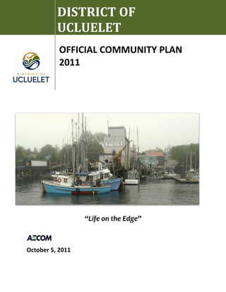
![[ this page left intentionally blank for double-sided printing]](data:image/gif;base64,R0lGODlhAQABAIAAAAAAAP///yH5BAEAAAAALAAAAAABAAEAAAIBRAA7)