Visions of a Green Transport Future for Leeds
•Télécharger en tant que PPTX, PDF•
0 j'aime•358 vues

We asked attendees at Leeds State of the City 2020 to draw their ideal transport future for Leeds. Here is what they came up with…

Recommandé
Recommandé
Contenu connexe
Tendances
Tendances (19)
Similaire à Visions of a Green Transport Future for Leeds
Similaire à Visions of a Green Transport Future for Leeds (20)
Plus de DecarboN8
Plus de DecarboN8 (20)
Dernier
Dernier (20)
Visions of a Green Transport Future for Leeds
- 1. Visions of a Green Transport Future for Leeds
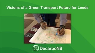
- 2. At Leeds State of the City 2020 we asked attendees to draw their ideal transport future for Leeds. Some drew solutions for specific transport issues like their own commute, others set out to redesign the whole system. Here is what they came up with…
- 3. • Green hubs around parks in suburban neighbourhoods connected by an underground • Tramlines running from the hubs across the city centre • Cycle and pedestrian only zone in the city centre and along the canal/river
- 4. • Light rail to add capacity to the network with lines running into the city centre and circular lines connecting the near suburbs and outer suburbs and villages
- 5. • Pedestrianised city centre with travellators, lifts and bike lifts • Underground to connect suburbs • Car-free tram / cycling / walking routes in and out of the city centre • Express bus running around the outer ring road stopping at tram hubs • Integrated and affordable cross- mode ticketing … or… tax cars and make public transport free
- 6. • Public transport in concentric circles around the outside of the city connecting suburban neighbourhoods with connections to city centre as well • Reliable trains!!! • Better signage and maps (like London transport map), not only digital but also physical maps accessible to those without smart phones.
- 7. • Public transport Hubs in a ring around Leeds connecting outer suburbs and villages to inner suburbs • Hubs connect to city centre and to other hubs via circular route • Free bus running in a circular route around city centre
- 8. • Pedestrianised city centre with blue badge parking only. Former car parks become greenspaces, playgrounds and secure bike parking • Good bus services running in a circular route around Leeds as well as into the city and to the larger greenspaces (Roundhay Park, Temple Newsam, Middleton Park etc…) Frequent buses with less competition from traffic • Safe walking routes into city centre from nearby dense housing areas • Good cycle paths in a ring around the city and connecting to parks • Park and Rides on the outer ring road with connections into city and to the circular neighbourhood buses. Hopefully mostly used for electric vehicles so with lots of charge points. • Reopen train line to Otley
- 9. The Urbal Fix, Tom Bliss • Co-located train/bus stations in the city centre and in hubs outside the centre (Headingley, Roundhay, etc.) • Circular tram line connecting suburban neighbourhoods with lines connecting to the city centre as well • Pedestrianised city centre
- 10. • Revive the tram connecting inner suburbs to city centre • A bus system that works following outer ring road • Pedestrianised city centre • Safe walking/cycling routes connecting city centre to inner suburbs
- 11. • Better, safer walking routes into city centre from inner suburbs (e.g. Beeston, Holbeck) • Public transport running in a circular route around inner suburbs • Segregated cycle routes in and out of the city • Congestion charge in the city centre
- 12. • Produce a Leeds Transport Green Paper—a holistic path to zero carbon for consultation. ‘Connecting Leeds’ isn’t enough • Congestion charge inside outer ring road for all non-electric vehicles • Off-road cycle paths into city • Whole inner city 20mph speed limit • Limit car entry into city from ring road— congestion charge, bus priority, park & ride • WYCC take control of all public transport systems • Cycle and pedestrian priority in road planning • Rail and bus hub with cycle hire in city centre
- 13. • Congestion charge on vehicles coming into the city centre from 6.30am to 10am would cut commuting • Residents parking or 2 hour parking only in inner suburbs (e.g.. Headingly, Hyde Park, Holbeck) • Shuttle buses from Elland Road Park and Ride (and others) to Headingley Stadium when matches on
- 14. • Clean Air Zone encompassing the city centre and inner suburban areas. • Charges for both commercial and private vehicles • Create the space for sustainable public transport, busses, cycles etc. and reduce ‘carte blanche’ private car transport in city
- 15. • Rail connection to Roundhay Park
- 16. • Train links connecting suburban neighbourhoods in the North East Leeds to central Leeds
- 17. Spine & Ribs System • Bus corridors along the major routes in and out of the city • “Rib” bus services connecting neighbourhoods between the corridors • Park and Rides outside the outer ring road
- 18. • Segregated cycle routes from North West Leeds into the city centre
- 19. Specific transport solution for a network of schools: • Electric minibus to shuttle staff and students between schools/sites (marked with an X on the map) • Increase capacity on trains to/from places like Wakefield and Barnsley where people avoid taking the train due to inadequate capacity • Make train fares more affordable (driving and parking should not be cheaper than taking the train)
- 20. • Pedestrianised city centre (walking, cycling and e- transport only) • Rail links into the city • Public transportation / personal transport interchange nodes in a ring around the city centre