Dsd int 2014 - data science symposium - interactive data lab, dr. annette zijderveld, deltares
•
1 j'aime•772 vues

data science

Recommandé
Contenu connexe
Similaire à Dsd int 2014 - data science symposium - interactive data lab, dr. annette zijderveld, deltares
Similaire à Dsd int 2014 - data science symposium - interactive data lab, dr. annette zijderveld, deltares (20)
Plus de Deltares
Plus de Deltares (20)
Dernier
Dernier (20)
Dsd int 2014 - data science symposium - interactive data lab, dr. annette zijderveld, deltares
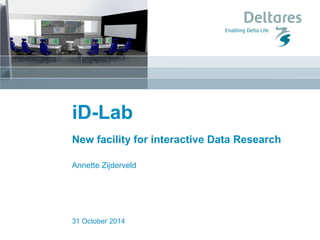
- 1. iD-Lab New facility for interactive Data Research Annette Zijderveld 31 October 2014
- 2. New Facility Goal: Develop, use and demonstrate our innovative interactive and collaborative data tools, models and software, in the Netherlands and Deltares wide. Develop our expertise and knowledge for correct and timely forecasting, warning and response in flood related disaster events. . 3 november 2014 iD-Lab Deltares wide
- 3. Concept iD-Lab 3 november 2014 (1) Room (1st floor Toren Delft) Work space Demonstration area Discussions Workshops Disaster management (hot phase) (2) Visualization equipment (high level) Large video wall Click Share system Demonstration screens Touch table Cameras Large White Board (3) ICT backend Workstations (not HDW) Calculation capacity Data storage Link with external ICT environment (cloud, super computing)
- 4. Design room 3 november 2014 •Control room and demonstration area can be separated •Open, professional design •Room left for additions
- 5. 3. IT back-end •Dedicated infrastructure with enterprise class hardware •High speed 10G redundant network starting with 10T storage & dual CPU compute nodes •Starting with full virtualization •faster deploy times •efficient and flexible use of resources •suitable for various IT innovations (ideas welcome) •scale up on demand using cloud services 3 november 2014
- 6. Disaster Management Demonstration Training Collaborative Data Research Researchesign Multi functional room
- 7. 3 november 2014 •New concepts for modeling using Data Science technology •Dealing with satellite data •Data mining and machine learning •Collaborative modeling •Interactive modeling concepts •Deltares Data strategy developed and applied: OpenEarth data management concept and Geomatics •Serious gaming & Augmented reality •Participatory approaches – touch table applications Collaborative Data Research
- 8. Data value chain Data science Data products Data acquisition Data management Data dissemination
- 9. Work on client or server? tailored data > WCS > WFS > SOS > SOAP > netCDF-CF- OPeNDAP > ISO SQL– PostGIS > SVN > GIT > http > ftp > KML > WMS > WFS > CSW graphics of data standard data raw data catalogue of data work done on server work done on client what where when who why how … data URLs smart phone & tablet users scientists professionals
- 10. Global forecasting models and services 3 november 2014 Global models in development Building up FEWS environment Goal: Run 3 global models daily •Flood model •Tide/storm surge model •Drought model Supporting •Global Flood Partnership, •BuZa DRR missions •WMO / Worldbank •Research activities
- 11. Modelling storm surge impact 3 november 2014 Delft3D + Delft Dashboard
- 12. Pilot project example: Risk Analysis Tool 3 november 2014 An Operational FEWS-Risk Analysis Tool - provide flood impact forecasting as decision support for disaster risk reduction The tool will help to answer questions such as: “Where should I put my sandbags?” “Which areas should I evacuate first?” It fit’s well into the purpose of the iD-LAB in terms of: •focus on Disaster Risk Reduction services •a strong demonstration of Deltares’ state of the art capabilities in forecasting, decision support, flood risk management and flood impact assessment Contact: Ferdinand Diermanse, Annemargreet de Leeuw and Dirk Eilander (RAW) Consequences (economic, people at risk etc.)
- 13. Pilot project example: Interactive design sessions for lakes (Menno Genseberger) environmental impact landscape design social issue social basis
- 14. Training facility •Disaster/crisis management exercises/simulations •Use of serious games for training with different stakeholders •Support the Dutch water boards in training •Providing the tools for training for use by external stakeholders •Training and Capacity building within the Global Flood Partnership •Delft-FEWS courses •Dedicated trainings for small groups 3 november 2014 Delft FEWS Serious Gaming
- 15. Questions? id-lab@deltares.nl 3 november 2014 ? iD-Lab